
An important map illustrating the Mississippi Valley during the French and Indian War.

Carte de la Floride, de la Louisiane, et Pays Voisins.
sold
- Digital Map Information
- Suitable for large format printing
- DPI: 600
- File Size: 6.42 MB
- File Type: ZIP / TIFF
- ICC color profile embedded
- Delivered instantly via download link
This is an attractively engraved and detailed 1757 map of the United States by the French cartographer Jacques-Nicholas Bellin. Centered on the Mississippi Valley, Bellin's map covers from the Riviere de Nord (Rio Grande) eastward to Lake Ontario and from Lake Huron to the Gulf of Mexico and Florida. This map is extremely rich in detail illustrating and naming countless American Indian settlements and villages. Bellin offers a wealth of new material throughout marking this map as a unique and meticulously researched production. (more details)
The First Large Format Map of Chatham County, Georgia.
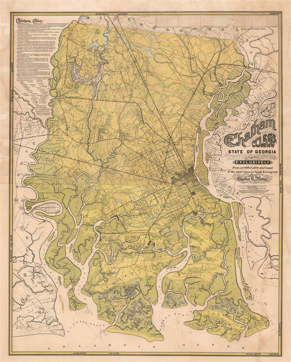
Chatham County State of Georgia Compiled Exclusively from certified plats and maps of the most eminent local surveyors by Charles G. Platon.
sold
- Digital Map Information
- Suitable for large format printing
- File Size: 98.41 MB
- File Type: ZIP / TIFF
- ICC color profile embedded
- Delivered instantly via download link
A rare and extraordinary 1875 Reconstruction Era map of Chatham County, Georgia, illustrating in large the vicinity of Savannah. This map was published by Charles G. Platen, who incorporated local survey work, the 1818 John McKinnon map, and the meticulous work of the U.S. Coast survey to compile this, the largest and most detailed map of the Savannah area ever issued. The intent behind the map, to develop agricultural lands, is evident in the color coding, with green referencing lowlands, swamps, and other wetlands, blue representing water, and yellow arable land. Platen advances the map considerably by drawing on the work of 36 local surveyors, all of which are named, to add property lots and owners throughout. (more details)
Only known example. Beauchamp's manuscript map of Persia/ Iran and Iraq - the first scientific map of these regions.
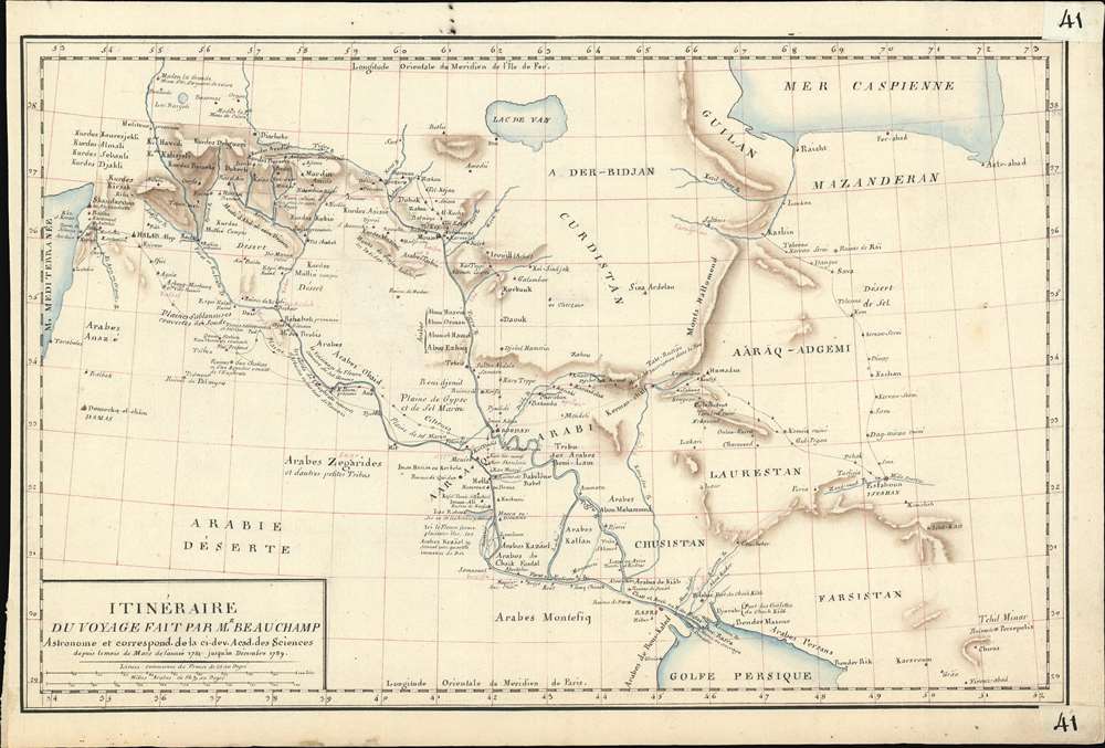
Itinéraire du Voyage Fait par Mr. Beauchamp Astronome et correspond de la cui dev. Acad. des Sciences.
sold
- Digital Map Information
- Suitable for large format printing
- DPI: 600
- File Size: 9.23 MB
- File Type: ZIP / TIFF
- ICC color profile embedded
- Delivered instantly via download link
An extraordinary discovery, this finely executed (hand-drawn) c. 1790 map of Syria, Iraq, and Iran / Persia is the only known map recording the explorations of the French astronomer and clergyman, Pierre-Joseph de Beauchamp. Comprising of the first scientific mapping of any significant part Persia/Iraq, coverage extends from the Mediterranean to the Persian Gulf and reaches as far north as Lake Van and the Caspian Sea. While we cannot definitively prove it, we believe this map to have been composed in Beauchamp's own hand for the use of Joseph Jérôme Lefrançois de Lalande (1732 - 1807), a fellow astronomer and friend. It may have been he who added additional annotations and place names to the map in light red ink. (more details)
One of the Earliest Maps of Chile by a Chilean.
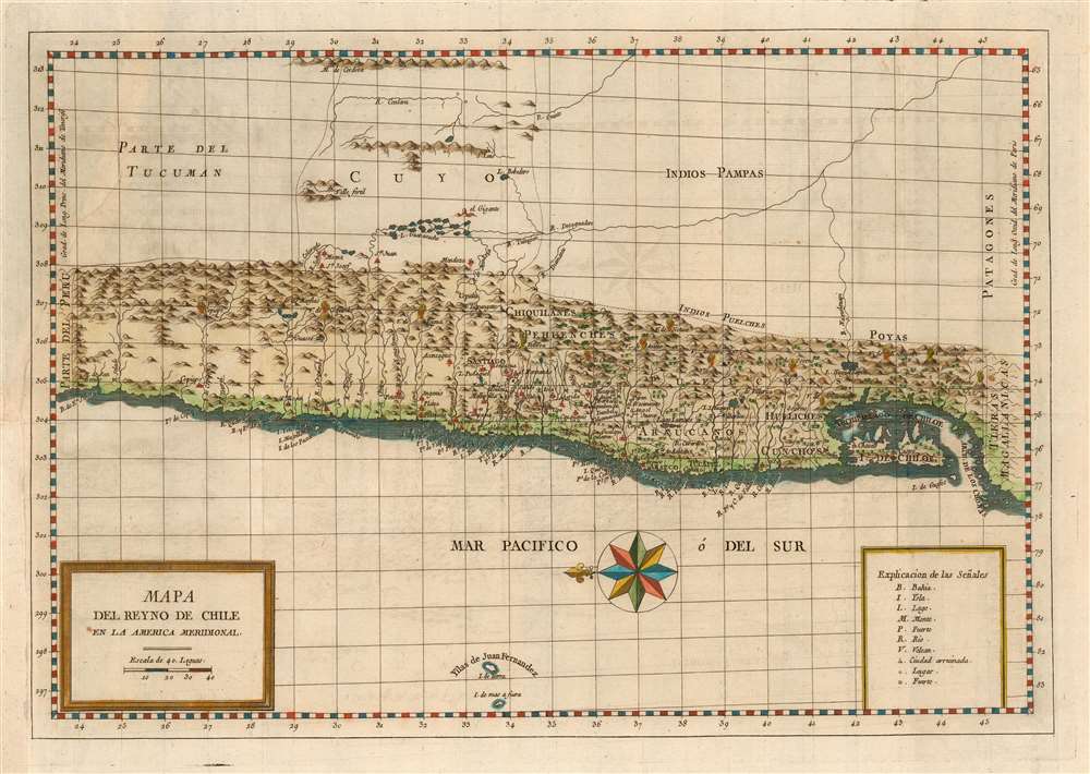
Mapa Del Reyno De Chile En La America Meridional.
sold
- Digital Map Information
- Suitable for large format printing
- DPI: 600
- File Size: 10.65 MB
- File Type: ZIP / TIFF
- ICC color profile embedded
- Delivered instantly via download link
This is a 1788 map of the Kingdom of Chile, produced for inclusion in Juan Ignacio Molina's Compendio de la Historia Geográfica, Natural y Civil del Reino de Chile. The map is among the few maps of the region based on information from someone who actually lived there; Molina's experience as a naturalist and ornithologist brought him far afield, and the map reflects a deeper knowledge of areas away from the coastline than do previous maps. The east-oriented map extends from Peru to south of Chiloe island. The abundant settlement of the coastal strip and its rivers are clearly defined. Chile's mountainous terrain is depicted pictorially, and thirteen active volcanoes are marked on the map. (more details)
Maine's shipbuilding capital!
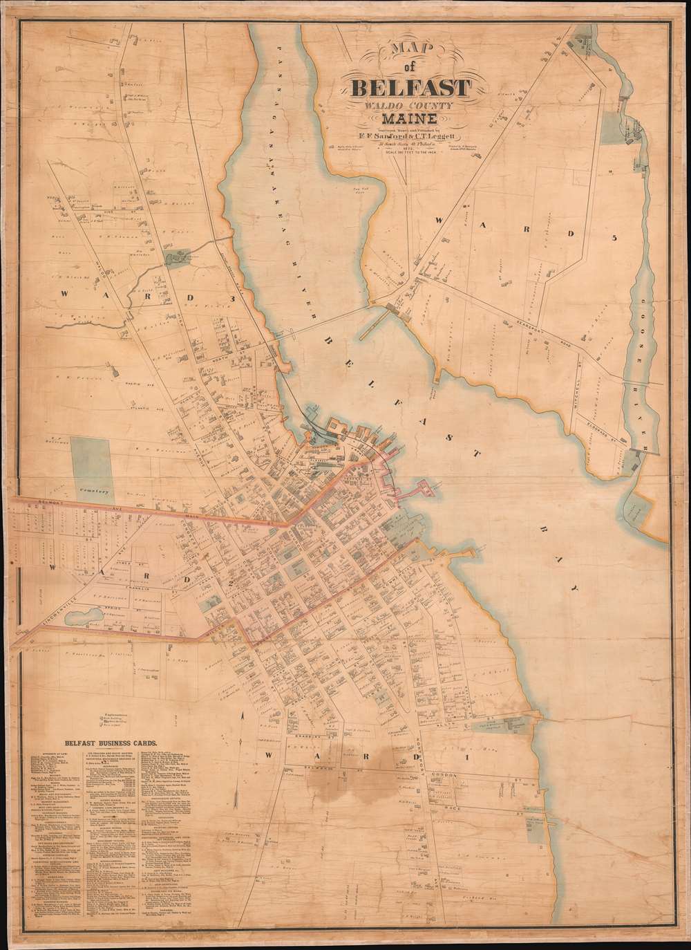
Map of Belfast Waldo County Maine.
sold
- Digital Map Information
- Suitable for large format printing
- File Size: 98.73 MB
- File Type: ZIP / TIFF
- ICC color profile embedded
- Delivered instantly via download link
An extremely rare 1875 wall map of Belfast, Maine, issued by E. F. Sanford and C. T. Leggett. Centered on Belfast Bay and the Passagassawakeag River, the map covers the urban center of Belfast and surrounding areas. Throughout the 19th and into the 20th century, Belfast was a major center of shipbuilding. Numerous ship yards, lumber yards, Foundries, Wharves, and Chandlers are noted throughout the map. The map also names individual property owners and businesses. (more details)
Lionising the achievements of the French Navy!

Quelques Voyages Récents de Batiments de Guerre.
sold
- Digital Map Information
- Suitable for large format printing
- File Size: 58.16 MB
- File Type: ZIP / TIFF
- ICC color profile embedded
- Delivered instantly via download link
This is a 1954 Hervé Baille pictorial map of the world tracing voyages by French warships. The map depicts the word on a Mercator Projection centered on the Atlantic. Fancifully illustrated, cartoonish animals, including penguins, seals, walruses, whales, and polar bears, draw the viewer's attention, as do illustrations of a bison and an otter in North America, a giraffe and an elephant in Africa, a kangaroo in Australia, and wolves and a yak in Asia. Sharks and several different species of marine life populate the seas. (more details)
Bilingual Chinese and English plan of Kowloon and Hong Kong.
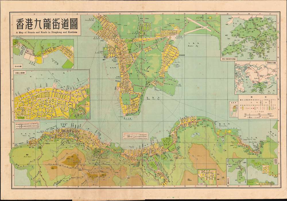
香港九龍街道圖 / A Map of Streets and Roads in Hong Kong and Kowloon.
sold
This is a 1957 Dah Chung Book Company bilingual Chinese and English city plan or map of Hong Kong and Kowloon, China. Depicting the Kowloon Peninsula and the northern coast of Hong Kong, streets are labeled in both languages, along with bays, parks, and other locations. Colors highlight urban areas and indicate the region's topography and ocean depth. Numerous insets are included along the borders and illustrate the entire Hong Kong region, situate Hong Kong with relation to regional cities in China, and detail areas of Hong Kong including Dakeng, Central and Sheung Wan, and Lychee Corner. (more details)
The first scientific mapping of the Rio Negro in Brazil!
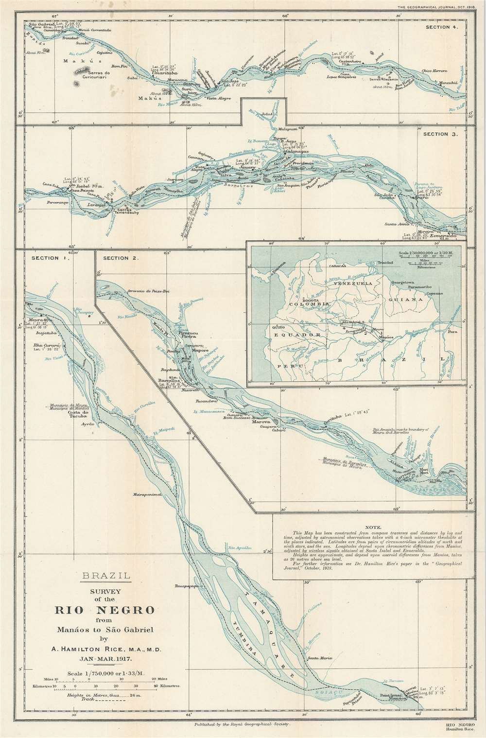
Survey of the Rio Negro from Manáos to São Gabriel.
sold
- Digital Map Information
- Suitable for large format printing
- File Size: 57.04 MB
- File Type: ZIP / TIFF
- ICC color profile embedded
- Delivered instantly via download link
This is a 1918 Alexander Hamilton Rice Jr. map of the Rio Negro in Brazil and is the first scientific map of the Rio Negro - the largest blackwater river in the world. Rice's map divides the river into four sections and depicts from Manaos (Manaus) to Sao Gabriel. A stated goal of Rice's 1917 expedition to the region was to map the river, which despite its immensity and significance, was at the time, almost unknown. Sao Gabriel and Manaos are both labeled, as are numerous villages and other settlements along the river's banks. Numerous islands within the river are illustrated, as are tributaries (all of which are labeled). Latitude and longitude references are provided in many locations, and a short paragraph to the right of center states that the map was 'constructed from compass traverses and distances by log and time, adjusted by astronomical observations taken with a 6-inch micrometer theodolite at the places indicated'. An inset detailing northern South America and situating the four sections of the Rio Negro presented here is situated along the right border. (more details)
No examples catalogued in OCLC or visible on the market

Madras and it Environs in 1733 and 1862 to illustrate the Annals of 'Madras in the Olden Time' by J. Talboys Wheeler.'
sold
- Digital Map Information
- Suitable for large format printing
- File Size: 44.22 MB
- File Type: ZIP / TIFF
- ICC color profile embedded
- Delivered instantly via download link
This is a rare 1862 map of Madras in India, now known as Chennai. It was printed for James Talboys Wheeler for inclusion in his history of the Presidency of Madras. The sheet actually contains two full maps of the city and its surrounds - one dated to 1733, and the other showing the 'present day' city, revealing Madras' growth and the extensive development of the plain surrounding it. (more details)
Issued on the very day the Taiwan-based Japanese Southern Army finalized plans to invade the Philippines.
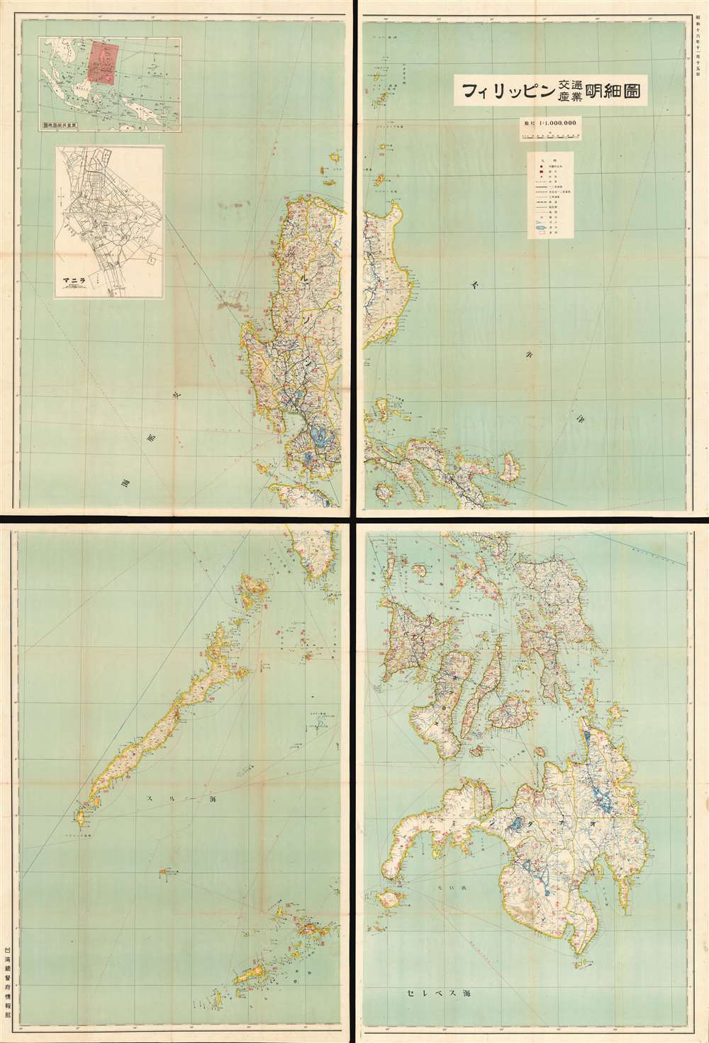
Philippines Detailed Traffic and Industry Map. / フィリッピン交通產業明細圖
sold
- Digital Map Information
- Suitable for large format printing
- File Size: 179.57 MB
- File Type: ZIP / TIFF
- ICC color profile embedded
- Delivered instantly via download link
An impressive 1941 Showa 16 Japanese map of the Philippines. This enormous production covers the entirety of the Philippines in incredible detail. It was issued by the Japanese Bureau of Information just months before the December 1941 invasion of the Philippines. The focus of the map is the Philippine transportation network. The level of detail evident in this map illustrates the extreme interest the Japanese had in the Philippines, not only as a source of personnel and resources, but as a stepping stone to Southeast Asia and Melanesia. (more details)
Shanghai 2.0.

Shanghai Urban Construction Design Map. / 上海都市建設計畫圖
sold
- Digital Map Information
- Suitable for large format printing
- File Size: 30.14 MB
- File Type: ZIP / TIFF
- ICC color profile embedded
- Delivered instantly via download link
An outstanding 1938 / Minguo 28 / Showa 14 urban planning map of 'Greater Shanghai', a massive-scale redevelopment of Shanghai proposed between 1927 and 1945. Published by the Shanghai-Hengshen Company, this map illustrates the proposed Japanese version of the Greater Shanghai Plan. The map is oriented to the east with the Hunagpu River at center. Color-coding illustrates a rigidly zoned urban center, with industrial areas, docks, commercial areas, parks, mixed use, and residential zones. (more details)
Shows the University of Oxford's constituent colleges.

Plan of the City and University of Oxford.
sold
- Digital Map Information
- Suitable for large format printing
- File Size: 20.46 MB
- File Type: ZIP / TIFF
- ICC color profile embedded
- Delivered instantly via download link
This is a 1902 Edward C. Alden city plan or map of Oxford, England, the world-famous university city. Home to the University of Oxford and Oxford Brooks University, the map depicts Oxford from New Botley to New Marston and from the Sunnymeade Estate to New Hincsey and New Iffley. Many of the University of Oxford's constituent colleges, including Queen's College, Exeter College, University College, and Trinity College, appear. Other buildings, including the Bodleian Library, the University galleries, the University Press, and the University Museum, are also illustrated and labeled. Churches, gardens, Oxford Castle, the city's two train stations, and numerous other buildings complete the depiction of a bustling metropolis. Streets throughout the city are identified, and the city's rivers thread their way through the beloved city. (more details)
Marks plantations and sugar works on the most heavily fortified island in the Caribbean.
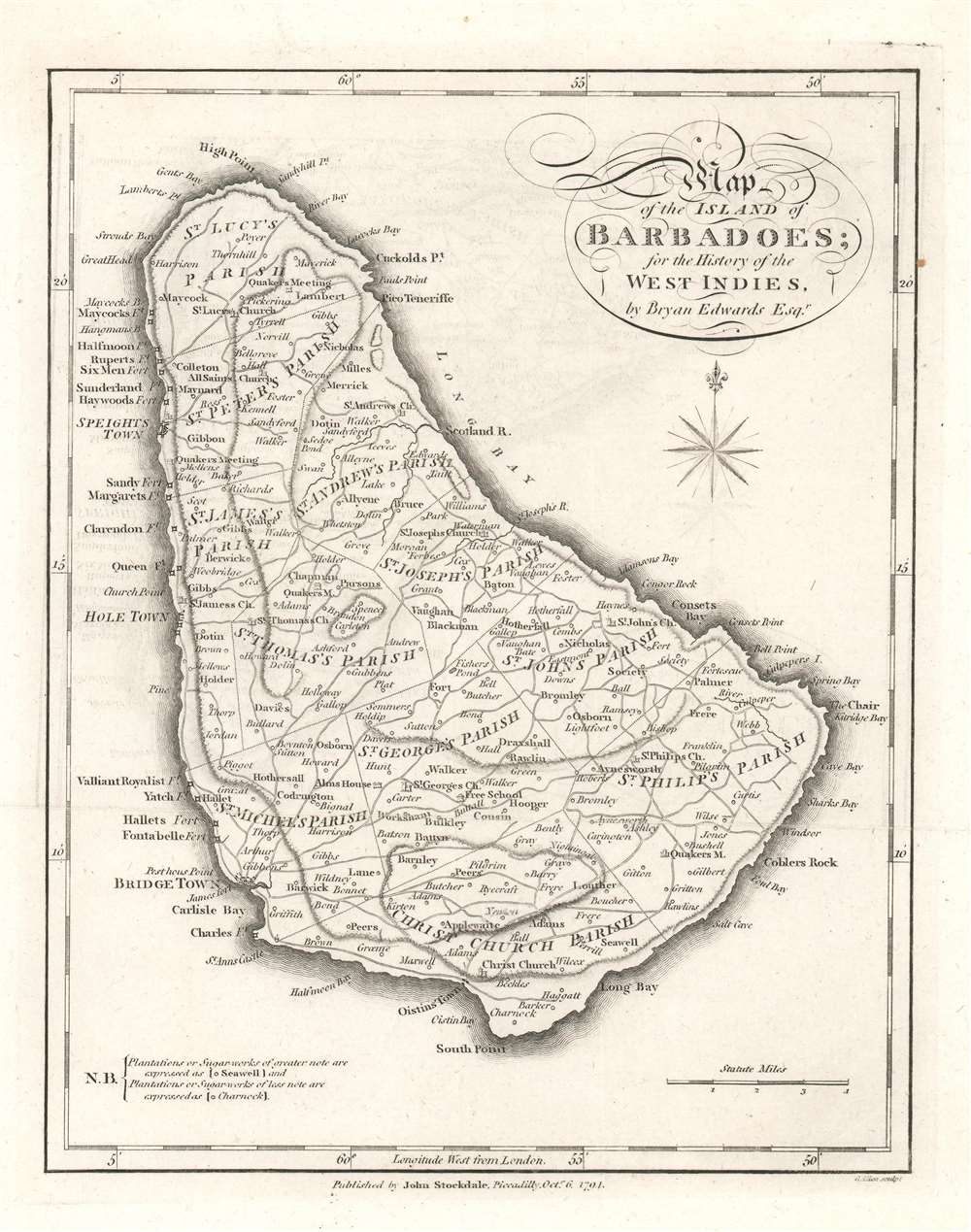
Map of the Island of Barbadoes.
sold
- Digital Map Information
- Suitable for large format printing
- DPI: 600
- File Size: 3.62 MB
- File Type: ZIP / TIFF
- ICC color profile embedded
- Delivered instantly via download link
This is a 1794 Bryan Edwards and John Stockdale map of Barbados, which was then the most heavily fortified island in the Caribbean. (more details)
A WWII era Japanese map transport map of the Philippines.

Map of the Philippines Transportation. / フィリッピン交通詳密地圖
sold
- Digital Map Information
- Suitable for large format printing
- Full resolution TIFF file
- ICC color profile embedded
- Delivered instantly via download link
This is a c. 1944 Japanese transportation map of the Philippines during World War II. This two sided maps illustrates all of the Philippines. The northern part, on the recto or front, covers the majority of Luzon and most of Mindoro (the southernmost parts of that island are illustrated in an inset), red lines highlight two different road grades. The southern part of the Philippines are mapped on the verso. Thin blue lines trace a third. Roads under construction are also represented. The island's railways are also marked. Circles locate cities, towns, and villages, all of which are labeled. An inset situated along the right border details the region surrounding Manila. Manuscript notations in this inset to the right of Manila appear to add five villages that were not printed on the original map. (more details)
Published only a few years after Admiral Nelson's tour of duty in the West Indies.
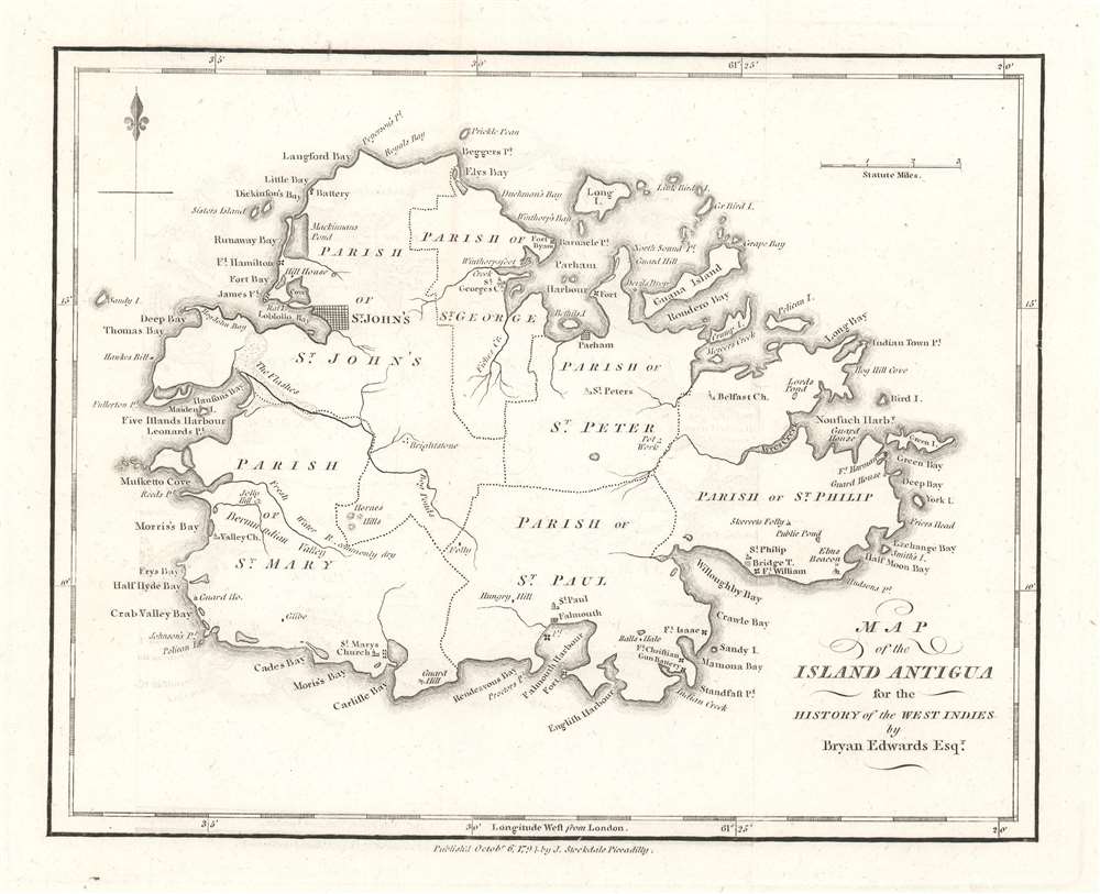
Map of the Island Antigua.
sold
- Digital Map Information
- Suitable for large format printing
- DPI: 600
- File Size: 2.86 MB
- File Type: ZIP / TIFF
- ICC color profile embedded
- Delivered instantly via download link
This is a 1794 Bryan Edwards map of Antigua. Published after Horatio Nelson's tour of duty in the West Indies, Antigua's many forts and coastal batteries underscore the tense situation in the Caribbean. Nelson was in the region enforcing the Navigation Acts, which prohibited trade between British subjects and the newly independent United States of America. Antigua held a prominent place in the Caribbean sugar trade, and Antiguan merchants loathed Nelson and the Navigation Acts for hindering their access to critical American markets. St. John's, the capital of modern-day Antigua and Barbuda, is clearly labeled, and several other settlements occupy coastal land. Bays, points, and other coastal features are also identified, as are many smaller islands. (more details)
A map of Grenada long before the 1983 U.S. invasion.

Map of the Island of Grenada.
sold
- Digital Map Information
- Suitable for large format printing
- DPI: 600
- File Size: 2.98 MB
- File Type: ZIP / TIFF
- ICC color profile embedded
- Delivered instantly via download link
This is a 1794 Bryan Edwards and John Stockdale map of Grenada. Grenada was a British colony in 1794 and today is a member of the British Commonwealth. Here, Fort Royal takes the place of the modern-day capital, St. George's. The island's six quartiers are labeled, along with rivers, bays, and points. In American memory, Grenada evokes the U.S. invasion in 1983, when American troops landed on the island to remove a Communist government that was supposedly sympathetic to Cuba and the Soviet Union. (more details)
A member of the British Commonwealth of Nations.
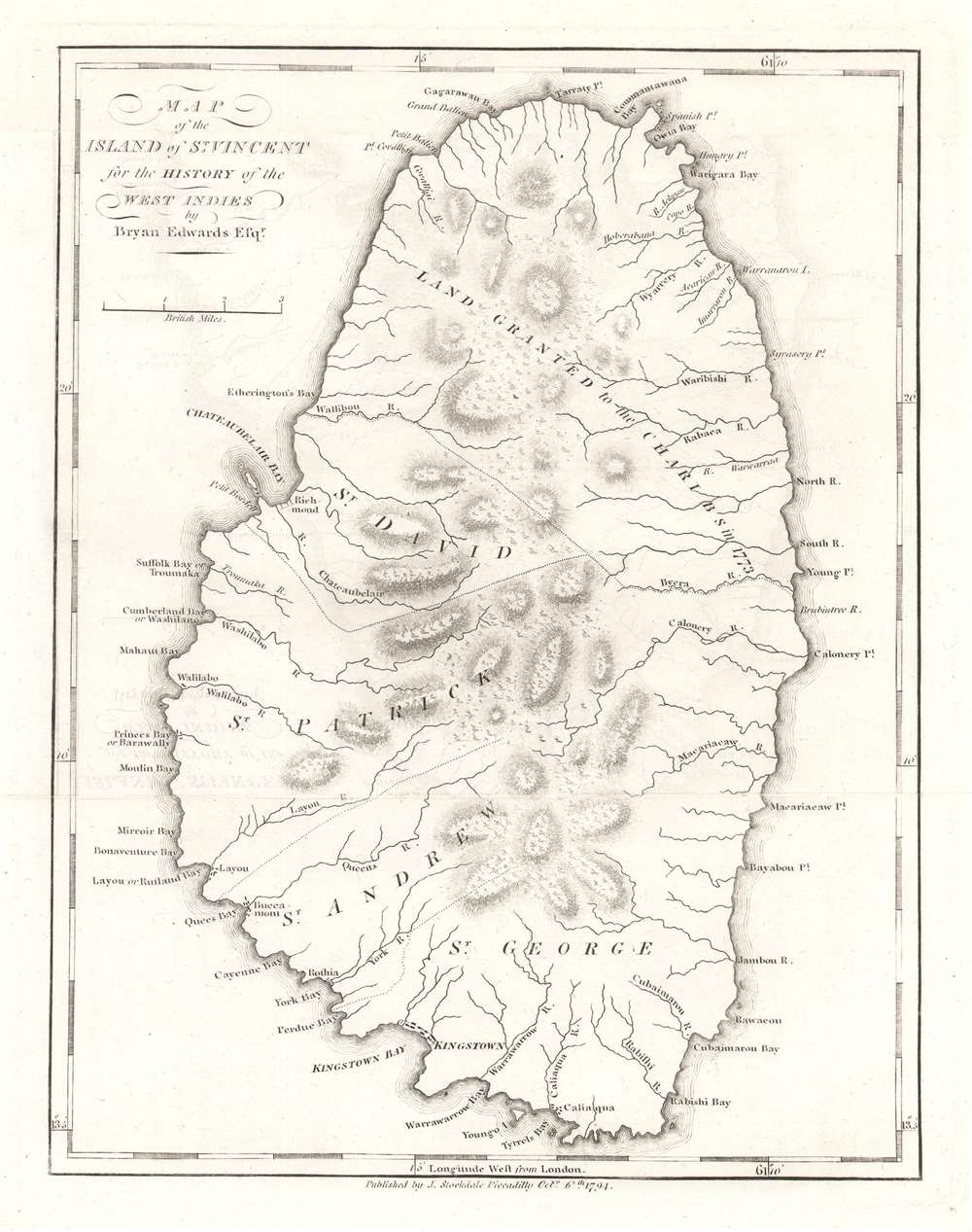
Map of the Island of St. Vincent.
sold
- Digital Map Information
- Suitable for large format printing
- DPI: 600
- File Size: 3.01 MB
- File Type: ZIP / TIFF
- ICC color profile embedded
- Delivered instantly via download link
This is a 1794 Bryan Edwards and John Stockdale map of Saint Vincent. Part of the Winward Islands, Saint Vincent is the largest island in the modern-day country 'Saint Vincent and the Grenadines'. Kingstown, the island's capital, is labeled. Bays and points are marked along the coast, and the island's parishes are identified. The northernmost portion of the island is labeled 'land granted to the Charibs in 1773'. The Caribs are St. Vincent's native peoples, and they repeatedly revolted against British rule in the 18th century. Calm was only restored after a treaty was signed in 1796. Saint Vincent gained its independence in 1979 and is part of the British Commonwealth of Nations to this day. (more details)
Promotes Howard Johnson's restaurants along the Pennsylvania and New Jersey Turnpikes!
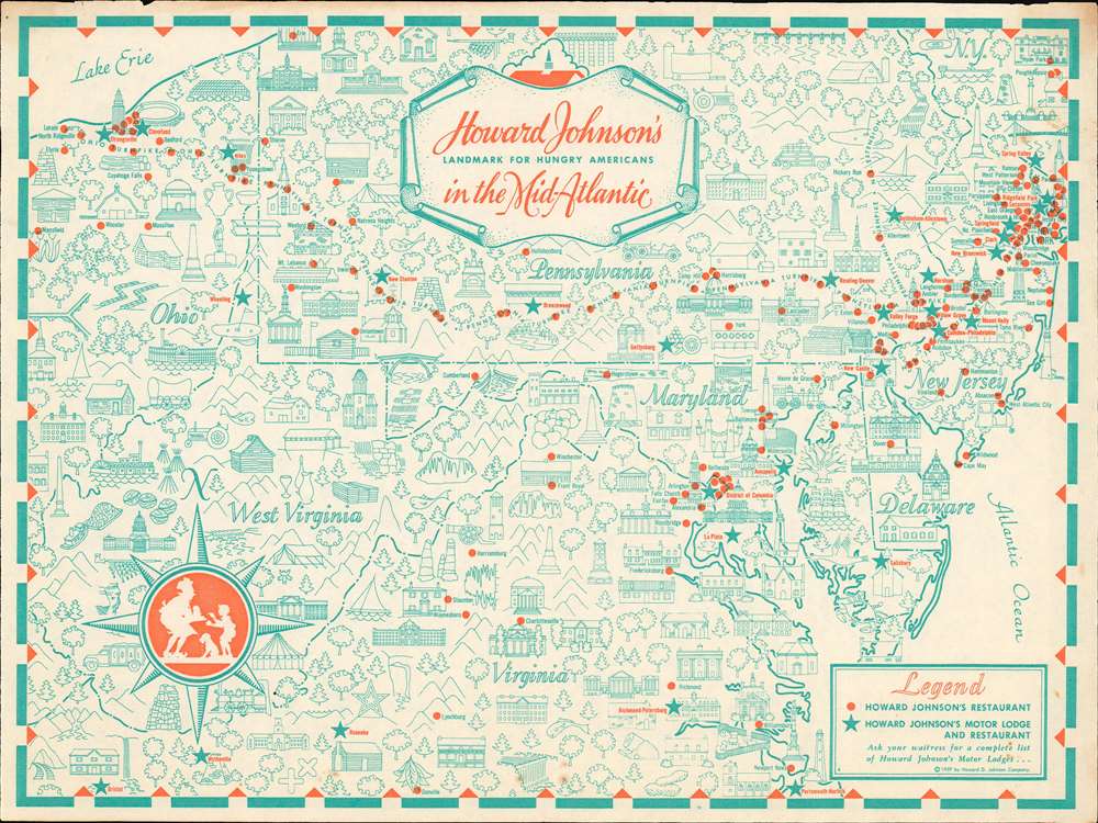
Howard Johnson's Landmark for Hungry Americans in the Mid-Atlantic.
sold
This is a 1959 Howard Johnson's pictorial placemat map of the Mid-Atlantic states. Promoting Howard Johnson's restaurants and motor lodges, the map depicts the region from Ohio to the Atlantic Ocean and from Poughkeepsie, New York to Norfolk, Virginia. Without question, Howard Johnson's wants to bring the viewer's attention to their many restaurant locations along the Ohio, Pennsylvania, and New Jersey Turnpikes, all of which are marked by red dots. Stars promote Howard Johnson's Motor Lodge and Restaurant, presumably where travelers could not only eat, but also book a room to spend the night. Illustrations of buildings, lighthouses, trees, and even golf courses create an 'I Spy'-like aesthetic that most likely engrossed children, allowing their parents a brief respite as they waited for their meal. (more details)
Extraordinary 'Iron Curtain' Cold War serio-comic map! One of only 2 Serio-Comic maps to illustrate the Iron Curtain.

Mapa Humoristico da Europa em 1953
sold
- Digital Map Information
- Suitable for large format printing
- File Size: 34.8 MB
- File Type: ZIP / TIFF
- ICC color profile embedded
- Delivered instantly via download link
An exceptional and rare 1953 J. R. Silva serio-comic zoomorphic pictorial map of Europe illustrating the raising of the Iron Curtain at the height of the Cold War. The map covers Europe and parts of the Atlantic, and is one of only 2 serio-comic maps to illustrate the Iron Curtain. It presents the political situation in 1953, shortly after the death of Joseph Stalin, the rise of Nikita Krushchev, and Georgi Malenkov's announcement of the Soviet Union's first hydrogen bomb. Silva is playing on the traditional meaning of 'Iron Curtain' as a fireproof barrier in theaters. He further interprets the chaos of post-Stalin European politics as a 'circus.'
In this serio-comic map, a great wrought iron fence, the Iron Curtain, divides Europe. Russia, a great polar bear, is the antagonist, with subject nations, lesser bears, dancing and performing to its tune. Other European countries look on with fear, boredom, and curiosity while the Americas, on a large balcony across the Atlantic, show great interest in the show. The dominant North American powers are represented by a Mexican horse / cowboy, a Canadian walrus / sailor, and a militaristic United States lion. Other American nations, comprising Central and South America, appear as a great variety of well-dressed birds, all of which are labeled. (more details)
In this serio-comic map, a great wrought iron fence, the Iron Curtain, divides Europe. Russia, a great polar bear, is the antagonist, with subject nations, lesser bears, dancing and performing to its tune. Other European countries look on with fear, boredom, and curiosity while the Americas, on a large balcony across the Atlantic, show great interest in the show. The dominant North American powers are represented by a Mexican horse / cowboy, a Canadian walrus / sailor, and a militaristic United States lion. Other American nations, comprising Central and South America, appear as a great variety of well-dressed birds, all of which are labeled. (more details)
The most important map of Georgia issued before the American Revolutionary War.
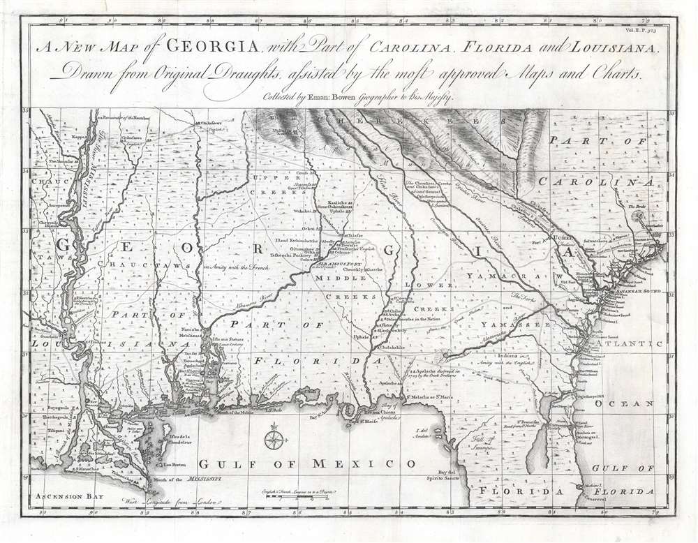
A New Map of Georgia with Part of Carolina, Florida and Louisiana.
sold
- Digital Map Information
- Suitable for large format printing
- DPI: 600
- File Size: 16.01 MB
- File Type: ZIP / TIFF
- ICC color profile embedded
- Delivered instantly via download link
One of the finest and most important large-scale maps of Georgia ever produced, this is Emmanuel Bowen's 1748 map of the colony of Georgia, considered the first obtainable specific map of that region. The map covers the Atlantic coast from Charleston (South Carolina) to Cape Canaveral (Florida) and extends westward to just beyond the Mississippi River, covering the Gulf Coast and the Mississippi Delta. It extends north along the Mississippi to about 35° N Latitude. This map was drawn by Bowen just 15 years after General James Oglethorpe received the Georgia charter from King George II, for whom the colony is named (April 21, 1732). It was intended to accompany the expanded 1748 edition of John Harris's work Navigantium atque Itinerantium Bibliotheca, which included a new chapter on the founding of Georgia. (more details)