
The most important map of Florida, issued 1 year after statehood at the end of the Second Seminole War.

The State of Florida.
sold
- Digital Map Information
- Suitable for large format printing
- DPI: 600
- File Size: 81.56 MB
- File Type: ZIP / TIFF
- ICC color profile embedded
- Delivered instantly via download link
The first official map of the State of Florida, this spectacular production was issued in 1846, on year after statehood and at the end of the Second Seminole War, by the Army Bureau of Topographical Engineers. Here the map is presented in deluxe full color format, dissected and mounted on linen. The map was drawn by Joseph Goldsborough Bruff, an adventurer, playboy, and civilian contractor working with the Topographical Engineers. It illustrates the state of the Florida survey as of 1846, as well as major events, routes, and settlements associated with the First and Second Seminole Wars. Moreover, the map includes holdover grants from the Spanish era, including Arredondo's Grant and Forbes' Purchase. With unsurpassed detail and scale, this map became the foundational map for most subsequent maps of Florida through the end of the 19th century. (more details)
Fine 19th century tourist map of Bermuda.

Tourist's Map of the Bermuda Islands.
sold
- Digital Map Information
- Suitable for large format printing
- File Size: 19.72 MB
- File Type: ZIP / TIFF
- ICC color profile embedded
- Delivered instantly via download link
A rare c. 1890 tourist map of Bermuda by James Henry Stark. The map is oriented to the Northwest and covers all of Bermuda. A large inset at center details Hamilton, Bermuda's cosmopolitan capital. A dotted line identifies steamer routes around the island. Additional, the map identifies much that would be of interest to tourists, including hotels, roads, bridges, museums, churches, and of course, both the old and new Lunatic Asylums. (more details)
Depicts the ephemeral post WWII - Pre Communist Shangahi.
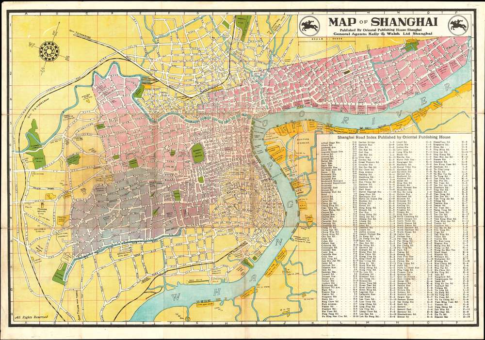
Map of Shanghai.
sold
- Digital Map Information
- Suitable for large format printing
- File Size: 46.44 MB
- File Type: ZIP / TIFF
- ICC color profile embedded
- Delivered instantly via download link
An uncommon 1946 English language map of Shanghai, China issued by the Oriental Publishing House for the firm of Kelly and Walsh. The map centers on the old Chinese city, with its former circular walls apparent. The former International Settlement is colored pink, while the French Concession is purple. Along the Bund, various privae clubs, hotels, banks, and other business are noted. ‘Pootung’ (Pudong), across the Huangpu River, is largely undeveloped but warehouses lining shore. All streets are labelled, and an extensive street index occupies the lower right quadrant. The verso features a handy table reconciling old European street names and the ‘new’ Chinese names adopted following the collapse of the concession system. (more details)
A Banned Map! Raremanuscript map of Haishi Shihei's important map of Korea.

Chosen Hachido no Zu (or) Chosen Koko Zenzu (General Map of Korea).
sold
- Digital Map Information
- Suitable for large format printing
- DPI: 600
- File Size: 30.63 MB
- File Type: ZIP / TIFF
- ICC color profile embedded
- Delivered instantly via download link
A banned map! This very rare c. 1785 manuscript map of Korea prepared by Hayashi Shihei. This map was drawn to illustrate Shihei's Sangoku Tsuran Zusetsu (Illustrated General Survey of the Three Countries). It covers all of Korea as well as the adjacent islands ... (more details)
A Vietnamese manuscript map of the Ho Chi Minh Campaign that ended the Vietnam War.

Diên Biên Chiên Dich Hô Chi Minh.
sold
This is a 1975 Vietnamese manuscript map of the Ho Chi Minh Campaign, the final campaign of the Vietnam War. The map depicts southern Vietnam from Tây-Ninh to Xuân-Lôc and from Tây-Ninh to Vung Tàu and and My-Tho. The red arrows illustrate all the actions that took place between April 7 and April 29, 1975, while the yellow arrows highlight the final push into Saigon itself, which fell to North Vietnamese forces on April 30, 1975, effectively ending the Vietnam War. South Vietnamese cities and bases that fell to North Vietnamese forces are illustrated by blue walls and labeled. The date that each location fell is also provided. (more details)
A charming pictorial map of New York City created by a German Jewish refugee living in New York City.
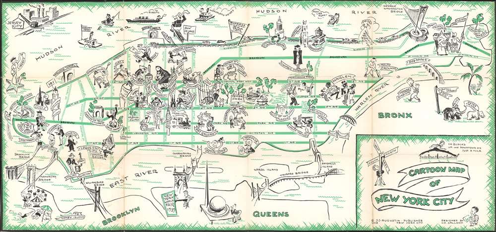
Cartoon Map of New York City.
sold
- Digital Map Information
- Suitable for large format printing
- File Size: 16.19 MB
- File Type: ZIP / TIFF
- ICC color profile embedded
- Delivered instantly via download link
This is a 1938 Henry Emil Salloch pictorial map of New York City. The map depicts the city from Battery Park to the Bronx and from the Hudson River and Jersey City to Brooklyn and Queens. Wonderfully illustrated, pictorial vignettes highlight neighborhoods, ... (more details)
A pictorial tourist map of New York City created to promote the New York World's Fair.
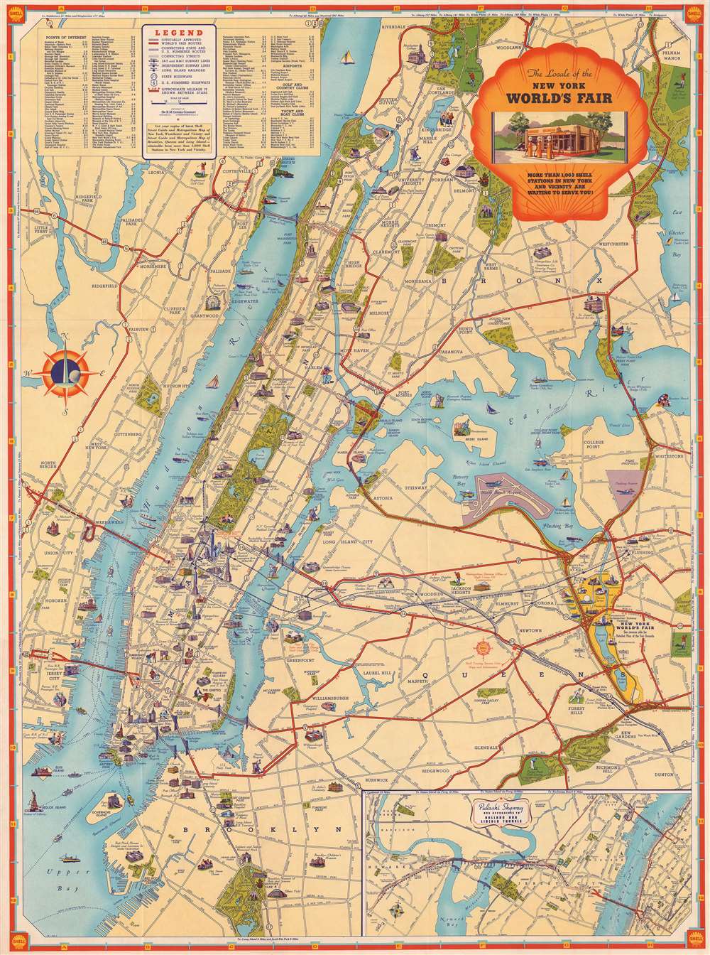
The Locale of the New York World's Fair
sold
- Digital Map Information
- Suitable for large format printing
- File Size: 43.83 MB
- File Type: ZIP / TIFF
- ICC color profile embedded
- Delivered instantly via download link
This is a 1939 Shell Oil Company pictorial city map or plan of New York City. The map depicts the region from Jersey City to Flushing and from Riverdale, Woodlawn, and Pelham to Prospect Park and New York Bay. Created as a tourist map for people driving ... (more details)
Exceptional map of Boston on the cusp of its landfill transformation into a modern metropolis.
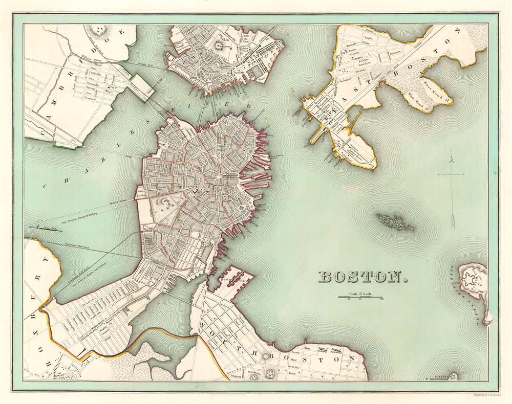
Boston.
sold
- Digital Map Information
- Suitable for large format printing
- DPI: 600
- File Size: 12.13 MB
- File Type: ZIP / TIFF
- ICC color profile embedded
- Delivered instantly via download link
This is an 1838 Thomas G. Bradford map of Boston on the cusp of its transformation, via landfills and railroads, from a colonial port to a major metropolitan center. The map centers on the Shawmut Peninsula or Boston proper. It is surrounded by ... (more details)
Illustrates the island at the height of the rivalry between the British East India Company and the Dutch East India Company.
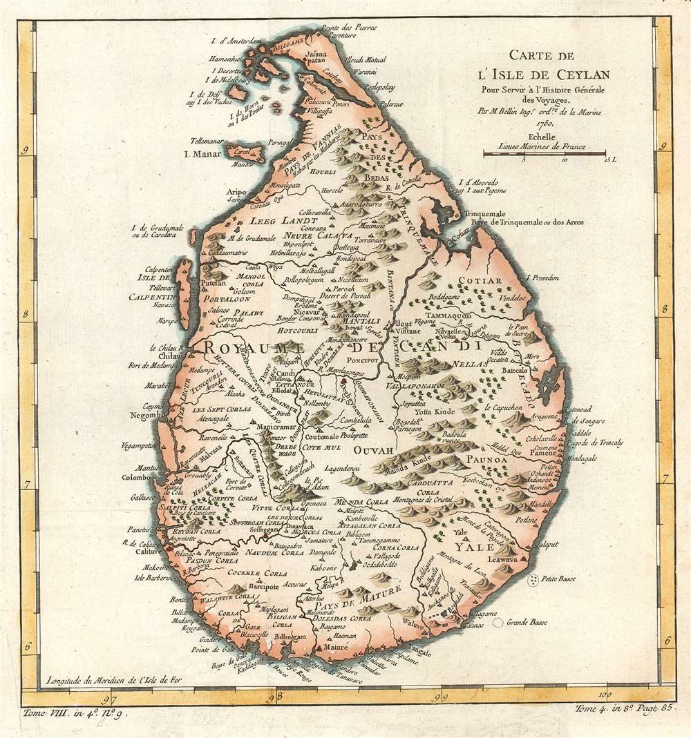
Carte de L'Isle de Ceylon.
sold
- Digital Map Information
- Suitable for large format printing
- Full resolution TIFF file
- ICC color profile embedded
- Delivered instantly via download link
This is a 1750 Jacques-Nicolas Bellin map of Ceylon or Sri Lanka. The map depicts the entire island of from north to south, inclusive of the Isle de Calpetin, Isle Manar, and a group of small islands on the northwest shore. The well-defined ... (more details)
Modernist railroad schmatic map of China.

National Railway.
sold
An interesting 1980 official Chinese government map of the railroad systems of China, including Taiwan. This starkly modern map exhibits no geographical content, rather, in the spirit of London Underground maps of the 1920s and 1930s, focuses exclusively on the railroad network and connections. (more details)
One of the few surviving maps from Meinertzhagan's Nairobi Map Room used for field opperations in the WWI East Africa Campaign.
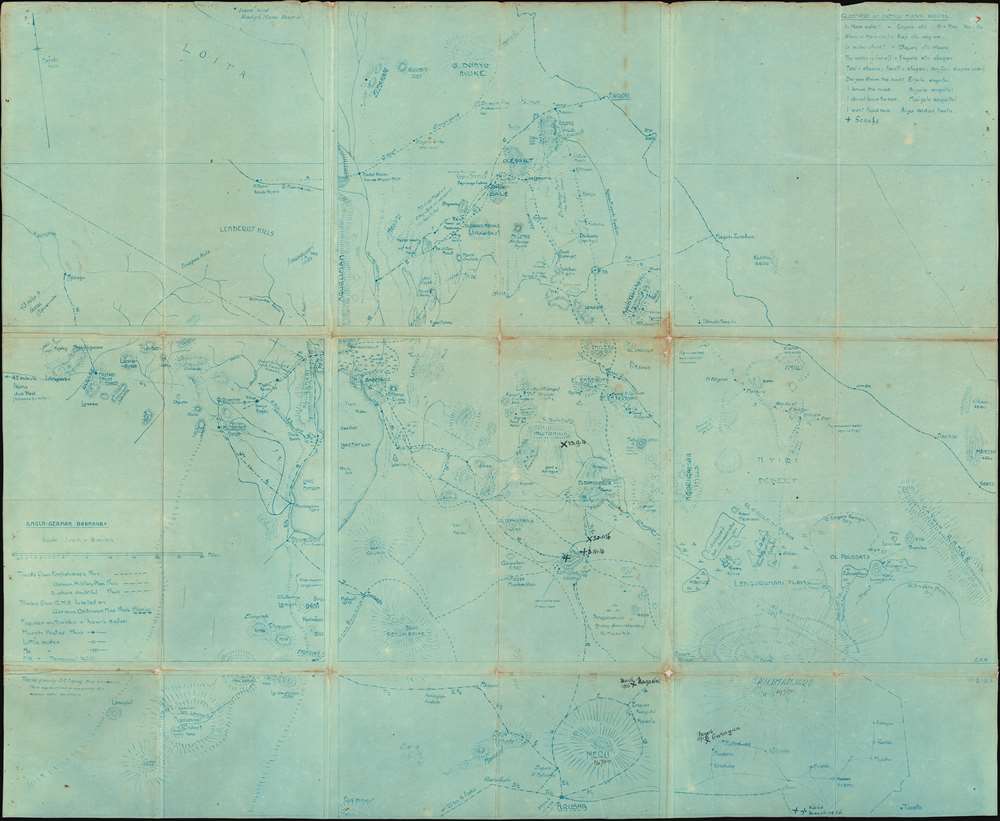
Anglo-German Boundary.
sold
- Digital Map Information
- Suitable for large format printing
- File Size: 28.87 MB
- File Type: ZIP / TIFF
- ICC color profile embedded
- Delivered instantly via download link
One of the most extraordinary military maps we have encountered, this is a September 17, 1914 cyanotype British field map of modern-day Kenya and Tanzania. It is the only surviving example of a definitive field map from the World War I (WWI) East Africa Campaign (1914 - 1918). Likely prepared for the British invasion of German East Africa in November 1914 (which was unsuccessful), the map illustrates the border regions of British and German East Africa (modern Kenya and Tanzania, respectively). Based on a detailed reconnaissance of the Serengeti Plain, the map offers a wealth of information critical to guerilla military movement, not commonly available on published topographical maps. There are extensive manuscript annotations, likely by an officer of the East African Mounted Rifles, marking battles and troop movements. The map is printed in the cyanotype technique, likely at the British Army HQ in Nairobi under the supervision of the brilliant but divisive intelligence operative Lt. Col. Richard Meinertzhagen. (more details)
An extremely rare French broadside promoting the Sao Paulo-Rio Grande Railway in Brazil.

États-Unis du Brésil: Compagnie du Chemin de Fer de São Paulo et Rio Grande.
sold
- Digital Map Information
- Suitable for large format printing
- File Size: 17.52 MB
- File Type: ZIP / TIFF
- ICC color profile embedded
- Delivered instantly via download link
This is a c. 1900 broadside promoting investment in Brazil's São Paulo-Rio Grande Railway. Written in French and published by the Imprimerie Chaix in Paris, a map of the Brazilian coastline from Rio de Janeiro, Brazil to Montevideo, Uruguay occupies the left portion of the broadside. Cities, towns, and villages are identified, but the focus of the work is the planned construction of the Compagnie du Chemin de Fer de São Paulo et Rio Grande (Sao Paulo-Rio Grande Railway Company) between Itarare to the Uruguay River with two spur lines to the Parana River. Illustrated in orange, lines operated by the Compagnie du Chemin de Fer de São Paulo et Rio Grande would connect with lines operated by the Compagnie Générale du Chemins de Fer Brésiliens (General Brazilian Railway Company) and the Compagnie des Chemins de Fer Sud-Ouest Brésiliens (Southwest Brazilian Railway Company). The routes of the Compagnie Générale du Chemins de Fer Brésiliens are shown here in black, while the lines operated by the Compagnie des Chemins de Fer Sud-Ouest Brésiliens are blue. (more details)
Charming pictorial map exaggerating Florida!
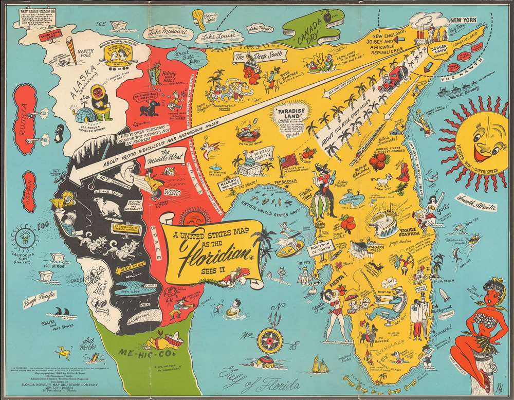
A United States Map as the Floridian Sees It.
sold
- Digital Map Information
- Suitable for large format printing
- File Size: 12.7 MB
- File Type: ZIP / TIFF
- ICC color profile embedded
- Delivered instantly via download link
A humorous 1948 Jack Swenningsen map of the United States as seen from the perspective of a Floridian. No doubt inspired by Daniel K. Wallingford's c. 1930s maps, A Yorker's Idea … and A Bostonian's Idea…, this map presents an outsized Florida and pokes fun at provincial Floridian ideas about California, Canadas, Alaska, and he Midwest. Here Florida covers the entire Eastern portion of the United States. The Mason-Dixon Line divides not the North and the South, but the United States and Canada, known only for its signature soda, 'Canada Dry.'. The author plays with the connect between New York and Long Island and Florida, suggesting that it is just an easy 100 miles away. It also suggests that all roads to Florida are 'one way.' California, Alaska, Texas, and the mid-west are presented as a freezing wasteland. Florida itself is filled with all of the joys of the good life: sunshine, bathing beauties, oranges, Yankee Stadium, glamor, and of course, fishing. (more details)
Rare bird's-eye view of Colby College, Waterville, Maine.

Colby College.
sold
- Digital Map Information
- Suitable for large format printing
- File Size: 25.38 MB
- File Type: ZIP / TIFF
- ICC color profile embedded
- Delivered instantly via download link
This is a rare 1909 Richard Rummell view of Colby College, a private liberal arts school located in Waterville, Maine. The view illustrates the original campus, of which no buildings survive. The view centers on Memorial Hall, constructed in 1869 to memorialize the Colby men who died in the Civil War and the center of campus life. Prominently featured to the right of Memorial Hall, is Chemical Hall, the home of chemistry lectures and labs, the president's office, and a faculty meeting room. To the left is South College Hall, constructed in 1821, and the campus's first building in downtown Waterville. In the distance the distinctive dome of Shannon Observatory, built in 1889 to the specification of the distinguished physicist William Rogers, who Colby lured from Harvard. The Kennebec River Flows in the background. (more details)
Planning map of Prosepct Park, Brooklyn's finest park.
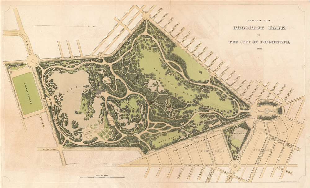
Design for Prospect Park in the City of Brooklyn.
sold
- Digital Map Information
- Suitable for large format printing
- File Size: 3.46 MB
- File Type: ZIP / TIFF
- ICC color profile embedded
- Delivered instantly via download link
This is a rare 1870 edition of Calvert Vaux and Frederick Law Olmsted's map of Prospect Park, Brooklyn. The map depicts the park as a whole and includes pathways, lakes, buildings, individual trees, rocks, and elevation measurements. The streets and avenues surrounding the park are also noted. (more details)
A virtually unknown view of the Steamship Lexington disaster in Long Island Sound.

Awful Conflagration of the Steam Boat Lexington in Long Island Sound on the evening of January 13th, 1840 by which lamentable event about 140 persons lost their lives!
sold
- Digital Map Information
- Suitable for large format printing
- DPI: 600
- File Size: 9.66 MB
- File Type: ZIP / TIFF
- ICC color profile embedded
- Delivered instantly via download link
This is an 1840 view of the tragic burning of the steamboat Lexington on the Long Island Sound, New York. It was issued shortly after the disaster to satisfy public interest in the devastating event. The burning of the Lexington was one of the greatest steamboat disasters in American history and captured the popular interest in a number of important views, with this particular view being the rarest we have encountered. The view illustrates the accident, which took place on January 13, 1840, and claimed the lives of all but four of the 143 people on board. Unlike many of the views published soon after the tragedy, here the creators chose to emphasize that four people were saved: one passenger and three members of the crew. (more details)
Modernist railroad schmatic map of China.
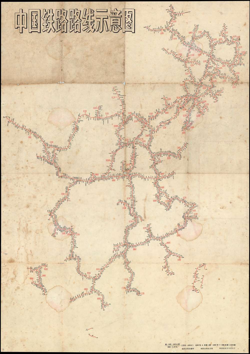
中国铁路路线示意图 / Chinese Railroad Schematic Route Map.
sold
- Digital Map Information
- Suitable for large format printing
- File Size: 24.09 MB
- File Type: ZIP / TIFF
- ICC color profile embedded
- Delivered instantly via download link
An interesting 1966 Schematic map of the railroad systems of China, including Taiwan, issued by China Cartographic Publishing House (中国地图出版社). This starkly modern map exhibits no geographical content, rather, in the spirit of London Underground maps of the 1920s and 1930s, focuses exclusively on the railroad network and connections. (more details)
Modernist railroad schmatic map of China.
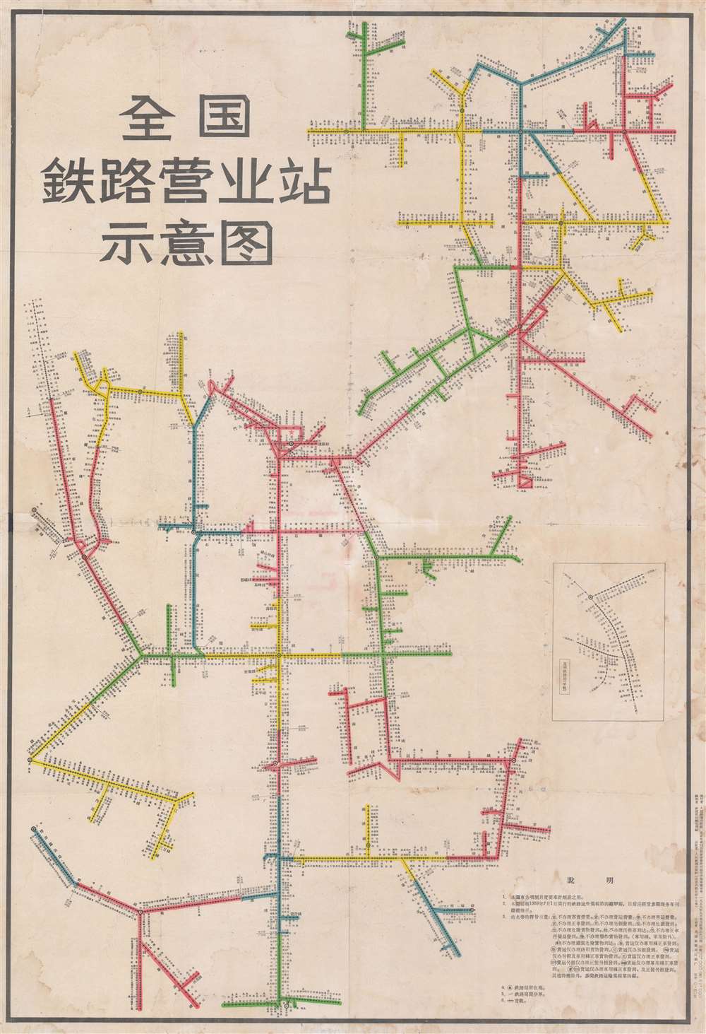
全国鉄路营业站示意图 / National Railroad Schematic Route Map of China.
sold
- Digital Map Information
- Suitable for large format printing
- File Size: 55.47 MB
- File Type: ZIP / TIFF
- ICC color profile embedded
- Delivered instantly via download link
A remarkable 1957 - 1959 schematic map illustrating the railroads of China. This starkly modern map exhibits no geographical content, rather, in the spirit of London Underground maps of the 1920s and 1930s, focuses exclusively on the railroad network and connections. Text in the lower right describe the rules and regulations of the railroads, noting the fares will go in effect in July of 1959, and establishing a graphic key to understand the map. An inset in the lower right details the narrow gage Kunming-Hekou Railway built by the French between 1904 and 1910. The enormous size and dramatic character of the map suggest that this was made for in-station display, not for private use. (more details)
A lovely map of the world illustrating California as an island.
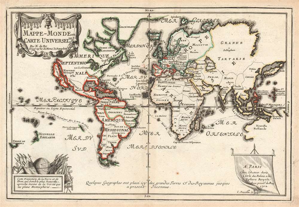
Mappe-Monde ou Carte Universelle.
sold
- Digital Map Information
- Suitable for large format printing
- DPI: 600
- File Size: 9.15 MB
- File Type: ZIP / TIFF
- ICC color profile embedded
- Delivered instantly via download link
This is a scarce and important 1702 Nicholas de Fer map of the world which depicts the entire world according to its 17th century conception. The map is adorned by a beautiful title cartouche in the upper left quadrant and another illustration depicting a globe and flags is featured in the lower left quadrant. Spanish possessions are noted with boundaries color coded in red outline. Routes around the world are illustrated, as are a host of other interesting features. (more details)
A rare geological map of Ibiza, one of the Balearic Islands located in the Mediterranean.
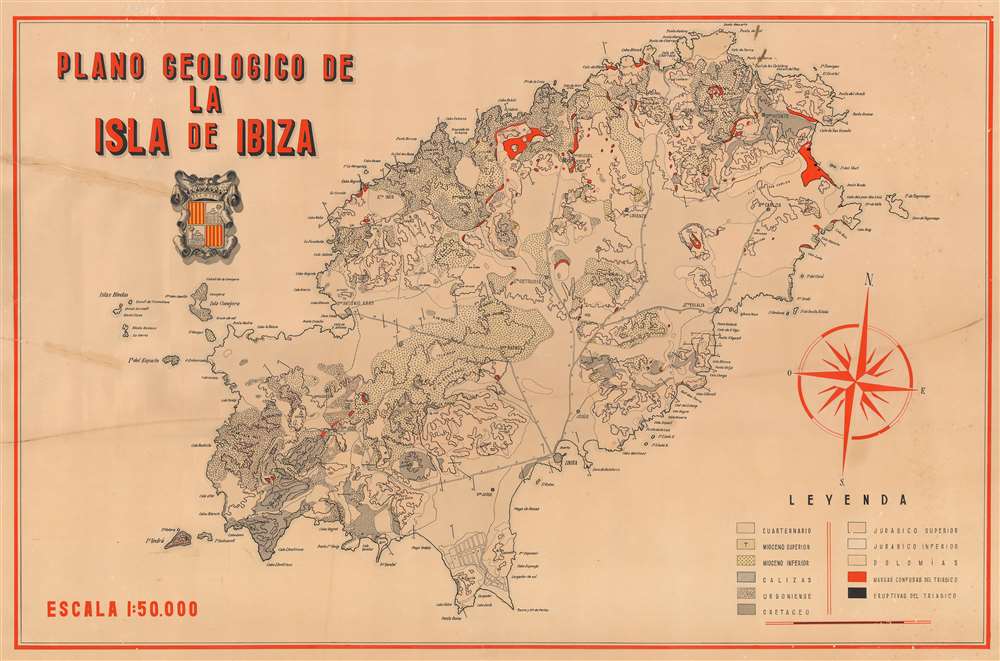
Plano Geologico de la Isla de Ibiza
sold
- Digital Map Information
- Suitable for large format printing
- File Size: 52.6 MB
- File Type: ZIP / TIFF
- ICC color profile embedded
- Delivered instantly via download link
This is a c. 1950 geological map of Ibiza, Spain, one of the Balearic Islands. The map depicts the entire island, from the Isla de es Vedrà to Illa Tagomago and from the Punta des Moscarter to the Torre de ses Portes. Highly detailed, ... (more details)