
Largest newspaper map of its kind - a unique reference to the Vietnam War.
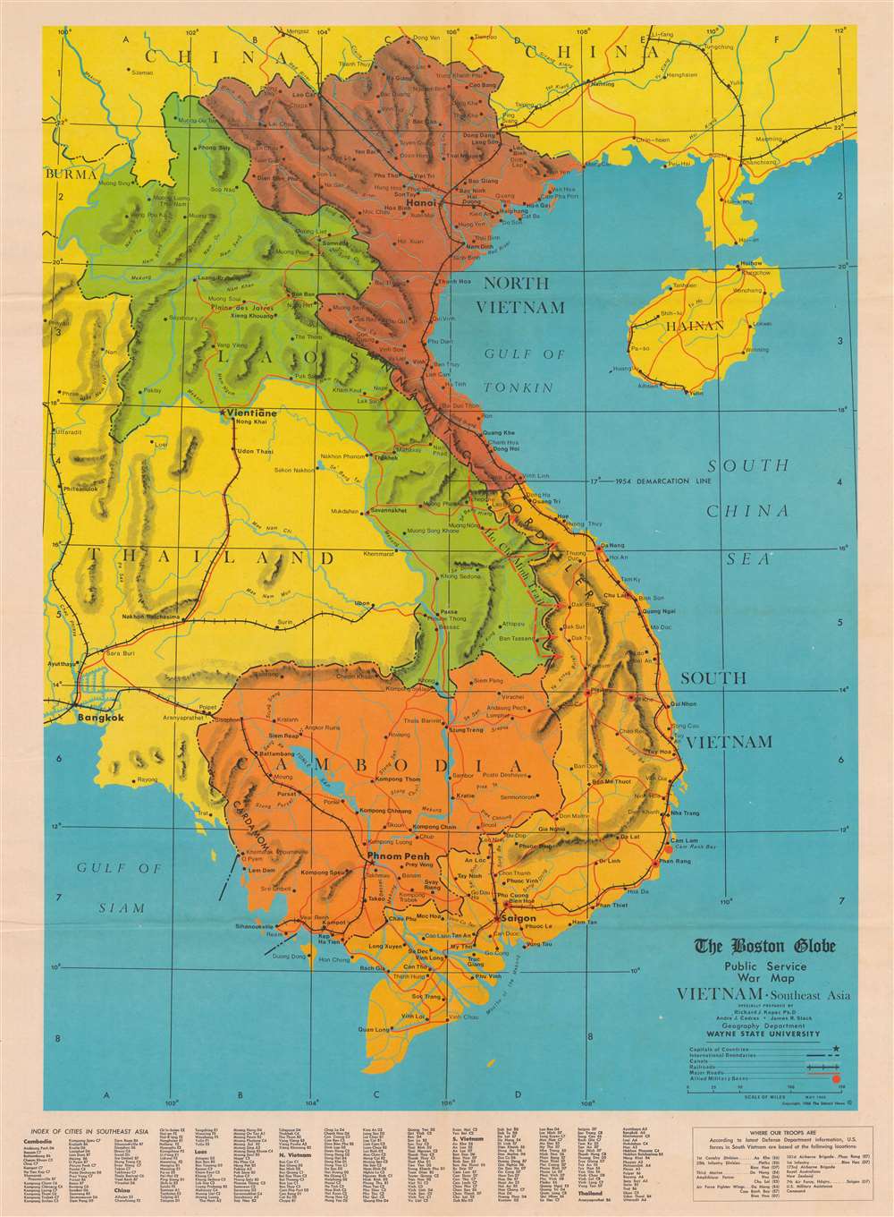
The Boston Globe Public Service War Map Vietnam Southeast Asia.
sold
This is a 1966 Detroit News and Boston Globe map of Southeast Asia published during the Vietnam War (1955 - 1975). This map represents the largest of its kind published by an American newspaper up to that point. (more details)
Londoner's take on the Wild West.

Sheriff Danny Arnold's Pictorial Map of the Old West Showing pioneer trails and battles, Indian's territories, stagecoach lines, military forts, historical data of the frontier period around 1840.
sold
- Digital Map Information
- Suitable for large format printing
- File Size: 45.38 MB
- File Type: ZIP / TIFF
- ICC color profile embedded
- Delivered instantly via download link
This is a c. 1950 Fran Dowie pictorial map of the United States highlighting American frontier history. Captioned illustrations mark important historical events: battles during the Indian Wars, acts of frontier justice against outlaws such as Jesse James and Billy the Kid, and the shootout at the O.K. Corral, are just a few of the events noted. Pioneer trails, such as the Oregon Trail, the Santa Fe Trail, and the Pony Express Route, are illustrated as well. The Grand Canyon, the Rocky Mountains, and the Sierra Nevada Mountains evoke the majesty of the rugged terrain. The whole is surrounded by a pictorial border incorporating portraits of frontier personalities: Doc Holliday, Crazy Horse, Jim Bowie, Wyatt Earp, Davy Crockett, and Jesse James. (more details)
First civilian aerial view of the Panama Canal.
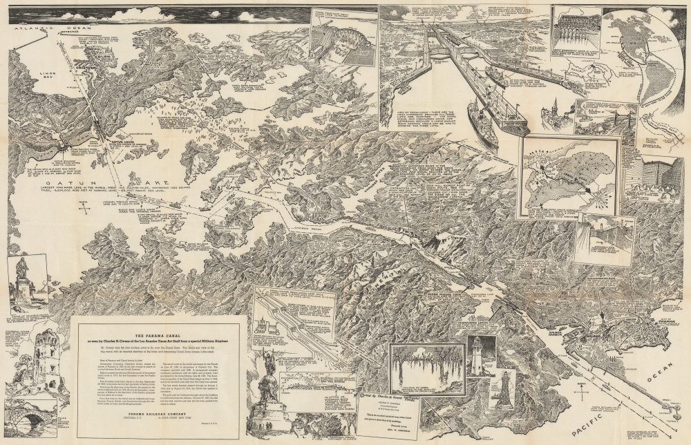
The Panama Canal as seen by Charles H. Owens of the Los Angeles Times Art Staff from special Military Airplane.
sold
- Digital Map Information
- Suitable for large format printing
- File Size: 75.79 MB
- File Type: ZIP / TIFF
- ICC color profile embedded
- Delivered instantly via download link
This is a 1925 Charles H. Owens pictorial bird's-eye view map of the Panama Canal. Owens was the first civilian artist to fly over the canal, offering him a unique perspective and understanding of the canal, resulting in this view. (more details)
Geognostic study of the United States shortly after the Gold Rush.

Geognostische Karte der Nord-Americanischen Freistaaten.
sold
- Digital Map Information
- Suitable for large format printing
- File Size: 13.19 MB
- File Type: ZIP / TIFF
- ICC color profile embedded
- Delivered instantly via download link
A superb 1853 Carl Radefeld and Joseph Meyer geologic map of the United States with special highlighting of the California Gold Region. (more details)
Boston, before the Back Bay.
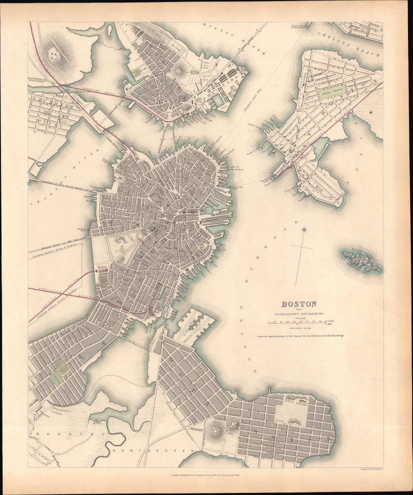
Boston with Charlestown and Roxbury.
sold
- Digital Map Information
- Suitable for large format printing
- File Size: 11.37 MB
- File Type: ZIP / TIFF
- ICC color profile embedded
- Delivered instantly via download link
This is an 1842 Society for the Diffusion of Useful Knowledge (S.D.U.K.) map of Boston. It provides a snapshot of the city in transition, in the early days of the railroad boom, but before much of the landfill that would give Boston its modern form. (more details)
Portland and Ogdensburg Railroad.

Topographical Map of the White Mountains Showing Location of the Portland and Ogdensburg Railroad.
sold
- Digital Map Information
- Suitable for large format printing
- Full resolution TIFF file
- ICC color profile embedded
- Delivered instantly via download link
This is an 1879 John Suwerkrop topographical map of the White Mountains, New Hampshire. The map highlights the route of a short-lived railroad (Portland and Ogdensburg Railroad) for the 1879 meeting of the American Institute of Instruction, the first interstate organization dedicated to improving education within the United States. (more details)
Unobtainable first state of one of the most influential maps of New England ever made.

A MAP of the most INHABITED part of NEW ENGLAND, containing the PROVINCES of MASSACHUSETS BAY and NEW HAMPSHIRE, with the COLONIES of KONEKTIKUT AND RHODE ISLAND. Divided into Counties and Townships: The whole composed of Actual Surveys and its situation adjusted by ASTRONOMICAL OBSERVATIONS.
$55,000.00
Acquire
- Digital Map Information
- Suitable for large format printing
- File Size: 35.46 MB
- File Type: ZIP / TIFF
- ICC color profile embedded
- Delivered instantly via download link
This is the rare 1755 first state of Braddock Mead's French and Indian War Era map of New England - one of the most significant and iconic American maps ever produced. It is one of the first large-format regional maps of any part of North America and was the most comprehensively researched and detailed map of contemporary New England. (more details)
Chromolithograh - one of the largest battles of the Age of Sail.

The Battells One the 28th of May 1672.
sold
- Digital Map Information
- Suitable for large format printing
- File Size: 24.28 MB
- File Type: ZIP / TIFF
- ICC color profile embedded
- Delivered instantly via download link
This is a 1901 10-foot-long chromolithograph view of the Battle of Solebay during the Third Anglo-Dutch War. This dramatic view was issued for the training British naval officers. It was published by the Naval Records Society after paintings made by Willem van de Velde. (more details)
Visualizing the Celestial Sphere.

Situs Terrae Circulis Coelestibus Circundatae.
sold
- Digital Map Information
- Suitable for large format printing
- File Size: 24.78 MB
- File Type: ZIP / TIFF
- ICC color profile embedded
- Delivered instantly via download link
This beautiful work is Andreas Cellarius' celestial chart, in its 1661 second state with sumptuous original color, illustrating the position of the Earth within the celestial sphere divided into its circles. Its lush, baroque presentation - filled with clouds, putti, and muses - frames a useful visual glossary illustrating terminology important to the astronomer and the geographer. (more details)
University of North Carolina after the turn of the century.

University of North Carolina.
sold
- Digital Map Information
- Suitable for large format printing
- File Size: 21.34 MB
- File Type: ZIP / TIFF
- ICC color profile embedded
- Delivered instantly via download link
This is a 1907 Richard Rummell photogravure bird's-eye view of the University of North Carolina. It is one of the rarer Rummell Univeristy views and one that we have not handled or seen previously. (more details)
1818 Manuscript Survey of the Coal Producing Lands of the Lackawanna Watershed, Luzerne County, Penn
At the Dawn of Pennsylvania's Anthracite Boom.

H.W.D. 1818.
sold
- Digital Map Information
- Suitable for large format printing
- File Size: 281.65 MB
- File Type: ZIP / TIFF
- ICC color profile embedded
- Delivered instantly via download link
This is a fascinating manuscript survey, dated 1818, of the southeastern parts of Luzerne County, PA. The survey captures the region in the period just after the invention of the means of exploiting anthracite but prior to the development of the transportation infrastructure required to economically get it to market. (more details)
Malay road network.
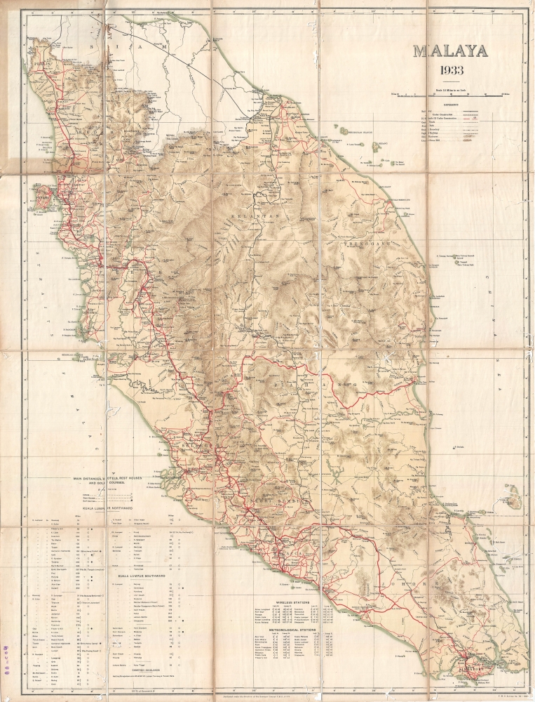
Malaya 1933.
sold
- Digital Map Information
- Suitable for large format printing
- File Size: 16.96 MB
- File Type: ZIP / TIFF
- ICC color profile embedded
- Delivered instantly via download link
A rare 1933 map of Malaya, modern-day Malaysia, issued by the surveyor general of the Federated Malay States (FMS). The map covers the Malay peninsula from the Thai/Siamese border to Singapore. This is a topographical map drawn to illustrate the developing road system. Roads, both extant and under construction, are highlighted in red. The map also details railway lines, cart tracks, light railways, and state boundaries. Hotels, rest houses, and golf courses are also identified. A table in the lower left identifies distances from Kuala Lumpur, wireless stations, and meteorological stations. (more details)
Messageries Maritime's newest vessels.
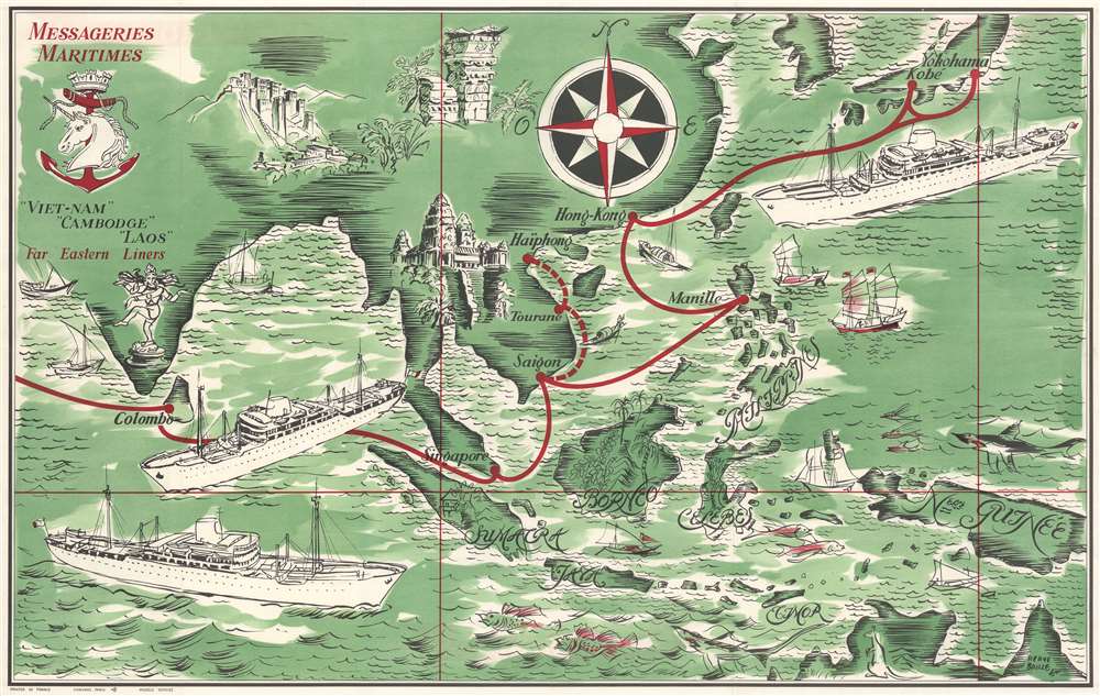
Messageries Maritimes. 'Viet-Nam' 'Cambodge' 'Laos' Far Eastern Liners.
sold
- Digital Map Information
- Suitable for large format printing
- Full resolution TIFF file
- ICC color profile embedded
- Delivered instantly via download link
This is a c. 1950 Hervé Baille pictorial map of Asia issued to promote passage service Messageries Maritime's newest vessels: Cambodge, Laos, and Viet-Nam. The three impressive vessels dominate the page while en route from Colombo to Yokohama. Additional pictorial vignettes highlight historic sites, including Angkor Wat and the Potala Palace. (more details)
Lost Treasure.

Pirates and Treasures of the Southeastern States.
sold
- Digital Map Information
- Suitable for large format printing
- File Size: 27.74 MB
- File Type: ZIP / TIFF
- ICC color profile embedded
- Delivered instantly via download link
This is a playful but informative Keiser and Schlensker 1952 pictorial map of the southeastern United States illustrating lost, sunken, and buried treasure and romanticizing the region's pirate history. (more details)
Where Bachelder mastered viewmaking.

Lewiston, Maine. To the Citizens of Lewiston this picture is most respectfully dedicated by the Publisher John D. Bachelder.
sold
- Digital Map Information
- Suitable for large format printing
- File Size: 14.45 MB
- File Type: ZIP / TIFF
- ICC color profile embedded
- Delivered instantly via download link
An outstanding two-color 1856 lithograph view of Lewiston, Maine, by John D. Bachelder, the famous chronicler of the Battle of Gettysburg. (more details)
Detailing the English Channel.
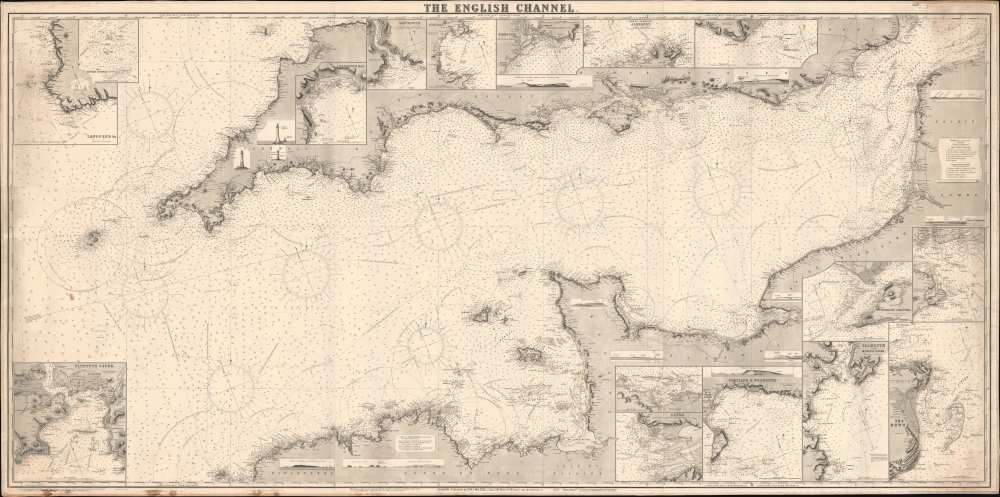
The English Channel.
$800.00
Acquire
- Digital Map Information
- Suitable for large format printing
- File Size: 137.27 MB
- File Type: ZIP / TIFF
- ICC color profile embedded
- Delivered instantly via download link
This is a rare 1887 Norie and Wilson blueback nautical chart of the English Channel. This massive chart is nearly 7 feet long and contains excellent coastal detail and beautiful insets of ports along the English and French coasts. (more details)
India on the eve of the Great Depression.
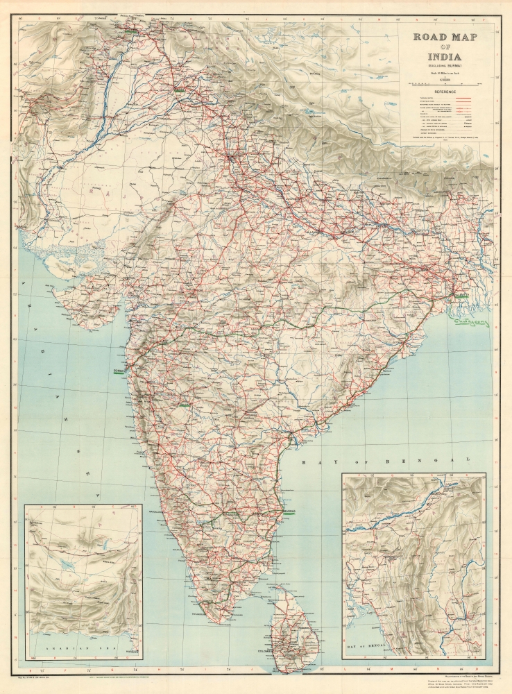
Road Map of India (Excluding Burma).
sold
- Digital Map Information
- Suitable for large format printing
- Full resolution TIFF file
- ICC color profile embedded
- Delivered instantly via download link
This is a 1929 Survey of India road map of India published under Brigadier Robert Henry Thomas. (more details)
Only the fourth known example of the very first subway map for use by the public.
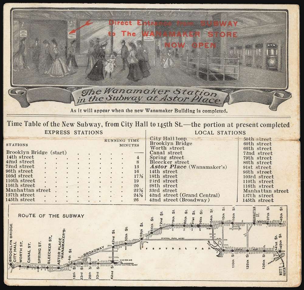
The Wanamaker Vest Pocket Subway Guide / The Wanamaker Station in the Subway at Astor Place.
sold
- Digital Map Information
- Suitable for large format printing
- Full resolution TIFF file
- ICC color profile embedded
- Delivered instantly via download link
This 1904-07 Wanamaker Vest Pocket Subway Guide is one of only four known surviving examples of the first subway map intended for public use. It was printed in 1904 on behalf of, or by, Wanamaker's department stores to promote their expanded New York City location, which featured an underground entrance to the Astor Place subway station. That busy subway platform is pictured here in an image entitled 'The Wanamaker Station in the Subway at Astor Place,' showing fashionably-dressed New Yorkers at the entrance to the Wanamaker's store (pointed out to the reader with the red, hand-stamped note, 'Direct Entrance from Subway to the Wanamaker Store Now Open.')andnbsp; A train, with its taillight shining, can be seen leaving on the uptown track. Below this vignette are a timetable and a map of the nascent subway (then extending from Brooklyn Bridge to 145th Street.) Special attention, naturally, is given on both the map and timetable to the Astor Place stop with its underground Wanamaker's storefront. Although Wanamaker's is long defunct, the same entrance is today used by the sole K-Mart in Manhattan. (more details)
Earliest acquirable state of the Zeno map.
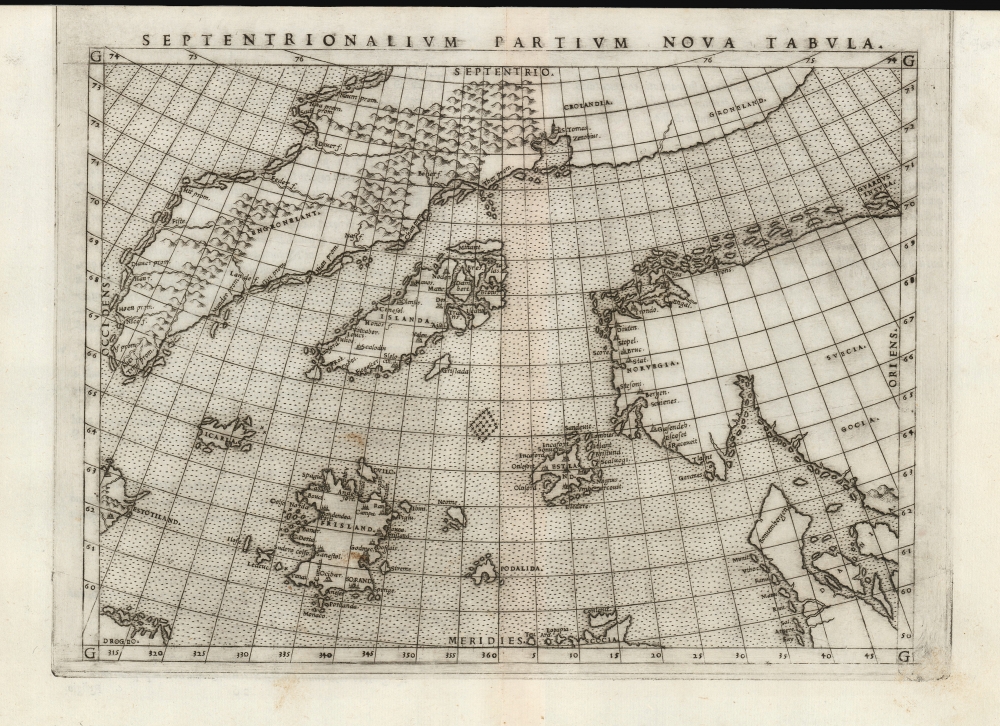
Septentrionalium Partium Nova Tabula.
sold
- Digital Map Information
- Suitable for large format printing
- Full resolution TIFF file
- ICC color profile embedded
- Delivered instantly via download link
This is the most important map of Girolamo Ruscelli's 1561 - 1562 edition Ptolemy: the earliest acquirable iteration of Nicoló Zeno's 1558 Carta Da Navegar De Nicolo et Antonio Zeni Furono In Tramontana Lano MCCCLXXX, revealing the alleged 14th-century voyages of Zeno's ancestors, Nicoló and Antonio. Zeno's fraud, intended to enhance his political power in Venice and later embraced as to co-opt the 1492 Columbia discovery of America, was responsible for the initial appearance and subsequent tenacity of the apocryphal islands Frisland, Icaria, Drogeo, and the coastline of Estotiland, which was taken by some of Europe's finest geographers to be the coast of Labrador. (more details)
One year after statehood - Hawaiian edition.
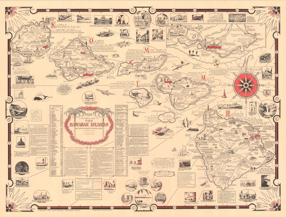
Aloha. A Pictorial Map of the Hawaiian Islands. The United States' Fiftieth State.
sold
This is a scarce 1960 Ernest Dudley Chase and Doris Riemann pictorial map of Hawaii, a visually rich and educational celebration of the archipelago a year after statehood. This is one of the scarcer Chase maps, especially as here, in its Hawaiian edition. (more details)