
One of the earliest comparative mountains and rivers charts and the first to include waterfalls.
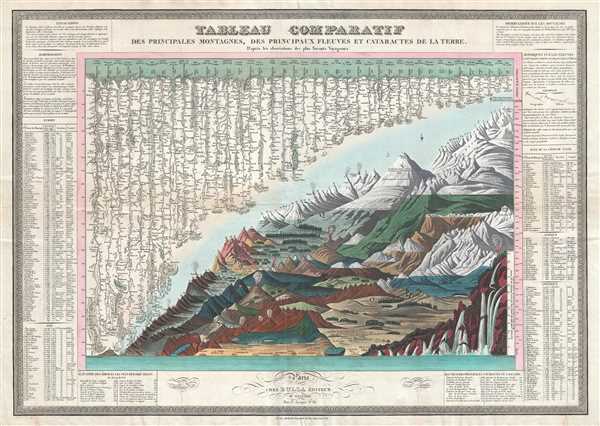
Tableau Comparatif des Principales Montanges, des Principaux Fleuves et Cataractes de la Terre. D'après les observations des plus Savants Voyageurs.
sold
- Digital Map Information
- Suitable for large format printing
- DPI: 300
- File Size: 19.2 MB
- File Type: ZIP / TIFF
- ICC color profile embedded
- Delivered instantly via download link
This is François Bulla's rare 1826 comparative mountains and rivers chart, one of the first charts to integrate mountains and rivers on a single chart, and the first to add waterfalls. For a long time, this map was considered by scholars to be the earliest ... (more details)
Important Japanese Map of Singapore issued just after the WWII Battle of Singapore, considered by Churchill the 'worse disaster' in British Military History.
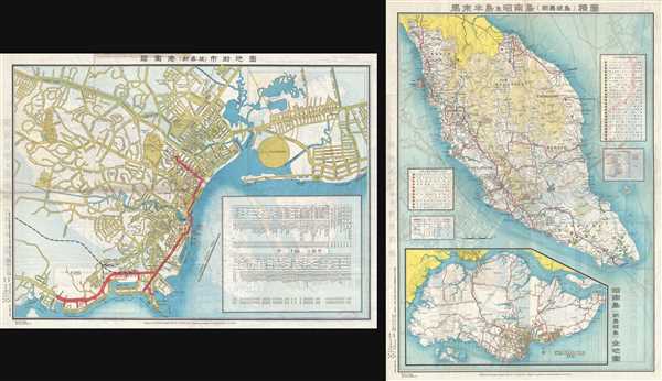
新嘉坡市街地圖 / Map of Singapore City. / Shingapōru shigai chizu. / 馬來半島旅行案内地圖 / Malay Peninsula Travel Map. / Marē Hontō ryokō annai chizu.
sold
- Digital Map Information
- Suitable for large format printing
- File Size: 25.51 MB
- File Type: ZIP / TIFF
- ICC color profile embedded
- Delivered instantly via download link
A very rare 1942 WWII (World War II) map of Singapore City and the Malay Peninsula (Malaysia) issued by the Singapore Japanese Club. Although the first edition of this map was issued in 1938, the present example dates to 1942, and was issued just after ... (more details)
A set of iconic American World War II propaganda broadside maps 'targeting' Berlin and Tokyo.

Target Tokyo; Newsmap. Monday, October 18, 1943. / Target Berlin; Newsmap. Monday, October 25, 1943.
sold
- Digital Map Information
- Suitable for large format printing
- File Size: 24.87 MB
- File Type: ZIP / TIFF
- ICC color profile embedded
- Delivered instantly via download link
Two of the most iconic American World War II propaganda maps, these are F. E Manning's 1943 propaganda broadsides 'Target Berlin' and 'Target Tokyo'. The focus of the broadsides are dramatic shaded panoptic views centered on Berlin and Tokyo, respectively, ... (more details)
An early view of San Francisco, California - possibly before the California Gold Rush.

San Francisco.
sold
- Digital Map Information
- Suitable for large format printing
- Full resolution TIFF file
- ICC color profile embedded
- Delivered instantly via download link
This is a c. 1848 Carl Wilhelm Medau view of San Francisco, California. Although undated, we believe this view to have been created prior to or just at the start of the California Gold Rush due to the relatively small number of buildings illustrated. The ... (more details)
Labels St. Louis, Jefferson City, and Independence.
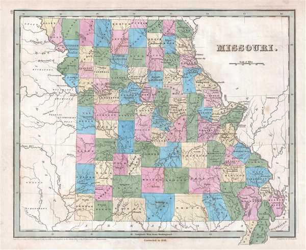
Missouri.
sold
- Digital Map Information
- Suitable for large format printing
- DPI: 300
- File Size: 4.04 MB
- File Type: ZIP / TIFF
- ICC color profile embedded
- Delivered instantly via download link
This is an 1846 Thomas G. Bradford map of Missouri. The map depicts the region from the modern-day states of Nebraska, Kansas, and Oklahoma, all labeled here as 'Indian District, to the Mississippi River, Illinois, and Kentucky, and from the ... (more details)
A wonderful pictorial tourist map of the Black Hills that features illustrations of stagecoaches, cowboys, and bison.

Souvenir Map of the Black Hills of South Dakota: The Sunshine State.
sold
- Digital Map Information
- Suitable for large format printing
- File Size: 17.19 MB
- File Type: ZIP / TIFF
- ICC color profile embedded
- Delivered instantly via download link
This is a c. 1947 K. Pyle pictorial map of the Black Hills, a small isolated mountain range located in western South Dakota and eastern Wyoming. The map depicts the region from Sundance, Wyoming to Rapid City, South Dakota and from Belle ... (more details)
Beautiful pictorial map of the Western Hemisphere featuring vignettes of wildlife, natural resources, and cities.
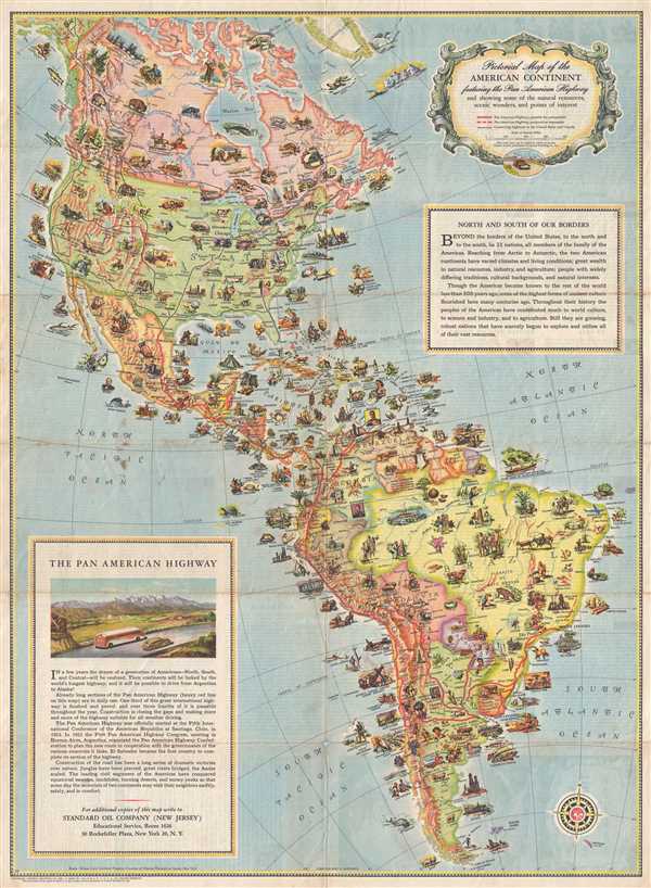
Pictorial Map of the American Continent following the Pan American Highway and showing some of the natural resources, scenic wonders, and points of interest.
sold
- Digital Map Information
- Suitable for large format printing
- File Size: 14.93 MB
- File Type: ZIP / TIFF
- ICC color profile embedded
- Delivered instantly via download link
This is a very attractive and beautifully illustrated c.1930 pictorial map of North America and South America created to promote the Pan-American Highway, a network of roads measuring about 29,800 miles in length. Except for an ... (more details)
An uncommon and detailed map depicting Australia and the East Indies.

Johnson's Australia and East Indies.
sold
- Digital Map Information
- Suitable for large format printing
- File Size: 12.44 MB
- File Type: ZIP / TIFF
- ICC color profile embedded
- Delivered instantly via download link
This is an 1867 A. J. Johnson map of Australia, the East Indies, and Southeast Asia. The map depicts from modern-day Thailand and Vietnam to Australia, including all of the East Indies, the Philippines, and New Guinea. Highly ... (more details)
The first edition of Johnson's newly engraved Asia map.

Johnson's Asia.
sold
- Digital Map Information
- Suitable for large format printing
- File Size: 10.9 MB
- File Type: ZIP / TIFF
- ICC color profile embedded
- Delivered instantly via download link
This is A. J. Johnson and Ward's 1867 map of Asia. The map depicts the region from central Europe to the Pacific Ocean and the Aleutian Islands and from the Arctic Ocean to Borneo and New Guinea. In 1867, Johnson did a major ... (more details)
A charming map of New York City and the surrounding area.
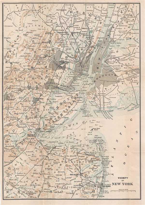
Vicinity of New York.
sold
- Digital Map Information
- Suitable for large format printing
- File Size: 3.56 MB
- File Type: ZIP / TIFF
- ICC color profile embedded
- Delivered instantly via download link
This is a c. 1910 map of New York City and its vicinity. The map depicts the region from Plainfield, New Jersey to Jamaica, New York and from Bergen County, New Jersey and Westchester County, New York to Monmouth County, New ... (more details)
A unique and special broadsheet propaganda piece relating to the early colonization of Queensland, Australia.

Queensland Government : important to farmers, their sons, working farm men, gardeners, fruit growers, dairymen, and others wishing to obtain freehold homes, and cultivate their own land.
sold
- Digital Map Information
- Suitable for large format printing
- File Size: 10.12 MB
- File Type: ZIP / TIFF
- ICC color profile embedded
- Delivered instantly via download link
An extraordinary rare government-issued 1898 broadsheet chromolithograph poster promoting immigration to Queensland, Australia. Surrounding a map of Queensland highlighting regional Land Offices, this broadsheet boasts of ... (more details)
A detailed and humorous depiction of Cape Cod.

A Map of Cape Cod.
sold
- Digital Map Information
- Suitable for large format printing
- File Size: 15.99 MB
- File Type: ZIP / TIFF
- ICC color profile embedded
- Delivered instantly via download link
This is a 1930 Town Crier Shop pictorial map of Cape Cod, Massachusetts. The map depicts the region from Buzzards Bay to the Atlantic Ocean and from Race Point to Woods Hole. Highly detailed, numerous locations throughout ... (more details)
A souvenir from the 1893 Chicago World's Fair - the expo that became synonymous with 'American Exceptionalism'.

Souvenir of World Fair Chicago 1893.
sold
- Digital Map Information
- Suitable for large format printing
- File Size: 13.6 MB
- File Type: ZIP / TIFF
- ICC color profile embedded
- Delivered instantly via download link
This is an 1893 souvenir silk kerchief featuring a view of the 1893 Chicago World's Fair, which was officially called the 1893 World Columbian Expo. Opened in 1892 to celebrate the 400th anniversary of the landing of ... (more details)
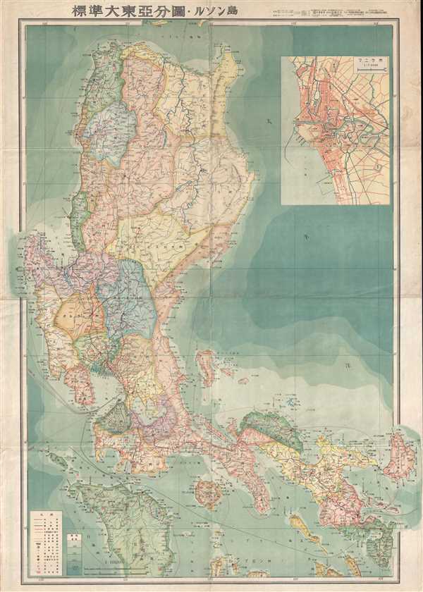
A highly uncommon Coprosperity Sphere map.

標準大東亞分圖 : ルソン島 / Standard Map of the Great East Asia: Luzon.
sold
- Digital Map Information
- Suitable for large format printing
- File Size: 16.5 MB
- File Type: ZIP / TIFF
- ICC color profile embedded
- Delivered instantly via download link
This is an important and rare World War II (WWII) 1943 Showa 18 Japanese Map of the Philippines. The map covers the northern Philippine Island of Luzon. Oceanic depths are illustrated with blue shading. Air and sea ... (more details)
A 1959 reissue of a highly uncommon Coprosperity Sphere map.
標準大東亞分圖 : ルソン島 / Standard Map of the Great East Asia: Luzon.
sold
- Digital Map Information
- Suitable for large format printing
- File Size: 13.05 MB
- File Type: ZIP / TIFF
- ICC color profile embedded
- Delivered instantly via download link
A 1959 reissue of an important and rare World War II (WWII) 1943 Showa 18 Japanese Map of the Philippines. The map covers the northern Philippine Island of Luzon. Oceanic depths are illustrated with blue shading. ... (more details)
Illustrates the Baltimore and Ohio Railroad, which wouldn't be completed until 1851.
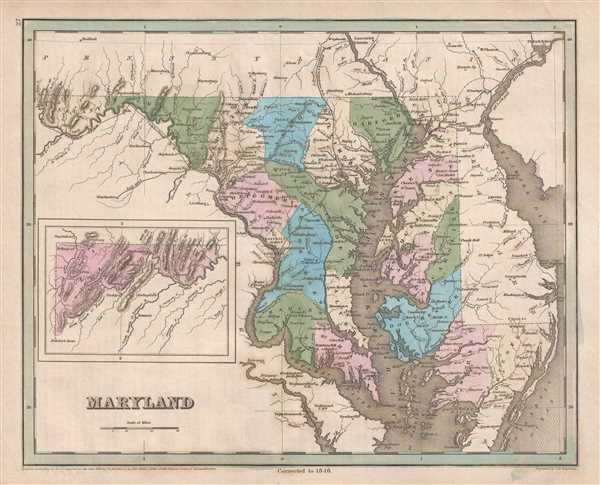
Maryland.
sold
- Digital Map Information
- Suitable for large format printing
- DPI: 300
- File Size: 5.01 MB
- File Type: ZIP / TIFF
- ICC color profile embedded
- Delivered instantly via download link
This is an 1846 Thomas G. Bradford map of Maryland. The map depicts the region from Cumberland, Maryland to Delaware Bay and from Pennsylvania to Virginia. An inset map situated in the lower left corner illustrates ... (more details)
A charming pictorial map of the coast of Massachusetts - features an illustration of the Gloucester Sea Serpent and several famous ships.

An Historic and Pictorial Map of Boston Harbor and Massachusetts Bay Includeing Cape Cod and Cape Ann.
sold
- Digital Map Information
- Suitable for large format printing
- File Size: 4.64 MB
- File Type: ZIP / TIFF
- ICC color profile embedded
- Delivered instantly via download link
This is a 1941 Edward Rowe Snow pictorial map of Boston Harbor, Massachusetts Bay, and Cape Cod. The Map depicts the Atlantic coast of Massachusetts from Cape Ann to Buzzards Bay and Nantucket Sound. Highly ... (more details)
Features illustrations of Grand Canyon National Park and Mesa Verde National Park - both of which border the Navajo Nation.
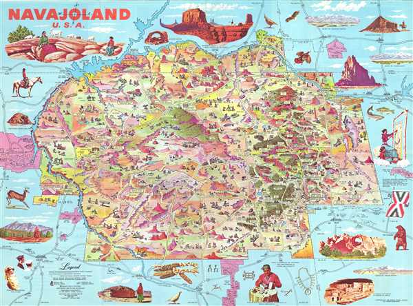
Navajoland U.S.A.
sold
- Digital Map Information
- Suitable for large format printing
- File Size: 18.1 MB
- File Type: ZIP / TIFF
- ICC color profile embedded
- Delivered instantly via download link
This is the 1968 edition of Don Bloodgood's pictorial map of the Navajo Nation. The map was published for the Navajo Tribal Council to strengthen tribal identity, both internally and externally, in the face of compounded external pressure relating to the discovery of rich mineral deposits on Navajo lands, and internal crises due to poor infrastructure and endemic poverty. The map, a celebration of Navajo land and culture, was distributed for free nationally, where it drew attention to tribal causes. (more details)
llustrates the Presidential Election of 1884 between Grover Cleveland and James G. Blaine.
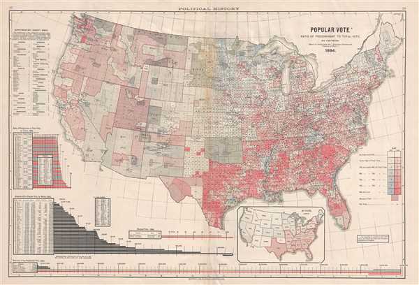
Popular Vote. Ratio of Predominant to Total Vote, by Counties.
sold
- Digital Map Information
- Suitable for large format printing
- File Size: 11.32 MB
- File Type: ZIP / TIFF
- ICC color profile embedded
- Delivered instantly via download link
This is a Fletcher W. Hewes and Charles Scribner's Sons political map of the United States. The map depicts the continental United States from the Pacific Ocean to the Atlantic Ocean and from the Canadian ... (more details)
Summarizes the state of affairs in immediately before World War II in Africa.

The Knickerbocker News Map of Africa.
sold
- Digital Map Information
- Suitable for large format printing
- File Size: 7.2 MB
- File Type: ZIP / TIFF
- ICC color profile embedded
- Delivered instantly via download link
This is a 1938 Sparland pictorial map of Africa relating to events leading up to World War II. The map depicts the continent of Africa from the Mediterranean Sea to the Cape of Good Hope and from the ... (more details)