
An iconic and beautiful map of New York City.
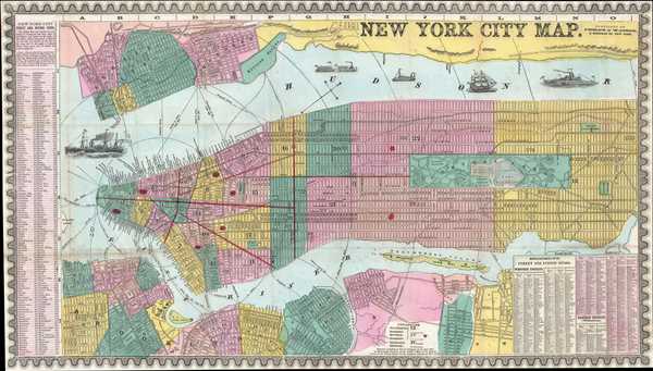
New York City Map.
sold
- Digital Map Information
- Suitable for large format printing
- File Size: 14.27 MB
- File Type: ZIP / TIFF
- ICC color profile embedded
- Delivered instantly via download link
This is an uncommon and colorful 1857 map of New York City by Humphrey Phelps. The map depicts Manhattan south of 131st Street as well as adjacent parts of Brooklyn, Queens, Hoboken, and Jersey City. Individual streets are named as are many individual buildings. ... (more details)
Early edition of the most unusual and decorative pocket maps of New York City to appear in the 19th century.
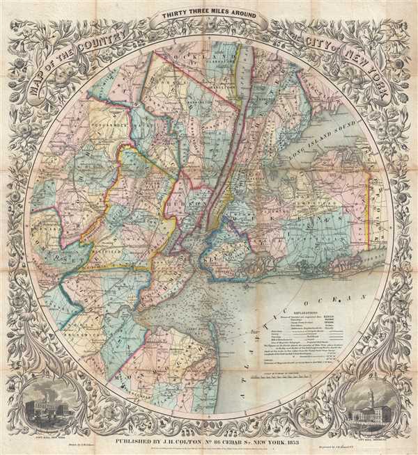
Map of The Country Thirty Three Miles Around The City of New York.
sold
- Digital Map Information
- Suitable for large format printing
- DPI: 300
- File Size: 23.06 MB
- File Type: ZIP / TIFF
- ICC color profile embedded
- Delivered instantly via download link
This is the extremely rare 1853 edition of one of the most beautiful pocket maps of New York made in the 19th century: Colton's Thirty Three Miles Around the City of New York . The map depicts New York City and vicinity as far south as Ocean County, New Jersey, ... (more details)
Highlights mass transit in New York City including the Elevated Railroad and the Street Horse Cart Railroads.

Citizens and Travelers Guide Map in, to and from the City of New York and Adjacent Places.
sold
- Digital Map Information
- Suitable for large format printing
- File Size: 15.62 MB
- File Type: ZIP / TIFF
- ICC color profile embedded
- Delivered instantly via download link
This is an 1877 D. A. Edsall and Company city map or plan of New York City drawn to promote 'Adams Express Company'. The map depicts Manhattan from 63rd Street to The Battery and from the Hudson (North) River to Hunter's Point, Green Point, and Brooklyn. An ... (more details)
Charming map of Central Park.

Map of Central Park.
sold
- Digital Map Information
- Suitable for large format printing
- File Size: 1.64 MB
- File Type: ZIP / TIFF
- ICC color profile embedded
- Delivered instantly via download link
This is an 1866 map of Central Park shortly after its completion when it was considered an innovative wonder of urban civic design. The map depicts the park from 58th Street to 111th Street and from Columbus Avenue to Madison Avenue. Highly detailed, ... (more details)
Illustrates the route of the South Carolina Rail Road Company.
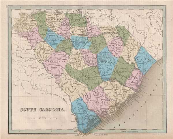
South Carolina.
sold
- Digital Map Information
- Suitable for large format printing
- DPI: 300
- File Size: 4.61 MB
- File Type: ZIP / TIFF
- ICC color profile embedded
- Delivered instantly via download link
This is an 1846 Thomas G. Bradford map of South Carolina. The map depicts the region from Georgia to the Atlantic Ocean and from North Carolina to Savannah, Georgia. The route of the South Carolina Rail Road Company, between Charleston, Columbia, and ... (more details)
Beautiful map illustrating Albemarle Sound, Pamplico Sound, Cape Fear, and Cape Hatteras.

North Carolina.
sold
- Digital Map Information
- Suitable for large format printing
- DPI: 300
- File Size: 4.9 MB
- File Type: ZIP / TIFF
- ICC color profile embedded
- Delivered instantly via download link
This is an 1846 Thomas G. Bradford map of North Carolina. The map depicts the retion from Kentucky, Tennessee, and Georgia to the Atlantic Ocean and from Kentucky and Virginia to South Carolina and Georgia. Highly detailed, each county is labeled and ... (more details)
Yaggy's important anatomical study, a publishing landmark of its time.
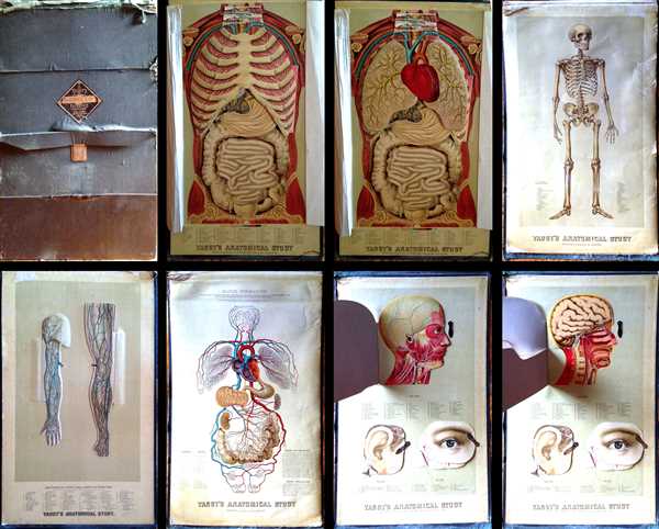
Yaggy's Anatomical Study Presenting the Skeleton, Muscles, Arteries, Veins and Nerves also Four Life-Size Manikins of The Body, The Head, The Eye and Ear with Additional Manikins of Arm and Leg.
sold
- Digital Map Information
- Suitable for large format printing
- Full resolution TIFF file
- ICC color profile embedded
- Delivered instantly via download link
This is an 1886 edition of Levi W. Yaggy’s important anatomical study. This large folio, intended for the instruction of human anatomy, contains large life-size charts or ‘manikins’ featuring the human anatomy, which include the skeleton, ... (more details)
The region that provides the world with one of its finest spirits - mezcal.
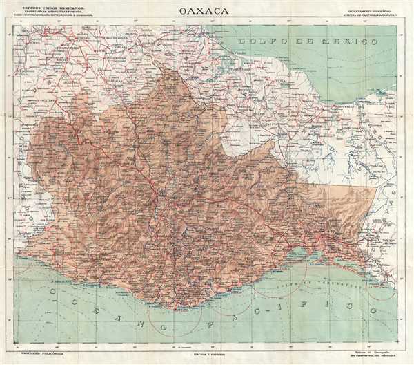
Oaxaca.
sold
- Digital Map Information
- Suitable for large format printing
- File Size: 10.83 MB
- File Type: ZIP / TIFF
- ICC color profile embedded
- Delivered instantly via download link
This is a 1942 Secretaria de Agricultura y Fomento map of the state of Oaxaca, in southern Mexico. The map depicts Oaxaca from its borders with Guerrero and Puebla to Chiapas and Tabasco and from Puebla, Veracruz, and the Gulf of Mexico to the ... (more details)
Includes the Austro-Hungarian Empire.
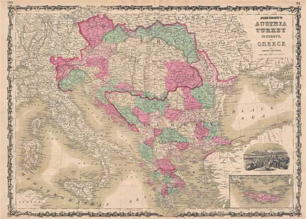
Johnson's Austria Turkey in Europe and Greece.
sold
- Digital Map Information
- Suitable for large format printing
- File Size: 13.94 MB
- File Type: ZIP / TIFF
- ICC color profile embedded
- Delivered instantly via download link
This is a beautiful example of Johnson and Ward's 1863 map of Austria, Turkey in Europe and Greece. The map depicts from Italy eastward to include all of Austria, Hungary, the Balkans (Bosnia, Serbia, Albania, Croatia, Macedonia, Bulgaria, ... (more details)
A beautiful map of Kentucky and Tennessee just after the outbreak of the American Civil War.

Johnson's Kentucky and Tennessee.
sold
- Digital Map Information
- Suitable for large format printing
- File Size: 16.72 MB
- File Type: ZIP / TIFF
- ICC color profile embedded
- Delivered instantly via download link
This is an 1863 A. J. Johnson map of Kentucky and Tennessee. The map depicts the region from Arkansas to Virginia and North Carolina and from Ohio, Indiana, and Illinois to Alabama and Georgia. Probably the most decorative of Johnson's ... (more details)
The United States on the cusp of the Mexican American War with unusual Texas pre-Comprimise of 1850 configuration.
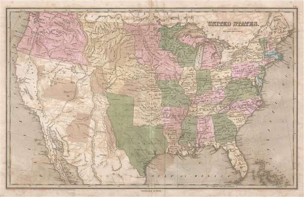
United States.
sold
- Digital Map Information
- Suitable for large format printing
- Full resolution TIFF file
- ICC color profile embedded
- Delivered instantly via download link
This is the scarce 1846 Thomas G. Bradford map of the United States including Texas at its fullest. The map, published on the cusp of the Mexican-American War, depicts the country from the Pacific Ocean to the Atlantic Ocean and from ... (more details)
Scarce Hartford Map imprint arguing Manifest Destiny.
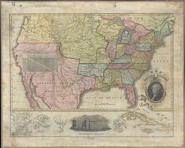
Map of the United States Compiled from the most Authentic Sources.
sold
- Digital Map Information
- Suitable for large format printing
- DPI: 300
- File Size: 20.46 MB
- File Type: ZIP / TIFF
- ICC color profile embedded
- Delivered instantly via download link
This is a fascinating 1833 wall map of the United States published in Hartford, Connecticut, by Willis Thrall. In an unusual flourish for the time, Thrall's map covers the United States from Coast to Coast, extending from Oregon to ... (more details)
Scarce linen map of Long Island prepared for motoring enthusiasts.
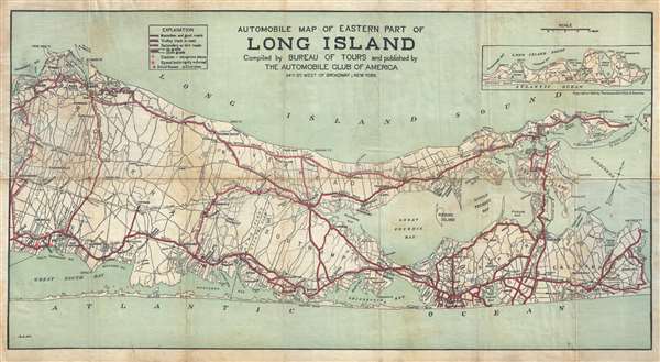
Automobile Map of Eastern Part of Long Island compiled by Bureau of Tours and published by the Automobile Club of America.
sold
- Digital Map Information
- Suitable for large format printing
- File Size: 23.04 MB
- File Type: ZIP / TIFF
- ICC color profile embedded
- Delivered instantly via download link
This is a rare linen map of Suffolk County, Long Island, New York, including the Hamptons, prepared by L. B. Mork for the Automobile Club of America. The map extends from Stony Brook and Sayville east, past Southampton, ... (more details)
Map made at the height of the Shanghaiing epidemic in San Francisco and Astoria.
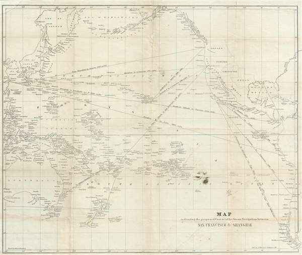
Map indicating the proposed Course of the Steam Navigation between San Francisco and Shanghae.
sold
- Digital Map Information
- Suitable for large format printing
- DPI: 300
- File Size: 6.76 MB
- File Type: ZIP / TIFF
- ICC color profile embedded
- Delivered instantly via download link
This is an unusual c. 1850 China Trade map illustrating the steam navigation routes between San Francisco, California, Shanghai, China, and Sydney, Australia. The map coves all of the Pacific Ocean from New Zealand to ... (more details)
Illustrates the recently completed Atlantic Telegraph.
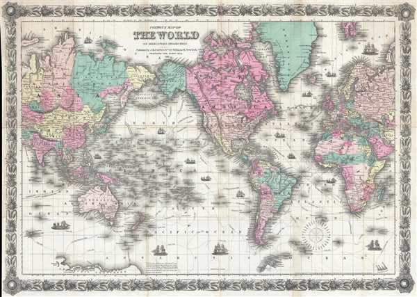
Colton's Map of the World on Mercator's Projection.
sold
- Digital Map Information
- Suitable for large format printing
- File Size: 15.14 MB
- File Type: ZIP / TIFF
- ICC color profile embedded
- Delivered instantly via download link
This is a rare 1859 J.H. Colton folding pocket map of the world on a Mercator Projection. With the Americas at center, the map depicts the entire known world from Central Asia and the Indian Ocean to Russia, the Middle ... (more details)
Iconic humorous map satirizing the stereotypical insular Bostonian.

This Map Presents A Bostonian's Idea of the United States of America.
sold
- Digital Map Information
- Suitable for large format printing
- File Size: 4.16 MB
- File Type: ZIP / TIFF
- ICC color profile embedded
- Delivered instantly via download link
This is a 1936 Daniel Wallingford map of the United States as viewed by the stereotypical Bostonian. Poking fun at the caricaturized idea of a Bostonian, the map depicts the country varying detail, with a high degree of accuracy and numerous cities and towns labeled in the Northeast and decreasing accuracy and density of cities and towns further to the west. Cape Cod in particular is disproportionately enormous. The 'western prairies' the cities are listed, but not placed anywhere, rather are simply said to be 'located in this territory'. The Mississippi River barely extemds north beyhond Saint Louis, while Denver and Omaha are both decidedly West Coast cities. As a point of caution, the publishers have included a warning, 'As this map contains some inaccuracies, its use in connection with problems in navigation, astronomy, meteorology, etc. is not recommended.' An inset map of Boston and its environs is located in the lower right corner, with 'important cities and towns not shown on general map for lack of space are included in this inset.' It is also of note that Bali is no longer located in Indonesia, but just off the coast of Central America, per this map. (more details)
Extremely rare nautical chart of the Kattegat and Baltic Seas.
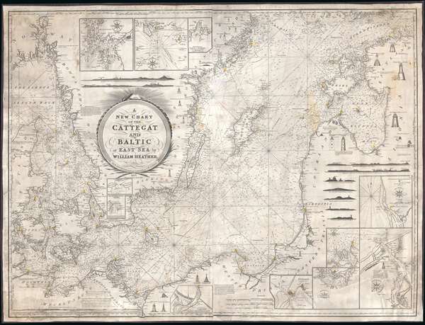
A New Chart of the Cattegat and Baltic or East Sea.
sold
- Digital Map Information
- Suitable for large format printing
- DPI: 300
- File Size: 45.15 MB
- File Type: ZIP / TIFF
- ICC color profile embedded
- Delivered instantly via download link
This is an extremely rare and extraordinarily beautiful 1837 William Heather and John William Norie blueback nautical chart or maritime map of the Kattegat and Baltic Seas. The map depicts the region from Norway and Denmark (Jutland) to the Baltic States of Estonia and Latvia (Eastland, Livonia, Courland) and from Norway and the Gulf of Finland to northern Europe. The map is highly detailed with numerous cities are labeled, including Copenhagen, Stockholm (Christiana), Gdańsk (Danzig), Talinn (Revel), and Riga. Myriad depth soundings are indicated, particularly in the Kattegat Sea and along the coastlines. Numerous inset maps are included along three of the four sides. Along the top border, three inset maps situated and illustrate the entrances to Gothenburg, the principal entrance to Stockholm, and the harbor of Sleete or Slitehamn, on the island of Gottland. Along the right side and bottom border, inset maps depict the entrance to Klaipėda (Memel), Lithuania, Riga, Rogerwyck, the entrance to Szczecin (Stettin), Poland, Baltiysk, Poland, and a second inset map illustrating the entrance to Szczecin. Manuscript notations in yellow ink throughout the map mark the locations of lighthouses and other lights used for navigation. Twenty-eight different lighthouses are illustrated in profile, along with notes concerning others. One such note, located on the Jutland Peninsula, informs the viewer that a striped flag is hoisted from the Scaw lighthouse if ice in the Kattegat impedes navigation. Other notes inform the viewer on improvements to harbors, or when the lighthouses in certain parts of the region are lit. Several coastal views are also illustrated, allowing a mariner to have a better understanding of what they should be seeing when passing a given stretch of coastline. An extremely decorative title cartouche is situated slightly to the left of center. (more details)
A scarce and incredibly charming pictorial map of Yellowstone National Park.
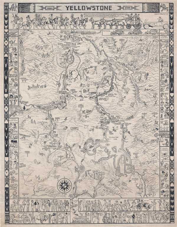
Yellowstone.
sold
This is a scare 1935 Jo Mora pictorial map of Yellowstone National Park. The map depicts the park in detail from West Yellowstone, Montana to the east entrance to the park and from Gardiner, Montana to the park's south ... (more details)
A definitive early map of the Hopi (Moqui) pueblos in New Mexcio and Arizona.
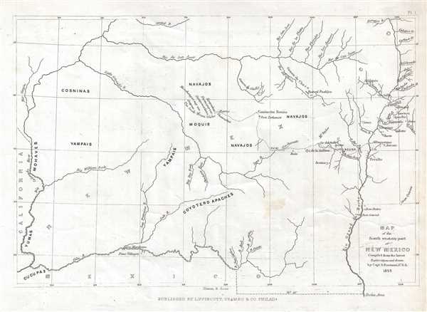
Map of the South western part of New Mexico.
sold
- Digital Map Information
- Suitable for large format printing
- DPI: 300
- File Size: 1.28 MB
- File Type: ZIP / TIFF
- ICC color profile embedded
- Delivered instantly via download link
This is an 1853 Seth Eastman map of New Mexico and Arizona focusing on the seven Moqui or Hopi pueblos. The map depicts the region from the Colorado River to the Rio Grande del Norte and the cities of Santa Fe and ... (more details)
A whimsical window into the childhood wonderland of Mother Goose.

To the Land of Mother Goose.
sold
- Digital Map Information
- Suitable for large format printing
- File Size: 6.78 MB
- File Type: ZIP / TIFF
- ICC color profile embedded
- Delivered instantly via download link
This is a rare 1930 Perin Gift Company pictorial map of Mother Goose Land. The central image depicts Mother Goose flying on her goose, and numerous nursery rhymes are illustrated. Beloved classics, such as 'Hey, ... (more details)