
The largest best view of Victoria - printed in Victoria.

Victoria, B.C. 1889.
sold
- Digital Map Information
- Suitable for large format printing
- File Size: 140.21 MB
- File Type: ZIP / TIFF
- ICC color profile embedded
- Delivered instantly via download link
A fine two-color chromolithograph bird's-eye view of Victoria, British Columbia, Canada, published by Ellis and Co., owner of the local Victoria newspaper The Colonist. The view looks northeast on Victoria from a high point above the Strait of Juan de Fuca. When this map was made, Victoria was entering a period of rapid growth and expansion, leading to a high degree of civic pride and 'presumably' a market for this magnificent view - by far the largest 19th-century view of the city. (more details)
Manuscript Viet Cong tactical map during Mini-Tet.

Trân Tấn Công Câù Chư Y.
sold
This is an original 1968 Vietnam War Viet Cong manuscript battle plan illustrating the Battle of South Saigon (Battle of the Y Bridge). Viet Cong officers undoubtedly used this plan in the field to formulate and communicate tactics. (more details)
The United States for the curious Swede.
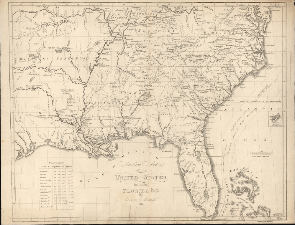
Southern Section of the United States including Florida etc. by John Melish.
$2,400.00
Acquire
- Digital Map Information
- Suitable for large format printing
- File Size: 17.01 MB
- File Type: ZIP / TIFF
- ICC color profile embedded
- Delivered instantly via download link
This is a rare 1824 Swedish map of Florida and the Southeastern United States published by Axel Leonard Klinckowström after the scarce 1816 map of John Melish. The map accompanied Klinckowström's Tocqueville-style narrative, expounding on the United States for Swedish audiences. (more details)
India as the key to Asia and the theater of the Great Game.
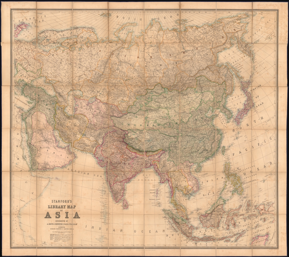
Stanford's Library Map of Asia.
sold
- Digital Map Information
- Suitable for large format printing
- File Size: 186.28 MB
- File Type: ZIP / TIFF
- ICC color profile embedded
- Delivered instantly via download link
This is an 1863 Edward Stanford and A. K. Johnston wall map of Asia. The map is designed to underscore British power and influence, both highlighting its colonial jewels and emphasizing the theaters of the Great Game in Central Asia. (more details)
The Mapuche in Chile.

Mapa Del Pais Que Habitan Los Araucanos En Chile, De Poncho Chileno.
sold
- Digital Map Information
- Suitable for large format printing
- File Size: 12.43 MB
- File Type: ZIP / TIFF
- ICC color profile embedded
- Delivered instantly via download link
This is a rare 1827 map of the Mapuche regions of south-central Chile based on the 1795 cartography of naturalist Juan Ignacio Molina - the first to map the lands of the Mapuche in any detail. (more details)
Rise and fall of Lemuria.
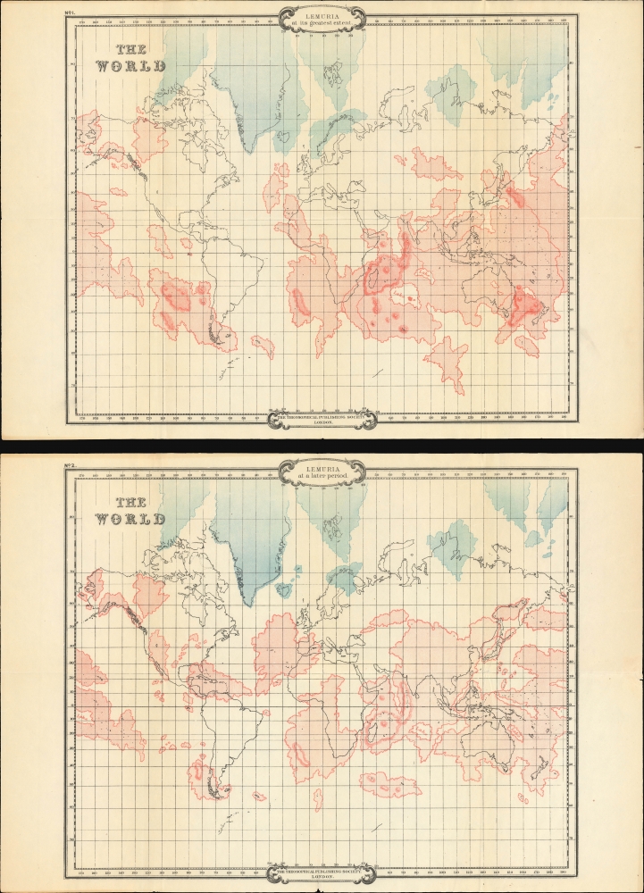
Lemuria at its Greatest Extent. / Lemuria at a Later Period.
sold
- Digital Map Information
- Suitable for large format printing
- File Size: 31.55 MB
- File Type: ZIP / TIFF
- ICC color profile embedded
- Delivered instantly via download link
An intriguing set of 2 maps, c. 1904, tracing the rise and fall of the lost civilization of Lemuria based upon the writings of William Scott-Elliot and the clairvoyant visions of Charles Webster Leadbeater. The maps underscore the late 19th and early 20th-century obsession with Lemuria, Atlantis, and all things 'mystical,' as well as the need to contextualize 'clairvoyant' visions with history and science. (more details)
A refrain that rings a little too true in 2020.

They've got an invisible program to end an undeclared war backed by a silent majority.
sold
This is a 1970 Robert Grossman and 'The Fund for New Priorities in America' anti-Vietnam-War broadside denouncing the lack of action by President Richard Nixon and the U.S. Senate. Entitled, They've got an invisible program to end and undeclared war backed by a silent majority, the broadside fires with 'both barrels' from the start. By using the phrases 'invisible program,' 'undeclared war,' and 'silent majority,' The Fund for New Priorities in America makes it clear they believe their government is purposely misleading the American people. (more details)
La Guerra Hispano-Estadounidense.
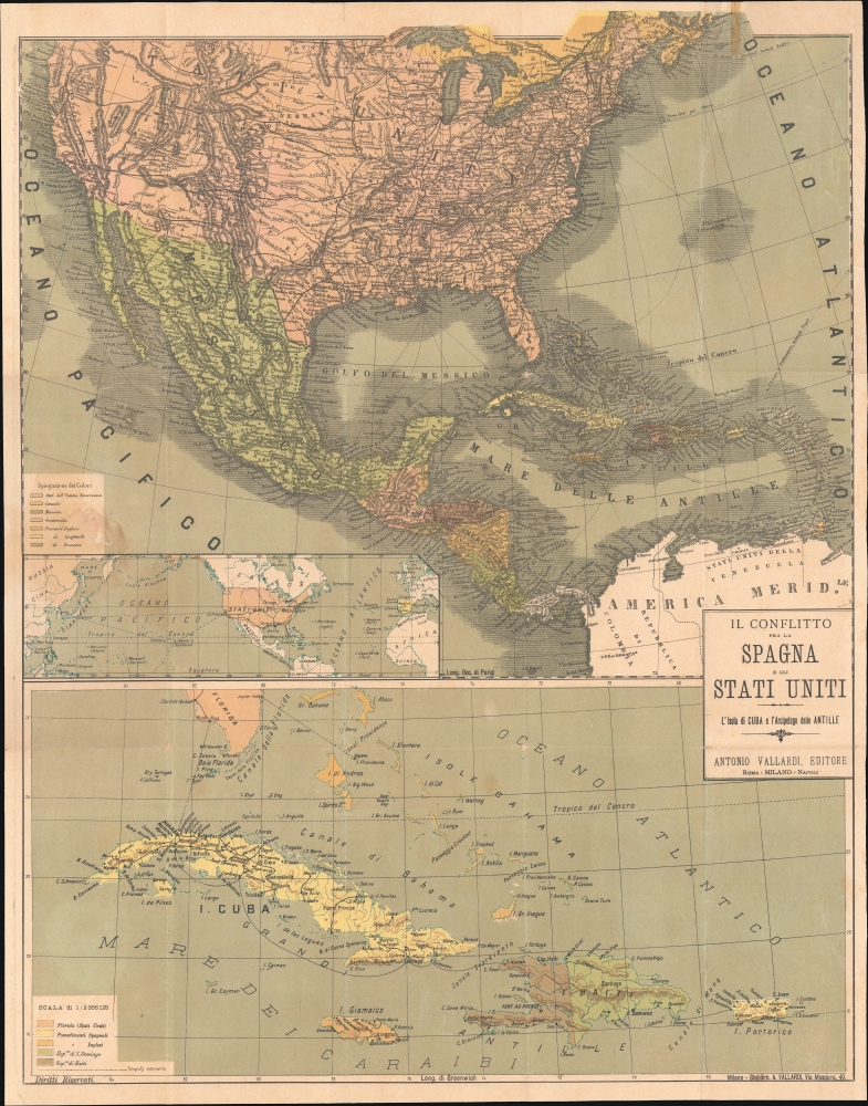
Il conflitto fra la Spagna e gli Stati Uniti L'Isola di Cuba e l'Arcipelago delle Antille.
sold
- Digital Map Information
- Suitable for large format printing
- Full resolution TIFF file
- ICC color profile embedded
- Delivered instantly via download link
A scarce c. 1898 Antonio Vallardi Italian-language folding map of the theaters of the Spanish-American War. While Italy had no direct involvement in the war, Italians were keenly interested in the broader geopolitical implications, particularly how the decline of the Spanish Empire might affect European colonial ambitions and the stability of the Mediterranean. (more details)
Short Route to (or from) India.
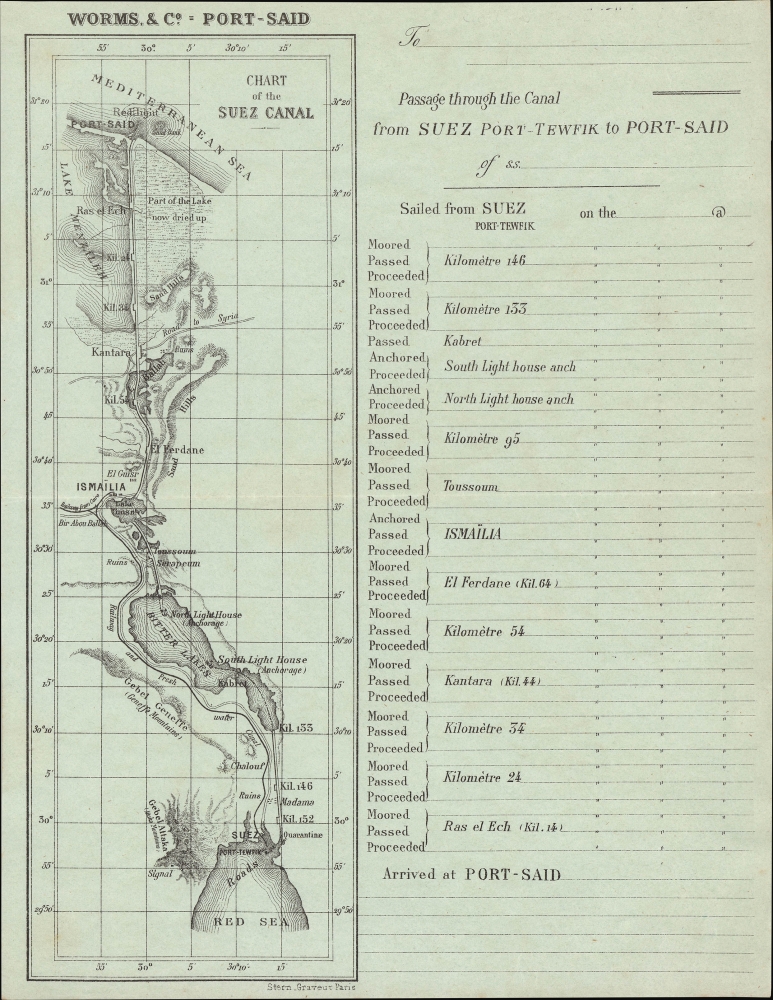
Chart of the Suez Canal. Passage through the Canal from Suez Port-Tewfik to Port-Said.
sold
- Digital Map Information
- Suitable for large format printing
- File Size: 4.5 MB
- File Type: ZIP / TIFF
- ICC color profile embedded
- Delivered instantly via download link
An intriguing lettersheet from the early days of the Suez Canal, this c. 1875 souvenir map and table was meant to chart the progress of a ship and its passengers through the canal. (more details)
Occupied Germany after World War II.

Atlanta Karte der Besatzungs-Zonen mit Neuen Postleitgebieten. Map of the Occupation Areas. Carte des Zones d'Occupation. КАРТА ОККУПАЦИОННЫХ ЗОН.
sold
- Digital Map Information
- Suitable for large format printing
- File Size: 22.91 MB
- File Type: ZIP / TIFF
- ICC color profile embedded
- Delivered instantly via download link
This is a 1946 Atlanta Service map of Germany delineating the Allied Occupation Zones after the defeat of Nazi Germany. (more details)
Natural wonders and the Manhattan Project.

'Chuckle' Map of Tennessee.
sold
- Digital Map Information
- Suitable for large format printing
- Full resolution TIFF file
- ICC color profile embedded
- Delivered instantly via download link
This is a c. 1949 Bill Dyer humorous pictorial map of Tennessee marking, with a bold question mark, a key research site of the Manhattan Project. (more details)
Navigate Paris by sight.
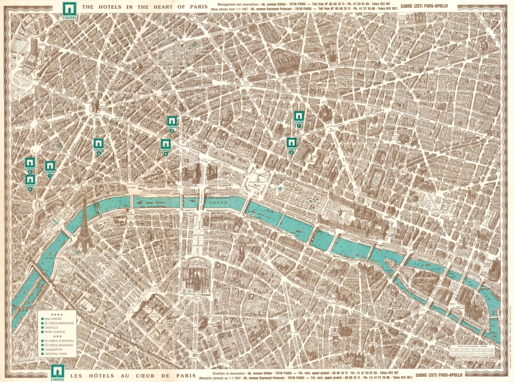
Cidotel The Hotels in the Heart of Paris. Cidotel Les Hôtels au Cœur de Paris.
sold
This is a 1986 Blondel la Rougery pictorial bird's-eye view map of Paris, France. The view exquisitely captures the unique architecture of Paris while serving as a helpful visual city guide. (more details)
VOC's Secret Map of the critical passage around Madagascar to the Indies.
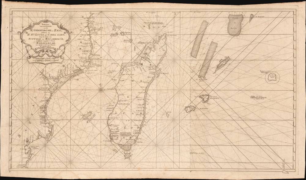
Paskaart van een Gedeelte van de Aethiopische-Zee, Strekkende van R. Sta. Lucia tot C. del Gado, Langs de Kusten van Suffalo en Mocambique, Bevattende Insgelyks 't Eiland Madagascar met Desselfs Onderhorige Eilanden.
sold
- Digital Map Information
- Suitable for large format printing
- File Size: 45.51 MB
- File Type: ZIP / TIFF
- ICC color profile embedded
- Delivered instantly via download link
This is an extremely rare 1753 Johannes II van Keulen / Jan de Marre nautical map of Madagascar, Mauritius, and the adjacent coast of Africa compiled for the sixth volume of the Zee-Fakkel - the Dutch East India Company's legendary 'Secret Atlas.' The map reveals tightly controlled navigational secrets when Madagascar was a haven not only for the world's most notorious pirates (including Captain Kidd) but also a source for the Atlantic Slave Trade. (more details)
Prepared for French participation in the American Revolutionary War.
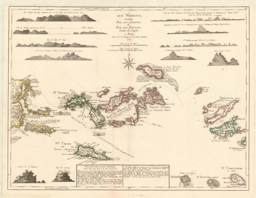
Les Vierges, Levées Par Les Anglais, et Par Les Dannois, Traduit de l'Anglais.
sold
- Digital Map Information
- Suitable for large format printing
- Full resolution TIFF file
- ICC color profile embedded
- Delivered instantly via download link
A rare 1779 map of the Virgin Islands by Georges-Louis Le Rouge prepared in anticipation of French participation in the American Revolutionary War (1775 - 1783). (more details)
Crete and Heraklion during the Longest Siege of the Great Turkish War.
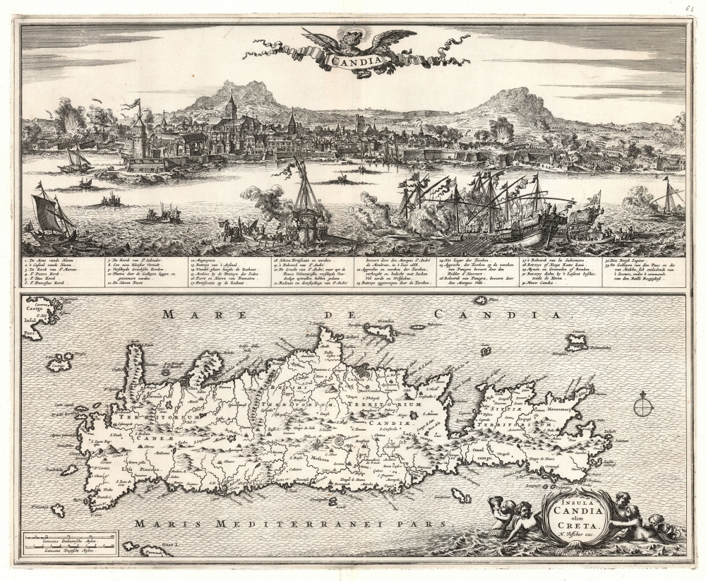
Candia. / Insula Candia olim Creta. N. Visscher exc.
sold
- Digital Map Information
- Suitable for large format printing
- File Size: 26.23 MB
- File Type: ZIP / TIFF
- ICC color profile embedded
- Delivered instantly via download link
This is Nicolas Visscher's 1670 map of Crete, accompanied by a dramatic panorama of the famous Siege of Candia (Heraklion). (more details)
Exceedingly rare, highly decorative, and important map of the Cape of Good Hope.
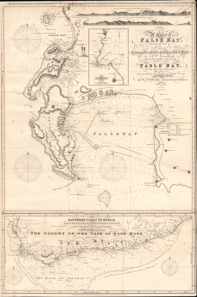
A Chart of False Bay Surveyed by Order of Rear Admiral Stopford, Commander in Chief at the Cape of Good Hope, by P. W. Gawthorpe, Master of His Majesty's Ship Lion, 1812; to which is added Table Bay, with Cape Town and its Environs.
sold
- Digital Map Information
- Suitable for large format printing
- File Size: 37.11 MB
- File Type: ZIP / TIFF
- ICC color profile embedded
- Delivered instantly via download link
A remarkable and rare 1819 / 1827 J. W. Norie commercial nautical chart of False Bay and the Cape of Good Hope, South Africa. The chart was issued shortly after the 1814 Treaty of Vienna when British sovereignty over the Cape Colony was internationally recognized. Norie issued it as False Bay and Simon's Town were emerging as key British naval and commercial winter shelters and resupply depots - marking them as strategic stopping points on voyages to Asia. (more details)
Encouraging creation of the Adirondack Park.

The New York Wilderness. Hamilton County and Adjoining Territory.
sold
- Digital Map Information
- Suitable for large format printing
- Full resolution TIFF file
- ICC color profile embedded
- Delivered instantly via download link
This is an 1879 Benjamin C. Butler and James A. Cooper map of the western portion of the Adirondacks. Published 13 years before the establishment of Adirondack Park, this map likely played a role in promoting the park's creation as well as encouraging tourists to visit the region. (more details)
Building the Suez Canal.

Percement de L'Isthme de Suez. / [Suez Canal.]
sold
- Digital Map Information
- Suitable for large format printing
- File Size: 17.77 MB
- File Type: ZIP / TIFF
- ICC color profile embedded
- Delivered instantly via download link
This is a dramatic large map of the Suez Canal, Egypt, issued in 1868, a year before the canal opened to commercial traffic. The map accompanies a scarce publication by L. Barreau, a French civil engineer based in Alexandria, describing the monumental undertaking. (more details)
Integrating Nature and Urban Sprawl.
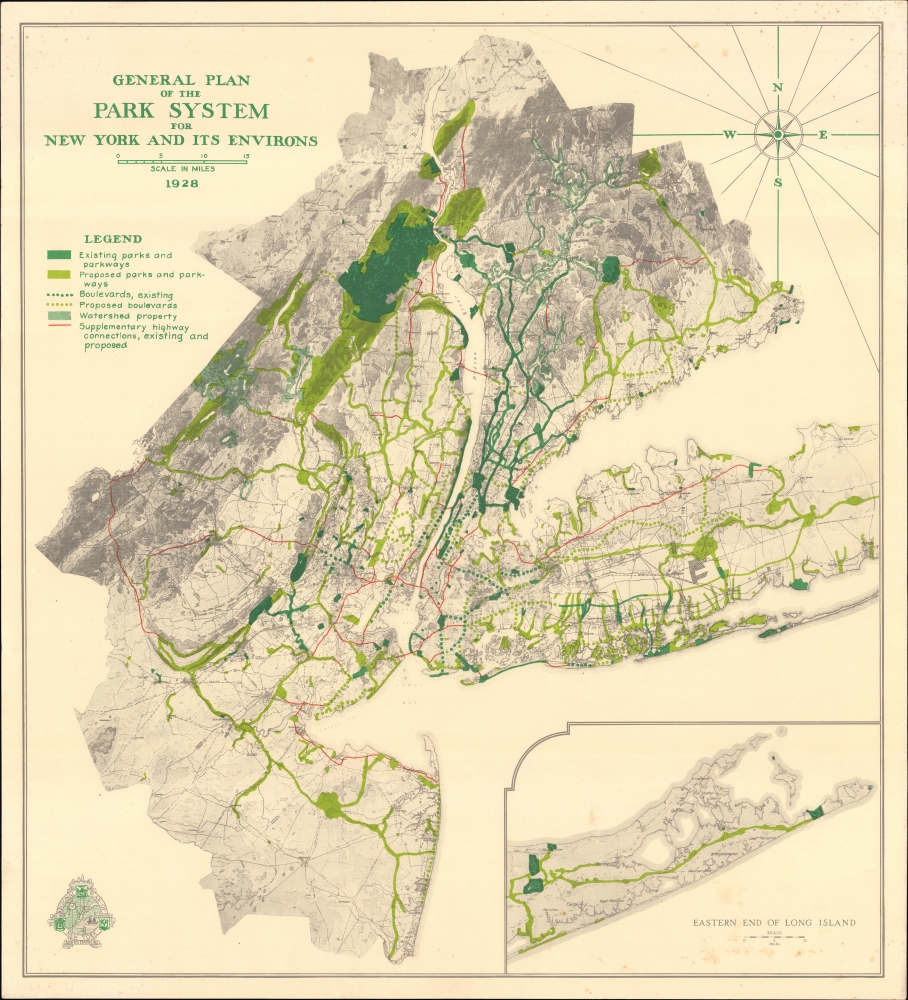
General Plan of the Park System for New York and Its Environs.
sold
- Digital Map Information
- Suitable for large format printing
- File Size: 23.24 MB
- File Type: ZIP / TIFF
- ICC color profile embedded
- Delivered instantly via download link
An absorbing map of the existing and proposed park system of New York City and the Tri-State Area, produced in 1928 by the nonprofit organization Regional Plan of New York and Environs. Among other features, it highlights the popularity of parkways as a means of providing automobile passengers with a pleasant experience traveling to and from the city. (more details)
Kibbutz Movement in Israel. 'A Wonderful Community...'

מפת ההתישבות הקיבוצית בשנת היובל לאם הקבוצות, דגניה, תzא-תשכא. / Map of the Kibbutz Settlements at the Jubilee of the Mother of Kibbutzim, Degania 1910-1961.
sold
This is a 1961 Shmuel Katz pictorial map of Israel celebrating the 50th anniversary, or 'Jubilee', of Degania Alef, the first Kibbutz founded in modern-day Israel. (more details)