
Extremely rare and early oversized double hemisphere constellation map, or celestial, by Frederik de Wit.

Planisphaerium Coeleste.
sold
- Digital Map Information
- Suitable for large format printing
- DPI: 300
- File Size: 18.1 MB
- File Type: ZIP / TIFF
- ICC color profile embedded
- Delivered instantly via download link
A remarkable and very rare example of Frederic de Wit's c. 1680 oversized and beautifully engraved double hemisphere celestial map. The map consists of two hemispheres surrounded by six supplementary diagrams. These illustrated the Copernican hypothesis, the ... (more details)
The first atlas map to show California as an Island.
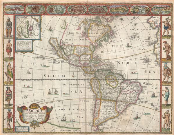
America with those known parts in that unknowne world both people and manner of buildings discribed and inlarged by I.S. Ano 1626.
sold
- Digital Map Information
- Suitable for large format printing
- DPI: 300
- File Size: 10.02 MB
- File Type: ZIP / TIFF
- ICC color profile embedded
- Delivered instantly via download link
A nice example of John Speed's 1626 map of America here in its fourth or 1676 state. One of the most iconic maps of America ever made, this map is surrounded by decorative vignettes illustrating the indigenous peoples and cities of the Americas. This map is ... (more details)
Historically significant exploration map of the American West including John Jacob Astor's Astoria trading post.
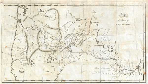
Sketch of the Routes of Hunt and Stuart.
sold
- Digital Map Information
- Suitable for large format printing
- DPI: 300
- File Size: 3.89 MB
- File Type: ZIP / TIFF
- ICC color profile embedded
- Delivered instantly via download link
A map of great historical importance, this is Washington Irving's scarce 1836 map detailing Wilson P. Hunt's 1810 westward trip from St. Louis, Missouri, to Astor's newly founded trading post Astoria at the mouth of the Columbia River, in present-day ... (more details)
Very rare Ottoman map in Ottoman Turkish / Arabic script.

[Europe]
sold
- Digital Map Information
- Suitable for large format printing
- File Size: 5.28 MB
- File Type: ZIP / TIFF
- ICC color profile embedded
- Delivered instantly via download link
This is an 1868 Ottoman map of Europe by Hafiz Ali Efendi. The map is beautifully colored and covers the continent of Europe from Spain and Portugal to Russia, the Ural Mountains, and the Caucasus from east to west and from Iceland to Italy and ... (more details)
19th century plan of Montevideo, Uruguay, showing Norbert Maillart's proposed boulevard.
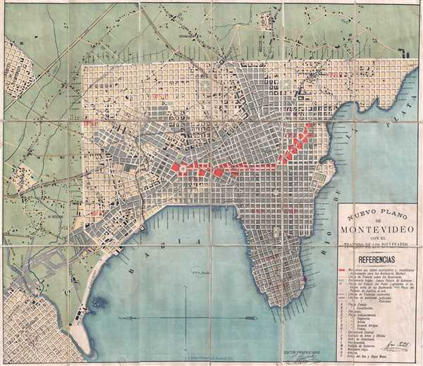
Nuevo Plano de Montevideo con el Trazado de los Boulevards.
sold
- Digital Map Information
- Suitable for large format printing
- File Size: 21.01 MB
- File Type: ZIP / TIFF
- ICC color profile embedded
- Delivered instantly via download link
This is an extremely rare 1888 chromolithograph city plan or map of Montevideo, Uruguay, showing French architect Norbert Maillart's proposed urban renewal plan. Centered around Montevideo Bay and oriented with east at top, this map covers ... (more details)
Stunning large format old color map of the East Indies.
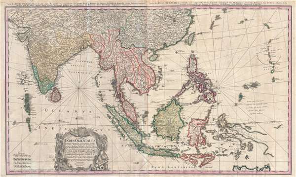
Carte des Indes orientales dessinée suivant les observations les plus recentes, dont le principal est tirée des cartes hydrographiques de Mr. D'Apres de Mannevillette. Dediée tres humblement à Son Altesse Serenissime Monsgr. le Prince Guillaume Charles Henry Friso, Souverain Prince d'Orange, Pr. de S.E. de Nassa, Stadthoudre hereditaire, Admiral et General Capit. des Provinces unies etc. etc, Chevalier de l'Ordre de Jarretiere, par ses tres humbles et tres soumis serviteurs l'Auteur et les. Heritiers de Homan. I. Feuille dans la quelle on represente les Indes deca la Riviere de Ganges, le Golfe de Bengale, Siam, Malacca, Sumatra. II. Feuille, qui comprend les isles de Sonde, l'archipel des Philippines, & les isles Moluques. dresseé par Mr. Tobie Mayer de la Societé Geograph.
sold
- Digital Map Information
- Suitable for large format printing
- Full resolution TIFF file
- ICC color profile embedded
- Delivered instantly via download link
This is a beautiful old color 1748 Homann Heirs map of India, Southeast Asia, and the East Indies. This map stretches from India, the Maldives, and Sri Lanka (Ceylon) in the west to the Marianas in the east, and China and Tibet in the ... (more details)
Rare city map of Cincinnati, Ohio.
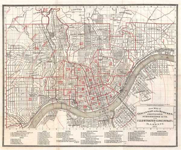
New Map of Cincinnati and Suburbs.
sold
- Digital Map Information
- Suitable for large format printing
- File Size: 8.01 MB
- File Type: ZIP / TIFF
- ICC color profile embedded
- Delivered instantly via download link
This is an 1875 D.J. Kenny map of Cincinnati, Ohio and its suburbs. The map is oriented to the north, with the Ohio River dominated the lower portion of the map, acting as the border between Ohio and Kentucky. The map is incredibly ... (more details)
Attractive decorative map.

Valentia Regnum; Contestani, Ptol. Edentani, Plin.
sold
- Digital Map Information
- Suitable for large format printing
- DPI: 300
- File Size: 12.69 MB
- File Type: ZIP / TIFF
- ICC color profile embedded
- Delivered instantly via download link
This is a beautiful c.1635 Blaeu map of Valencia, Spain. Oriented to the west and centered on Valencia, it extends south to Murcia and Orihuella and north to Senia and inland as far as Teruel. The map is highly decorative and ... (more details)
One the earliest American railroad maps.

Map of a Survey of the proposed Boston and Providence Rail-Way
sold
- Digital Map Information
- Suitable for large format printing
- DPI: 300
- File Size: 8.57 MB
- File Type: ZIP / TIFF
- ICC color profile embedded
- Delivered instantly via download link
A rare and important discovery, this is the one of the first railroad maps printed in the United States. Issued in 1828 by James Hayward, this is a topographic strip map illustrating two alternate routes for a horse powered ... (more details)
Stunningly engraved early map of Crete by Boschini.
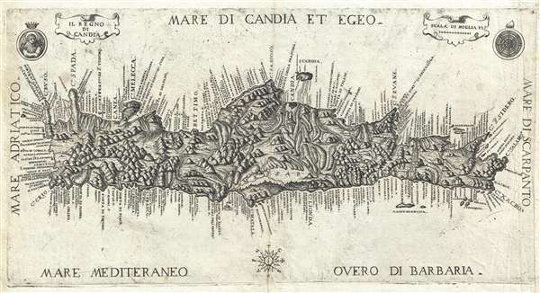
Il Regno di Candia.
sold
- Digital Map Information
- Suitable for large format printing
- DPI: 300
- File Size: 4.42 MB
- File Type: ZIP / TIFF
- ICC color profile embedded
- Delivered instantly via download link
A rare, stunningly engraved, and important 1651 map of Crete by Marco Boschini. The map covers the island in full with rich, almost organically engraved topography. The Lion of St. Mark, a symbol of Venice appears in the ... (more details)
Remarkable 19th century Japanese map of Bangkok, Thailand.
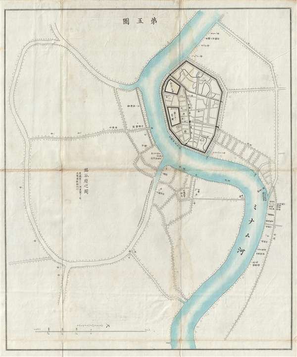
盤谷府之圖 / Bangkok House.
sold
- Digital Map Information
- Suitable for large format printing
- File Size: 9.36 MB
- File Type: ZIP / TIFF
- ICC color profile embedded
- Delivered instantly via download link
A scarce Meiji 8, 1875 Japanese issue plan or map of Bangkok, Thailand. Centered on the Chao Phraya River, the map covers the 'S' shaped bend in the river where the original royal fortifications of Bangkok stood. Some of ... (more details)
Japanese propaganda map resonding to the 1922 'Limitation of Naval Armament' treaty.

太平洋諸島歷史地圖 / Pacific Islands Historical Map. / Tàipíngyáng zhūdǎo lìshǐ dìtú. / 比律賓群島地圖 / Map of the Philippines. / Bǐ lǜ bīn qúndǎo dìtú.
sold
- Digital Map Information
- Suitable for large format printing
- File Size: 20.96 MB
- File Type: ZIP / TIFF
- ICC color profile embedded
- Delivered instantly via download link
An extremely rare and historically significant 1922 (Taishō 11) map of the Philippines and the Pacific. This map is divided into two sections, the right most sections covers the Pacific Basin form the Bering Straits to ... (more details)
Exeptional view of San Francisco, California by early African American publisher.

San Francisco. Looking South from North Point.
sold
- Digital Map Information
- Suitable for large format printing
- Full resolution TIFF file
- ICC color profile embedded
- Delivered instantly via download link
A view of San Francisco, California originally published in 1877 by G. T. Brown and company. The present example is a 20th century reproduction issued by John Howell Books, a now defunct California bookstore active from ... (more details)
Exquisitely detailed map and view of Recife, Brazil.

Das Norder Theil des Lands Brasilien.
sold
- Digital Map Information
- Suitable for large format printing
- DPI: 300
- File Size: 9.36 MB
- File Type: ZIP / TIFF
- ICC color profile embedded
- Delivered instantly via download link
This is a stunningly engraved 1655 Matthaeus Merian map of the coast of Brazil and a view of Olinda and Recife in Pernambuco, Brazil. The inset map, shown as if being unrolled on a piece of parchment, shows the coast of ... (more details)
Rare Stars and Stripes map of Korea.

Korea.
sold
- Digital Map Information
- Suitable for large format printing
- File Size: 11.69 MB
- File Type: ZIP / TIFF
- ICC color profile embedded
- Delivered instantly via download link
This c. 1951 map of Korea was produced by Stars and Stripes , a U.S. military publication. The map details the entire Korean peninsula, showing both political and physical features. The 38th parallel is unmistakable and ... (more details)
One of the more attractive 19th century commercial atlas maps of New York City.
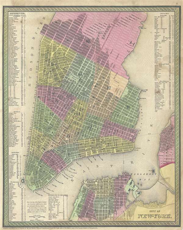
City of New York.
sold
- Digital Map Information
- Suitable for large format printing
- DPI: 300
- File Size: 8.05 MB
- File Type: ZIP / TIFF
- ICC color profile embedded
- Delivered instantly via download link
One of the more attractive atlas maps of New York City to appear in the mid-19th century, this is a beautiful example of Samuel Agustus Mitchell's 1854 map of southern Manhattan. The map depicts southern Manhattan from ... (more details)
Rare Lee Corporation advertisement featuring heroes and villians of the Old West.

The Lee Pictorial Map of the Old West.
sold
- Digital Map Information
- Suitable for large format printing
- File Size: 29.79 MB
- File Type: ZIP / TIFF
- ICC color profile embedded
- Delivered instantly via download link
This c. 1970 Lee Pictorial Map of the Old West depicts the entire United States. This map is apparently an advertisement for the Lee Corporation drawn by graphic artist Charles Varner. The map of the United States is ... (more details)
Striking Ortelius map of the Holy Land.
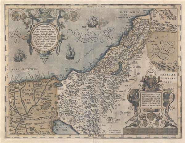
Palestinae Sive Totius Terrae Promissionis Nova Descriptio Auctore Tilemanno Stella Sigenensi.
sold
- Digital Map Information
- Suitable for large format printing
- DPI: 300
- File Size: 9.23 MB
- File Type: ZIP / TIFF
- ICC color profile embedded
- Delivered instantly via download link
This is an old color 1603 Abraham Ortelius map of Palestine or the Holy Land. The map covers from the ancient city of Berytus (Beirut, Lebanon) to the Red Sea and from the Nile River to Damascus (Syria). The map shows ... (more details)
Rare and striking 1896 map of The Pamir Mountains.

The Pamirs and Adjoining Territories of Central Asia and India.
sold
- Digital Map Information
- Suitable for large format printing
- File Size: 29.01 MB
- File Type: ZIP / TIFF
- ICC color profile embedded
- Delivered instantly via download link
This is a rare 1896 map of the Pamir Mountains in Central Asia. The map was commissioned by George Nathaniel Curzon to accompany his paper The Pamirs and the Source of the Oxus , which he read at the Royal ... (more details)
Incredible 19th century Czech Map of Bohemia.

Politická a místopisná mapa Království českého obsahující veškery obce nad 300 obyvatel, všecky fary, filialní kostely a kláštery, sídla býv. panství, všecky silnice a železnice, pošty a stanice telegrafní, (všecko podle nejnovějšího stavu), znamenitější zámky a ssutiny [sic] atd. atd.
sold
- Digital Map Information
- Suitable for large format printing
- File Size: 31.9 MB
- File Type: ZIP / TIFF
- ICC color profile embedded
- Delivered instantly via download link
This 1870 Josef Erben political and topographical map of Bohemia came directly to us from Prague and is a very rare find outside of the Czech Republic. Prague (Praha) is clearly visible near the center of ... (more details)