
Gorgeous Burritt hand colored Map of the Heavens.

A Celestial Planisphere, or Map of the Heavens.
sold
- Digital Map Information
- Suitable for large format printing
- DPI: 300
- File Size: 7.62 MB
- File Type: ZIP / TIFF
- ICC color profile embedded
- Delivered instantly via download link
This is a rare and beautiful 1833 hand colored map of the night sky by Elijah Burritt. Centered on the ecliptic Line, this map identifies the various zones associated with each major constellation. The Milky Way is shaded. A scale exhibiting the sun's place in ... (more details)
Large decorative nautical chart of the Outer Banks.

Sketch D Showing the Progress of the Survey in Section No. IV from 1845 to 1861.
sold
- Digital Map Information
- Suitable for large format printing
- File Size: 13.99 MB
- File Type: ZIP / TIFF
- ICC color profile embedded
- Delivered instantly via download link
This is an exceptional example of the 1861 U.S. Coast Survey's progress chart for the coasts of Virginia and North Carolina. Covers from Cape Henry, Virginia, south past the Pamlico Sound and Cape Hatteras, to Cape Fear. It was here, looking over the Pamlico ... (more details)
Early map of Scandinavia showing Finland as part of Sweden.

Scandinavia, or Sweden, Denmark and Norway.
sold
- Digital Map Information
- Suitable for large format printing
- DPI: 300
- File Size: 13.16 MB
- File Type: ZIP / TIFF
- ICC color profile embedded
- Delivered instantly via download link
This fascinating hand colored 1817 map of Scandinavia depicts Sweden, Denmark, and Norway. Modern day Finland, though included, was then part of the Kingdom of Sweden. Relief is shown by hachure with towns, cities, and major topographical features ... (more details)
Spectacular old color Seutter map of Artesia in northern France.
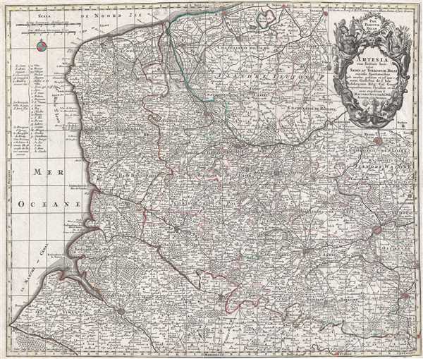
Artesia cum finitimis locis velut Sedes Ac Theatrum Belli : curiosis Spectatoribus ob oculos positum et ad normam Guilielmi de l'Isle celeberrimi Reg. Gal. Geogr. repraesentatum, excusum et venum expositum a Matthaæo Seutter, S.C.M.G. Augustæ Vindelic.
sold
- Digital Map Information
- Suitable for large format printing
- DPI: 300
- File Size: 15.5 MB
- File Type: ZIP / TIFF
- ICC color profile embedded
- Delivered instantly via download link
This spectacular old color 1760 Matthäus Seutter map of Artois (Artesia) in northern France. The map covers a large portion of northern France and notes the cities of Dunkerque (Dunkerke), Ypres, Lille (Ryssel Lille), Lens (which is home to the ... (more details)
1826 Pendleton issue of John Foster's 1677 map of New England, the first map printed in the English Colonies of North America.
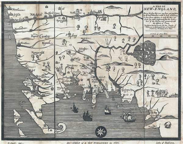
A Map of New-England : being the first that ever was here cut, and done by the best pattern that could be had, which being in some places defective, it made the other less exact: Yet doth it sufficiently show the scituation of the country and conveniently well the distances of places : The figures that are joyned with the names of places are to distinguish such as have been assaulted by the Indians from others.
sold
- Digital Map Information
- Suitable for large format printing
- DPI: 300
- File Size: 24.45 MB
- File Type: ZIP / TIFF
- ICC color profile embedded
- Delivered instantly via download link
This is the Moses Swett 1826 edition of John Foster's 1677 map of New England, the first map printed in America. The map, here as an early 19th century lithograph, was originally printed as a woodcut on single plate. Oriented to the West, the ... (more details)
Unique map of the United States that includes the 'forgotten' state of Franklinia.
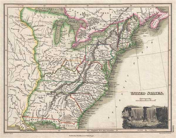
United States.
sold
- Digital Map Information
- Suitable for large format printing
- DPI: 300
- File Size: 2.96 MB
- File Type: ZIP / TIFF
- ICC color profile embedded
- Delivered instantly via download link
This 1819 map of the United States depicts the Atlantic coast from Nova Scotia and New Brunswick to northern Florida. This is one of the latest and few maps to identify the ephemeral pseudo-state of Franklinia. There is a vignette view of the ... (more details)
Rare religious allegorical map depicting the path to redemption.

A Plan of the Road From the City of Destruction to the Celestial City. Engraved expressly for Virtue's, Elegant Edition of The Pilgrim's Progress
sold
- Digital Map Information
- Suitable for large format printing
- DPI: 300
- File Size: 1.64 MB
- File Type: ZIP / TIFF
- ICC color profile embedded
- Delivered instantly via download link
This 1850 religious allegorical map illustrates the pilgrim's progress from the City of Destruction to the Celestial City. On the way from the City of Destruction, the pilgrims encountered several obstacles, including Slough of Despond, the ... (more details)
Scarce and beautiful map of New York City.

New York.
sold
- Digital Map Information
- Suitable for large format printing
- DPI: 300
- File Size: 5.02 MB
- File Type: ZIP / TIFF
- ICC color profile embedded
- Delivered instantly via download link
A fine 1840 first edition example of the Society for the Diffusion of Useful Knowledge city plan or map of New York City. The map coves southern Manhattan from the Battery northwards to 42nd street as well as portions of adjacent Jersey ... (more details)
Incredible old color 17th century map of Genoa and Liguria showing nearby Cinque Terre
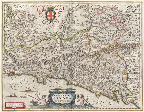
Riviera di Genova di Levante
sold
- Digital Map Information
- Suitable for large format printing
- DPI: 300
- File Size: 9.55 MB
- File Type: ZIP / TIFF
- ICC color profile embedded
- Delivered instantly via download link
This incredible 1646 Johannes Blaeu map of the Bay of Genoa depicts the Ligurian coast from Genoa (Genoua) to the Cinque Terre. There is a large, allegorical decorative cartouche for the title of the map. A few sailing ships are present ... (more details)
Gorgeous old color 17th century map of Genoa and Liguria showing nearby Cinque Terre.

Liguria, ò Stato della Republica di Genova
sold
- Digital Map Information
- Suitable for large format printing
- DPI: 300
- File Size: 9.49 MB
- File Type: ZIP / TIFF
- ICC color profile embedded
- Delivered instantly via download link
This gorgeous 1646 Willaem Janszoon Blaeu map depicts the Mediterranean coast of France and Italy, or as it was known then Liguria or the Republic of Genova. It stretches from Nice (Nizza) to Genoa (Genoua) and the Cinque Terre. There ... (more details)
Spectacular highly decorative old color 17th century map of Tuscany.
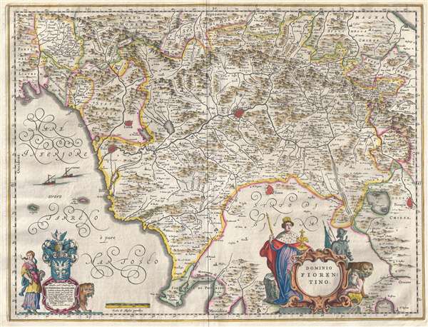
Dominio Fiorentino
sold
- Digital Map Information
- Suitable for large format printing
- DPI: 300
- File Size: 9.26 MB
- File Type: ZIP / TIFF
- ICC color profile embedded
- Delivered instantly via download link
This is a spectacular 1646 old color map of Tuscany, or the Florentine Territory (Fiorentino) by Johannes Blaeu. The map covers the entire region of Tuscany with the cities of Perugia, Siena, Florence (Firenze), Lucca, and Pisa ... (more details)
Beautiful old color 17th century map of Calabria.
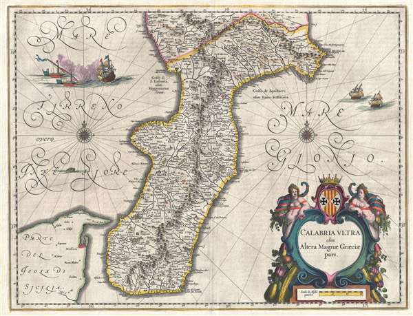
Calabria Ultra, olim, Altera Magnæ Græciæ pars.
sold
- Digital Map Information
- Suitable for large format printing
- DPI: 300
- File Size: 10.84 MB
- File Type: ZIP / TIFF
- ICC color profile embedded
- Delivered instantly via download link
This beautiful old color 1646 Willaem Janszoon Blaeu map of Calabria depicts the entire region as well as extreme southern Basilicata and northeastern Sicily. The cities of Regio (Reggio) and Tropea are easily recognizable and ... (more details)
Very attractive and detailed railroad route map of the Western United States.

ABC The Pathfinder Railway Guide Map Western Section
sold
- Digital Map Information
- Suitable for large format printing
- File Size: 32.6 MB
- File Type: ZIP / TIFF
- ICC color profile embedded
- Delivered instantly via download link
A very engaging 1907 railroad map of the western part of the United States. The map covers from Michigan and Georgia in the east to Washington and California in the west. The map includes the southernmost reaches of Canada, ... (more details)
Very attractive and detailed railroad route map of the Eastern United States.
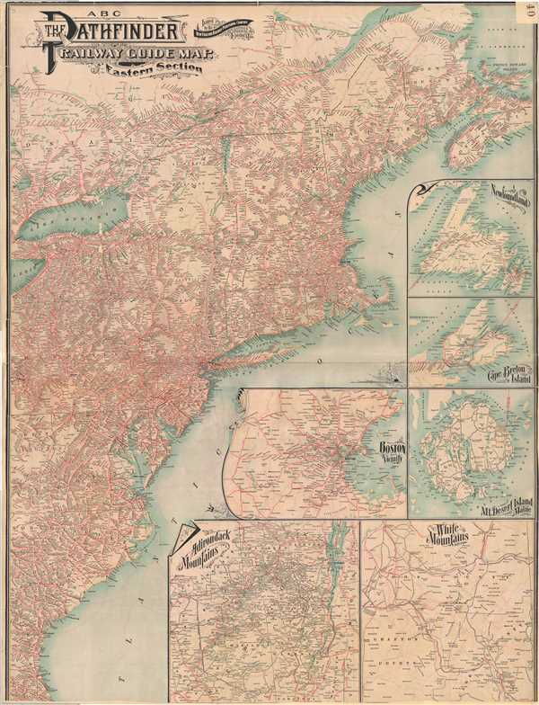
ABC The Pathfinder Railway Guide Map. Eastern Section
sold
- Digital Map Information
- Suitable for large format printing
- File Size: 32.4 MB
- File Type: ZIP / TIFF
- ICC color profile embedded
- Delivered instantly via download link
A very attractive large format 1901 railroad map of the eastern part of the United States. The map covers the Atlantic Seaboard from Nova Scotia to Florida and extends west as far as Lake Erie. An array of 7 inset maps fill ... (more details)
Rare map of Luzon issued in Manila at the outbreak of the Philippine-American War.

Island of Luzon and its Surroundings 1899.
sold
- Digital Map Information
- Suitable for large format printing
- File Size: 20.04 MB
- File Type: ZIP / TIFF
- ICC color profile embedded
- Delivered instantly via download link
An extremely rare 1899 map of the Island of Luzon in the Philippines issued at the outbreak of the Philippine-American War. The map covers all of Luzon as well as some of the nearby islands including Mindoro, Boracay, ... (more details)
Rare map of the Philippines issued at the outset of the Philippine-American War.

Philippine Islands.
sold
- Digital Map Information
- Suitable for large format printing
- File Size: 10.93 MB
- File Type: ZIP / TIFF
- ICC color profile embedded
- Delivered instantly via download link
A rare c. 1899 pocket map of the Philippines or Philippine Islands. The map covers the entire archipelago from northern Luzon to southern Mindanao and from Palawan to the Pacific. An inset in the upper right focuses ... (more details)
Interesting thematic map illustrating the events of the WWII Philippines Campaign of 1945.
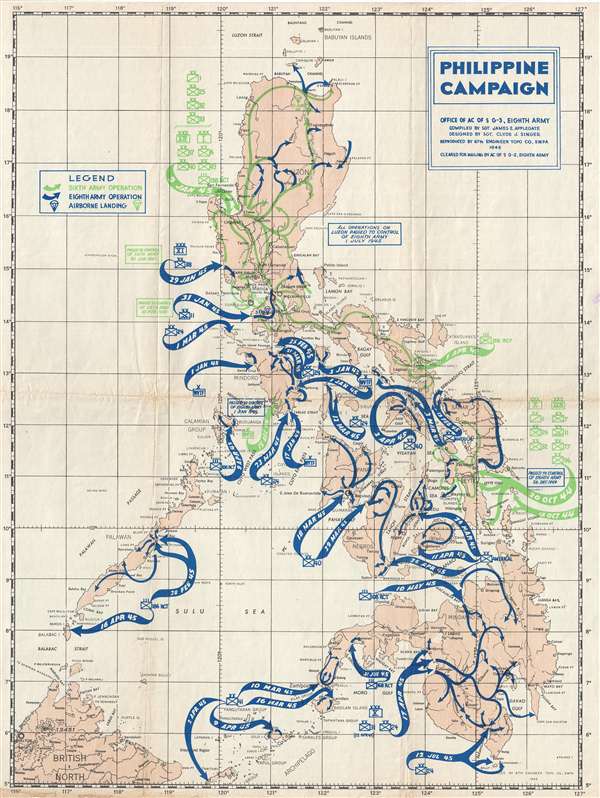
Philippine Campaign.
sold
- Digital Map Information
- Suitable for large format printing
- Full resolution TIFF file
- ICC color profile embedded
- Delivered instantly via download link
An unusual 1945 World War II era thematic map of the Philippine Islands illustrating the events of the Philippine Campaign (1944 – 1945). The map covers the entirety of the Philippine archipelago with sinuous arrows indicating military activity. Blue arrows detail the Eighth Army Operation, green arrows indicate the Sixth Army operation, and little parachute drawings in either color represent airborne landing sites. (more details)
Rare 19th Century Japanese Map of Luzon, the Philippines.

[Untitled, Philippines] 第二圖 / Map Two.
sold
- Digital Map Information
- Suitable for large format printing
- File Size: 7.72 MB
- File Type: ZIP / TIFF
- ICC color profile embedded
- Delivered instantly via download link
A scarce Meiji 8, 1875 Japanese issue plan or map of Luzon in the Philippines. Centered on Manila Bay, the map covers all of Luzon north of Legazpi, Marinduque, and northern Mindoro. The map is primarily a nautical ... (more details)
Blair's remarkable 19th century Temperance Movement map of New York City.
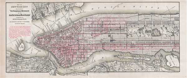
Map of New York City to Accompany 'The Temperance Movement or the Conflict between Man and Alcohol.'
sold
- Digital Map Information
- Suitable for large format printing
- File Size: 7.47 MB
- File Type: ZIP / TIFF
- ICC color profile embedded
- Delivered instantly via download link
A fascinating 1887 persuasive map of New York City in which the locations of some 9000 licensed bars and saloons are identified in red. The map covers Manhattan south of 115th street as well as adjacent parts of ... (more details)
Ephemeral map of North America showing Texas as a Republic and the 54 40 dispute.

North America.
sold
- Digital Map Information
- Suitable for large format printing
- DPI: 300
- File Size: 5.35 MB
- File Type: ZIP / TIFF
- ICC color profile embedded
- Delivered instantly via download link
This Bradford 1841 map of North America includes the United States, British Territory (Canada), Russian America (Alaska), Mexico, and Texas as a Republic. Central America, the West Indies, and Greenland are also ... (more details)