
Interesting map depicting the distribution of the world's animals, industry and ocean currents.

Johnson's Map of The World Showing the Geographical Distribution & Range of The Principal Members of The Animal Kingdom. Johnson's Map of The World Illustrating the Productive Industry and exhibiting the principal features of Commerce And Navigation. Johnson's Map Showing the Principal Ocean Currents and Boundaries of the River Systems.
sold
- Digital Map Information
- Suitable for large format printing
- File Size: 8.09 MB
- File Type: ZIP / TIFF
- ICC color profile embedded
- Delivered instantly via download link
This is one of the thematic world map sets from the rare 1864 edition of Johnson and Ward's New Illustrated Atlas . It features three maps within a single border. The first map depicts the geographical distribution and range of the principal members of the animal ... (more details)
Johnson's depiction of the worlds time zones.

A Diagram Exhibiting the difference of time between the places shown and Washington.
sold
- Digital Map Information
- Suitable for large format printing
- File Size: 1.64 MB
- File Type: ZIP / TIFF
- ICC color profile embedded
- Delivered instantly via download link
A very attractive example of Johnson's 1866 diagram of the world's time zones. Consists of a circular engraving in which numerous clocks are drawn, each representing a major world city. At the center is clock representing the time in Washington, D. C. The time in ... (more details)
Lovely depiction of the town of Eluru, India under British control.
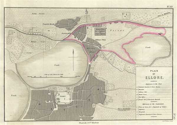
Plan of Ellore.
$200.00
Acquire
- Digital Map Information
- Suitable for large format printing
- DPI: 300
- File Size: 4.08 MB
- File Type: ZIP / TIFF
- ICC color profile embedded
- Delivered instantly via download link
This is a nice example of the 1854 Pharoah and Company map of the town of Eluru in the Indian State of Andhra Pradesh. It covers the town at the time it was a military station and part of the Madras Presidency under British control. The map notes the three tanks, ... (more details)
Beautiful early plan of the city of Bangalore or Bengaluru, India.
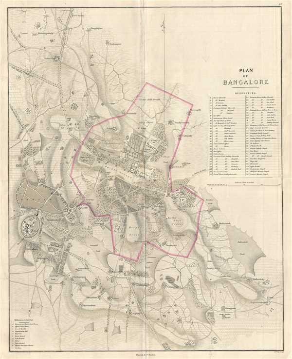
Plan of Bangalore.
sold
- Digital Map Information
- Suitable for large format printing
- DPI: 300
- File Size: 11.4 MB
- File Type: ZIP / TIFF
- ICC color profile embedded
- Delivered instantly via download link
This is a beautiful 1854 map or plan of the city of Bangalore (Bengaluru), in the Indian state of Karnataka. It covers the old city in 1854 when it was part of the Princely State of Mysore, a nominal sovereign entity of the British Raj controlled by the Maharaja ... (more details)
Among the earliest Dutch attempts to map the Great Lakes and an important early representation New England and New Amsterdam (New York).
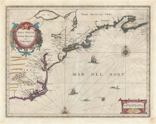
Nova Anglia Novum Belgium et Virginia.
sold
- Digital Map Information
- Suitable for large format printing
- Full resolution TIFF file
- ICC color profile embedded
- Delivered instantly via download link
A fine first edition first state old color example of Jan Jansson's 1636 map of the northeast American coastline from Cape Lookout (here identified as C. of Feare) to Nova Scotia. The map includes parts of modern day North Carolina, Virginia, Maryland, ... (more details)
Scarce city plan of Madras or Chennai, India during British rule.
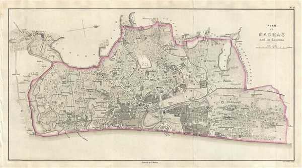
Plan of Madras and its Environs.
sold
- Digital Map Information
- Suitable for large format printing
- DPI: 300
- File Size: 7.78 MB
- File Type: ZIP / TIFF
- ICC color profile embedded
- Delivered instantly via download link
This is a scarce 1854 map or plan of the city of Madras or Chennai in the Indian state of Tamil Nadu. It covers the city located on the Coromandel Coast and extends from the Adyar River north to the Captain Cotton Canal and Tondiarpet. The map is ... (more details)
One of the earliest obtainable maps or plans of New Orleans, Louisiana.
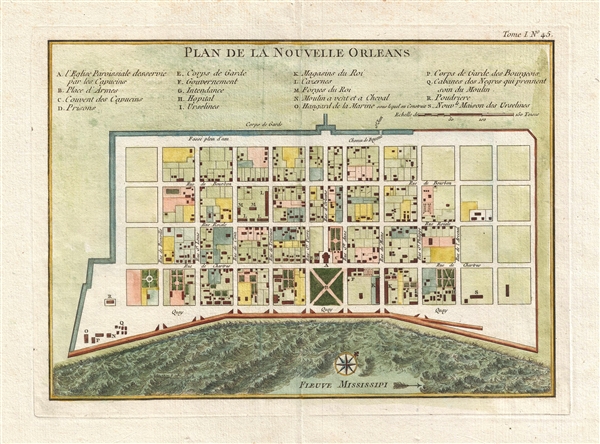
Plan de la Nouvelle Orleans.
sold
- Digital Map Information
- Suitable for large format printing
- DPI: 300
- File Size: 3.88 MB
- File Type: ZIP / TIFF
- ICC color profile embedded
- Delivered instantly via download link
This scarce 1764 map by J. N. Bellin is one of the earliest obtainable maps of New Orleans, Louisiana. Oriented to the northwest, Bellin's map covers the original settlement of New Orleans along the Mississippi River and inland as far the Fosse ... (more details)
Important highly decorative map from the first specific Atlas of Italy.

Regno di Napoli.
sold
- Digital Map Information
- Suitable for large format printing
- DPI: 300
- File Size: 9.2 MB
- File Type: ZIP / TIFF
- ICC color profile embedded
- Delivered instantly via download link
A beautifully engraved 1620 map of southern Italy or the Kingdom of Naples by Giovanni Antonio Magini. Centered on the Gulf of Taranto, this magnificent decorative map covers from Rome northern Sicily and from Rome to Albania, inclusive of al ... (more details)
The most important and influential map of Virginia and Carolina to appear in the 17th century.

Virginiae Item et Floridae Americae Provinciarum, nova Descriptio.
sold
- Digital Map Information
- Suitable for large format printing
- DPI: 300
- File Size: 9.36 MB
- File Type: ZIP / TIFF
- ICC color profile embedded
- Delivered instantly via download link
Published in 1606 by the Mercator/Hondius firm, this is the most influential map of the southeastern part of North America to emerge in the 17th century and the first map to depict Virginia and Florida. Entitled, Virginiae Item et Floridae , ... (more details)
Rare Jansson variant of the Braun and Hogenberg Moscow.
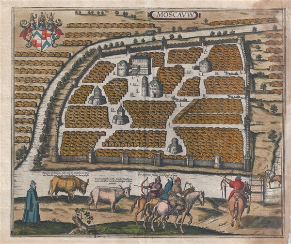
Moscavw.
sold
- Digital Map Information
- Suitable for large format printing
- File Size: 21.4 MB
- File Type: ZIP / TIFF
- ICC color profile embedded
- Delivered instantly via download link
The rare 1657 Jansson view and map of Moscow, Russia. The view depicts Moscow as seen from an elevated point just above the Moskva River. The Neglinnaya River forms a partial moat around he city. The Kremlin, built between 1485 and 1530 ... (more details)
One of the iconic maps of the golden age of Pictorial Maps.

A Map and History of Peiping; formerly known as Peking; capital of provinces, princedoms, and kingdoms since 1121 B.C.; in 1264 A.D. the capital of the Mongol Empire of Kublai Khan; made the capital of the Ming Empire and built as it is today by Yung Lo in 1421; continued as the capital of the Chinese Empire through the Ming and Ching Dynasties; and now a city which will live long in the memory of man as one of the greatest the world has ever known. Completed on this fifth day of February in the year of our Lord Nineteen Hundred and Thirty-six.
sold
- Digital Map Information
- Suitable for large format printing
- File Size: 35.71 MB
- File Type: ZIP / TIFF
- ICC color profile embedded
- Delivered instantly via download link
An example of Frank Dorn's iconic 1936 chromolithograph pictorial map of Beijing or Peking, China. It is considered one of the great maps from the Golden Age of Pictorial Cartography. The map captures Beijing in the days leading up to World War II (1939 - 1945) - though by this time, China was already at odds with Japan, and the Second Sino-Japanese War (1937 - 1945), a precursor to WWII in Asia, was brewing. (more details)
Aerial enhanced photographic view of San Francisco.

San Francisco Bay Metropolitan Area (Comprising the Nine Counties Bordering on the Bay).
sold
- Digital Map Information
- Suitable for large format printing
- File Size: 23.19 MB
- File Type: ZIP / TIFF
- ICC color profile embedded
- Delivered instantly via download link
An impressive 1932 enhanced photographic panoramic view map of the San Francisco Bay area. Oriented to the east, this view covers the entire bay and the San Francisco Peninsula from Novato and Napa to San Jose. Important cities, ... (more details)
Dramatic view of Moscow in the early 18th century.

La Ville de Moscou, Capitale de la Moscovie.
sold
- Digital Map Information
- Suitable for large format printing
- DPI: 300
- File Size: 7.25 MB
- File Type: ZIP / TIFF
- ICC color profile embedded
- Delivered instantly via download link
This is a beautiful 1729 view of Moscow by Pieter Van der Aa. It depicts the capital of the Tsardom of Russia, Moscow, as it appeared in the early 18th century. Features the countryside in the foreground with shepherds and cattle ... (more details)
Very rare early view of Moscow.

Moscou Capitale de la Moscovie Suivant Olearius.
sold
- Digital Map Information
- Suitable for large format printing
- DPI: 300
- File Size: 6.38 MB
- File Type: ZIP / TIFF
- ICC color profile embedded
- Delivered instantly via download link
A scarce and finely engraved 1719 view and map of Moscow, Russia by Pieter van der Aa. Oriented to the west, this remarkable view illustrates all of Moscow as it appeared at the end of the 17th century. It gives the impression ... (more details)
Iconic early map of New England and New York with 'Visscher View' of New Amsterdam.
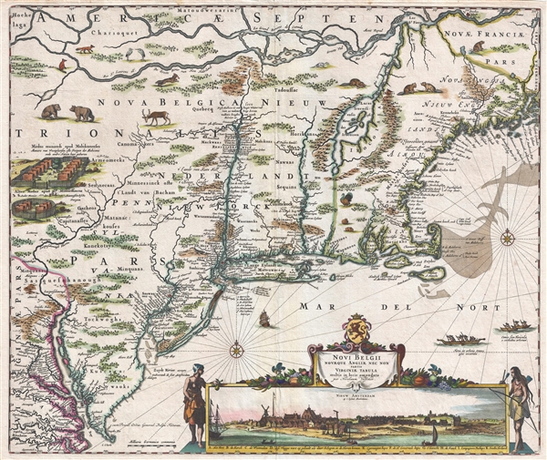
Novi Belgii Novaeque Angliae Nec Non Pennsylvaniae et Partis Virginiae Tabula multis in locis emendata.
sold
- Digital Map Information
- Suitable for large format printing
- DPI: 300
- File Size: 15.13 MB
- File Type: ZIP / TIFF
- ICC color profile embedded
- Delivered instantly via download link
A map of extreme importance, this is a fine example of Nicholaas Visscher's 1684 Novi Belgii or map of New York, New England, Pennsylvania, and Virginia. This is the first map in the Jansson-Visscher Series here presented in ... (more details)
An important map of North America from the Great Age of Exploraiton and one of the first to incorporate the cartography of John White and Jacques le Moyne.
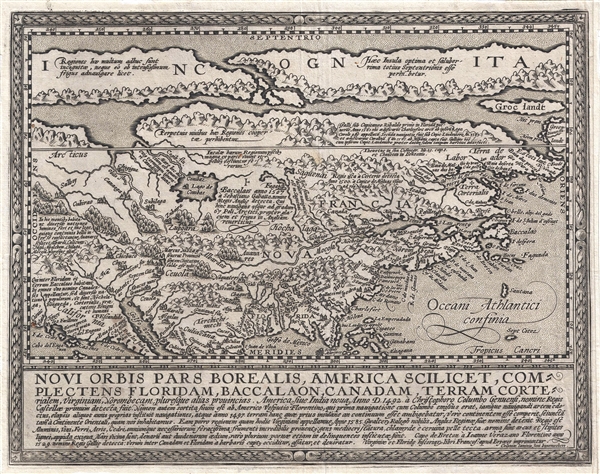
Novi Orbis Pars Borealis, America Scilicet, Complectens Floridam, Baccalaon, Canadam, Terram Corte . . . 1585.
sold
- Digital Map Information
- Suitable for large format printing
- DPI: 300
- File Size: 4.37 MB
- File Type: ZIP / TIFF
- ICC color profile embedded
- Delivered instantly via download link
A beautifully engraved, rare, and important 1600 map of North America by Mattias Quad. Derived from Cornelis de Jode's 1593 Americae Pars Borealis , Quad's map covers all of North America from the unknown arctic to the Gulf ... (more details)
A fine example of one of the second earliest obtainable map of Tennessee, issued 1796, the first year of Tennessee's statehood.
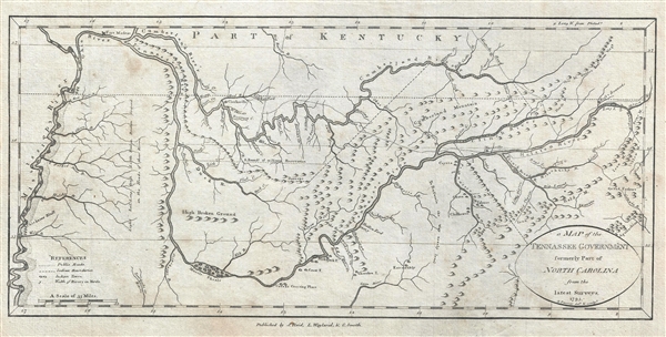
A Map of the Tennassee Government formerly Part of North Carolina from the latest Surveys. 1795.
sold
- Digital Map Information
- Suitable for large format printing
- DPI: 300
- File Size: 3.78 MB
- File Type: ZIP / TIFF
- ICC color profile embedded
- Delivered instantly via download link
A fine example of one of the second earliest obtainable map of Tennessee, issued 1796, the first year of Tennessee's statehood. This is the rare first state of John Reid's 1796 Map of the Tennassee Government . ... (more details)
One of the earliest obtainable specific maps of Georgia. Issued with the second atlas published in America.
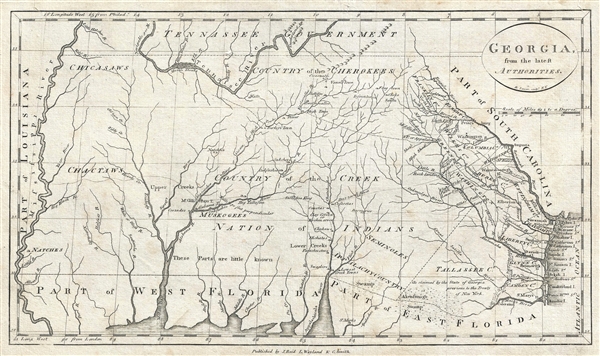
Georgia, from the latest Authorities.
sold
- Digital Map Information
- Suitable for large format printing
- DPI: 300
- File Size: 4.57 MB
- File Type: ZIP / TIFF
- ICC color profile embedded
- Delivered instantly via download link
One of the earliest obtainable specific maps of Georgia, this is a very attractive example of John Reid's 1796 presentation of Georgia. The map covers from the Atlantic Ocean to the Mississippi and from the ... (more details)
Extremely colorful pictorial map of the Hawaiian Islands by illustrater Joseph Feher.

The Dole Map of the Hawaiian Islands.
sold
- Digital Map Information
- Suitable for large format printing
- Full resolution TIFF file
- ICC color profile embedded
- Delivered instantly via download link
This is a 1950 Joseph Feher pictorial map of the Hawaiian Islands. The map depicts all eight of the major islands in the archipelago from Nihau and Kauai to Hawaii. Myriad illustrations populate the map, with each island's uniqueness coming through thanks to these illustrations. Vignettes celebrating Hawaiian daily life, culture, and history are present, as are sailing ships from every era and even an airliner. Numerous tropical fish surround the archipelago, including a Humuhumunukunukuapuaa and a butterfly fish, along with an octopus and a moray eel. An index to the right of the map details most of these illustrations, although a few are left out. (more details)
Scarce 1937 reimagining of an iconic deco age map of Paris updated to incorporate modern sports and new buildings.

Nouveau Paris Monumental Inineraire Pratique de L'Etranger Dans Paris.
sold
- Digital Map Information
- Suitable for large format printing
- File Size: 24.66 MB
- File Type: ZIP / TIFF
- ICC color profile embedded
- Delivered instantly via download link
An uncommon late c. 1937 reimagining of an iconic tourist pocket map of Paris, France. Presented as a same field birds-eye view, this map centers on the Seine River, and covers the heart of modern Paris. ... (more details)