
Vivid Map of China just prior to the Opium Wars.

Chinese Empire and Japan.
sold
- Digital Map Information
- Suitable for large format printing
- DPI: 300
- File Size: 6.49 MB
- File Type: ZIP / TIFF
- ICC color profile embedded
- Delivered instantly via download link
This is a beautiful 1835 first edition map of China and Japan by David H. Burr. It covers China from Little Tibet to include all of Japan. Macao is identified. The Great Wall of China is clearly rendered. The disputed body of water between Korea and Japan is here ... (more details)
Map of Asia in the early 19th century under imperial European sway.
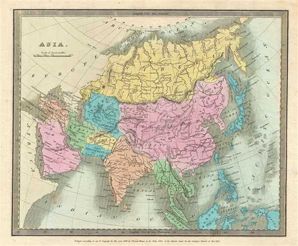
Asia.
sold
- Digital Map Information
- Suitable for large format printing
- DPI: 300
- File Size: 5.48 MB
- File Type: ZIP / TIFF
- ICC color profile embedded
- Delivered instantly via download link
This lovely 1835 first edition map of Asia was issued by David H. Burr. The map covers the entire Asian continent from the Arctic Ocean to the Indian Ocean and from the Red Sea to the New Guinea. Towns, rivers, mountains, deserts, islands and various other ... (more details)
Burr's map of Palestine during the waning Ottoman years
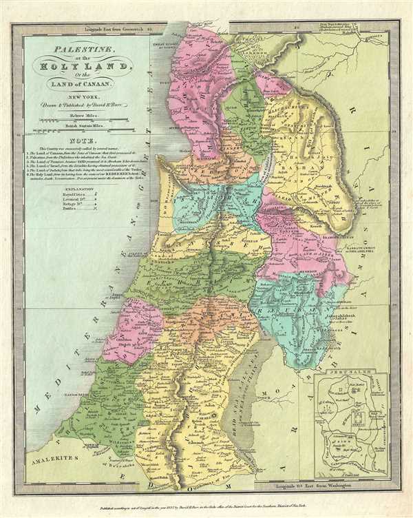
Palestine, or the Holy Land, Or the Land of Canaan.
sold
- Digital Map Information
- Suitable for large format printing
- DPI: 300
- File Size: 5.25 MB
- File Type: ZIP / TIFF
- ICC color profile embedded
- Delivered instantly via download link
This is an interesting 1832 example of the 1832 first edition map of Israel, Palestine or the Holy Land by David H. Burr. It covers the region from Sidon south to the southern tip of the Dead Sea and includes the modern day nations of Israel, Lebanon and ... (more details)
Beautiful map featuring Lake Superior, the largest of the Great Lakes of North America.
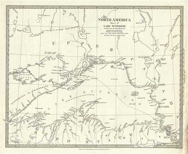
North America Sheet IV Lake Superior.
sold
- Digital Map Information
- Suitable for large format printing
- DPI: 300
- File Size: 5.51 MB
- File Type: ZIP / TIFF
- ICC color profile embedded
- Delivered instantly via download link
This is a beautiful 1832 first edition S.D.U.K. map of Lake Superior, the largest of the five Great Lakes. Centered on Lake Superior, the map coves the modern day regions of southern Ontario, northern Michigan and northeastern Minnesota. Although the ... (more details)
Detailed plan of the bustling port city of Liverpool, England.

Liverpool.
sold
- Digital Map Information
- Suitable for large format printing
- DPI: 300
- File Size: 7.21 MB
- File Type: ZIP / TIFF
- ICC color profile embedded
- Delivered instantly via download link
This is a nice 1836 first edition map of the city of Liverpool, England issued by the Society for the Diffusion of Useful Knowledge, or S.D.U.K. Highly detailed, the map notes individual streets, buildings, parks, markets and docks. An inset in the ... (more details)
Beautiful city plan of Dublin, Ireland's capital city.

Dublin.
sold
- Digital Map Information
- Suitable for large format printing
- DPI: 300
- File Size: 8.49 MB
- File Type: ZIP / TIFF
- ICC color profile embedded
- Delivered instantly via download link
This is a lovely 1836 map of the city of Dublin, Ireland issued by the Society for the Diffusion of Useful Knowledge, or S.D.U.K. It depicts the city of Dublin, at the time confined mainly within the Circular Road located at the mouth of the Liffey River, including part of Phoenix Park. Highly detailed, the map notes individual streets, buildings, parks, squares, and docks. Trinity College is labeled to the right of center, with several hospitals, the military barracks, and the College Botanic Gardens among the other identified locations around the city. Artistic profile views of fourteen of the most important buildings of the city, such as St. George's Church, the Royal Exchange, St. Patrick's Church, and Nelson's Pillar. (more details)
Early 19th century map detailing the lost city of Pompeii.

Pompeii.
sold
- Digital Map Information
- Suitable for large format printing
- DPI: 300
- File Size: 6.46 MB
- File Type: ZIP / TIFF
- ICC color profile embedded
- Delivered instantly via download link
A beautiful example of the 1832 first edition S.D.U.K. map of Pompeii, Italy. Pompeii was destroyed by the eruption of the volcano Vesuvius, in A.D. 79 and remained buried under ash until its rediscovery in 1748. Though excavations had been in ... (more details)
Detailed map depicting the ancient city of Athens with beautiful panoramic views.

Athens.
sold
- Digital Map Information
- Suitable for large format printing
- DPI: 300
- File Size: 7.32 MB
- File Type: ZIP / TIFF
- ICC color profile embedded
- Delivered instantly via download link
This is an attractive 1832 first edition map of Ancient Athens, Greece, issued by the Society for the Diffusion of Useful Knowledge, or S.D.U.K. The map details the city of Athens, capital of the Athenian Empire and heart of Ancient Greek ... (more details)
Map of the United States during westward expansion.

North America Index Map to Canada and the United States.
sold
- Digital Map Information
- Suitable for large format printing
- DPI: 300
- File Size: 7.14 MB
- File Type: ZIP / TIFF
- ICC color profile embedded
- Delivered instantly via download link
An uncommon 1834 first edition map of the United States and Canada issued by the Society for the Diffusion of Useful Knowledge, or S.D.U.K. The map covers the United States east of the Mississippi as well as the Trans-Mississippi ... (more details)
Early map of China and the Birman Empire with a curiously misshapen Korea.

China and the Birman Empire with parts of Cochin-China and Siam.
sold
- Digital Map Information
- Suitable for large format printing
- DPI: 300
- File Size: 6.45 MB
- File Type: ZIP / TIFF
- ICC color profile embedded
- Delivered instantly via download link
This is a nice 1834 first edition map depicting China and Burma (Myanmar) along with parts of Thailand, Laos and Vietnam issued by the Society for the Diffusion of Useful Knowledge, or S.D.U.K. Extends from Assam in India east as ... (more details)
Rare English issued joinly published variant on Delisle's map of the Roman Empire.

An historical map of the Roman Empire and the neighbouring barbarous nations to the year of our Lord four hundred when the empire began to be rent with foreign invasions. / Theatrum historicum ad annum Christi quadringentesimu in quo tum Imperii Romani tum barbarorum circumincolentium status ob oculos ponitur.
sold
- Digital Map Information
- Suitable for large format printing
- Full resolution TIFF file
- ICC color profile embedded
- Delivered instantly via download link
This is a scarce c. 1709 large scale historical map of Europe under the the Roman Empire and the surrounding 'barbarous' regions. The map essentially covers all of Europe and parts of Central Asia from the Azores to the Indus ... (more details)
Spectacularly decorate map of the world attempting to reconcile the discoveries of Bering with the De Fonte apocrypha.
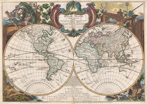
Mappe monde nouvelle : dediée a monseigneur le comte de Maurepas Ministre et Secretaire d'Etat.
sold
- Digital Map Information
- Suitable for large format printing
- DPI: 300
- File Size: 22.51 MB
- File Type: ZIP / TIFF
- ICC color profile embedded
- Delivered instantly via download link
A fine example of Le Rouge's highly decorative 1744 / 48 map of the world on a stereographic projection or, more commonly, in two hemispheres. Cartographically the map appears on the cusp of the great explorations of the 18th ... (more details)
Monumental North America maps with incomplete Great Lake and Califorina as an Island.

Amerique septentrionale divisee en ses principales parties, ou sont distingues les vns des autres les estats suivant qu'ils appartiennent presentemet aux Francois, Castillans, Anglois, Suedois, Danois, Hollandois, tiree des relations de toutes ces nations par le S. Sanson, geographe ordinaire du roy. 1692.
sold
- Digital Map Information
- Suitable for large format printing
- DPI: 300
- File Size: 23.55 MB
- File Type: ZIP / TIFF
- ICC color profile embedded
- Delivered instantly via download link
An impressive and scarce 1692 map of North America issued by Alexis-Hubert Jaillot on a massive scale. The map covers all of North America and Central America from Baffin Bay to the Spanish Main. The map extends westward to ... (more details)
Monumental world map showing California as an Island.
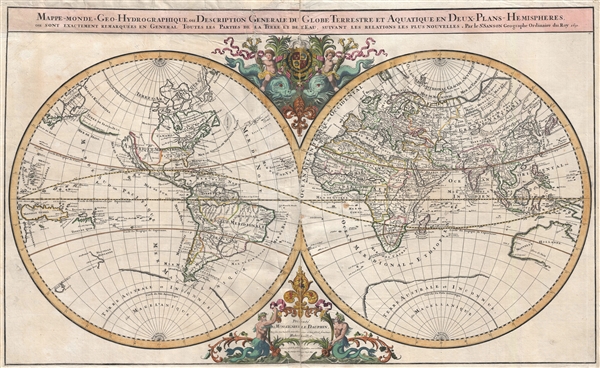
Mappe-monde Geo-Hydrographique ou Description Generale du Globe Terrestre et Aquatique en Deux-Plans-Hemipsheres ou son Exactement Remarquees en General Toutes les Parties de la Terre et de L'Eau, suivant les Relations les plus Nouvelles, par le S. Sanson Geographe Ordinaire du Roy.
sold
- Digital Map Information
- Suitable for large format printing
- DPI: 300
- File Size: 26.26 MB
- File Type: ZIP / TIFF
- ICC color profile embedded
- Delivered instantly via download link
An extraordinary map of monumental proportions, this Sanson and Jaillot's c.1691 decorative map of the world on a double hemisphere projection. Covers the entire world according to its 17th century conception of Nicolas ... (more details)
Belcher's influential chart is considered the first British Map of Hong Kong.
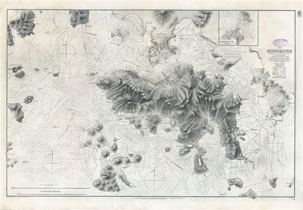
China Hong Kong Surveyed by Captn. Sir Edward Belcher in H.M.S. Sulphur 1841.
sold
- Digital Map Information
- Suitable for large format printing
- File Size: 31.4 MB
- File Type: ZIP / TIFF
- ICC color profile embedded
- Delivered instantly via download link
An iconic map of the utmost importance and rarity, this is the 1890 issue of Edward Belcher's nautical map of Hong Kong (香港) and vicinity. Belcher's 1841 study is considered to be the first British survey of Hong ... (more details)
Exceedingly rare map illustrating the events of the Second Anglo-Mysore War.
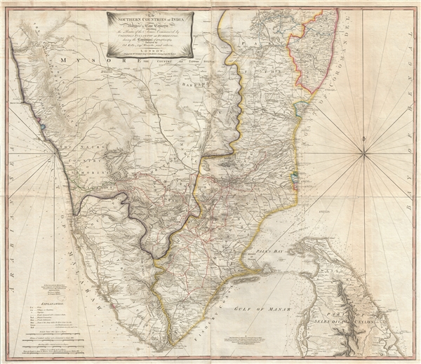
The Southern Countries of India from Madrass to Cape Comorin describing the Routes of the Armies Commanded by Colonels Fullarton and Humberston, during the Campaigns of 1782, 1783, & 1784.
sold
- Digital Map Information
- Suitable for large format printing
- DPI: 300
- File Size: 52.23 MB
- File Type: ZIP / TIFF
- ICC color profile embedded
- Delivered instantly via download link
An extremely rare 1781 map of Southern India by William Faden. The map covers from Mangalore and Madras, south to Cape Comorin (Kanyakumari) and includes the northern half of Sri Lanka or Ceylon. Map with relief is ... (more details)
Striking topographical chart of San Francisco Peninsula on heavy stock.
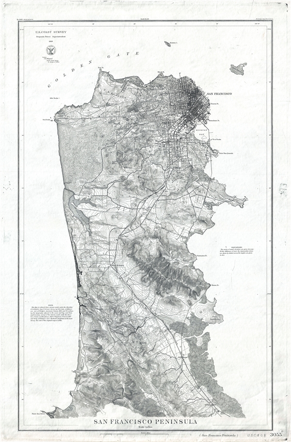
San Francisco Peninsula. U.S. Coast Survey. Benjamin Peirce, Superintendent. 1869. Price $1.50. Verified J.E. Hilgard. Assist Coast Survey. In Charge of Office.
sold
- Digital Map Information
- Suitable for large format printing
- File Size: 16.35 MB
- File Type: ZIP / TIFF
- ICC color profile embedded
- Delivered instantly via download link
A fine heavy stock example of the scarce U.S. Coast Survey map of San Francisco Peninsula. The map depicts the immediate city of San Francisco and surrounding areas as far south as San Pedro and Millbrae Station, ... (more details)
Home city to some of the world's finest French wines.
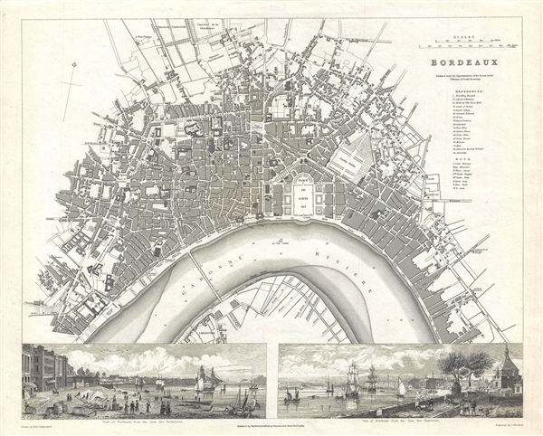
Bordeaux.
sold
- Digital Map Information
- Suitable for large format printing
- DPI: 300
- File Size: 7.36 MB
- File Type: ZIP / TIFF
- ICC color profile embedded
- Delivered instantly via download link
This map is a steel plate engraving, dating to 1832 by the Society for the Diffusion of Useful Knowledge, S.D.U.K. It represents the city of Bordeaux, famous for its extraordinary French Wines. This fascinating ... (more details)
Set of four maps depicting the history of the United States from 1578 to 1692.

First Map to accompany Willards history of the United States 1578. / Second Map to accompany Willards history of the United States 1620. / Third Map to accompany Willards history of the United States 1643. / Fourth Map to accompany Willards history of the United States 1692.
sold
- Digital Map Information
- Suitable for large format printing
- Full resolution TIFF file
- ICC color profile embedded
- Delivered instantly via download link
This is a set of four maps from Willards History of the United States issued in 1829. These four maps, part of a series of 10 maps, depict the history of the United States from 1578 to 1692. The first map, from ... (more details)
Attractive plan of Munich when it was the capital of the Kingdom of Bavaria.

Munich (Munchen).
sold
- Digital Map Information
- Suitable for large format printing
- DPI: 300
- File Size: 7.51 MB
- File Type: ZIP / TIFF
- ICC color profile embedded
- Delivered instantly via download link
This is a beautiful first edition map of the German city of Munich issued in 1832 by the Society for the Diffusion of Useful Knowledge, or S.D.U.K. It depicts the city a time when it was the capital of the ... (more details)