
Earliest known iternation of Colton's iconic Comparative Mountains and Rivers Chart.
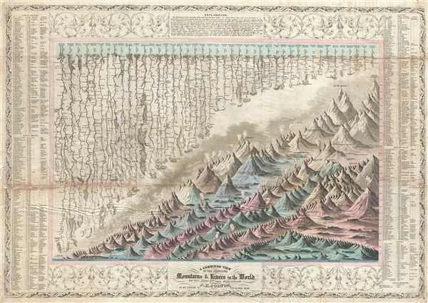
A Combined View of the Principal Mountains and Rivers in the World with Tables showing their relative Heights and Lengths.
sold
- Digital Map Information
- Suitable for large format printing
- Full resolution TIFF file
- ICC color profile embedded
- Delivered instantly via download link
A scarce 1849 pocket format edition of Colton's Mountains and Rivers chart. This is the earliest known iteration of Colton's iconic Mountains and Rivers chart which would later be popularized in his 1855 Atlas of the World and in Johnson's 1860 New Family Atlas . ... (more details)
Map of the Russian Empire across Asia and Europe.

Russian Empire.
sold
- Digital Map Information
- Suitable for large format printing
- DPI: 300
- File Size: 5.62 MB
- File Type: ZIP / TIFF
- ICC color profile embedded
- Delivered instantly via download link
This is a beautiful 1834 first edition map of the Russian Empire issued by David H. Burr. It covers the Empire in its entirety, both in Asia and in Europe. Throughout, the map identifies various cities, towns, rivers, mountain passes and an assortment of ... (more details)
Burr's first edition map depicting the Balkans.

Turkey in Europe.
sold
- Digital Map Information
- Suitable for large format printing
- DPI: 300
- File Size: 5.17 MB
- File Type: ZIP / TIFF
- ICC color profile embedded
- Delivered instantly via download link
A first edition map depicting the Balkans and part of Greece issued in 1835 by David H. Burr. It extends northward from the Sea of Marmara to Moldavia (Moldova). Drawn when the Ottoman Empire controlled much of the region, it covers what is today Greece, ... (more details)
Early 19th century map of Netherlands, Belgium and Luxembourg.
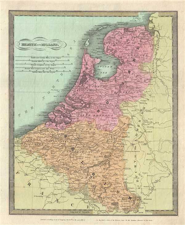
Belgium and Holland.
sold
- Digital Map Information
- Suitable for large format printing
- DPI: 300
- File Size: 5.92 MB
- File Type: ZIP / TIFF
- ICC color profile embedded
- Delivered instantly via download link
This is an example of David H. Burr’s 1831 first edition map of Holland (the Netherlands), Belgium and Luxemburg. It covers from the North Sea to Luxembourg. Towns, rivers, mountains, canals and various other important topographical details are noted. ... (more details)
Burr's first edition map depicting Scotland.

Scotland.
sold
- Digital Map Information
- Suitable for large format printing
- DPI: 300
- File Size: 6.6 MB
- File Type: ZIP / TIFF
- ICC color profile embedded
- Delivered instantly via download link
An attractive 1834 first edition map of Scotland by David H. Burr. It covers Scotland from the Orkney islands to Wigtown in the south inclusive of the Hebrides. Towns, rivers, mountains, railroads, roads and various other important topographical details ... (more details)
Burr's representation of Chile and Argentina.
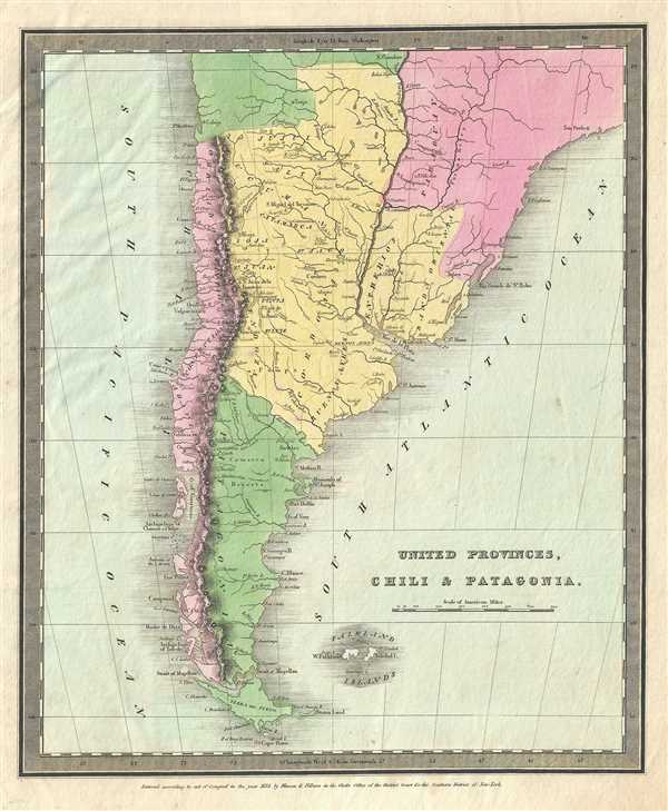
United Provinces, Chili and Patagonia.
sold
- Digital Map Information
- Suitable for large format printing
- DPI: 300
- File Size: 4.73 MB
- File Type: ZIP / TIFF
- ICC color profile embedded
- Delivered instantly via download link
This is a first edition 1833 map of Chile and Argentina by David H. Burr. It covers Chile and Argentina along with parts of Bolivia and Paraguay. Throughout, the map identifies various cities, towns, rivers, mountain passes and an assortment of ... (more details)
Early map of Gran Columbia

Colombia.
sold
- Digital Map Information
- Suitable for large format printing
- DPI: 300
- File Size: 5.71 MB
- File Type: ZIP / TIFF
- ICC color profile embedded
- Delivered instantly via download link
This is a first edition 1834 map of Colombia or Gran Colombia by David H. Burr. This map covers Gran Colombia or Great Colombia, which included territories of modern day Colombia, Venezuela, Ecuador, Panama, and part of northern Brazil, Peru ... (more details)
First edition of Burr's map of the West Indies.

West Indies.
sold
- Digital Map Information
- Suitable for large format printing
- DPI: 300
- File Size: 5.32 MB
- File Type: ZIP / TIFF
- ICC color profile embedded
- Delivered instantly via download link
This is a detailed first edition map of the West Indies issued by David H. Burr. Centered on the island of Hispaniola (Santo Domingo), it covers the Caribbean from southern Florida, south as far as the Gulf of Panama and the Spanish Main, ... (more details)
Burr's first edition map of Mexico before the Texas War of Independence.

The United States of Mexico.
sold
- Digital Map Information
- Suitable for large format printing
- DPI: 300
- File Size: 5.26 MB
- File Type: ZIP / TIFF
- ICC color profile embedded
- Delivered instantly via download link
This is an attractive 1832 first edition map of Mexico and Guatemala by David H. Burr. It covers from Upper California south to Panama including the modern day region of California, New Mexico, Arizona, Colorado, Utah, Nevada, Texas, ... (more details)
Map of Louisiana with early county division.

Louisiana.
sold
- Digital Map Information
- Suitable for large format printing
- DPI: 300
- File Size: 5.03 MB
- File Type: ZIP / TIFF
- ICC color profile embedded
- Delivered instantly via download link
This is a beautiful 1834 first edition map of Louisiana by David H. Burr. Shows river ways, roads, canals, swamps and some topographical features. Offers color-coding at the county level. Various American Indian villages noted ... (more details)
Depicts Chickasaw and Choctaw Territory just following to Trail of Tears.

Mississippi.
sold
- Digital Map Information
- Suitable for large format printing
- DPI: 300
- File Size: 4.47 MB
- File Type: ZIP / TIFF
- ICC color profile embedded
- Delivered instantly via download link
This is an important 1835 first edition map of Mississippi by David H. Burr. It depicts the state in detail noting rivers, roads, towns and other topographical features with color-coding at the county level. The map is ... (more details)
Burr's vivid depiction of Georgia.

Georgia.
sold
- Digital Map Information
- Suitable for large format printing
- DPI: 300
- File Size: 4.39 MB
- File Type: ZIP / TIFF
- ICC color profile embedded
- Delivered instantly via download link
This first edition map of Georgia was issued by David S. Burr in 1834. It depicts the state in detail, noting roads, rivers, lakes and a host of other topographical features, with relief shown by hachure. Offers ... (more details)
Beautiful map depicting North Carolina and South Carolina.
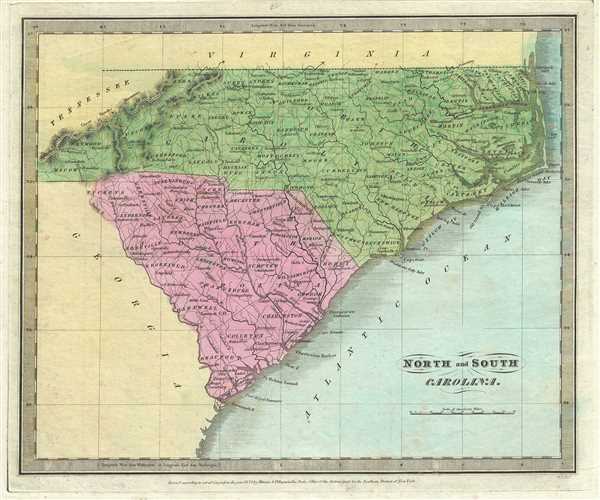
North and South Carolina.
sold
- Digital Map Information
- Suitable for large format printing
- DPI: 300
- File Size: 4.78 MB
- File Type: ZIP / TIFF
- ICC color profile embedded
- Delivered instantly via download link
This is an attractive 1834 first edition David H. Burr map of North Carolina and South Carolina. It notes both states depicting counties, rivers, roads, towns, cities, islands and mountains beautifully rendered ... (more details)
19th century hand colored map of Arkansas.

Arkansas.
sold
- Digital Map Information
- Suitable for large format printing
- DPI: 300
- File Size: 4.85 MB
- File Type: ZIP / TIFF
- ICC color profile embedded
- Delivered instantly via download link
A beautifully 1835 first edition map of Arkansas issued by David H. Burr depicts the state with color-coding at a county level. Political boundaries as well as major rivers, towns, roads, swamps and mountains ... (more details)
Map of Missouri showing early county configurations.
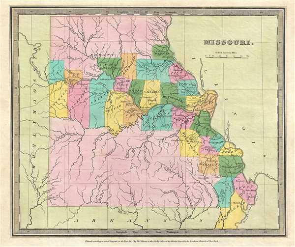
Missouri.
sold
- Digital Map Information
- Suitable for large format printing
- DPI: 300
- File Size: 4.46 MB
- File Type: ZIP / TIFF
- ICC color profile embedded
- Delivered instantly via download link
This is an unusual 1834 first edition map of Missouri by David H. Burr. It depicts the very early county configuration with most of the population attached to the Mississippi and Missouri rivers. The western ... (more details)
Early map of Indiana depicting the changing American Indian situation.
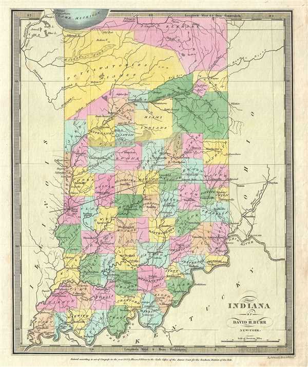
Indiana.
sold
- Digital Map Information
- Suitable for large format printing
- DPI: 300
- File Size: 4.97 MB
- File Type: ZIP / TIFF
- ICC color profile embedded
- Delivered instantly via download link
A beautiful example of David H. Burr’s important map of Indiana. Depicts the state with moderate detail showing river ways, roads, canals, and some topographical features. Offers color-coding at the county ... (more details)
Early map of Virginia before it was divided.

Virginia.
sold
- Digital Map Information
- Suitable for large format printing
- DPI: 300
- File Size: 6.15 MB
- File Type: ZIP / TIFF
- ICC color profile embedded
- Delivered instantly via download link
This is a nice example of David H. Burr’s 1834 first edition map of Virginia. It covers all of what is today Virginia and West Virginia as well as the entire Chesapeake Bay. The western part of Virginia ... (more details)
Important map of Oahu, Hawaii, issued by the U.S. Government shorly following Annexation.

Oahu, Hawaiian Islands.
sold
- Digital Map Information
- Suitable for large format printing
- File Size: 2.84 MB
- File Type: ZIP / TIFF
- ICC color profile embedded
- Delivered instantly via download link
This large, scarce and extraordinary 1902 map of the island of Oahu, Hawaii, was prepared for the 1906 Report of the Governor of the Territory of Hawaii to the Secretary of the Interior . Honolulu, Pearl ... (more details)
Extremely rare British Admiralty chart of the Savannah River.
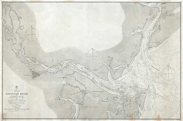
America East Coast Savannah River & Calibogue Sound from the United States Coast Survey 1855 with additions & corrections from survey of 1862.
sold
- Digital Map Information
- Suitable for large format printing
- Full resolution TIFF file
- ICC color profile embedded
- Delivered instantly via download link
A beautiful and extremely scarce 1861 British Admiralty Hydrographic Office maritime map or nautical chart detailing the Savannah River and Calibogue Sound, Georgia. Centered , the Savannah River, this ... (more details)
Large format dissected map of Norway in Norwegian.
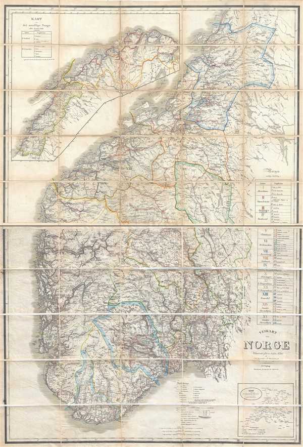
Veikart over Norge
sold
- Digital Map Information
- Suitable for large format printing
- Full resolution TIFF file
- ICC color profile embedded
- Delivered instantly via download link
An uncommon 1868 large format dissected map of Norway by J. Waligorsky and N. Wergeland. Published in Christiania, Norway, by Jacob Dybwad, this large map covers the entirety of Norway from the Arctic ... (more details)