
Extremely rare and early oversized double hemisphere constellation map, or celestial, by Frederik de Wit.
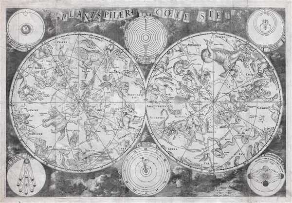
Planisphaerium Coeleste.
sold
- Digital Map Information
- Suitable for large format printing
- DPI: 300
- File Size: 84.78 MB
- File Type: ZIP / TIFF
- ICC color profile embedded
- Delivered instantly via download link
A remarkable and very rare example of Frederic de Wit's c. 1680 oversized and beautifully engraved double hemisphere celestial map. The map consists of two hemispheres surrounded by six supplementary diagrams. These illustrated the Copernican hypothesis, the ... (more details)
John Jeffries' own copy of his historic narrative recording the first international aerial voyage across the English Channel.

A Narrative of the Two Aerial Voyages of Doctor Jeffries with Mons. Blanchard; with Meteorological Observations and remarks. / First Voyage, on the Thirtieth of November, 1784, from the Rhedarium, near Grosvenor Square, London, into the Paris of Stone, in the Country of Kent; in performing which, we were suspended, and floating in the Atmosphere, on Hour and twenty-one Minutes. / Second Voyage, on the Seventh of January, 1785, from the Cliffs of Dover, Near the Royal Castle, across the British Channel, into the Forest of Guines, in the Province of Artois, in France: In completing which, we were suspended, and floating in the Atmosphere, Two Hours over the Sea; and forty-seven minutes of the Land of France.
sold
- Digital Map Information
- Suitable for large format printing
- Full resolution TIFF file
- ICC color profile embedded
- Delivered instantly via download link
One of the most important books ever published with regard to the history of aviation, this is the American physician John Jeffries' (February 5, 1744 - September 16, 1819) personal copy of his narratives of two balloon voyages personally undertaken in the ... (more details)
Jehoshaphat Aspin's rare map illustrating the discoveries of John Oxley and George Evans in New South Wales, Australia.
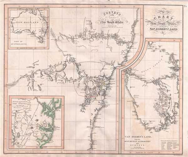
A Chart of New South Wales, Van Diemen's Land, &c. / Surveys of the Interior of New South Wales. / Van Diemen's Land from the Most Recent Authorities and Surveys. / British Settlements of Port Jackson, & C.
sold
- Digital Map Information
- Suitable for large format printing
- Full resolution TIFF file
- ICC color profile embedded
- Delivered instantly via download link
This rare and important 1827 map by the mysterious female cartographer Jehoshaphat Aspin is one of the earliest obtainable separate maps of New South Sales, Australia, to illustrate the explorations undertaken by John Oxley and George Evans between 1817 ... (more details)
Johnson's depiction of the worlds time zones.

A Diagram Exhibiting the difference of time between the places shown and Washington.
sold
- Digital Map Information
- Suitable for large format printing
- File Size: 7.28 MB
- File Type: ZIP / TIFF
- ICC color profile embedded
- Delivered instantly via download link
This is a very attractive example of Johnson and Ward's 1863 diagram of the world's time zones. It consists of a circular engraving in which numerous clocks are drawn, each representing a major world city. At the center is clock representing the time ... (more details)
A grand design for the future of Seattle in this 1911 Bogue Plan.

Map of the City of Seattle and adjacent territories accompanying report of Municipal Plans Commission.
sold
This is a rare and important 1911 map or plan of the city of Seattle by Virgil G. Bogue. This map, present the proposed ‘Bogue Plan’ and covers the city of Seattle as foreseen by the visionary engineer. The famous plan presented a grand design ... (more details)
One of the most decorative maps of Southern California.
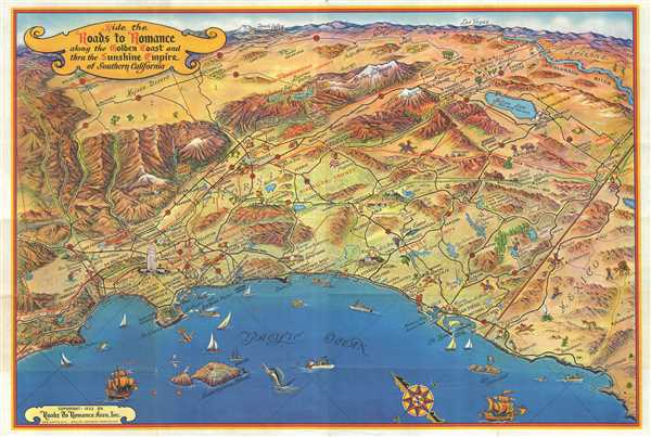
Ride the Roads to Romance along the Golden Coast and thru the Sunshine Empire of Southern California.
sold
- Digital Map Information
- Suitable for large format printing
- Full resolution TIFF file
- ICC color profile embedded
- Delivered instantly via download link
This is an attractive 1953 bird’s eye view map of southern California issued by the Roads to Romance Association, Inc. It covers from Malibu Beach to Ensenada in Mexico and includes the counties of Los Angeles, Orange, Riverside, San Diego, ... (more details)
A most impressive 18th century wall map of the world.

A General Map of the World, or Terraqueous Globe with all the New Discoveries and Marginal Delineations, Containing the Most Interesting Particulars in the Solar, Starry and Mundane System, by Sam. Dunn, Mathematician.
sold
- Digital Map Information
- Suitable for large format printing
- Full resolution TIFF file
- ICC color profile embedded
- Delivered instantly via download link
An absolutely stunning and monumental double hemisphere wall map of the world by Samuel Dunn dating to 1794. This extraordinary map is so large and so rich in detail that it is exceptionally challenging to do it full justice in either ... (more details)
Important founding map relating to the Columbia River and Oregon Territory.
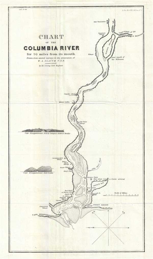
Chart of the Columbia River for 90 miles from its mouth.
sold
- Digital Map Information
- Suitable for large format printing
- Full resolution TIFF file
- ICC color profile embedded
- Delivered instantly via download link
This is an important and scarce 1838 map or nautical chart of the Columbia River by William A. Slacum. The Columbia River, the largest river in the Pacific Northwest region of the United States forms the border between the states of ... (more details)
One of the rare maps to focus on the popular tourist destination of Block Island, Rhode Island.
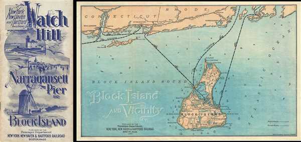
Block Island and Vicinity.
sold
- Digital Map Information
- Suitable for large format printing
- Full resolution TIFF file
- ICC color profile embedded
- Delivered instantly via download link
This is a rare and beautiful 1903 map of Block Island, Rhode Island published by the Passenger Department, New York, New Haven and Hartford Railroads. This is one of the few maps of this popular tourist destination that ... (more details)
Scarce tourist map of New England.
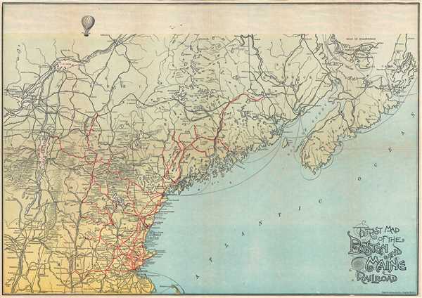
Tourist Map of the Boston and Maine Railroad.
sold
- Digital Map Information
- Suitable for large format printing
- Full resolution TIFF file
- ICC color profile embedded
- Delivered instantly via download link
This is a scarce c.1910 tourist map of New England published by the Rand Avery Supply Company. Issued as a tourist map, it depicts the regions along the Boston and Maine Railroad lines (not the Pan Am Railways), and covers from Provincetown north to the Gulf of St. Lawrence and from Nova Scotia west as far as Montreal. Throughout, the map notes cities, towns, islands, rivers, lakes and a host of additional topographical features. Railway lines are marked in red throughout. The map also notes several hotels and resorts along the way. This map, unusually near the top, changes into a bird's eye view perspective to illustrate the sky. An illustration of a hot air balloon is included to divert attention to this change in perspective. (more details)
A beautiful view of New York City to illustrate the opening of the Brooklyn Bridge.
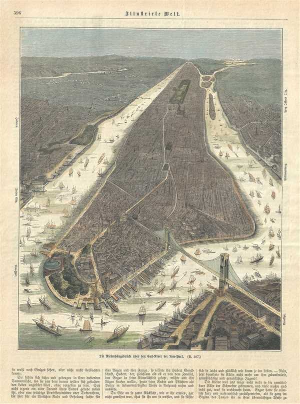
Illustrirte Welt.
sold
- Digital Map Information
- Suitable for large format printing
- Full resolution TIFF file
- ICC color profile embedded
- Delivered instantly via download link
This is a beautiful c.1885 bird’s eye view or map of New York City, issued in the German Illustrierte Welt . The view covers the entire Island of Manhattan from Battery Park north as far as the Spuyten Duyvil Creek ... (more details)
A decorative 17th century map of Africa's Slave Coast, Ivory Coast and Gold Coast.
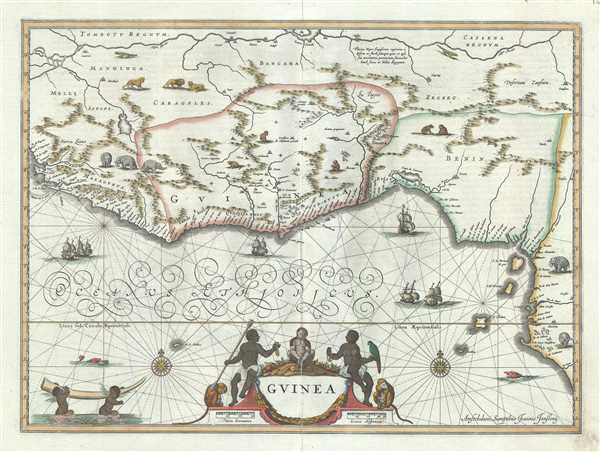
Guinea.
sold
- Digital Map Information
- Suitable for large format printing
- Full resolution TIFF file
- ICC color profile embedded
- Delivered instantly via download link
This is a rare and attractive c.1660 map of West Africa by Jan Jansson. It depicts the African Gold Coast, Ivory Coast and Slave Coast from Guinea south through the modern nations of Sierra Leone, Mali, Liberia, ... (more details)
An early triangulation chart of Florida.
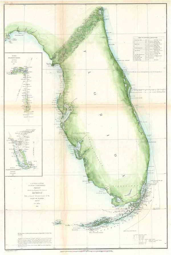
Sketch F Showing the Progress of the Survey in Section VI. With a General Reconnaissance of the Coast of Florida 1848-60.
sold
- Digital Map Information
- Suitable for large format printing
- Full resolution TIFF file
- ICC color profile embedded
- Delivered instantly via download link
A beautiful example of the U.S. Coast Survey's 1860 triangulation chart or map of the Florida Peninsula. This nautical map covers from St. Augustine and Apalachee Bay southwards as far as Key West and the Dry ... (more details)
A scarce nautical chart of Key West and surroundings.
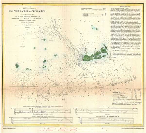
(Sketch F No. 5) Preliminary Chart of Key West Harbor and Approaches.
sold
- Digital Map Information
- Suitable for large format printing
- Full resolution TIFF file
- ICC color profile embedded
- Delivered instantly via download link
An uncommon 1851 U.S. Coast Survey nautical chart or maritime map of Key West, Florida, and its approaches. Centered on Key West, this map covers from Boca Grande Key eastward to Raccoon Key, north as far as ... (more details)
One of the rarest and most desirable U.S. Coast Survey maps of the Chesapeake Bay.

Sketch C Showing the Progress of the Survey in Section III From 1843 to 1861.
sold
- Digital Map Information
- Suitable for large format printing
- File Size: 16.02 MB
- File Type: ZIP / TIFF
- ICC color profile embedded
- Delivered instantly via download link
This is an exceptional example of the 1861 U.S. Coast Survey’s progress chart of the Chesapeake Bay. The map covers the from the mouth of the Susquehanna River southward as far as Cape Henry and Norfolk. ... (more details)
Nautical Chart depicting the Kennebec River of Maine.
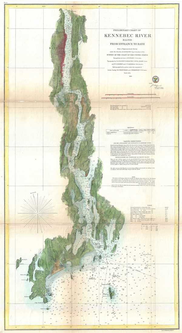
Preliminary Chart of Kennebec River Main from Entrance to Bath.
sold
- Digital Map Information
- Suitable for large format printing
- File Size: 12.65 MB
- File Type: ZIP / TIFF
- ICC color profile embedded
- Delivered instantly via download link
This is a beautiful example of the U.S. Coast Survey nautical chart or maritime map of the Kennebec River, Maine. It covers the Kennebec River from its entrance to the town of Bath. This extraordinarily ... (more details)
One of the first illustrations of the Great Boston Fire of 1872. - See more at: http://www.geographicus.com/P/AntiqueMap/BostonFireRuins-harpersweekly-1872#sthash.VhY812R2.dpuf

Boston-General view of the Ruins, from the West side of Washington Street - The Old South Church and the 'Transcript' Building in the foreground.
sold
- Digital Map Information
- Suitable for large format printing
- Full resolution TIFF file
- ICC color profile embedded
- Delivered instantly via download link
This is a dramatic journalistic view of Boston, Massachusetts prepared to illustrate the ruin after the Great Boston Fire of 1872. Issued just three weeks after the tragic fire (November 7-8, 1872), ... (more details)
Early 19th century map of Netherlands, Belgium and Luxemboug.

General-Charte von dem Koonigreiche der Niederlande nebst dem Grossherzogthume Luxemburg.
sold
- Digital Map Information
- Suitable for large format printing
- Full resolution TIFF file
- ICC color profile embedded
- Delivered instantly via download link
This is a scarce separate-issue 1826 map of Holland (the Netherlands), Belgium and Luxembourg by C. F. Weiland. It covers all of Belgium and Holland from the North Sea south to France, Luxembourg. ... (more details)
The first view to illustrate the devastation following the Great Boston Fire of 1872.

Bird's-Eye View of Boston, Showing the Burned District.
sold
- Digital Map Information
- Suitable for large format printing
- File Size: 33.83 MB
- File Type: ZIP / TIFF
- ICC color profile embedded
- Delivered instantly via download link
A dramatic 1872 view of Boston, illustrating the extent of the devastation caused by the Great Boston Fire of November 7-8, 1872. Issued just three weeks later, this is one of the first depictions of the fire. In order to satisfy the immediate demand for information about the disaster, Harper's Weekly turned to Currier and Ives, who had already contracted illustrator Charles R. Parsons to collect material to produce a grand view of the city. Parsons - already employed as head of Harper's art department - was in a unique position, consolidate the resources of both firms to swiftly produce this timely view. It therefore predates the famous grand format Currier and Ives The City Of Boston by a year. (more details)
Beautiful early pictorial map of London.
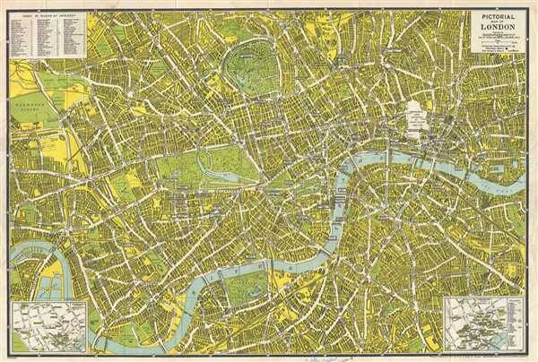
Pictorial Map of London.
sold
- Digital Map Information
- Suitable for large format printing
- Full resolution TIFF file
- ICC color profile embedded
- Delivered instantly via download link
This is a wonderful World War II era city plan or pocket map of London published c.1942 by the Geographia Map Co. Ltd. It covers downtown London from the Hammersmith Bridge and Wormwood scrubs ... (more details)