
Remarkable first editon of Jaillot's important map of America showing California as an Island.
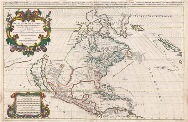
Amerique septentrionale divisee en ses principales parties, ou sont distingues les vns des autres les estats suivant qu'ils appartiennent presentemet aux Francois, Castillans, Anglois, Suedois, Danois, Hollandois, tiree des relations de toutes ces nations par le S. Sanson, geographe ordinaire du roy. 1674.
sold
- Digital Map Information
- Suitable for large format printing
- Full resolution TIFF file
- ICC color profile embedded
- Delivered instantly via download link
A large, impressive, and scarce 1674 map of North America issued by Alexis-Hubert Jaillot offered here in its first edition. The map covers all of North America and Central America from Baffin Bay to the Spanish Main. The map extends westward to past an Insular ... (more details)
Speculative early map of Siberia based upon the journals of Marco Polo.
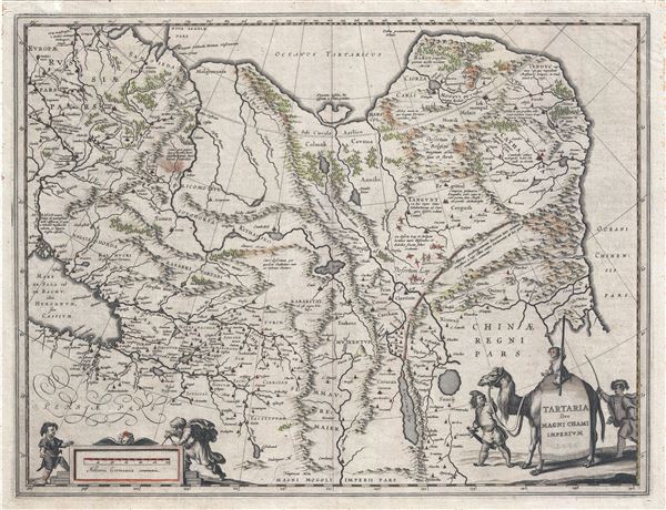
Tartaria sive Magni Chami Imperium.
sold
- Digital Map Information
- Suitable for large format printing
- DPI: 300
- File Size: 13 MB
- File Type: ZIP / TIFF
- ICC color profile embedded
- Delivered instantly via download link
A fine c. 1645 map of northeast Asia (Siberia or Tartary) by J. Blaeu. The map covers from the Caspian Sea and the Volga River east as far as the China Sea and the city of Xanadu. It extends north to Nova Zembla and south to the Upper Ganges River. When Blaeu ... (more details)
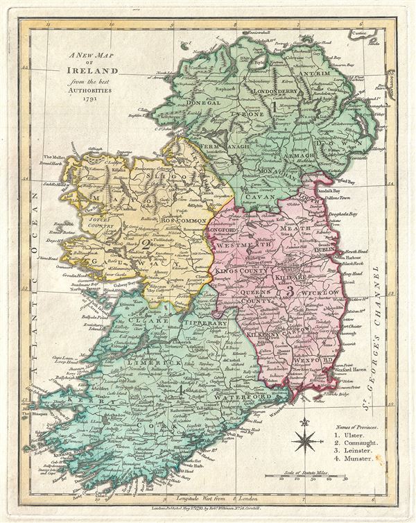
A New Map of Ireland from the best Authorities 1791.
sold
- Digital Map Information
- Suitable for large format printing
- Full resolution TIFF file
- ICC color profile embedded
- Delivered instantly via download link
This is a fine 1793 map of Ireland by Robert Wilkinson. Wilkinson's map depicts Ireland in full with color coding dividing the island into its four ancient provinces: Ulster, Connaught, Leinster, and Munster. These in turn are subdivided into 32 traditional ... (more details)
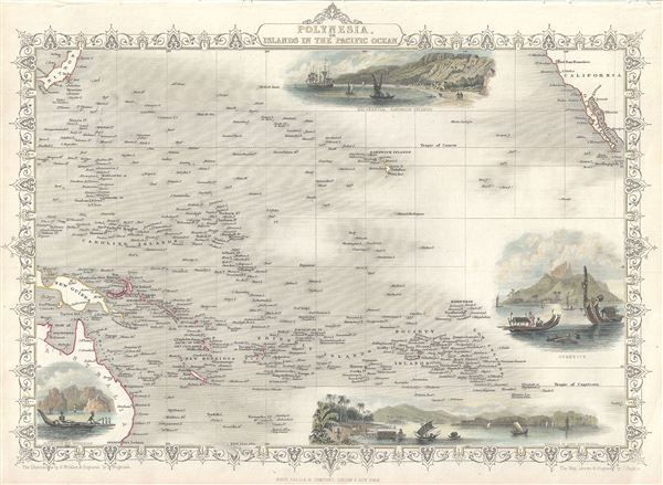
Polynesia or Islands in the Pacific Ocean.
sold
- Digital Map Information
- Suitable for large format printing
- Full resolution TIFF file
- ICC color profile embedded
- Delivered instantly via download link
This is an impressive 1851 Tallis map of Polynesia or the Islands of the Pacific Ocean. It covers from Japan to California south as far as Australia and the Low Archipelago. Four inset views are included, featuring Resolution Bay, Marquesas, the Harbor of ... (more details)
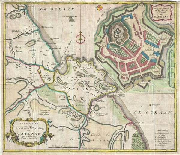
Land-Kaart van het Eiland en de Volkplanting van Cayenne aan de Kust van Zuid-Amerika.
sold
- Digital Map Information
- Suitable for large format printing
- Full resolution TIFF file
- ICC color profile embedded
- Delivered instantly via download link
This is a beautiful c.1760 map of the coast of French Guyana and the Island of Cayenne by Isaak Tirion. It covers from River Kourou south as far as River Kaw (Cau) and River Orapu. A large inset in the upper right quadrant features the fortifications of ... (more details)
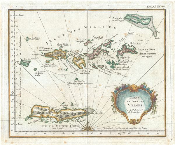
Carte des Isles des Vierges.
sold
- Digital Map Information
- Suitable for large format printing
- File Size: 0.52 MB
- File Type: ZIP / TIFF
- ICC color profile embedded
- Delivered instantly via download link
This is an extremely scarce 1764 map of the Virgin Islands in the Caribbean Sea by Jacques-Nicolas Bellin. It covers the Virgin Islands and the British Virgin Islands including St. Croix, St. Thomas, St. John, Tortola, Virgin Gorda and Anegada Islands, ... (more details)
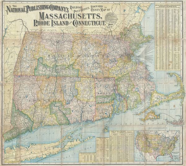
The National Publishing Company's Railroad, Post Office, Township and County Map of Massachusetts, Rhode Island and Connecticut.
sold
- Digital Map Information
- Suitable for large format printing
- Full resolution TIFF file
- ICC color profile embedded
- Delivered instantly via download link
This is a large and impressive relic of the great age of American Railroads. This dramatic map, issued by the National Publishing Company in 1902, covers the states of Massachusetts, Connecticut, and Rhode Island with adjacent parts of Long Island, ... (more details)
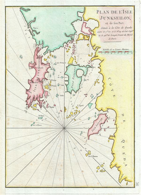
Plan de l'Isle Junseilon, et de son Port.
sold
- Digital Map Information
- Suitable for large format printing
- Full resolution TIFF file
- ICC color profile embedded
- Delivered instantly via download link
This is a scarce 1775 nautical chart or maritime map of the port and harbor of the Island of Phuket, Thailand by Jean-Baptiste d'Apres de Mannevillette. It details the Island of Phuket or Junk Ceylon along with its harbors and the coast of Queda ... (more details)
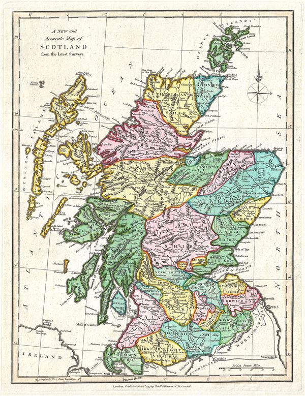
A New and Accurate Map of Scotland from the latest Surveys.
sold
- Digital Map Information
- Suitable for large format printing
- Full resolution TIFF file
- ICC color profile embedded
- Delivered instantly via download link
This is a finely detailed 1793 map of Scotland by Robert Wilkinson. Wilkinson's map covers Scotland in full from the Cheviot Hills to the Orkney Island and from the Outer Hebrides (Western Islands) to Aberdeenshire. Color coding divides the ... (more details)
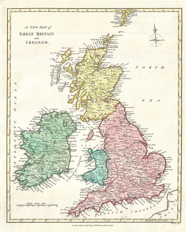
A New Map of Great Britain and Ireland.
sold
This is an exquisitely detailed 1793 map of the British Isles by Robert Wilkinson. Wilkinson's map covers all of England, Scotland, and Ireland, inclusive of the Shetland Isles. Color coding divides the map according to region, with ... (more details)

A New Map of Prussia from the best Authorities.
sold
- Digital Map Information
- Suitable for large format printing
- Full resolution TIFF file
- ICC color profile embedded
- Delivered instantly via download link
This is a finely detailed 1793 map of Prussia, by Robert Wilkinson. It covers from the Baltic Sea south as far as Torun (Thorn), and depicts the Holy Roman Empire Circles of Hockkerland, Samland, Natangen, the Palatinate of Culm, ... (more details)
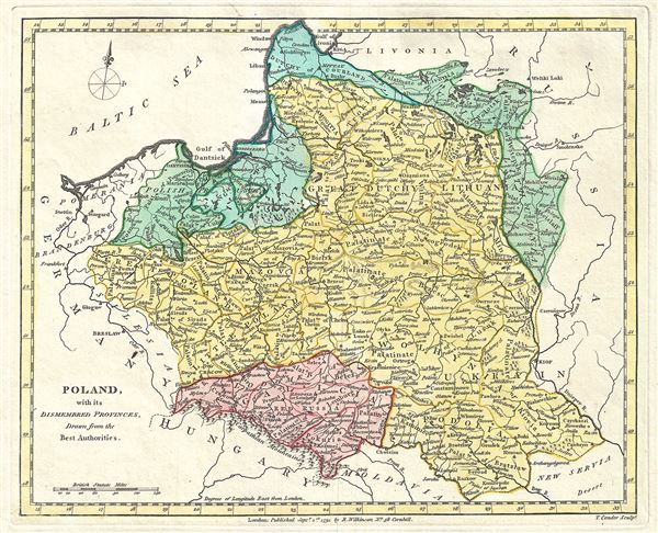
Poland, with its Dismembered Provinces, Drawn from the Best Authorities.
sold
- Digital Map Information
- Suitable for large format printing
- Full resolution TIFF file
- ICC color profile embedded
- Delivered instantly via download link
This is Robert Wilkinson's finely detailed 1791 map of Poland. It covers Poland, Polish Prussia, Lithuania, and Ukraine. In addition to cities and provinces, this map notes geographical features including mountains, rivers and ... (more details)
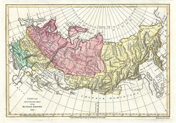
A New and Accurate Map of the Russian Empire 1792.
sold
- Digital Map Information
- Suitable for large format printing
- Full resolution TIFF file
- ICC color profile embedded
- Delivered instantly via download link
This is a scarce and beautiful 1792 map of the Russian Empire by Robert Wilkinson. It covers the lands claimed by Tsarist Russia from the Black and Baltic Seas fully across Asia to the Bearing Strait and the Peninsula of ... (more details)
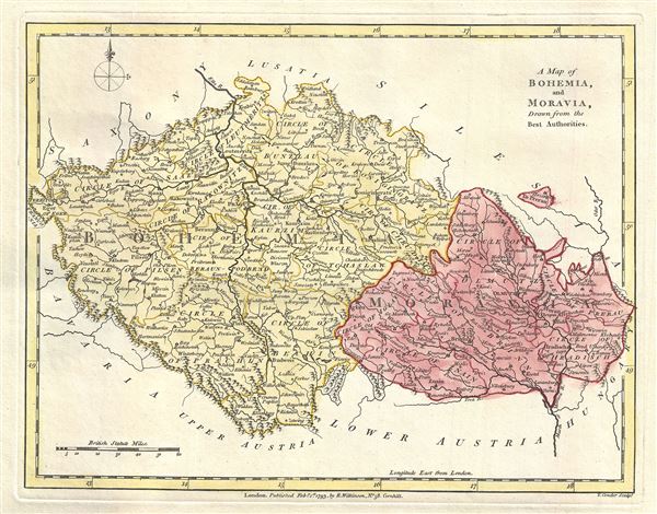
A Map of Bohemia, and Moravia, Drawn from the Best Authorities.
sold
- Digital Map Information
- Suitable for large format printing
- Full resolution TIFF file
- ICC color profile embedded
- Delivered instantly via download link
This is a beautiful 1793 map of Bohemia and Moravia, Germany by Robert Wilkinson. It covers what is today the Czech Republic from Eger (Cheb) east as far as Ostrava. It notes numerous towns, rivers, cities, mountains and ... (more details)
First specific map to reveal America as separate continent. First European map to show Japan. First map to identify the Pacific Ocean.

Die neuwen inseln so hinder Hispanien gegen Orient bey dem land Indie ligen.
sold
- Digital Map Information
- Suitable for large format printing
- Full resolution TIFF file
- ICC color profile embedded
- Delivered instantly via download link
A fine 1554 example of Sebastian Munster's map of America or the New World. This is one the earliest and most influential obtainable maps of the Americas. This is the first specific published map to reveal all of North ... (more details)

A Map of The Dutchy of Silesia, Drawn from the Best Authorities.
sold
- Digital Map Information
- Suitable for large format printing
- Full resolution TIFF file
- ICC color profile embedded
- Delivered instantly via download link
This is an unusual 1792 map of Silesia by Robert Wilkinson, in what was then part of the Holy Roman Empire. The map details the principalities within this duchy, which was bordered by Poland, Hungary, Moravia, Bohemia ... (more details)

The Circle of Lower Saxony, Drawn from the Latest Authorities.
sold
- Digital Map Information
- Suitable for large format printing
- Full resolution TIFF file
- ICC color profile embedded
- Delivered instantly via download link
A finely detailed 1793 map of Lower Saxony in what is now north central Germany, by Robert Wilkinson. As shown here, Lower Saxony was bordered by Denmark and the Baltic Sea to the north, Westphalia to the west, ... (more details)
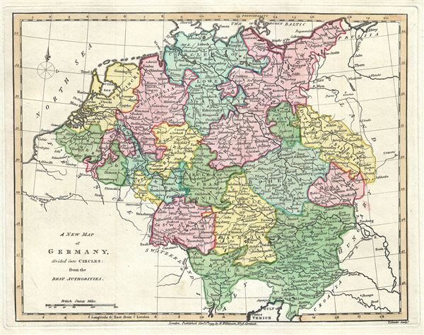
A New Map of Germany divided into Circles from the Best Authorities.
sold
- Digital Map Information
- Suitable for large format printing
- Full resolution TIFF file
- ICC color profile embedded
- Delivered instantly via download link
This is a fine 1791 map of Germany by Robert Wilkinson. It covers all of modern day Germany and Austria, and divides the area into the 'imperial circles' devised by the Holy Roman Empire to administer, tax, and ... (more details)
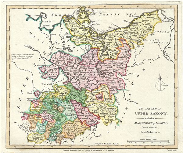
The Circle of Upper Saxony, with the Marquistate of Lusatia, Drawn from the Best Authorities.
sold
- Digital Map Information
- Suitable for large format printing
- Full resolution TIFF file
- ICC color profile embedded
- Delivered instantly via download link
This is an attractive 1791 map of Upper Saxony, in what is now Mitteldeutschland, by Robert Wilkinson. The map covers from the Baltic Sea in the north to Bohemia to the south and from Lower Saxony in the west ... (more details)

A New and Accurate Map of England and Wales, from the latest Surveys.
sold
- Digital Map Information
- Suitable for large format printing
- Full resolution TIFF file
- ICC color profile embedded
- Delivered instantly via download link
This is a beautiful 1793 map of England and Wales by Robert Wilkinson. Wilkinson's map covers England in full from Scotland south to the English Channel and from St. George's Channel to the mouth of the Thames ... (more details)