
Pristine 18th century case or pocket map of Paris, France.
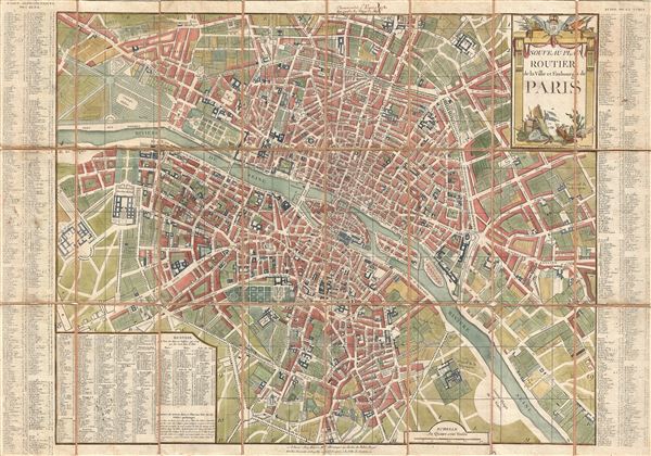
Nouveau Plan Routier de la Ville et Faubourgs de Paris.
sold
- Digital Map Information
- Suitable for large format printing
- DPI: 300
- File Size: 34.75 MB
- File Type: ZIP / TIFF
- ICC color profile embedded
- Delivered instantly via download link
A fine 1781 dissected pocket map of Paris issued by Esnauts and Rapilly. Centered on the Seine, this map depicts Pre-Revolutionary pre-Haussmann Paris. Covers Paris on Both sides of the Seine from the Ecole Militaire to the Hospital de la Roquette, extends north as ... (more details)
Beautiful two part map of Ireland.

Hiberniae Pars Australis.
sold
- Digital Map Information
- Suitable for large format printing
- DPI: 300
- File Size: 24.54 MB
- File Type: ZIP / TIFF
- ICC color profile embedded
- Delivered instantly via download link
A beautiful example of Hondius and Mercator's 1638 map of Ireland. This map is presented in two panels. The lower panel covers southern Ireland from Balatymore Bay to the Bay of Galway. The upper panel covers from Dublin to Ramhead. Towns and cities are ... (more details)
Wonderful early map of South and Southeast Asia.

A new and accurate map of the Empire of the Great Mogul, together with India on both sides the Ganges, and the adjacent countries. Drawn from the most approved modern maps and charts: the whole being regulated by astronl. observations, by Eman: Bowen.
sold
- Digital Map Information
- Suitable for large format printing
- Full resolution TIFF file
- ICC color profile embedded
- Delivered instantly via download link
A fine 1744 map of India and Southeast Asia by the English cartographer Emanuel Bowen. The map covers all of India and Southeast Asia including the modern day nations of India, Sri Lanka (Ceylon), Burma (Pegu), Thailand (Siam), Malaysia (Malacca), ... (more details)
Rare Singapore Map! Only 100 examples ever printed.

Le Detroit de Malacca dresse sur les memoires des plus savans voyageurs modernes.
sold
- Digital Map Information
- Suitable for large format printing
- DPI: 300
- File Size: 3.14 MB
- File Type: ZIP / TIFF
- ICC color profile embedded
- Delivered instantly via download link
An exceptional and scarce 1727 Pieter van der Aa map of the Strait of Malacca and Singapore including parts of adjacent Sumatra and the Malaya Peninsula (Malaysia). Taking full advantage of the small paper size, this map is oriented to the ... (more details)
Rare Singapore Map! Only 100 examples ever printed.

L'Ile de Sumatra suivant les plus nouvelles observations des meilleurs geographes.
sold
- Digital Map Information
- Suitable for large format printing
- Full resolution TIFF file
- ICC color profile embedded
- Delivered instantly via download link
An exceptional and scarce 1727 Pieter van der Aa map of Sumatra, the Strait of Malacca, Singapore, and the southern part of the Malaya Peninsula. Taking full advantage of the small paper size, this map is oriented to the northwest with ... (more details)
Exceedingly rare map of Singapore and the Straits of Malacca.
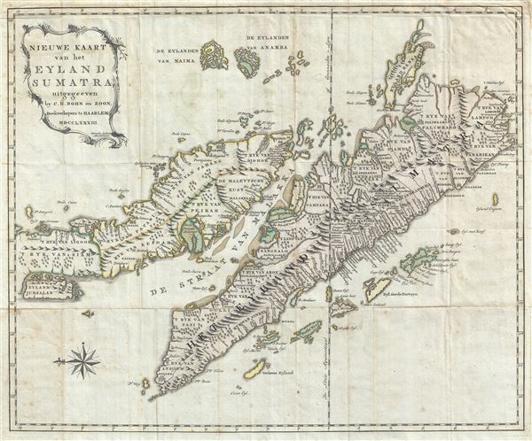
Nieuwe Kaart van het Eyland Sumatra, uitgegeeven by C. H. Bohn en Zoon, Boekverkopers te Haaarlem MDCCLXXXIII.
sold
- Digital Map Information
- Suitable for large format printing
- DPI: 300
- File Size: 15.39 MB
- File Type: ZIP / TIFF
- ICC color profile embedded
- Delivered instantly via download link
A fine engraved 1783 map of the Malay Peninsula, Singapore, the Straits of Malacca, and Sumatra by Christoph Heinrich Bohn. Oriented to the east, Bohn's map covers from the Island of Junsalan (Penang / Prince of Wales Island / Pulu ... (more details)
Scarce miniature map embracing the prevalent cartographic myths of the early 18th century. Does this map show the Madagascar pirate colony of Libertalia?

Totius Orbis Terrarum Representatio.
sold
- Digital Map Information
- Suitable for large format printing
- DPI: 300
- File Size: 2.21 MB
- File Type: ZIP / TIFF
- ICC color profile embedded
- Delivered instantly via download link
An extremely scarce 1733 German miniature map of the world engraved by Georg Paul Busch. Presenting the world on a hemispherical projection, this map embraces many of the cartographic myths prevalent in the early 18th century. ... (more details)
Attractive map of Texas.

Johnson's New Map of the State of Texas.
sold
- Digital Map Information
- Suitable for large format printing
- File Size: 16.04 MB
- File Type: ZIP / TIFF
- ICC color profile embedded
- Delivered instantly via download link
This is an exceptional example of Johnson and Ward's highly desirable 1864 map of Texas. Created during the American Civil War, this extraordinary folio map details the state of Texas in full. Identifies the elevated Table ... (more details)
Yukon and Klondike Gold Rush Map.
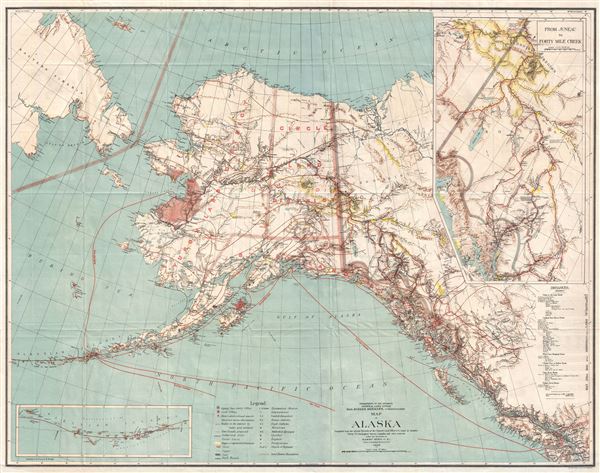
Map of Alaska.
sold
- Digital Map Information
- Suitable for large format printing
- File Size: 24.41 MB
- File Type: ZIP / TIFF
- ICC color profile embedded
- Delivered instantly via download link
A highly uncommon map of Alaska issued in 1898, just one year after the discovery of gold in the Klondike and at the height of the Klondike Gold Rush. Issued by the General Land office under Binger Hermann, this map covers ... (more details)
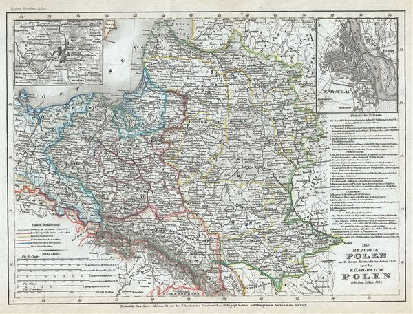
Die Republik Polen nach ihrem Bestande im Jahre 1772 und das Konigreich Polen seit dem Jahre 1815.
sold
- Digital Map Information
- Suitable for large format printing
- Full resolution TIFF file
- ICC color profile embedded
- Delivered instantly via download link
This is a scarce 1852 map of Poland and Lithuania by Joseph Meyer. It covers in whole or part of the modern day nations of Poland, Lithuania, Latvia, Belarus, Germany, Czech Republic and Ukraine. An inset in the top left ... (more details)

Ungarn und Siebenburgen.
sold
- Digital Map Information
- Suitable for large format printing
- Full resolution TIFF file
- ICC color profile embedded
- Delivered instantly via download link
This is a scarce 1849 map of Hungary and Transylvania (Romania) by Joseph Meyer. It includes the modern day nations of Hungary, Romania, Slovakia, Croatia and Serbia. Throughout, the map identifies numerous cities, towns, ... (more details)

Preussen.
sold
- Digital Map Information
- Suitable for large format printing
- Full resolution TIFF file
- ICC color profile embedded
- Delivered instantly via download link
This is an uncommon example of Joseph Meyer's 1849 map of Prussia, Germany. Covers the German states from the border with Holland and Belgium eastward as far as Poland and Russia; and extends south to include Bavaria. ... (more details)
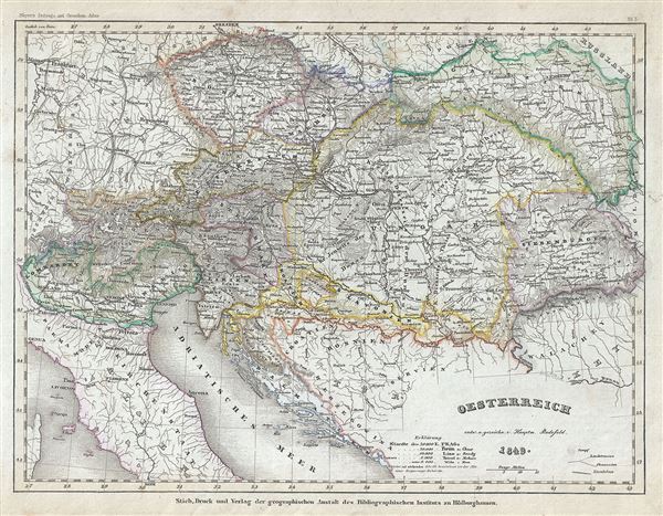
Oesterreich.
sold
- Digital Map Information
- Suitable for large format printing
- Full resolution TIFF file
- ICC color profile embedded
- Delivered instantly via download link
This is an attractive 1849 map of Austria by Joseph Meyer. It covers the territories claimed by the once vast Austrian Empire, including in whole or part the modern day nations of Austria, Hungary, Italy, Germany, ... (more details)

Das Konigreich Holland.
sold
- Digital Map Information
- Suitable for large format printing
- Full resolution TIFF file
- ICC color profile embedded
- Delivered instantly via download link
This is a lovely 1849 map of Holland or the Netherlands by Joseph Meyer. It covers the Kingdom of Netherlands, commonly referred to as Holland, from the North Sea to Belgium and the Grand Duchy of the Lower Rhine. ... (more details)
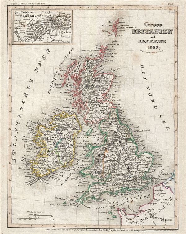
Gross. Britanien und Ireland.
sold
- Digital Map Information
- Suitable for large format printing
- Full resolution TIFF file
- ICC color profile embedded
- Delivered instantly via download link
This is a fine map of Great Britain and Ireland or the British Isles by Joseph Meyer dating to 1849. It includes England, Scotland, Wales and Ireland and covers from the Shetland Islands to the English Channel. ... (more details)
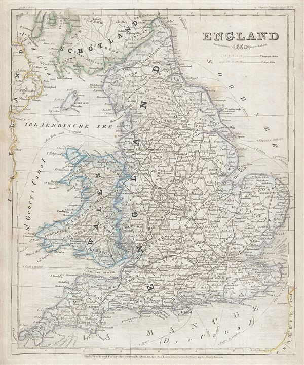
England.
sold
- Digital Map Information
- Suitable for large format printing
- Full resolution TIFF file
- ICC color profile embedded
- Delivered instantly via download link
This is a fine 1850 map of England by Joseph Meyer. It covers both England and Wales from Northumberland to Cornwall and from the St. George's Channel east as far as the Strait of Dover. The Isle of Man is also ... (more details)

Jreland.
sold
- Digital Map Information
- Suitable for large format printing
- Full resolution TIFF file
- ICC color profile embedded
- Delivered instantly via download link
This is a fine 1849 map of Ireland by Joseph Meyer. The map shows all of Ireland divided by county. It covers from Donegal in the north to Cork in the south. After the Norman Invasion the old provincial ... (more details)

Dis Schweiz.
sold
- Digital Map Information
- Suitable for large format printing
- File Size: 5.05 MB
- File Type: ZIP / TIFF
- ICC color profile embedded
- Delivered instantly via download link
This is a fine 1849 map of Switzerland by Joseph Meyer. It covers the entire country and shows the division by Cantons from Vaud to Grisons. Also shows parts of adjacent France, Germany, and Italy. ... (more details)
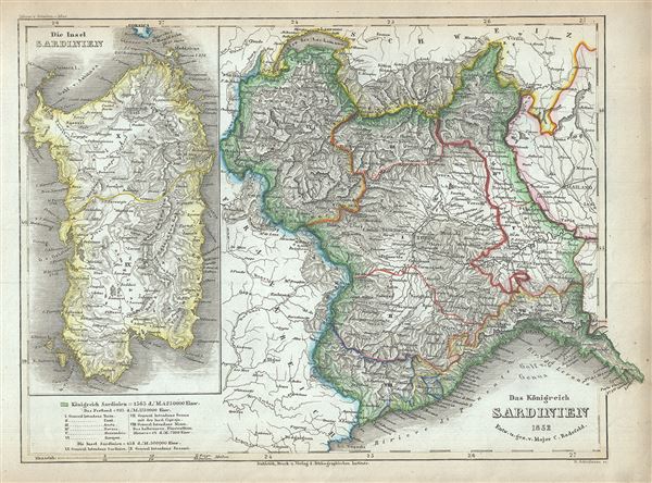
Das Konigreich Sardinien.
sold
- Digital Map Information
- Suitable for large format printing
- Full resolution TIFF file
- ICC color profile embedded
- Delivered instantly via download link
This is a scarce 1852 map of the Kingdom of Sardinia by Joseph Meyer. Centered on Piedmont, this map covers the Kingdom of Sardinia's claims both on the Island of Sardinia and the mainland provinces ... (more details)
Mostly likely the finest commercially published Civil War Era map of the Mississippi River.

Panorama Of The Mississippi Valley And Its Fortifications.
sold
- Digital Map Information
- Suitable for large format printing
- File Size: 16.95 MB
- File Type: ZIP / TIFF
- ICC color profile embedded
- Delivered instantly via download link
An exceptionally scarce 1863 Charles Magnus Civil War era broadside map of the Mississippi River valley from St. Louis to the Delta of the Mississippi. This map, or as it is called 'panorama,' is ... (more details)