
1641 Spanish Text Edition - only 25 printed.
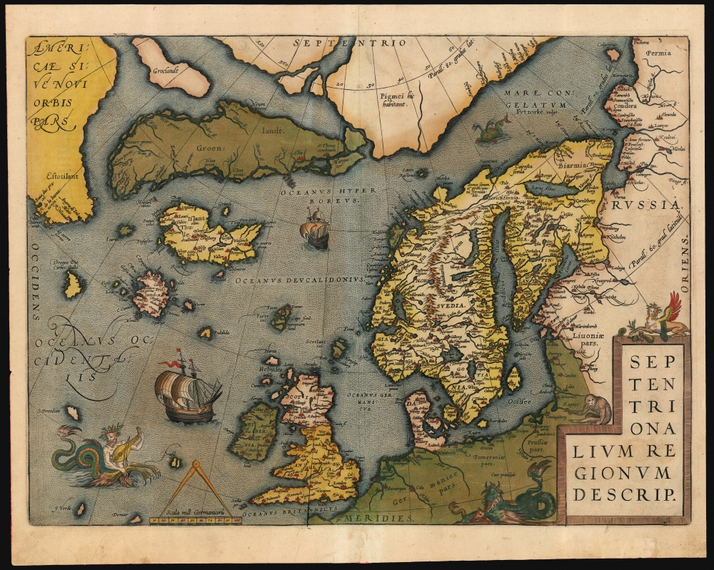
Septentrionalium Regionum Desrip.
sold
- Digital Map Information
- Suitable for large format printing
- Full resolution TIFF file
- ICC color profile embedded
- Delivered instantly via download link
One of Abraham Ortelius' most interesting maps, this is his 1570 map of Scandinavia and the Arctic. During the Age of Discovery, these northern parts of the world represented regions as remote and unfamiliar as the coasts of America, Africa, and Asia. (more details)
Battle of Bunker's Hill.
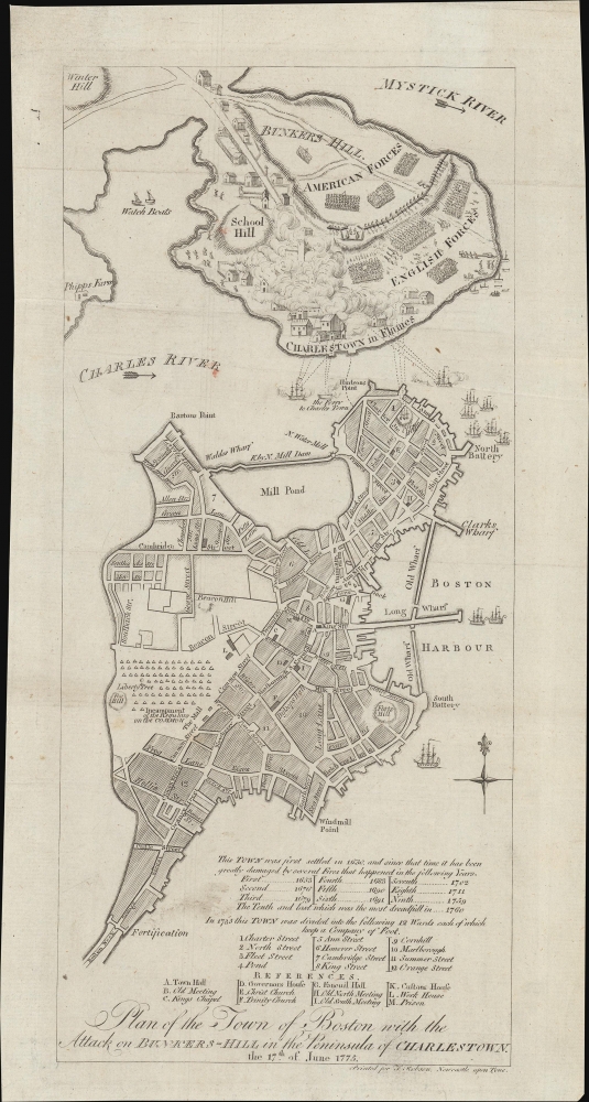
Plan of the Town of Boston with the Attack on Bunkers-Hill in the Peninsula of Charlestown, the 17th of June 1775.
sold
- Digital Map Information
- Suitable for large format printing
- File Size: 4.28 MB
- File Type: ZIP / TIFF
- ICC color profile embedded
- Delivered instantly via download link
This is a 1778 map of the American Revolutionary War Battle of Bunker's Hill, Charleston and Boston, Massachusetts, engraved by T. Robson for the British edition of James Murray's Impartial History of the Present War in America. (more details)
One of the Earliest Maps on the Mercator Projection.
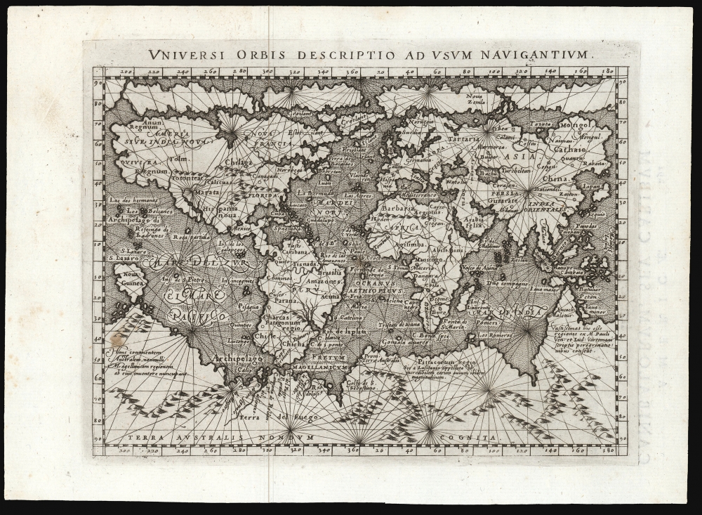
Universi Orbis Descriptio Ad Usum Navigantium.
sold
- Digital Map Information
- Suitable for large format printing
- Full resolution TIFF file
- ICC color profile embedded
- Delivered instantly via download link
This beautifully engraved world map is the 1596 first edition of Giovanni Magini's reduction of Mercator's 1569 world wall map. It is among the first commercial maps not by Mercator himself to employ the projection. (more details)
One of the Earliest Modern European Views of Ethiopia
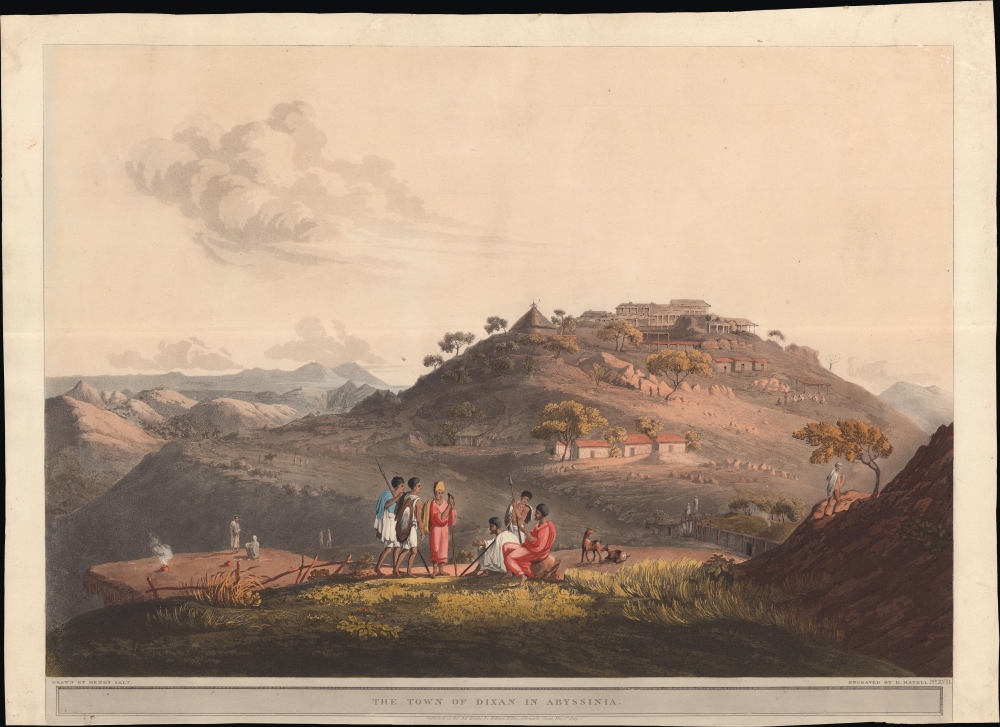
The Town of Dixan in Abyssinia.
$1,200.00
Acquire
- Digital Map Information
- Suitable for large format printing
- File Size: 29.3 MB
- File Type: ZIP / TIFF
- ICC color profile embedded
- Delivered instantly via download link
A lovely aquatint view of the village of Dixan, near the present border of Ethiopia and Eritrea, encountered by Henry Salt on his travels through Abyssinia (Ethiopia). (more details)
The Long Gray Line.

United States Military Academy West Point.
sold
- Digital Map Information
- Suitable for large format printing
- File Size: 32.35 MB
- File Type: ZIP / TIFF
- ICC color profile embedded
- Delivered instantly via download link
This is a scarce 1908 Richard Rummell view of the United States Military Academy at West Point in a brilliant full-color example. This view appeared during a concerted period of updates, expansions, and renovations to the campus, many guided by the landscape design firm Olmsted Brothers, headed by Frederick Law Olmsted's sons, Frederick Law Olmsted Jr. (1870 - 1957) and John Charles Olmsted (1852 - 1920). (more details)
Arizona after statehood.
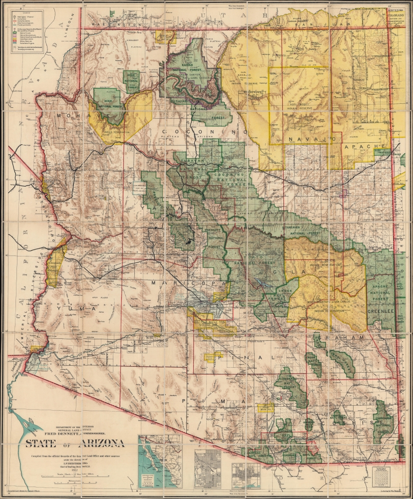
State of Arizona.
sold
- Digital Map Information
- Suitable for large format printing
- Full resolution TIFF file
- ICC color profile embedded
- Delivered instantly via download link
This is the 1912 Ithamar Berthrong and Daniel O'Hare map of Arizona - among the first official U.S. government maps Arizona as a state. (more details)
Morocco and Spanish Sahara just after the Ifni War and highlighted oil production.
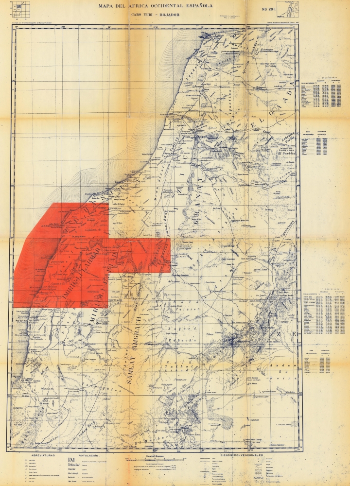
Mapa del Africa Occidental Española. Cabo Yubi - Bojador.
sold
This is a 1958 Spanish Servicio Geográfico de Ejército map of Morocco and the Spanish Sahara. Published either during or just after the end of the Ifni War, the map highlights the oil-producing region in the Spanish Sahara. It includes a small part of the region ceded to Morocco along the top. (more details)
South Vietnamese economy during the War.

Bản đô Việt Nam Cộng Hòa Kinh tế. [Economic map of the Republic of Vietnam.]
sold
This is a c. 1963 Nhựt Báo dân ý Tranh - Đấu Cho Ý Dân pictorial economic map of the Republic of Vietnam (South Vietnam). Pictorial icons highlight aspects of Vietnam's economy, and photographs illustrate South Vietnam's advances. This map was published by Dân ý, one of several South Vietnamese Daily active during the Vietnam War that went defunct with Saigon's transition to communism. (more details)
Earliest Railroad in Vermont.

Central Vermont Railroad and Connections.
sold
- Digital Map Information
- Suitable for large format printing
- Full resolution TIFF file
- ICC color profile embedded
- Delivered instantly via download link
A beautiful c. 1890 chromolithographed view of New England and part of Quebec highlighting the routes of the Central Vermont Railroad. (more details)
The Earth is round!
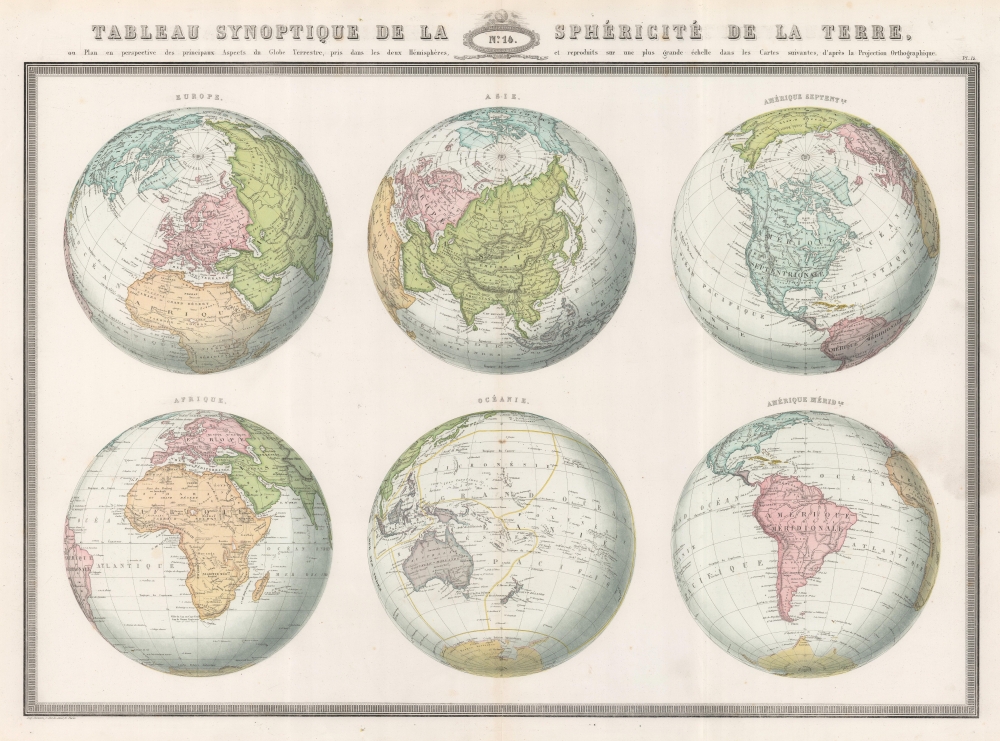
Tableau Synoptique de la Sphéricité de la Terre ou Plan en perspective des principaux Aspects du Globe Terrestre, pris dans les deux Hémisphères, et reproduits sur une plus grande échelle dans les Cartes suivantes, d'après la Projection Orthographique.
sold
- Digital Map Information
- Suitable for large format printing
- File Size: 33.04 MB
- File Type: ZIP / TIFF
- ICC color profile embedded
- Delivered instantly via download link
This is the 1860 F. A. Garnier map of the Earth in a visual summary of the Earth's sphericity from multiple angles. (more details)
A haven for artists.

Nuova Pianta dell'Isola di Capri. / Isola di Capri.
sold
- Digital Map Information
- Suitable for large format printing
- Full resolution TIFF file
- ICC color profile embedded
- Delivered instantly via download link
This is a c. 1930 Editori Richtor tourist map of Capri, Italy. Capri has been a tourist destination for European artists and celebrities since the mid-19th century due to its stunning natural beauty and open social atmosphere. (more details)
Revitalizing the Riviera in the Postwar Period.

Nice Cannes Menton and the Coast Roads.
sold
A c. 1955 English-language pictorial view of the French Riviera or Côte d'Azur in southern France, drawn by E. Lancaster and published by the French Ministere des Travaux Publics, des Transports et du Tourisme. It displays the region in the early phase of a post-World War II revival when it became an international destination for the rich and famous. (more details)
Earliest Acquirable Printed Map of Arabia.
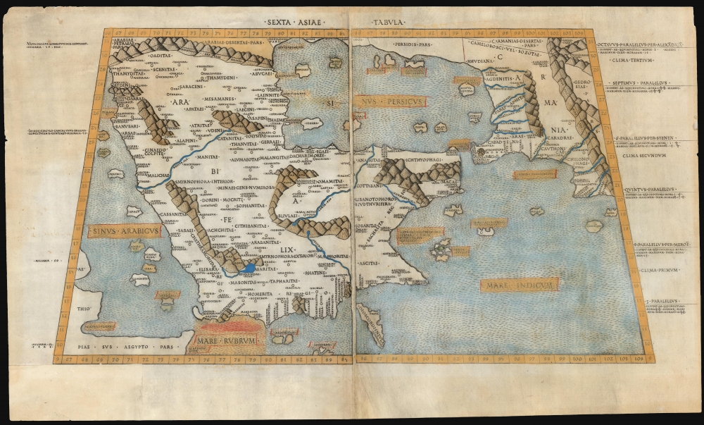
Sexta Asiae Tabula.
sold
- Digital Map Information
- Suitable for large format printing
- Full resolution TIFF file
- ICC color profile embedded
- Delivered instantly via download link
A foundational work of Renaissance cartography: this is the first acquirable printed map of the Arabian Peninsula. Appearing in the Rome edition of Ptolemy, in its 1478 printing, it is preceded only by the unacquirable 1477 Bologna Ptolemy. Ptolemy's 2nd-century innovation of representing the three-dimensional world on a grided mathematical projection provided the basis of all modern cartography. Of all the early printed versions of Ptolemy's maps, those produced for the Rome edition are considered the finest until Mercator's 1578 edition. The present example is embellished with attractive old hand color. (more details)
The European World As Columbus Sailed.

[Untitled map of the world] 'Secunda etas mūdi'.
sold
- Digital Map Information
- Suitable for large format printing
- Full resolution TIFF file
- ICC color profile embedded
- Delivered instantly via download link
One of the most distinctive early maps, this is the incunable map of the world accompanying Hartman Schedel's 1493 Liber Cronicarum or the 'Nuremberg Chronicle'. It is one of the few 15th-century printed maps available to the collector, but even among the earliest printed world maps, it is unique in its presentation and content. Published while Columbus sailed, this map captures the European world at the dawn of the Age of Discovery, just 40 years after the printing press. (more details)
One of the most desirable printed maps of any part of the world, in original color.
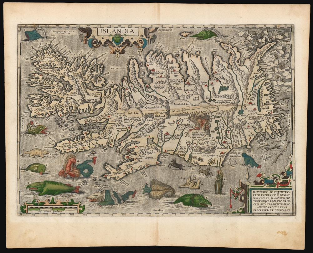
Islandia.
sold
- Digital Map Information
- Suitable for large format printing
- Full resolution TIFF file
- ICC color profile embedded
- Delivered instantly via download link
This is a superb example of Abraham Ortelius' 1587 map of Iceland, in a desirable 1603 Vrients edition with original color. Ortelius' Islandia is arguably the most famous decorative map, being the 'monster map' par excellence, as it presents a menagerie of the sea monsters typically found on early maps. The map is geographically important as well. Beyond strongly evoking Iceland's astonishing terrain with its vigorously engraved mountains, it is remarkably accurate since it is the first map of Iceland derived from the contemporaneous work of an Icelander, Gudbrandur Thorlaksson (Guðbrandur Þorláksson; c. 1542 - 1627). (more details)
First map of the region printed in color.
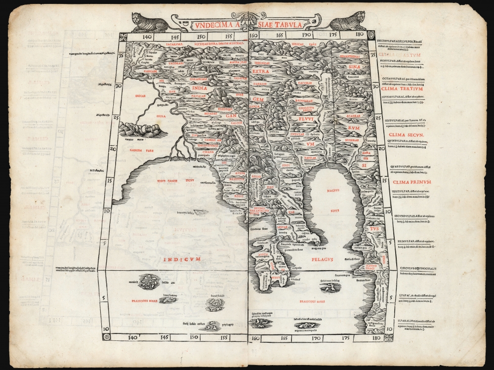
Undecima Asiae Tabula
sold
- Digital Map Information
- Suitable for large format printing
- File Size: 19.28 MB
- File Type: ZIP / TIFF
- ICC color profile embedded
- Delivered instantly via download link
This is a rare example of Bernard Sylvanus' 1511 Ptolemaic map of Southeast Asia and the Malay Peninsula. Printed in a single edition, it is one of the most visually distinctive early woodcut maps of the Far East, an area known to ancient geographers as 'India Extra Gangem' or 'India Beyond the Ganges'. By Ptolemy's reckoning, this map depicted the easternmost extreme of the Indian Ocean. This part of the world would soon be revealed to contain the East Indies and the Spice Islands. (more details)
One of the Earliest Printed Maps of India.
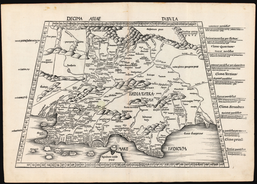
Decima Asie Tabula.
$8,500.00
Acquire
- Digital Map Information
- Suitable for large format printing
- File Size: 22.27 MB
- File Type: ZIP / TIFF
- ICC color profile embedded
- Delivered instantly via download link
This is Martin Waldseemüller's 1513 edition of the Ptolemaic map of India, one of the earliest acquirable maps of the area and an essential step in the subcontinent's cartographic evolution. Waldseemüller and Ringmann issued it for their 1513 Geographie Opus Novissima, the most comprehensively edited and amended edition of Claudius Ptolemy's 2nd-century geography. Moreover, this map was the largest format edition of Ptolemy's map to have been produced to date. (more details)
Most Unique Early Map of the World.
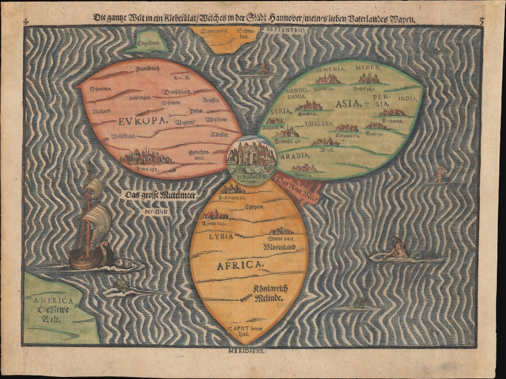
Die gantze Welt in ein Kleberblat, Welches ist der Stadt hannover / meines lieben Vaterlandes Wapen.
sold
- Digital Map Information
- Suitable for large format printing
- Full resolution TIFF file
- ICC color profile embedded
- Delivered instantly via download link
This is Heinrich Bünting's c. 1581-1585 iconic map of the world, dramatically presented as a clover leaf. This beautiful woodcut appeared in Bünting's Itinerarium Sacrae, the first and for many years the only complete work of biblical geography. (more details)
Official planning map by St. Petersburg, Florida - 2nd state.
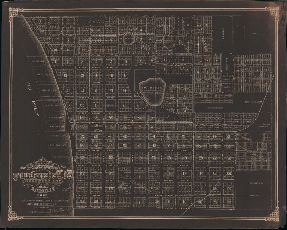
Map of the City of St. Petersburg Hillsborough Co. Florida 1906.
sold
- Digital Map Information
- Suitable for large format printing
- File Size: 90.03 MB
- File Type: ZIP / TIFF
- ICC color profile embedded
- Delivered instantly via download link
An extraordinary 1908 wall map of St. Petersburg, Florida, issued at the height of its early 20th century development as a railroad and tourist town. The only other known example of this map is a 1906 edition previously offered by Geographicus (StPetersburg-titcomb-1906). The present map features several major updates, including the additional developments of Lake Park, Lake Side, Richland Park, Glover, Plunket, and a row of commercial properties on First Street. The sewage lines, evident on the 1906 edition, are here removed to focus on other development.The map was drawn by St. Petersburg's City Engineer, John Poore Titcomb, who took the position in 1901. (more details)
First acquirable map of China and Japan.

[Ta. Superioris. Indiae Et Tartariae Maioris.]
sold
- Digital Map Information
- Suitable for large format printing
- Full resolution TIFF file
- ICC color profile embedded
- Delivered instantly via download link
A seminal work, this 1522 Lorenz Fries map is the first European map to focus on China and Japan and the first specific map to utilize Marco Polo's geographical reports of East Asia. It was also one of the first maps included in a printed edition of Ptolemy's Geographia to reflect a contemporaneous understanding of the subject region. It is also the only acquirable printed map of the region derived from Martin Waldseemüller's 1507 world map, representing one of the first efforts to reconcile ancient geography with new information from exploration and geographical theory. (more details)