
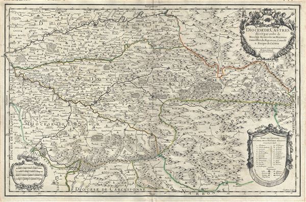
Diocese de Castres.
sold
- Digital Map Information
- Suitable for large format printing
- DPI: 300
- File Size: 18.51 MB
- File Type: ZIP / TIFF
- ICC color profile embedded
- Delivered instantly via download link
This is a fine 1690 map of Castres, located in the department of Tran, France by Alexis Hubert Jaillot. Centered on Brassac, the map covers the region from Albi south as far as Olonzac and from Saint-Sulpic east to Saint-Gervais-sur-Mare. The map renders the ... (more details)
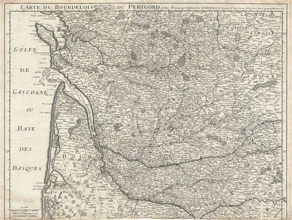
Carte du Bourdelois du Perigord et des Provinces voisines.
sold
- Digital Map Information
- Suitable for large format printing
- DPI: 300
- File Size: 20.87 MB
- File Type: ZIP / TIFF
- ICC color profile embedded
- Delivered instantly via download link
This is an attractive 1714 map of Bourdelois, Gironde, region and the former provinces of Perigord, part of the Aquitaine region of France by Guillaume De L'isle. It covers from La Rochelle, the capital city of the department of Charente Maritime, south as ... (more details)
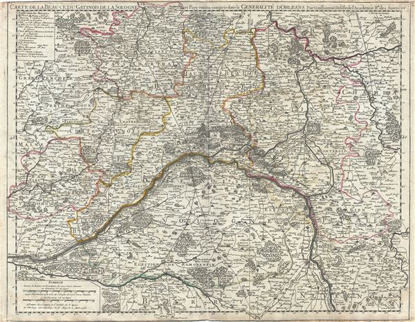
Carte de la Beauce du Gatinois de la Sologne et Pays voisins compris dans la Generalite dOrleans.
sold
- Digital Map Information
- Suitable for large format printing
- DPI: 300
- File Size: 20.72 MB
- File Type: ZIP / TIFF
- ICC color profile embedded
- Delivered instantly via download link
This is a fascinating 1718 map of the Loire Valley region of France by Guillaume De L'isle. Centered on the City of Orleans, the capital of the Loiret department and the Centre region in France, the map extends from Nogent-le-Roi (Noget) south as far as ... (more details)
1878 Rand McNally Railroad Map of the Michigan Central Railroad (Midwest and Northeast United States
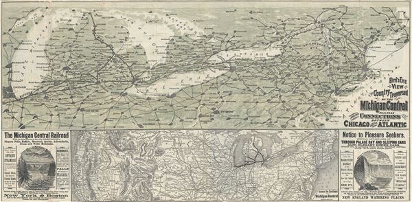
Bird's Eye View of the Country Traversed by the Michigan Central Railroad and its Connections between Chicago and the Atlantic.
sold
- Digital Map Information
- Suitable for large format printing
- Full resolution TIFF file
- ICC color profile embedded
- Delivered instantly via download link
This is beautiful 1878 railroad map or bird's eye-view map of the Northeast and the Midwestern United States, depicting the Michigan Central Railroad, printed by Rand McNally and Company. This relic of the great age of American Railroads, covers the ... (more details)
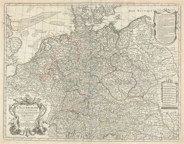
L'Allemagne Dressee sur les observations de Tycho-Brahe, de Kepler, de Snellius, sur celles de Messieurs de l'Academie Royale des Sciences etc.
sold
- Digital Map Information
- Suitable for large format printing
- DPI: 300
- File Size: 21.71 MB
- File Type: ZIP / TIFF
- ICC color profile embedded
- Delivered instantly via download link
An appealing 1780 map of Germany by Delisle. This is a later revision, by Jean-Claude Dezauche, of Guillaume De L'isle's map of 1701. This map, which underwent numerous republications, covers the Germanic territories from the Baltic Sea to the Gulf ... (more details)

Partie Septentrionale du Duche de Brabant ou se trouvent les Mairies de Bosleduc, le Turnhout, de Santhoven, d'Herentals, les Marquisats de Berg-op-Zoom, et du St. Empire, la Baronie de Breda, partie de la Seigneurie de Malines, et de l'Eveche de Lyege etc.
sold
- Digital Map Information
- Suitable for large format printing
- DPI: 300
- File Size: 19.27 MB
- File Type: ZIP / TIFF
- ICC color profile embedded
- Delivered instantly via download link
This is an attractive map of the Duchy of Brabant by Robert de Vaugondy. The map depicts part of modern day Belgium and the Netherlands, which was at the time this map was made, part of the Duchy of Brabant. It covers from Bergen op Zoom ... (more details)
Spectacular patriotic wall map of the United States illustrating the Republic of Texas.
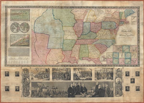
Phelps and Ensign's travellers' guide, and map of the United States, containing the roads, distances, steam boat and canal routes etc.
sold
- Digital Map Information
- Suitable for large format printing
- DPI: 300
- File Size: 34.84 MB
- File Type: ZIP / TIFF
- ICC color profile embedded
- Delivered instantly via download link
A very patriotic piece, this spectacular 1841 decorative wall map of the United States was prepared New York firm of Phelps and Ensign. The highly appealing production covers the United States from the Rocky Mountains to the Atlantic ... (more details)
Spectacular view of the World with pictorial illustration.
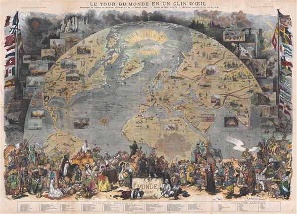
Le Tour de Monde en un Clin d'Oeil.
sold
- Digital Map Information
- Suitable for large format printing
- File Size: 57.23 MB
- File Type: ZIP / TIFF
- ICC color profile embedded
- Delivered instantly via download link
A spectacular 1876 pictorial diorama presenting a 'tour of the world in the blink of an eye.' The map is projected as a view from space and details the world roughly from the Equator to the North Pole and from California to India. ... (more details)

Mitchell's Map of Illinois Exhibiting its Internal Improvements, Counties, Towns, Roads, etc.
sold
- Digital Map Information
- Suitable for large format printing
- DPI: 300
- File Size: 12.25 MB
- File Type: ZIP / TIFF
- ICC color profile embedded
- Delivered instantly via download link
An extremely rare 1838 map of Illinois by Samuel Augustus Mitchell. It covers the state of Illinois along with parts of neighboring Indiana, Kentucky, Missouri and the Wisconsin Territory. The map depicts a very early county ... (more details)
A scarce map of the world after Coronelli.
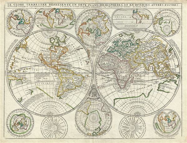
Le Globe Terrestre Represente en Deux Plans - Hemispheres, et en Diverses Autres Figures.
sold
- Digital Map Information
- Suitable for large format printing
- Full resolution TIFF file
- ICC color profile embedded
- Delivered instantly via download link
A scarce example of Jean Baptiste Nolin's 1742 map of the world in two hemispheres. The main map is surrounded by ten additional maps showing the world on various projections and at various periods. Cartographically this map ... (more details)
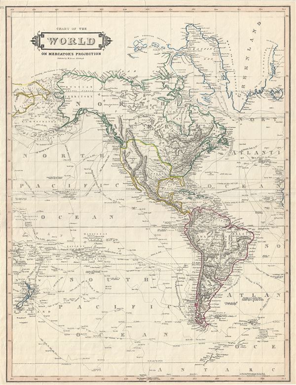
Chart of the World on Mercator's Projection.
sold
- Digital Map Information
- Suitable for large format printing
- DPI: 300
- File Size: 9.91 MB
- File Type: ZIP / TIFF
- ICC color profile embedded
- Delivered instantly via download link
An exceptional example of Daniel Lizars' 1831 map of North America and South America. The map, although titled 'The World,' depicts the western hemisphere including North America, South America, Greenland and New Zealand. ... (more details)
A foundational Holy Land map.
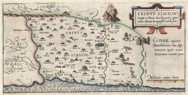
Tribus Simeon nempe ea Terrae Sanctae portio, quam tribus Simeon in ingressu nacta fuit.
sold
- Digital Map Information
- Suitable for large format printing
- DPI: 300
- File Size: 3.74 MB
- File Type: ZIP / TIFF
- ICC color profile embedded
- Delivered instantly via download link
This is a fine example of Christian van Adrichem's rare 1590 map of the lands granted to the Tribe of Simeon at the time of Joshua's division of the Twelve Tribes. Oriented to the East and identifies the lands of the ... (more details)
A foundational Holy Land map.
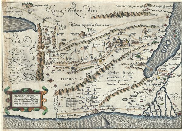
Pharan desertum, et confinia eius cum parte Aegypti, ea videlicet terrae regio, in qua filij Israel post exitum de Aegypto, triginta octo annis vagati sunt antequam terram promissam ingrederentur.
sold
- Digital Map Information
- Suitable for large format printing
- Full resolution TIFF file
- ICC color profile embedded
- Delivered instantly via download link
This is a beautiful and rare 1590 old color example of Cristian van Adrichem's map of Israel, Palestine or the Holy Land, depicting the Desert of Pharan or Paran and the Wandering of the Israelites. The map is ... (more details)
A foundational Holy Land map.
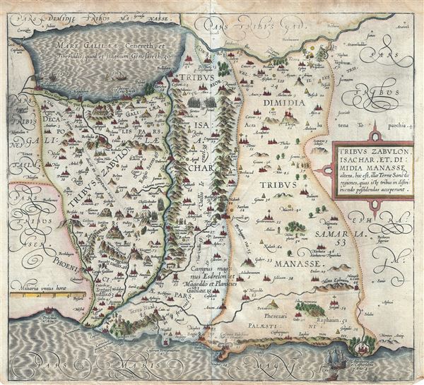
Tribus Zabulon, Isachar, et, Dimidia Manasse altera, hoc est, illae Tarrae Sanctae regiones, quas iste tribus in distribuendo possidendas acceperunt.
sold
- Digital Map Information
- Suitable for large format printing
- DPI: 300
- File Size: 9.29 MB
- File Type: ZIP / TIFF
- ICC color profile embedded
- Delivered instantly via download link
This is a beautiful and rare 1590 example of Christian van Adrichem's map of the lands granted to the Tribes of Zabulon or Zebulun, Issachar or Isachar and the western half of the tribe of Manasseh at the time ... (more details)
An important map for Mississippi River Navigation by future Confederate General Robert E. Lee.
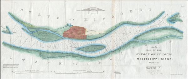
No. 3. Map of the Harbor of St. Louis, Mississippi River. Oct. 1837.
sold
- Digital Map Information
- Suitable for large format printing
- Full resolution TIFF file
- ICC color profile embedded
- Delivered instantly via download link
A scarce 1837 map of the Mississippi River in the vicinity of St. Louis, Missouri by Robert E. Lee. Centered on the Mississippi River and oriented to the west, this map covers from Cahoe Island, past the ... (more details)
An important map for Mississippi River Navigation by future Confederate General Robert E. Lee.
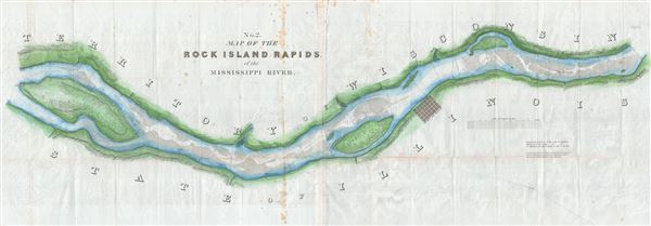
No. 2. Map of the Rick Island Rapids, of the Mississippi River.
sold
- Digital Map Information
- Suitable for large format printing
- Full resolution TIFF file
- ICC color profile embedded
- Delivered instantly via download link
A scarce 1837 map of the Mississippi River's Rock Island Rapids in the vicinity of Milan, Illinois by Robert E. Lee. Centered on the Mississippi River and oriented to the west, this map covers from Fort ... (more details)
An important map for Mississippi River Navigation by future Confederate General Robert E. Lee.

No. 1. Map of the Des Moines Rapids, of the Mississippi River.
sold
- Digital Map Information
- Suitable for large format printing
- Full resolution TIFF file
- ICC color profile embedded
- Delivered instantly via download link
A scarce 1837 map of the Mississippi River's Des Moines Rapids in the vicinity of Fort Des Moines (Montrose, Iowa) by Robert E. Lee. Centered on the Mississippi River and oriented to the west, this map ... (more details)
A foundational Holy Land map.
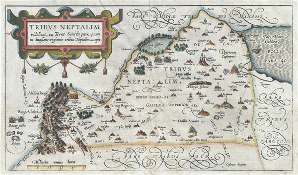
Tribus Neptalim videlicet, ea Terrae Sanctae pars, quam in divisione regionis tribus Neptalim accepit.
sold
- Digital Map Information
- Suitable for large format printing
- DPI: 300
- File Size: 4.4 MB
- File Type: ZIP / TIFF
- ICC color profile embedded
- Delivered instantly via download link
A fine example of Christian van Adrichem's rare 1590 map of the lands granted to the Tribe of Naphtali at the time of Joshua's division of the Twelve Tribes. The map is oriented to the east and covers ... (more details)
A foundational Holy Land map.

Tribus Gad nempe, ca Terrae Sancte pars, quae obtigit in partitione regionis tribui Gad.
sold
- Digital Map Information
- Suitable for large format printing
- DPI: 300
- File Size: 6.4 MB
- File Type: ZIP / TIFF
- ICC color profile embedded
- Delivered instantly via download link
This is a fine example of Christian van Adrichem's rare 1590 map of the lands granted to the Tribe of Gad at the time of Joshua's division of the Twelve Tribes. The map is oriented to the east and ... (more details)
A foundational Holy Land map.
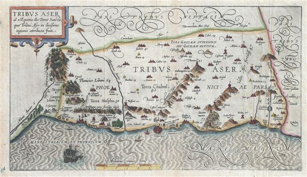
Tribus Aser id est, portio illa Terrae Sancta, quae Tribui Aser in diuisione regionis attributa fuit.
sold
- Digital Map Information
- Suitable for large format printing
- DPI: 300
- File Size: 6.45 MB
- File Type: ZIP / TIFF
- ICC color profile embedded
- Delivered instantly via download link
This is a beautiful example of Christian van Adrichom's rare 1590 map of the lands granted to the Tribe of Asher at the time of Joshua's division of the Twelve Tribes. The map is oriented to the ... (more details)