

Map 1. Map 2. Map 3. Map 4. Map 5. Map 6. Map 7. Map 8. Map 9. Map 10. Map 11. Map 12.
sold
- Digital Map Information
- Suitable for large format printing
- File Size: 71.08 MB
- File Type: ZIP / TIFF
- ICC color profile embedded
- Delivered instantly via download link
This is a fascinating 1880 set of twelve maps or charts of all the stars and constellations of the night sky, by Richard A. Proctor. The charts, which comprise of six northern and six southern maps, show all the stars visible to the naked eye, and fifteen hundred ... (more details)

Northern Constellations. Southern Constellations.
sold
- Digital Map Information
- Suitable for large format printing
- File Size: 12.63 MB
- File Type: ZIP / TIFF
- ICC color profile embedded
- Delivered instantly via download link
This is a beautiful 1870 set of two maps or charts depicting the stars and constellations of the night sky over the year, in the northern and southern hemispheres. Created by Richard A. Proctor, these maps are issued as index plates, in which the six northern and ... (more details)
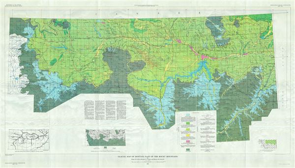
Glacial Map of Montana East if the Rocky Mountains.
sold
- Digital Map Information
- Suitable for large format printing
- File Size: 76.68 MB
- File Type: ZIP / TIFF
- ICC color profile embedded
- Delivered instantly via download link
This is a beautiful 1961 map of Montana by the U.S. Geological Survey. It covers Montana east of the Rocky Mountains, from Lewis and Clark National Forest east as far as Richland and the Montana state boundary. The map is highly detailed and notes lakes, creeks, ... (more details)
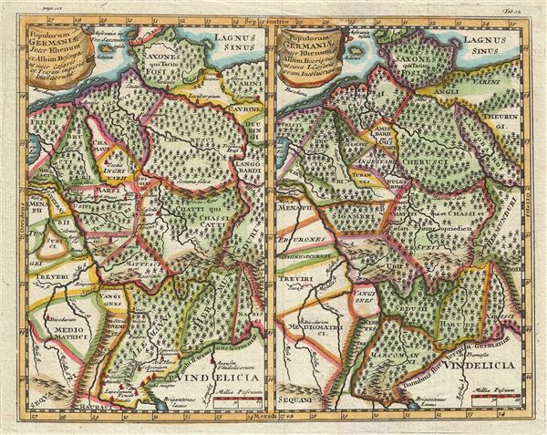
Populorum Germanium inter Rhenum et Albim descriptio ut inter Caesaris et Trajani imperia Incoluerunt. Populorum Germaniae inter Rhenum et Albim descriptio ut circa I. Caesaris aevum Incoluerunt.
sold
- Digital Map Information
- Suitable for large format printing
- DPI: 300
- File Size: 3.68 MB
- File Type: ZIP / TIFF
- ICC color profile embedded
- Delivered instantly via download link
This is a stunning 1661 map by Philipp Cluver depicting Germany during Roman times. Essentially two maps on a single sheet, both maps cover the same region in Germany, viz. between the Rhine and Elbe Rivers and from Denmark south as far as Switzerland and ... (more details)

Reynolds' Map of London with the Recent Improvements.
sold
- Digital Map Information
- Suitable for large format printing
- File Size: 27.99 MB
- File Type: ZIP / TIFF
- ICC color profile embedded
- Delivered instantly via download link
An uncommon example of the 1876 issue of Reynolds' tourist map of London. Centered on the Thames River, this map covers London from Highbury to Peckham and from West Kensington to the West India Docks. The map shows all omnibus and train routes as well ... (more details)

Paris Mignon Indiquant les Boulevards, Avenues, Rues principales, Monuments, Eglises, Mairies et Chemins de fer.
sold
- Digital Map Information
- Suitable for large format printing
- File Size: 4.16 MB
- File Type: ZIP / TIFF
- ICC color profile embedded
- Delivered instantly via download link
This is an attractive 1880s map of Paris issued by Madame Lefilleul. Centered on the Seine Rivers, it covers embastilled Paris as contained in the Thiers Wall, and its immediate vicinity, including the Bois de Boulogne and Bois de Vincennes. It reflects ... (more details)

Carte du Peloponese, pour servir a l'Histoire de la Grece.
sold
- Digital Map Information
- Suitable for large format printing
- DPI: 300
- File Size: 4.19 MB
- File Type: ZIP / TIFF
- ICC color profile embedded
- Delivered instantly via download link
This is a beautiful 1782 map of southern Greece by Jean- Baptiste-Claude Delisle de Sales. The map covers the entire Peloponnese peninsula including the islands of Ithaca, Cephalonia, Zaknythos or Zante and Cythera. It also includes the southern part ... (more details)

Carte de l'Archipel pour servir a l'Histoire de la Grece.
sold
- Digital Map Information
- Suitable for large format printing
- DPI: 300
- File Size: 4.53 MB
- File Type: ZIP / TIFF
- ICC color profile embedded
- Delivered instantly via download link
This is a scarce 1782 Jean- Baptiste-Claude Delisle de Sales Map of Greece and the Greek Archipelago. The map covers southern Greece, the Greek Isles and Crete from the Macedonia and the boot of Italy to Asia Minor and south as far as Crete. It ... (more details)

Carte Generale de la Grece.
sold
- Digital Map Information
- Suitable for large format printing
- DPI: 300
- File Size: 4.44 MB
- File Type: ZIP / TIFF
- ICC color profile embedded
- Delivered instantly via download link
This is a lovely 1782 map of Greece, Turkey and the Balkans by Jean- Baptiste-Claude Delisle de Sales. The map covers from the Adriatic Sea and the boot of Italy eastward to cover the Black Sea, Cappadocia, Cyprus and Syria. It extends ... (more details)

Carte de la France sous le Regne de Louis XVI.
sold
- Digital Map Information
- Suitable for large format printing
- DPI: 300
- File Size: 4.58 MB
- File Type: ZIP / TIFF
- ICC color profile embedded
- Delivered instantly via download link
This is a beautiful 1782 map by Jean- Baptiste-Claude Delisle de Sales depicting France during the reign of Louis XVI. The map covers all of France and part of modern day Belgium and Switzerland from Bruxelles (Brussels) to the Pyrenees ... (more details)

Carte de l'Ancienne Phinicie.
sold
- Digital Map Information
- Suitable for large format printing
- DPI: 300
- File Size: 3.9 MB
- File Type: ZIP / TIFF
- ICC color profile embedded
- Delivered instantly via download link
This is a scarce 1782 map of Phoenicia or modern day Cyprus, Lebanon, Syria and Israel or Palestine (Holy Land) by Jean- Baptiste-Claude Delisle de Sales. The map covers from southern Turkey to Palestine and inland as far as ... (more details)
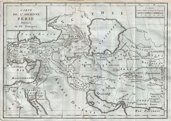
Carte de l'Ancienne Perse Divisee en XX. Satrapies.
sold
- Digital Map Information
- Suitable for large format printing
- DPI: 300
- File Size: 4.07 MB
- File Type: ZIP / TIFF
- ICC color profile embedded
- Delivered instantly via download link
This is a rare 1782 map of ancient Persia by Jean- Baptiste-Claude Delisle de Sales. The map covers the lands of the First Persian Empire as divided into 20 Satrapies or provinces from Turkey and the Mediterranean Sea, east ... (more details)

Carte de l'Italie Ancienne.
sold
- Digital Map Information
- Suitable for large format printing
- DPI: 300
- File Size: 4.53 MB
- File Type: ZIP / TIFF
- ICC color profile embedded
- Delivered instantly via download link
This is an uncommon 1770 map of Italy during ancient Roman times, by Jean- Baptiste-Claude Delisle de Sales. The map covers all of Italy in the days of the Roman Empire from Cisalpine Gaul to Sicily, including the islands ... (more details)
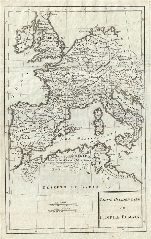
Partie Occidentale de l'Empire Romain.
sold
- Digital Map Information
- Suitable for large format printing
- DPI: 300
- File Size: 4.25 MB
- File Type: ZIP / TIFF
- ICC color profile embedded
- Delivered instantly via download link
An appealing 1770 map of the Western Roman Empire by Jean- Baptiste-Claude Delisle de Sales. The map covers the western portion of the Roman Empire from Portugal to the Adriatic Sea and from Britain to northern Africa. ... (more details)

Carte de l'Empire de Carthage.
sold
- Digital Map Information
- Suitable for large format printing
- DPI: 300
- File Size: 4.02 MB
- File Type: ZIP / TIFF
- ICC color profile embedded
- Delivered instantly via download link
This is an interesting 1770 map by Jean- Baptiste-Claude Delisle de Sales, depicting the Empire of Carthage. Centered on the Mediterranean, the map covers from Bordeaux in France to the Province of Tripoli and includes ... (more details)

Partie Orientale de l'Empire Romain.
sold
- Digital Map Information
- Suitable for large format printing
- DPI: 300
- File Size: 4.45 MB
- File Type: ZIP / TIFF
- ICC color profile embedded
- Delivered instantly via download link
This is an attractive 1770 map of the Eastern Roman Empire by Jean- Baptiste-Claude Delisle de Sales. It covers the eastern portion of the Mediterranean inclusive of Greece, and extends inland as far as modern day ... (more details)

Carte de l'Empire de Charlemagne pour servir aux Histoires de France et d'Allemagne.
sold
- Digital Map Information
- Suitable for large format printing
- DPI: 300
- File Size: 4.21 MB
- File Type: ZIP / TIFF
- ICC color profile embedded
- Delivered instantly via download link
This is a beautiful example of the 1770 Jean- Baptiste-Claude Delisle de Sales' map of the Empire of Charlemagne. It covers Europe and the European Empire of Charles the Great from Ireland south as far as northern ... (more details)
Scarce view of New York City.

Birds Eye View of New York and Vicinity.
sold
- Digital Map Information
- Suitable for large format printing
- File Size: 16.83 MB
- File Type: ZIP / TIFF
- ICC color profile embedded
- Delivered instantly via download link
An exceptionally scarce 1912 chromolithograph C. S. Hammond and Company map and view of New York City and vicinity. The view extends from Ellis Island to Huntington Bay and from Yonkers to Jamaica Bay, covering ... (more details)
Scarce map illustrating Salt's discovery of the ancient lost city of Adulis.
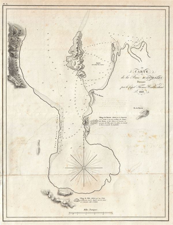
Carte de la Baie D'Annesley.
sold
- Digital Map Information
- Suitable for large format printing
- DPI: 300
- File Size: 6.25 MB
- File Type: ZIP / TIFF
- ICC color profile embedded
- Delivered instantly via download link
A scarce and important 1810 Henry Salt nautical chart or maritime map of Annesley Bay (Gulf of Zula, Bay of Arafali), Eritrea, Africa. The bay is located about 30 miles south of the modern day Eritrean city of ... (more details)
Scarce map showing the Salt's rediscovery of Opsian Bay, known in antiqity as the site of the Opsian Stone.
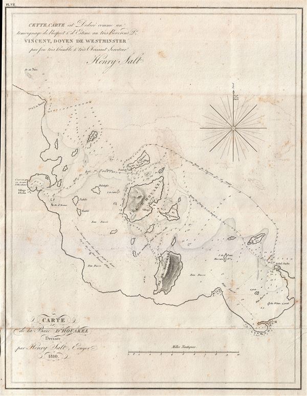
Carte de la Baie D'Houakel.
sold
- Digital Map Information
- Suitable for large format printing
- DPI: 300
- File Size: 5.56 MB
- File Type: ZIP / TIFF
- ICC color profile embedded
- Delivered instantly via download link
A scarce and important 1809 Henry Salt nautical chart or maritime map Howakil Bay (Houakel), Eritrea. Howakil Bay is a large bite in the coast of Eritrea. It is a maze of small islands, reefs, and shoals that ... (more details)