
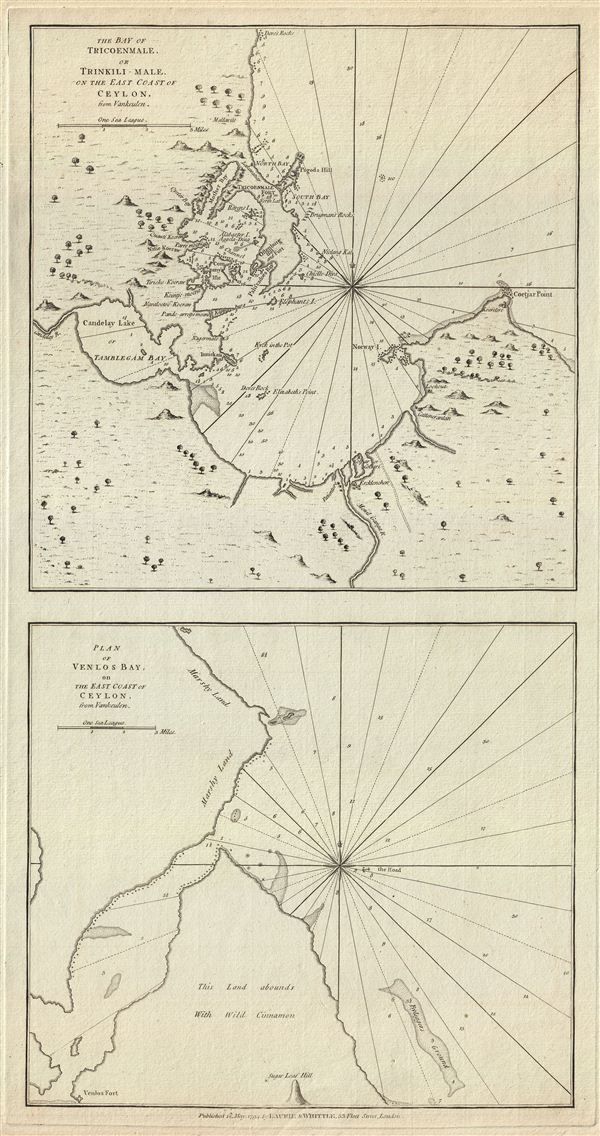
The Bay of Tricoenmale or Trinkili-Male, on the East Coast of Ceylon. Plan of Venlos Bay, on the East Coast of Ceylon.
sold
- Digital Map Information
- Suitable for large format printing
- DPI: 300
- File Size: 10.57 MB
- File Type: ZIP / TIFF
- ICC color profile embedded
- Delivered instantly via download link
This is a fine example of Laurie and Whittle's 1794 nautical chart or maritime map of the Tricoenmale or Trinkili-Male (Trincomalee) Bay and the Venlos (Vandelous) Bay on the east coast of Sri Lanka or Ceylon. Essentially two maps on a single sheet, the upper map ... (more details)
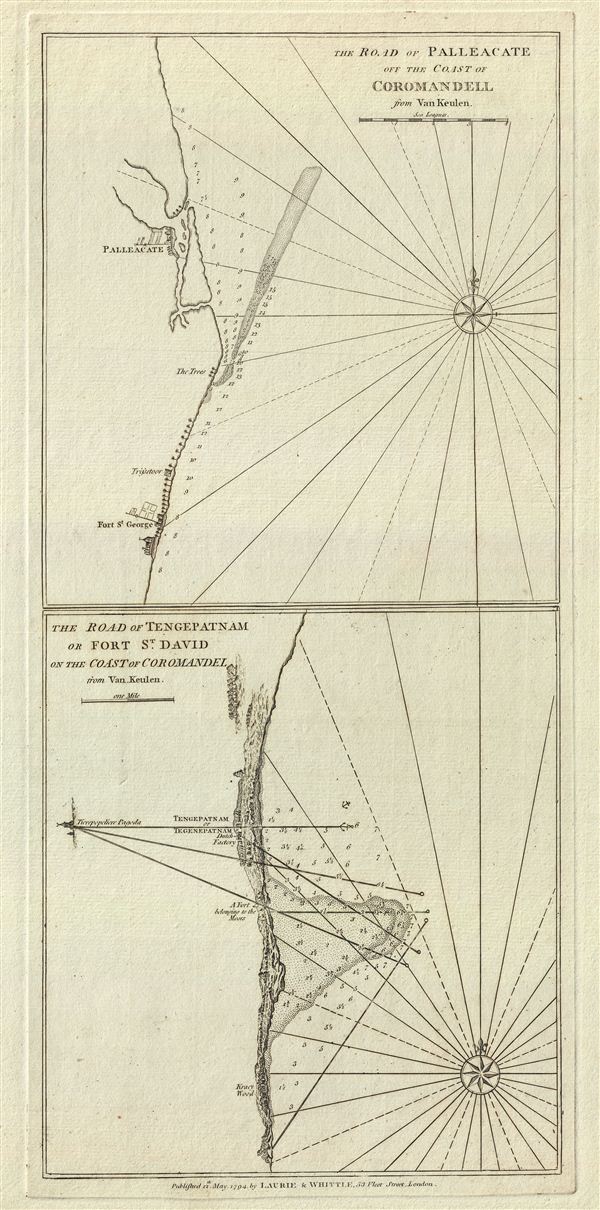
The Road of Palleacate, off the Coast of Coromandell. The Road of Tengepatnam or Fort St. David on the Coast of Coromandel.
sold
- Digital Map Information
- Suitable for large format printing
- DPI: 300
- File Size: 7.46 MB
- File Type: ZIP / TIFF
- ICC color profile embedded
- Delivered instantly via download link
This is a fine example of Laurie and Whittle's 1794 nautical chart or maritime map of Palleacate (Pulicat) and Tengepatnam or Fort St. David on the Coromandel Coast in the state of Tamil Nadu, India. Essentially two maps on one sheet, the upper map details ... (more details)
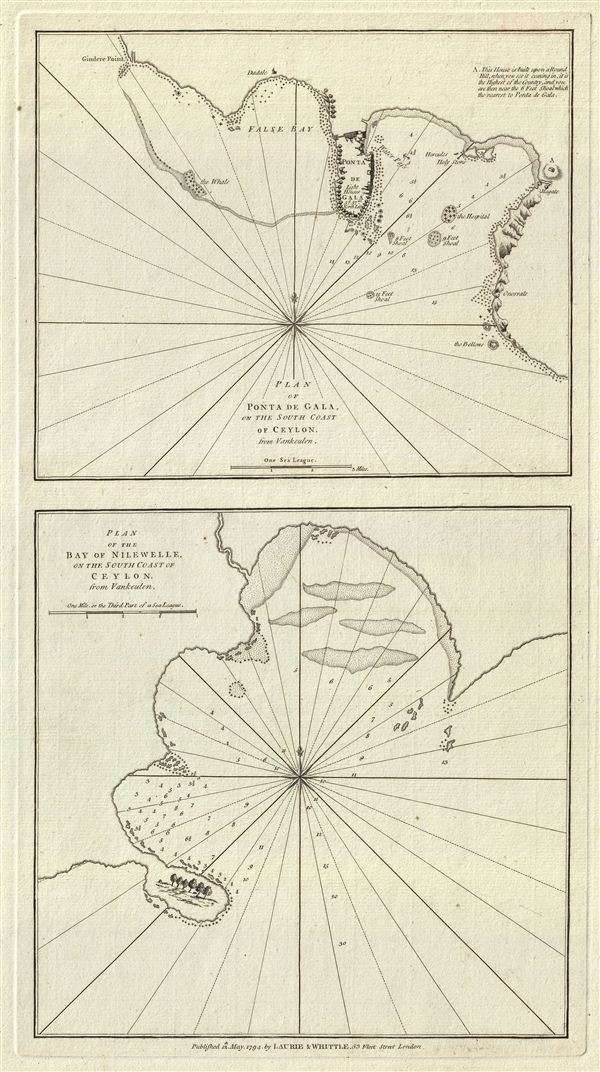
Plan of Ponta de Gala, on the South Coast of Ceylon.
sold
- Digital Map Information
- Suitable for large format printing
- DPI: 300
- File Size: 7.81 MB
- File Type: ZIP / TIFF
- ICC color profile embedded
- Delivered instantly via download link
This is a fine example of Laurie and Whittle's 1794 nautical chart or maritime map of Ponta de Gala (Galle) and Nilewelle (Nilwella) on the southern coast of Sri Lanka or Ceylon. Essentially two maps on one sheet, the upper map features the region of Galle ... (more details)
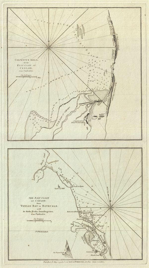
Calpentyn Road, on the West Coast of Ceylon. The East Coast of Ceylon, from Venlos Bay to Batecalo, with the Banks, Rocks, Soundings & ca.
sold
- Digital Map Information
- Suitable for large format printing
- DPI: 300
- File Size: 7.71 MB
- File Type: ZIP / TIFF
- ICC color profile embedded
- Delivered instantly via download link
This is a fine example of Laurie and Whittle's 1794 nautical chart or maritime map of Calpentyn Road (Kalpitiya) on the western coast of Sri Lanka and of the east coast of Sri Lanka from Venlos Bay (Vandelous Bay) to Batecalo (Batticaloa). Essentially two ... (more details)
The largest and most detailed map of Bombay (Mumbai) to appear in the 18th century.
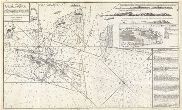
A Plan of Bombay-Harbour on th Coast of Malabar.
sold
- Digital Map Information
- Suitable for large format printing
- DPI: 300
- File Size: 20.38 MB
- File Type: ZIP / TIFF
- ICC color profile embedded
- Delivered instantly via download link
This is a fine example of Laurie and Whittle's 1794 nautical chart or maritime map of Bombay (Mumbai) Island, city, and harbor, India. The map covers from Salsette Island to the continent south to Hunary Island. There is a detailed plan of the city of ... (more details)
The earliest recognizable printed map of Bombay, India.

A New Mapp of the Island of Bombay and Sallset.
sold
- Digital Map Information
- Suitable for large format printing
- DPI: 300
- File Size: 12.17 MB
- File Type: ZIP / TIFF
- ICC color profile embedded
- Delivered instantly via download link
An extremely scarce map, this is John Thornton's 1711 map of Bombay Harbor, India. First drawn in 1685 for the Atlas Maritimus , this map is the first printed map to offer any real detail of Bombay harbor. Following in the style of the Thames School, ... (more details)
Scarce early nautical chart detailing Phuket, Thailand (Siam).
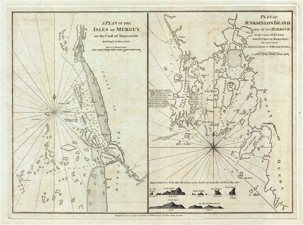
A Plan of the Isles of Merguy on the Coast of Tanasserim. Plan of Junkseylon Island and of its Harbour on the Coast of Queda.
sold
- Digital Map Information
- Suitable for large format printing
- DPI: 300
- File Size: 11.38 MB
- File Type: ZIP / TIFF
- ICC color profile embedded
- Delivered instantly via download link
This is a fine example of Laurie and Whittle's 1798 nautical chart or maritime map of the Island of Phuket, Thailand and the Mergui Archipelago (on the coast of the Tenasserim Division), Burma (Myanmar). Essentially two maps on a single sheet, the ... (more details)
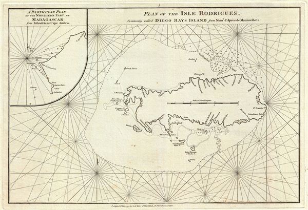
Plan of the Isle Rodrigues, Commonly called Diego Rays Island.
sold
- Digital Map Information
- Suitable for large format printing
- DPI: 300
- File Size: 9.66 MB
- File Type: ZIP / TIFF
- ICC color profile embedded
- Delivered instantly via download link
This is a fine example of Laurie and Whittle's 1794 nautical chart or maritime map of the Isle Rodrigues or Diego Rays Island, part of the Mascarene Islands in the Indian Ocean. It covers the entire island along with surrounding smaller islands, ... (more details)
An early nautical chart of the Seychelles.
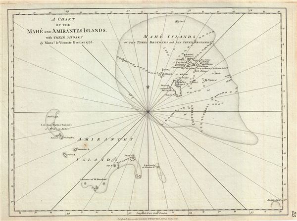
A Chart of the Mahe and Amirantes Islands with their Shoals.
sold
- Digital Map Information
- Suitable for large format printing
- DPI: 300
- File Size: 14.37 MB
- File Type: ZIP / TIFF
- ICC color profile embedded
- Delivered instantly via download link
This is a fine example of Laurie and Whittle's 1794 nautical chart or maritime map of Mahe and Amirantes Islands, Seychelles. It covers the Mahe and Amirantes islands, also known as the Three Brothers and the Seven Brothers, along with their ... (more details)
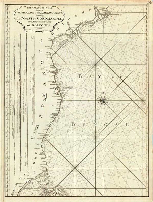
The Coast of India between Calymere and Gordeware Points, including the Coast of Coromandel, with part of the Coast of Golconda.
sold
- Digital Map Information
- Suitable for large format printing
- DPI: 300
- File Size: 15.45 MB
- File Type: ZIP / TIFF
- ICC color profile embedded
- Delivered instantly via download link
This is a fine example of Laurie and Whittle's 1794 nautical chart or maritime map of the southeastern coast of India or the Coromandel Coast. The map covers the southeastern coast of India from point Gordeware (modern day Godavari Point) ... (more details)
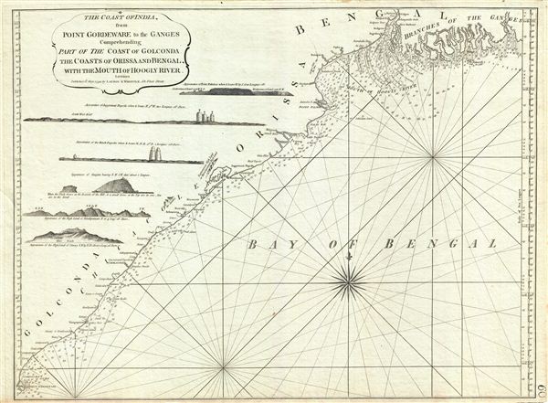
The Coast of India from Point Gordeware to the Ganges Comprehending Part of the Coast of Golconda, the Coasts of Orissa and Bengal, with the Mouth of Hoogly River.
sold
- Digital Map Information
- Suitable for large format printing
- DPI: 300
- File Size: 16.31 MB
- File Type: ZIP / TIFF
- ICC color profile embedded
- Delivered instantly via download link
This is a fine example of Laurie and Whittle's 1794 nautical chart or maritime map of the Golconda Coast, the coast of Orissa and Bengal and the mouths of the Hooghly River, northeastern India. It covers from the mouths of the Ganges ... (more details)
One of the earliest nautical charts to show the coasts near Kuala Lumpur, Malaysia.
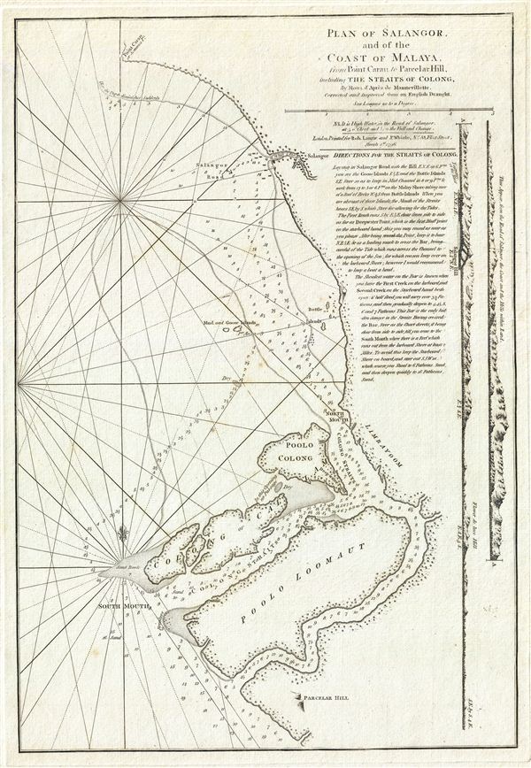
Plan of Salangor, and of the Coast of Malaya, from Point Caran to Paracelar Hill, including the Straits of Colong.
sold
- Digital Map Information
- Suitable for large format printing
- DPI: 300
- File Size: 10.41 MB
- File Type: ZIP / TIFF
- ICC color profile embedded
- Delivered instantly via download link
A scarce 1796 map of the coasts of Malay (modern day Malaysia) in the vicinity of Kuala Lumpur, this is a fine example of Laurie and Whittle's 1796 nautical chart or maritime map of Selangor and the Strait of Malacca on the western ... (more details)
A scarce map of Bali, Indonesia, during the Dutch colonial period.
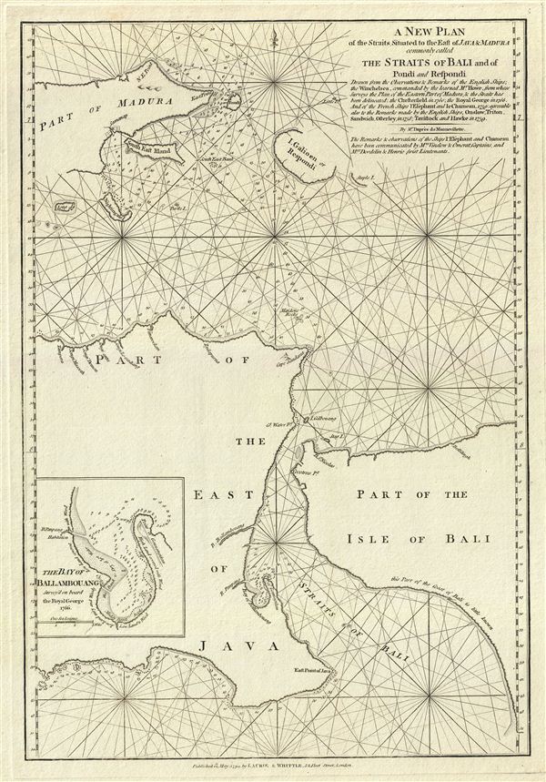
A New Plan of the Straits Situated to the East of Java & Madura commonly called The Straits of Bali and of Pondi and Respondi.
sold
- Digital Map Information
- Suitable for large format printing
- DPI: 300
- File Size: 10.51 MB
- File Type: ZIP / TIFF
- ICC color profile embedded
- Delivered instantly via download link
This is a fine example of Laurie and Whittle's 1794 nautical chart or maritime map of the Strait of Bali, Indonesia. It covers from Java's eastern extension to include the western half of Bali and the islands of Madura and ... (more details)
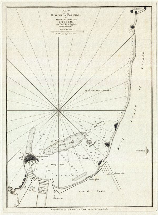
Plan of the Harbour of Colombo, on the West Coast of Ceylon.
sold
- Digital Map Information
- Suitable for large format printing
- DPI: 300
- File Size: 7.04 MB
- File Type: ZIP / TIFF
- ICC color profile embedded
- Delivered instantly via download link
This is a fine example of Laurie and Whittle's 1794 nautical chart or maritime map of the harbor of Colombo, on the west coast of Ceylon or Sri Lanka. It covers the harbor of what is now one of the busiest ports in the ... (more details)
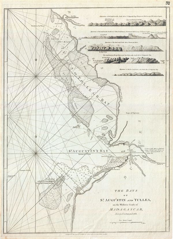
The Bays of St. Augustin and Tullea, on the Western Coast of Madagascar, surveyed in 1755 and 1768.
sold
- Digital Map Information
- Suitable for large format printing
- DPI: 300
- File Size: 15.74 MB
- File Type: ZIP / TIFF
- ICC color profile embedded
- Delivered instantly via download link
This is a fine example of Laurie and Whittle's 1794 nautical chart or maritime map of the Bays of St. Augustin and Tullea (Tulear Bay) on the western coast of Madagascar. The chart covers part of the modern day ... (more details)
Fifty photogravures of Old Shanghai.

Shanghai of To-day. A Souvenir Album of Fifty Vandyke Gravure Prints of the 'Model Settlement'
sold
An unusual discovery, this is the 1930 third edition of Shanghai of To-day. A Souvenir Album of Thirty-eight Vandyke Prints of the 'Model Settlement' . Following a short introduction by F. L. Hawkes Pott, the ... (more details)

Vest Pocket Map of New York.
sold
- Digital Map Information
- Suitable for large format printing
- File Size: 36.23 MB
- File Type: ZIP / TIFF
- ICC color profile embedded
- Delivered instantly via download link
An extremely large c. 1907 map of New York City by Walker and Company. Walker's large scale folding map covers all of Manhattan, most of Brooklyn, Queens, and the Bronx, and parts of adjacent New Jersey. ... (more details)
James Bruce's African speculations on the Lost Mines of King Solomon at Ophir and Tarshish.
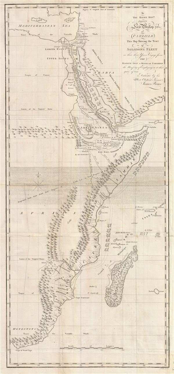
To the Right Revd. John Lord Bishop of Carlisle This Map Shewing the Tract of Solomons Fleet in thir three Years Voyage from the Elantic Gulf to Ophir and Tarshish the Necessity of Empolying in it that space of time is Dedicated by his Most Obedient Servent James Bruce.
sold
- Digital Map Information
- Suitable for large format printing
- Full resolution TIFF file
- ICC color profile embedded
- Delivered instantly via download link
This is a fascinating, significant, beautifully engraved, intricately detailed 1813 map of eastern Africa, covering from the Mediterranean to the Cape of Good Hope. The map serves to highlight Bruce's ... (more details)

A Chart of the Maderas and Canary Islands.
sold
- Digital Map Information
- Suitable for large format printing
- DPI: 300
- File Size: 20.64 MB
- File Type: ZIP / TIFF
- ICC color profile embedded
- Delivered instantly via download link
This is a fine example of Laurie and Whittle's 1794 nautical chart or maritime map of Madeira, the Savages, and the Canary Islands. The map covers from the island of Porto Santo and Madeira, ... (more details)

Plan of Mathurin Bay, on the North Side of the Island of Diego Rays, called by the French Isle Rodriguez, in the Indian Ocean.
sold
- Digital Map Information
- Suitable for large format printing
- DPI: 300
- File Size: 18.2 MB
- File Type: ZIP / TIFF
- ICC color profile embedded
- Delivered instantly via download link
This is a fine example of Laurie and Whittle's 1794 nautical chart or maritime map of the port of Mathurin Bay, Iles. Rodrigues, Mauritius. The map shows detail sounding in the harbor as well ... (more details)