
An unusual treasure of American Folk Art.

For Gun and Women, and Horse and Flask, These are Our Law, Let Any Ask.
sold
- Digital Map Information
- Suitable for large format printing
- File Size: 3.74 MB
- File Type: ZIP / TIFF
- ICC color profile embedded
- Delivered instantly via download link
An extraordinary bit of Americana. This Folk Art manuscript (hand drawn) map of Kentucky was produced by an unknown artist in 1929. The map, though somewhat difficult to interpret, covers Kentucky from Reelfoot Lake on the Tennessee-Missouri-Kentucky border along ... (more details)
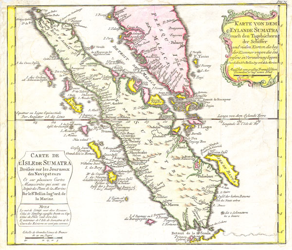
Karte von Dem Eylande Sumatra nach den Tagebuchern der Schiffer / Carte de l’Isle de Sumatra Drefsee sur les Journaux des Navigatuers.
sold
- Digital Map Information
- Suitable for large format printing
- DPI: 300
- File Size: 2.48 MB
- File Type: ZIP / TIFF
- ICC color profile embedded
- Delivered instantly via download link
This is a beautiful map of the island of Sumatra and the southern tip of the Malaysian Peninsula was produced by the French Cartographer Jacques-Nicolas Bellin in 1852. Depicts the entirety of Sumatra as well as much of modern day Malaysia. Includes the Straights ... (more details)
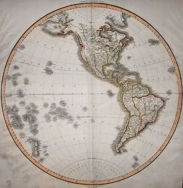
Western Hemisphere.
sold
- Digital Map Information
- Suitable for large format printing
- Full resolution TIFF file
- ICC color profile embedded
- Delivered instantly via download link
This hand colored map is a steel plate engraving, dating to 1814 by the important English mapmaker Pinkerton. It is a representation of the Americas, North and South, from the perspective of the Western Hemisphere. This map is extremely detailed and beautifully ... (more details)
Tokagawa period map covering the ancient Musashu Kuni province around Tokyo.
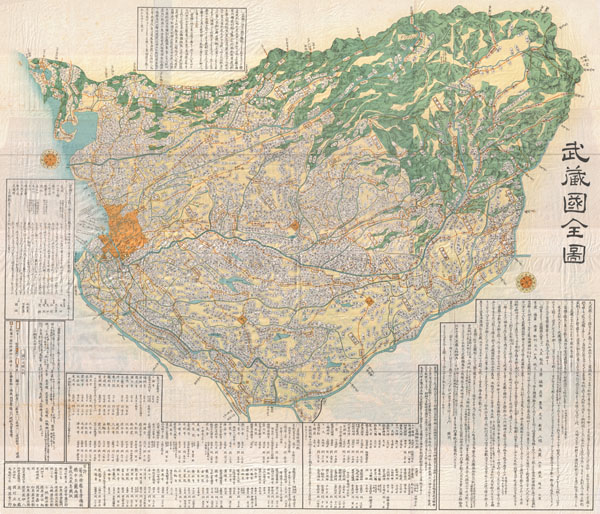
Musashi Kuni.
sold
- Digital Map Information
- Suitable for large format printing
- File Size: 135.14 MB
- File Type: ZIP / TIFF
- ICC color profile embedded
- Delivered instantly via download link
A breathtaking large format Edo Period Japanese woodblock map of Musashi Kuni dating to 1858. Musashi (???, Musashi no kuni?) was a province of Japan, which today comprises Tokyo Prefecture, most of Saitama Prefecture and part of Kanagawa Prefecture, mainly ... (more details)
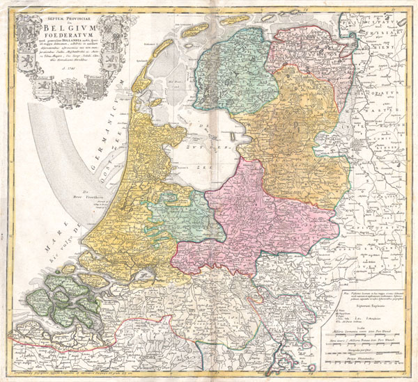
Septem Provinciae seu Belgium Foederatum: quod generaliter Hollandia audit, speciali mappa delineatum, adhibitis in auxilium observationibus astronomicis nec non mensurationibus Snelii, Muschenbrokii…
sold
- Digital Map Information
- Suitable for large format printing
- DPI: 300
- File Size: 5.16 MB
- File Type: ZIP / TIFF
- ICC color profile embedded
- Delivered instantly via download link
A beautifully detailed 1748 Homann Heirs map seven states of the Belgian Federation – what is today Holland or the Netherlands. Title cartouche in the upper left quadrant features the armorial coasts of the seven states: Geldern, Holland, Zeeland, ... (more details)

The White Mountains of New Hampshire.
sold
- Digital Map Information
- Suitable for large format printing
- File Size: 13.75 MB
- File Type: ZIP / TIFF
- ICC color profile embedded
- Delivered instantly via download link
An attractive pictorial 1937 map of the White Mountains of New Hampshire issued by National Geographic. Covers the region from Littleton and Sugar Hill to the Maine border. Notes towns, historical sites, roads, railroads and river ways. Topography ... (more details)

(D No. 3) Preliminary Chart of the Entrances to Cape Fear River and New Inlet North Carolina.
sold
- Digital Map Information
- Suitable for large format printing
- DPI: 300
- File Size: 5.37 MB
- File Type: ZIP / TIFF
- ICC color profile embedded
- Delivered instantly via download link
A rare hand colored 1853 coastal chart of coast of North Carolina near Smith's Island and Cape Fear. Details the entrance to the Cape Fear River and New Inlet. Includes detailed sailing instructions, references to light houses, depth soundings, ... (more details)
Rare art deco plan of Edinburgh, Scotland.

Pictorial Map of Edinburgh and Leith.
sold
- Digital Map Information
- Suitable for large format printing
- File Size: 28.02 MB
- File Type: ZIP / TIFF
- ICC color profile embedded
- Delivered instantly via download link
This is an unusual art deco style plan of Edinburgh, Scotland by George A. Reid. Covers the whole of Edinburgh with important monuments and buildings represented in profile. Names various streets, parks, and business as well as railways, ... (more details)

Provincetown Harbor Massachusetts.
sold
- Digital Map Information
- Suitable for large format printing
- File Size: 3.05 MB
- File Type: ZIP / TIFF
- ICC color profile embedded
- Delivered instantly via download link
A rare hand colored 1857 costal chart of Provincetown, at the tip of Cape Cod, in Massachusetts. Offers a wealth of information with regard to both the region's hydrography and its topography. Locates the Salt Marsh & the Highlands; ... (more details)

Pigot & Co.'s New Map of England & Wales with part of Scotland Including the New Lines of Canals, Rail Roads, &c.
sold
- Digital Map Information
- Suitable for large format printing
- DPI: 300
- File Size: 23.47 MB
- File Type: ZIP / TIFF
- ICC color profile embedded
- Delivered instantly via download link
An extremely attractive 1830 pocket format map of England, Wales, and part of Scotland issued by James Pigot & Sons. Offers extraordinary detail through noting towns, cities, large estates, canals, railroad lines, and ferries. ... (more details)

New York
sold
- Digital Map Information
- Suitable for large format printing
- Full resolution TIFF file
- ICC color profile embedded
- Delivered instantly via download link
This hand colored map is a copper plate engraving, dating to 1850 by the legendary American Mapmaker S.A. Mitchell, the elder. It represents New York. This historically important map is extremely rare as it existed only in the ... (more details)
Spectacular view of Boston and Cape Cod.

Bird's Eye View of Boston Harbor in colors Along the South Shore to Plymouth Cape Code Canal and Provincetown Showing all Steamboat Routes.
sold
- Digital Map Information
- Suitable for large format printing
- File Size: 4.78 MB
- File Type: ZIP / TIFF
- ICC color profile embedded
- Delivered instantly via download link
A remarkable chromolithograph map and view of Boston Harbor from Boston to Provincetown. Includes all of Cape Cod Bay, Quincy Bay and Dorchester Bay with the communities of Boston, East Boston, South Boston, Dorchester, ... (more details)
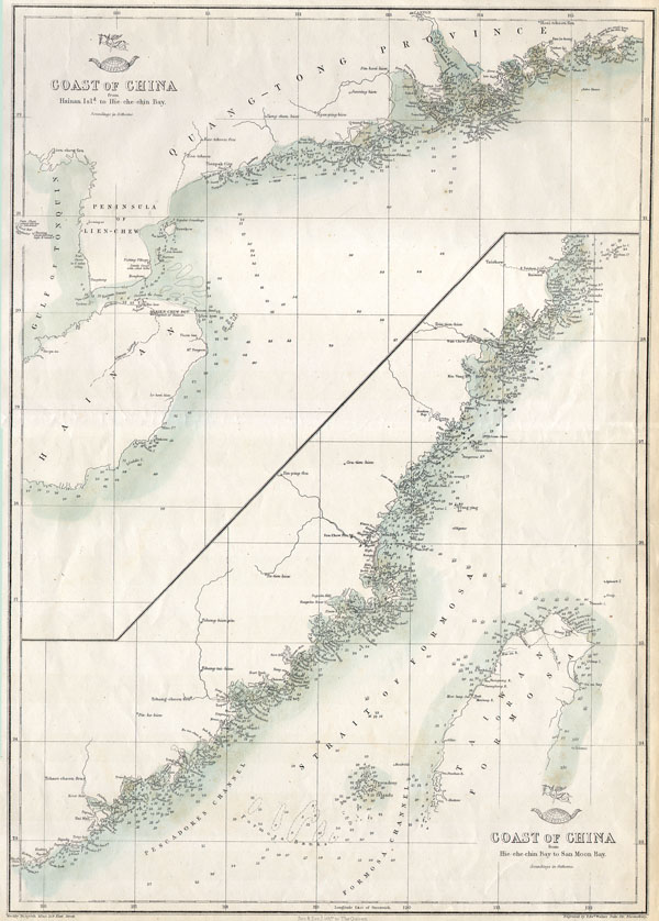
Coast of China from Hainan 1s1d. to Hie-che-chin Bay / Coast of China fromHie-che-chin Bay to San Moon Bay
sold
- Digital Map Information
- Suitable for large format printing
- File Size: 1.77 MB
- File Type: ZIP / TIFF
- ICC color profile embedded
- Delivered instantly via download link
This hand colored map is a lithographic transfer, dating to 1863, by London cartographer Edward Weller. Depicts the coast of China, including the Strait of Formosa and most of Taiwan or Formosa Island. Depth soundings ... (more details)
Spectacular view of Boston and Cape Cod.
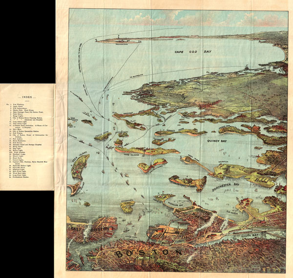
Bird's Eye View of Boston Harbor and South Shore to Provincetown Showing Steamboat Routes.
sold
- Digital Map Information
- Suitable for large format printing
- File Size: 16.52 MB
- File Type: ZIP / TIFF
- ICC color profile embedded
- Delivered instantly via download link
A remarkable chromolithograph map and view of Boston Harbor from Boston to Provincetown. Includes all of Cape Cod Bay, Quincy Bay and Dorchester Bay with the communities of Boston, East Boston, South Boston, ... (more details)

Turquie Europeenne.
sold
- Digital Map Information
- Suitable for large format printing
- DPI: 300
- File Size: 7.82 MB
- File Type: ZIP / TIFF
- ICC color profile embedded
- Delivered instantly via download link
A beautiful map of Greece from De Vaugondy's 1752 Atlas Universal. Depicts the whole of Greece from Bosnia and Croatia east to through Bulgaria and Romania to the Black Sea and south through Macedonia, ... (more details)
Rare early automobile map of eastern Long Island and the Hamptons.

Automobile Map of Long Island, New York. East.
sold
- Digital Map Information
- Suitable for large format printing
- File Size: 13.15 MB
- File Type: ZIP / TIFF
- ICC color profile embedded
- Delivered instantly via download link
An extremely attractive early automobile pocket map of the eastern part of Long Island. Published in 1905 by George Walker and the Automobile Club of America this map covers Suffolk County from ... (more details)

Tape Indicator Map of London.
sold
- Digital Map Information
- Suitable for large format printing
- File Size: 24.09 MB
- File Type: ZIP / TIFF
- ICC color profile embedded
- Delivered instantly via download link
This is an unusual large format folding pocket map of London printed in 1910 by C. Smith and Sons. Depicts the city of London in considerable detail with special attention to streets, railways ... (more details)
Extraordinary full color example of John Sennex's Rome.
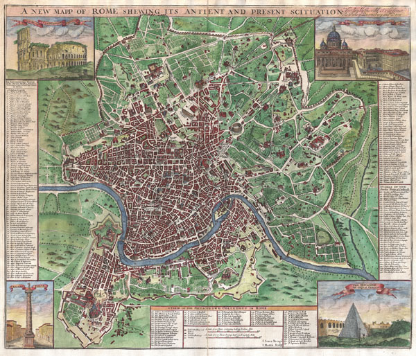
A New Mapp of Rome Shewing Its Antient And Present Scituation. Most Humbly Inscribed to His Grace The Duke of Queensbury and Dover.
sold
- Digital Map Information
- Suitable for large format printing
- Full resolution TIFF file
- ICC color profile embedded
- Delivered instantly via download link
A radiant full color example of John Sennex's 1721 map of Rome. Covers the entire and part of the surrouding countryside. Identifies both modern and ancient monuments in profile. Some of ... (more details)

Schematismus Geographiae Mathematicae ... Cura Homann Heredum Norimbergae Anno 1753.
sold
- Digital Map Information
- Suitable for large format printing
- Full resolution TIFF file
- ICC color profile embedded
- Delivered instantly via download link
This is a rare 1753 Homan Heirs chart of the Solar System. Features 23 diagrams including spheres, earth and celestial globes, planetary systems, temperature zones, and projection systems ... (more details)

Southold and Shelter Island Suffold Co. L.I.
sold
- Digital Map Information
- Suitable for large format printing
- File Size: 12.73 MB
- File Type: ZIP / TIFF
- ICC color profile embedded
- Delivered instantly via download link
A rare example of Fredrick W. Beers' Map of Southold and Shelter Island, Long Island, New York. Published in 1873, this magnificent map covers from Franklinville and Mattituck Hills ... (more details)