
Literary Maps (sold)
An idyllic land created at the end of the Great War. A sharp juxtaposition to bomb-blasted Europe.
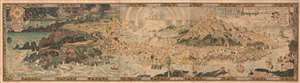
An Anciente Mappe of Fairy Land newly discovered and set forth.
sold
- Digital Map Information
- Suitable for large format printing
- Full resolution TIFF file
- ICC color profile embedded
- Delivered instantly via download link
An extraordinary 6-foot-long masterpiece, this is Bernard Sleigh's 1918 fantastical map of Fairy Land - in tis deluxe first edition. This wonderful map offers a wide birds-eye view panorama of the island of 'Fairy Land' which it describes as 'newly discovered and set forth'. Fairy Land is a wonderful juxtaposition of European fairy tales, literature, and Greek mythology. One can travel from King Arthur's Tomb to Peter Pan's House to the 'Bay of Moaning,' or the visit the roost of Dragons, watch Perseus save Andromeda, chat with Hercules, or visit the 'Harbour of Dreamland.' A red line indicates the route of passage 'From the World' to 'a place that never was and always will be.'
As pointed out by map historian Tim Bryars, this map was printed in 1918, the final year of World War I. Bryars astutely asks,
As pointed out by map historian Tim Bryars, this map was printed in 1918, the final year of World War I. Bryars astutely asks,
Could the map constitute a yearning for a return to pre-1914 Edwardian innocence? Compared with the devastated, bomb-blasted landscape of northern France, this vision of a make-believe land may have seemed a seductive escape for a European society bearing the psychological and physical scars of mass conflict.Another approach to this map is to study it within the context of the Arts and Crafts Movement. Sleigh was a close associate of Robert Morris and this map clearly follows Arts and Crafts Movement ideology. The typeface and decoration are very much in the style of Morris's Kelmscott Press and its embrace of traditional pre-industrial era production techniques. (more details)
An idylic fantastical land created by Bernard Sleigh at the end of the Great War and which then stood in sharp justaposition to bomb-blasted Europe.
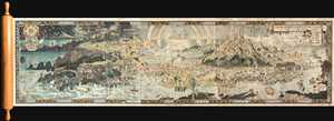
An Anciente Mappe of Fairy Land newly discovered and set forth.
sold
- Digital Map Information
- Suitable for large format printing
- Full resolution TIFF file
- ICC color profile embedded
- Delivered instantly via download link
An extraordinary 6 foot long presentation edition of Bernard Sleigh's 1918 fantastical map of Fairy Land. This wonderful map offers a wide birds-eye view style panorama of the island of 'Fairy Land' which it describes as 'newly discovered and set forth'. Fairy ... (more details)
The only surviving example of a fantasy masterwork.
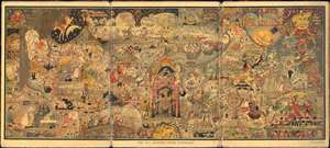
All Mother Goose Panorama.
sold
- Digital Map Information
- Suitable for large format printing
- Full resolution TIFF file
- ICC color profile embedded
- Delivered instantly via download link
This is the only known surviving example of Luxor Price's 1923 panoramic view of Mother Goose Land. The view was inspired by Price's son Peter's love of all-things Mother Goose. He claims that all Mother Goose characters save one were herein illustrated - which is missing we have been unable to ascertain. The map follows similar 'fantasy' maps issued shortly after World War I that harken back to the more halcyon Edwardian Era (1901 - 1914). The overall density of images is impressive enough that it is unsurprising why the printer made the rather bombastic claim that this was the 'most difficult piece of color engraving ever done in the world.' (more details)
The Middle Earth 'Wilderness'.
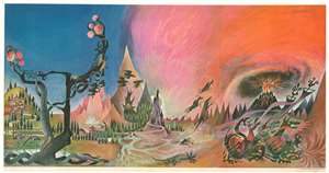
This is the rare 1965 Ballantine 'Wilderness' poster by Barbara Remington issued for the American release of the paperback edition of J. R. R. Tolkien's Lord of the Rings. The artwork was used as the cover art for each of the three volumes such that, set together, they formed a triptych. The artwork was also issued, as here, in an enormous panoramic poster wherein all three images are joined as one. Remington's work played a significant role in popularizing Tolkien's work worldwide. (more details)
First Edition 'BREM' map of Middle Earth!
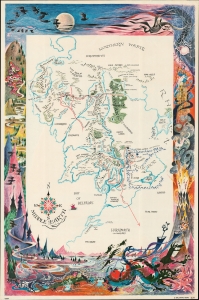
An example of one of the rarest and most iconic J. R. R. Tolkien 'Middle Earth' maps - the 1965 first edition poster-map issued to promote Ballentine's first American issue of the Lord of the Rings, featuring the illustrations of Barbara Remington. (more details)
First Edition 'BREM' map of Middle Earth!
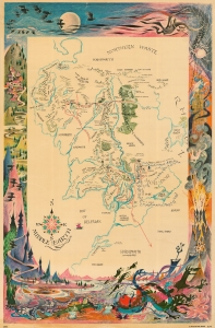
An example of one of the rarest and most iconic J. R. R. Tolkien 'Middle Earth' maps - the 1965 first edition poster-map issued to promote Ballentine's first American issue of the Lord of the Rings, featuring the illustrations of Barbara Remington. (more details)
Longing for what was loss in the Great War.
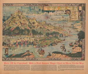
An Anciente Mappe of Fairy Land newly discovered and set forth.
sold
- Digital Map Information
- Suitable for large format printing
- Full resolution TIFF file
- ICC color profile embedded
- Delivered instantly via download link
An unusual discovery. This is a period magazine promotion of Bernard Sleigh's fantastical 1921 map of Fairyland - one of the great masterpieces of fantasy cartography. Bernard Sleigh produced the original to wide acclaim in the aftermath of World War I (1914 - 1918). The present double page presentation, issued by The World magazine, offers a teaser glimpse of the right side of Sleigh's 6-foot-long masterpiece, as well as fascinating content offering unique insights into the map's publication. (more details)
Iconic Tolkien promotional poster map.
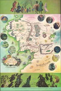
This is the iconic 1970 rare poster map of J. R. R. Tolkien's Middle Earth drawn by Pauline Diana Baynes to promote the George Allen and Unwin release of the Lord of the Rings. Tolkien heaped praise upon Baynes' work, saying 'They are more than illustrations, they are a collateral theme. I showed them to my friends whose polite comment was that they reduced my text to a commentary on the drawings.' (more details)
Tolkienana!
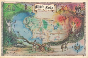
This is an extremely rare 1976 map of J. R. R. Tolkien's Middle Earth drawn by Larry Jannoff and Nicklas Aquila Jr. The map can be considered 'Fan Art' as it was neither commissioned by or drawn in conjunction with Tolkien or his publishers. Nonetheless, it followed closely on the Ballentine paperback release of the Lord of the Rings and is considered one of the better and rarer bits of Tolkienana. (more details)
The 'BREM' map of Middle Earth!
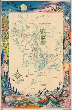
A beautiful example of one of the rarest and most iconic J. R. R. Tolkien 'Middle Earth' maps - the 1969 poster-map issued to promote Ballentine's first American issue of the Lord of the Rings, featuring the illustrations of Barbara Remington. (more details)
Iconic Tolkien promotional poster map.
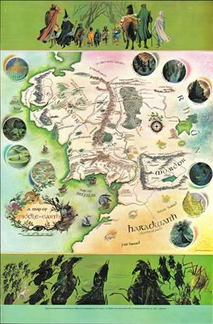
This is the iconic 1970 rare poster map of J. R. R. Tolkien's Middle Earth drawn by Pauline Diana Baynes to promote the George, Allen and Unwin release of the Lord of the Rings. Tolkien heaped praise upon Baynes' work, saying 'They are more than illustrations, they are a collateral theme. I showed them to my friends whose polite comment was that they reduced my text to a commentary on the drawings.' (more details)
The best and rarest printed map of Middle Earth.
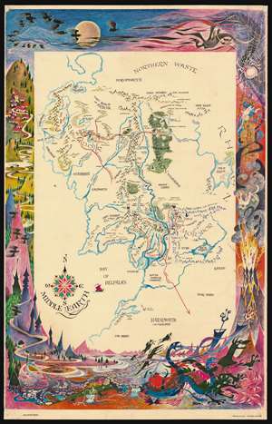
A beautiful example of one of the rarest and most iconic J. R. R. Tolkien 'Middle Earth' maps ever issued - the 1969 map issued to promote the first American issue of the Lord of the Rings, featuring the illustrations of Barbara Remington. (more details)
Iconic Tolkien promotional poster map.
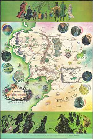
This is the iconic 1970 rare poster map of J. R. R. Tolkien's Middle Earth drawn by Pauline Diana Baynes to promote the George, Allen and Unwin release of the Lord of the Rings. Tolkien heaped praise upon Baynes' work, saying 'They are more than illustrations, they are a collateral theme. I showed them to my friends whose polite comment was that they reduced my text to a commentary on the drawings.' (more details)
The first separate issue map of Middle Earth.
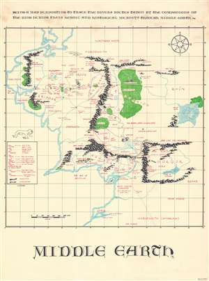
Middle Earth. Being a map purporting to trace the divers routes taken by the companions of the ring during their heroic and historical journeys through Middle Earth.
sold
A rare map of J. R. R. Tolkien's Middle Earth drawn in 1967 by M. Blackburn and issued in by Bruin Inc. This map is based upon the classic map of Middle Earth drawn by J. R. R.'s son, Christopher Tolkien, for the release of the Fellowship of the Ring. To this map has been appended annotation and overprinting, as well as a legend, detailing the routes taken by various figures from the Lord of the Rings. These are broken out and coded according to the subgroups established after the 'Breaking of the Fellowship' at the end of the Fellowship of the Ring. This map has the novel addition of a scale, uncommon in Middle Earth maps, where distances are frequently debated based upon interpretations of the text. (more details)
Iconic Tolkien promotional poster map.
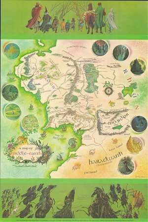
This is the 1978 edition of the iconic 1970 poster map of J. R. R. Tolkien's Middle Earth drawn by Pauline Diana Baynes to promote the George, Allen and Unwin release of the Lord of the Rings. Tolkien heaped praise upon Baynes' work, saying 'They are more than illustrations, they are a collateral theme. I showed them to my friends whose polite comment was that they reduced my text to a commentary on the drawings.' (more details)
The 'BREM' map of Middle Earth!
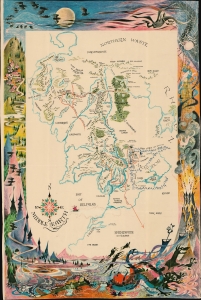
An example of one of the rarest and most iconic J. R. R. Tolkien 'Middle Earth' maps - the 1969 poster-map issued to promote Ballentine's first American issue of the Lord of the Rings, featuring the illustrations of Barbara Remington. (more details)
'I don’t think it extravagant to say that in this map Miss Baynes proves that she can paint as well as Lewis could write.' - Walter Hooper (friend of Lewis)
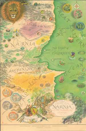
A very attractive example of the rare 1972 Pauline Baynes' promotional poster map of C. S. Lewis' fantasy world Narnia, the setting for the 8-volume Chronicles of Narnia. Although published nearly 20 years after C. S. Lewis' death, this map offers the first representation of Narnia as a comprehensive whole. It is based directly on Bayne's collaboration with C. S. Lewis (1898 - 1963) from the early proof editions of the novels in the 1950s, through his death. Although Baynes and Lewis never became close, as she did with J. R. R. Tolkien (1892 - 1973), she illustrated his work both before and after his death. (more details)
Celebrating American literature.
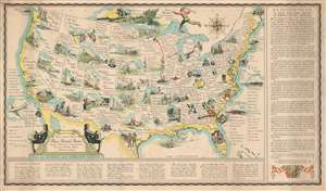
Being a Literary Map of These United States depicting a Renaissance no less astonishing than that of Periclean Athens or Elizabethan London.
sold
- Digital Map Information
- Suitable for large format printing
- File Size: 31.1 MB
- File Type: ZIP / TIFF
- ICC color profile embedded
- Delivered instantly via download link
This is a 1942 Gladys and Sterling North and Frederic Dornseif pictorial map of the United States celebrating literary achievement. Each state features at least one novelist, poet, or historian, and many highlight a work set there. For example, Nebraska focuses on My Antonia by Willa Cather, while The Yearling by Marjorie Kinnan Rawlings dominates Florida. Authors known for works set outside the United States are referenced in the Pacific or Atlantic Oceans, respectively. Pearl Buck and her novel The Good Earth are included on the China Clipper in the Pacific, while authors who took up residence in Europe, including Gertrude Stein and Ernest Hemingway, are listed on the passenger list of the S.S. Europa. The U.S.S. Foreign Correspondent also occupies space in the Atlantic, with William Shirer and John Gunther among its passengers. (more details)
Cartographic wonderlands.
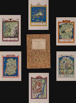
A delightful work of geographical fantasy, this is Dion Clayton Calthrop and Gilbert Anthony Pownall's 1824 Traveler's Joy: A Device. The fantasy atlas takes readers on a tour of imagined places, succinctly described by Calthrop to leave room for interpretation and gorgeously illustrated by Pownall. (more details)
The most beloved fantasy series since Tolkien.
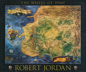
An uncommon large-scale 1997 promotional map illustrating the 'Westlands', the primary setting of Robert Jordan's Wheel of Time series. It was issued to promote Book 7 of the series, A Crown of Swords based upon the original map art. Jordan fans will recognize the map from the endpapers of the hardcover editions of each volume designed by Elissa Mitchell. Coverage extends from the Spine of the World to the Aryth Ocean, and from the Blight (Shayol Ghul) to the Sea of Storms. The verso features glowing reviews for the Wheel of Time series. (more details)
The most beloved fantasy series since Tolkien.
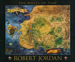
An uncommon large-scale 1997 promotional map illustrating the 'Westlands', the primary setting of Robert Jordan's Wheel of Time series. It was issued to promote Book 7 of the series, A Crown of Swords based upon the original map art. Jordan fans will recognize the map from the endpapers of the hardcover editions of each volume designed by Elissa Mitchell. Coverage extends from the Spine of the World to the Aryth Ocean, and from the Blight (Shayol Ghul) to the Sea of Storms. The verso features glowing reviews for the Wheel of Time series. (more details)
Fantasy map covered in vignettes of the most popular fairy tales and nursery rhymes - including the Cow Who Jumped Over the Moon!
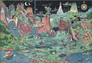
The Land of Make Believe.
sold
- Digital Map Information
- Suitable for large format printing
- File Size: 35.81 MB
- File Type: ZIP / TIFF
- ICC color profile embedded
- Delivered instantly via download link
This is a 1930 Jaro Hess pictorial map of the Land of Make Believe. The map is derived from over fifty nursery rhymes, fairy tales, and children's stories with creative, entertaining, and attractive illustrations. Some of the many stories referenced are Little ... (more details)
Reliving Jules Verne's great adventure novel.
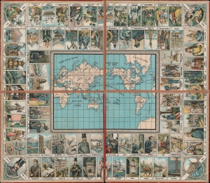
Le Voyage autour du Monde en 80 jours, d'apres le roman de Jules Verne...
sold
- Digital Map Information
- Suitable for large format printing
- Full resolution TIFF file
- ICC color profile embedded
- Delivered instantly via download link
A delightful c. 1885 French-language chromolithograph board game produced by Roche Frères based on Jules Verne's novel Around the World in Eighty Days. Sticking close to the novel's plot, players travel from London through the Suez Canal, India, Singapore, Hong Kong, Shanghai, Tokyo, and the United States before returning to the Reform Club in London. (more details)
A game which was included with a purchase of Weston's English Quality Biscuits in 1933.
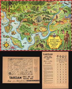
The Tarzan Jungle Map and Treasure Hunt
sold
- Digital Map Information
- Suitable for large format printing
- File Size: 49.71 MB
- File Type: ZIP / TIFF
- ICC color profile embedded
- Delivered instantly via download link
This is a 1933 Weston's Quality English Biscuits fantasy game map of Tarzan's Jungle. The map functions as a game board and depicts from the start, which is off the coast of Tarzan's homeland, to the finish, which is, truthfully, not far from the start (as the ... (more details)
Tolkien's Middle-Earth!
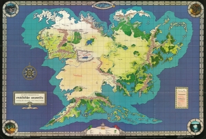
An Artist's Interpretation of Middle Earth including the Wild Lands - east, south, and north.
sold
This is a 1982 map of J. R. R. Tolkien's fantasy world 'Middle-Earth' by Peter C. Fenlon. Fans of Tolkien will be quick to recognize the northeastern part of the map, generally known as the Westlands, encompassing the main theater of both the Hobbit and The Lord of the Rings. The cartography for these areas, from Forodwaith to Umbar and from the western ocean (Belegaer) to the Sea of Rhûn, is drawn directly from the iconic map that accompanied the The Lord of the Rings. (more details)
Tolkien's Middle-Earth!
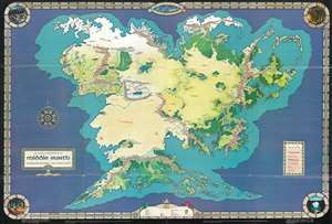
An Artist's Interpretation of Middle Earth including the Wild Lands - east, south, and north.
sold
This is a 1982 map of J. R. R. Tolkien's fantasy world 'Middle-Earth' by Peter C. Fenlon. Fans of Tolkien will be quick to recognize the northeastern part of the map, generally known as the Westlands, encompassing the main theater of both the Hobbit and The Lord of the Rings. The cartography for these areas, from Forodwaith to Umbar and from the western ocean (Belegaer) to the Sea of Rhûn, is drawn directly from the iconic map that accompanied the The Lord of the Rings. Unlike the maps published in Tolkien's famous books, the present map extends south and west to embrace the entire continent of Endor. Cartographically, Endor roughly mirrors Europe (Westlands), Africa (Haradwraith), and Asia (east of Rhûn). Although Tolkien's Legendarium does in fact give some hints regarding the lands and topography to the east of Mordor and Rhûn, much of the cartography here seems to have been imagined by Fenlon. Nonetheless, this map proved popular in the 1980s and was distributed to complement Iron Crown Enterprises successful LOTR-based role-playing game series. Although the map has no scale, we extrapolated a scale of 1:19000000 based on Tolkien's statement that Mirkwood was 300 miles wide. (more details)
Tolkien's Middle-Earth!
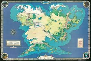
An Artist's Interpretation of Middle Earth including the Wild Lands - east, south, and north.
sold
This is a 1982 map of J. R. R. Tolkien's fantasy world 'Middle-Earth' by Peter C. Fenlon. Fans of Tolkien will be quick to recognize the northeastern part of the map, generally known as the Westlands, encompassing the main theater of both the Hobbit and The Lord of the Rings. The cartography for these areas, from Forodwaith to Umbar and from the western ocean (Belegaer) to the Sea of Rhûn, is drawn directly from the iconic map that accompanied the The Lord of the Rings. Unlike the maps published in Tolkien's famous books, the present map extends south and west to embrace the entire continent of Endor. Cartographically, Endor roughly mirrors Europe (Westlands), Africa (Haradwraith), and Asia (east of Rhûn). Although Tolkien's Legendarium does in fact give some hints regarding the lands and topography to the east of Mordor and Rhûn, much of the cartography here seems to have been imagined by Fenlon. Nonetheless, this map proved popular in the 1980s and was distributed to complement Iron Crown Enterprises successful LOTR-based role-playing game series. Although the map has no scale, we extrapolated a scale of 1:19000000 based on Tokien's statement that Mirkwood was 300 miles wide. (more details)
Tolkien's Middle-Earth!
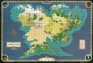
An Artist's Interpretation of Middle Earth including the Wild Lands - east, south, and north.
sold
This is a 1982 map of J. R. R. Tolkien's fantasy world 'Middle-Earth' by Peter C. Fenlon. Fans of Tolkien will be quick to recognize the northeastern part of the map, generally known as the Westlands, encompassing the main theater of both the Hobbit and The Lord of the Rings. The cartography for these areas, from Forodwaith to Umbar and from the western ocean (Belegaer) to the Sea of Rhûn, is drawn directly from the iconic map that accompanied the The Lord of the Rings. Unlike the maps published in Tolkien's famous books, the present map extends south and west to embrace the entire continent of Endor. Cartographically, Endor roughly mirrors Europe (Westlands), Africa (Haradwraith), and Asia (east of Rhûn). Although Tolkien's Legendarium does in fact give some hints regarding the lands and topography to the east of Mordor and Rhûn, much of the cartography here seems to have been imagined by Fenlon. Nonetheless, this map proved popular in the 1980s and was distributed to complement Iron Crown Enterprises successful LOTR-based role-playing game series. (more details)
Bookstores in the Mission District!
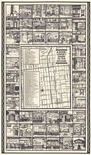
This is a 1991 Wayne Holder and Elizabeth Newman map of the Mission District, San Francisco, California. A description of the map published in the May 1991 edition of the North Mission News describes the map best:
A Book Lover's Guide to the Mission is a handy, pocket-sized guide to the many bookstores and cafes in this culturally rich and ethnically diverse neighborhood. It also lists galleries, theatres, and other places where booklovers hang out.(more details)
The front has drawings of thirty-four shop fronts, and listings of almost fifty establishments. On the back, you will find descriptions of each place, along with hours of business, addresses and telephone numbers.
In a departure from the usual competitive nature of business, many of the small shops in the area, as well as the Mission Branch of the San Francisco Public Library, contributed to help make the map a reality. Wayne Holder, owner of Manzanita Used Books and Records, created the map with local graphic artist Elizabeth Newman.
Newcomers and visitors can use the map to become acquainted with the neighborhood, and even long-term residents may find a few surprises. The neighborhood is constantly changing, so we plan to update the listings periodically. On this page you’ll find we have added six new cafes that have opened since the first edition of the map was issued in late February. The map is available at most Mission district bookstores and cafes. Pick up a map soon and take a walking tour of the neighborhood!
Follow New York City's most famous authors around Manhattan.
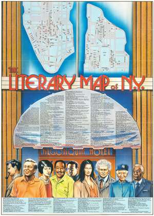
This is a 1988 Linda Ayriss and Brian Ladner pictorial literary map of New York City. Focusing on the borough of Manhattan, 141 locations around Manhattan associated with famous authors and poets are numerically identified. The vast majority of these are residences, but other identified locales include the San Remo Café, the Cedar Street Tavern, the Algonquin Hotel, and The New Yorker and Vanity Fair offices. An alphabetical index lists the authors and poets in question, with their most recognizable works noted in italics (especially if one was written at a particular location). Among these are F. Scott Fitzgerald, Joseph Heller, Allen Ginsberg, William S. Burroughs, Langston Hughes, Edith Wharton, and Willa Cather. The entire map is drawn as if it is the façade of the Algonquin Hotel and the top section of the index appears within the awning over the hotel's front doors. A series of portraits beneath the façade of the Algonquin Hotel celebrate New York City authors, including Norman Mailer, James Baldwin, Dylan Thomas, and Dorothy Parker. (more details)
A French allegorical map commenting on the state of poetry in France at the end of the 17th century.
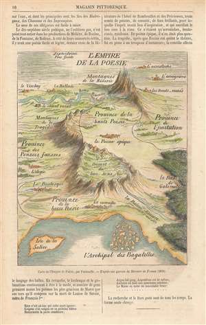
L'Empire de la Poesie.
sold
- Digital Map Information
- Suitable for large format printing
- File Size: 5.47 MB
- File Type: ZIP / TIFF
- ICC color profile embedded
- Delivered instantly via download link
This is an 1859 reprint of a 1696 Bernard de Fontanelle fantasy map of the Empire of Poetry (L'Empire de la Poesie). The map depicts every region in this allegorical country, which include the Province of High Poetry (Province de la haute Poesie), the Province of Low Poetry (Province de la basse Poesie), the Province of Imitation (Province de l'Imitation) and the Province of False Thoughts Province des Pensees fausses). The capital of this fantastical nation is the Epic Poem (le Poeme epique) situated in High Poetry, while the cities of Burlesque (Le Burlesque) and Comedy (La comedie) are in Low Poetry. The Desert of Good Sense (Desert du bon Sens), which could also be translated as the Desert of Right Meanings, separates High and Low Poetry, while the Mountains of Tragedy form the border between High Poetry and False Thoughts. Two Rivers, Reason and Rhyme, run through the country, although they never converge. The Island of Satire (Isle de la Satire and the Archipelago of Trivia (l'Archipel des Bagatelles) appear in the bay at the bottom of the map. (more details)
A whimsical window into the childhood wonderland of Mother Goose.
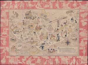
To the Land of Mother Goose.
sold
- Digital Map Information
- Suitable for large format printing
- File Size: 6.78 MB
- File Type: ZIP / TIFF
- ICC color profile embedded
- Delivered instantly via download link
This is a rare 1930 Perin Gift Company pictorial map of Mother Goose Land. The central image depicts Mother Goose flying on her goose, and numerous nursery rhymes are illustrated. Beloved classics, such as 'Hey, Diddle Diddle', 'Jack and Jill', 'Humpty ... (more details)