
Manuscript Maps (sold)
The only indigenous Siamese map outside of Siam.
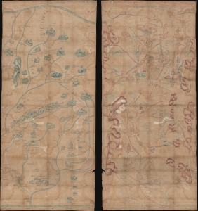
[Siam, Cambodia.]
sold
- Digital Map Information
- Suitable for large format printing
- Full resolution TIFF file
- ICC color profile embedded
- Delivered instantly via download link
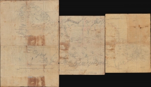
Two c. 1800 Siamese / Thai manuscript maps, drawn back-to-back on hand loomed cotton. The significance of these maps cannot be understated. They are likely working drafts for parts of a series of maps compiled for and presented to the Siamese kings sometime between 1783 and 1825. Collectively, they represent the only examples of indigenous Siamese non-religious cartographic visualization outside 17 Royal Maps (really just 11, see below). As working draft, these maps may predate the Royal Siamese Maps, possibly making them the earliest known Thai maps. (more details)
Unique manuscript record of the War of the Quadruple Alliance. Author's own copy.
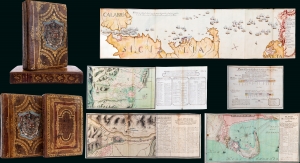
Guerra De Cerdeña Ysicilia, En Los Años De 1717, 18, 19, Y 1720. Con Reflexiones Militares Del Marquèsde La Mina Conde De Pezuela.
sold
This is an extraordinary 2-volume 1755-57 manuscript account of the War of the Quadruple Alliance, fought over Sicily, drafted by a participant, the II Marques de la Mina, Jaime Miguel de Guzmán Davalos y Spinola. It is Mina's personal copy, emblazoned with his arms, rich with masterfully executed foldout manuscript maps and tables, and features exceptional provenance. At the time of writing, this work was suppressed in Spain, as the loss of the Spanish fleet at the Battle of Cape Passaro was a royal embarrassment, leading to it remaining unpublished for more than 140 years. The War of the Quadruple Alliance here represented, while not well known, had global ramifications, as it significantly diminished the Spanish navy, giving the British largely unopposed free reign on the colonial stage, particularly in the Americas. (more details)
Extraordinary manuscript map collection of Taiwan and Fujian relating to the 1874 Punitive Expedition and the cartography of Le Gendre.
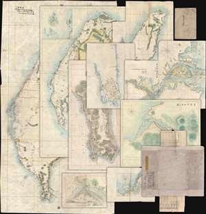
[Taiwan Manuscript Map Collection relating to 1874 Taiwan Punitive Expedition.]
sold
- Digital Map Information
- Suitable for large format printing
- Full resolution TIFF file
- ICC color profile embedded
- Delivered instantly via download link
An extraordinary collection of nine 1874 manuscript maps detailing Taiwan and part of Fujian province, China. The maps were compiled and drafted by one, Sudo Katsuzō (湏藤 or 湏藤勝三) of Tochigi Prefecture, Japan, on an official or semi-official 1874 mission to Taiwan and thence to mainland China. Most of the maps in this set were compiled between March of and June of 1874 and are related to the 1871 Mundan Incident and the subsequent 1874 Taiwan Punitive Expedition. The Taiwan maps are primarily derived from maps drawn by the American Consul to Qing Taiwan Charles William (Guillaum) Joseph Émile Le Gendre's (August 26, 1830 - September 1, 1899) between 1867 and 1873. Others, particularly those of mainland china and Tamsui, are derived from British Admiralty Hydrographic Charts. In addition to the manuscript maps, the collection also contains its original binder and Sudo's application booklet requesting permission to travel from Taiwan to Fujian and Shanghai. (more details)
A stunning late 19th century Vietnamese manuscript map.
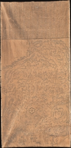
清化省圖本 / [Map of Thanh Hóa Province].
sold
- Digital Map Information
- Suitable for large format printing
- Full resolution TIFF file
- ICC color profile embedded
- Delivered instantly via download link
An incredible, one-of-a-kind large-format 1878 manuscript map depicting Thanh Hóa Province (清化省) in north-central Vietnam by Trần Lưu Huệ, an official at the court of the Nguyễn Dynasty. It is one of only a few examples of traditional Chinese-influenced Vietnamese cartography in private hands and outside of Vietnam. The area here covered was significant for the Nguyễn emperors, who had risen to prominence from Thanh Hóa in the early Lê Dynasty (r. 1428 - 1789). This, nonetheless, captures the Nguyễn Empire in decline as French Indochina began its push into the region. (more details)
Unique espionage portrait Paraguay under the Lopez dictatorship.
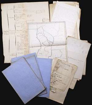
This is an incomparable find: an unpublished manuscript set, dated approximately 1860, consisting of maps, surveys, charts, and research notes pertaining to Paraguay, written by French naval officer and hydrographer Ernest Amédée Barthélemy Mouchez (1821 - 1892). It describes in detail Paraguay's volatile situation under dictator Carlos Antonio López Ynsfrán (née 1792, ruled 1841 - 1862,) whose autocracy set the stage for the disastrous reign of his son, Francisco Solano López Carrillo. (1827 - 1870) (more details)
Ming cartographic heritage.

大明一統二京十三省図 / Great Ming Unification Two Capitals and Thirteen Provinces Map / Da Ming Yi Yong Er Jing Shi San Shen Tu
sold
- Digital Map Information
- Suitable for large format printing
- Full resolution TIFF file
- ICC color profile embedded
- Delivered instantly via download link
This previously unknown 1769 Chinese-language manuscript map of Ming China and Korea is among the most important East Asian cartographic discoveries to emerge in recent years. Monumental in scale and exceptionally detailed, it preserves official Ming Dynasty geographic knowledge long thought lost, likely produced in Tokugawa Japan by descendants of Chinese scholars who fled the fall of the Ming Dynasty in 1644. Rich with elegant calligraphy, extensive topographical and political detail, and numerous textual annotations, the map offers an unparalleled window into the geography, historical memory, and intellectual traditions of the Ming loyalist diaspora. As a unique manuscript with no known counterpart, it represents a once-in-a-lifetime opportunity to acquire an extraordinary artifact of Chinese cartography, Sino-Japanese cultural exchange, and the enduring legacy of the Great Ming. (more details)
Earliest view of Tsingtao or Qingdao - drawn shortly after the German takeover.
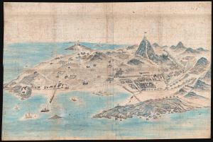
[Tsingtao]
sold
- Digital Map Information
- Suitable for large format printing
- File Size: 78.87 MB
- File Type: ZIP / TIFF
- ICC color profile embedded
- Delivered instantly via download link
This is an outstanding c. 1899 Chinese manuscript view of the city of Qingdao (Tsingtao), China, as it appeared early in the German colonial period. It is hand-painted by an unknown Chinese artist on silk and represents the earliest known image of Qingdao. (more details)
The only known traditional Vietnamese map outside of Vietnam. Illustrates the Long Wall of Quảng Ngãi, lost until 2005!
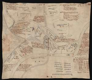
Plan du Huyen de Nghia Hanh. / [Untitled]
sold
- Digital Map Information
- Suitable for large format printing
- Full resolution TIFF file
- ICC color profile embedded
- Delivered instantly via download link
This fascinating c. 1819 Vietnamese manuscript map on linen depicts the huyên or district of Nghĩa Hành, located in the rural South-Central Coast region of Vietnam. This is the only known indigenous Vietnamese map to illustrate the Long Wall of Quảng Ngãi, one of the lost wonders of Southeast Asia. The map is fascinating and offers much else of interest. It follows the course of the Song Vé River from its mouth, to its intersection with the early 19th century Route Mandarine, to a great wall, also known as the Long Wall of Quảng Ngãi. The map identifies 14 villages, some quite large, others little more than familial homesteads, and has notations on local taxation. The overlaying late 19th century French text describes the situation of each village, how it can be reached, and notes that it is available for sale. (more details)
Some of the earliest surviving original illustrations associated with the King Features Mickey Mouse comic series.
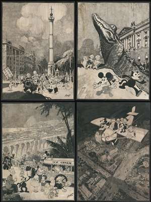
[Biedermann / King Features / Disney Original Calendar Art]
sold
- Digital Map Information
- Suitable for large format printing
- File Size: 303.48 MB
- File Type: ZIP / TIFF
- ICC color profile embedded
- Delivered instantly via download link
A one-of-a-kind set of four 30 x 40 inch original 1930 Disney / King Features manuscript pen and ink drawings of impressive size, by the master cartoonist Louis Biedermann. They are among he earliest surviving original artworks related to the Micky Mouse Comic Strip (1930 - 1995). The drawings feature Mikey Mouse (just 2 years after he was created), Felix the Cat, Bonzo the Dog, Jiggs and Maggie, Dub Dora and others. (more details)
Extraordinary early manuscript map of Shanghai, China.
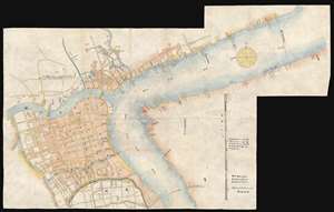
[Shanghai, China]
sold
- Digital Map Information
- Suitable for large format printing
- File Size: 12.79 MB
- File Type: ZIP / TIFF
- ICC color profile embedded
- Delivered instantly via download link
This is an outstanding map of great significance, an 1874 (Tongzhi 13) manuscript version of the 1873 Shinagawa Tadamichi Map of Qing Shanghai, China. This large format map covers Qing Shanghai's old foreign district. From the conflux of the Huangpu River and the Wusong River, the map extends westward to, roughly, the modern day Xisang Middle Road, south to, roughly, Fangbang Middle Road, and eastward along the Huangpu River to the Dalian Road Tunnel. Houses appear in red, roads are yellow, rivers are green, and open land is uncolored. (more details)
A hand drawn manuscript map - most likely the first accurate nautical chart of west Sumatra's Pepper Coast.
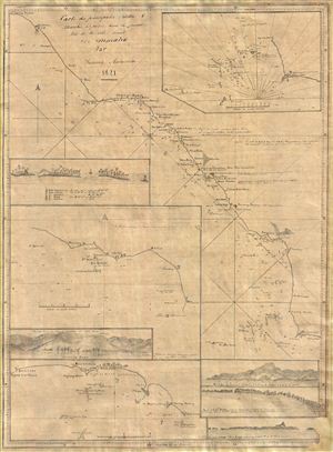
Cartes de principales Rades and Marchés à poivre dans la partie Nord de la Cote Ouest De Sumatra Par Samuel Ashmore.
sold
- Digital Map Information
- Suitable for large format printing
- DPI: 300
- File Size: 10.71 MB
- File Type: ZIP / TIFF
- ICC color profile embedded
- Delivered instantly via download link
Drawn by Australian-Irish sea captain Samuel Ashmore, this important and one of a kind 1821 manuscript (hand drawn) nautical chart or maritime map is the first accurate depiction of the pepper ports of northwestern Sumatra, modern day Aceh. The map covers the ... (more details)
One of a kind manuscript map illustrating Tongyeong, an important South Korean city and former naval fort.
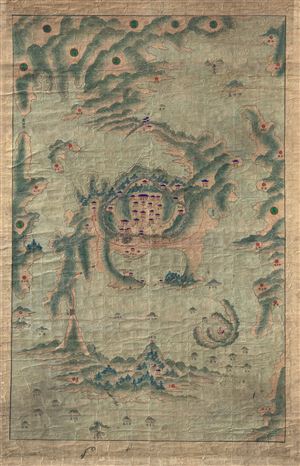
[Tongyeong]
sold
- Digital Map Information
- Suitable for large format printing
- DPI: 300
- File Size: 40.7 MB
- File Type: ZIP / TIFF
- ICC color profile embedded
- Delivered instantly via download link
A scarce early 19th century Korean map of the famous naval base at Tongyeong. The map covers the old naval base, at center, as well as many of the surrounding islands and seas. As with many East Asian maps of this period there is no defined scale. More ... (more details)
Covered wagons in the Rockies - on the overland trail.

Our-Camp 62d Pine-Grove-Creek Rocky Mountains.
sold
- Digital Map Information
- Suitable for large format printing
- File Size: 86.98 MB
- File Type: ZIP / TIFF
- ICC color profile embedded
- Delivered instantly via download link
An exceptional discovery, this is a Daniel A. Jenks' original 1859 pen-and-ink drawing depicting a camp in the Platte Valley, in the Rocky Mountains of modern-day Wyoming, composed on his overland journey to California. It is part of a series of drawings Jenks composed trail-side covering his Transmississippi travels from 1849 to 1865. This is the only known example of one of Jenks' individual drawings appearing on the market. (more details)
Comparing a Viet Cong POW and US Army analysis of Vietnam War battle.
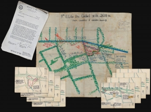
9th U.S. Inf. Div. Contact with 261. B Bn From 111255H to 120600H March 69.
sold
- Digital Map Information
- Suitable for large format printing
- Full resolution TIFF file
- ICC color profile embedded
- Delivered instantly via download link
A one-of-a-kind archive of manuscript maps accompanied by a report by Viet Cong prisoner of war, Pham Xuan Quy, and the U.S. Army 9th Infantry Division Col. Ira Hunt, to illustrate conflicting perspectives on the 1969 Vietnam War Battle of Thanh Phu, fought in the Mekong Delta southwest of Saigon. The collection consists of a large manuscript map, drawn by the Vietnamese Kot Mai, that provides an overview of the battle from start to finish, supplemented by 8 smaller manuscript maps detailing the battle's progression. The archive is significant for being a comparison of both the western and the Viet Cong perspective on the same battle - both of which are preserved in this, the Harris Report. (more details)
Exceptional early manuscript map of the Financial Center of the World - Wall Street!
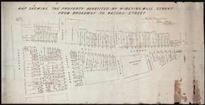
Map Shewing the Property Benefited by Widening Wall Street from Broadway to Nassau Street.
sold
- Digital Map Information
- Suitable for large format printing
- DPI: 300
- File Size: 11.96 MB
- File Type: ZIP / TIFF
- ICC color profile embedded
- Delivered instantly via download link
A unique once-in-a-lifetime discovery for the New York City collector, this is a one-of-a-kind 1851 manuscript cadastral survey map of New York City's Wall Street between Broadway and Pearl Street – including the site of the New York Stock Exchange and ... (more details)
A previously unknown early manuscript map of the early vicinity of Saigon or Ho Chi Minh City, Vietnam.
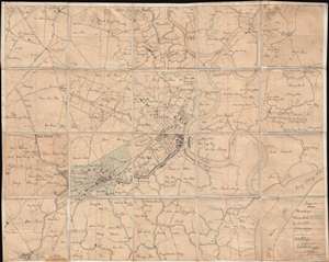
[Saigon and Cholon]
sold
- Digital Map Information
- Suitable for large format printing
- File Size: 40.34 MB
- File Type: ZIP / TIFF
- ICC color profile embedded
- Delivered instantly via download link
The finest and most detailed manuscript map yet discovered illustrating Saigon or Ho Chi Minh City, Vietnam. The map is centered on the center of Saigon City, west of the Song Sai Gon River between the Nhiêu Lộc River and the Bến Nghé River. It ... (more details)
A previously unknown manuscript map of Tokugawa era trade routes between Japan, Taiwan, and China.
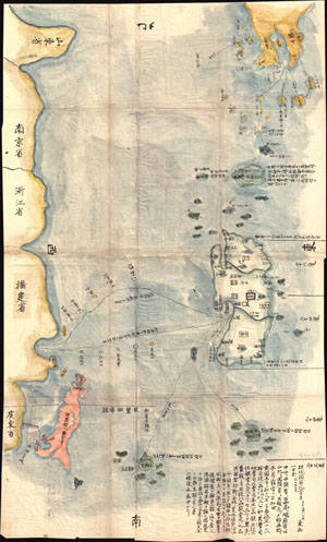
Satsuma Daimyo
sold
- Digital Map Information
- Suitable for large format printing
- DPI: 300
- File Size: 20.78 MB
- File Type: ZIP / TIFF
- ICC color profile embedded
- Delivered instantly via download link
This extraordinary discovery is a previously unknown 1781 (Temmei 1 ) manuscript map of Taiwan and the Satsuma Daimyo. This rare map covers from the southern shores of Kyushu south along the Ryukyu Islands (including Okinawa) to Taiwan and the ... (more details)
An even greater New York.
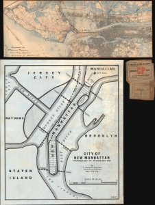
[New Manhattan] / City of New Manhattan.
sold
- Digital Map Information
- Suitable for large format printing
- Full resolution TIFF file
- ICC color profile embedded
- Delivered instantly via download link
This is a bold and futuristic 1911 - 1931 proposal to transform Manhattan with a landfill extending 8 miles into New York Harbor by T. Kennard Thomson, one of the founding fathers of American structural engineering and a pioneer of the Skyscraper Age. These two maps comprehend the first and last iteration of Kennard Thomson's 'New Manhattan': a preliminary partial manuscript plan dating to March 22, 1911 (predating the official release of the proposal in May) and the final 1930 iteration, in full manuscript. (more details)
One-of-a-Kind Manuscript of The Banda Oriental and the Captaincy of Rio Grande de São Pedro.
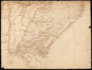
[Untitled Manuscript Map of Uruguay and the Banda Oriental.]
sold
- Digital Map Information
- Suitable for large format printing
- DPI: 600
- File Size: 33.21 MB
- File Type: ZIP / TIFF
- ICC color profile embedded
- Delivered instantly via download link
This is a meticulous c. 1753 manuscript map of the Banda Oriental, the region that became Uruguay, as well as parts of neighboring Argentina and southern Brazil. The anonymous Portuguese author likely penned the map after the 1750 Treaty of Madrid, which fixed the border between Spanish and Portuguese territory along the Uruguay River. (more details)
Manuscript of the finest map of the Bosporus in the year of the Great Istanbul Earthquake.
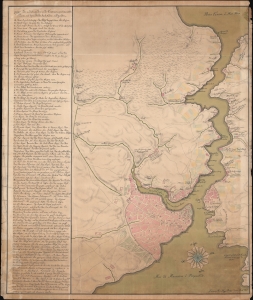
[Bosporus / Istanbul].
sold
- Digital Map Information
- Suitable for large format printing
- Full resolution TIFF file
- ICC color profile embedded
- Delivered instantly via download link
A unique 1766 manuscript map of Istanbul and the Bosporus drawn by the Slovenian surveyor and engineer Anton Mrak (1739 - 1801). This map represents the state-of-the-art mapping of the region in the year of the disastrous Great Istanbul Earthquake. The finely executed hand-drawn map is oriented loosely to the north, and covers the entirety of the Bosporus, the walled city of Istanbul, and the surrounding communities. Istanbul itself is mapped with great care, with coverage detailing the Sultanahmet, Eminoönü, Beyazit, and Fatih districts. Locations along the Bosporus are noted with detail. Curiously, the map is in Italian, but the alphanumeric key appearing along the left is in a combination of German and Ottoman Turkish. (more details)
Remarkable log book of the China Station flagship during and after the Boxer Rebellion.
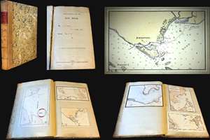
Logbook for use of Junior Officers Afloat. C. V. L. N. / Log Book. Mr. C. V. L. Norcock / H.M.S. Hannibal Glory.
sold
An exceptional and important 1900 – 1902 British naval logbook penned by Charles Vernon Lowcay Norcock (1884 - 1963), an officer in the Royal Navy, recording his experience as a Midshipman on the HMS Glory, flagship of the China Station, in the years of and immediately following the Boxer Rebellion (1899 - 1901). The full logbook covers three ships, recording the voyages of the HMS Hannibal from May to November of 1900; Norcock's subsequent service on the HMS Glory, flagship of the China Station from October of 1900 to January of 1902; and his return voyage to England on the HMS Aurora, from January to February of 1902 - thus covering Norcock's full tour of duty. The content of this volume is exceptionally rich, surpassing most other logbooks, with numerous original manuscript maps of important East Asian ports including Hong Kong, Shanghai, Singapore, Kowloon, Nagasaki, Suez, Valetta, Wusong (Shanghai), Nagasaki, and more. (more details)
Remarkable book with a railroad magnate's appended manuscript maps and annotations relating to the Battle of Gettysburg. Also, an unrecorded early printed map of the Battle of Gettysburg.
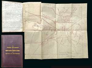
A remarkable discovery, this is a fine example of Michael Jacob's scarce 1864 book on the Confederate invasion of Pennsylvania and the Battle of Gettysburg. While the book itself is uncommon and interesting, the most exciting aspects of the piece are manuscript notes, tipped-in maps, and annotations, by railroad magnate Robert S. Hollins, describing the Battle of Gettysburg and its aftermath. Along with the usual map that accompanies this book, the present example contains additional two tipped-in maps. One a unique manuscript dated to August of 1863, making it one of the earliest known maps of the battle, drawn just days after the conflict. The other is a small but previously unknown printed map of the town and battlefield published by Andrew J. Cross, a clergyman of Baltimore. The extensive manuscript notes, by Baltimore railroad man Robert S. Hollins, describe horse thievery by New Jersey soldiers from Pennsylvania farmers shortly after the battle as well as the acquisition of the maps. (more details)
Only Known Surviving Examples of WWI 'balloonatic' Views.
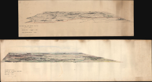
Panoramic View. La Bassee (Canal) to Loos. No 30. Balloon Section. 21:2:1917. / Panoramic View from Q 24a0.0: Lens to Vimy.
sold
- Digital Map Information
- Suitable for large format printing
- Full resolution TIFF file
- ICC color profile embedded
- Delivered instantly via download link
An extraordinary survival, this is a pair of manuscript panoramic views of part of the Western Front in northeastern France during World War I (1914 - 1918). These views were drawn by members of the Royal Naval Air Service and the Royal Flying Corps who rode in baskets beneath hydrogen-filled balloons thousands of feet above the front lines to observe enemy movements and direct artillery fire. Known as kite balloons, these were legitimate military targets, earning the 'balloonatics' had a very high mortality rate. (more details)
Enigmatic early map of China from the late 18th or early 19th centuries.
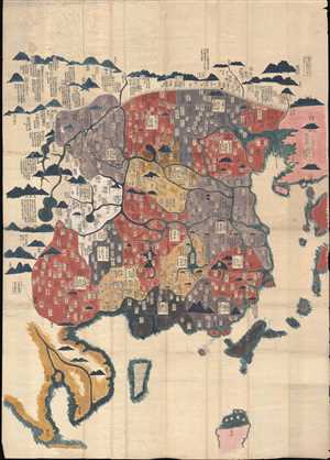
[China]
sold
- Digital Map Information
- Suitable for large format printing
- Full resolution TIFF file
- ICC color profile embedded
- Delivered instantly via download link
A very unusual an enigmatic early Chinese language grand format manuscript map of China on mulberry paper with old color. This map most likely dates from the late 18th or early 19th century and may be an Edo Era Japanese copy of an unknown ... (more details)
A hand drawn manuscript map - most likely the first accurate nautical chart of west Sumatra's Pepper Coast.
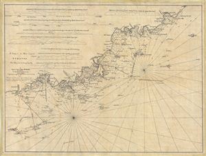
A Survey of the West Coast of Sumatra From Padang head to batang Capay Bay.
sold
- Digital Map Information
- Suitable for large format printing
- DPI: 300
- File Size: 13.45 MB
- File Type: ZIP / TIFF
- ICC color profile embedded
- Delivered instantly via download link
A remarkable discovery, this is a c. 1820 manuscript map of the western coasts of Sumatra (Indonesia) around the city of Pedang by Scottish sea captain John MacDonald. The map covers the west central Sumatra coastline from, roughly, Pedang ... (more details)
Planning Egypt's Agricultural Future.
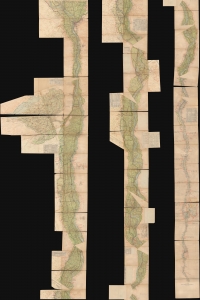
التفتيش العام ري الوجه القبلي / [General Inspection of Irrigation of Upper Egypt].
sold
- Digital Map Information
- Suitable for large format printing
- Full resolution TIFF file
- ICC color profile embedded
- Delivered instantly via download link
A unique and striking cartographic production clocking in at over 30 feet long, this 'strip map' was prepared c. 1940 to catalog irrigation works along the Nile River for most of its course through Egypt, from Cairo to Aswan. It was made by (or for) the Egyptian Ministry of Public Works, with extensive annotations suggesting 'field use.' (more details)
German Immigration to Texas - slavery content.
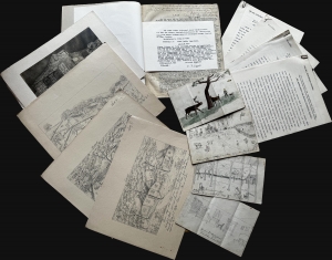
This is a unique manuscript and typescript archive covering the experiences of the German Wuppermann family's immigration to Texas from roughly 1857 to 1865. It is told from the perspective of Klara Anna Laura Tafel (née Wuppermann; 1851 - 1946), a young girl at the time of the recorded events. Work includes references to the harshness of frontier life, slavery (the Wuppermanns owned two slaves), the American Civil War, and anti-German prejudice at the hands of the Know-Nothings. (more details)
The heyday of rum production in colonial Martinique.
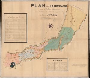
Plan de l'Htion La Montagne situèe a St. Pierre-Martinique contenant 521 hectares, 08 ares, 83 centiares, appartenant aux hèritiers Pécoul.
sold
- Digital Map Information
- Suitable for large format printing
- File Size: 247.21 MB
- File Type: ZIP / TIFF
- ICC color profile embedded
- Delivered instantly via download link
This large-scale 1886 manuscript wall map illustrates the original sugar plantation and rum refiners of the Pécoul family, the 'Habitation la Montagne', Martinique. The map illustrates the hey-day French colonial plantation culture and rum production in Martinique, before the 1902 eruption of Mount Pelée. (more details)
Resplendent primary-source manuscript illustrating the Kandahar theater fo the First Anglo-Afghan War.
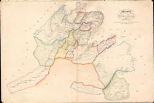
Districts of Kundahar 1840.
sold
- Digital Map Information
- Suitable for large format printing
- DPI: 600
- File Size: 26.75 MB
- File Type: ZIP / TIFF
- ICC color profile embedded
- Delivered instantly via download link
An exquisitely drafted manuscript map of the Kandahar Region, Afghanistan, during the First Anglo-Afghan War (1839 - 1942). Resplendently drafted and colored by the Indian Quartermaster General's Office (QMG), the map incorporates traditional Bengali handmade inks. During this conflict, Kandahar was the most important British base in Afghanistan, and the surrounding region was a theater of fierce and constantly evolving guerrilla war. The present map is the result of direct field mapping, completed under onerous war-footing, yet nonetheless represents one of the earliest broadly accurate maps of the Kandahar region. The map is roughly centered on the city of Kandahar and presents a stellar overview of the surrounding region, extending from Girishk and the Helmand Valley, in the west, to Qalati Giliji, in the east, covering parts of the modern Afghan provinces of Helmand, Kandahar, Uruzgan and Zabol. It is, moreover, one of very few surviving original manuscript maps from First Anglo-Afghan War, the first (not the last) major western foray into Afghanistan. (more details)
Extraordinary manuscript satirical map of Europe during World War II with Chinese Text.
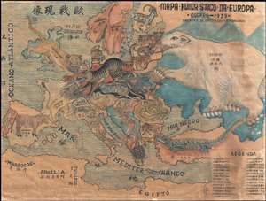
Mapa Humoristico Da Europa - Guerra - 1939 / 歐戰现像
sold
- Digital Map Information
- Suitable for large format printing
- File Size: 8.5 MB
- File Type: ZIP / TIFF
- ICC color profile embedded
- Delivered instantly via download link
An exceptional zoomorphic satirical map of Europe in 1939, here in manuscript form with all text translated into Chinese. This map is based upon a map drawn by the artist António Soares and published by Livraria Franco just weeks after ... (more details)
Pre-invasion manuscript planning map of Guadalcanal - a decisive WWII battle.
Guadalcanal Island.
sold
- Digital Map Information
- Suitable for large format printing
- Full resolution TIFF file
- ICC color profile embedded
- Delivered instantly via download link
This is a 1942 four-sheet manuscript World War II map of Guadalcanal, Solomon Islands, prepared ship-board in anticipation of the decisive August 7, 1942, landing on Guadalcanal that began the Guadalcanal Campaign. It is one of the few surviving maps from the ad hoc Marine effort to gather critical reconnaissance on Guadalcanal days before the impending invasion. It is thus unique record of one of the most decisive and pivotal battles in the World War II (1939 - 1945) Pacific Theater. (more details)
Controversial Japanese manuscript map identifying Dodko / Takeshima / Liancourt Islands as Korean territory

三国通覧輿地路程全図 / Sangoku tsūran yochi rotei zenzu. / Illustrated General Route Map of the Three Countries.
sold
- Digital Map Information
- Suitable for large format printing
- Full resolution TIFF file
- ICC color profile embedded
- Delivered instantly via download link
A banned and controversial map, this is the is the rarest and most important of the five c. 1785 maps issued by Hayashi Shihei. The map's title roughly translates to 'Illustrated General Route Map of the Three Countries.' The three ... (more details)