
Manuscript Maps
First scientific survey of the Islamic holy city of Madinah.

حرم شريف ايله سائر اماكين مباركه وعسكريه وباشلوجه اسواقى كوسترر مدينه منوره شهرينك طپوغرافياى منظمه اصوليله اخذ اولنان خريطه سيدر. / [Map of the Prophet’s Mosque (Haram Sharif) with All Sacred Places, Military Buildings and Main Squares Showing Topography of the City of Medina Al-Munawwarah with a Legend]
$85,000.00
Acquire
- Digital Map Information
- Suitable for large format printing
- File Size: 35.58 MB
- File Type: ZIP / TIFF
- ICC color profile embedded
- Delivered instantly via download link
A seminal map. This large-scale Arabic manuscript map is the first scientific survey of the Islamic holy city of Medina (المدينة المنورة / Madinah), in modern-day Saudi Arabia. The map was compiled for Abd al-Mutalib ibn Ghalib, Emir and Grand Sharif of Mecca, known for his pro-slavery anti-Ottoman positions, as well as for his modernization of infrastructure in both Mecca and Medina. (more details)
Foundational manuscript plan of colonial Saigon.
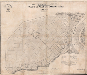
Batiments Civils Projet de Ville de 500,000 Ames Saîgon.
$35,000.00
Acquire
- Digital Map Information
- Suitable for large format printing
- File Size: 36.53 MB
- File Type: ZIP / TIFF
- ICC color profile embedded
- Delivered instantly via download link
This is Lucien Florent Paul Coffyn's 1862 manuscript masterplan of Saigon - the first and most significant map of Saigon (Ho Chi Minh City). Coffyn was the French military engineer tasked with transforming a war-torn fort into a model colonial capital. Following the 1861 French occupation of Saigon, authorities resolved to build a new city on the wartorn site at a monumental scale, reflecting boundless imperial ambition. Coffyn, driven by an unwavering belief in the colony's promise, envisioned a grand, European-style metropolis designed to accommodate half a million residents across 25 square kilometers. The present map - exquisitely drafted and signed by both Coffyn and Vice Admiral Louis Bonard, Governor of Cochinchina - is the likely original manuscript submitted for formal approval. Over the subseqeunt decades, Coffyn's street layout and placement of major sites were implemented with fidelity, though not comprehensively, marking this as the foundational document of colonial Saigon. It stands as a unique testament to French imperial planning and an unparalleled artifact of Asian colonial urbanism. (more details)
Foundational thought behind the mouse, the chorded keyboard, hyperlinks, metatagging...

The ENGELBART HYPOTHESIS: How The Co-Evolution of Human Tools and Systems Raise Collective I.Q. to Solve Urgent and Complex Problems / Timeline 1925-2010.
$25,000.00
Acquire
An expansive hand-drawn mural drawn in 2008 by Eileen Clegg and Valerie Landau in collaboration with computer science pioneer Douglas Engelbart (signed). The mural illustrates the 'Engelbart Hypothesis', a theory of human-computer co-evolution and how it evolved from roughly 1925 to 2008. It was produced in Palo Alto for the 40th university of the 'Mother of all Demos', a landmark event on December 9, 1968 in which Engelbart and the Stanford Research Institute demonstrated prototypes for the mouse, the chorded keyboard, hyperlinks, meta tagging, and more, forming the bases of modern human-computer interface (worth watching on YouTube). (more details)
Merrill's own manuscript draft of New Hampshire's first town plan.
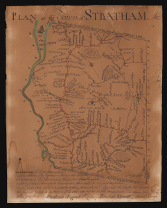
Plan of the Town of Stratham.
$25,000.00
Acquire
- Digital Map Information
- Suitable for large format printing
- File Size: 3.77 MB
- File Type: ZIP / TIFF
- ICC color profile embedded
- Delivered instantly via download link
An extraordinary discovery, this is Phinehas Merrill's 1792 original manuscript draft of his important Plan of the Town of Stratham, published a year later in 1793. Not only is this the first map of any New Hampshire town, it is a key example of early American mapmaking, comparable in many ways to Christopher Colles' 1789 Roads. Moreover, while the printed map is in and of itself significant - and rare, existing in just 12 known examples - this unprecedented example is Merrill's own working draft, drawn by his own hand and exhibiting signs of an evolving production. (more details)
Stunning 18th Century Manuscript Wall Map of Pisa.
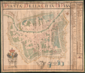
Pianta della Citta di Pisa.
$25,000.00
Acquire
- Digital Map Information
- Suitable for large format printing
- File Size: 64.13 MB
- File Type: ZIP / TIFF
- ICC color profile embedded
- Delivered instantly via download link
An incredible discovery, this large-format 1760 manuscript map of Pisa, Italy, was prepared by Ranieri Spadaccini and Ignazio Pellegrini. It provides a unique and highly detailed historical record of the city's walls, streets, Medieval religious structures, and other infrastructure in the mid to late 18th century. (more details)
Battle for the Fate of the Levant.
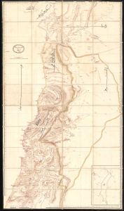
ردشمنلوا میسرت كنویامه هیرب هناخسدنهم هطیرح وبشا [This map was drawn by the Imperial Engineering Office].
$20,000.00
Acquire
- Digital Map Information
- Suitable for large format printing
- Full resolution TIFF file
- ICC color profile embedded
- Delivered instantly via download link
An extraordinary, one-of-a-kind large-format manuscript folding map of Ottoman Syria produced by the sultan's Imperial Engineering Office c. 1832. It was made in the context of the First Egyptian Ottoman War (1831 - 1833), which saw the region temporarily come under Egyptian rule. (more details)
Sardinia becomes Italian.
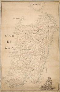
[Sardegna.]
$18,000.00
Acquire
- Digital Map Information
- Suitable for large format printing
- Full resolution TIFF file
- ICC color profile embedded
- Delivered instantly via download link
An exceptional and finely executed c. 1720 manuscript map of Sardinia (Sardegna), Italy. The map captures Sardinia as it transitioned from Spanish Habsburg to Savoyard rule following the War of the Quadruple Alliance (1718 - 1720). It was produced under the new Savoy rulers as an administrative and defensive tool to modernize the 16th-century Spanish tower system, cataloging existing towers and planning new ones. This transition marks the point when Sardinia became 'Italian'. (more details)
African-American Creoles in Britain's Atlantic Empire.
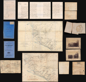
A remarkable find, this is an archive of maps, intelligence documents, and correspondence produced by the British War Office and Sir Francis de Winton relating to the 1887 Yoni Expedition in Sierra Leone, which de Winton led. This war had profound implications for the futures of freed African-American slaves settling in Freetown. The British launched this punitive military campaign against the Yoni to protect allied tribes in Sierra Leone's interior. Though a minor colonial conflict, the Yoni Expedition had wider significance as part of the 'Scramble for Africa'. Moreover, it included the British 1st West India Regiment, composed of descendants of enslaved people from Britain's North American colonies, including those who had joined the British during the American Revolution. (more details)
Oldest map of any part of Shanghai.
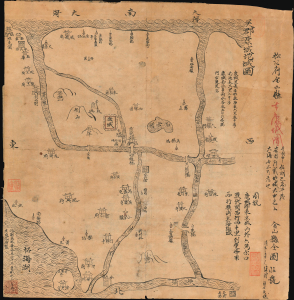
Regional map of Wujun Kangcheng. / 吳郡康城地域圖 / Full map of Jinshan County. 金山縣全圖
$12,000.00
Acquire
- Digital Map Information
- Suitable for large format printing
- File Size: 9.32 MB
- File Type: ZIP / TIFF
- ICC color profile embedded
- Delivered instantly via download link
This is an extraordinary Qing-era Chinese manuscript map by Huang Tingxi (黄廷熙) illustrating Jinshan County, today the Jinshan District of Shanghai Municipality, as it was c. 322 AD / CE. Much of the territory depicted here is underwater today, but this map nonetheless represents the earliest specific cartographic representation of the Shanghai region. (more details)
Imperial Struggle for the Manchu Homeland
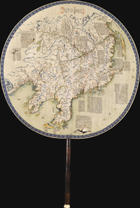
東三省俄部邊防全省圖說 / [Illustrated Description of the Russian Section of the Three Eastern Provinces for Border Defense].
$11,000.00
Acquire
- Digital Map Information
- Suitable for large format printing
- Full resolution TIFF file
- ICC color profile embedded
- Delivered instantly via download link
This is a stunning c. 1900 manuscript fan map of Manchuria prepared by a group of Qing military officers led by one surnamed Ren. Demonstrating astonishingly fine and meticulous workmanship, it covers the border region of Manchuria at a time when Qing rule of their Manchu homeland was greatly imperiled by both the Russian Empire and Imperial Japan. (more details)
Paris during the Interwar Period.
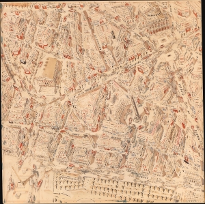
[Paris.]
$9,500.00
Acquire
- Digital Map Information
- Suitable for large format printing
- File Size: 31.49 MB
- File Type: ZIP / TIFF
- ICC color profile embedded
- Delivered instantly via download link
This vibrant, likely Joseph Pinchon, watercolor map of Paris, c. 1931-38, highlights the city's Interwar shopping, bar, theater, and café life. The artist's confident hand reveals Paris as a dynamic crucible of creativity and commerce during the luminous interval before the dark years of World War II. While the piece is unattributed, there is strong anecdotal evidence that is the work came from the Huguette Marcelle Clark (1906 - 2011) collection and is by one of the major French artists she patronized: Joseph Porphyre Pinchon (1871 - 1953), Jean Mercier, or Chéri Hérouard, Pinchon being the most likely candidate. (more details)
Two significant rarities - Saigon and Shanghai - back to back.
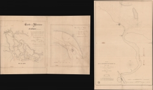
Carte de la Rivière de Saigon (Cochinchine). / Plan du Band de Corail (rivière de Saigon). / Plan de al Rivière de Woosung Levé en 1842 Par les Capitaines H. Kellet and R. Collinson, de la Marine Anglaise.
$7,500.00
Acquire
- Digital Map Information
- Suitable for large format printing
- Full resolution TIFF file
- ICC color profile embedded
- Delivered instantly via download link
This is a remarkable set of back-to-back maps - both are significant in different ways. The most interesting is a finely-executed c. 1860 manuscript chart detailing river approaches to Saigon (Ho Chi Min City). On the verso (or recto, depending) is an 1850 printed nautical chart of the approaches to Shanghai based on the cartography of the First Opium War (1839 - 1842). Both maps are significant, with the manuscript taking primacy as, in all likelihood, it is the first modern hydrographic survey of the Song Sai Gon Estuary. (more details)
Address book with White Star Lines and Titanic content.
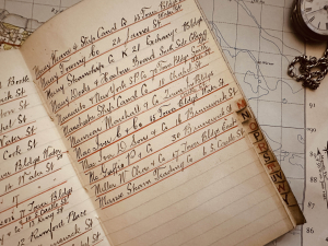
This is a fascinating c. 1910 manuscript address book with significant White Star Lines and Titanic associations. The address book was compiled by someone with deep connections to the U.K. and specifically the Liverpool shipping industry.The book contains 177 neatly written names and addresses, 113 of which are in Liverpool in the vicinity of White Star Lines offices (1864 - 1897). While the owner and compiler of the book is unknown, the author was undoubtedly active in shipping or shipbuilding circles in Liverpool between about 1840 and 1910. (more details)
Unique record of D-Day.
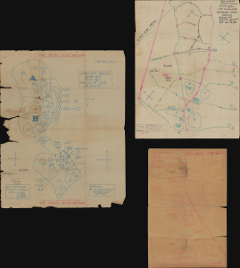
Operations Overlay. Annex No. 1 to F.O. No. 1. HQ-357th Inf. 28 May 1944. / ADM. OVERLAY. France 1:25000 GSGS-4250. NEPTUNE ANNEX#2 TO FO#1 HQ 357th INF, May 28, 1944. / Annex 3a. Overlay to Accompany Intelligence Annex to FO #1 HQ 357th INF. 28 May 1944.
$6,000.00
Acquire
This is a collection of three 1944 World War II manuscript map overlays created nine days before the D-Day invasion in Normandy (May 28, 1944), all of which bear the classification BIGOT - TOP SECRET. All three were drawn for the 357th Infantry Regiment, which landed on Utah Beach on June 8, 1944, two days after D-Day. The overlays provide insight into how infantry soldiers prepared and the details these men valued enough to carry into the field. These overlays were found sewn into the collar of a uniform jacket a soldier received in the field. (more details)
First view of Georgetown, Malaya, center of the Spice Trade. Manuscript.
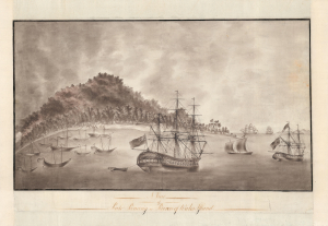
A View of Pulo Pinang or Prince of Wales Island.
$6,000.00
Acquire
- Digital Map Information
- Suitable for large format printing
- DPI: 600
- File Size: 27.08 MB
- File Type: ZIP / TIFF
- ICC color profile embedded
- Delivered instantly via download link
A remarkable, finely executed manuscript view of Georgetown, Penang Island (modern-day Malaysia), drawn in 1788, just 2 years after that colony's founding. This is most likely the earliest surviving image of Georgetown, the first British settlement in Southeast Asia and, by the early 19th century, the center of the spice trade and the epicenter of British power in Southeast Asia. (more details)
'As for the Subways,' Dr. Thomson wrote, 'they should never have been built'.
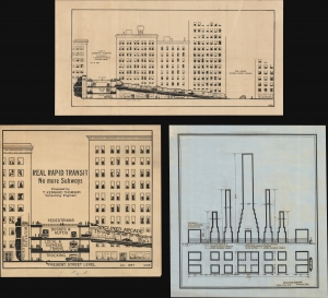
Real Rapid Transit No More Subways. / Plan to Eliminate Subways.
$5,500.00
Acquire
- Digital Map Information
- Suitable for large format printing
- Full resolution TIFF file
- ICC color profile embedded
- Delivered instantly via download link
These are the original 1927-1931 manuscript illustrations for T. Kennard Thomson's No More Subways initiative, intended to solve New York City's out-of-control traffic congestion. In line with the car-centric ideologies of Robert Moses (1888 - 1981), Thomson's plan called for the replacement of subways with segregated tiered roads, railroad tracks, and highways along New York's major avenues. (more details)
Manuscript record of the voyage that nearly transformed the American Civil War into a global conflict.
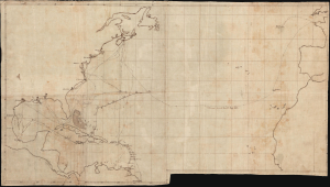
[Voyage of the HMS Rinaldo, 1861-1863]
$5,000.00
Acquire
- Digital Map Information
- Suitable for large format printing
- Full resolution TIFF file
- ICC color profile embedded
- Delivered instantly via download link
A unique c. 1863 manuscript map documenting one of the most consequential British naval voyages of the early American Civil War (1861 - 1865): the 1861-63 Atlantic cruise of HMS Rinaldo. Operating along the North American and West Indian Station, the British warship visited Union and Confederate ports, protected British commercial and diplomatic interests, and carried the released Confederate commissioners James Murray Mason and John Slidell- central figures in the Trent Affair - from Provincetown, Massachusetts, to St. Thomas in the Danish West Indies. This manuscript unites two important episodes in Anglo-American Civil War diplomacy: the resolution of the Trent Affair and the confrontation between General Butler and British acting consul George Coppell. (more details)
Great New Orleans Fire of 1788.
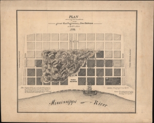
Plan showing the boundaries of the great Conflagration of New Orleans on the 21st of March 1788.
$4,500.00
Acquire
- Digital Map Information
- Suitable for large format printing
- File Size: 409.88 MB
- File Type: ZIP / TIFF
- ICC color profile embedded
- Delivered instantly via download link
This is a dramatic original c. 1880 manuscript map of 1788 Great Fire of New Orleans drafted by eccentric German-American civil engineer Baron Ludwig von Reizenstein for later publication in George E. Waring Jr.'s influential History and Present Condition of New Orleans, Louisiana, and Report on the City of Austin, Texas published in 1881. It records the 1788 Great Fire, one of the most destructive disasters to befall 18th-century New Orleans. The report, survey, and map were significant in influencing late 19th-century efforts at New Orleans fire control. (more details)
Hellish Property Dispute at Hell Gate.
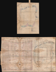
Map of Wards Island / Plan No. 3 of Partition of Waterrights at Ward's Island.
$4,000.00
Acquire
- Digital Map Information
- Suitable for large format printing
- Full resolution TIFF file
- ICC color profile embedded
- Delivered instantly via download link
This is a unique c. 1870 manuscript map and appraisal of property values on and around Wards Island (now part of Randalls and Wards Islands) in New York City prepared by surveyor Rudolph Rosa. It refers to an intense and consequential legal dispute over ownership of waters immediately surrounding the island, which at this time was primarily dedicated to hospitals and other institutions for people with physical and mental health problems. (more details)
Pimlico's social geography at the outset of WWII.
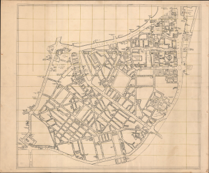
[Pimlico, London.]
$3,500.00
Acquire
- Digital Map Information
- Suitable for large format printing
- Full resolution TIFF file
- ICC color profile embedded
- Delivered instantly via download link
This is an exceptional c. 1939 manuscript map of Pimlico, London, capturing the social geography of wartime London just before the Blitz, German aerial bombing campaign against London and the rest of the United Kingdom. Uniquely, rather than emphasizing civil defense, it meticulously identifies the pubs, clubs, theaters, and nightlife that sustained morale in the shadow of grim war. The map's remarkable precision, suggestive of a military hand, leads us to believe it was prepared as a recreation guide for soldiers on leave, preserving a vibrant urban landscape that would soon be devastated during the Blitz of 1940-1941. (more details)
Lavishly illustrated manuscirpt journal.
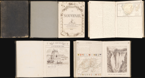
Le Souvenir. Voyages, Excursions, Histoire, Anecdotes, Descriptions, Promenades, Etc., Etc...
$3,500.00
Acquire
This is a 1860 French-language manuscript journal Le Souvenir written by F. G. Ch. Picard, likely of Geneva. Composed in Picard's clean hand and academic French, the work reads like an encyclopedia, covering a rambling range of topics from whaling to the cultures of Africa to the Chinese military, Daniel Boone, and ballooning. The work is rich with 26 masterfully drawn illustrations and 6 maps. (more details)
Some of the Most Expensive Real Estate in New York City.
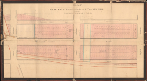
Map of Real Estate in the 12th Ward of the City of New York Belonging to Jacob Harsen, M.D.
$3,500.00
Acquire
- Digital Map Information
- Suitable for large format printing
- DPI: 600
- File Size: 60.42 MB
- File Type: ZIP / TIFF
- ICC color profile embedded
- Delivered instantly via download link
This is an 1848 John J. Serrell large-format manuscript plat map of a portion of the Upper West Side of Manhattan between 71st and 73rd Streets. Among other features, the map demonstrates the degree to which Manhattan's familiar grid pattern was misaligned with earlier properties in this portion of the island. (more details)
Large, Beautifully Executed Schoolgirl Map.
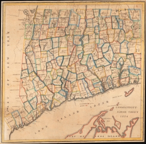
Connecticut Exene Tobey 1854.
$3,500.00
Acquire
- Digital Map Information
- Suitable for large format printing
- File Size: 26.2 MB
- File Type: ZIP / TIFF
- ICC color profile embedded
- Delivered instantly via download link
This is an attractive 1854 schoolgirl manuscript map of Connecticut drawn by 13-year-old Exene E. Tobey of New Canaan. (more details)
New York City's grid swallows up The Parade.
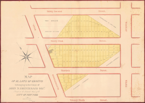
Map of 92 Lots of Ground belonging to the Estate of John N. Grenzebach Desd. Situate in the Sixteenth War of the City of New York.
$3,000.00
Acquire
- Digital Map Information
- Suitable for large format printing
- Full resolution TIFF file
- ICC color profile embedded
- Delivered instantly via download link
This is a finely executed 1838 Daniel Ewen manuscript map capturing the early evolution of NoMad and Koreatown, Manhattan, New York City. Today, this area is one of the most vibrant parts of New York, known for its bustling Koreatown and sleek restaurants. When this map was drawn, these properties were in the process of being broken out of the John Nicholas Grenzebach estate and lotted for sale. (more details)
Foundations of flood control in New Orleans - original manuscript draft.
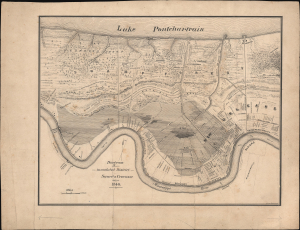
Diagram showing the inundated District Sauvé's Crevasse May 3rd 1849.
$3,000.00
Acquire
- Digital Map Information
- Suitable for large format printing
- Full resolution TIFF file
- ICC color profile embedded
- Delivered instantly via download link
This is an exceptional original c. 1880 manuscript map of New Orleans drafted by eccentric German-American civil engineer Baron Ludwig von Reizenstein for later publication in George E. Waring Jr.'s influential Report on the Social Statistics of Cities. It records the 1849 Sauvé Crevasse Flood, one of the most destructive natural disasters to befall 19th-century New Orleans. The report, survey, and map were significant in influencing late 19th-century efforts at New Orleans flood control. Unlike his other maps of New Orleans events, which were based on historical sources, Reizenstein likely witnessed this flood in person. (more details)
New York Builds to its Limits, Before Removing Its Limits.
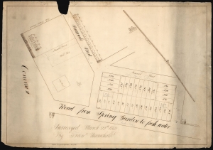
(On Verso) Land on Chatham Street Surveyed by Fran. Maerschalk 1757.
$3,000.00
Acquire
- Digital Map Information
- Suitable for large format printing
- DPI: 600
- File Size: 48.56 MB
- File Type: ZIP / TIFF
- ICC color profile embedded
- Delivered instantly via download link
This is an early 19th-century manuscript map of the City Hall Park area, New York City. It is an early 19th-century copy of a 1759 survey by Francis Maerschalk detailing the future City Hall Park and the area directly to the southeast. The survey fits into a gap in the mapping of the city between the 1755 Maerschalk plan and the 1760s plans of Montresor and Ratzer. (more details)
Providing historical context.
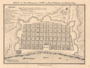
Plan of New Orleans in 1770, by Capt. Pittman of the British Army.
$3,000.00
Acquire
- Digital Map Information
- Suitable for large format printing
- File Size: 5.81 MB
- File Type: ZIP / TIFF
- ICC color profile embedded
- Delivered instantly via download link
This is an exceptional original c. 1880 manuscript draft map of New Orleans in 1770 drafted by eccentric German-American civil engineer Baron Ludwig von Reizenstein for later publication in George E. Waring Jr.'s influential 1881 History and Present Condition of New Orleans, Louisiana, and Report on the City of Austin, Texas. (more details)
Environmental Movement - Earth Day.
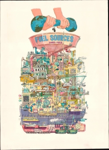
This is the c. 1970 original art for Darrel Millsap's unpublished illustration of the global fossil fuel industry. The image is a harsh criticism of global waste and energy consumption, issued at the beginning of the U.S. environmentalism movement, most likely associated with the 1970 launch of Earth Day. (more details)
Layers of History and Cartography.
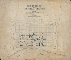
Plan et project de la Nouvelle Orleans.
$2,800.00
Acquire
- Digital Map Information
- Suitable for large format printing
- File Size: 15.18 MB
- File Type: ZIP / TIFF
- ICC color profile embedded
- Delivered instantly via download link
This is a remarkable c. 1880 manuscript map of New Orleans, drafted by eccentric German-American civil engineer Baron Ludwig von Reizenstein for later publication in George E. Waring Jr.'s influential 1881 History and Present Condition of New Orleans, Louisiana, and Report on the City of Austin, Texas. It is based on an earlier map dated 1763, though it more directly reflects the state of the city in the 1720s. (more details)
Revisiting New Orleans from 1798.
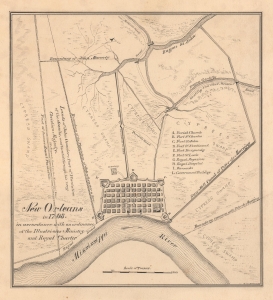
New Orleans in 1798, in accordance with an ordinance of the Illustrious Ministry and Royal Charter.
$2,800.00
Acquire
- Digital Map Information
- Suitable for large format printing
- Full resolution TIFF file
- ICC color profile embedded
- Delivered instantly via download link
This is an exceptional original c. 1880 manuscript draft map of New Orleans in 1798 drafted by eccentric German-American civil engineer Baron Ludwig von Reizenstein for later publication in George E. Waring Jr.'s influential 1881 History and Present Condition of New Orleans, Louisiana, and Report on the City of Austin, Texas. (more details)
Earliest map of Tribeca?
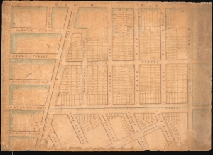
Map of Part of the Estate belonging to the Heirs of Anty Lispenard Decd. Situate to the South Ward of Canal Street New York.
$2,750.00
Acquire
- Digital Map Information
- Suitable for large format printing
- DPI: 600
- File Size: 70.94 MB
- File Type: ZIP / TIFF
- ICC color profile embedded
- Delivered instantly via download link
This unique c. 1801 manuscript map is likely the earliest to specifically illustrate modern-day Tribeca, New York City. The survey dates to 1801, but this manuscript copy was likely drawn around 1808-1809 when the author Amos Corning held the office of City Surveyor. It details lands owned by Anthony Lispenard Bleecker (1741 - 1816), here subdivided into properties, on some of which landholders are identified. (more details)
From memory...
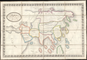
Asie Faite de Mémoire par Alexandrine Beaucousiu.
$2,500.00
Acquire
- Digital Map Information
- Suitable for large format printing
- Full resolution TIFF file
- ICC color profile embedded
- Delivered instantly via download link
An exceptionally well-executed 1832 French pen and ink schoolgirl map of Asia by Alexandrine Breaucousiu. Significantly, Breaucousiu drew the map from memory, which may account for the loose interpretation of geographical forms, but which at the same time exhibits a remarkable flair for geographic sketching (we tried this ourselves and could not produce a finer map). Moreover, individual countries and regions are filled with finely curving descriptive French script. (more details)