
Buache, Phillipe (sold)
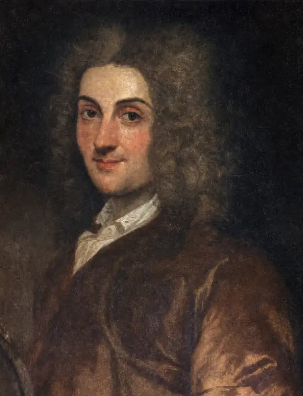
Phillipe Buache (February 7, 1700 - January 24, 1773) was a late 18th-century French cartographer and map publisher. Buache began his cartographic career as the workshop assistant and apprentice to the important and prolific cartographer Guillaume de L'Isle (1685 - 1726). Upon De L'Isle's untimely death, Buache took over the publishing firm, cementing the relationship by marrying De L'Isle's daughter. Over the years, Buache republished many of De L'Isle's maps and charts. Buache was eventually appointed Premier Geographe du Roi, a position created for and previously held by Guillaume de L'Isle. Buache is most respected for introducing hachuring as a method for displaying underwater elevation on a two-dimensional map surface. Buache compiled maps based upon geographic knowledge, scholarly research, the journals of contemporary explorers and missionaries, and direct astronomical observation. Nevertheless, even in 18th-century Paris, geographical knowledge was severely limited - especially regarding those unexplored portions of the world, including the poles, the Pacific northwest of America, and the interior of Africa and South America. In these areas, Buache, like his primary rival Robert de Vaugondy (fl. c. 1716 - 1786), must be considered a speculative geographer or 'positive geographer'. Speculative geography was a genre of mapmaking that evolved in Europe, particularly Paris, in the middle to late 18th century. Cartographers in this genre filled in unknown areas on their maps with speculations based on their vast knowledge of cartography, personal geographical theories, and often dubious primary source material gathered by explorers and navigators. This approach, which attempted to use the known to validate the unknown, naturally engendered many rivalries. Buache's feuds with other cartographers, most specifically Didier Robert De Vaugondy, resulted in numerous conflicting papers being presented before the Académie des Sciences, of which both were members. The era of speculative cartography effectively ended with the late 18th-century explorations of Captain Cook, Jean-François de Galaup de La Perouse, and George Vancouver. Buache was succeeded by his nephew Jean-Nicholas Buache de Neuville (1741 - 1825).
The beginning of the Greek struggle for independence.
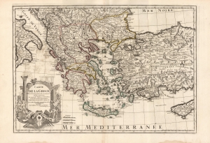
Carte De La Grece...
sold
- Digital Map Information
- Suitable for large format printing
- DPI: 600
- File Size: 86.2 MB
- File Type: ZIP / TIFF
- ICC color profile embedded
- Delivered instantly via download link
This is the 1745 Buache edition of Guillaume De l'Isle's 1707 map of Greece and the western part of Turkey. It presents the region at the beginning of a period of Greek revolts against Ottoman rule. (more details)
Beautiful early map of Southern India.
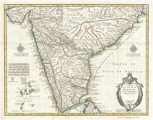
Carte des Cotes de Malabar et de Coromandel.
sold
- Digital Map Information
- Suitable for large format printing
- DPI: 300
- File Size: 13.67 MB
- File Type: ZIP / TIFF
- ICC color profile embedded
- Delivered instantly via download link
This is a beautiful 1745 map of southern India by Guillaume Delisle and Philippe Buache. The map covers southern India and the Malabar Coast from the Gulf of Kutch south to Cape Comorin and the northern half of Sri Lanka. The Lakshadweep Islands are included. ... (more details)
1st geological map of the United States.
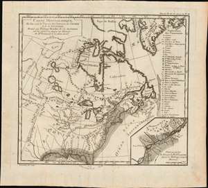
Carte minéralogique, où l'on voit la Nature des Terreins du Canada et de la Louisiane.
sold
- Digital Map Information
- Suitable for large format printing
- Full resolution TIFF file
- ICC color profile embedded
- Delivered instantly via download link
An object of considerable rarity and significance, this is the first geological map of the United States, drawn by Philippe Buache and published in 1752 by Jean-Étienne Guettard. The map covers the eastern part of the modern-day United States and Canada from the Rio del Norte (Rio Grande) and the apocryphal 'Mer de L'Ouest' (Sea of the West) to the Atlantic seaboard, Greenland, and the Grand Banks. The map was part of Guettard's curious presentation issued at the Paris Académie Royale des Sciences comparing the geography of North America to the geography of Switzerland. The report also contained, therefore, the first geological map of Switzerland. (more details)
Innovative, if incorrect, theories about the world's mountain ranges.
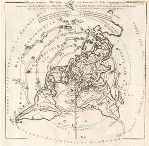
Planisphere Physique où l'on voit du Pole Septentrional ce que l'on connoit de Terres et de Mers; Avec les Grandes Chaînes de Montagnes qui traversent le Globe.
sold
- Digital Map Information
- Suitable for large format printing
- Full resolution TIFF file
- ICC color profile embedded
- Delivered instantly via download link
This is a beautiful 1752 Philippe Buache map of the world represented on an unusual polar projection rendered from the North Pole. The map covers from the North Pole Arctic region south beyond Tasmania (Van Diemen's Land) to include parts of New Zealand and even Cap de la Circoncision (Bouvet Island). (more details)
A foundational map and the single most influential map of the the Pacific Northwest issued in the middle of the 18th Century.
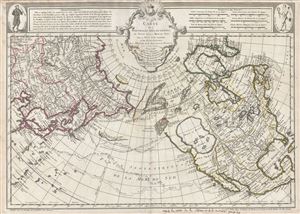
Carte Des Nouvelles Decouvertes au Nord de la Mer de Sud, tant a l'Est de la Syberie et du Kamtchatka, qu'a L'Ouest de la Nouvelle France.
sold
- Digital Map Information
- Suitable for large format printing
- DPI: 300
- File Size: 17.62 MB
- File Type: ZIP / TIFF
- ICC color profile embedded
- Delivered instantly via download link
Rare first edition of Joseph Nicolas De l'Isle's extraordinary 1752 map of North America, Siberia, the Arctic, and the North Pacific. J. N. De L'Isle and Buache drew this map to illustrate their speculations on the feasibly of a Northwest Passage. ... (more details)
Extremely rare, highly influential, and very important foundational map of the North Pacific showing Sea of the West and the apocryphal discoveries of Admiral de Fonte.
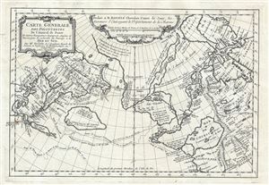
Carte General Des Decouvertes De L'Amiral de Fonte Et autres Navigateurs Espagnols, Anglois, et Russes, pour la recherche du Passage a la Mer du Sud.
sold
- Digital Map Information
- Suitable for large format printing
- DPI: 300
- File Size: 6.51 MB
- File Type: ZIP / TIFF
- ICC color profile embedded
- Delivered instantly via download link
An object of extreme historical importance and rarity, this map was the center of one of the most heated cartographic debates in history. This is an unrecorded state of Joseph-Nicolas de L'Isle's (Delisle) map of the Northern Pacific Ocean and ... (more details)
Thorough, early defense of the Sea of the West and the Northwest Passage.
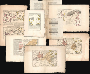
Exposé des Découvertes au Nord de la Grande Mer...
sold
- Digital Map Information
- Suitable for large format printing
- Full resolution TIFF file
- ICC color profile embedded
- Delivered instantly via download link
This is an extremely rare example of Philippe Buache's 1753 Exposé des Découvertes au Nord de la Grande Mer, the essential maps published to support the astonishing geographical theories of Philippe Buache and Joseph Nicolas De l'Isle, presented in August 1752 to the Paris Academie des Sciences. It was then the most complete cartographical defense of Nicolas De l'Isle's 'exposé' of Russian cartographic advances, along with Buache's synthesis of several mappings of the Pacific Northwest, revealing compelling (if ultimately false) evidence of a viable Northwest Passage. These maps were later included in the 1753-1755 Considérations Géographiques, 'the magnum opus of the Delisle-Buache theory of the layout of lands in the North Pacific space,' (Lada-Mocarski, 1969) appearing there in their second states. These six sheets are all first state examples, indicating that the Exposé enjoyed an earlier publication, spurred perhaps by the novelty of Buache and De l'Isle's arguments and the urgency with which the two geographers wished to assuage and rebut critics of their presentation to the Academie. (more details)
Auchagah Map, a unique synthesis of American Indian and European cartography.
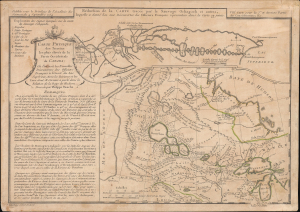
Réduction de la Carte tracée par le Sauvage Ochagach et autres. / Carte Physique des Terreins les plus eleves de la Partie Occidentale du Canada.
sold
- Digital Map Information
- Suitable for large format printing
- Full resolution TIFF file
- ICC color profile embedded
- Delivered instantly via download link
This is Philipe Buache's c. 1754 dual map of inland water routes west of Lake Superior extending, ostensibly, to the Pacific. It is an important and intellectually complex juxtaposition of two radically divergent cartographic conceptions of the North American interior: American Indian (Cree) geographic knowledge (known as the Auchagah Map) and Philippe Buache's speculative synthesis of French exploration, hydrographic theory, and the elusive dream of a navigable route to the Pacific. Within a decade of this map's issue, the route revealed here between Lake Superior and Winnipeg became the primary artery of the Canadian fur trade. (more details)
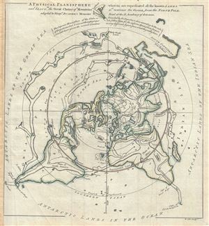
A Physical Planisphere wherein are represented all the known Lands and Seas, w.th the Great Chains of Mountains w.ch traverse the Globe from the North Pole.
sold
- Digital Map Information
- Suitable for large format printing
- Full resolution TIFF file
- ICC color profile embedded
- Delivered instantly via download link
This is a beautiful 1757 Philippe Buache map of the world represented on an unusual polar projection rendered from the North Pole. The map covers from the North Pole Arctic region south beyond Tasmania (Van Diemen's Land) to include parts of ... (more details)
Spanish commentary on the Sea of the West.
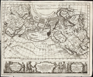
Mapa de la America Septentl. Asia Oriental y Mar Del Sur Intermedio Formado sobre las Memorias mas recientes y exactas hasta el año de 1754.
sold
- Digital Map Information
- Suitable for large format printing
- File Size: 9.44 MB
- File Type: ZIP / TIFF
- ICC color profile embedded
- Delivered instantly via download link
This is a rare 1757 Madrid edition of Joseph Nicolas De l'Isle and Philippe Buache's 1752 map of North America, Siberia, the Arctic, and the North Pacific. The map presents De L'Isle's accurate mapping of the Asian northeast alongside Buache's fabricated Northwest Passage. This unusual Spanish edition of the map was issued to illustrate an unambiguous argument by the editor attacking the credibility of the map and the reports upon which it was founded. (more details)
A monument to speculative cartography showing the Sea of the West and mythical discoveries of De Fonte.
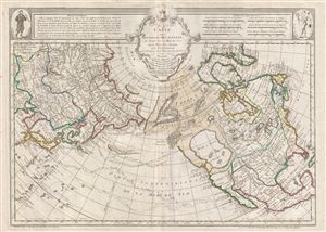
Carte Des Nouvelles Decouvertes au Nord de la Mer de Sud, tant a l'Est de la Syberie et du Kamtchatka, qu'a L'Ouest de la Nouvelle France.
sold
- Digital Map Information
- Suitable for large format printing
- DPI: 300
- File Size: 20.31 MB
- File Type: ZIP / TIFF
- ICC color profile embedded
- Delivered instantly via download link
The 1789 Dezauche edition of Joseph Nicolas De l'Isle's extraordinary 1752 map of North America, Siberia, the Arctic, and the North Pacific. J. N. De L'Isle and Buache drew this map to illustrate their speculations on the feasibly of a ... (more details)
Buache's fantastic speculative mapping of the undiscovered Antarctic continent.
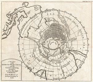
Chart of the Antarctic Polar Circle, with the Countries Adjoining, According to the New Hypothesis of M. Buache. From the Memoirs of the Royal Academy at Paris.
sold
- Digital Map Information
- Suitable for large format printing
- Full resolution TIFF file
- ICC color profile embedded
- Delivered instantly via download link
This is an unusual and highly speculative map of the southern Polar Regions (Antarctic) drawn in 1763 by the scientific geographer M. Buache. A subtle and unusual map that yields more fascinating discoveries the longer one studies it, ... (more details)
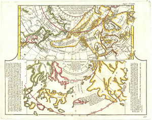
Carte Des Nouvelles Decouvertes dressee par Phil. Bauche Pr. Geograp? Du Roi presentee a l'Adad? Des Sciences le g Aout 1762 et approuvee dans son assemblee du 6 Septembre suivant. / Extrait d'une Carte Japonoise de L'Univers apportee en Europe par Kaempser et deposee dans le cabinet de seu Mr. Han-Sloane president de la Soceity Royale de Londres.
sold
- Digital Map Information
- Suitable for large format printing
- DPI: 300
- File Size: 6.48 MB
- File Type: ZIP / TIFF
- ICC color profile embedded
- Delivered instantly via download link
This is a fascinating combination of two contrasting maps on a single sheet. Both maps cover the northeastern parts of Asia and the northwestern parts of North America. This two map chart was originally drawn by Phillip Buache to ... (more details)
Dreams of a Northwest Passage and the Sea of the West.
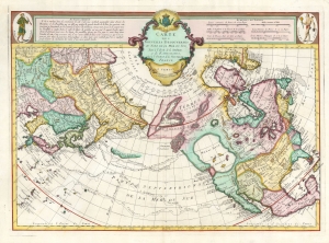
Carte Des Nouvelles Decouvertes au Nord de la Mer de Sud, tant a l'Est de la Syberie et du Kamtchatka, qu'a L'Ouest de la Nouvelle France.
sold
- Digital Map Information
- Suitable for large format printing
- Full resolution TIFF file
- ICC color profile embedded
- Delivered instantly via download link
This is the Buache / De l'Isle map of North America, Siberia, the Arctic, and the North Pacific in its 1776 Venice edition published by Francois Santini. Joseph Nicolas De l'Isle's and Philippe Buache drew this map to illustrate their speculations on the feasibly of a Northwest Passage. Cartographically, this map is derived from data secreted from the Russian 'Academy of Sciences' combined with Buache's own speculations on the Northwest Passage. This map is highly significant for its revival of the 'Sea of the West' hypothesis. This is a landmark map and perhaps the single most influential map of the region issued in the mid-18th century. (more details)
French invasion of Dominica during the American Revolutionary War.
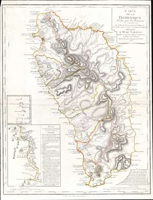
Carte de la Dominique Prise par les Francois Le 7 septembre 1778...
sold
- Digital Map Information
- Suitable for large format printing
- DPI: 600
- File Size: 22.83 MB
- File Type: ZIP / TIFF
- ICC color profile embedded
- Delivered instantly via download link
This is a 1778 Phillipe Buache map of Dominica. An inset situated on the lower left details the September 7, 1778, French invasion of the island, complete with illustrations of the French fleet and British defenses. The large central map depicts the entire island, illustrating the island's coastline and labeling bays, points, and other coastal features. The two largest settlements, Le Roseau (the colonial capital) and Portsmouth are both labeled, along with several smaller villages. Rivers snake their way from the island's central mountains to the ocean, and a handful of roads make their way across the island. (more details)
Rare French map detailing the Golden Age of Caribbean Piracy.
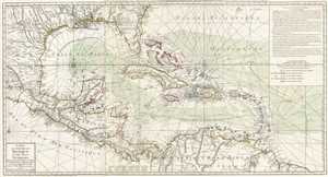
Carte du Golphe du Mexique et des Isles Antilles.
sold
- Digital Map Information
- Suitable for large format printing
- DPI: 300
- File Size: 17.7 MB
- File Type: ZIP / TIFF
- ICC color profile embedded
- Delivered instantly via download link
A fine example of the 1780 Dezauche edition of Buache's important map of the West Indies. Centered on Cuba, this massive map covers Central America, the Gulf of Mexico, the West Indies, and the Caribbean from Mexico and Texas to the Lesser Antilles and from Florida to the Spanish Main. Cartographically, Buache derived this map from Henry Popple's remarkable 1733 map of North America. As a whole it exhibits numerous significant advances over the earlier Buache / De L'Isle model of the region. These include a more sophisticated mapping of peninsular Florida, the Gulf Coast, and the interior of Texas, Florida, and Mexico. The Mission de Los Teijas, one of the first usages of the word 'Texas' on a published map, is noted. Rumb lines are evident throughout, suggesting this map was also based on sea chart sources. (more details)
Rare French map detailing the Golden Age of Caribbean Piracy.
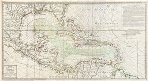
Carte du Golphe du Mexique et des isles Antilles.
sold
- Digital Map Information
- Suitable for large format printing
- DPI: 300
- File Size: 30.45 MB
- File Type: ZIP / TIFF
- ICC color profile embedded
- Delivered instantly via download link
A fine example of the 1780 Dezauche edition of Buache's important map of the West Indies. Centered on Cuba, this massive map covers Central America, the Gulf of Mexico, the West Indies, and the Caribbean from Mexico and Texas to ... (more details)
A remarkable Pre-Cook polar projection showing the Arctic and the Sea of the West.
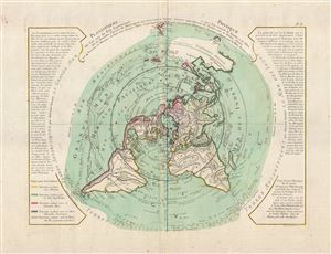
Planisphere Physique.
sold
- Digital Map Information
- Suitable for large format printing
- DPI: 300
- File Size: 12.32 MB
- File Type: ZIP / TIFF
- ICC color profile embedded
- Delivered instantly via download link
An exceptionally bright and beautiful c. 1781 Philippe Buache map of the world presented on an unusual polar projection rendered from the North Pole. The map covers from the North Pole Arctic region south beyond Tasmania (Van ... (more details)
A remarkable Pre-Cook polar projection showing the Arctic and the Sea of the West.
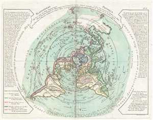
Planisphere Physique.
sold
- Digital Map Information
- Suitable for large format printing
- DPI: 300
- File Size: 7.47 MB
- File Type: ZIP / TIFF
- ICC color profile embedded
- Delivered instantly via download link
An exceptionally bright and beautiful c. 1781 Philippe Buache map of the world presented on an unusual polar projection rendered from the North Pole. The map depicts the world from the North Pole Arctic region south beyond ... (more details)
The first edition of this important map to illustrate all three of Cook's seminal voyages.
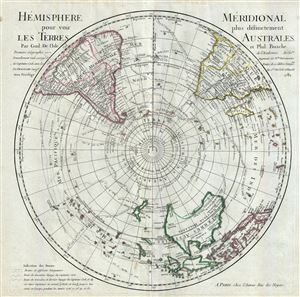
L'Hemisphere Meridional pour voir plus distinctement Les Terres Australes.
sold
- Digital Map Information
- Suitable for large format printing
- DPI: 300
- File Size: 14.89 MB
- File Type: ZIP / TIFF
- ICC color profile embedded
- Delivered instantly via download link
This is a stunning map of the Southern Hemisphere drawn by Guillaume de L'Isle and updated in 1782 by Jean-Claude Dezauche. Extends from the South Pole northwards in all directions as far as the Equator, encompassing in ... (more details)
A foundational map and the first to name 'Texas'.

Carte De La Louisiane Et Du Cours Du Mississipi Avec Les Colonies Anglaises.
sold
- Digital Map Information
- Suitable for large format printing
- DPI: 300
- File Size: 22.82 MB
- File Type: ZIP / TIFF
- ICC color profile embedded
- Delivered instantly via download link
A foundational map and one of the most important illustrations of North America ever published, this the 1782 Dezauche edition Guillaume De L'Isle's influential Carte de la Louisiane et du Cours du Mississipi . ... (more details)
Beautifully illustrates the intriguing discoveries of the Baron Lahonton.
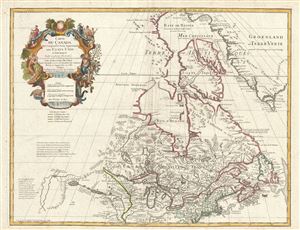
Carte du Canada Qui Comprend la Partie Septentrionale des Etats Unis D'Amerique.
sold
- Digital Map Information
- Suitable for large format printing
- DPI: 300
- File Size: 20 MB
- File Type: ZIP / TIFF
- ICC color profile embedded
- Delivered instantly via download link
This is the 1783 Dezauche issue of Phillipe Buache and Guillaume D L'Isle's important map of northern North America. The map covers the United States north of the Chesapeake and Canada or New France. De L'Isle ... (more details)
The only edition of this landmark map to include the United States.
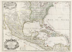
Carte du Mexique et des Etats unis d'Amerique, Partie Meridionale.
sold
- Digital Map Information
- Suitable for large format printing
- DPI: 300
- File Size: 20.63 MB
- File Type: ZIP / TIFF
- ICC color profile embedded
- Delivered instantly via download link
This is the 1783 Dezauche issue of Phillipe Buache and Guillaume D L'Isle's important map of North America and the West Indies. The map covers the United States, Mexico, New Mexico, Central America and the West ... (more details)
First of this series to recognize the United States.
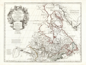
Carte du Canada Qui Comprend la Partie Septentrionale des Etats Unis D'Amerique.
sold
- Digital Map Information
- Suitable for large format printing
- Full resolution TIFF file
- ICC color profile embedded
- Delivered instantly via download link
This is the 1783 Dezauche issue of Guillaume de l'Isle's map of Canada and the Northern United States. Published after the close of the American Revolutionary War (1775 - 1783), this is one of the first French maps to formally recognize the United States. (more details)
One of the last French maps to use the term 'Sea of Korea'.
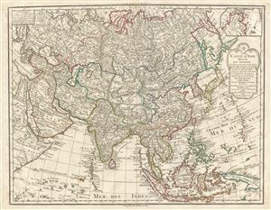
Carte D'Asie dressee pour L'Instruction…
sold
- Digital Map Information
- Suitable for large format printing
- DPI: 300
- File Size: 20.59 MB
- File Type: ZIP / TIFF
- ICC color profile embedded
- Delivered instantly via download link
A rare and attractive 1800 map of Asia by Guillaume Delisle and Philippe Buache. Centered on Independent Tartary, this map covers the entire continent from Africa and the Mediterranean east to the Bering Sea ... (more details)
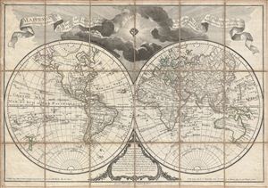
Mappemonde a l'usage de l'Instr.on par Guillaume Delisle et Philippe Buache Premiers Geographes et de l'Academie des Sciences. Revue e Augmentee des Nles. Decouvertes par Dezauche en 1808.
sold
- Digital Map Information
- Suitable for large format printing
- DPI: 300
- File Size: 23.46 MB
- File Type: ZIP / TIFF
- ICC color profile embedded
- Delivered instantly via download link
An uncommon and appealing 1808 pocket map of the world in two hemispheres by Dezauche. This is a later revision, by Dezauche, of Guillaume de Lisle and Phillipe Buache's map of 1785. This popular map, which ... (more details)