
Russell, John (sold)

John Russell (c. 1750 - 1829) was a British cartographer active in London during the late 18th and early 19th centuries. Russell apprenticed as a goldsmith under William Palmer before turning to engraving and printing. He drew maps and engraved for several major publishers of his period including Alexander Dalrymple, Benjamin Henry, Robert Sayer, John Moore, and William Guthrie. Russell's 10 apprentices included such prominent cartographers as Alexander Findlay and Samuel Clapp. Russell was based on Constitution Row Grays Inn Lane, Middlesex (London).
The United States just after the American Revolutionary War.
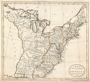
A Map of the United States of America Agreeable to the Peace of 1783.
sold
- Digital Map Information
- Suitable for large format printing
- DPI: 300
- File Size: 7.77 MB
- File Type: ZIP / TIFF
- ICC color profile embedded
- Delivered instantly via download link
An unusual c. 1783 John Russell map of the United States issued shortly after the American Revolutionary War. The map depicts the United States according to the 1783 Treaty of Paris that formally ended the War. These borders extended from the middle of the Great ... (more details)
1794 Russel Map of the Middle States of the United States (New York, Ohio, Pennsylvania, New Jersey,
Uncommon American Revolutionary War Map of the Middle Atlantic States, including Ohio.
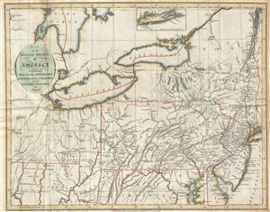
Map of the Middle States of America. Comprehends New-York, New-Jersey, Pennsylvania, Delaware, and the Territory N.W. of Ohio.
sold
- Digital Map Information
- Suitable for large format printing
- Full resolution TIFF file
- ICC color profile embedded
- Delivered instantly via download link
This is a scarce and beautiful 1794 map of the middle states of the United States, including New York, Ohio, Pennsylvania, New Jersey, Delaware and Virginia by John Russell. This Revolutionary War era map covers from the Hudson River Westward to include Fort ... (more details)
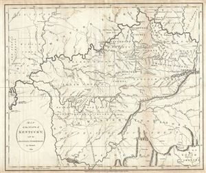
Map of the State of Kentucky; with the Adjoining Territories.
sold
- Digital Map Information
- Suitable for large format printing
- DPI: 300
- File Size: 8.68 MB
- File Type: ZIP / TIFF
- ICC color profile embedded
- Delivered instantly via download link
This is an unusual and scarce 1794 map of Kentucky by John Russell. This early map covers all of Kentucky, the northern parts of Georgia, most of Tennessee (here called South Western Territory) and parts of Georgia, Indiana and Ohio (North Western ... (more details)
Important post-Revolutionary War map of New England!
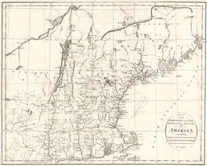
Map of the Northern, or, New England States of America, Comprehending Vermont, New Hampshire, District of Main, Massachusetts, Rhode Island, and Connecticut.
sold
- Digital Map Information
- Suitable for large format printing
- DPI: 600
- File Size: 11.76 MB
- File Type: ZIP / TIFF
- ICC color profile embedded
- Delivered instantly via download link
An attractive and finely engraved 1795 map of New England by John Russell - one of the few commercial maps of New England issued immediately following the American Revolutionary War (1775 - 1783). The map covers the northwestern part of the United States from, roughly, Lake Oneida (near Fort Stanwix) to Passamaquoddy Bay, New Brunswick, and from Montreal south as far as Tappan Zee, Martha's Vineyard, and Nantucket. This includes the District of Maine (which was then under the governance of Massachusetts), Vermont, New Hampshire, Massachusetts, Connecticut, and Eastern New York. (more details)
The First European Edition of the Seminal Ellicott Plan.
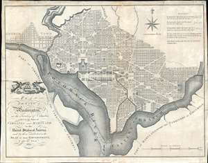
Plan of the City of Washington in the Territory of Columbia ceded by the States of Virginia and Maryland tothe United States of America and by them established as the Seat of their Government after the Year 1800.
sold
- Digital Map Information
- Suitable for large format printing
- DPI: 600
- File Size: 22.36 MB
- File Type: ZIP / TIFF
- ICC color profile embedded
- Delivered instantly via download link
This is the 1795 Russell edition of Andrew Ellicott's seminal plan or map of Washington D.C., published prior to its becoming in 1800 the capital of the United States. The map illustrates the original urban layout of Washington D.C, then only a small part of the District of Columbia. Centered on the confluence of the Potomac and the Eastern Branch (Anacostia) Rivers, the map covers the Washington D.C. grid as far north as W Street. It also includes the older nearby city of Georgetown. (more details)
Labels several different land companies that played an important role in American expansion into the Northwest Ordinance.
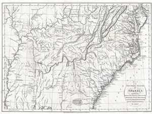
Map of the Southern States of America, Comprehending Maryland, Virginia, Kentucky, Territory South of the Ohio, North Carolina, Tennessee Government, South Carolina, and Georgia.
sold
- Digital Map Information
- Suitable for large format printing
- DPI: 300
- File Size: 6.89 MB
- File Type: ZIP / TIFF
- ICC color profile embedded
- Delivered instantly via download link
This is a 1795 John Russell map of the southeastern United States. The map depicts the region from the Mississippi River to the Atlantic Ocean and from Wilmington, Delaware to Mobile and Mobile Bay, Alabama and Pensacola, Florida. Expansion of the ... (more details)
Fascinating map. One of the earliest obtainable maps of Kentucky and Tennessee.
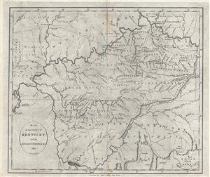
Map of the State of Kentucky; with the Adjoining Territories. 1795.
sold
- Digital Map Information
- Suitable for large format printing
- DPI: 300
- File Size: 8.93 MB
- File Type: ZIP / TIFF
- ICC color profile embedded
- Delivered instantly via download link
This 1795 map by John Reid is one of the earliest obtainable maps of Kentucky and Tennessee. Centered on the Cumberland River, the map covers from New Madrid on the Mississippi River to, roughly, the Cumberland Gap, and from the confluence of the ... (more details)
The Mackenzie and Coppermine river systems illustrated with impressive detail!
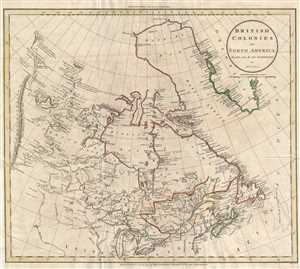
British Colonies in North America.
sold
- Digital Map Information
- Suitable for large format printing
- DPI: 300
- File Size: 6.52 MB
- File Type: ZIP / TIFF
- ICC color profile embedded
- Delivered instantly via download link
This is an 1811 John Russell map of Canada. The map depicts the region from the 'Stony Mountains' (Rocky Mountains) to the Atlantic Ocean and from Baffin's Bay and Greenland to the northern United States, including the Great Lakes. Among other ... (more details)
Proto-Discovery of Great Salt Lake?
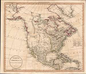
North America, Drawn from the Best Authorities by J. Russell.
sold
- Digital Map Information
- Suitable for large format printing
- Full resolution TIFF file
- ICC color profile embedded
- Delivered instantly via download link
A most fascinating 1811 John Russell map of North America with an intriguing mapping of Great Salt Lake issued just prior the development of the Western Fur Trade and the seminal explorations of Zebulon Pike (1779 - 1813), Stephen Harriman Long (1874 - 1864), and Jedidiah Smith (1799 - 1831). The map postdates the Lewis and Clark Expedition (1803 - 1806), but reconnaissance from that voyage is nowhere in evidence. Instead, the map details the dubious voyage of 'Mr. Lawrence' (see below). Coverage from the Pacific Ocean to the Atlantic Ocean and from Baffin Bay and northern Canada to the extreme northern reaches of South America. The extreme northern portion of North America, above the Arctic Circle, is incomplete, but the Arctic coast is slowing being filled in. The map further identifies the first two European overland expeditions to the North American Arctic, those of Herne and Mackenzie. The United States, still limited to the lands east of the Mississippi and north of Florida, has 15 states, reflecting the addition of Vermont (1791) and Kentucky (1792). (more details)
Proto-Discovery of Great Salt Lake?
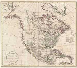
North America, Drawn from the Best Authorities by J. Russell.
sold
- Digital Map Information
- Suitable for large format printing
- DPI: 300
- File Size: 7.01 MB
- File Type: ZIP / TIFF
- ICC color profile embedded
- Delivered instantly via download link
A most fascinating 1811 John Russell map of North America with an intriguing mapping of Great Salt Lake issued just prior the development of the Western Fur Trade and the seminal explorations of Zebulon Pike (1779 - 1813), Stephen Harriman Long (1874 - 1864), and Jedidiah Smith (1799 - 1831). The map postdates the Lewis and Clark Expedition (1803 - 1806), but reconnaissance from that voyage is nowhere in evidence. Instead, the map details the dubious voyage of 'Mr. Lawrence' (see below). Coverage from the Pacific Ocean to the Atlantic Ocean and from Baffin Bay and northern Canada to the extreme northern reaches of South America. The extreme northern portion of North America, above the Arctic Circle, is incomplete, but the Arctic coast is slowing being filled in. The map further identifies the first two European overland expeditions to the North American Arctic, those of Herne and Mackenzie. The United States, still limited to the lands east of the Mississippi and north of Florida, has 15 states, reflecting the addition of Vermont (1791) and Kentucky (1792). (more details)
Early map of the United States illustrating various land speculation companies in the Ohio and Mississippi Valleys.
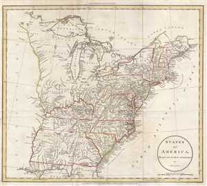
States of America.
sold
- Digital Map Information
- Suitable for large format printing
- DPI: 300
- File Size: 6.39 MB
- File Type: ZIP / TIFF
- ICC color profile embedded
- Delivered instantly via download link
This is an 1811 John Russell map of the United States illustrating numerous land grants in the newly acquired lands west of the Appalachian Mountains. The map depicts the United States from the Mississippi River to the Atlantic Ocean and from ... (more details)
Map of the West Indies just prior to the War of 1812.
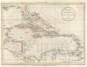
West Indies.
sold
- Digital Map Information
- Suitable for large format printing
- DPI: 300
- File Size: 6.7 MB
- File Type: ZIP / TIFF
- ICC color profile embedded
- Delivered instantly via download link
This is an 1811 John Russell map of the West Indies and Central America. The map depicts the region from the Yucatan Peninsula to the Lesser Antilles and from Florida to northern South America, including Colombia and Venezuela. A remarkable ... (more details)
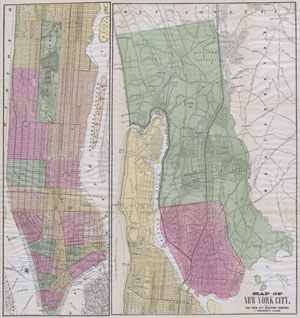
Map of New York City. The Trow City Directory Company, 11 University Place.
sold
- Digital Map Information
- Suitable for large format printing
- File Size: 8.54 MB
- File Type: ZIP / TIFF
- ICC color profile embedded
- Delivered instantly via download link
A large and rare hand colored map of New York City prepared by Fisk & Russell for the Trow City Directory Company. Covers all of Manhattan Island and in a very unusual variation on most maps of the period, the whole of the Bronx. Most ... (more details)