
Young, James H. (sold)

James Hamilton Young (December 18, 1792 - c. 1870) was a Scottish-American draughtsman, engraver, and cartographer active in Philadelphia during the first half of the 19th century. Young was born in Avondale, Lanark, Scotland and emigrated to the United States sometime before 1817. Young was a pioneer in American steel plate engraving, a process superior to copper plate engraving due to the increased durability of steel. His earliest known maps date to about 1817, when Young was 25. At the time he was partnered with William Kneass (1780 - 1840), as Kneass, Young and Company, an imprint that was active from 1817 to 1820. He then partnered with with George Delleker, publishing under the imprint of Young and Delleker, active from 1822 to 1823. Young engraved for numerous cartographic publishers in the Philadelphia area, including Anthony Finley, Charles Varle, and Samuel Augustus Mitchell, among others. His most significant work includes maps engraved for Anthony Finley and later Samuel Augustus Mitchell. Mitchell proved to be Young's most significant collaborator. The pair published numerous maps from about 1831 well into the 1860s. Young retired sometime in the mid to late 1860s. In 1840 he registered a patent for an improved system of setting up typography for printing. ˆˆ
First map to show U.S. claims to British Columbia.
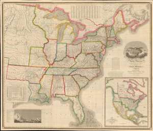
Map of the United States of North America Compiled from the Latest and most Authentic Information by David H. Vance.
sold
- Digital Map Information
- Suitable for large format printing
- DPI: 600
- File Size: 277.94 MB
- File Type: ZIP / TIFF
- ICC color profile embedded
- Delivered instantly via download link
This is the first edition of David Vance and Anthony Finley's outstanding wall map of the United States, published in 1825, here in a remarkable fresh state. This map is significant with regard to its early date, contemporaneous with Amos Lay's map, but more ambitions and predating the 1829 Tanner map by 4 years, as well as its detailed coverage of historic developments. Converge encompasses the Untitled States as it appeared at the time, extending from roughly the Texas Border (100° West of Greenwich / 27° West of Washington) to the Pacific and from the Saint Lawrence River to the Florida Keys. A large inset map appears in the lower right quadrant, illustrating the whole of North America. This is the first map to illustrate American claims to British Columbia that would later spark the 54°40' Debate. (more details)
Settling the great northern wilderness.
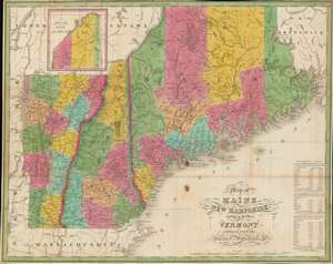
Map of Maine, New Hampshire and Vermont, Compiled From The Latest Authorities.
sold
- Digital Map Information
- Suitable for large format printing
- Full resolution TIFF file
- ICC color profile embedded
- Delivered instantly via download link
This is an attractive 1826 folding map of Maine, New Hampshire, and Vermont produced by Anthony Finley, James H. Young, and David H. Vance. Though originally engraved for Finley's A New American Atlas, this is a rare separate issue. It portrays northern New England as the region was undergoing a population boom in the decades after independence. (more details)
Charming and detailed.
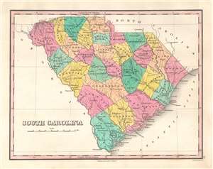
South Carolina.
sold
- Digital Map Information
- Suitable for large format printing
- Full resolution TIFF file
- ICC color profile embedded
- Delivered instantly via download link
This is a beautiful example of Anthony Finley's important 1827 map of South Carolina. A rarity of the time period, this map depicts the state individually rather than bundled with North Carolina. Rivers, roads, canals, and some topographical features are illustrated, including the Savanna River and the Blue Ridge Mountains. Cities and towns are identified, such as Charleston, George Town, Newberry, and Greenville. Counties are shaded different colors to allow for easy differentiation. Augusta and Savannah, Georgia, both just across the Savannah River in Georgia, are also labeled. (more details)
A chart comparing the elevation of the mountains of the world - predates the discovery of Mt. Everest.
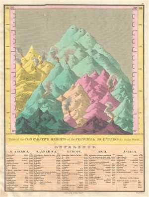
Table of the Comparative Heights of the Principal Mountains etc. in the World.
sold
- Digital Map Information
- Suitable for large format printing
- DPI: 300
- File Size: 2.77 MB
- File Type: ZIP / TIFF
- ICC color profile embedded
- Delivered instantly via download link
This is an 1828 example of Anthony Finley's highly sought-after chart of the comparative heights of the principal mountains of the world. The chart details the world's great mountains in relative proximity to one another and divided by continent. Each mountain is ... (more details)
A beautiful map of Africa predating the mid-19th century explosion of expeditions to explore the 'Dark Continent'.
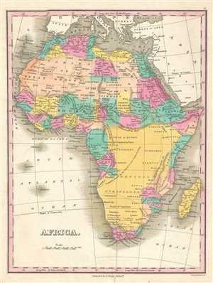
Africa.
sold
- Digital Map Information
- Suitable for large format printing
- DPI: 300
- File Size: 2.68 MB
- File Type: ZIP / TIFF
- ICC color profile embedded
- Delivered instantly via download link
This is an 1828 Anthony Finley map of Africa that predates the mid-19th century explosion of European exploration of Africa. The map depicts the entire continent from the Atlantic Ocean to the Horn of Africa and from continental Europe to the Cape of Good Hope. As ... (more details)
Labels the Land of Liakhov, which is more widely known as the Legendary Ivory Islands.
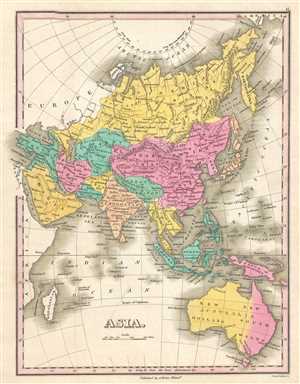
Asia.
sold
- Digital Map Information
- Suitable for large format printing
- DPI: 300
- File Size: 2.59 MB
- File Type: ZIP / TIFF
- ICC color profile embedded
- Delivered instantly via download link
This is an 1828 Anthony Finley map of Asia. The map depicts the region from the Mediterranean Sea to the Bering Strait and Papua New Guinea and from the Arctic Ocean to Tasmania. It was common during this era in cartographic history to include Australia and the ... (more details)
A detailed map of India and the surrounding region - including the Maldives.
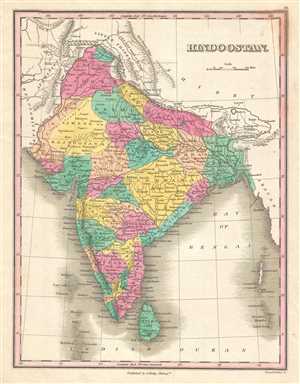
Hindoostan.
sold
- Digital Map Information
- Suitable for large format printing
- DPI: 300
- File Size: 2.7 MB
- File Type: ZIP / TIFF
- ICC color profile embedded
- Delivered instantly via download link
This is an 1828 Anthony Finley map of India. The map depicts the region from Kandahar in Afghanistan to Myanmar and from Tibet, Nepal, and China to Sri Lanka (Ceylon) and the Indian Ocean. Highly detailed, regions within India are shaded different colors to ... (more details)
Illustrates the territory assigned to each of the Biblical tribes of Israel.
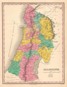
Palestine.
sold
- Digital Map Information
- Suitable for large format printing
- Full resolution TIFF file
- ICC color profile embedded
- Delivered instantly via download link
This is an 1828 Anthony Finley map of Israel, Palestine, or the Holy Land. The map depicts the region from Sidon and Damascus to Zoar at the southern tip of the Dead Sea, including the modern-day nations of Israel, Lebanon, and Palestine, as well as parts ... (more details)
First map of Liberia.
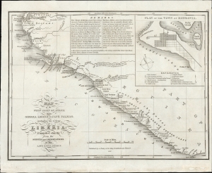
Map of the West Coast of Africa, from Sierra Leone to Cape Palmas; including the Colony of Liberia: Compiled chiefly from the surveys and observations of the Late Revd. J. Ashmun.
sold
- Digital Map Information
- Suitable for large format printing
- File Size: 5.42 MB
- File Type: ZIP / TIFF
- ICC color profile embedded
- Delivered instantly via download link
This is the most important early map of Liberia, first issued in 1830, shortly after the colony's founding. This map was published by ardent 'Colonization' supporter Anthony Finley, based upon the cartography of the American Colonization Society forerunner Jehudi Ashmun. (more details)
First map of Liberia.
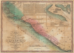
Map of the West Coast of Africa, from Sierra Leone to Cape Palmas; including the Colony of Liberia: Compiled chiefly from the surveys and observations of the Late Revd. J. Ashmun.
sold
- Digital Map Information
- Suitable for large format printing
- Full resolution TIFF file
- ICC color profile embedded
- Delivered instantly via download link
The most important early map of Liberia issued shortly after its founding. This map was published in 1830 by ardent 'Colonization' supporter Anthony Finley based upon the cartography of Jehudi Ashmun. The map depicts the west African coast from Freetown, Sierra Leone, to Cape Palmas. Light red shading indicates territory claimed as Liberia by the American Colonization Society (ACS), while the darker red strip, about 150 miles, indicates regions actually under ACS control. The map is derived from cartography produced by Jehudi Ashmun, an agent of the U.S. Government and the ACS who traveled extensively throughout the region in an attempt to acquire lands and organize peaceful relations with the generally unwelcoming established tribal kingdoms. (more details)
The first and most important map of the colony of Liberia.
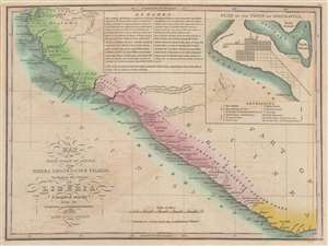
Map of the West Coast of Africa, from Sierra Leone to Cape Palmas; including the Colony of Liberia: Compiled chiefly from the surveys and observations of the Late Revd. J. Ashmun.
sold
- Digital Map Information
- Suitable for large format printing
- DPI: 600
- File Size: 7.1 MB
- File Type: ZIP / TIFF
- ICC color profile embedded
- Delivered instantly via download link
The most important early map of Liberia issued shortly after its founding. This map was published in 1830 by Anthony Finley based upon the cartography of Jehudi Ashmun. The map covers the west African coast from Freetown, Sierra Leone, to Cape Palmas. Light red shading indicates territory claimed as Liberia by the American Colonization Society (ACS), while the darker red strip, about 150 miles, indicates regions actually under ACS control. The map is derived by cartography produced by Jehudi Ashmun, an agent of the U.S. Government and the ACS who traveled extensively throughout the region in an attempt to acquire lands and organize peaceful relations with the generally unwelcoming established tribal kingdoms. (more details)
Territorial Expansion in the Jacksonian Era.
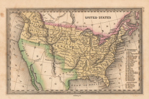
United States.
sold
- Digital Map Information
- Suitable for large format printing
- File Size: 1.79 MB
- File Type: ZIP / TIFF
- ICC color profile embedded
- Delivered instantly via download link
This is a charming 1832 miniature map of the United States engraved by James H. Young, the leading map engraver of his day, for Carey and Lea's Family Cabinet Atlas. It is notable for reflecting the country's territorial evolution at this stage, including the disputed border in the Pacific Northwest. (more details)
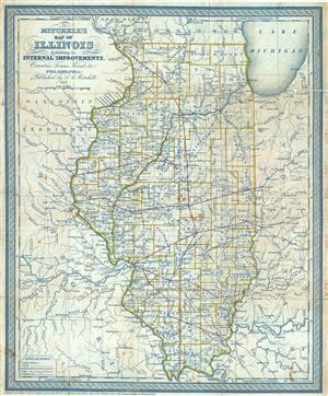
Mitchell's Map of Illinois Exhibiting its Internal Improvements, Counties, Towns, Roads, etc.
sold
- Digital Map Information
- Suitable for large format printing
- DPI: 300
- File Size: 12.25 MB
- File Type: ZIP / TIFF
- ICC color profile embedded
- Delivered instantly via download link
An extremely rare 1838 map of Illinois by Samuel Augustus Mitchell. It covers the state of Illinois along with parts of neighboring Indiana, Kentucky, Missouri and the Wisconsin Territory. The map depicts a very early county configuration and notes ... (more details)
World with Republic of Texas.
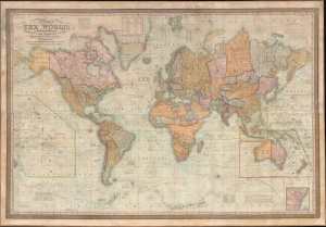
Map of the World, on Mercator's Projection Exhibiting the Researches of the Principal Modern Travelers and Navigators.
sold
- Digital Map Information
- Suitable for large format printing
- File Size: 189.78 MB
- File Type: ZIP / TIFF
- ICC color profile embedded
- Delivered instantly via download link
This is an impressive large-scale 1838 wall map of the world issued by S. A. Mitchell. The map includes ephemeral geographical content, including the Republic of Texas, U.S. claims to British Columbia, an early state of exploration in central Africa, and ongoing speculation regarding the Northwest Passage. (more details)
1871 Reissue of a seminal 1841 map.
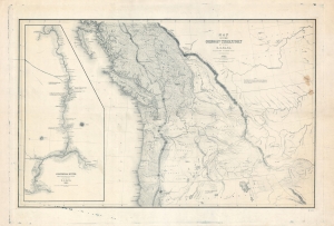
Map of the Oregon Territory by the U.S. Ex. Ex.
sold
- Digital Map Information
- Suitable for large format printing
- File Size: 113.73 MB
- File Type: ZIP / TIFF
- ICC color profile embedded
- Delivered instantly via download link
This is the 1871 U.S.H.O. reissue of Commodore Wilkes' 1841 U.S. exploring expedition map of Oregon Territory, the finest and most important map of Oregon of the 19th century. The reissue was prepared from the original copper plate and is on higher quality paper than the original 1841 report issue. (more details)
The 'first geometrically constructed map of any significant portion of Hawaii.' - Fitzpatrick
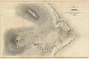
Map of Part of the Island of Hawaii Sandwich Islands Shewing the Craters and Eruption of May and June 1840.
sold
- Digital Map Information
- Suitable for large format printing
- DPI: 600
- File Size: 28.81 MB
- File Type: ZIP / TIFF
- ICC color profile embedded
- Delivered instantly via download link
This extraordinary production is Commodore Wilkes' 1841 U.S. Exploring Expedition map of the island of Hawaii. An incredibly important work, this is, according to Fitzpatrick, the 'first geometrically constructed map of any significant portion of Hawaii.' Wilkes' map covers the vicinity of the volcanoes Mauna Loa, Mauna Kea, and Kilauea as well as the Hawaiian shoreline roughly between Laupahoehoe and Kahaualea, including Hilo Bay and city. Topography is rendered in striking hachure. (more details)
Seminal Map of the Pacific Northwest.
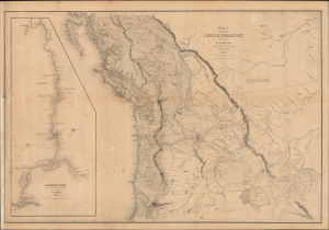
Map of the Oregon Territory by the U.S. Ex. Ex.
sold
- Digital Map Information
- Suitable for large format printing
- Full resolution TIFF file
- ICC color profile embedded
- Delivered instantly via download link
This Commodore Wilkes' rare large-format 1841 U.S. Exploring Expedition (U.S. Ex. Ex.) map of Oregon Territory, which appeared in the expedition Atlas. Wilkes' map was the finest and most detailed map of this largely unknown Oregon-Washington-Vancouver-Idaho region yet published and is considered by map historian Carl I. Wheat to be 'really quite extraordinary'. (more details)
A definitive map of the Pacific Northwest, considered by Wheat, 'really quite extraordinary.'
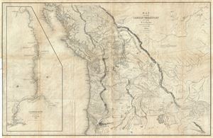
Map of the Oregon Territory by the U.S. Ex. Ex.
sold
- Digital Map Information
- Suitable for large format printing
- DPI: 300
- File Size: 29.57 MB
- File Type: ZIP / TIFF
- ICC color profile embedded
- Delivered instantly via download link
This important and extraordinary production is Commodore Wilkes' 1841 U.S. Exploring Expedition map of Oregon Territory. The map covers roughly from the 50th parallel to Mount Shasta, the upper Sacramento River, and Great Salt Lake (labeled Youta ... (more details)
A definitive map of the Pacific Northwest, considered by Wheat, 'really quite extraordinary.'
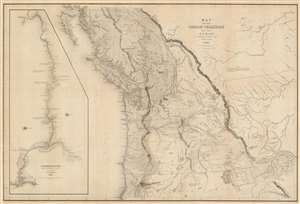
Map of the Oregon Territory by the U.S. Ex. Ex.
sold
- Digital Map Information
- Suitable for large format printing
- DPI: 600
- File Size: 59.51 MB
- File Type: ZIP / TIFF
- ICC color profile embedded
- Delivered instantly via download link
This important and extraordinary production is Commodore Wilkes' 1841 U.S. exploring expedition map of Oregon Territory, the finest and most important map of Oregon of the 19th century. The map covers roughly from the 50th parallel to Mount Shasta, the upper Sacramento River, and Great Salt Lake (Youta Lake) and from the Pacific to the Black Hills. It includes, either in part or full, modern day Washington, Oregon, British Columbia, Vancouver, Idaho, Utah, Nevada, Montana, Wyoming, and California. A large inset occupying the left quadrants focuses on the Columbia River where the United States exploring expedition lost one of its ships, the Peacock, on the infamous Columbia Bar. Topography is rendered by hachure and the engravers even made some attempt to illustrate the vast pine forests of the Pacific Northwest. (more details)
A first edition Mitchell map of Florida - names ephemeral Leigh Read County!
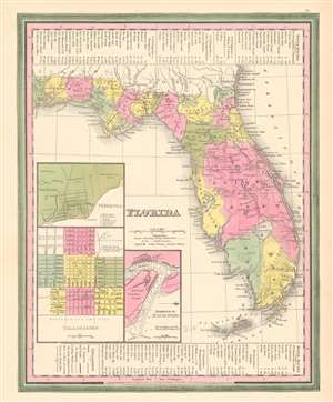
Florida.
sold
- Digital Map Information
- Suitable for large format printing
- DPI: 600
- File Size: 10.59 MB
- File Type: ZIP / TIFF
- ICC color profile embedded
- Delivered instantly via download link
This is a first edition 1846 Samuel Augustus Mitchell and Henry Schenck Tanner map of Florida, notable as being one of the few maps to include the ephemeral Leigh Read County (Mosquito County). The map depicts Florida in full, from the Perdido River to the Atlantic Ocean and from Georgia and Alabama to Key West. Roads connecting the towns, forts, and other settlements are illustrated, along with railroads (there were only 2 at the time) and canals. Inset maps in the lower left corner detail the cities of Pensacola and Tallahassee and the harbor of St. Augustine. Information concerning water routes is included along the top and bottom borders. The whole is surrounded by the Carey and Hart border, which Mitchell only used in this first edition of the atlas. (more details)
Map of Texas at the moment of Annexation.
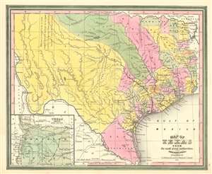
Map of Texas from the most recent authorities.
sold
- Digital Map Information
- Suitable for large format printing
- DPI: 600
- File Size: 14.99 MB
- File Type: ZIP / TIFF
- ICC color profile embedded
- Delivered instantly via download link
A rare 1845 / 1846 first edition example of the C. S. Williams / J. H. Young / S. A. Mitchell map of Texas published in the final days of the Republic of Texas just at Texas was preparing to join the United States. Coverage includes Texas at its fullest extent, reaching from the Santa Fe and the Rio Grande del Norte to the Sabin River and extending as far north as the Arkansas River (plus a stovepipe encompassing the Green Mountains not fully illustrated). Northwestern Texas is incorporated via an inset in the lower left. (more details)
Guide map for transcontinental emigrant travel in the antebellum period.
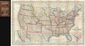
A New Map of the United States of America.
sold
- Digital Map Information
- Suitable for large format printing
- File Size: 16.94 MB
- File Type: ZIP / TIFF
- ICC color profile embedded
- Delivered instantly via download link
An unusual example of Charles Desilver's 1856 pocket map of the United States. The map covers the United States from coast to coast during the post-Mexican American War / pre-Civil War Period - a era of incredible national optimism, Indian Wars, ... (more details)
U.S. Naval Academy.
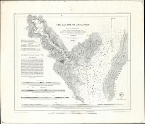
The Harbor of Annapolis.
sold
- Digital Map Information
- Suitable for large format printing
- File Size: 36.9 MB
- File Type: ZIP / TIFF
- ICC color profile embedded
- Delivered instantly via download link
This is the 1874 U.S. Coast Survey nautical map detailing Annapolis Harbor, Maryland, in a scarce separate issue example. (more details)
100 years of progress.
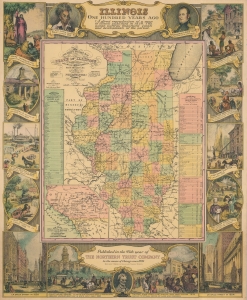
Illinois One Hundred Years Ago.
sold
- Digital Map Information
- Suitable for large format printing
- File Size: 28.5 MB
- File Type: ZIP / TIFF
- ICC color profile embedded
- Delivered instantly via download link
This is a 1934 Northern Trust Company and William Mark Young pictorial map of Illinois. A pictorial border surrounds a historic map of the state created by J. H. Young and published by S. A. Mitchell. (more details)