
Ensign, Edward Hooker (sold)

Edward Hooker Ensign (August 18, 1818 - July 10, 1871) was an American map and print publisher based in New York during the middle part of the 19th century. Edward was born in West Hartland, Connecticut. Little is known of Ensign's training but he may have inherited his business from his father, Timothy Ensign (1795 - 1859), who was a map publisher active in New York. Ensign seems to have had a flair for partnerships and variously published with Humphrey Phelps (1799 - 1875), Horace Thayer, Thomas C. Fanning (1805 - 1873) and Erastus C. Bridgman (1817 - 1870), among others. His various imprints include 'Phelps and Ensign' (1841-1844), 'T. and E. H. Ensign' (1844-1848), 'Ensign and Thayer' (1849), 'Ensign, Thayer, and Company' (1850-1851), 'Horace Thayer and Company' (1852), and 'Ensign, Bridgman and Fanning' (1854-1863). It appears that father and son worked together for some time as well, publishing as either 'T. and E. H. Ensign' or 'Ensigns'. At least some of these companies maintained offices in both Buffalo and New York City.
Spectacular patriotic wall map of the United States illustrating the Republic of Texas.
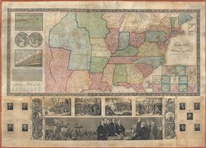
Phelps and Ensign's travellers' guide, and map of the United States, containing the roads, distances, steam boat and canal routes etc.
sold
- Digital Map Information
- Suitable for large format printing
- DPI: 300
- File Size: 34.84 MB
- File Type: ZIP / TIFF
- ICC color profile embedded
- Delivered instantly via download link
A very patriotic piece, this spectacular 1841 decorative wall map of the United States was prepared New York firm of Phelps and Ensign. The highly appealing production covers the United States from the Rocky Mountains to the Atlantic Seaboard and from Green Bay ... (more details)
Map of the United States just prior to the Mexican American War. Shows the Republic of Texas.
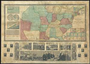
Ensign's Travellers' Guide, and Map of the United States, containing the Roads, Distances, Steam Boat and Canal Routes and c.
sold
- Digital Map Information
- Suitable for large format printing
- DPI: 300
- File Size: 54.44 MB
- File Type: ZIP / TIFF
- ICC color profile embedded
- Delivered instantly via download link
An extremely scarce variant on Ensign and Thayer's series of highly decorative United States wall maps. This map, dated 1845, predates the annexation of Texas and the Mexican-American War by one year. It illustrates the Republic of Texas according to its early proclaimed borders, names Austin's colony, and identifies Austin as the capital. In addition, the map features a large Missouri Territory. Small mountains and rivers charts on the Bulla / Darton model appear in the upper left quadrant. The bottom of the map features a large panorama of the Signing of the Declaration of Independence as well as various scenes from American History. To either side are illustration of Metacom, the Pokunoket Sachem called 'King Philip' and James Polk, who had just been elected 11th president of the United Sates. Portraits of other former presidents fan out on either side of the panorama. (more details)
Illustrates the Republic of Texas the year before it joined the United States and the Oregon border dispute between the United States and Canada.
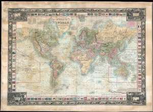
Map of the World, on Mercators Projection.
sold
- Digital Map Information
- Suitable for large format printing
- DPI: 600
- File Size: 91.02 MB
- File Type: ZIP / TIFF
- ICC color profile embedded
- Delivered instantly via download link
This is a rare 1845 Edward Hooker Ensign map of the world on Mercator's projection depicting both the Republic of Texas and the Oregon border dispute between Canada and the United States. A visually striking and incredibly detailed piece, countries throughout the world are labeled, along with innumerable cities and towns. Myriad coastal locations are identified as well. The courses of the world's most important explorers, including Christopher Columbus, Captain James Cook, Vancouver, and La Perouse are illustrated and labeled, many of the courses also provide several dates along the route. An inset of sorts details the Southern Pacific Ocean, labeling numerous islands and tracing the voyages of Cook and Vancouver in detail. The Mountains of the Moon, an apocryphal chain of mountains in Africa, are illustrated almost completely across the center of the continent, with the vast majority of the African interior marked simply as 'unexplored'. The whole is surrounded by two different borders. (more details)
An extremely scarce manifest-destiny era wall map of the United States with an inset of the newly admitted Texas.
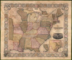
Map of the United States from the Best Authorities.
sold
- Digital Map Information
- Suitable for large format printing
- DPI: 300
- File Size: 74.47 MB
- File Type: ZIP / TIFF
- ICC color profile embedded
- Delivered instantly via download link
A scarce 1846 wall map of the United States by Horace Thayer and Edward Ensign. This remarkable map covers the United Stated from Texas and the Upper Mississippi Valley eastward to the Atlantic and from Lake Superior to the Gulf of Mexico. Insets detail Oregon ... (more details)
Texas at its fullest - months after joining the United States.
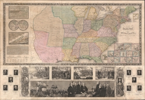
Ensign's Travellers' Guide, and Map of the United States, containing the Roads, Distances, Steam Boat and Canal Routes.
sold
- Digital Map Information
- Suitable for large format printing
- Full resolution TIFF file
- ICC color profile embedded
- Delivered instantly via download link
A scarce Mexican-American War (1846 - 1848) variant edition of Ensign and Thayer's series of United States wall maps. This map, dated 1846, is the first edition to show Texas after joining the United States - with its fullest borders extending north as far as modern-day Wyoming and including New Mexico. (more details)
Incredible cartouche depicting John Hancock and the Boston Tea Party.
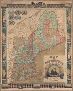
Map of New England.
sold
- Digital Map Information
- Suitable for large format printing
- DPI: 300
- File Size: 30.35 MB
- File Type: ZIP / TIFF
- ICC color profile embedded
- Delivered instantly via download link
This is an 1847 Ensigns and Thayer map of New England. The map depicts the region from northern Maine and the St. Lawrence River to Long Island Sound and Nantucket and from eastern New York and Montreal, Canada to New Brunswick. Counties in the states of Maine, ... (more details)
Wonderful decorative propaganda map advocating for the United States as a global power following the acquisition of Upper California and Texas as the end of the Mexican American War.
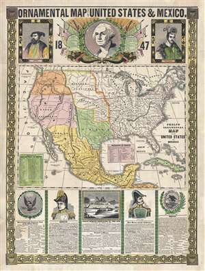
Ornamental Map of The United States and Mexico, 1847.
sold
- Digital Map Information
- Suitable for large format printing
- DPI: 300
- File Size: 18.49 MB
- File Type: ZIP / TIFF
- ICC color profile embedded
- Delivered instantly via download link
A remarkably graphic propaganda map of the United States in 1847 by Humphrey Phelps. Boldly expressing U.S. dominance of the continent, this map loudly proclaims Manifest Destiny. The United States is here transformed by victory in the Mexican-American War ... (more details)
San Francisco named Yerba Buena! Mexican-American War! Texas at its fullest expression!
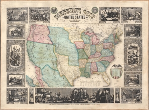
Pictorial Map of the United States.
sold
- Digital Map Information
- Suitable for large format printing
- Full resolution TIFF file
- ICC color profile embedded
- Delivered instantly via download link
A scarce American wall map of the United States and Mexico issued by Ensign and Thayer in 1848 - at the end of the Mexican American War (1846 - 1848). This is one of the few maps to identify San Francisco as Yerba Buena, exhibit Texas's fullest territorial claims, and show Upper California (California, New Mexico, Arizona, Utah, Nevada, Colorado, etc..) prior to its breakup into territories. As the title suggests, the map covers the United States in full and is one of the earliest examples of this map to extend from coast to coast - reflecting the new borders established claimed by the United States in 1846, and formalized by the 1848 Treaty of Guadeloupe-Hidalgo, which ended the Mexican-American War. At this time, no railroads extended west of the Mississippi. Predating the 1849 Gold Rush, Sacramento, founded in 1850, is not present, but the map notes John Sutter's colony of New Helvetica and nearby Sutter's Fort. Great Salt Lake is embryonically mapped, illustrative of the limited knowledge then amiable regarding the geographical disposition of the Great Basin. Nebraska extends northwards to the Canadian border and Washington/Oregon have their eastern terminus at the Rocky Mountains. (more details)
On the cusp of the Westward Expansion.
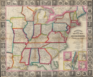
Phelps’s National Map of the United States, A Travellers Guide. Embracing the Principal Rail Roads, Canals, Steam Boat and Stage Routes throughout the Union.
sold
- Digital Map Information
- Suitable for large format printing
- DPI: 600
- File Size: 45.75 MB
- File Type: ZIP / TIFF
- ICC color profile embedded
- Delivered instantly via download link
This is the 1848 issue of the first state of Phelps's map of the United States. The map was issued during the Mexican-American War (1846 - 1848), and as such captures an ephemeral moment in American history: after Texas joined the Union, but before the Treaty of Guadeloupe-Hidalgo and the annexation of Upper California. (more details)
San Francisco as Yerba Buena! Mexican-American War! Texas at its fullest expression!
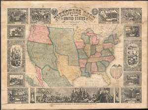
Pictorial Map of the United States.
sold
- Digital Map Information
- Suitable for large format printing
- DPI: 600
- File Size: 145.35 MB
- File Type: ZIP / TIFF
- ICC color profile embedded
- Delivered instantly via download link
A scarce American wall map of the United States and Mexico issued by Ensign and Thayer in 1848 - at the end of the Mexican American War (1846 - 1848). This is one of the few maps to identify San Francisco as Yerba Buena, exhibit Texas's fullest territorial claims, and show Upper California (California, New Mexico, Arizona, Utah, Nevada, Colorado, etc..) prior to its breakup into territories. As the title suggests, the map covers the United States in full and is one of the earliest examples of this map to extend from coast to coast - reflecting the new borders established claimed by the United States in 1846, and formalized by the 1848 Treaty of Guadeloupe-Hidalgo, which ended the Mexican-American War. At this time, no railroads extended west of the Mississippi. Predating the 1849 Gold Rush, Sacramento, founded in 1850, is not present, but the map notes John Sutter's colony of New Helvetica and nearby Sutter's Fort. Great Salt Lake is embryonically mapped, illustrative of the limited knowledge then amiable regarding the geographical disposition of the Great Basin. Nebraska extends northwards to the Canadian border and Washington/Oregon have their eastern terminus at the Rocky Mountains. (more details)
Scarce educational Broadside - Tree of Liberty!

Tree of Liberty.
sold
- Digital Map Information
- Suitable for large format printing
- DPI: 300
- File Size: 19.61 MB
- File Type: ZIP / TIFF
- ICC color profile embedded
- Delivered instantly via download link
A wonderful bit of broadside Americana, this is a c. 1849 Edward Hooker Ensign and Horace Thayer illustration of the 'Tree of Liberty.' The tree, which grows from roots surrounded by hard working Americans, consists of medallions for each state along with ... (more details)
Outstanding 1849 broadside promoting routes the California Gold Rush.
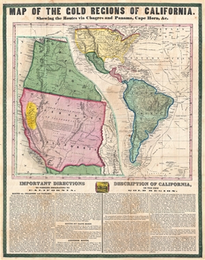
Map of the Gold Regions of California. Showing the Routes via Chagres and Panama, Cape Horn, & c.
sold
- Digital Map Information
- Suitable for large format printing
- DPI: 300
- File Size: 14.37 MB
- File Type: ZIP / TIFF
- ICC color profile embedded
- Delivered instantly via download link
A rare and remarkable example of Ensign and Thayer's 1849 promotional broadside map illustrating routes to and from the California Gold Fields. 'Forty-Niners' traveling across the continent to California faced a daunting and dangerous voyage. Moreover, ... (more details)
San Francisco named Yerba Buena! Mexican-American War! Texas at its fullest expression!
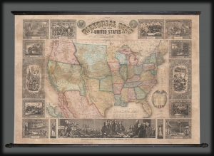
Pictorial Map of the United States.
sold
- Digital Map Information
- Suitable for large format printing
- DPI: 600
- File Size: 1830.69 MB
- File Type: ZIP / TIFF
- ICC color profile embedded
- Delivered instantly via download link
A scarce American wall map of the United States and Mexico issued by Ensign and Thayer in 1849 - at the height of the California Gold Rush and the end of the Mexican-American War (1846 - 1848). This is one of the few maps to identify San Francisco as Yerba Buena, exhibit Texas's fullest territorial claims, and show Upper California (California, New Mexico, Arizona, Utah, Nevada, Colorado, etc.) prior to its breakup into territories. It is also the only map from this series to highlight the California Gold Region. (more details)
Early days of the California Gold Rush.
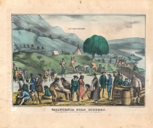
California Gold Diggers, Mining Operations on the Western shore of the Sacramento River.
sold
- Digital Map Information
- Suitable for large format printing
- Full resolution TIFF file
- ICC color profile embedded
- Delivered instantly via download link
A fascinating c. 1849 early view of the California Gold Rush, prepared by Kellogg and Comstock and printed by Ensign and Thayer. Displaying a portion of the Sacramento River, it reveals the ad hoc and multicultural environment of the Gold Rush. (more details)
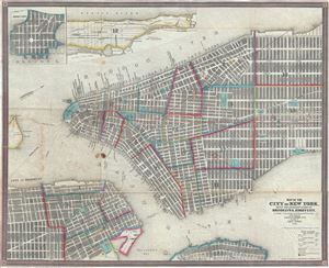
Map of the City of New York, with the Adjacent Cities of Brooklyn and Jersey City, and the Village of Williamsburg.
sold
- Digital Map Information
- Suitable for large format printing
- Full resolution TIFF file
- ICC color profile embedded
- Delivered instantly via download link
This is a scarce and beautiful 1850 pocket map of New York City published by Ensign, Thayer and Co. It covers Manhattan from 32nd Street south to the Battery and Brooklyn from Navy Yard to Sackett Street as well as part of Williamsburg. A large part of ... (more details)
Scarce decorative Wall Map of the World.
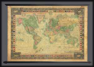
Map of the World, on Mercators Projection.
sold
- Digital Map Information
- Suitable for large format printing
- Full resolution TIFF file
- ICC color profile embedded
- Delivered instantly via download link
An attractive 1850 wall map of the world by the New York firm of Ensign and Thayer. The map presents the entire world on a Mercator Projection. It is surrounded by ensigns or flags of major maritime powers as well as an unusual decorative border defined by seashell vignettes. Different countries are highlighted by color, except the United States, wherein the individual states have their own color defination. The map meticulously details the routes of important explorers, including Christopher Columbus’ first voyage John and Sebastian Cabot, Vasco de Gama, Magellan, Sir Francis Drake, Commodore Anson, Captain James Cook, Captain Jean de la Perouse, Captain George Vancouver, and the United States Exploring Expedition (U.S. Ex. Ex.). In California, the Gold Region, reflecting general interest in the 1849 California Gold Rush, is noted. Texas is illustrated according to the Compromise of 1850, thus underscoring the cartographers' meticulousness in updating their maps. (more details)
Illustrates the original site of Columbia College, now Columbia University.
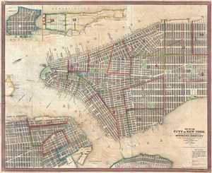
Map of the City of New York, with the Adjacent Cities of Brooklyn and Jersey City, and the Village of Williamsburg.
sold
- Digital Map Information
- Suitable for large format printing
- DPI: 300
- File Size: 13.12 MB
- File Type: ZIP / TIFF
- ICC color profile embedded
- Delivered instantly via download link
This is a scarce and beautiful 1850 pocket map of New York City published by Ensign, Thayer and Co. It depicts Manhattan from 32nd Street south to the Battery and Brooklyn from the Navy Yard to Sackett Street as well as part of Williamsburg. A large ... (more details)
Highly decorative pictorial map of the United States.
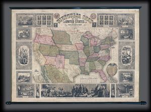
Pictorial Map of the United States.
sold
- Digital Map Information
- Suitable for large format printing
- DPI: 300
- File Size: 12.11 MB
- File Type: ZIP / TIFF
- ICC color profile embedded
- Delivered instantly via download link
An appealing and highly decorative 1854 wall map of the United States. Issued by Ensign, Bridgman and Fanning, this map was drawn and engraved by J.M. Atwood and covers the entire United States from Atlantic to Pacific and from Canada to the Gulf of ... (more details)
Pre-Civil War Westward Expansion.
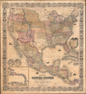
Map of the United States, with its Territories; also Mexico and the West Indies.
sold
- Digital Map Information
- Suitable for large format printing
- File Size: 87.11 MB
- File Type: ZIP / TIFF
- ICC color profile embedded
- Delivered instantly via download link
A scarce American wall map of the United States and Mexico issued by Ensign, Bridgeman and Fanning in 1856. As the title suggests, the map covers all of the United States as well as Mexico, Cuba, and Central America as far as Panama. Inset maps in the lower left illustrate the world and the Lesser Antilles. The focus of the map is westward expansion in the United States. Updates accordingly focused on administrative changes west of the Mississippi. Here, Texas conforms to the Compromise of 1850 borders, and the Gadsden Purchase has added new territory to New Mexico. The borders of Kansas and Nebraska follow the Kansas-Nebraska Act of May 30, 1854, in which Nebraska stretches to the Canadian border. The gold region in the Sacramento Valley is highlighted in California. The map notes emigrant and exploration routes to the west, including Fremont's Route, the Oregon Trail, and the Santa Fe Caravan route. American Indian lands are rigorously identified throughout as if to remind emigrants that the land is not completely free and uninhabited. (more details)
Modestly sized wall map illustrating the westward expansion.
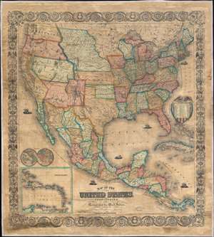
Map of the United States, with its Territories; also Mexico and the West Indies.
sold
- Digital Map Information
- Suitable for large format printing
- File Size: 120.99 MB
- File Type: ZIP / TIFF
- ICC color profile embedded
- Delivered instantly via download link
A scarce American wall map of the United States and Mexico issued by Ensign, Bridgeman and Fanning in 1856. As the title suggests, the map covers all of the United States as well Mexico, Cuba, and Central America as far as Panama. Inset maps in the lower left illustrate the world and the Lesser Antilles. The focus of the map is westward expansion in the United States. Updates accordingly focused in administrative changes west of the Mississippi. Here, Texas configures to the Compromise of 1850 borders and the Gadsden Purchase has added new territory to New Mexico. The borders of Kansas and Nebraska adhere to the Kansas-Nebraska Act of May 30, 1854 in which Nebraska stretches to the Canadian border. The gold region in the Sacramento Valley is highlighted in California. The map noes emigrant and exploration routes to the west, including Fremont's Route, The Oregon Trail, and the Santa Fe Caravan route. American Indian lands are rigorously identified throughout, as if to remind emigrants that the land is not completely free and uninhabited. (more details)
The early days of Minnesota Territory.
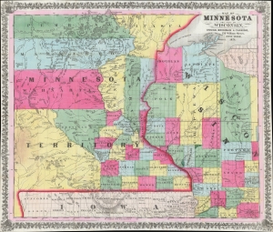
Map of Minnesota and Part of Wisconsin.
sold
- Digital Map Information
- Suitable for large format printing
- Full resolution TIFF file
- ICC color profile embedded
- Delivered instantly via download link
A stunning 1856 Ensign, Bridgman, and Fanning map of Minnesota Territory representing the early settlement of Minnesota. This map illustrates the beginning of the settlement plan for Minnesota proposed by Jonathan Carver in his 1778 Travels. When this map was issued, life in Minnesota was characterized by harsh living conditions and frontier lawlessness dominated by American Indian relations and the fur trade. (more details)
Pedagogical tool - The Empire of Things.
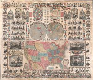
The Cottage Ornament.
sold
- Digital Map Information
- Suitable for large format printing
- File Size: 145.31 MB
- File Type: ZIP / TIFF
- ICC color profile embedded
- Delivered instantly via download link
An impressive pedagogical tool, this is Ensign, Bridgman and Fanning's 1857 wall map of the United States with a densely informative surround. The complex and dense wall map was designed to address pedagogical issues of the mid-19th century, when the westward expansion and homesteading led to increased rural populations without access to educational infrastructure. It is intended to be a textbook at-a-glance, able teach American history, science, and geography, as well as inspire patriotic optimism. The overall organization and pictorial richness mean the reader need not even be literate to absorb the map's messages. (more details)