
Guthrie, William (sold)

William Guthrie (1708 - March 9, 1770) was a Scottish historian, journalist, and writer. Born in Brechin, he studied at Aberdeen University with the idea of becoming a parochial schoolmaster. Instead, in 1730, he elected to settle in London and try his hand at literature. He covered parliamentary debates f or the Gentleman's Magazine and soon earned a reputation for being a political writer. He published several scholarly works, including a History of England from the Invasion of Julius Caesar to 1688 in four volumes, and, most notably, his Geographical Historical, and Commercial Grammar.
Presents geographical thought from between the French and Indian War and the American Revolution.
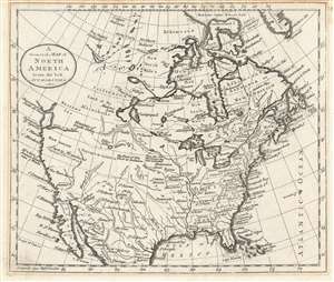
A General Map of North America from the best Authorities.
sold
- Digital Map Information
- Suitable for large format printing
- DPI: 600
- File Size: 5.1 MB
- File Type: ZIP / TIFF
- ICC color profile embedded
- Delivered instantly via download link
This is a c. 1785 William Guthrie map of North America that is based upon a c. 1770 Thomas Kitchin map of North America after the French and Indian War and before the American Revolution. Depicting the continent from the Pacific Ocean to the Atlantic Ocean and from Baffin's Bay to Mexico, and the Gulf of Mexico, the map provides an overview (although slightly flawed) of the state of affairs on the North American continent at the pivotal point in world history. (more details)
First map of Maine produced in the American Republic.
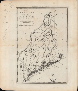
The province of Maine, from the best authorities.
sold
- Digital Map Information
- Suitable for large format printing
- Full resolution TIFF file
- ICC color profile embedded
- Delivered instantly via download link
A fascinating 1794 map of the 'Province of Maine' by Samuel Lewis and engraved by William Barker for Matthew Carey's American Edition of Guthrie's Geography improved, the first atlas published in the American Republic. It depicts the territory in the years just following independence, with borders that remained disputed and would later be shifted southwards as part of a compromise with Great Britain. (more details)
First map of the Granite State produced in the American Republic.
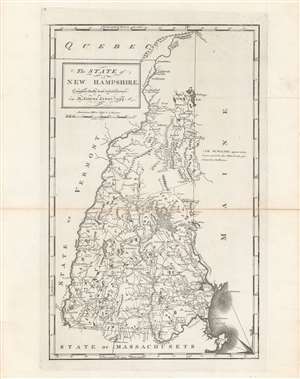
The state of New Hampshire, compared chiefly from actual surveys.
sold
- Digital Map Information
- Suitable for large format printing
- DPI: 600
- File Size: 32.14 MB
- File Type: ZIP / TIFF
- ICC color profile embedded
- Delivered instantly via download link
This is Samuel Lewis' 1794 map of New Hampshire, which appeared in Carey's General Atlas, the first atlas produced and published in the United States. It provides a wonderful snapshot of the state in the early days of the American Republic. (more details)
Earliest map of Georgia published in the American Republic.
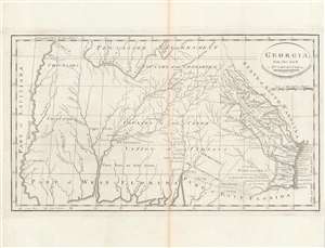
Georgia, from the latest authorities.
sold
- Digital Map Information
- Suitable for large format printing
- DPI: 600
- File Size: 24.43 MB
- File Type: ZIP / TIFF
- ICC color profile embedded
- Delivered instantly via download link
This is a significant map of Georgia from Carey's General Atlas, considered the first atlas published in the new American Republic. It demonstrates that much of the modern state of Georgia was still occupied primarily by Native Americans and little understood by white settlers. (more details)
Poland and Lithuania, just after their partition.
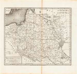
Poland, shewing the claims of Russia, Prussia and Austria until the late depredations, the extent of which cannot as yet be ascertained.
sold
- Digital Map Information
- Suitable for large format printing
- DPI: 600
- File Size: 33.06 MB
- File Type: ZIP / TIFF
- ICC color profile embedded
- Delivered instantly via download link
Here is Matthew Carey and William Barker's c. 1795 map, for Carey's General Atlas, of that lands that had composed the Polish-Lithuanian Commonwealth, which were broken up and distributed to Austria, Prussia, and Russia in the late 19th century. Aside from its cartographic qualities, this map is an instructive case study in knowledge production at a time of considerable change and instability. (more details)
Earliest Atlas Map of Vermont Published in the United States.
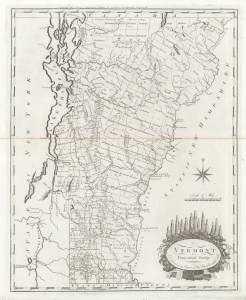
Vermont From Actual Survey.
sold
- Digital Map Information
- Suitable for large format printing
- DPI: 600
- File Size: 18.24 MB
- File Type: ZIP / TIFF
- ICC color profile embedded
- Delivered instantly via download link
The first map of Vermont published in the United States. This 1795 work was drawn and engraved by Amos Doolittle for Matthew Carey's Carey's American Edition of Guthrie's Geography Improved, the first atlas published in the United States. (more details)
Earliest Atlas Map of Vermont Published in the United States - here in striking old color.
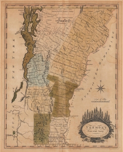
Vermont From Actual Survey.
sold
- Digital Map Information
- Suitable for large format printing
- File Size: 11.17 MB
- File Type: ZIP / TIFF
- ICC color profile embedded
- Delivered instantly via download link
This is the first map of Vermont published in the United States, here in striking original color. This 1795 work was drawn and engraved by Amos Doolittle for Matthew Carey's Carey's American Edition of Guthrie's Geography Improved, the first atlas published in the United States. (more details)
The earliest map of Pennsylvania published in the American Republic.
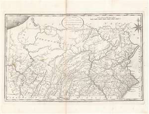
The State of Pennsylvania : reduced with permission from Reading Howell's map.
sold
- Digital Map Information
- Suitable for large format printing
- DPI: 600
- File Size: 35.23 MB
- File Type: ZIP / TIFF
- ICC color profile embedded
- Delivered instantly via download link
This is a fine first state example of Samuel Lewis’ 1795 map of Pennsylvania for Carey's General Atlas, the first atlas published in the young American Republic. It was an especially significant map as the producers of the atlas were based in Philadelphia, also the nation’s (temporary) capital at the time, which they used as the Prime Meridian throughout the atlas. (more details)
Earliest map of South Carolina published in the United States.
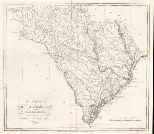
The state of South Carolina : from the best authorities.
sold
- Digital Map Information
- Suitable for large format printing
- DPI: 600
- File Size: 32.86 MB
- File Type: ZIP / TIFF
- ICC color profile embedded
- Delivered instantly via download link
This is a first state example of Samuel Lewis' 1795 map of South Carolina for Carey's General Atlas, the first atlas published in the American Republic. It illustrates the state's mountains, rivers, coastline, settlements, and infrastructure as they appeared soon after American Independence. (more details)
The earliest map of the North Pacific published in the American Republic.
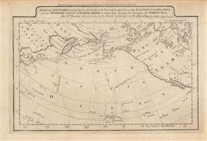
A map of the discoveries made by Capts. Cook and Clerke in the years 1778 and 1779...
sold
- Digital Map Information
- Suitable for large format printing
- DPI: 600
- File Size: 4.92 MB
- File Type: ZIP / TIFF
- ICC color profile embedded
- Delivered instantly via download link
This is a rare c. 1795 map of the northern Pacific Ocean from Carey's General Atlas, the first atlas published in the new American Republic. It highlights the three Pacific voyages of Captain James Cook and the overland route from Hudson's Bay to the Artic Ocean, 'discovered,' with critical help from indigenous guides, by Samuel Hearne. (more details)
A map of New Jersey from the first atlas produced in the American Republic.
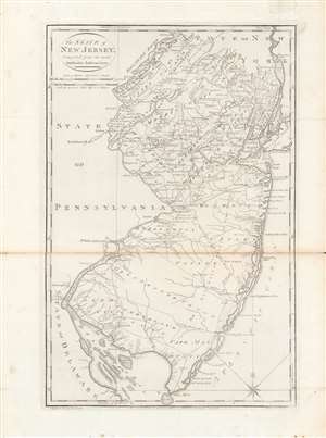
The state of New Jersey, compiled from the most authentic information.
sold
- Digital Map Information
- Suitable for large format printing
- DPI: 600
- File Size: 28 MB
- File Type: ZIP / TIFF
- ICC color profile embedded
- Delivered instantly via download link
Here is Mathew Carey and Samuel Lewis' c. 1796 map of New Jersey, made for Carey's General Atlas, the first atlas produced and published in the American Republic. It portrays the state in the years just after the American Revolution, in which it had played a central role. (more details)
First map of China published in the American Republic.
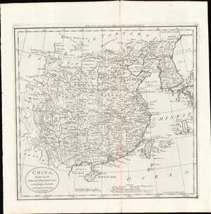
China, divided into its Great Provinces. According to the best Authorities.
sold
- Digital Map Information
- Suitable for large format printing
- Full resolution TIFF file
- ICC color profile embedded
- Delivered instantly via download link
This is a c. 1796 map of China from Carey's General Atlas, the first atlas published in the new American Republic. It depicts 'China proper,' roughly the territory covered by the Ming Dynasty, which had been conquered by the Manchu Qing Dynasty in 1644. (more details)
First map of India published in the American Republic.
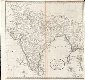
Map of Hindostan or India.
sold
- Digital Map Information
- Suitable for large format printing
- DPI: 600
- File Size: 10.77 MB
- File Type: ZIP / TIFF
- ICC color profile embedded
- Delivered instantly via download link
This is a rare c. 1796 map of South Asia from Carey's General Atlas, the first atlas published in the new American Republic. It shows the Indian subcontinent at a period of rapid transition towards the hegemony of the British East India Company (EIC). (more details)