
Tardieu, Pierre Alexander (sold)

Pierre Alexander Tardieu (1756 - 1844) was a prominent French cartographer and engraver operating in the mid-19th century. Pierre Tardieu's work is known for its detail and precision. Pierre Alexander Tardieu is frequently confused with both Jean Baptiste Pierre Tardieu and Ambroise Tardieu, two other unrelated French map and print engravers active in the late 18th and early 19th centuries.
The earliest specific map of Martha's Vineyard.
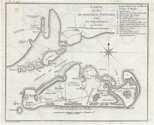
Carte de L'Ile de Martha's Vineyard avec ses dependances, pour les Lettres d'un Culuvateur Ameriquain.
sold
- Digital Map Information
- Suitable for large format printing
- DPI: 300
- File Size: 3.33 MB
- File Type: ZIP / TIFF
- ICC color profile embedded
- Delivered instantly via download link
This attractive map by P. F. Tardieu is the earliest obtainable separate map of Martha's Vineyard. It covers Martha's Vineyard in full as well as parts of the adjacent Elizabeth Islands. The map extends northwards to include, vaguely, all of Buzzards Bay and ... (more details)
Later edition of Lewis Evans' map, considered a milestone both for its political significance and expansion of cartographic knowledge.
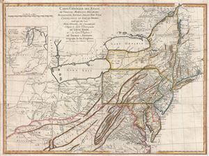
Carte Generale des Etats de Virginie, Maryland, Delaware, Pensilvanie, Nouveau-Jersey, New-York, Connecticut et Isle de Rhodes Ainsi que des Lacs Erie, Ontario, et Champlain. D'Apres la Carte Ameriquaine de Louis Evans et la Carte Anglaise de Thomas-Jefferys.
sold
- Digital Map Information
- Suitable for large format printing
- DPI: 300
- File Size: 16.54 MB
- File Type: ZIP / TIFF
- ICC color profile embedded
- Delivered instantly via download link
A scarce French edition of Louis Evans' highly influential map of the Middle British Colonies, one of the most important maps of the British Colonies to appear in the 18th century. The map covers Louisville on the Ohio River eastward as far as Narragansett ... (more details)
Later edition of Lewis Evans' map, considered a milestone both for its political significance and expansion of cartographic knowledge.

Carte Generale des Etats de Virginie, Maryland, Delaware, Pensilvanie, Nouveau-Jersey, New-York, Connecticut et Isle de Rhodes Ainsi que des Lacs Erie, Ontario, et Champlain. D'Apres la Carte Ameriquaine de Louis Evans et la Carte Anglaise de Thomas-Jefferys.
sold
- Digital Map Information
- Suitable for large format printing
- DPI: 300
- File Size: 17.66 MB
- File Type: ZIP / TIFF
- ICC color profile embedded
- Delivered instantly via download link
A fine and scarce French edition of Louis Evans' highly influential map of the Middle British Colonies, one of the most important maps of the British Colonies to appear in the 18th century. The map covers Louisville on the Ohio River eastward as far as ... (more details)
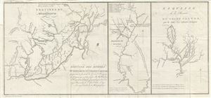
Esquisse du Muskinghum Esquisse des rivieres Muskinghum et Grand Castor.
sold
- Digital Map Information
- Suitable for large format printing
- Full resolution TIFF file
- ICC color profile embedded
- Delivered instantly via download link
This is a scarce 1787 map of the Ohio River region by Pierre Tardieu. Divided into three maps, this is one of the earliest maps of the region. The large map in the left depicts the course of the Ohio River, from the Hockhoking River and the Sandusky ... (more details)
Carte Générale de l'Ile de St. Domingue.
sold
- Digital Map Information
- Suitable for large format printing
- DPI: 300
- File Size: 16.83 MB
- File Type: ZIP / TIFF
- ICC color profile embedded
- Delivered instantly via download link
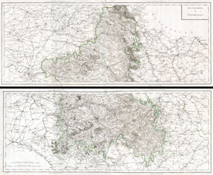
This is a rare and enormous 1797 Tardieu map of the Champagne region of France. Printed during the French Revolution - an 6 de la Republique. Covers from Paris in the west to Sarre-Louis in the east, from Rocroi in the north to Avallon in the south. ... (more details)
Features the short-lived State of Franklin or Frankland.
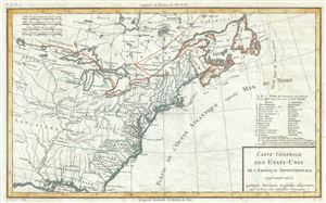
Carte Generale des Etats-Unis de l'Amerique Septentrionale, renfermant aussi quelques Provinces Angloises adjacentes.
sold
- Digital Map Information
- Suitable for large format printing
- Full resolution TIFF file
- ICC color profile embedded
- Delivered instantly via download link
This is a fascinating 1797 map of the United States by Pierre Tardieu. The map centers on the Great Lakes covering from the Lake of the Woods (Lake des Bois) eastward to Newfoundland and the Atlantic Ocean, and from James Bay south to the Gulf of ... (more details)
Stunning early map of the Niagara Isthmus with exceptionally fine engraving.
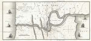
Plan de la Cataracte de Niagara et le l'Isthme qui separe les Lacs Erié et Ontario.
sold
- Digital Map Information
- Suitable for large format printing
- DPI: 300
- File Size: 3.5 MB
- File Type: ZIP / TIFF
- ICC color profile embedded
- Delivered instantly via download link
A wonderful 1801 map of the Niagara Falls and the Niagara isthmus between Lake Erie and Lake Ontario. Oriented to the west, this map covers the Niagara River from Lake Erie to Lake Ontario. It identifies Fort Erie, Fort Niagara, Grand Isle, and ... (more details)
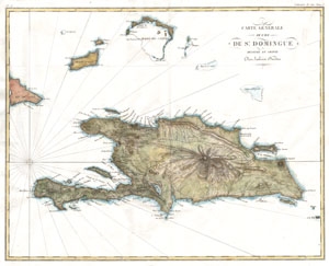
Carte Générale de l'Ile de St. Domingue.
sold
- Digital Map Information
- Suitable for large format printing
- DPI: 300
- File Size: 3.86 MB
- File Type: ZIP / TIFF
- ICC color profile embedded
- Delivered instantly via download link
A rare and beautiful 1802 map of the West Indies island of Hispaniola or Santo Domingo ( St. Domingue ) by Ambroise Tardieu. This rare and stunning map depicts the island with all of Tardieu's glorious hallmark detail. Roads, topography, ... (more details)
Ephemeral mapping of North America immediately followng the Louisiana Purchase.
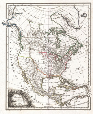
Amerique Septentrionale.
sold
- Digital Map Information
- Suitable for large format printing
- DPI: 300
- File Size: 4.37 MB
- File Type: ZIP / TIFF
- ICC color profile embedded
- Delivered instantly via download link
A highly uncommon and desirable 1810 map of North America by the French cartographer Ambrose Tardieu. Depicts all of North America including Canada, Mexico the United States at a formative but ephemeral period shortly following the U.S. ... (more details)
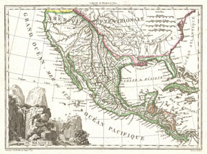
Mexique.
sold
- Digital Map Information
- Suitable for large format printing
- Full resolution TIFF file
- ICC color profile embedded
- Delivered instantly via download link
This is an unusual 1810 map of Mexico and the United States by the French cartographer J. B. Tardieu. Depicts all of Mexico and much of the United States shortly following the acquisition of Louisiana but prior to the acquisition of ... (more details)
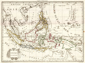
Oceanique Occidentale.
sold
- Digital Map Information
- Suitable for large format printing
- DPI: 300
- File Size: 3.65 MB
- File Type: ZIP / TIFF
- ICC color profile embedded
- Delivered instantly via download link
A highly desirable c. 1810 mapping of Southeast Asia and the East Indies by the French cartographer Ambrose Tardieu. Covers from Burma to Australia and from Sumatra to New Guinea. Includes Siam (Thailand), Cambodia (Cambodge), ... (more details)
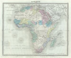
Afrique.
sold
- Digital Map Information
- Suitable for large format printing
- Full resolution TIFF file
- ICC color profile embedded
- Delivered instantly via download link
This is an attractive 1874 map of Africa by Ambroise Tardieu. It covers the entire continent in considerable detail considering the level to which it was explored at the time. It extends from the Mediterranean south to Cape ... (more details)
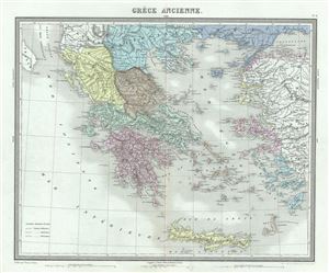
Grece Ancienne.
sold
- Digital Map Information
- Suitable for large format printing
- Full resolution TIFF file
- ICC color profile embedded
- Delivered instantly via download link
This is a fine 1874 map of Ancient Greece by Ambroise Tardieu. This map focuses on Greece under the Roman Empire, covering from the Ionian Sea to Aegean Sea and from Macedonia to the Mediterranean Sea. Details mountains, ... (more details)
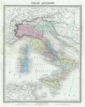
Italie Ancienne.
sold
- Digital Map Information
- Suitable for large format printing
- Full resolution TIFF file
- ICC color profile embedded
- Delivered instantly via download link
An uncommon and attractive 1874 map of Italy during ancient Roman times. The map coves from Gaule Transpine to Sicily. Also includes the islands of Corsica and Sardinia. Throughout, the map identifies various cities, ... (more details)
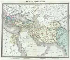
Empire d'Alexandre.
sold
- Digital Map Information
- Suitable for large format printing
- Full resolution TIFF file
- ICC color profile embedded
- Delivered instantly via download link
This is a beautiful 1874 map of the Empire of Alexander the Great by Ambroise Tardieu. It covers from Alexander's homeland in Macedonia eastwards past Asia Minor and Persia as far as India and south to include Egypt. ... (more details)
1874 Tardieu Map of Central Europe (Germany, Poland, Switzerland, Austria, Hungary, Bohemia, Lithuan
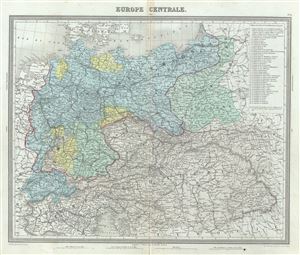
Europe Centrale.
sold
- Digital Map Information
- Suitable for large format printing
- Full resolution TIFF file
- ICC color profile embedded
- Delivered instantly via download link
This is a fine example of Ambroise Tardieu's 1874 map of the Central Europe. It covers the German Confederation from the Baltic Sea to the Adriatic Sea and from Switzerland to the Austro-Hungarian Empire. The top ... (more details)
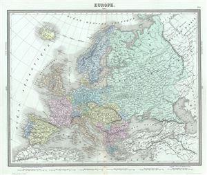
Europe.
sold
- Digital Map Information
- Suitable for large format printing
- Full resolution TIFF file
- ICC color profile embedded
- Delivered instantly via download link
This is an example of Ambroise Tardieu's 1874 map of Europe. It covers the continent in its entirety from the Atlantic to the Caspian Sea and from the Arctic Ocean to the Mediterranean Sea. It also details ... (more details)
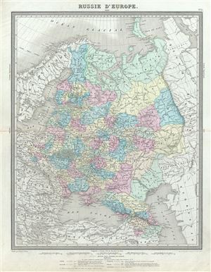
Russie d'Europe.
sold
- Digital Map Information
- Suitable for large format printing
- Full resolution TIFF file
- ICC color profile embedded
- Delivered instantly via download link
This is a fine 1874 map of European Russia by Ambroise Tardieu. It covers from the Arctic Ocean to the Black Sea and from the Baltic Sea east to the Ural Mountains. Tardieu identifies various cities, roads, ... (more details)
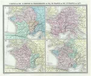
I. Gaule en 507. II. Empire de Charlemagne en 814. III. France en 987. IV. France en 1677.
sold
- Digital Map Information
- Suitable for large format printing
- Full resolution TIFF file
- ICC color profile embedded
- Delivered instantly via download link
This is a fine 1874 map of Gaul or France by Ambroise Tardieu. Essentially four maps on a single sheet, it depicts Gaul or France during 507, 816, 987 and 1677. The first map, Gaul in 507 depicts the ... (more details)
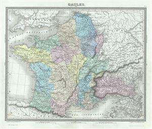
Gaules.
sold
- Digital Map Information
- Suitable for large format printing
- Full resolution TIFF file
- ICC color profile embedded
- Delivered instantly via download link
This is a beautiful 1874 map of Gaul or France in ancient Roman times issued by Ambroise Tardieu. It covers from the English Channel south as far as the Pyrenees Mountains and Hispania. It includes ... (more details)
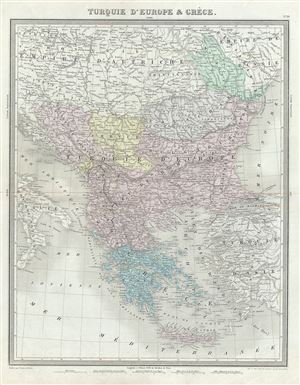
Turquie d'Europe et Greece.
sold
- Digital Map Information
- Suitable for large format printing
- Full resolution TIFF file
- ICC color profile embedded
- Delivered instantly via download link
This is a beautiful 1874 map of Greece, the Balkans and the European part of Turkey by Ambroise Tardieu. It covers from Moldavia to Candia or Crete and from the Gulf of Venice to the Sea of Marmara. ... (more details)
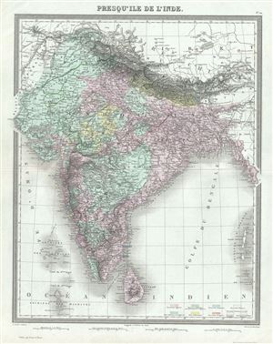
Presqu'Ile de l'Inde.
sold
- Digital Map Information
- Suitable for large format printing
- Full resolution TIFF file
- ICC color profile embedded
- Delivered instantly via download link
This is a beautiful 1874 map of the Indian Subcontinent by Ambroise Tardieu. It covers the entire subcontinent from the Himalayas south as far as Ceylon (Sri Lanka) and from Sindh as far east as ... (more details)
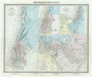
Geographie de la Bible.
sold
- Digital Map Information
- Suitable for large format printing
- Full resolution TIFF file
- ICC color profile embedded
- Delivered instantly via download link
This is a scarce 1874 map of Israel, Palestine or the Holy Land with surrounding regions by Ambroise Tardieu. Essentially four maps on a single sheet, the maps depict the geography of the Bible. ... (more details)
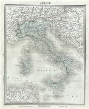
Italie.
sold
- Digital Map Information
- Suitable for large format printing
- Full resolution TIFF file
- ICC color profile embedded
- Delivered instantly via download link
This is a beautiful 1874 map of Italy by Ambroise Tardieu. It depicts the Italian peninsula in the midst of its struggle for national solidarity. Includes the Kingdom of Sardinia, Corsica, and ... (more details)
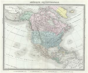
Amerique Septentrionale.
sold
- Digital Map Information
- Suitable for large format printing
- Full resolution TIFF file
- ICC color profile embedded
- Delivered instantly via download link
This is a finely detailed 1874 map of the North America by Ambroise Tardieu. This map covers the entire continent from the Arctic Circle to the northern part of South America inclusive of the ... (more details)
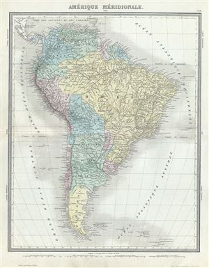
Amerique Meridionale.
sold
- Digital Map Information
- Suitable for large format printing
- Full resolution TIFF file
- ICC color profile embedded
- Delivered instantly via download link
This is a fine 1874 map of South America by Ambroise Tardieu. It covers the entire continent from the Panama to Cape Horn and from the Pacific to the Atlantic. The Falkland and South Georgia ... (more details)
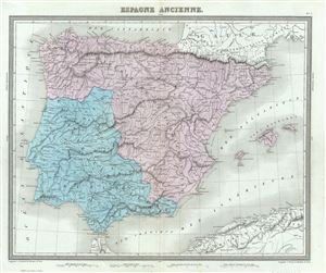
Espagne Ancienne.
sold
- Digital Map Information
- Suitable for large format printing
- Full resolution TIFF file
- ICC color profile embedded
- Delivered instantly via download link
This is a fine example of Conrad Ambroise Tardieu's 1874 map of Ancient Iberia or Spain and Portugal. The map covers all of Iberia under the Roman Republic from the Atlantic Ocean to the ... (more details)
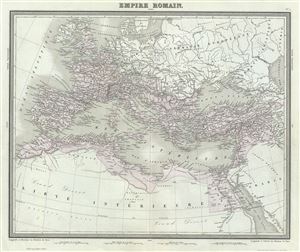
Empire Romain.
sold
- Digital Map Information
- Suitable for large format printing
- Full resolution TIFF file
- ICC color profile embedded
- Delivered instantly via download link
This is a beautiful and uncommon 1874 map of the Roman Empire by Ambroise Tardieu. The map shows the extent of the Roman Empire at its height, and covers most of Europe, the Middle East, ... (more details)
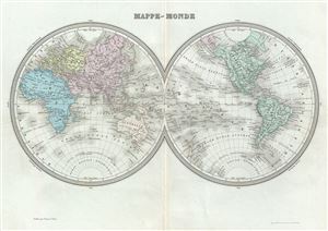
Mappe-Monde.
sold
- Digital Map Information
- Suitable for large format printing
- Full resolution TIFF file
- ICC color profile embedded
- Delivered instantly via download link
This is a beautiful 1874 map of the World in hemispheres by Ambroise Tardieu. It offers a fascinating snapshot of the world during a period of rapid globalization and discovery. The ... (more details)
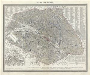
This is a fine 1874 map or city plan of Paris, France. It depicts Paris and its immediate vicinity in extraordinary detail. Centered on the Seine River, it covers Paris as contained ... (more details)