
Vancouver, George (sold)
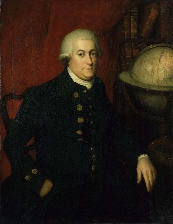
George Vancouver (June 22, 1750 - May 10, 1798) was a British naval officer and explorer active in the late 18th century. Vancouver was the last of the great naval explores of the 18th century and, along with Captain James Cook and Perouse, is credited with the first accurate mapping of the Northwest Coast of America. Vancouver was born in King's Lynn, England and joined the Royal Navy at age 13 as a seaman. While little is known of Vancouver's early life, he first appears in the annals of history as a midshipmen aboard the HMS Resolution of Captain Cook's second voyage in search of Terra Australis. On this expedition Vancouver claimed to have "been nearer the south pole than any other man" (after climbing the bowsprit before the ship turned back in the face of mountains of Antarctic ice). He also accompanied the third Cook expedition as a midshipman on the HMS Discovery where he witnessed the discovery of the Hawaiian Islands as well as Cooks tragic death on those same islands. Returning to England under Cook's second, Captain Clerke recommended Vancouver for promotion to Lieutenant. Under his new commission he spent several years learning surveying in the Caribbean aboard the HMS Martin, where he also distinguished himself in a number of military altercations with the French. In 1790 Vancouver received an appointment as the Captain of the HMS Discovery and was commissioned to complete the exploration of American's Northwest Coast begun by Cook and Perouse. Between 1791 and 1795 Vancouver's remarkable diligence and attention to detail created the first truly accurate cartographic picture of the American Coast between San Francisco Bay and California. Vancouver was the first to map countless rivers and inlets and to identify Vancouver Island. During his four years of exploration he also spent three winters in Hawaii, creating in the process the first accurate map of the islands. Unlike many earlier explorers Vancouver generally maintained good and respectful relations with the indigenous peoples he encountered. In Hawaii Vancouver allegedly negotiated the cession of Hawaii to England as well as introduced beneficial flora and fauna to the archipelago. Vancouver returned to England in 1795 where he immediately ran afoul of the powers that be. During his voyages Vancouver excited the ire of more than one crew member, including the well-connected naturalist Archibald Menzies, the sailing master Joseph Whidbey, and Thomas Pitt, the powerful Baron of Camelford. Slandered and assaulted by these influential enemies, one of Britian's greatest explorers fell into obscurity. He died shortly after in 1798 and was buried in an unremarkable grave at St. Peter's Churchyard, Petersham, Surrey, England. The journals of Vancouver's expedition, as well as his all-important maps, were published posthumously in the same year as his death. Robin Fisher, the academic Vice President of Mount Royal University in Calgary and author of two books on Vancouver, writes:
He [Vancouver] put the northwest coast on the map...He drew up a map of the north-west coast that was accurate to the 'nth degree,' to the point it was still being used into the modern day as a navigational aid. That's unusual for a map from that early a time.Today Vancouver is memorialized by Vancouver Island, which he discovered, the Hudson Bay Company's Fort Vancouver, the city of Vancouver, Vancouver Peninsula Australia, Mount Vancouver, the 8th highest mountain in Canada, Vancouver Bay in Jervis Inlet, and the Vancouver Maritime Museum. For his 250th birthday, the Canada Post issued a special postage stamp in his honor.
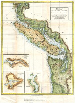
A Chart Shewing part of the Coast of N.W. America, with the tracks of His Majesty's Sloop Discovery and Armed Tender Chatham;; Commanded by George Vancouver Esq. and prepared under his immediate inspection by Lieut. Joseph Baker in which the Continental Shore has been traced and determined from Lat: 46.30 N. and Long236.12 E. to Lat: 52.15 N. and Long . 232.40 E. at the different periods shown by the Tracks.
sold
- Digital Map Information
- Suitable for large format printing
- File Size: 15.36 MB
- File Type: ZIP / TIFF
- ICC color profile embedded
- Delivered instantly via download link
This is a hand colored 1871 reissue of what is considered to be the great navigator George Vancouver's most important and influential map detailing the northwest coast of America. Originally issued in 1798, Vancouver's map covers from Cape Lookout (modern day ... (more details)
The map that disproved the Northwest Passage.
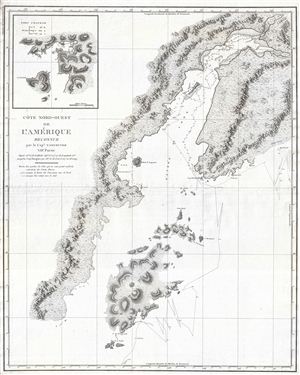
Cote Nord-Ouest de L'Amerique Reconnue par le Cape. Vancouver. VIIe Partie.
sold
- Digital Map Information
- Suitable for large format printing
- DPI: 300
- File Size: 17.73 MB
- File Type: ZIP / TIFF
- ICC color profile embedded
- Delivered instantly via download link
One of the great navigator George Vancouver's most important and influential maps, this is Vancouver's 1799 mapping of Kodiak Island and Cook Inlet, Alaska. Centered on the entrance to Cook Inlet, this map covers from Knik Arm and Turnagain Arm southwards as ... (more details)
A cornerstone map of Australian discovery and colonization.
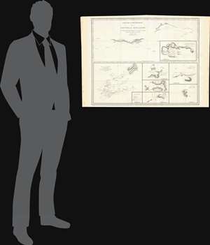
Partie de la Cote Sud-Ouest de la Nouvelle Hollande avec les Routes de la Corvette la Decouverte et sa conserve le Chatham commandes par Georges Vancouver en l'Annee 1791.
sold
- Digital Map Information
- Suitable for large format printing
- DPI: 300
- File Size: 13.52 MB
- File Type: ZIP / TIFF
- ICC color profile embedded
- Delivered instantly via download link
One of the great navigator George Vancouver's most important and influential maps, this is Vancouver's 1799 mapping of southwestern Australia and New Zealand. Though less well known than his historic mapping of the Pacific Northwest, Vancouver's work in ... (more details)
Cornerstone map of Australian discovery and colonization.
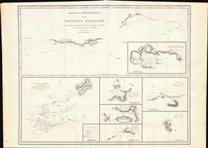
Partie de la Cote Sud-Ouest de la Nouvelle Hollande avec les Routes de la Corvette la Decouverte et sa conserve le Chatham commandes par Georges Vancouver en l'Annee 1791.
sold
- Digital Map Information
- Suitable for large format printing
- DPI: 600
- File Size: 29.25 MB
- File Type: ZIP / TIFF
- ICC color profile embedded
- Delivered instantly via download link
One of the great navigator George Vancouver's most important and influential maps, this is Vancouver's 1799 mapping of southwestern Australia and New Zealand. Though less well known than his historic mapping of the Pacific Northwest, Vancouver's work in Australia and New Zealand is no less significant. (more details)
Quite simply the largest, most beautiful, and most important early map of Hawaii ever published.
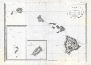
Carte des Iles Sandwich d'apres la reconnoissance qui en a ete faite dans les differentes relaches de la corvette La Decouverte et de sa conserve Le Chatham commandes par le Capt. Vancouver en 1792, 1793 et 1794.
sold
- Digital Map Information
- Suitable for large format printing
- DPI: 300
- File Size: 16.94 MB
- File Type: ZIP / TIFF
- ICC color profile embedded
- Delivered instantly via download link
A seminal map. This is a fine example of George Vancouver's 1799 map of the Hawaiian Islands, considered the largest, most important, and most beautiful map of Hawaii to appear in the 18th century. George Vancouver first sighted Hawaii on January 18, ... (more details)
Quite simply the largest, most beautiful, and most important early map of Hawaii ever published.
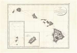
Carte des Iles Sandwich d'apres la reconnoissance qui en a ete faite dans les differentes relaches de la corvette La Decouverte et de sa conserve Le Chatham commandes par le Capt. Vancouver en 1792, 1793 et 1794.
sold
- Digital Map Information
- Suitable for large format printing
- DPI: 600
- File Size: 21.69 MB
- File Type: ZIP / TIFF
- ICC color profile embedded
- Delivered instantly via download link
This is a beautiful example of George Vancouver's seminal 1799 map of the Hawaiian Islands, considered the largest, most important, and most beautiful map of Hawaii to appear in the 18th century. George Vancouver first sighted Hawaii on January 18, 1778, when, as a midshipman on the HMS Discovery, consort ship to Captain James Cooks' HMS Resolution, becoming one of the first Europeans to see the idyllic island group. Despite Cook's having been killed by angry Hawaiian natives, Vancouver formed a good opinion of the both the archipelago and the Hawaiian people. Fourteen years later and captain of his own ship, George Vancouver chose the Hawaiian Islands as a winter base while exploring the Northwest Coast of America in search of the elusive Northwest Passage. During his three seasonal visits to the Hawaiian Islands, Vancouver and his Lieutenant Joseph Baker completed this, the first complete map of the archipelago. His route, which zigzags around and between the islands, is carefully noted and includes visits in 1792, 1793, and 1794. (more details)
Quite simply the largest, most beautiful, and most important early map of Hawaii ever published.
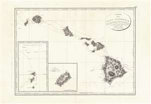
Carte des Iles Sandwich d'apres la reconnoissance qui en a ete faite dans les differentes relaches de la corvette La Decouverte et de sa conserve Le Chatham commandes par le Capt. Vancouver en 1792, 1793 et 1794.
sold
- Digital Map Information
- Suitable for large format printing
- Full resolution TIFF file
- ICC color profile embedded
- Delivered instantly via download link
This is a beautiful example of George Vancouver's seminal 1799 map of the Hawaiian Islands, considered the largest, most important, and most beautiful map of Hawaii to appear in the 18th century. George Vancouver first sighted Hawaii on January 18, 1778, as a midshipman on the HMS Discovery, consort ship to Captain James Cook's HMS Resolution, becoming one of the first Europeans to see the idyllic island group. Despite Cook's having been killed by angry Hawaiian natives, Vancouver formed a good opinion of the both the archipelago and the Hawaiian people. Fourteen years later and captain of his own ship, George Vancouver chose the Hawaiian Islands as a winter base while exploring the Northwest Coast of America in search of the elusive Northwest Passage. During his three seasonal visits to the Hawaiian Islands, Vancouver and his Lieutenant Joseph Baker completed this, the first complete map of the archipelago. His route, which zigzags around and between the islands, is carefully noted and includes visits in 1792, 1793, and 1794. (more details)
Reveals Vancouver's explorations on the Columbia River.
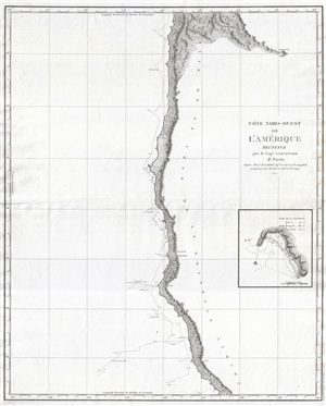
Cote Nord-Ouest de L'Amerique Reconnue par le Cape. Vancouver. 2e Partie.
sold
- Digital Map Information
- Suitable for large format printing
- DPI: 300
- File Size: 12.04 MB
- File Type: ZIP / TIFF
- ICC color profile embedded
- Delivered instantly via download link
A fine example of George Vancouver's 1799 mapping of the northern California and Oregon. This map covers from Cape Lookout and the Columbia River southward past Cape Gregory, Cape Orford, Port St. George, the Bay of Trinidad, and Cape Mendocino to ... (more details)
One of George Vancouver's most beautiful and impressive maps.
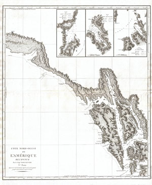
Cote nord-ouest de l'Amerique. Reconnue par le Cape. Vancouver. Ve. Partie
sold
- Digital Map Information
- Suitable for large format printing
- DPI: 300
- File Size: 18.12 MB
- File Type: ZIP / TIFF
- ICC color profile embedded
- Delivered instantly via download link
One of the great navigator George Vancouver's beautiful maps, this 1799 chart focuses on the rugged coastline of the southern Alaska panhandle from modern day Yakutat Bay (Baie de Beering) to the Alexander Archipelago (Archipel du Roi George III). ... (more details)
One of George Vancouver's most beautiful and impressive maps.
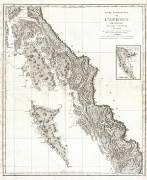
Cote nord-ouest de l'Amerique. Reconnue par le Cape. Vancouver. IVe. Partie
sold
- Digital Map Information
- Suitable for large format printing
- DPI: 300
- File Size: 24.01 MB
- File Type: ZIP / TIFF
- ICC color profile embedded
- Delivered instantly via download link
One of the great navigator George Vancouver's beautiful maps, this 1799 chart focuses on the rugged coastline of British Columbia and southern Alaska panhandle. This is the first truly accurate and detailed reconnaissance of this forbidding ... (more details)
The first accurate map of the southern Alaska coastline.
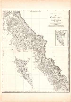
Cote Nord-Ouest de L'Amerique Reconnue par le Cape. Vancouver. IVe Partie.
sold
- Digital Map Information
- Suitable for large format printing
- DPI: 600
- File Size: 100.84 MB
- File Type: ZIP / TIFF
- ICC color profile embedded
- Delivered instantly via download link
One of George Vancouver's most important and influential charts, this is a 1799 mapping of the coast from (Prince) Frederick Sound and Prince of Wales Island to Haida Gwaii (or the Queen Charlotte Islands), now on the border between Alaska and Canada. It was the first truly accurate and detailed reconnaissance of this forbidding coastline. (more details)
The first English mappings of San Diego and San Francisco Bays.
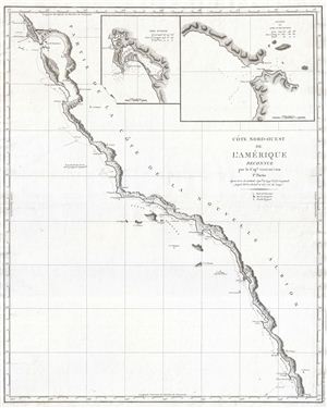
Cote Nord-Ouest de L'Amerique Reconnue par le Cape. Vancouver. 1e Partie.
sold
- Digital Map Information
- Suitable for large format printing
- DPI: 300
- File Size: 13.42 MB
- File Type: ZIP / TIFF
- ICC color profile embedded
- Delivered instantly via download link
One of the great navigator George Vancouver's most important and influential maps, this is Vancouver's 1799 mapping of the California coastline roughly from San Francisco Bay in the north to Santo Domingo, Mexico. Vancouver's exploration ... (more details)
The first published map of the northwest coast to show Vancouver Island, the Puget Sound, and the Columbia River.
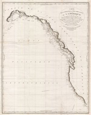
Carte de la Partie de la Cote Nord-Ouest de L'Amerique Reconnue pendant Etes de 1792, 1793, et 1794
sold
- Digital Map Information
- Suitable for large format printing
- DPI: 300
- File Size: 20.9 MB
- File Type: ZIP / TIFF
- ICC color profile embedded
- Delivered instantly via download link
One of the great navigator George Vancouver's most important and influential maps, this is the 1799 general reconnaissance of the west coast of America from San Diego to Kodiak Island, Alaska. At last the west coast of America, particular ... (more details)
The first published map of the northwest coast to show Vancouver Island, the Puget Sound, and the Columbia River.
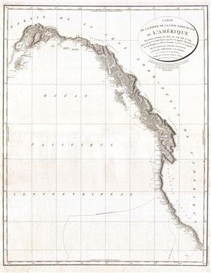
Carte de la Partie de la Cote Nord-Ouest de L'Amerique Reconnue pendant Etes de 1792, 1793, et 1794
sold
- Digital Map Information
- Suitable for large format printing
- DPI: 300
- File Size: 17.19 MB
- File Type: ZIP / TIFF
- ICC color profile embedded
- Delivered instantly via download link
One of the great navigator George Vancouver's most important and influential maps, this is the 1799 general reconnaissance of the west coast of America from San Diego to Kodiak Island, Alaska. At last the west coast of America, particular ... (more details)
First printed mapping of the Columbia river and Puget Sound.
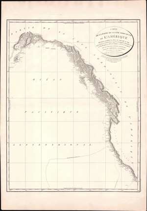
Carte de la Partie de la Cote Nord-Ouest de L'Amerique Reconnue pendant Etes de 1792, 1793, et 1794.
sold
- Digital Map Information
- Suitable for large format printing
- Full resolution TIFF file
- ICC color profile embedded
- Delivered instantly via download link
One of George Vancouver's most influential maps, this is the 1799 general reconnaissance of the west coast of America from San Diego to Kodiak Island, Alaska. This beautifully engraved map features several notable firsts, including the first published mapping of the Puget Sound, the first mapping of Vancouver as an island, the first mapping of the Johnston Strait, the first detailed mapping of Cook Inlet, and the first published map of the Columbia River. In general, this represents the finest mapping of the American west coast to appear for nearly 40 years from its publication. Vancouver's tracks in 1792, 1793, and 1794 are noted. (more details)
First printed charting of the Columbia river and Puget Sound.
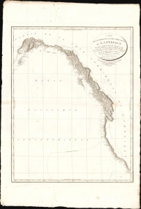
Carte de la Partie de la Cote Nord-Ouest de L'Amerique Reconnue pendant Etes de 1792, 1793, et 1794.
sold
- Digital Map Information
- Suitable for large format printing
- File Size: 26.04 MB
- File Type: ZIP / TIFF
- ICC color profile embedded
- Delivered instantly via download link
One of George Vancouver's most influential maps, this is the 1799 general reconnaissance of the west coast of America from San Diego to Kodiak Island, Alaska. This beautifully engraved chart features several notable firsts, including the first published mapping of the Puget Sound, the first mapping of Vancouver as an island, the first mapping of the Johnston Strait, the first detailed mapping of Cook Inlet, and the first published map of the Columbia River. In general, this represents the finest mapping of the American west coast to appear for nearly 40 years from its publication. Vancouver's tracks in 1792, 1793, and 1794 are noted. (more details)
First map to show Vancouver Island and Puget Sound.
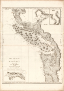
Cote Nord-Ouest de L'Amerique Reconnue par le Cape. Vancouver. 3e. Partie.
sold
- Digital Map Information
- Suitable for large format printing
- DPI: 600
- File Size: 1024.17 MB
- File Type: ZIP / TIFF
- ICC color profile embedded
- Delivered instantly via download link
This is the 1799 French edition of George Vancouver's 1799 nautical map of Vancouver Island, the Strait of Juan de Fuca, the mouth of the Columbia River, and Queen Charlotte Sound, extending from Cape Lookout (in modern-day Oregon) to Cape Swaine (Alaska). It is considered to be the great navigator George Vancouver's most important and influential map, among those he produced in his foundational reconnaissance of the northwest coast of America (1791 - 1795). (more details)
Vancouver's most important map. The first map to show Vancouver Island and the Puget Sound.
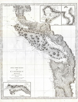
Cote Nord-Ouest de L'Amerique Reconnue par le Cape. Vancouver. 3e. Partie.
sold
- Digital Map Information
- Suitable for large format printing
- DPI: 300
- File Size: 21.35 MB
- File Type: ZIP / TIFF
- ICC color profile embedded
- Delivered instantly via download link
Considered to be the great navigator George Vancouver's most important and influential map, this is the third plate of his reconnaissance of the northwest coast of America. This 1799 map covers from Cape Lookout (modern day Oregon) ... (more details)
First map to show Vancouver Island and Puget Sound.
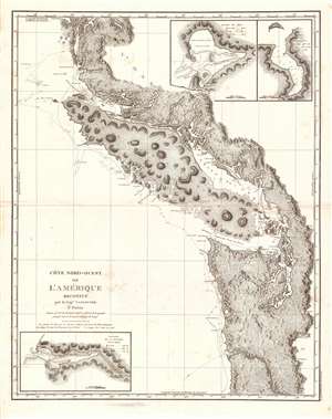
Cote Nord-Ouest de L'Amerique Reconnue par le Cape. Vanouver. 3e. Partie.
sold
- Digital Map Information
- Suitable for large format printing
- Full resolution TIFF file
- ICC color profile embedded
- Delivered instantly via download link
This is the 1799 French edition of George Vancouver's 1799 nautical map of the region around Vancouver Island, the Strait of Juan de Fuca, the mouth of the Columbia River, and Queen Charlotte Sound, extending from Cape Lookout (in modern-day Oregon) to Cape Swaine (Alaska). It is considered to be the great navigator George Vancouver's most important and influential map, among those he produced in his foundational reconnaissance of the northwest coast of America (1791 - 1795). (more details)
1st to show Vancouver Island and Puget Sound.
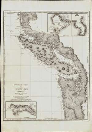
Cote Nord-Ouest de L'Amerique Reconnue par le Cape. Vanouver. 3e. Partie.
sold
- Digital Map Information
- Suitable for large format printing
- Full resolution TIFF file
- ICC color profile embedded
- Delivered instantly via download link
This is the 1799 French edition of George Vancouver's 1799 nautical map of the region around Vancouver Island, the Strait of Juan de Fuca, the mouth of the Columbia River, and Queen Charlotte Sound, extending from Cape Lookout (in modern-day Oregon) to Cape Swaine (Alaska). It is considered to be the great navigator George Vancouver's most important and influential map, among those he produced in his foundational reconnaissance of the northwest coast of America (1791 - 1795). (more details)
Some of the earliest nautical views of the Pacific Northwest ever published.
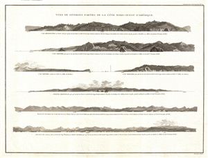
Vues de Diverses Parties de la Cote Nord-Ouest d'Amerique.
sold
- Digital Map Information
- Suitable for large format printing
- DPI: 300
- File Size: 7.29 MB
- File Type: ZIP / TIFF
- ICC color profile embedded
- Delivered instantly via download link
A fine example of George Vancouver's 1799 view sheet depicting various coastal profile views of the Pacific Northwest. This sheet features seven beautifully rendered views detailing, from top: Cape Mendocino, California (Cap ... (more details)
Some of the earliest nautical views of the Pacific Northwest ever published.
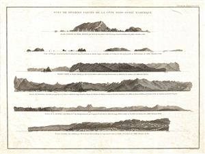
Vues de Diverses Parties de la Cote Nord-Ouest d'Amerique.
sold
- Digital Map Information
- Suitable for large format printing
- DPI: 300
- File Size: 8.26 MB
- File Type: ZIP / TIFF
- ICC color profile embedded
- Delivered instantly via download link
A fine example of George Vancouver's 1799 view sheet depicting various coastal profile views of the Pacific Northwest. This sheet features six beautifully rendered views detailing, from top: the Scott Islands (British ... (more details)
Some of the earliest nautical views San Francisco, San Diego, and Santa Barbara.
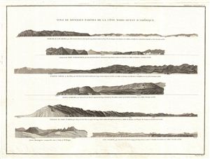
Vues de Diverses Parties de la Cote Nord-Ouest d'Amerique.
sold
- Digital Map Information
- Suitable for large format printing
- DPI: 300
- File Size: 7.69 MB
- File Type: ZIP / TIFF
- ICC color profile embedded
- Delivered instantly via download link
A fine example of George Vancouver's 1799 view sheet for the western coast of North America in and around modern day California. This sheet features seven beautifully rendered views detailing, from top: Drakes Bay, ... (more details)
Some of the earliest nautical views Alaska, Mexico and South America ever published.
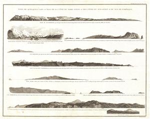
Vues de Quelques Caps et Iles de la Cote du Nord Ouest et des Cotes Du Sud-Ouest et due Sud de L'Amerique.
sold
- Digital Map Information
- Suitable for large format printing
- DPI: 300
- File Size: 7.03 MB
- File Type: ZIP / TIFF
- ICC color profile embedded
- Delivered instantly via download link
A fine example of George Vancouver's 1799 view sheet depicting various capes explored by Vancouver and his officers during this historic exploration of the western coast of America. This sheet features nine ... (more details)
The first published coastal views of parts of Australia and New Zealand.
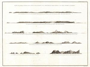
Vues de quelques Parties de la Cote Sud ouest de la Nouvelle Hollande et des Iles Oparo et Snares.
sold
- Digital Map Information
- Suitable for large format printing
- DPI: 300
- File Size: 5.45 MB
- File Type: ZIP / TIFF
- ICC color profile embedded
- Delivered instantly via download link
A fine example of George Vancouver's 1799 view sheet depicting various coastal profile views of Australia and New Zealand. This sheet features six beautifully rendered views detailing, from top: Chatham ... (more details)