

Nouveau Plan de Paris Divise en Vingt Arrondissements.
sold
- Digital Map Information
- Suitable for large format printing
- Full resolution TIFF file
- ICC color profile embedded
- Delivered instantly via download link
A spectacular large format linen backed folding map of Paris, France. Published by the Hachette firm in 1870. Depicts the city in extraordinary hand colored detail with all train lines, streets and major buildings depicted. Comes with booklet containing a useful ... (more details)
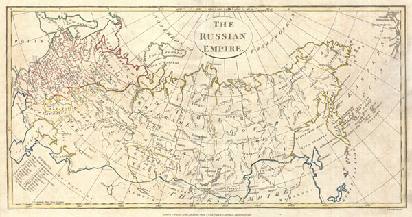
Russian Empire.
sold
- Digital Map Information
- Suitable for large format printing
- DPI: 300
- File Size: 6.37 MB
- File Type: ZIP / TIFF
- ICC color profile embedded
- Delivered instantly via download link
A fine 1799 map of the Russian Empire by the English mapmaker Clement Cruttwell. Covers the entire region and makes note of the many regional governments, or oblasts, as they were then known. These include the governments of Archangel, Vologda, Upha, Caucasus, ... (more details)

Western Hemisphere.
sold
- Digital Map Information
- Suitable for large format printing
- Full resolution TIFF file
- ICC color profile embedded
- Delivered instantly via download link
This fascinating hand colored 1815 map by Edinburgh cartographer John Thomson depicts North America and South America or the Western Hemisphere. Map covers from the Arctic to the Antarctic and from New Zealand to the Cape Verde Islands. Depicts the routes of ... (more details)

South America.
sold
- Digital Map Information
- Suitable for large format printing
- DPI: 300
- File Size: 7.3 MB
- File Type: ZIP / TIFF
- ICC color profile embedded
- Delivered instantly via download link
A fine 1799 map of South America by the English mapmaker Clement Cruttwell. Covers all of South America as well as parts of Central America as far north as Honduras. Crutwell identifies a number of indigenous peoples throughout as well as missions stations ... (more details)

L’Irlande divisee Par Provinces Civiles et Ecclesiastiques.
sold
- Digital Map Information
- Suitable for large format printing
- DPI: 300
- File Size: 2.62 MB
- File Type: ZIP / TIFF
- ICC color profile embedded
- Delivered instantly via download link
This is a rare and elegantly produced 1766 map of Ireland by the French cartographer Louis Brion de la Tour and his associate Louis Charles Desnos. Depicts the island of Ireland divided into four sections. Decorative title cartouche in the upper left ... (more details)
Shows the partitioning of Poland.

Poland.
sold
- Digital Map Information
- Suitable for large format printing
- DPI: 300
- File Size: 6.98 MB
- File Type: ZIP / TIFF
- ICC color profile embedded
- Delivered instantly via download link
A fine 1799 map of Poland by the English mapmaker Clement Cruttwell. Shows the partitioning of the Polish-Lithuanian Commonwealth in 1765-1795 between Prussia, Austria, and Russia. The map covers the area from Poznan in the west to just west of Kiev ... (more details)

Map of the Public Surveys in California to accompany the Report of the Surveyor General 1854
sold
- Digital Map Information
- Suitable for large format printing
- Full resolution TIFF file
- ICC color profile embedded
- Delivered instantly via download link
This magnificent map is one of the rarest and most sought after early Land Survey maps of California. Dates to 1854. Formally titled: 'Map of the Public Surveys in California to accompany the Report of the Surveyor General 1854.' Prepared by P.S. ... (more details)
A fascinating 17th century pre-Cook speculation on the configuration of northwestern America.

Carte Generale Des Decouvertes de L'Amiral de Fonte representant la grand porbabilite d'un Passage Au Nord Ouest par Thomas Jefferys Geographe du Roi a Londres 1768.
sold
- Digital Map Information
- Suitable for large format printing
- DPI: 300
- File Size: 15.19 MB
- File Type: ZIP / TIFF
- ICC color profile embedded
- Delivered instantly via download link
A truly fascinating 1772 map of the northwestern parts of North America by Robert de Vaugondy and Thomas Jefferys. Essentially depicts the north eastern parts of Asia, speculations on northwestern America, and Admiral De Fonte's mythical ... (more details)
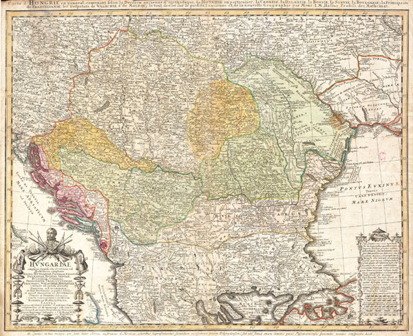
Hvngariae (Huntariae)
sold
- Digital Map Information
- Suitable for large format printing
- Full resolution TIFF file
- ICC color profile embedded
- Delivered instantly via download link
A stunning 1752 Homann Heirs hand colored map of Hungary, northern Greece, and the Balkans. Expansive view of the region which covers modern day Hungary, Croatia, Macedonia, Albania, the Slav republics and Romania south to the northern ... (more details)

Sketch A Shewing the progressof theSurvey in Section No. 1 from 1844 to 1873.
sold
- Digital Map Information
- Suitable for large format printing
- File Size: 53.19 MB
- File Type: ZIP / TIFF
- ICC color profile embedded
- Delivered instantly via download link
An exceptional example of the 1873 U.S. Coast Survey's progress nautical chart for Massachusetts and Maine. Covers the coast line from Narraganset Bay (Rhode Island) eastwards past Martha's Vineyard and Nantucket then north to Cape ... (more details)

North Carolina Gold region
sold
- Digital Map Information
- Suitable for large format printing
- Full resolution TIFF file
- ICC color profile embedded
- Delivered instantly via download link
This hand colored map is a copper plate engraving, dating to 1850 by the legendary American Mapmaker S.A. Mitchell, the elder. It represents the state of North Carolina. This historically important map is extremely rare as it ... (more details)
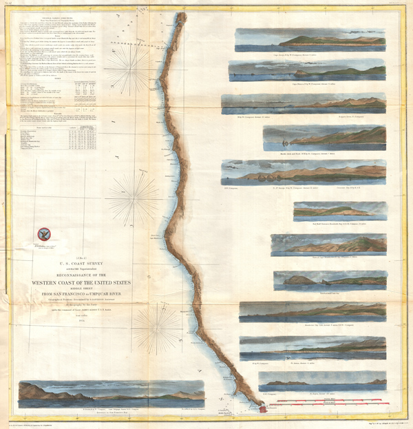
(J No. 2) Reconnaissance of the Western Coast of the United States Middle Sheet From San Francisco to Umpquah River.
sold
- Digital Map Information
- Suitable for large format printing
- Full resolution TIFF file
- ICC color profile embedded
- Delivered instantly via download link
A remarkable 1854 map by the United States Coast Survey. Covers the coastline of California and Oregon from San Francisco (depicted) northwards as far as the Umpqua (Umpquah) River. Offers soundings only along the coast line ... (more details)

New Map of Boston compiled from the latest Surveys.
sold
- Digital Map Information
- Suitable for large format printing
- File Size: 13.19 MB
- File Type: ZIP / TIFF
- ICC color profile embedded
- Delivered instantly via download link
Offered is an extremely scarce large format pocket map of Boston dating to 1870. This beautiful large format map depicts the whole of Boston as the Back Bay landfill neared completion. In fact, only a small part of the land ... (more details)
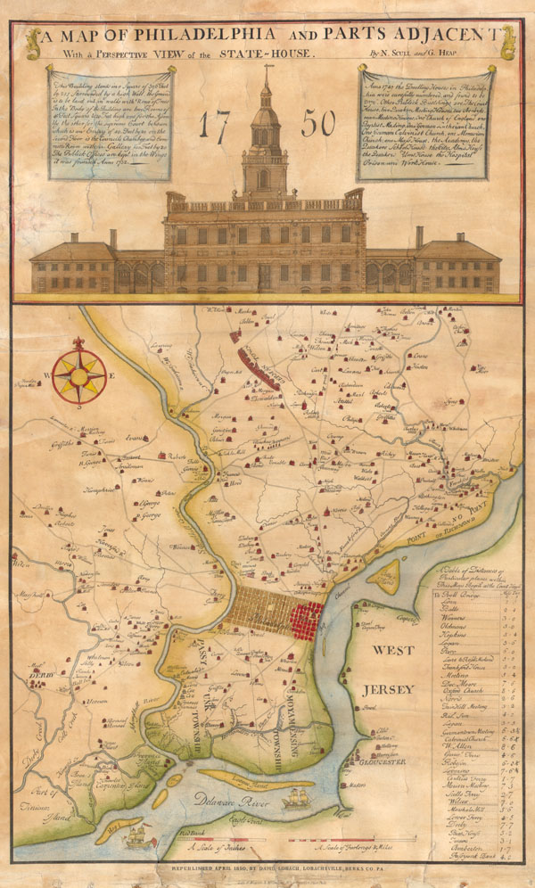
A Map of Philadelphia and Parts Adjacent With a Perspective View of the State-House.
sold
- Digital Map Information
- Suitable for large format printing
- DPI: 300
- File Size: 3.45 MB
- File Type: ZIP / TIFF
- ICC color profile embedded
- Delivered instantly via download link
This rare map is an 1850 reprint of an important 1752 map originally issued by N. Scull and G. Heap. George Heap, a surveyor and city coroner of Philadelphia, and Nicolas Scull, Surveyor General of the Province of ... (more details)
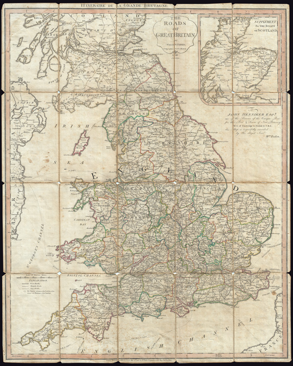
The Roads of Great Britain. Itineraire de la Grande Bretagne.
sold
- Digital Map Information
- Suitable for large format printing
- Full resolution TIFF file
- ICC color profile embedded
- Delivered instantly via download link
A very attractive example of Faden's desirable 'Roads of Great Britain' in its second edition, 1790. Covering from Scotland to Cornwall, this large pocket map was designed with the traveler in mind, showing most ... (more details)
Unusual early mapping of the transmississippi showing origins of Nebraska and New Mexico Territory.

United States.
sold
- Digital Map Information
- Suitable for large format printing
- Full resolution TIFF file
- ICC color profile embedded
- Delivered instantly via download link
This is a fascinating 1851 map of the United States by the English map and atlas publisher John Tallis and his engraver John Rapkin. Covers the United States from Santa Fe north through the Missouri Territory to ... (more details)
Wonderful Art Deco Map of Paris and the Colonial Exposition.

Nouveau Paris Monumental Itineraire Pratique de L’Etranger Dans Paris. Exposition Coloniale Internationale Paris 1931.
sold
- Digital Map Information
- Suitable for large format printing
- File Size: 71.18 MB
- File Type: ZIP / TIFF
- ICC color profile embedded
- Delivered instantly via download link
This is an extremely attractive 1931 tourist pocket map of Paris, France. Covers the old walled city of Paris and the immediate vicinity. Drawn in a lavish art deco style with important buildings are shown in ... (more details)
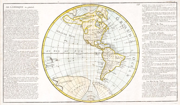
De L'Amerique en General..
sold
- Digital Map Information
- Suitable for large format printing
- Full resolution TIFF file
- ICC color profile embedded
- Delivered instantly via download link
This is a beautifully hand colored 1785 map of North America and South America. The cartography of the North America west coast is conjectural at best, with islands, inland seas, and hopeful northwest passages ... (more details)
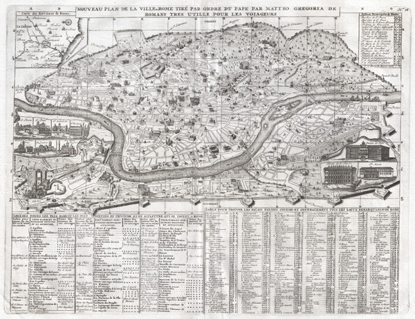
Nouveau Plan dela Ville de Rome Tire Par Ordre du Pape Par Matteo Gregoria de Romans Tres utille Pour Les Voiageurs.
sold
- Digital Map Information
- Suitable for large format printing
- DPI: 300
- File Size: 15.22 MB
- File Type: ZIP / TIFF
- ICC color profile embedded
- Delivered instantly via download link
A highly detailed 1721 map of Rome and a splendid example of Henri Chatelain's magnificent engraving. Covers the walled center of Rome on either side of the Tiber from the Porta del Popolo to the Porta St. ... (more details)
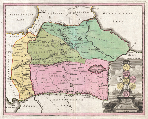
Armenia Vtraque.
sold
- Digital Map Information
- Suitable for large format printing
- DPI: 300
- File Size: 13.42 MB
- File Type: ZIP / TIFF
- ICC color profile embedded
- Delivered instantly via download link
An uncommon 1720 map of the Caucuses by Christopher Weigel. This most unusual aspect of this map is its focus on the lands between the Black Sea and the Caspian, commonly known as the Caucuses. In ... (more details)