
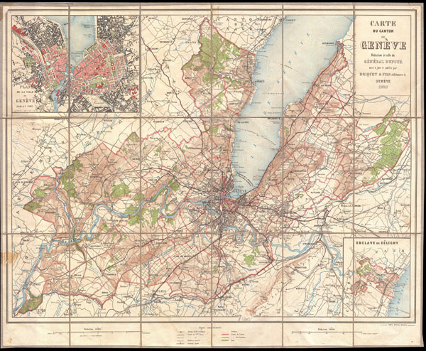
Carte du Canton de Geneve
sold
- Digital Map Information
- Suitable for large format printing
- File Size: 18.71 MB
- File Type: ZIP / TIFF
- ICC color profile embedded
- Delivered instantly via download link
A rare 1929 pocket issue map of the Canton du Geneve or the Canton of Geneva. Covers they city of Geneva, Switzerland, as well as much of the surrounding area and a significant part of Lake Geneva. Extends northward as far as Coppet, southward as far as St. ... (more details)
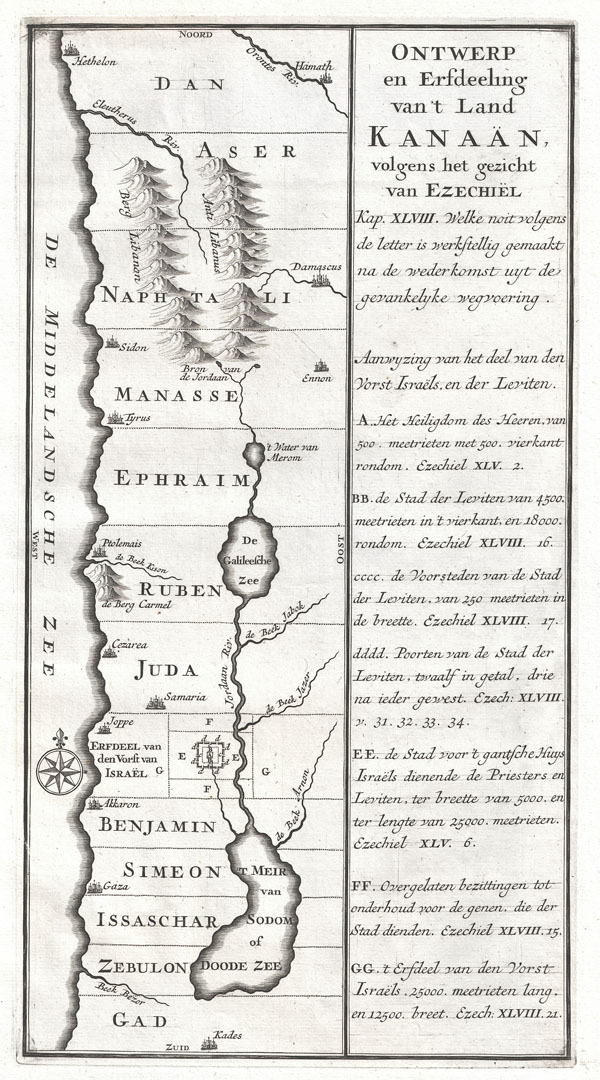
Ontwerp en Erfdeeling van't Land Kanaan, volgens het gezicht van Ezechiel.
sold
- Digital Map Information
- Suitable for large format printing
- DPI: 300
- File Size: 2.85 MB
- File Type: ZIP / TIFF
- ICC color profile embedded
- Delivered instantly via download link
An extremely uncommon c. 1729 map of ancient Israel. This map shows Israel from Hethelon in the north to Kades, just south of the Dead Sea. Divided into the areas controlled by the Twelve Tribes of Israel, from the north these are Dan, Aser, Naphtali, ... (more details)
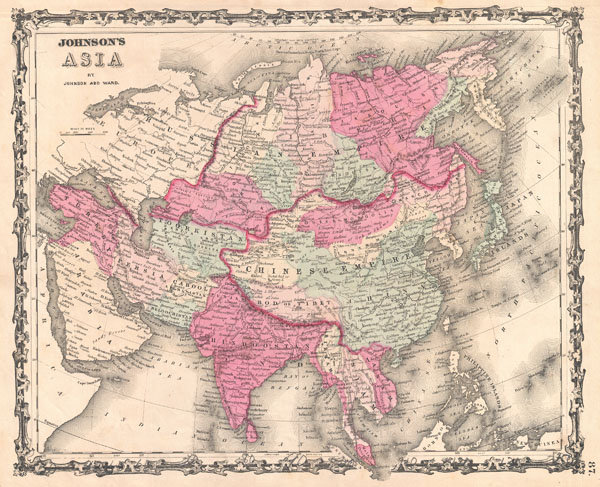
Johnson's Asia.
$100.00
Acquire
- Digital Map Information
- Suitable for large format printing
- File Size: 8.11 MB
- File Type: ZIP / TIFF
- ICC color profile embedded
- Delivered instantly via download link
A very nice example of A. J. Johnson's 1862 map of Asia. Covers from the Arabian Peninsula and Turkey eastward as far as Kamchatka, Japan, the Philippines and New Guinea. Shows the Empires if Hindoostan (India), China (includes Tibet), Toorkistan, ... (more details)

Johnson's China.
sold
- Digital Map Information
- Suitable for large format printing
- File Size: 8.11 MB
- File Type: ZIP / TIFF
- ICC color profile embedded
- Delivered instantly via download link
A very nice example of A. J. Johnson's 1862 map of China. Covers China from Tibet and Yunnan east to Korea and north as far as Mongolia. Extends south to include the island of Hainan. Formosa or Taiwan are also included. Insets detail the Harbor ... (more details)
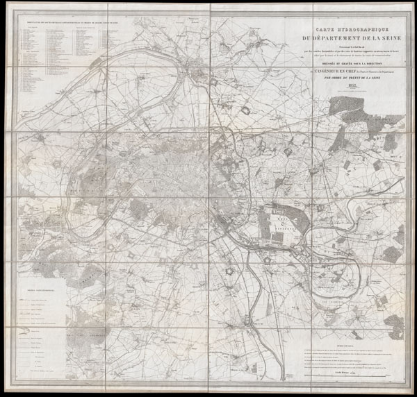
Carte Hydrographique du Departement de La Seine.
sold
- Digital Map Information
- Suitable for large format printing
- DPI: 300
- File Size: 58.19 MB
- File Type: ZIP / TIFF
- ICC color profile embedded
- Delivered instantly via download link
This is an extraordinary large format folding map of Paris and its vicinity dating to 1852. Covers from Argenteuil in the northwest to the Foret de Bondy in the northeast and from the Bois de Verrieres in the southwest to Bois Notre Dame in the ... (more details)

Johnson's Japan Nippon, Kiusiu, Sikok, Yesso and the Japanese Kuriles.
sold
- Digital Map Information
- Suitable for large format printing
- File Size: 7.9 MB
- File Type: ZIP / TIFF
- ICC color profile embedded
- Delivered instantly via download link
A very nice example of A. J. Johnson's 1862 map of Japan. Covers the Japanese Islands from Kiusiu north to Yesso (Hokkaido). Offers considerable detail with color cording according to province. An inset map in the upper right focuses on ... (more details)

Johnson's Turkey in Asia Persia Arabia & Co.
sold
- Digital Map Information
- Suitable for large format printing
- File Size: 7.44 MB
- File Type: ZIP / TIFF
- ICC color profile embedded
- Delivered instantly via download link
A very nice example of A. J. Johnson's 1862 map of Arabia, Persia and Turkey in Asia. Covers from the Mediterranean and Egypt eastwards as far as the Mouths of the Indus River, as well as southward as far as the Horn of Africa and ... (more details)

Johnson's Hindostan or British India.
sold
- Digital Map Information
- Suitable for large format printing
- File Size: 8.2 MB
- File Type: ZIP / TIFF
- ICC color profile embedded
- Delivered instantly via download link
A very nice example of A. J. Johnson's 1862 map of India and Southeast Asia. Covers from the Mouths of the Indus River eastward to include all of India, Burma, Siam (Thailand), Laos, Cambodia, Malaysia (Malacca) and Vietnam ... (more details)

Johnson's Illinois.
sold
- Digital Map Information
- Suitable for large format printing
- File Size: 11.38 MB
- File Type: ZIP / TIFF
- ICC color profile embedded
- Delivered instantly via download link
This is A. J. Johnson's 1862 map of Illinois. Covers the entire state as well as portions of the adjacents states of Iowa, Missouri and Indiana. Offers color coding according to county and notations for railways, roadways, ... (more details)

Johnson's Minnesota and Dakota.
sold
- Digital Map Information
- Suitable for large format printing
- File Size: 6.6 MB
- File Type: ZIP / TIFF
- ICC color profile embedded
- Delivered instantly via download link
A beautiful example of A. J. Johnson's 1862 map of Minnesota and Dakota. Covers both states as well as adjacent parts of Wisconsin and Iowa. This map predates the splitting of the Dakotas and instead depicts them as a ... (more details)

Johnson's New Jersey.
sold
- Digital Map Information
- Suitable for large format printing
- File Size: 7.95 MB
- File Type: ZIP / TIFF
- ICC color profile embedded
- Delivered instantly via download link
A beautiful example of A. J. Johnson's 1862 map of New Jersey. Covers the entire state along with portions of adjacent Delaware, Pennsylvania, and New York. Offers color coding according to county and notations for ... (more details)
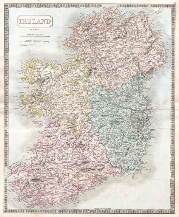
Ireland.
sold
- Digital Map Information
- Suitable for large format printing
- DPI: 300
- File Size: 14.86 MB
- File Type: ZIP / TIFF
- ICC color profile embedded
- Delivered instantly via download link
A beautiful example of Sidney Hall's c. 1850 map of Ireland. The island is depicted in full divided into its four provinces of Munster, Leinster, Connaught and Ulster. Shows cities, roads, rivers, trains and some ... (more details)
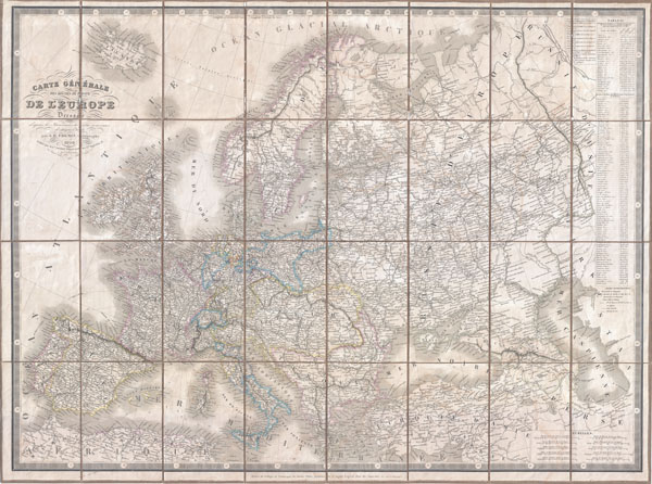
Carte Generale des routes de poste de L'Europe Dressee d'apres les itineraires les plus nouveaux de chaque etats.
sold
- Digital Map Information
- Suitable for large format printing
- DPI: 300
- File Size: 39.85 MB
- File Type: ZIP / TIFF
- ICC color profile embedded
- Delivered instantly via download link
An extremely scarce 1844 postal map of Europe in case or pocket format by the French map publishers A. Logerot and A. R. Fremin. Details the whole of Europe noting thousands of towns, cities, and villages as ... (more details)
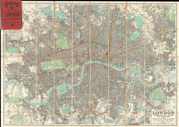
Philips' New Map of London Extending Four & a Half Miles Round Charing Cross.
sold
- Digital Map Information
- Suitable for large format printing
- File Size: 55.18 MB
- File Type: ZIP / TIFF
- ICC color profile embedded
- Delivered instantly via download link
A stunning example of George Philip's c. 1985 folding pocket map of London, England. Covers the urban center of London from Barnes in the west to Victoria Dock in the east, as well as north as far as Finsbury ... (more details)
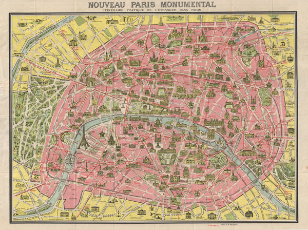
Nouveau Paris Monumental Inineraire Pratique de L'Etranger Dans Paris.
sold
- Digital Map Information
- Suitable for large format printing
- File Size: 25.43 MB
- File Type: ZIP / TIFF
- ICC color profile embedded
- Delivered instantly via download link
A later example of the famous 'Nouveau Paris Monumental' tourist pocket map of Paris. Covers Paris from the Bois de Boulogne to the Bois de Vincennes. Monuments and important buildings are shown in relief - ... (more details)
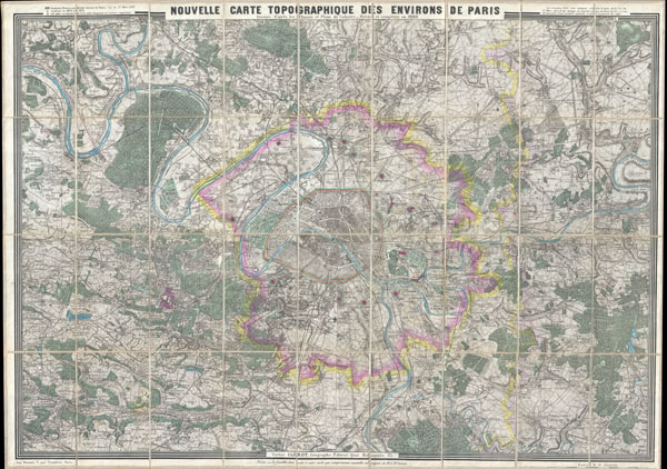
Nouvelle Carte Topographique des Environs de Paris.
sold
- Digital Map Information
- Suitable for large format printing
- File Size: 70.4 MB
- File Type: ZIP / TIFF
- ICC color profile embedded
- Delivered instantly via download link
Issued in 1880 by Victor Clerot, this is one of the largest and most strikingly beautiful 19th century folding maps of Paris we have ever encountered. Details the greater Paris vicinity from the Bois de ... (more details)
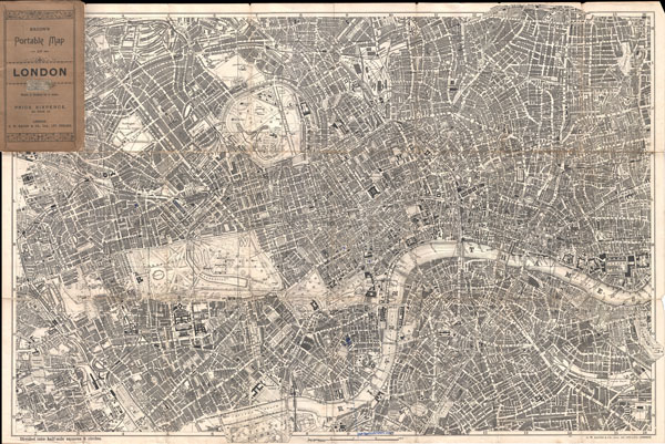
Bacon's Portable Map of London.
sold
- Digital Map Information
- Suitable for large format printing
- File Size: 31.54 MB
- File Type: ZIP / TIFF
- ICC color profile embedded
- Delivered instantly via download link
Extremely attractive map of London, England aroun the turn of the century. Issued c. 1899 by G. W. Bacon, this map covers central London along the Thames River from Fulham Cemetary in the west to ... (more details)
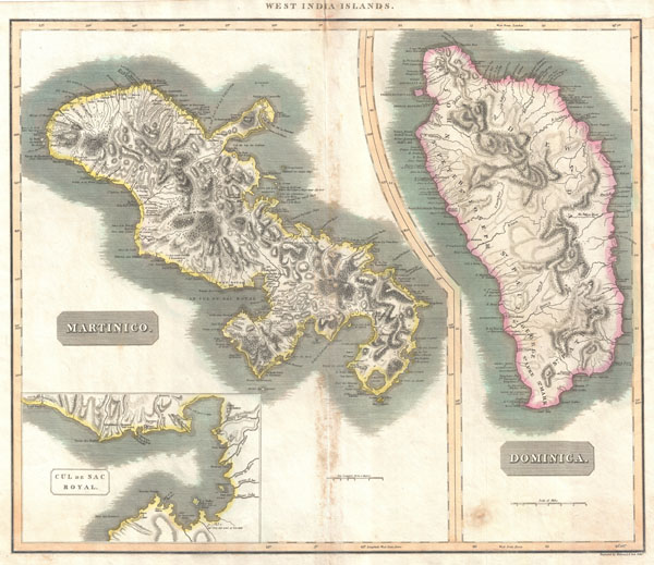
West India Islands. / Martinico. / Dominica. / Cul de Sac Royal.
sold
- Digital Map Information
- Suitable for large format printing
- DPI: 300
- File Size: 16.83 MB
- File Type: ZIP / TIFF
- ICC color profile embedded
- Delivered instantly via download link
A fine example of John Thomson's stunning c. 1814 map of the West India islands of Dominica and Martinique. Divided into two sections, this map offers spectacular detail of these two picturesque ... (more details)
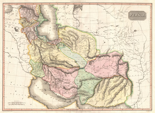
Persia.
sold
- Digital Map Information
- Suitable for large format printing
- DPI: 300
- File Size: 18.07 MB
- File Type: ZIP / TIFF
- ICC color profile embedded
- Delivered instantly via download link
An exceptionally attractive example of John Pinkerton's rare 1811 map of Persia. Covers from the Black Sea in the northwest to Fergana in the northeast, to the Arabian Desert in the southwest ... (more details)

Johnson's Cuba, Jamaica and Porto Rico.
sold
- Digital Map Information
- Suitable for large format printing
- File Size: 8.07 MB
- File Type: ZIP / TIFF
- ICC color profile embedded
- Delivered instantly via download link
A beautiful example of A. J. Johnson's 1862 map of Cuba, Jamaica, the Bahamas and Porto Rico. Also shows part of the Florida Keys. Offers superb detail of the entire region including ... (more details)