
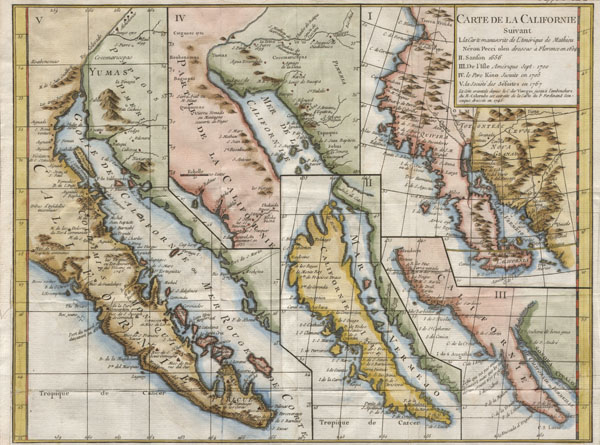
Carte de la Californie suivant / I. La carte manuscrite de l'Amérique de Mathieu Néron Pecci olen dresse à Florence en 1604 / II. Sanson 1656 / III. De L'Isle Amérique Sept. 1700 / IV. le Pere Kino Jesuite en 1705 / V. La Societe des Jésuites en 1767.
sold
- Digital Map Information
- Suitable for large format printing
- DPI: 300
- File Size: 3.12 MB
- File Type: ZIP / TIFF
- ICC color profile embedded
- Delivered instantly via download link
A rare and important map of California in five different states, ranging from roughly 1656 to 1767. Engraved by the important French cartographer Robert De Vaugondy, for the c. 1770 edition of the Denis Diderot (1713-84) Encyclopedie . This map explores the ... (more details)

A New Map of the United States of America, from the latest authorities.
sold
- Digital Map Information
- Suitable for large format printing
- DPI: 300
- File Size: 18.12 MB
- File Type: ZIP / TIFF
- ICC color profile embedded
- Delivered instantly via download link
Published by John Cary in 1806, this is one of the most interesting atlas maps of the United States to appear in the early 19th century. Covers the entire United States east of the Mississippi River as well as parts of the Louisiana Territory and Canada. ... (more details)
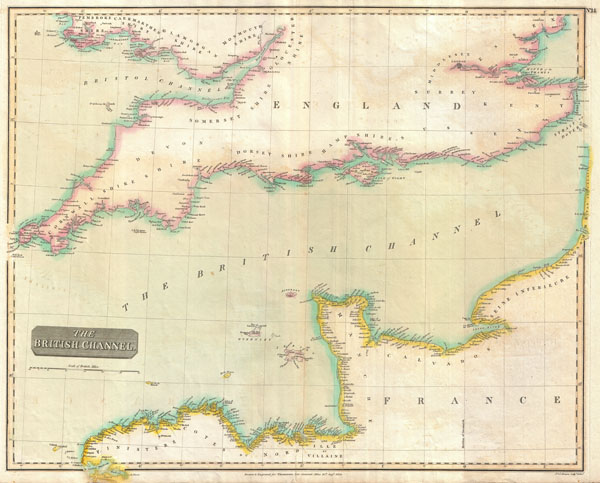
The British Channel.
sold
- Digital Map Information
- Suitable for large format printing
- DPI: 300
- File Size: 12.91 MB
- File Type: ZIP / TIFF
- ICC color profile embedded
- Delivered instantly via download link
A fine example of John Thomson's 1814 map of the British or English Channel. Depicts England from Cornwall eastward as far as Canterbury and the Strait of Dover. Extends northward as far as Pembroke Shire and St. Brides Bay. Includes London and the Isle of ... (more details)
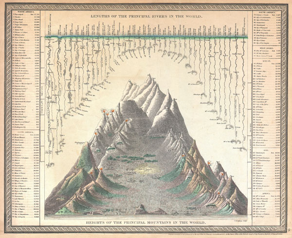
Lengths of the Principal Rivers in the World. / Heights of the Principal Mountains in the World.
sold
- Digital Map Information
- Suitable for large format printing
- DPI: 300
- File Size: 10.71 MB
- File Type: ZIP / TIFF
- ICC color profile embedded
- Delivered instantly via download link
A good example of the S. A. Mitchell Sr. / Cowperthwait map of the principal mountains and rivers of the world. Mountains are shown along the bottom of the map with important cities and geological formations noted at their appropriate elevations. Rivers ... (more details)
A significant reimagining and re-engraving of Johnson's Comparative Mountains and Rivers Chart.

Johnson's Chart of Comparative Heights of Mountains, and Lengths of Rivers of Africa. Johnson's Chart of Comparative Heights of Mountains, and Lengths of Rivers of Asia. Johnson's Chart of Comparative Heights of Mountains, and Lengths of Rivers of Europe. Johnson's Chart of Comparative Heights of Mountains, and Lengths of Rivers of South America. Johnson's Chart of Comparative Heights of Mountains, and Lengths of Rivers of North America.
sold
- Digital Map Information
- Suitable for large format printing
- File Size: 7.75 MB
- File Type: ZIP / TIFF
- ICC color profile embedded
- Delivered instantly via download link
This is the 1864 edition of Johnson's Mountains and Rivers Chart. This chart, printed in 1864, represents a significant reimagining and re-engraving of Johnson's pre-1864 mountains and rivers charts. Johnson first introduced a mountains and rivers ... (more details)
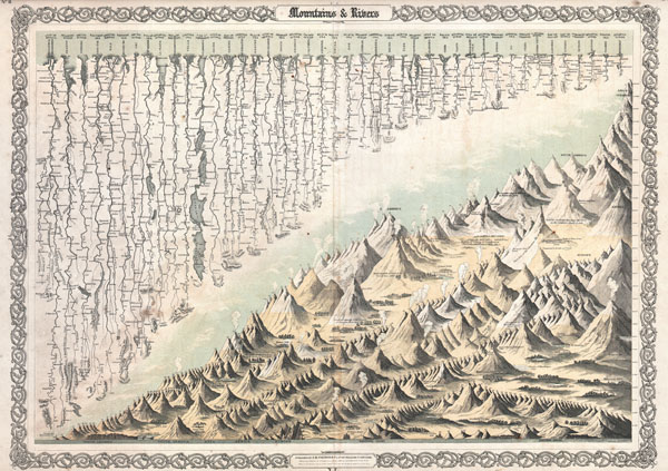
Mountains & Rivers
sold
- Digital Map Information
- Suitable for large format printing
- File Size: 21.85 MB
- File Type: ZIP / TIFF
- ICC color profile embedded
- Delivered instantly via download link
Most likely the finest American Mountains and Rivers chart / map of the 19th century. This is the 1855 Colton prototype for the popular 1860-1863 Johnson's Mountains and Rivers chart. Depicts the relative distances of the world's great rivers and the ... (more details)

Southern Regions.
sold
- Digital Map Information
- Suitable for large format printing
- File Size: 6.02 MB
- File Type: ZIP / TIFF
- ICC color profile embedded
- Delivered instantly via download link
An excellent example of Colton's c. 1855 map of the South Pole, Antarctica, or the Southern Polar Regions. Sows the Great Southern Continent with both solid and tentatively sketched in borders. Notes the travels of important Antarctic explorers of ... (more details)

Johnson's Prussia Norway, Sweden and Denmark.
sold
- Digital Map Information
- Suitable for large format printing
- File Size: 17.6 MB
- File Type: ZIP / TIFF
- ICC color profile embedded
- Delivered instantly via download link
A stunning example of the 1862 Johnson and Ward map of Scandinavia. Includes Norway, Sweden, Denmark and Prussia. Also includes most, and in some cases all, of Finland, Poland, Estonia, Latvia, Lithuania, and parts of western Russia, though they ... (more details)
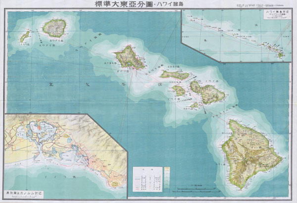
Hawaii
sold
- Digital Map Information
- Suitable for large format printing
- File Size: 9.88 MB
- File Type: ZIP / TIFF
- ICC color profile embedded
- Delivered instantly via download link
One of the most beautiful maps of Hawaii ever produced. A stunning large format Japanese map of Hawaiian Island group dating to World War II. Covers the entirety of the Hawaiian Islands with a large inset city plan of Honolulu in the lower left ... (more details)
Japanese World War II Map of Hawaii.

Hawaii
sold
- Digital Map Information
- Suitable for large format printing
- File Size: 29.47 MB
- File Type: ZIP / TIFF
- ICC color profile embedded
- Delivered instantly via download link
One of the most beautiful maps of the Hawaiian Islands ever produced; this is a stunning large format Japanese map of Hawaiian Island group dating to World War II. The map overs the entireties of the Hawaiian Islands with a large inset city ... (more details)
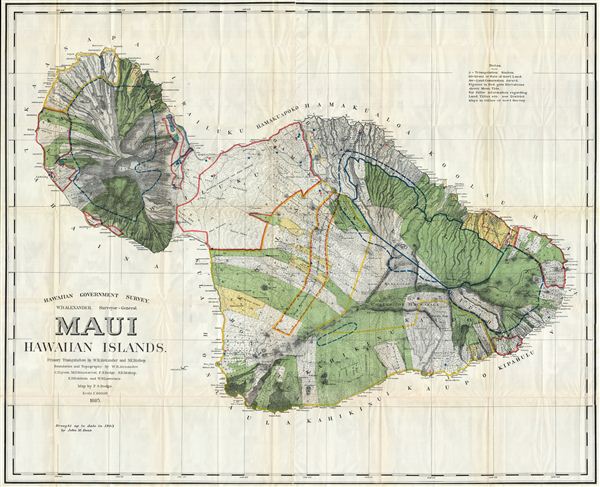
Hawaiian Government Survey, W.D. Alexander. Surveyor- General.Maui Hawaiian Islands.
sold
- Digital Map Information
- Suitable for large format printing
- File Size: 79 MB
- File Type: ZIP / TIFF
- ICC color profile embedded
- Delivered instantly via download link
This very large, rare, and extraordinary 1885 map of the island of Maui, Hawaii, was prepared for the 1906 Report of the Governor of the Territory of Hawaii to the Secretary of the Interior. Covers the entire island in stupendous detail. ... (more details)
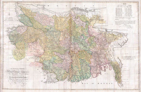
An Actual Survey, of the Provinces of Bengal, Bahar & c. by Major James Rennell Esq. Engineer to the Honorable the East India Company. Published by Permission of the Court of Directors from a Drawing in their Possession by A. Dury.
sold
- Digital Map Information
- Suitable for large format printing
- DPI: 300
- File Size: 117.03 MB
- File Type: ZIP / TIFF
- ICC color profile embedded
- Delivered instantly via download link
An altogether spectacular wall sized map of those parts of Bengal and Bihar, India. Follows the course of the Ganges River from Varanasi (Benares) eastward to the Ganges Delta and the Bay of Bengal. Includes Varanasi (Benares), Dacca ... (more details)
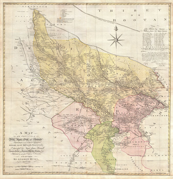
A Map of the Provinces of Delhi, Agrah, Oude, and Ellahabad, comprehending the Countries lying between Delhi, and the Bengal-Provinces, Surveyed by Major James Rennell, Surveyor General to the Honorable East-India Company, and Published by order of the Court of Directors of the said Company. By Andrew Dury, MDCCXXVII.
sold
- Digital Map Information
- Suitable for large format printing
- DPI: 300
- File Size: 82.56 MB
- File Type: ZIP / TIFF
- ICC color profile embedded
- Delivered instantly via download link
An altogether spectacular wall sized map of those parts of India near Delhi, Agra and Varanasi. Covers from Delhi in the northwest as far east along the Ganges River as Bihar and as far south as Sohagepour. Includes Varanasi ... (more details)

The Pictorial Plan of London.
sold
- Digital Map Information
- Suitable for large format printing
- File Size: 35.63 MB
- File Type: ZIP / TIFF
- ICC color profile embedded
- Delivered instantly via download link
This is a wonderful map of pocket map of London and published in 1923 by Geographia Ltd. Cover downtown London from the Hammersmith Bridge and Wormwood scrubs eastward past Hyde Park and Buckingham Place to Whitechapel Road ... (more details)
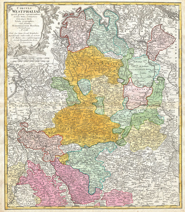
Circuli Westphaliae Quoad partem septentrionalem in sous Status ecclesiasticos & seculares divisi Tabula Geographica edita sumtibus Homannianorum Heredum Norimbergae Ao. 1761.
sold
- Digital Map Information
- Suitable for large format printing
- DPI: 300
- File Size: 22.72 MB
- File Type: ZIP / TIFF
- ICC color profile embedded
- Delivered instantly via download link
A beautifully detailed c. 1761 Homann Heirs map of Westphalia. Covers from Bremen and Hamburg in the north to Cologne, Bonn, Dusseldorf, Aix, Wyck and Luttich in the south. Arnheim, Nimmegen, Wesel, Munster, Minden, ... (more details)

Circulus Saxoniae Inferioris inomnes sous Status en Principatus accurate divisus ex conatibus Joh Bapt Homanni Norimbergae.
sold
- Digital Map Information
- Suitable for large format printing
- DPI: 300
- File Size: 23.25 MB
- File Type: ZIP / TIFF
- ICC color profile embedded
- Delivered instantly via download link
A beautifully detailed c. 1730 Homann Heirs map of Saxony. Covers from Bremen eastward as far as Hertzogt Pomeren and southward to Thuringen. Includes the cities of Hamburg, Berlin, Hall, Gottingen, Bremen and ... (more details)
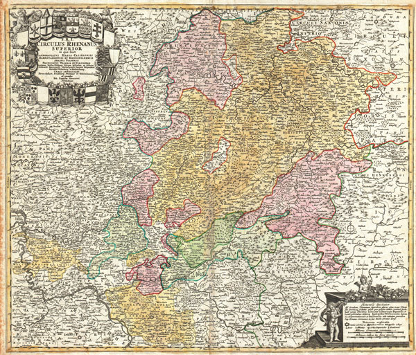
S.R.I. Circulus Rhenanus Superior in quo sunt Landgraviatus Hasson Casselensis, Darmstadiensis et Rhenofeldensis Abbatia Fuldensis…
sold
- Digital Map Information
- Suitable for large format printing
- DPI: 300
- File Size: 23.94 MB
- File Type: ZIP / TIFF
- ICC color profile embedded
- Delivered instantly via download link
A beautifully detailed c. 1730 Homann Heirs map of Upper Rhine region. Covers from Coblentz eastward as far as Schweinfurt, Schmalkalden and Mulhausen; northwards as far as Gottingen; and southwards as far as ... (more details)

S. R. I. Circulus Rhenanus Inferior sive Electorum Rheni Complectens Tres Archiepiscopatus, Moguntinum Coloniensem et Trevirensem, Palatinatum Rheni, Comit. Beilstein Newenaer, Inf. Isenberg et Reiferscheit
sold
- Digital Map Information
- Suitable for large format printing
- DPI: 300
- File Size: 27.24 MB
- File Type: ZIP / TIFF
- ICC color profile embedded
- Delivered instantly via download link
A beautifully detailed c. 1730 Homann Heirs map of Lower Rhine region. Follows the course of the Rhine from Wessel to Seltz. Includes the cities of Frankfurt, Wesel, Mundun, Stuttgart, Heidelberg, Arken, ... (more details)

The Flushing and North Side Railroad, with its leased branches.
sold
- Digital Map Information
- Suitable for large format printing
- File Size: 6.09 MB
- File Type: ZIP / TIFF
- ICC color profile embedded
- Delivered instantly via download link
A scarce example of Fredrick W. Beers' map of the Flushing and North Side Railroads, Queens, Long Island, New York. Published in 1873. Covers from Long Island City, Queens eastward as far as Whitestone, ... (more details)
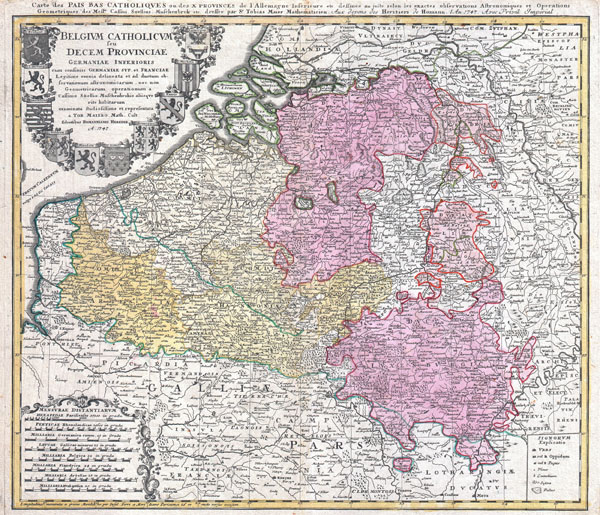
Belgium Catholicum seu Decem provinciae Germaniae Inferioris cum confiniis Germaniae sup. et Franciae… / Carte des Pais Bas Catholiques ou des X Provinces de l'Allemagne Inférieure etc.: legitime omnia delineata et ad ductum observationum astronomicarum, nec non geometricarum operationum a Cassinio, Snellio, Muschenbrokio aliisque rite habitarum, examinata studiosissime et representa a Tob. Maiero math. cult.: dessinée au juste selon les exactes observations astronomiques et operations geometriques de Messr. Cassini, Snellius, Muschenbrok etc. dressée par Sr. Tobias Maier
sold
- Digital Map Information
- Suitable for large format printing
- DPI: 300
- File Size: 24.47 MB
- File Type: ZIP / TIFF
- ICC color profile embedded
- Delivered instantly via download link
A beautifully detailed c. 1730 J. B. Homann map of Belgium and Luxembourg. Depicts Belgium and Luxembourg as well as parts of Holland, France and Germany. The map notes fortified cities, villages, ... (more details)