
Mapping Democracy in America.

Carte dressée pour l'ouvrage intitulé De la démocratie en Amérique.
sold
- Digital Map Information
- Suitable for large format printing
- DPI: 600
- File Size: 21.22 MB
- File Type: ZIP / TIFF
- ICC color profile embedded
- Delivered instantly via download link
This is an 1835 Benard map of North America created to accompany the Charles Gosselin edition of Alexis de Tocqueville's De la démocratie en Amérique (Democracy in America). Recognized as one of the most important commentaries on the United States, this map emphasizes population disparities within the United States and even separates the southern slave society from the northern free states. (more details)
The Foothills of the Himalayas.
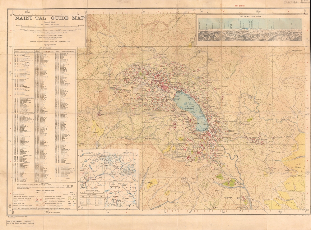
Naini Tāl Guide Map.
$1,500.00
Acquire
- Digital Map Information
- Suitable for large format printing
- File Size: 40.36 MB
- File Type: ZIP / TIFF
- ICC color profile embedded
- Delivered instantly via download link
An impressive 1938 topographical city plan or map of Nainital in the United Provinces of India (now Uttarakhand) produced by the Survey of India. It presents the steep topography of the area at the foothills of the Himalayas as well as structures throughout the city. (more details)
Hat City.

Danbury, Ct. taken from Hayes' Hill.
sold
- Digital Map Information
- Suitable for large format printing
- Full resolution TIFF file
- ICC color profile embedded
- Delivered instantly via download link
This is a c. 1858 lithograph bird's-eye view of Danbury, Connecticut, by George Hayward. The view illustrates Danbury at its height as a major center of hat making. (more details)
Rare second state!
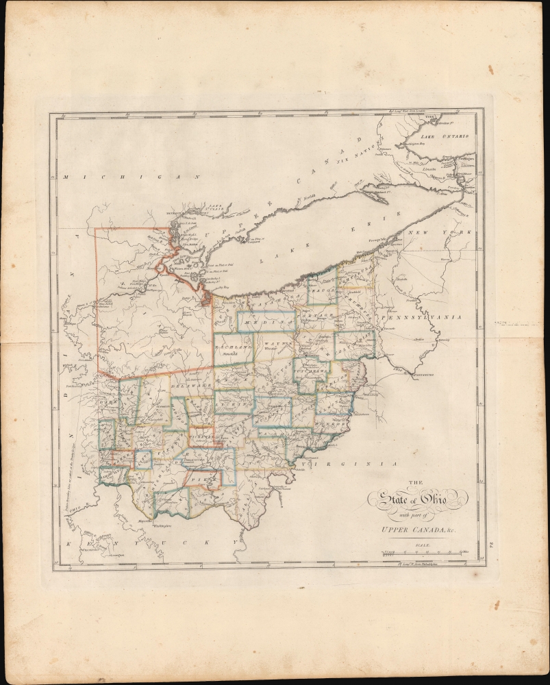
The State of Ohio with part of Upper Canada, etc.
sold
- Digital Map Information
- Suitable for large format printing
- DPI: 600
- File Size: 423.89 MB
- File Type: ZIP / TIFF
- ICC color profile embedded
- Delivered instantly via download link
This is the rare 1818 edition of Carey's map of Ohio. This second state is considerably rarer than the 1814 first state and notable for its significant updates, reflecting both corrections and Ohio's high-paced settlement. (more details)
A remarkably detailed survey map of India's Himalayan foothills.
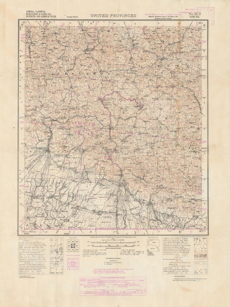
United Provinces. No. 53 O Naini Tal. Almora, Garhwal, Moradabad and Naini Tal Districts and Rampur State.
$1,000.00
Acquire
- Digital Map Information
- Suitable for large format printing
- File Size: 56.23 MB
- File Type: ZIP / TIFF
- ICC color profile embedded
- Delivered instantly via download link
An impressive 1943 zincographic Survey of India map of Nainital (here as Naini Tal) and environs in the United Provinces (now Uttarakhand). This picturesque region lies in the foothills of the Himalayas in northern India, near Nepal's western border with India. (more details)
Topography at the top of the world.
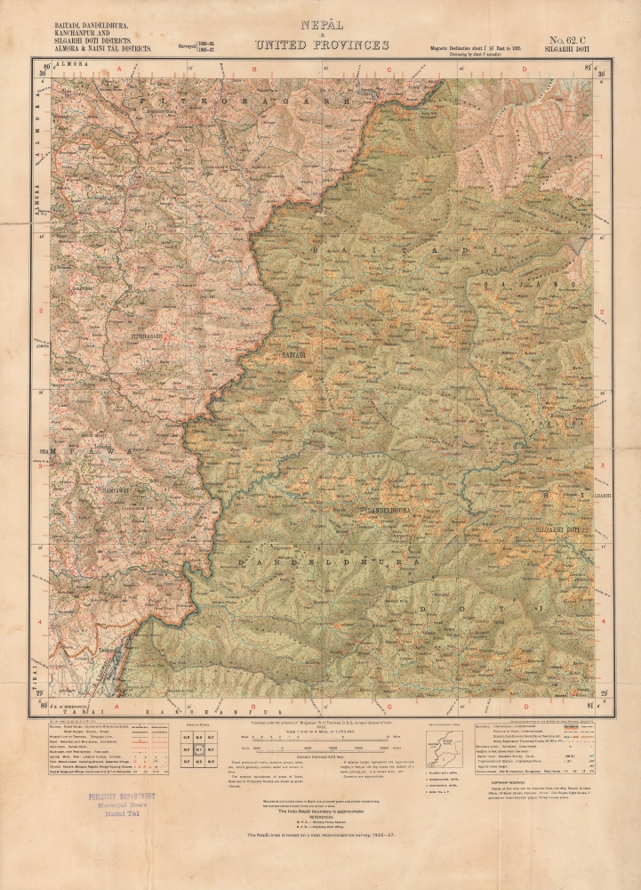
Nepal and United Provinces, No. 62. C Silgarhi Doti; Baitadi, Dandeldhura, Kanchanpur and Silgarhi Doti Districts. Almora and Naini Tal Districts.
$1,000.00
Acquire
- Digital Map Information
- Suitable for large format printing
- File Size: 27.05 MB
- File Type: ZIP / TIFF
- ICC color profile embedded
- Delivered instantly via download link
An absorbing 1932 Survey of India map of western Nepal. It highlights the remarkable terrain of the region, which sits on the border with Uttarakhand. (more details)
Landmark map used in Congressional and International Debates.
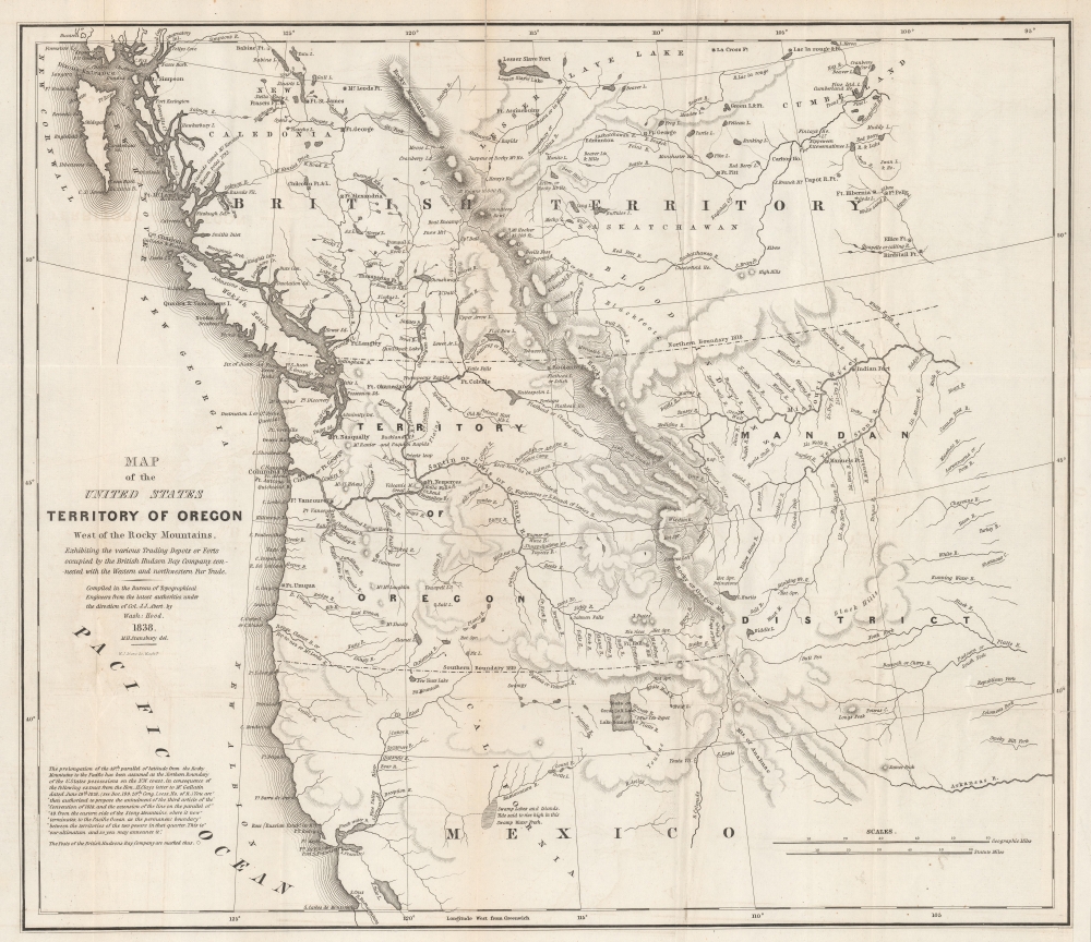
Map of the United States Territory of Oregon West of the Rocky Mountains, Exhibiting the various Trading Depots or Forts occupied by the British Hudson Bay Company, connected with the Western and northwestern Fur Trade.
sold
- Digital Map Information
- Suitable for large format printing
- DPI: 600
- File Size: 37.17 MB
- File Type: ZIP / TIFF
- ICC color profile embedded
- Delivered instantly via download link
This is the landmark 1838 map of the Oregon Territory by Captain Washington Hood, a founding member of the Corps of Topographical Engineers. This map was used for congressional debates of the status of the Oregon Territory, both regarding its position within the United States and in international disputes with Great Britain - the Oregon Question or 54°40′ Debate. (more details)
The 'first geometrically constructed map of any significant portion of Hawaii.' - Fitzpatrick
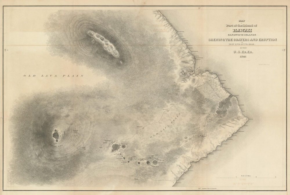
Map of Part of the Island of Hawaii Sandwich Islands Shewing the Craters and Eruption of May and June 1840.
sold
- Digital Map Information
- Suitable for large format printing
- DPI: 600
- File Size: 28.81 MB
- File Type: ZIP / TIFF
- ICC color profile embedded
- Delivered instantly via download link
This extraordinary production is Commodore Wilkes' 1841 U.S. Exploring Expedition map of the island of Hawaii. An incredibly important work, this is, according to Fitzpatrick, the 'first geometrically constructed map of any significant portion of Hawaii.' Wilkes' map covers the vicinity of the volcanoes Mauna Loa, Mauna Kea, and Kilauea as well as the Hawaiian shoreline roughly between Laupahoehoe and Kahaualea, including Hilo Bay and city. Topography is rendered in striking hachure. (more details)
A booming economy and an extensive railroad network.
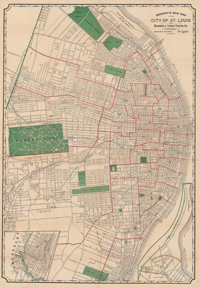
Shewey's New Map of the City of St. Louis.
$650.00
Acquire
- Digital Map Information
- Suitable for large format printing
- Full resolution TIFF file
- ICC color profile embedded
- Delivered instantly via download link
Detailing a city undergoing massive population growth, this is the 1891 Arista Shewey city plan or map of St. Louis, Missouri. By the turn of the 20th century, St. Louis emerged as the fourth-largest city in the United States with a booming economy and an extensive railroad network. (more details)
Soon after the Founding of Israel.

ישראל / [Israel].
sold
- Digital Map Information
- Suitable for large format printing
- File Size: 53.58 MB
- File Type: ZIP / TIFF
- ICC color profile embedded
- Delivered instantly via download link
A fascinating calendar and map of Israel published soon after its founding, this work was produced in 1953 for the Union Bank of Israel (more commonly known as Bank Igud). Among other features, it highlights the still-recent 'borders' of Israel, set according to the armistice lines following the 1948 Arab-Israeli War. (more details)
Mapping the 'roof of the world'.
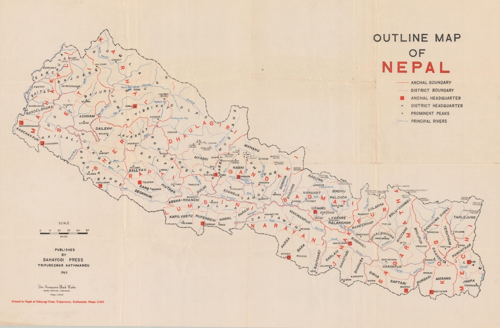
Outline Map of Nepal.
sold
A scarce, domestically produced map of Nepal, published by the Sahayogi Press in Katmandu in 1969. It presents the country at a moment of transition, as the Panchayat regime instituted in 1961 undertook major social and economic development programs. (more details)
Tracing 20 years of Atlantic hurricanes.
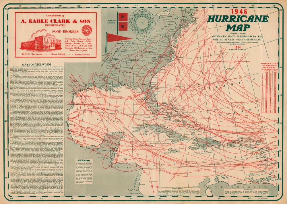
Hurricane Map 1946. Compiled from Authentic Data Furnished by the United States Weather Bureau Showing the Approximate Center Paths of Hurricanes and Near Hurricanes since 1924.
sold
- Digital Map Information
- Suitable for large format printing
- File Size: 48.65 MB
- File Type: ZIP / TIFF
- ICC color profile embedded
- Delivered instantly via download link
This is a 1946 Angus McGregor hurricane map of the Caribbean Sea, Gulf of Mexico, and the eastern United States. The map is a fascinating infographic achievement, tracking Atlantic hurricanes for over 20 years, from 1924 through 1945. Issued for commercial distribution and advertising, the map's also underscore a nation fascination with the powerful and destructive tropical storms. (more details)
Età dell'oro.

Carta indicante la situazione ed estensione delle principali terre possedute dagli'indiani.
sold
- Digital Map Information
- Suitable for large format printing
- File Size: 21.82 MB
- File Type: ZIP / TIFF
- ICC color profile embedded
- Delivered instantly via download link
An interesting Italian 1884 map focusing on Native American reservations, other areas of settlement, and historical displacement that appeared in Egisto Rossi's Gli Stati Uniti e la concorrenza americana. (more details)
The Finest Dutch World Map Venice Could Offer.
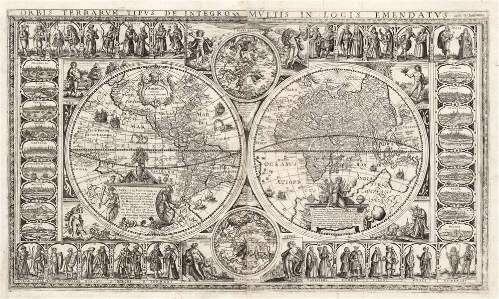
Orbis Terrarum Tipus de Integro Multis in Locis Emendatus.
sold
- Digital Map Information
- Suitable for large format printing
- Full resolution TIFF file
- ICC color profile embedded
- Delivered instantly via download link
This beautiful, extremely rare, separately-issued, double hemisphere carte á figures world map captures the most desirable elements of 17th century Dutch decorative cartography in one composition - including an Amsterdam imprint and the prominently displayed patronym of 'Willem Blaeu'. Both the imprint and the professed authorship were deliberately misleading: the map was engraved in Venice, not Amsterdam, and it has been attributed to the illustrator and printer Stefano Mozzi Scolari. The map is dated 1655. It is perhaps ironic that of the Dutch mapmakers from whom Scolari sourced this map, not one element appears to have been drawn from Blaeu, apart from his name. The engraver was not fully committed to deception: faintly in the lower right border is an additional, more honest imprint, 'in Venetia à S. Fosca'. Bifolco identifies this location as an engravers' shop associated with Scolari. (more details)
The Bordeaux 'Cru' system.

Carte Vinicole du Département de la Gironde.
sold
- Digital Map Information
- Suitable for large format printing
- Full resolution TIFF file
- ICC color profile embedded
- Delivered instantly via download link
This is an 1893 Féret et Fils viticultural map of the Gironde, France, highlighting Bordeaux wine varietals and the Cru system. The Gironde is the heart of Bordeaux wine country with over 110,000 hectares of vineyards producing some of the world's most prestigious wines. (more details)
Spectacular proof state map of Sicily.

[Carta della Sicilia con l'antica e la moderna divisione in Valli.]
sold
- Digital Map Information
- Suitable for large format printing
- DPI: 600
- File Size: 1703.84 MB
- File Type: ZIP / TIFF
- ICC color profile embedded
- Delivered instantly via download link
A spectacular c. 1805 large-scale folding map of Sicily, in a proof state, likely by Rizzi Zannoni. The map was issued thus, in an untitled proof state, in the chaos of the Napoleonic Wars (1803 - 1915), when Sicily became a British base of operations against Napoleonic Naples. It embraces Sicily, as well as Malta and Gozo, the Aeolian Islands, and other smaller islands. The detail and engraving throughout is extraordinary, surpassing any earlier map of Sicily. Something must also be said of the map's pristine original condition and presentation, with original green linen backing and finely tooled slipcase. (more details)
Novel adaptation of the optical telegraph to communicate typhoon data in the South China Sea.

Carte servant à suivre la marche des typhons ou dépressions signales par l'Observatoire de Phu-Liên.
sold
- Digital Map Information
- Suitable for large format printing
- File Size: 66.46 MB
- File Type: ZIP / TIFF
- ICC color profile embedded
- Delivered instantly via download link
This is a c. 1910 ferro-gallic printed Observatoire Central de l'Indochine typhoon tracking map of Vietnam and the South China Sea - a wonder of early infographic weather mapping and data transmission. The map is an innovative guide to transmitting typhoon data gathered by remote weather monitoring stations with the central observatory at Phu Liên (northern Vietnam) via the Semaphore System or Optical Telegraph. (more details)
The first map to focus specifically on the Pacific Coast of North America.
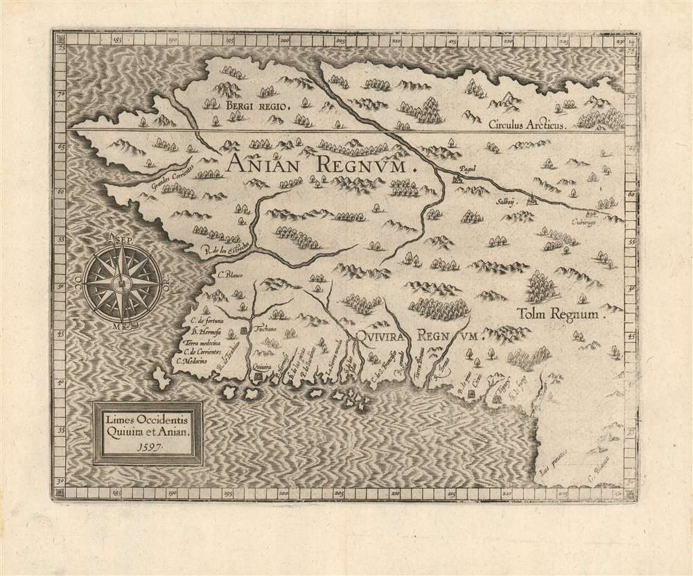
Limes Occidentis Quiuira et Anian. / Anian Regnum.
sold
- Digital Map Information
- Suitable for large format printing
- DPI: 600
- File Size: 8.73 MB
- File Type: ZIP / TIFF
- ICC color profile embedded
- Delivered instantly via download link
A strong example of Cornelis van Wytfliet's 1597 Anian Regnum; this is the first separate map to focus on the Pacific Northwest. The map presents the area now occupied by most of the west coast of the United States, Canada, and Alaska, in spite of this region having been beyond the ken of European explorers and geographers for centuries to come. The westward-reaching land mass bears a serendipitous resemblance to Alaska, although the area depicted is far more massive. (more details)
Elphinstone's map of London, with original silk roll-bag.
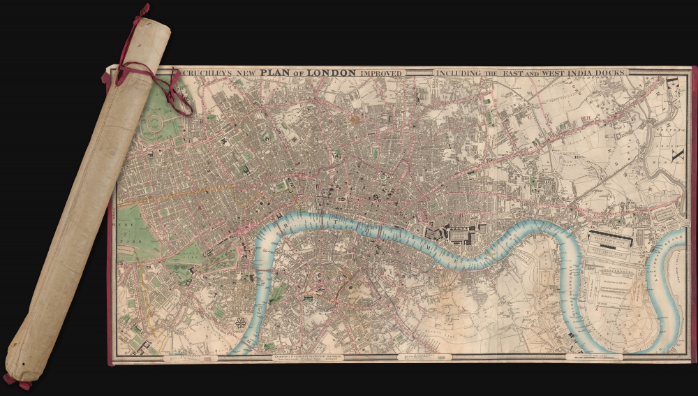
Cruchley's New Plan of London Improved including the East and West India Docks.
sold
- Digital Map Information
- Suitable for large format printing
- Full resolution TIFF file
- ICC color profile embedded
- Delivered instantly via download link
A fine example of the scarce 1831 edition of George Frederick Cruchley's large and famous city plan or map of London, contained within its original rolled silk slip-bag, a unique presentation giving the piece an authentic objective tactility. (more details)
The 100th anniversary of the Red Cross.

Hundredåret for Stiftelsen af Røde Kors 1863 - 1963.
sold
This 1962 Lucien Boucher pictorial map of the world celebrates the 100th anniversary of the Red Cross. Red crosses, red crescents, and a red lion with sun (Iran) symbols incised in white circles mark Red Cross, Red Crescent, and the Red Lion and Sun Societies. Red circles mark 'colonial' Red Cross outposts in Hong Kong, the Caribbean, Indonesia, and Polynesia. Pictorial vignettes highlight world cultures, including New York's skyline, llamas in South America, camels in North Africa, the Giza Pyramids and the Sphinx in Egypt, and kangaroos in Australia. Planes and ships marked with red crosses travel worldwide. A pictorial border surrounds the entire map and is made up of scenes of Red Cross, Red Crescent, and Red Lion and Sun Society workers, volunteers, and vehicles caring for individuals from every corner of the world. Flags of countries with Red Cross chapters line the top and bottom border. (more details)