
Carey, Matthew
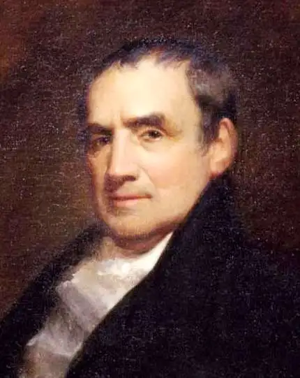
Matthew Carey (January 28, 1760 - September 16, 1839) was a Dublin born publisher who established himself in Philadelphia in the late 18th and early 19th century. A young man of socially progressive views, Carey's first known publication, produced when he was but 17 years old, was a pamphlet criticizing dueling. Another pamphlet, issued in the same year, attacked the Irish penal code. Shortly afterwards, in 1779, legal issues, possibly arising from his liberal political activism, forced Carey to flee to Paris. In Paris, Carey had the good fortune to befriend the visiting American diplomat and founding father, Benjamin Franklin (1706 - 1790). As an Irishman chafing under the rule of England, Carey sympathized with and admired the American revolutionary. The liberally minded pair struck up a lifelong friendship and Carey was hired to work at Franklin's press in Passy, France. A year later, Carey returned to Ireland and resumed his politically provocative publishing career with The Freemans's Journal and The Volunteer's Journal. It didn't take long for political pressure to once again force Carey from Ireland - this time to America (1784). Although largely without funds, Carey convinced Gilbert du Motier, Marquis de Lafayette (1757 - 1834), who he knew from Franklin's Paris circle, to lend him funds to establish a new publishing concern in Philadelphia. Despite this loan, Carey's firm remained under financed and opened on a shoestring budget. It was most likely his limited budget that led Carey to some of his most important publishing innovations. At the time cartographic publishing was dominated by large printing houses in London and Paris where most, if not all, of the work was completed in house. Without the finances to emulate this large publishing houses, Carey was forced to outsource much of his publishing work. This set the stage for subsequent American publishers who, in order to compete effectively with European firms, relied on an often bewildering network of alliances and collaborations. Carey was also a master of republishing many of his own maps in multiple different atlases and formats to maximize their profitability. His most important work is without a doubt the 1795 issue of the American Atlas the first atlas to be published in America. Carey died in 1839 but was succeeded by his son Henry Charles Carey (1793 - 1879) who, in partnership with his brother-in-law Isaac Lea (1792 - 1886), published numerous important maps and atlases under the Carey and Lea, Lea Brothers, and Lea and Blanchard imprints.
Britain's remaining North American colonies.
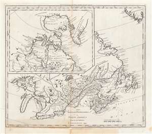
The British Possessions in North America from the best Authorities.
$450.00
Acquire
- Digital Map Information
- Suitable for large format printing
- DPI: 600
- File Size: 37.55 MB
- File Type: ZIP / TIFF
- ICC color profile embedded
- Delivered instantly via download link
This is a first edition example of Samuel Lewis' 1794 map of Canada for Carey's General Atlas, the first atlas published in the young American Republic. It depicts the remaining British colonies in North America (save for Bermuda) in the wake of the American Revolution, before they had cohered into a single entity and identity as Canada. (more details)
First Map of the first state to be published in the United States.
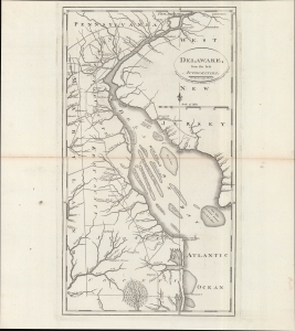
Delaware, from the best authorities.
$500.00
Acquire
- Digital Map Information
- Suitable for large format printing
- DPI: 600
- File Size: 24.55 MB
- File Type: ZIP / TIFF
- ICC color profile embedded
- Delivered instantly via download link
An example of Matthew Carey and William Barker's 1795 map of Delaware, which appeared in Carey's American Edition of Guthrie's Geography Improved, the first atlas published in the United States of America. It provides a fascinating snapshot of America's first state in the years following independence. (more details)
The last days of Ottoman Europe.
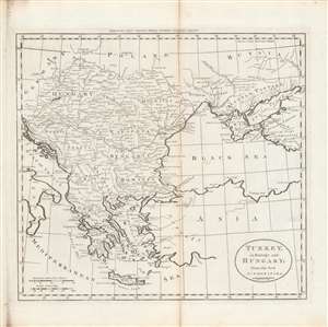
Turkey in Europe and Hungary; from the best authorities.
$400.00
Acquire
- Digital Map Information
- Suitable for large format printing
- DPI: 600
- File Size: 29.37 MB
- File Type: ZIP / TIFF
- ICC color profile embedded
- Delivered instantly via download link
This is Matthew Carey and William Barker's c. 1795 map of Ottoman Europe, Hungary, and nearby territories in southeastern Europe, made for Carey's General Atlas. It depicts the region as it was just prior to a major rearrangement that would see Ottoman rule over the European portion of its empire collapse. (more details)
Earliest Atlas Map of Connecticut Published in the American Republic.
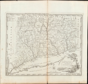
Connecticut from the Best Authorities.
$600.00
Acquire
- Digital Map Information
- Suitable for large format printing
- Full resolution TIFF file
- ICC color profile embedded
- Delivered instantly via download link
A fascinating 1795 map of the state of Connecticut, drawn and engraved by Amos Doolittle for Matthew Carey's Carey's American Edition of Guthrie's Geography Improved, the first atlas published in the United States of America. (more details)
Earliest Atlas Map of Maryland Published in the American Republic.
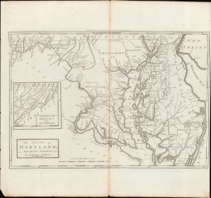
The State of Maryland, from the Best Authorities.
$600.00
Acquire
- Digital Map Information
- Suitable for large format printing
- Full resolution TIFF file
- ICC color profile embedded
- Delivered instantly via download link
An important map of Maryland from the early days of the American Republic, this 1795 work was drawn by Samuel Lewis and engraved by William Barker for inclusion in Matthew Carey's Carey's American Edition of Guthrie's Geography Improved, the first atlas published in the United States. (more details)
Italy during the French Revolutionary Wars.
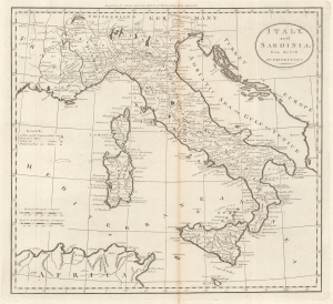
Italy, and Sardinia, from the best Authorities.
$450.00
Acquire
- Digital Map Information
- Suitable for large format printing
- File Size: 8.29 MB
- File Type: ZIP / TIFF
- ICC color profile embedded
- Delivered instantly via download link
This is a 1795 Matthew Carey map of Italy and Sicily. Published during the French Revolution (1789 - 1799), this map captures Italy at a moment of continental upheaval. (more details)
Acquainting North Americans with their southern neighbors.
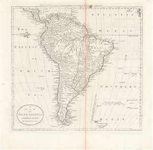
A Map of South America according to the best authorities.
$400.00
Acquire
- Digital Map Information
- Suitable for large format printing
- DPI: 600
- File Size: 29.02 MB
- File Type: ZIP / TIFF
- ICC color profile embedded
- Delivered instantly via download link
Intricately detailed and informative, this is Matthew Carey's c. 1795 map of South America, included in Carey's General Atlas, the first atlas published in the American Republic. It illustrates the continent just prior to the wars of independence that would expel the Spanish from the region, opening the door for greater influence from the United States. (more details)
First specific map of Rhode Island published in the United States.
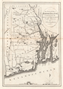
The State of Rhode Island; compiled from the Surveys and Observations of Caleb Harris. By Harding Harris.
$500.00
Acquire
- Digital Map Information
- Suitable for large format printing
- File Size: 5.66 MB
- File Type: ZIP / TIFF
- ICC color profile embedded
- Delivered instantly via download link
This is an example of Matthew Carey's 1795 reduction of Caleb and Harding Harris' unobtainable landmark map of Rhode Island. It is the earliest obtainable map of Rhode Island based on contemporaneous surveys and the first specific map of Rhode Island published in the United States. (The Harris map has appeared only once on the market in the last 25 years.) Harris' mapping of the state remained cutting-edge until 1831 when Stevens published his Topographical Map of the State of Rhode Island. (more details)
First map of Africa published in the American Republic.
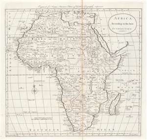
Africa according to the best authorities.
$300.00
Acquire
- Digital Map Information
- Suitable for large format printing
- DPI: 600
- File Size: 9.99 MB
- File Type: ZIP / TIFF
- ICC color profile embedded
- Delivered instantly via download link
This is a 1796 map of Africa from Carey's General Atlas, the first atlas published in the new American Republic. It was made at the height of the Transatlantic Slave Trade and the transformation of the institution of slavery in the early Republic. (more details)
Asia, from America's first atlas.
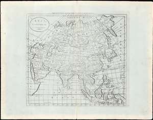
Asia, according to the best authorities.
$200.00
Acquire
- Digital Map Information
- Suitable for large format printing
- Full resolution TIFF file
- ICC color profile embedded
- Delivered instantly via download link
This is an uncommon c. 1796 map of Asia from Carey's General Atlas, the first atlas published in the United States after Independence. The map stretches from Asia Minor and Arabia across to Japan, the Philippines, and Indonesia, and from the arctic north of Siberia south to the Indian Ocean. (more details)
Published during the French Revolutionary Wars.
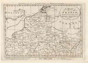
A Map of the Seat of War in France with the Country divided into its Several Departments.
$200.00
Acquire
- Digital Map Information
- Suitable for large format printing
- Full resolution TIFF file
- ICC color profile embedded
- Delivered instantly via download link
This is a 1796 Mathew Carey map of northeastern France, Belgium, Luxembourg, and Germany. Created during the French Revolutionary Wars (1792 - 1802), specifically the War of the First Coalition (1792 - 1797), fantastic detail is present in France. Cities and towns throughout northern France are identified, including Paris, Rouen, Le Havre, Lille, Calais, and Strasbourg. France is also divided into departments, created only six years before this map was created by the National Constituent Assembly. Very little detail is present outside France. Major cities are marked in England, Germany, and modern-day Belgium and the Netherlands. (more details)
A map of the West Indies from the first atlas published in the United States.
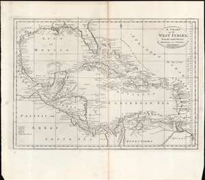
A Chart of the West Indies From the Latest Marine Charts and Surveys.
$250.00
Acquire
- Digital Map Information
- Suitable for large format printing
- Full resolution TIFF file
- ICC color profile embedded
- Delivered instantly via download link
This is a c. 1796 map of the West Indies from Carey's General Atlas, the first atlas published in the new American Republic. (more details)
An early American map of the Russian Empire.
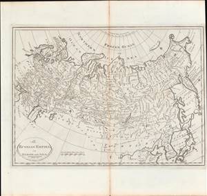
Russian Empire, in Europe and Asia.
$350.00
Acquire
- Digital Map Information
- Suitable for large format printing
- DPI: 600
- File Size: 9.01 MB
- File Type: ZIP / TIFF
- ICC color profile embedded
- Delivered instantly via download link
This is a rare c. 1811 map of the Russian Empire from Carey's General Atlas, the first atlas published in the new American Republic. It shows the Russian Empire after two and a half centuries of territorial expansion beginning with Ivan IV (the 'Terrible') through Catherine the Great. (more details)
North America after the Louisiana Purchase but before Lewis and Clark.
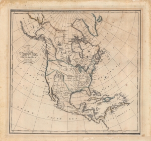
A New and Accurate Map of North America from the best Authorities.
$350.00
Acquire
- Digital Map Information
- Suitable for large format printing
- Full resolution TIFF file
- ICC color profile embedded
- Delivered instantly via download link
An interesting map of North America by Matthew Carey and engraved by John Bower for the 1814 edition of Carey's General Atlas. It reflects the state of geographical knowledge of interior North America at the start of the 19th century, before the discoveries of Lewis and Clark. (more details)
Early map of the Bluegrass State.
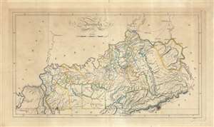
Kentucky.
$800.00
Acquire
- Digital Map Information
- Suitable for large format printing
- DPI: 600
- File Size: 28.74 MB
- File Type: ZIP / TIFF
- ICC color profile embedded
- Delivered instantly via download link
An 1814 map of the state of Kentucky by Matthew Carey and engraved by Enoch Gridley for the 1814 edition of Carey's General Atlas. Produced roughly twenty years after Kentucky gained statehood, it gives a sense of the rapid development of the state. (more details)
Translating geographic knowledge in Humboldt's wake.
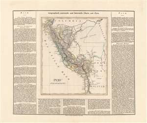
Peru.
$550.00
Acquire
- Digital Map Information
- Suitable for large format printing
- DPI: 600
- File Size: 57.42 MB
- File Type: ZIP / TIFF
- ICC color profile embedded
- Delivered instantly via download link
This is an 1827 German edition of Matthew Carey and Isaac Lea's map of Peru, published in Weimar by the Geographischen Instituts. It is an early map, among the first in German, of Peru following its independence, which had only been secured the previous year. (more details)
The Americas in the Wake of Independence.
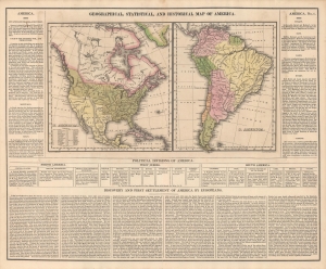
Geographical, Statistical, And Historical Map Of America.
$600.00
Acquire
- Digital Map Information
- Suitable for large format printing
- Full resolution TIFF file
- ICC color profile embedded
- Delivered instantly via download link
An informative c. 1827 map of the Americas that appeared in Matthew Carey and Isaac Lea's A Complete Historical, Chronological, And Geographical American Atlas. Among other features, it reflects territorial disputes that emerged in the wake of independence movements throughout the hemisphere. (more details)