
Social Realism and Zionism.
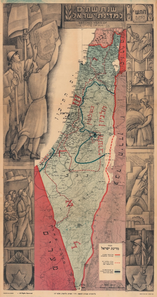
Second Year of the State of Israel.
sold
- Digital Map Information
- Suitable for large format printing
- File Size: 60.39 MB
- File Type: ZIP / TIFF
- ICC color profile embedded
- Delivered instantly via download link
A rare and striking 1949 Joseph Szapiro (Schapiro) Zionist map of Israel, with striking Social Realist imagery, celebrating the second anniversary of Israel's 1947 founding. The map depicts the region from the Mediterranean Sea to Jordan (Transjordan) and Syria and from Lebanon to Egypt and the Gulf of Eilat (Gulf of Aqaba). Highly detailed, cities, towns, and villages are labeled throughout, with Jerusalem and Tel Aviv given prominence. (more details)
Resolution of the Oregon Question.
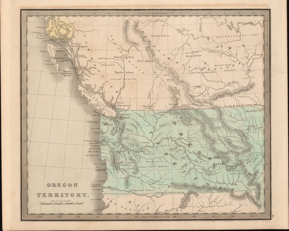
Oregon Territory.
sold
- Digital Map Information
- Suitable for large format printing
- DPI: 600
- File Size: 207.34 MB
- File Type: ZIP / TIFF
- ICC color profile embedded
- Delivered instantly via download link
This is Jeremiah Greenleaf's 1849 map of Oregon Territory. The map reflects the resolution of the Oregon Question, with a fixed boundary at the 49th parallel. It is one of the few atlas maps of Oregon Territory to appear prior to 1850. (more details)
First topographical map of the White Mountains.

A Map of the White Mountains of New Hampshire.
sold
- Digital Map Information
- Suitable for large format printing
- Full resolution TIFF file
- ICC color profile embedded
- Delivered instantly via download link
This is George Phillips Bond's 1853 map of the White Mountains, considered the first accurate topographic map of that range. Here, 'the names of the individual peaks of the Presidential Range appear for the first time on any map, as well as the names Cannon Mt., Twin Mts., Carrigain, Tremont, and Giant's Stairs.' ( Bent, p. 84). (more details)
Rome's Provinces in Northwest Africa.
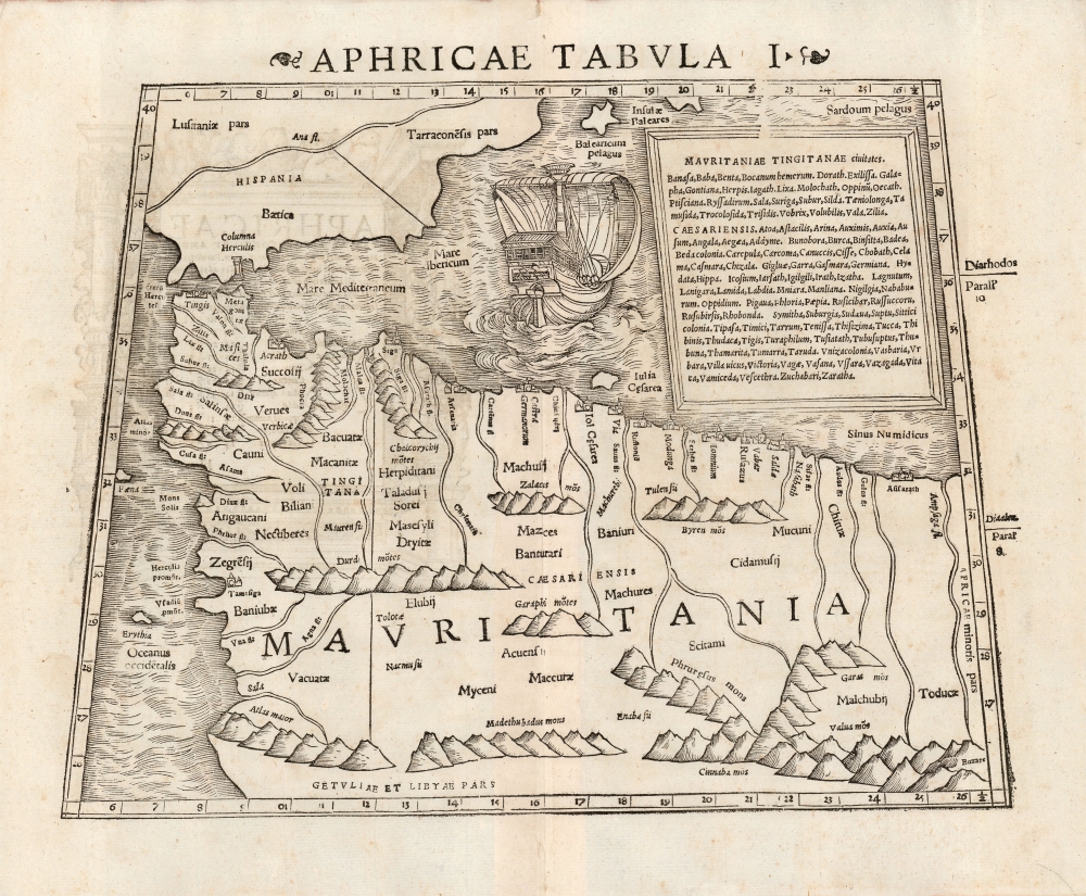
Aphricae Tabula I.
$750.00
Acquire
- Digital Map Information
- Suitable for large format printing
- DPI: 600
- File Size: 22.61 MB
- File Type: ZIP / TIFF
- ICC color profile embedded
- Delivered instantly via download link
This is a beautiful 1552 example of Sebastian Münster's Ptolemaic map of northwestern Africa and the Strait of Gibraltar. This was the first of Ptolemy's three particular maps of the part of Africa known to Rome in the second century; it represented the southwestern limit of the Alexandrian Roman geographer's knowledge.
Specifically, the map focuses on the Roman African provinces (annexed by Emperor Claudius in 44 C.E.) of Mauretania Tingitana west of the Moulouya River, and Mauritania Caesariensis to the east of it. The two provinces were administered respectively from the coastal cities of Tangier (Tingis) and Jol Caesarea (now called Cherchell, in modern Algeria.) Both of these are shown and named on the map. The map extends southwards to the Atlas Mountains, which Rome considered to be the southern border of their African provinces. (Rome's actual occupation did not reach so far - in the west, the area of Volubilis (here 'Voli Bilian')The The eastern limit of the map is the River Ampsaga, which represented the boundary between Mauretania and Numidia. it is now understood to correspond with the modern Oued-el-kabir river in Algeria. Thus, the present map extends through most of Algeria and Morocco. (more details)
Specifically, the map focuses on the Roman African provinces (annexed by Emperor Claudius in 44 C.E.) of Mauretania Tingitana west of the Moulouya River, and Mauritania Caesariensis to the east of it. The two provinces were administered respectively from the coastal cities of Tangier (Tingis) and Jol Caesarea (now called Cherchell, in modern Algeria.) Both of these are shown and named on the map. The map extends southwards to the Atlas Mountains, which Rome considered to be the southern border of their African provinces. (Rome's actual occupation did not reach so far - in the west, the area of Volubilis (here 'Voli Bilian')The The eastern limit of the map is the River Ampsaga, which represented the boundary between Mauretania and Numidia. it is now understood to correspond with the modern Oued-el-kabir river in Algeria. Thus, the present map extends through most of Algeria and Morocco. (more details)
The British invade Afghanistan, again.
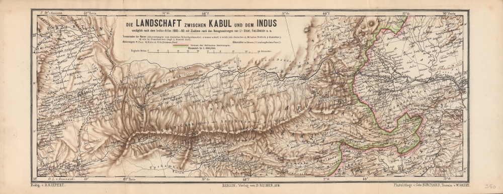
Die Landschaft zwischen Kabul und dem Indus.
sold
- Digital Map Information
- Suitable for large format printing
- File Size: 15.42 MB
- File Type: ZIP / TIFF
- ICC color profile embedded
- Delivered instantly via download link
A scarce and highly detailed 1878 topographical map by Heinrich Kiepert of a portion of eastern Afghanistan and surroundings, highlighting the lands between Kabul and Peshawar. It was made as tensions between Britain and Afghanistan peaked, a side effect of the 'Great Game' competition between Britain and Russia, which led to the Second Anglo-Afghan War. (more details)
Oxford and its many colleges given the pictorial treatment!
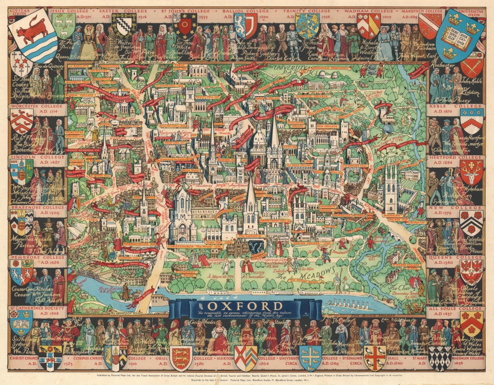
Oxford.
sold
- Digital Map Information
- Suitable for large format printing
- File Size: 70.86 MB
- File Type: ZIP / TIFF
- ICC color profile embedded
- Delivered instantly via download link
This is a wonderful c. 1948 Kerry Lee pictorial map of Oxford, England. Depicting Oxford in all its charm, Cathedral Church immediately draws the eye. Gold hued banners proclaim the city's many colleges, including Merton College, Balliol College, and Queen's College. Other golden hued banners mark more commonplace locations, such as the post office and several hotels. Red banners announce the locations of theatres, churches, the New Bodleian Library, the University Museum, and the Ashmolean Museum and Galleries. The Coats of Arms of Oxford's many colleges create the border, along with portraits of famous alumni. (more details)
Wonderful pictorial map of Cambridge and its colleges.
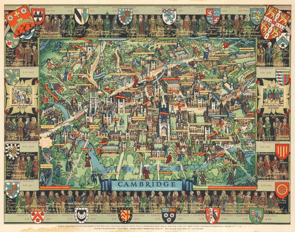
Cambridge.
sold
- Digital Map Information
- Suitable for large format printing
- File Size: 68.47 MB
- File Type: ZIP / TIFF
- ICC color profile embedded
- Delivered instantly via download link
This is a marvelous c. 1948 Kerry Lee pictorial map of Cambridge, England. Charmingly illustrating the world-famous university town, yellow panels mark the city's colleges, including Christ's College, King's College, St. John's College, Trinity College, and Queen's College. Banners highlight other important locations, including chapels, theaters, markets, gates, and The Pepysian Library. Famous personalities walk the streets of Cambridge, including Isaac Newton, William Wordsworth, Lord Keynes, Francis Bacon, Geoffrey Chaucer, and King Henry VIII and Anne Boleyn. Coats of Arms for the city's colleges adorn the border and state when each college was founded. 'Portraits' of famous alumni populate the rest of the border. (more details)
The Great Lakes and routes west.
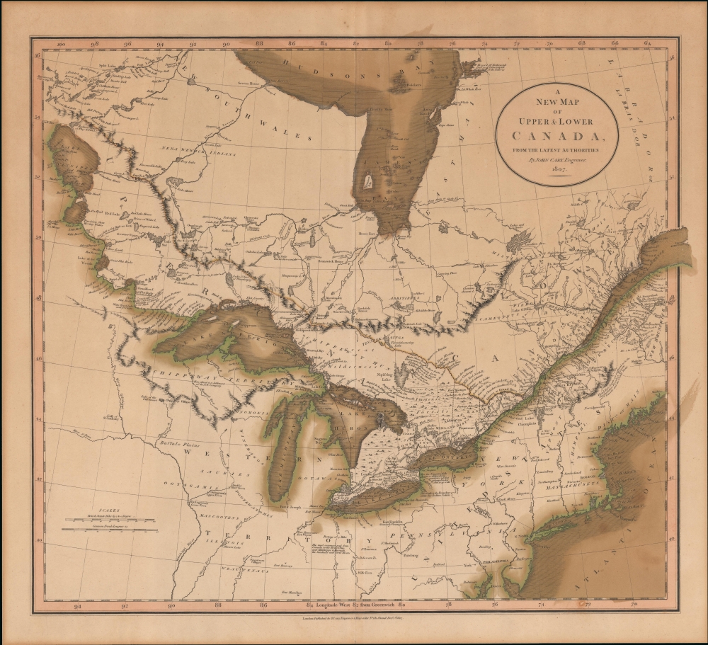
A New Map of Upper and Lower Canada, from the latest authorities.
sold
- Digital Map Information
- Suitable for large format printing
- DPI: 600
- File Size: 526.45 MB
- File Type: ZIP / TIFF
- ICC color profile embedded
- Delivered instantly via download link
This the first edition of John Cary's 1807 map of Canada and the Great Lakes. The map reflects the post-Revolutionary War period when Britain refocused its attention on developing its Canadian colonies. Meanwhile, the United States, following the expedition of Lewis and Clark, was about to begin its first major phase of westward expansion. Within Canada, the rivalry between the well-established fur-trading Hudson Bay Company and the upstart Northwest Company was heating up as both competed for valuable trade routes. (more details)
An early map of the California and Oregon coasts.
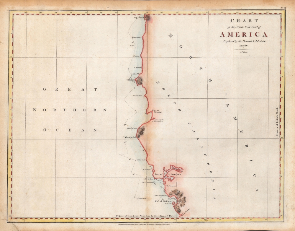
Chart of the North West Coast of America Explored by the Boussole and Astrolabe in 1786. 3rd Sheet.
sold
- Digital Map Information
- Suitable for large format printing
- Full resolution TIFF file
- ICC color profile embedded
- Delivered instantly via download link
An important early chart of the coasts of Northern California and Oregon, undertaken by the ill-fated French voyage led by La Perouse in 1786. This rare hand-colored example of the map came from the first English edition of the text and plates recounting La Perouse's voyage, published in London by J. and G. Robinson in 1798. (more details)
A new take on Michigan (not in Karpinski).
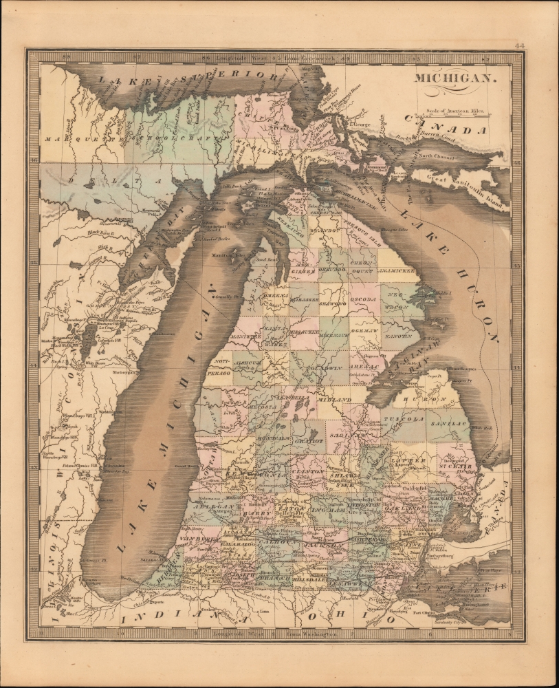
Michigan.
sold
- Digital Map Information
- Suitable for large format printing
- DPI: 600
- File Size: 206.82 MB
- File Type: ZIP / TIFF
- ICC color profile embedded
- Delivered instantly via download link
This is Jeremiah Greenleaf's 1849 map of Michigan. This map represents a complete remapping of Michigan not seen in earlier Greenleaf or Burr atlases. The famously distended form of lake Michigan has here been partially modified to greater accuracy. (more details)
Gearing up for the Civil War.
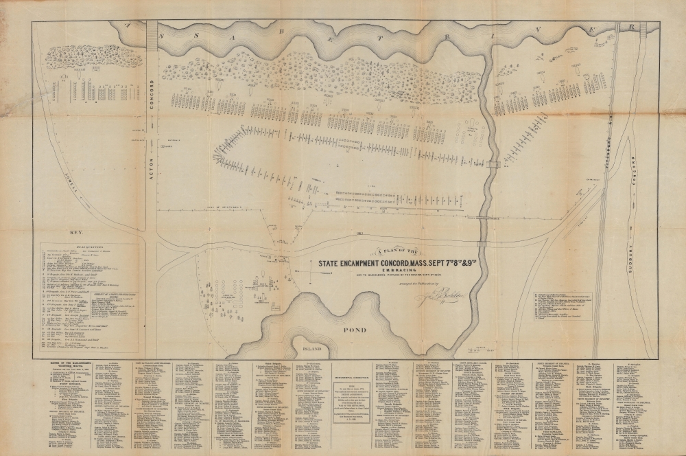
A Plan of the State Encampment Concord. Mass. Sept 7th 8th and 9th, Embracing Key to Bachelder’s Picture of the Review, Sept. 9th. 1859.
sold
- Digital Map Information
- Suitable for large format printing
- File Size: 29.1 MB
- File Type: ZIP / TIFF
- ICC color profile embedded
- Delivered instantly via download link
A rare map produced in the run-up to the U.S. Civil War, this is an 1859 plan of the camp of the Massachusetts Volunteers in Concord, Massachusetts, published by John Bachelder. Though generally less effective than regular army units, such state militias played an important role in the early months of the Civil War as regular units were organized, outfitted, and trained. (more details)
The only map of the Pilgrimage of Santiago de Compostela at its height.

Le Voyage de Madrid et La Chemin de S. Iacques en Galice. / La Riviere et les Environs de Bovrdeavx. / La Route des Postes de Paris a Bayonne.
sold
- Digital Map Information
- Suitable for large format printing
- DPI: 600
- File Size: 440.49 MB
- File Type: ZIP / TIFF
- ICC color profile embedded
- Delivered instantly via download link
Of the utmost importance and rarity, this is the only map to illustrate the pilgrimage route to Santiago de Compostela (Chemin St. Jacques / Way of St. James) to appear during its period of greatest significance. This map was issued in 1659 by Pierre Du Val and Jacques Lagniet. It follows closely on the November 7, 1659 signing Treaty of the Pyrenees, which sealed a peace between France and Spain, ending the Franco-Spanish War (1635 - 1659) and opening the pilgrimage routes to French devotees for the first time in nearly thirty years. (more details)
Unique First State.
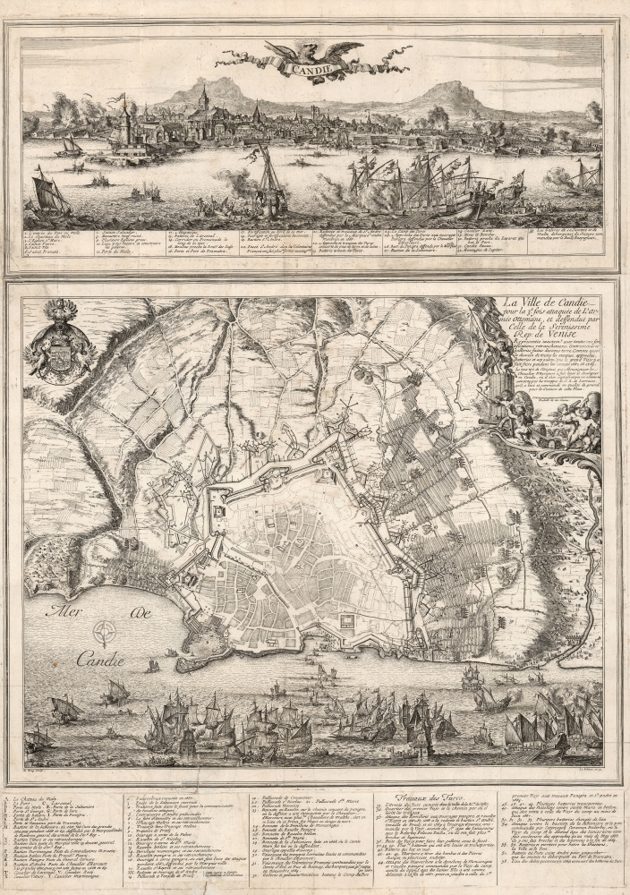
Candie/ La Ville de Candie pour la 3e. sois attaquee de L'armée Ottomane, et deffendue par Celle de la Serenissime Rep: de Venise... 1667, 68 et 69.
sold
- Digital Map Information
- Suitable for large format printing
- DPI: 600
- File Size: 109.01 MB
- File Type: ZIP / TIFF
- ICC color profile embedded
- Delivered instantly via download link
This is an extremely rare, likely unique, separately published 1668 broadsheet plan of the port of Heraklion / Candia, Crete, incorporating a striking panoramic view of the city. This broadsheet illustrates Venetian-controlled Heraklion during the final years of its 21-year-long Ottoman siege. It was privately commissioned and engraved to lionize the efforts of French nobleman Alphonse-Louis, Chevalier d’Harcourt, who perceived himself not only a defender of Crete, but as a latter-day crusader defending Christianity itself. (more details)
Controversial and consequential.

三國通覽圖 / [Overview Map of the Three Kingdoms].
sold
- Digital Map Information
- Suitable for large format printing
- DPI: 600
- File Size: 51.75 MB
- File Type: ZIP / TIFF
- ICC color profile embedded
- Delivered instantly via download link
A banned and controversial map, this is the is the rarest and most important of the five c. 1785 maps issued by Hayashi Shihei (林子平) in his work Sangoku Tsūran Zusetsu (三国通覧図說). The present map is a separate issue manuscript of Hayashi's 1785 map, with some minor changes. This example is significant as, despite being an inherently Japanese production, it unambiguously grants the both the disputed Dokdo Islands (Takeshima / Liancourt Rocks) to Korea, and the disputed Diaoyu (Senkaku Islands) to China. (more details)
The earliest acquirable European mapping of Korea based on firsthand report.
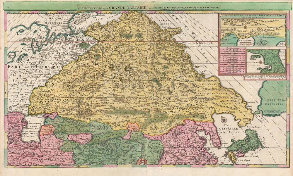
Carte Nouvelle de la Grande Tartarie.
$3,500.00
Acquire
- Digital Map Information
- Suitable for large format printing
- DPI: 600
- File Size: 123.4 MB
- File Type: ZIP / TIFF
- ICC color profile embedded
- Delivered instantly via download link
This is a stunning, original-color example of Pierre Mortier's 1696 two-sheet map of northern Asia, Siberia, and Tartary. It is drawn primarily from two sources: Hubert Jaillot's 1695 six-sheet wall map of Asia and Nicolaes Witsen's 1687 map of Tartary. As a result, this map represents the most up-to-date cartography of central and northeastern Asia of the seventeenth century, which would not be significantly improved upon until the maps of Strahlenberg thirty years later. (more details)
Discovery Era World Revealed.

Typus Orbis Universalis.
sold
- Digital Map Information
- Suitable for large format printing
- DPI: 600
- File Size: 26.37 MB
- File Type: ZIP / TIFF
- ICC color profile embedded
- Delivered instantly via download link
This is Sebastian Münster's 1550 Typus Orbis Universalis, one of the most distinctive world maps produced during the Age of Discovery. In the mid-sixteenth century, it was the best generally available summation of the rapidly expanding known world. The map was included in Münster’s magnum opus, Cosmographia Universalis, which for over 40 years was the go-to volume for the literate European seeking knowledge of the world. Consequently, this map had a disproportionate impact, providing a broad audience their first image of the post-Magellanic world. It was not challenged until the 1570 publication of Ortelius' Theatrum Orbis Terrarum. As important as its geographical revelations were, the map is also rich in the imagery of its era: it is bordered with billowing clouds and wind-heads marking the cardinal directions, puffing their breezes over the waters. The oceans are prowled by eight sea monsters and a sailing ship is shown crossing the Pacific and proudly firing its cannons. (more details)
Best American atlas map of North and South Carolina of the 19th century.
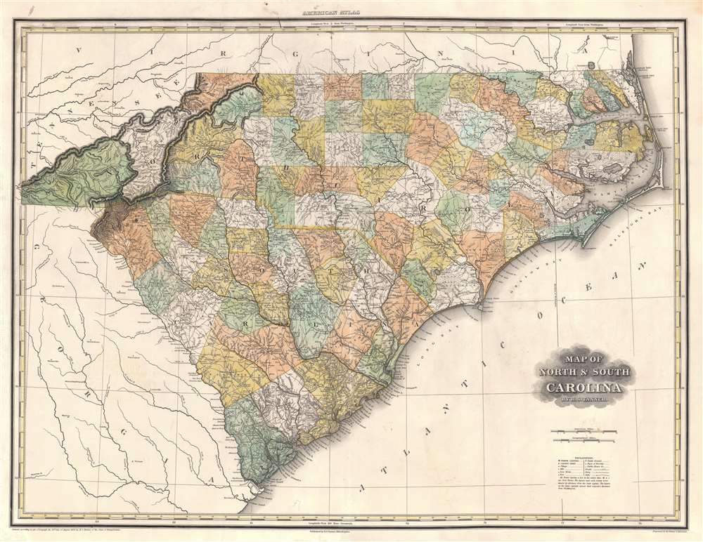
Map of North and South Carolina.
sold
- Digital Map Information
- Suitable for large format printing
- Full resolution TIFF file
- ICC color profile embedded
- Delivered instantly via download link
An uncommon 1823 first edition Henry Schenck Tanner map of North Carolina and South Carolina. When this map was illustrated, it represented the finest atlas map of these states then obtainable, featuring a wealth of important cartographic firsts, such as the addition of Haywood County (founded in 1808). The map remained definitive until new more detailed maps were produced after the American Civil War. (more details)
Photomap for planning the Iwo Jima invasion.
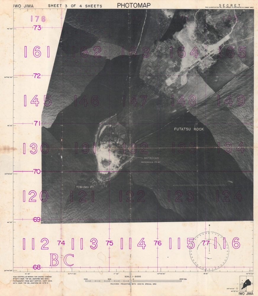
Photomap. Iwo Jima. Sheet 3 of 4 Sheets.
sold
- Digital Map Information
- Suitable for large format printing
- File Size: 67.32 MB
- File Type: ZIP / TIFF
- ICC color profile embedded
- Delivered instantly via download link
This is a 1944 64th Engineer Topographic Battalion photomap of Iwo Jima illustrating Mount Suribachi and Airfield No. 1 - the critical objectives of the Iwo Jima invasion. Few photographic maps have survived from Pacific invasions - this being thus a remarkable discovery. Photographic mapmaking was pioneered during World War II, particularly in the Pacific, where strategically critical battles were fought over tiny volcanic islands and atolls that were previously cartographically ignored. Engineer topographic battalions compiled aerial photography (as here), ship-side triangulation, older maps, and shipboard printed to produce on-the-spot yet highly accurate field maps. (more details)
Art deco aviation poster of Europe and Africa.

Sabena Belgian World Airlines.
sold
- Digital Map Information
- Suitable for large format printing
- File Size: 95.99 MB
- File Type: ZIP / TIFF
- ICC color profile embedded
- Delivered instantly via download link
A very attractive c. 1950 Claude Dohet art deco map of Africa and Europe advertising Sabena Airlines, the Belgian national carrier. The map features striking gold highlighting of routes in Africa and Europe. It recalls Belgium's cartographic heritage with Renaissance-style cartouche work evocative of Mercator and Ortelius, 18th century ships, and an elaborate compass rose. It is further elaborated by pictorial illustrations of European and Congolese people, and a dramatic illustration of Kano, Nigeria, at its height. (more details)
Only surviving cane map of Miami.

1940 Orange Bowl Festival.
sold
This singular survivor is the 1939-1940 'Orange Bowl' cane map of Miami and Miami Beach, Florida, drawn by Elizabeth H. Baldwin. It is one of only four known cane maps, and by far the rarest, this being the only known example. The map was issued late in 1939 for visitors to Miami attending the Orange Bowl and its adjacent festivities. The map promotes the Orange Bowl Festival (December 28 - January 7), the Football Classic (January 1), and the Peter Pan Pageant (December 30). (more details)