
Colonial Modernity in Korea...

朝鮮地圖 / [Map of Chōsen].
sold
- Digital Map Information
- Suitable for large format printing
- Full resolution TIFF file
- ICC color profile embedded
- Delivered instantly via download link
This is a scarce 1938 Showa 13 Government-General of Chōsen (朝鮮總督府) map of the thirteen provinces of colonial Korea. The map presents essential information, such as the location of important cities, government offices, waterways, existing and planned railways, and air and sea routes. (more details)
Russian map of North American issued at the height of the Cold War.

СЕВЕРНАЯ АМЕРИКА ПОЛИТИЧЕСКАЯ КАРТА. / [North America Political Map].
sold
- Digital Map Information
- Suitable for large format printing
- File Size: 89.16 MB
- File Type: ZIP / TIFF
- ICC color profile embedded
- Delivered instantly via download link
This is a 1952 USSR Directorate of Geodesy and Cartography map of North America, in Russian. published in Moscow at the height the Cold War (1947 - 1989). Coverage extends from the North Pole to northern South America including the West Indies. States and provinces throughout the United States, Mexico, and Canada are labeled with major cities identified. Red lines trace major railways and solid blue lines mark 'navigable channels', many of which are large rivers, including the Mississippi. Blue dashed lines follow shipping routes, which are identified by the two ports on either end with distances in both kilometers and miles provided. (more details)
From the first general atlas published in the United States.
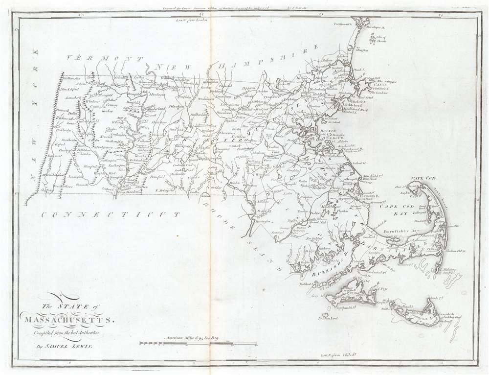
The State of Massachusetts.
sold
- Digital Map Information
- Suitable for large format printing
- Full resolution TIFF file
- ICC color profile embedded
- Delivered instantly via download link
This is a 1796 Mathew Carey and Samuel Lewis map of Massachusetts, published by Carey in the first general atlas of the United States. Cities, towns, and villages are labeled across the state, including Boston, Salem, Marblehead, and Plymouth. Major roads are depicted, along with rivers and lakes. Coastal bays and harbors, including Boston Harbor, Buzzards Bay, and Cape Cod Bay, are labeled. (more details)
Detailed elephant folio map of North America.
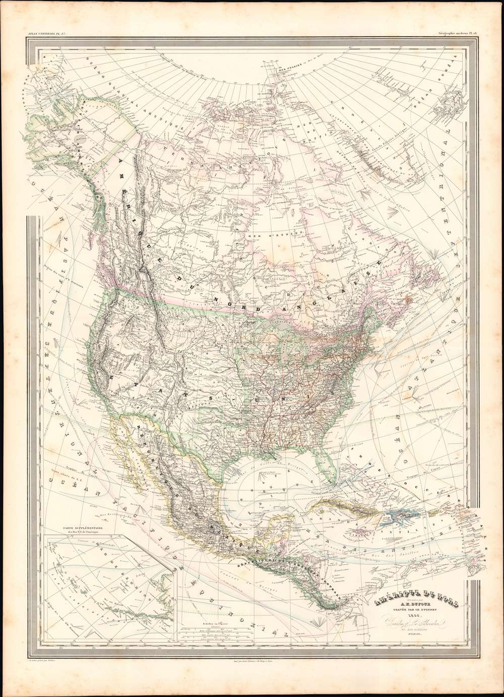
Amerique Du Nord.
sold
- Digital Map Information
- Suitable for large format printing
- File Size: 32.19 MB
- File Type: ZIP / TIFF
- ICC color profile embedded
- Delivered instantly via download link
This is a finely detailed large format 1860 elephant folio map of the North America on Mercator's projection by the French cartographer Auguste-Henri Dufour. This map covers the entire continent from the Arctic to the northern part of South America, inclusive of the West Indies, Central America, Mexico, the United States, Canada and Alaska. In addition to standard political and physical data, a wealth of cartographic information appears throughout, including nautical routes, currents, winds, notes on explorers, some offshore details, comments on the polar ice caps, notes on vegetation, and much more. An inset in the lower right focuses on the Aleutian Islands. (more details)
Istanbul during the Crimean War.
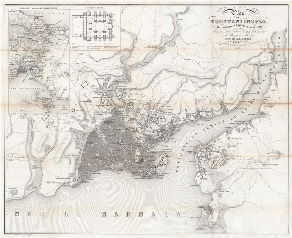
Plan de Constantinople de ses Faubourgs et d'une partie du Bosphore d'après Kauffor, Lechevalier, Joseph de Hammer et le Baron de Moltke.
sold
- Digital Map Information
- Suitable for large format printing
- File Size: 23.77 MB
- File Type: ZIP / TIFF
- ICC color profile embedded
- Delivered instantly via download link
This is a c. 1855 Adolphe Dufour city plan or map of Istanbul / Constantinople, Turkey. Published during the Crimean War (1853 - 1856), Dufour provides a detailed look at the Ottoman capital. The Hagia Sophia (labeled here as Ste. Sophie) is illustrated, along with other mosques, including the Suleymaniye Mosque. Many are illustrated iconographically, meaning a cross-section of the building illustrates the floor plan. The Topkapi Palace, also known as the Seraglio, is illustrated in detail. Numerous other locations are identified, including the French and Austrian embassies, the Grand Bazaar, other shops, and cemeteries. An inset situated in the upper left details the Hagia Sophia, alphabetically identifying parts of the iconic building. A second inset illustrates the entire Bosporus along with Istanbul and its environs. (more details)
Detailed road map of Barbados.
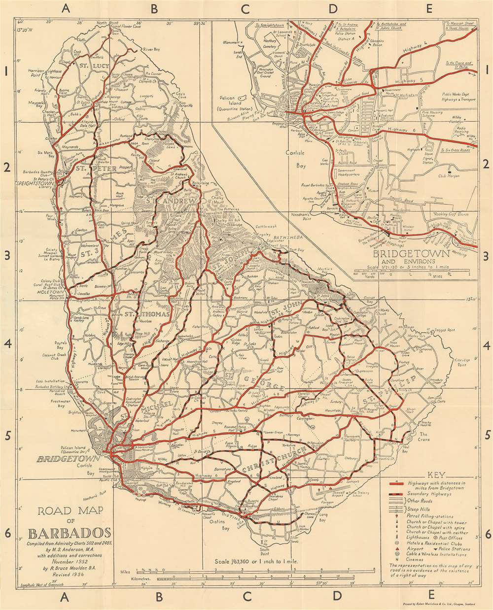
Road Map of Barbados.
sold
This is a 1956 Margaret Anderson and R. Bruce Moulder road map of Barbados. Red lines highlight major highways, while red and black dashed lines follow secondary highways. Distances along the major highways are marked by small numbers near the route. Roads marked by two thin black parallel lines are 'other roads' per the key situated in the lower right corner. Symbols mark churches, lighthouses, police stations, and gas stations around the island. Cities, towns, and other settlements are identified, along with coastal locations and various other inland locations. An inset of Bridgetown and its environs is situated in the upper right. Here, Anderson and Moulder identify parks, a playing field, cemeteries, schools, and churches. (more details)
The platting of the Northwest Ordnance.

Diagram of the State of Illinois.
sold
- Digital Map Information
- Suitable for large format printing
- Full resolution TIFF file
- ICC color profile embedded
- Delivered instantly via download link
This is an 1845 Frederick R. Conway map of Illinois. The state has been platted into townships. The township was created as the measure of the Public Land Survey System, which was first widely implemented to survey the Northwest Ordinance, including Illinois. The Public Land Survey System allowed for the systematic surveying and mapping of any territory gained by the United States. Cities and towns are labeled, including Chicago, Hennepin, Peoria, Springfield, and Bloomington. Major rivers are illustrated and identified, with Lake Michigan filling the upper right. (more details)
Best and largest map of Mount Desert Island at the height of its Gilded Age.
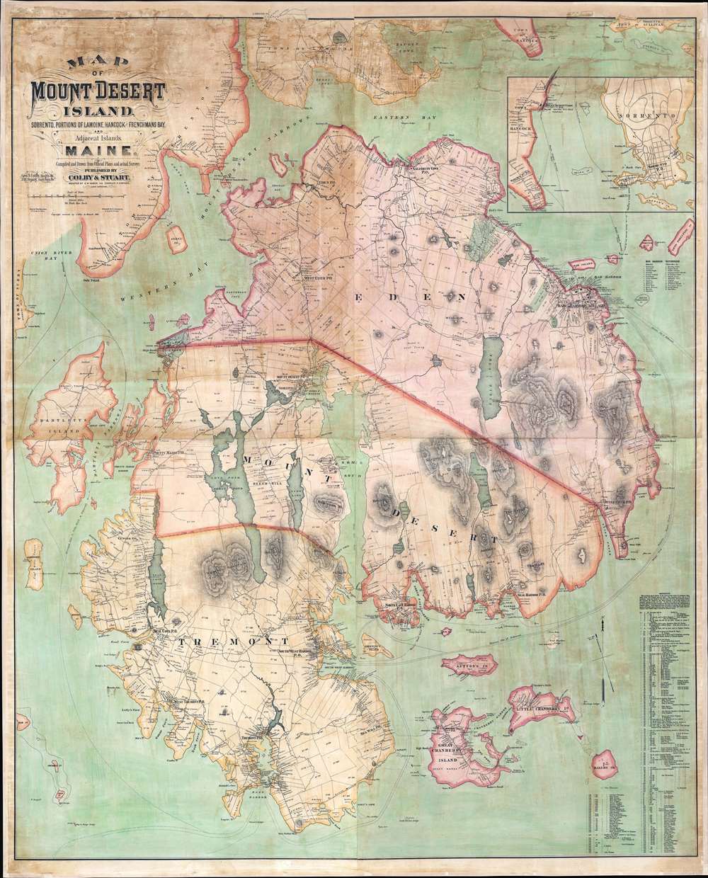
Map of Mount Desert Island, Sorrento, Portions of Lamoine, Hancock, and Frenchman's Bay, and Adjacent Islands, Maine.
sold
- Digital Map Information
- Suitable for large format printing
- File Size: 146.81 MB
- File Type: ZIP / TIFF
- ICC color profile embedded
- Delivered instantly via download link
The largest, rarest, and most important map of Mount Desert Island, Maine, to appear in the 19th century. Published by Colby and Stuart in 1887, this wall map captures Mount Desert Island and Bar Harbor at the height of its gilded age, when it rivaled Newport as a haven for the moneyed elite. The map embraces the island in exceptional detail, showing topography and roads, as well as property lots, the named estates of the wealthy, grand hotels, lodges, restaurants, and more. Today, most of Mount Desert Island is part of Acadia National Park, one of America's most beloved and beautiful national parks. (more details)
Highlights the burgeoning railroad network in New England.

Railroad Map of New England and Eastern New York.
sold
- Digital Map Information
- Suitable for large format printing
- Full resolution TIFF file
- ICC color profile embedded
- Delivered instantly via download link
This is an 1849 J.H. Goldthwait railroad map of New England, depicting from the Hudson River to the Atlantic coast. The map features featuring striking outline color, tracing railroad routes throughout Massachusetts, Connecticut, Rhode Island, Vermont, New Hampshire, and eastern New York. Among the railroads are the Boston and Maine Railroad; the Eastern Railroad; the Boston and Providence Railroad; the New York, New Haven, and Hartford Railroad; the Long Island Railroad; and the Hudson River Railroad. An inset along the right border focuses on Boston and its immediate vicinity and illustrates the area's railroads, including the Grand Junction Railroad. (more details)
Japanese interest in Operation Barbarossa!

闘ふ獨ソ要圖 / [Map of German-Soviet Fighting].
sold
- Digital Map Information
- Suitable for large format printing
- File Size: 39.92 MB
- File Type: ZIP / TIFF
- ICC color profile embedded
- Delivered instantly via download link
This is a very rare 1941 or Showa 16 map of Eastern Europe and Russia by the Osaka Mainchi Shimbun showing the advance of German forces into the Soviet Union during Operation Barbarossa. The map illustrates the battlefront just as the Germans had captured Minsk, were moving towards Moscow, and had encircled Kiev and Leningrad, in August or September 1941. The legend at bottom-left indicates symbols for crucial information such as national and provincial borders, capital cities, railways, ports, military bases, fortifications, important industrial centers, mines, and so on. The inset map at top-left shows distances (presumably by rail) between Berlin, Moscow, Baku, Khabarovsk, and Vladivostok, with Japan at far-right. As one of the major newspapers in Japan, the Osaka Mainchi Shimbun played a crucial role in informing the Japanese public about world affairs. Although Japan was part of the Tripartite Pact with Nazi Germany, the map does not evince any favor towards either side and appears to reproduce photographs from both the German and Soviet press (German on the left, Soviet on the right). Events on the Eastern Front and in the wider European war were followed closely in Japan, which was fighting its own war in China that, at this point, was transforming into a wider regional conflict. Although the wars in Europe and Asia were separate, they would be tied together following the Japanese attack on Pearl Harbor and the entry of the United States into the war. (more details)
Communist Chinese propaganda after the Tet Offensive.

战斗的越南 / Fighting Vietnam.
sold
This is a 1968 Communist Chinese propaganda map of Vietnam published weeks after the Viet Cong launched the Tet Offensive, one of the most dramatic turning points of the Vietnam War. Maps of Vietnam are printed on both sides of the sheet, each focusing on different aspects of the war. (more details)
A little known region mapped.
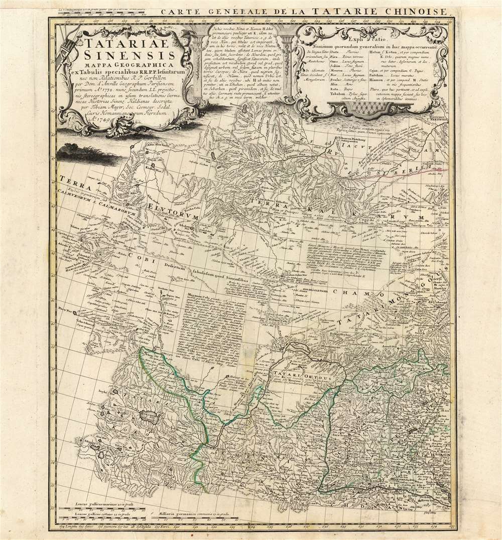
Tartariae Sinensis mappa Geographica...
$750.00
Acquire
- Digital Map Information
- Suitable for large format printing
- Full resolution TIFF file
- ICC color profile embedded
- Delivered instantly via download link
This is a handsome 1749 Homann Heirs map of western China, Mongolia and the extreme southeastern border with Russia. It was produced in order to accompany a German translation of P. Du Halde's 1732 Description de la Chine. As such, it is a faithful copy of J. B. D'Anville's Carte Generale de la Tartarie Chinoise which accompanied Du Halde's original text and the definitive mapping of this little-known and ill-mapped region. D'Anville's map - and Du Halde's data - were derived from Jesuit sources. Jesuits, with the blessing of the Qing Emperor Kangxi, produced at a map of the Chinese Empire's frontiers between 1708 and 1717. (more details)
The Mogul Empire.
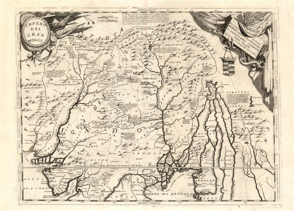
Impero Del Gran Mogol descritto e dedicato all' Illustrissimo et Eccellentisimo S. Girolamo Correr, Sauio Grande dal P. Cosmografo Coronelli.
sold
- Digital Map Information
- Suitable for large format printing
- Full resolution TIFF file
- ICC color profile embedded
- Delivered instantly via download link
This is Vincenzo Maria Coronelli's large 1691 map of India under Mughal Empire during the rule of Emperor Aurangzeb Alamgir (1618 - 1707). The map is a step beyond most maps of this region in the 17th century, most of which are derivative of the 1619 Baffin map of the Mogul Empire. This map depicts what is today Northern India, as well as parts of Pakistan, Bangladesh, Nepal, Bhutan, Burma, and Thailand. It extends from the Himalayas to the Bay of Bengal and from the Indus Valley to the Mekong River.
Many of Coronelli's maps were derived from the geographical information that appeared on his globes - notably his 1688 42-inch terrestrial globe. This map is able to offer more detail than what can be found on either of the two globe gores that encompass this region. (more details)
Many of Coronelli's maps were derived from the geographical information that appeared on his globes - notably his 1688 42-inch terrestrial globe. This map is able to offer more detail than what can be found on either of the two globe gores that encompass this region. (more details)
Boating on the Charles.
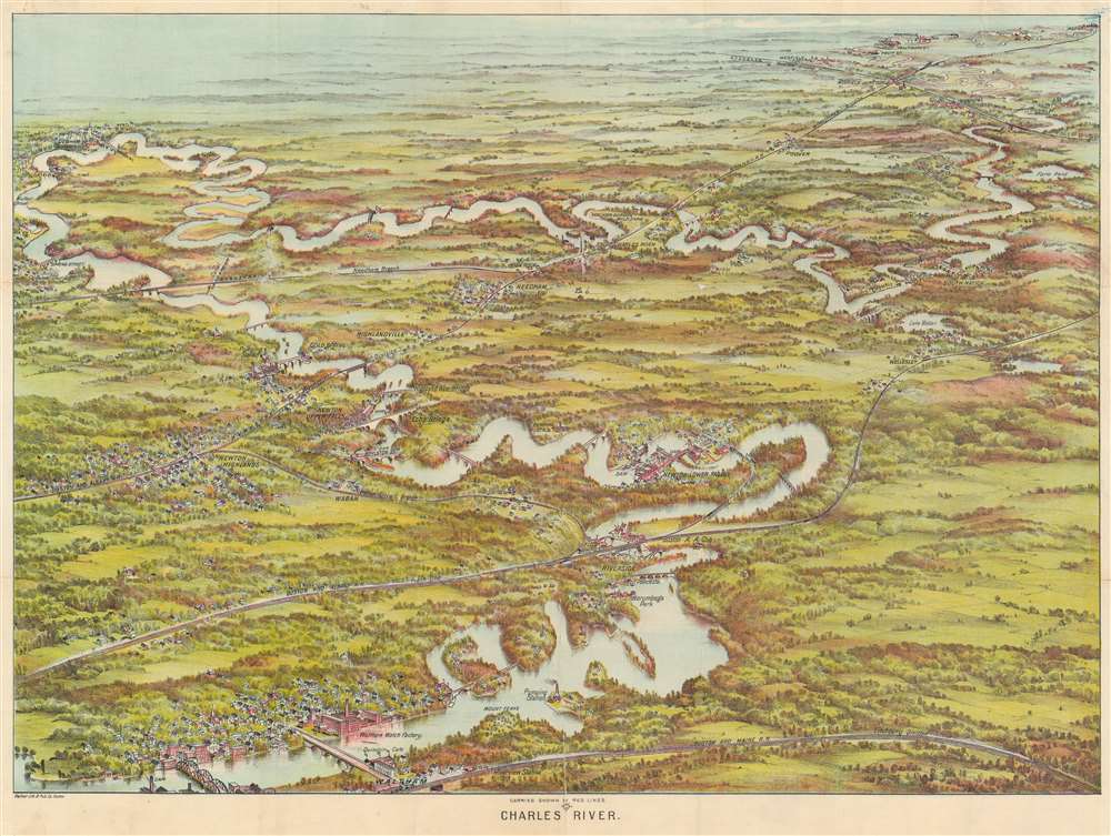
Charles River.
sold
- Digital Map Information
- Suitable for large format printing
- File Size: 113.66 MB
- File Type: ZIP / TIFF
- ICC color profile embedded
- Delivered instantly via download link
This is a beautiful 1907 bird's-eye view map of the Charles River, Massachusetts, by the Boston publisher George H. Walker. Printed in chromolithography, Walker's view illustrates the winding Charles River from Waltham to Medway and includes Riverside, Newton, Wellesley, South Natick, Dover, Needham, Waban, Dedham, Medfield, Rockville and Highlandville. Several landmarks are also noted, including the Waltham Watch Factory, Mount Feake Cemetery, Norumbega Park, Walker-Gordon Milk Farm, and Echo Bridge near Newton Upper Falls. Dams, bridges, lakes, and pumping stations are identified. Walker also notes a number of railway lines and stations throughout. (more details)
Iconic pictorial map of the Hawaiian Islands by illustrator Joseph Feher.

The Dole Map of the Hawaiian Islands.
sold
- Digital Map Information
- Suitable for large format printing
- File Size: 51.61 MB
- File Type: ZIP / TIFF
- ICC color profile embedded
- Delivered instantly via download link
This is a 1950 Joseph Feher pictorial map of the Hawaiian Islands. The map depicts all eight of the major islands in the archipelago from Nihau and Kauai to Hawaii. Numerous illustrations populate the map evoking each island's unique qualities. Vignettes celebrating Hawaiian life, culture, and history are present, as are sailing ships from every era and even an airliner. Numerous tropical fish surround the archipelago, including a Humuhumunukunukuapuaa and a butterfly fish, along with an octopus and a moray eel. An index to the right details most of these illustrations. (more details)
Japan presents itself to the world as a modern powerhouse of industry and development.
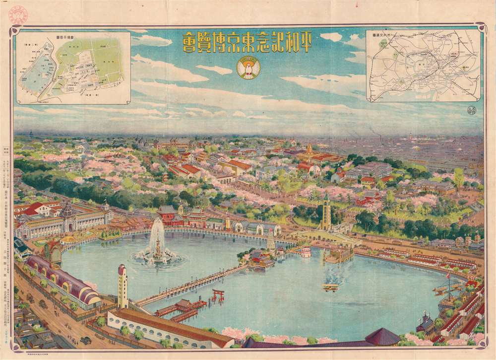
平和記念東京博覽會 / [Tokyo Peace Memorial Exhibition].
sold
- Digital Map Information
- Suitable for large format printing
- Full resolution TIFF file
- ICC color profile embedded
- Delivered instantly via download link
This is a rare Yoshida Koijūrō 1922 bird's-eye view map of Ueno Park, Taitō, Tokyo, Japan, illustrating the 1922 Tokyo Peace Memorial Exhibition. The view looks towards the northeast, over the Shinobazu Pond (不忍池), with the pavilions and halls of the Peace Exhibition noted in the inset map at top-left. The inset at top-right is a transportation map showing major rail and streetcar lines and stations, including Ueno Station. The exhibition was an opportunity for Japan to demonstrate its technological progress, imperial splendor, and cultural refinement. (more details)
Chicago after the Great Chicago Fire.
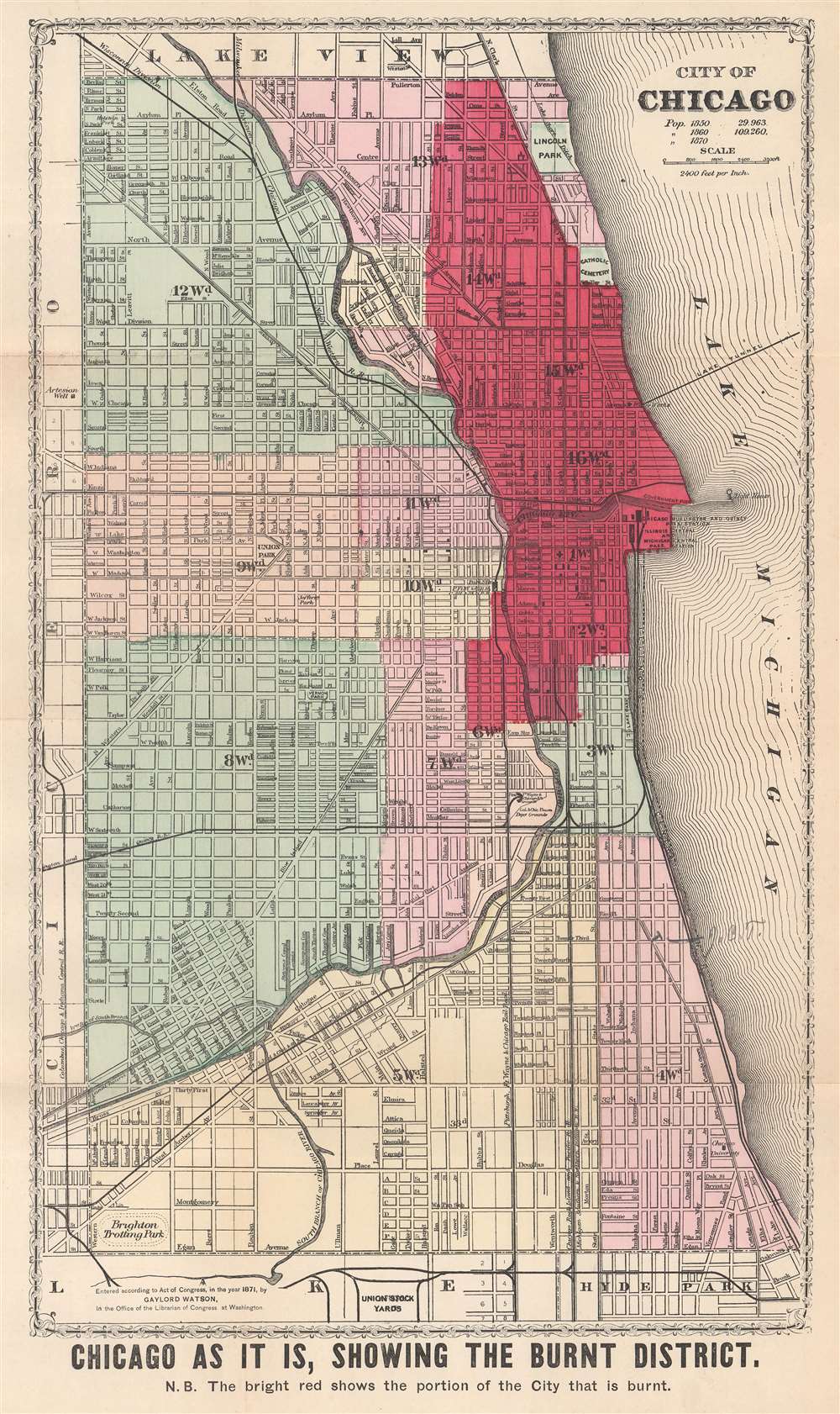
Chicago as it is, Showing the Burnt District.
sold
- Digital Map Information
- Suitable for large format printing
- File Size: 11.49 MB
- File Type: ZIP / TIFF
- ICC color profile embedded
- Delivered instantly via download link
This is an 1871 Gaylord Watson city plan or map of Chicago, Illinois, highlighting the area burned by the Great Chicago Fire. Dark red emphasizes the over three square miles burned by the fire and a nota bene below the bottom border reinforces this fact. City wards are labeled and shaded different colors for easy differentiation. Streets are illustrated and labeled throughout, along with parks, cemeteries, and an artesian well. Sites within the burned area are also identified, including three railroad passenger stations on the shore of Lake Michigan, the courthouse, post office, and water works. It is worth noting that the water tower and the pump house at the water works both survived the fire and can still be visited in Chicago. (more details)
Visit Fort Lauderdale!
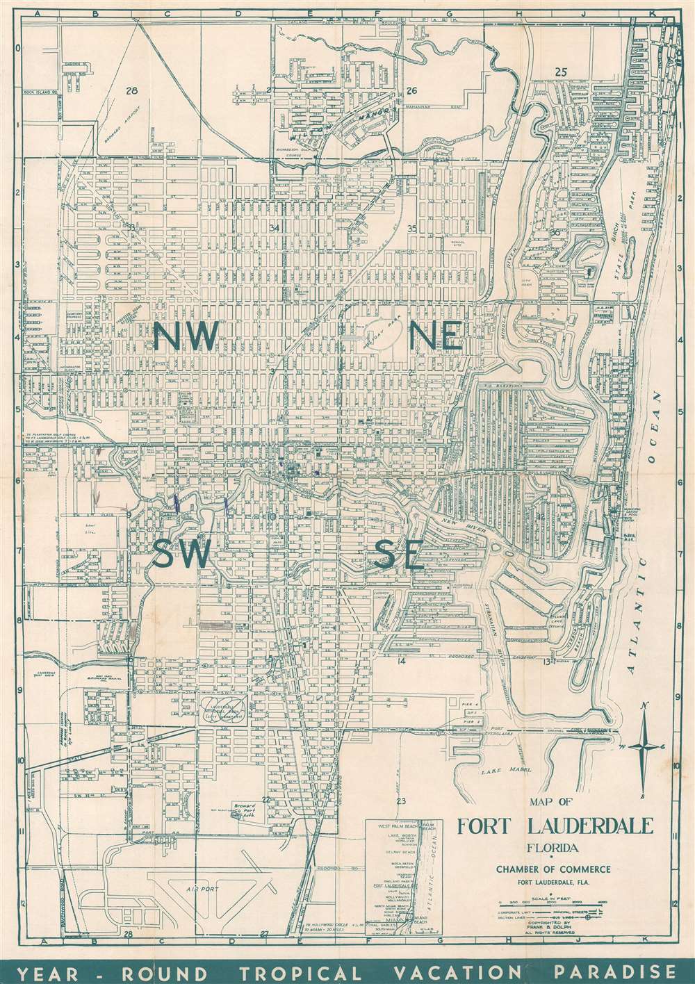
Map of Fort Lauderdale, Florida.
sold
This is a c. 1955 Frank B. Dolph city plan or map of Fort Lauderdale, Florida. Depicting from Oakland Park to the Fort Lauderdale Airport. Schools, churches, hospitals, and parks, and the Florida East Coast Railway's route through Fort Lauderdale are included. Revealingly, this piece also includes references to the Jim Crow era in the South and clearly and explicitly labels segregated schools, cemeteries, and planned recreation centers. Printed photographs and text on the verso highlight activities in and around Fort Lauderdale in an effort to entice tourists. (more details)
The mountain and the emperor.
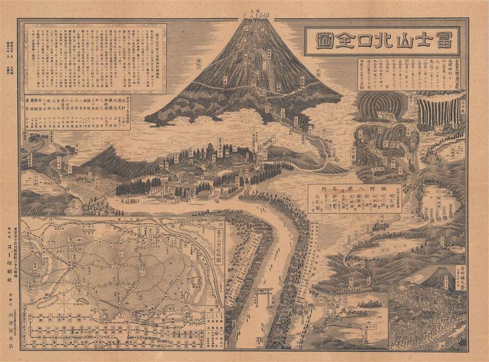
富士山北口全圖 / [Complete Map of the Northern Entrance to Mount Fuji].
sold
- Digital Map Information
- Suitable for large format printing
- Full resolution TIFF file
- ICC color profile embedded
- Delivered instantly via download link
This is a rare and ingenious 1933 Showa 8 bird's-eye view map showing the northern entrance to Mt. Fuji, the highest and most culturally important mountain in Japan. The map, published by Go Printing, was intended for tourists, hikers, and pilgrims visiting Buddhist and Shinto sites. It includes a tremendous amount of information - literally anything a traveler would need to know. (more details)
A subdivision of Tavares, Florida.
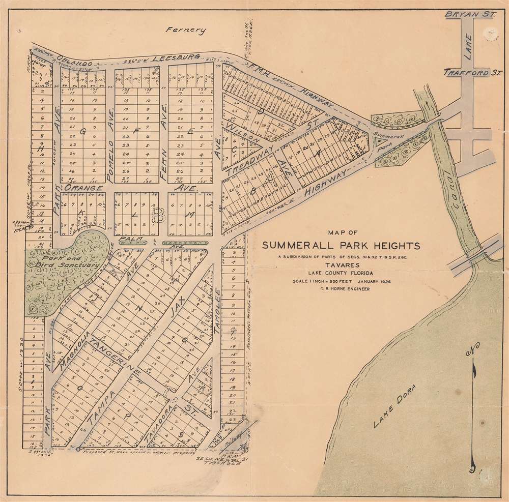
Map of Summerall Park Heights A Subdivision of Parts of Secs. 31 and 32 T. 19S R. 26E. Tavares Lake County Florida.
sold
- Digital Map Information
- Suitable for large format printing
- File Size: 7.02 MB
- File Type: ZIP / TIFF
- ICC color profile embedded
- Delivered instantly via download link
This is a 1926 C. R. Horne city plan or map of Summerall Park Heights, Tavares, Lake County, Florida. Depicting the subdivision in detail, individual lots are illustrated and numbered. Streets throughout are identified, although many do not exist in modern-day Summerall Park Heights. Some street names in common with today's subdivision are Fern Avenue, Pomelo Avenue, Palm Avenue, and Magnolia Avenue. The park and bird sanctuary marked on the map near the left border does not survive, but Summerall Park and the canal are both part of the modern-day subdivision. Part of Lake Dora occupies the lower right corner. (more details)