
Pictorial cartography with Caribbean flair.
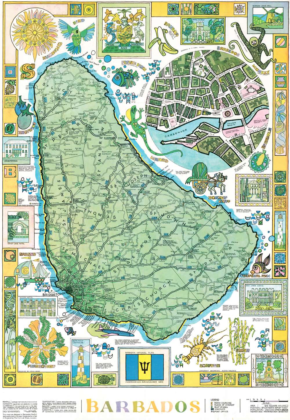
Barbados.
sold
This is a 1973 John Leigh pictorial map of Barbados. Created and designed in Barbados, the map features a decidedly Caribbean flair and color scheme. Illustrations of local wildlife, including hummingbirds, monkeys, lizards, several species of fish, and various flora, are juxtaposed with views of landmarks. Cities and towns are labeled all across the island and its road network is illustrated in detail. A circular inset in the upper right focuses on Bridgetown and identifies streets and important buildings. A pictorial border that incorporates views of popular sites around the island alongside colorful tropical-themed 'tiles' surrounds the whole, with the island's coat of arms occupying the top center. (more details)
Honolulu by streetcar and bus.

Honolulu. Island of Oahu. Territory of Hawaii, U.S.A.
sold
- Digital Map Information
- Suitable for large format printing
- File Size: 24.53 MB
- File Type: ZIP / TIFF
- ICC color profile embedded
- Delivered instantly via download link
This is a 1934 Honolulu Rapid Transit Company city plan or map of Honolulu, Hawaii. Meant to help people get around the city, Honolulu's streetcar and 'silver fleet bus' routes are noted. Streets throughout the city are illustrated and labeled, along with schools, parks, hospitals, clubs, and beaches. The University of Hawaii appears above and to the right of the map's center. A business directory and a short hotel index occupies the upper right. An inset map depicting the entire island of Oahu appears in the lower left. (more details)
Real estate in Orlando.
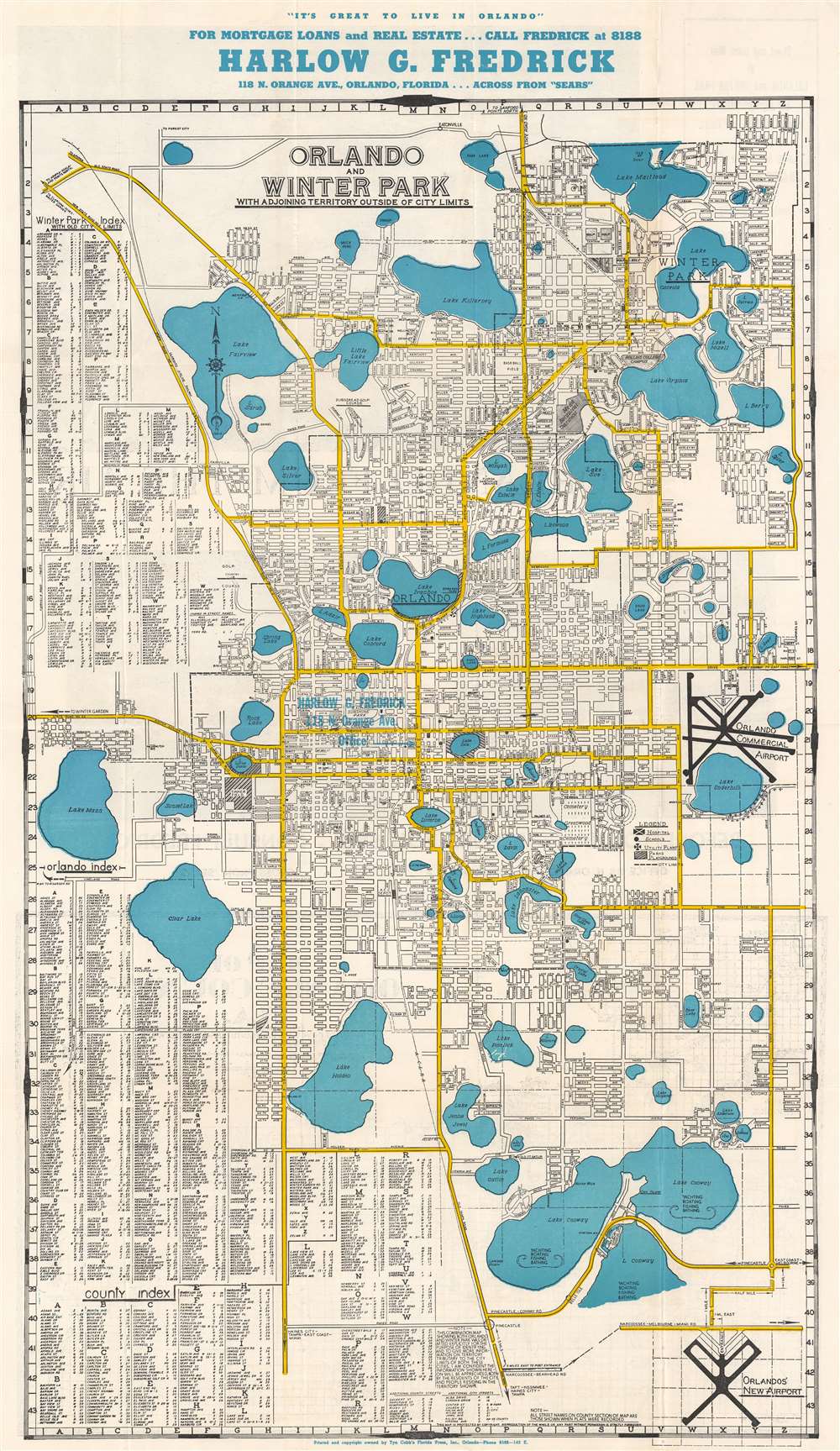
Orlando and Winter Park with Adjoining Territory Outside of City Limits.
sold
- Digital Map Information
- Suitable for large format printing
- Full resolution TIFF file
- ICC color profile embedded
- Delivered instantly via download link
This is a 1947 Tyn Cobb city plan or map of Orlando and Winter Park, Florida. Streets throughout the cities are illustrated and labeled, along with numerous lakes, the botanical gardens, and the Rollins College campus. Both the Orlando Commercial Airport and 'Orlando's New Airport', today's Orlando International Airport, appear in the lower right. Detailed street indexes for Winter Park, Orlando, and the surrounding county are situated along the left border and dominate the lower left. Blue overprinting highlights the location of Harlow G. Fredrick's real estate business. A smaller map of Orange County occupies the lower third of the sheet on the verso. (more details)
New Mexico's frontier history.

Historical Trails Through New Mexico the Land of Enchantment.
sold
- Digital Map Information
- Suitable for large format printing
- File Size: 39.52 MB
- File Type: ZIP / TIFF
- ICC color profile embedded
- Delivered instantly via download link
This is an fine example of Wilfred Stedman's beautifully illustrated 1940 map of the historical trails through New Mexico. The map covers New Mexico from Shiprock to El Paso. It notes the only point in the United States common to four states, where the boundaries of Utah, New Mexico, Arizona and Colorado meet. Historic routes and trails are identified, including the Butterfield Trail, the Santa Fe Trail, and the Goodnight Loving Trail, among others, as well as the exploratory routes taken by Cabeza de Vaca, Coronado, Onate, Escalante, and Espejo. Steadman's map also identifies various army forts, pueblos, national and state monuments. Throughout, the map is fantastically illustrated with carriages, cowboys, soldiers, explorers, forts, wildlife, etc. The verso contains information about the various trails and the Coronado Cuarto Centennial Celebrations. (more details)
New York City just after the Civil War.

Map of New York and Vicinity.
sold
- Digital Map Information
- Suitable for large format printing
- File Size: 42.73 MB
- File Type: ZIP / TIFF
- ICC color profile embedded
- Delivered instantly via download link
This is a scarce large format 1865 map or plan of New York City by Matthew Dripps. It depicts the island of Manhattan as well as parts of Brooklyn, Queens, Hoboken, and Jersey City. The map illustrates the city in considerable detail with all streets and, in Manhattan, block numbers clearly identified. An inset along the left border details the northern portion of Manhattan. The map labels most of the piers in lower Manhattan and shows numerous individual buildings with identifying numbers. Where Columbia University now stands, this map reveals a 19th century Lunatic Asylum. In Queens, Dripps labels Hunters Point and shows the beginnings of the Long Island Railroad. Astoria is delineated. Central Park is mapped in detail exhibiting the fully glory of Olmsted's plan. (more details)
Alaska just before the United States entered World War II.
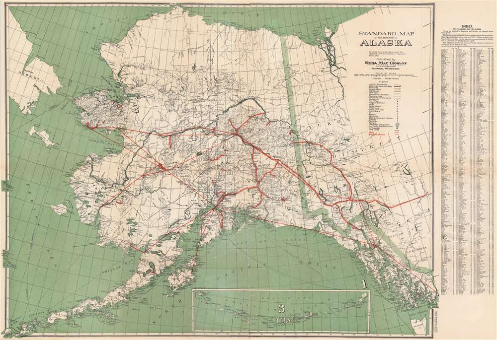
Standard Map of the Territory of Alaska.
sold
- Digital Map Information
- Suitable for large format printing
- File Size: 69.45 MB
- File Type: ZIP / TIFF
- ICC color profile embedded
- Delivered instantly via download link
An impressive piece, this c. 1940 Kroll Map Company map of Alaska. The map illustrates the territory before it became a state (1959) and just prior to World War II (1939 - 1945), where Alaska had a significant role. Coverage extends from Siberia to the Yukon Territory, and from the Arctic Ocean and the town of Barrow to Unalaska. Cities and towns are identified throughout, including Anchorage, Juneau, Seward, and Fairbanks. (more details)
1800 Depot de la Marine Nautical Chart or Map of the Rio de la Plata (Argentina, Buenos Aires, Monte
Finely engraved chart of the Rio de la Plata.
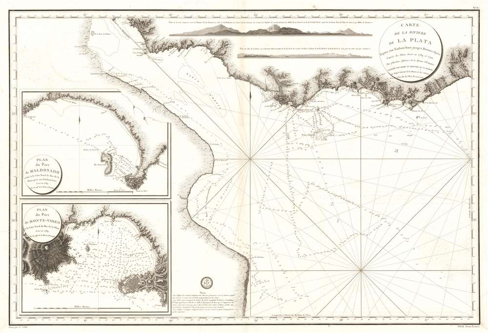
Carte de La Riviere de La Plata depuis son Embouchure jusqu'a Buenos-Ayres d'apres les Plans leves en 1789 et 1794.
sold
- Digital Map Information
- Suitable for large format printing
- Full resolution TIFF file
- ICC color profile embedded
- Delivered instantly via download link
This is an extremely scarce large format c. 1800 French nautical chart or maritime map of the Rio de la Plata, Argentina and Uruguay. The chart is noteworthy for the extraordinary engraving mastery it exhibits - a hallmark of the engraver Charles-Étienne Collin (1770 - 1840). This elegantly presented map covers the entire estuary from Los Cerros de San Juan to the Laguna de Rocha and extends south to approximately 55 degrees south latitude. The chart includes the important ports of Buenos Aires, Sacramento, Montevideo, and Maldonado, among others. The detail is primarily coastal, extending only about 10 miles inland, but the terrestrial detail offered throughout, including topography rendered in hachure, is extraordinary. Nautically, the map offers a multitude of soundings and outlines several shoals. Two large inset maps offer extraordinary detail focused on the ports of Maldonado and Montevideo, both in modern-day Uruguay. Shore profiles line the top of the map. (more details)
A perfect map for a tourist in Singapore in the late 1950s.

Map of Singapore.
sold
This is a c. 1957 Chanrai's Men's Shop and British Overseas Airways Corporation (B.O.A.C.) map of Singapore. Streets throughout the city are illustrated, although only major streets and avenues are labeled. The Central Fire Station, Fort Canning, King George Park, the Raffles Hotel, and the Clyde Terrace Market are all noted. A further twenty-nine locations are identified numerically and correspond to a table along the right border. (more details)
First State map of the Catskill Forest Preserve.

Map of Lands Belonging to the Forest Preserve situated in the Counties of Delaware Greene Sullivan and Ulster. Compiled from the Official Maps and Field Notes on file in the State Departments at Albany, N.Y. By authority of the Fisheries, Game and Forest Commission.
sold
- Digital Map Information
- Suitable for large format printing
- Full resolution TIFF file
- ICC color profile embedded
- Delivered instantly via download link
This is the first official map of the Catskill Forest Preserve, issued in 1899. It was produced by the New York State Fisheries, Game, and Forest Commission under the supervision of William F. Fox, then the Superintendent of Forests for New York State. This mammoth map, printed to two sheets (four feet wide if joined), is centered on Delaware, Greene, Sullivan and Ulster Counties in New York State, on the west bank of the Hudson River. It shows the boundaries of counties, towns, and individual tracts of land within those counties, with areas of forest reserve highlighted in red. Water routes, roads, and railroads are also detailed. Streets are named. Mountains are shown pictorially in hachure. (more details)
The world at the outbreak of WWII.
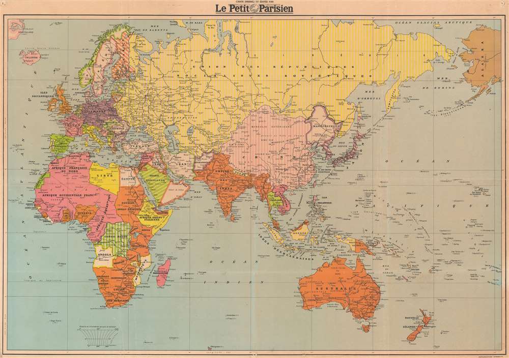
Grande Carte en Couleurs du Théatre des Opérations de la Guerre Mondiale.
sold
- Digital Map Information
- Suitable for large format printing
- File Size: 49.47 MB
- File Type: ZIP / TIFF
- ICC color profile embedded
- Delivered instantly via download link
This is a 1939 Le Petit Parisien world map illustrating World War II before the Spring 1940 offensive. The map depicts the world from the Atlantic Ocean to Alaska and Hawaii and from the Arctic to the Cape of Good Hope, Australia, and New Zealand. (more details)
A pictorial map of American World War I cemeteries and monuments published on the eve of World War II.

Remembrance Map of American Cemeteries and Battle Monuments in Europe.
sold
- Digital Map Information
- Suitable for large format printing
- File Size: 47.67 MB
- File Type: ZIP / TIFF
- ICC color profile embedded
- Delivered instantly via download link
This is a 1939 Cora W. Baker pictorial map of American World War I cemeteries and battlefield monuments in Europe. The map depicts the region from Brittany, France to Germany and from southern England and the Netherlands to Nantes and Besancon, France. American cemeteries and monuments are illustrated in profile throughout France and Belgium, with Brookwood American Cemetery and Memorial in England and the Naval Monument in Gibraltar being the only two sites outside of the two aforementioned countries. Some of the cemeteries include the Somme (Bony) American Cemetery, Suresnes American Cemetery, Meuse-Argonne (Romagne) American Cemetery, and the St. Mihiel (Thiaucourt) American Cemetery in France and the Flanders Field American Cemetery in Belgium. Each of the monuments was erected for a specific purpose. The Naval Monument at Brest, France, for example, commemorates the city's serivce as the principal point of embarkation and debarkation for the American Expeditionary Forces (AEF), while the Tours American Monument commemorates the service of the 650,000 men who served in the Services of Supply (SOS) of the AEF, since Tours was the headquarters of the SOS during the war. Other American monuments in France include the Chateau-Thierry American Monument, the Cantigny American Monument, the Bellicourt American Monument, the Montsec American Monument, and the Montfaucon American Monument. The Audenarde American Monument and the Kemmel American Monument are situated in Belgium. All of these cemeteries and monuments, along with those commemorating the sacrifices of men and women who served in World War II, are operated and maintained by the American Battle Monuments Commission. Cities important to American operations during World War I are also labeled, as are major rivers. The whole is surrounded by a border made up of the shoulder patches of all the American divisions that served in Europe during World War I. (more details)
Senegal's Capital, Dakar.
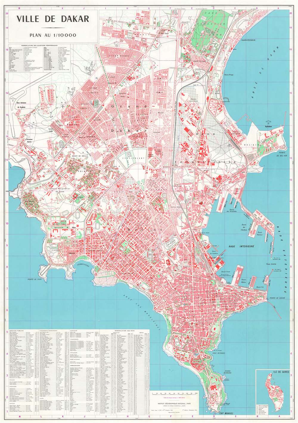
Ville de Dakar.
sold
This is a visually striking uncommon first edition 1964 Institut Géographique National map of Dakar, capital of Senegal. The map is beautifully produced on a large scale, depicting the Dakar Plateau from Cape Manuel to the Parc Forestier de Hann (Parc Hann). It meticulously details roads, parks, individual buildings, important facilities, and more. An inset in the lower right focuses on the island of Gorée. When it was issued, this was the finest and most highly detailed map of Dakar yet produced. (more details)
Pre-war era map of Jacksonville.

Map of Jacksonville, Florida, and vicinity.
sold
This is a c. 1930 Dolph and Stewart city plan or map of Jacksonville, Florida and its immediate environs highlighting the city's ongoing development. The map focuses on what is now the city's urban core, prior to consolidation; the area loosely delineated by the Ortega River, St. John's, and the Trout River. The Lake Forest neighborhood is shown at a time when it would have sported pecan groves. The proposed road and bridge linking Edgewood and Tallulah Avenues is marked, but has not yet been constructed: the bridge, crossing Moncrief Creek, was not completed until 1945. (more details)
Fascinating map of Washington, D.C. depicting fatal diseases.

No. III. Map of the City of Washington Showing Location of Fatal Cases of Diarrhoeal Diseases for the Year Ended June 30, 1901.
sold
- Digital Map Information
- Suitable for large format printing
- File Size: 37.09 MB
- File Type: ZIP / TIFF
- ICC color profile embedded
- Delivered instantly via download link
This is a fascinating and rare 1901 Norris Peters map of Washington D.C. illustrating fatal cases of diarrheal diseases. This large map covers from the Rock Creek Cemetery to Haines Point and from Georgetown to the Anacostia River. City blocks are identified numerically. Red overprinted squares mark fatal cases of diarrheal diseases throughout the city. (more details)
Disease map of Washington, D.C.

No. IV. Map of the City of Washington Showing Location of Fatal Cases of Lung Diseases for the Year Ended June 30, 1901.
sold
- Digital Map Information
- Suitable for large format printing
- File Size: 35.77 MB
- File Type: ZIP / TIFF
- ICC color profile embedded
- Delivered instantly via download link
A fascinating and uncommon 1901 Norris Peters map of Washington D.C. illustrating fatal cases of lung disease, including pneumonia, bronchitis, and other acute lung disorders. This large map depicts the city from the Rock Creek Cemetery to Haines Point and from Georgetown to the Anacostia River. City blocks are identified numerically. Overprinting with symbols marks fatal cases of these lung diseases throughout the city. Curiously, these cases have been divided by 'race', a red 'X' depicts a fatal 'white' case, and a black 'X' depicts a fatal 'colored' case. Cases are scattered throughout the city, with some appearing as lone cases, others in clusters. (more details)
The struggle for Southeast Asia.
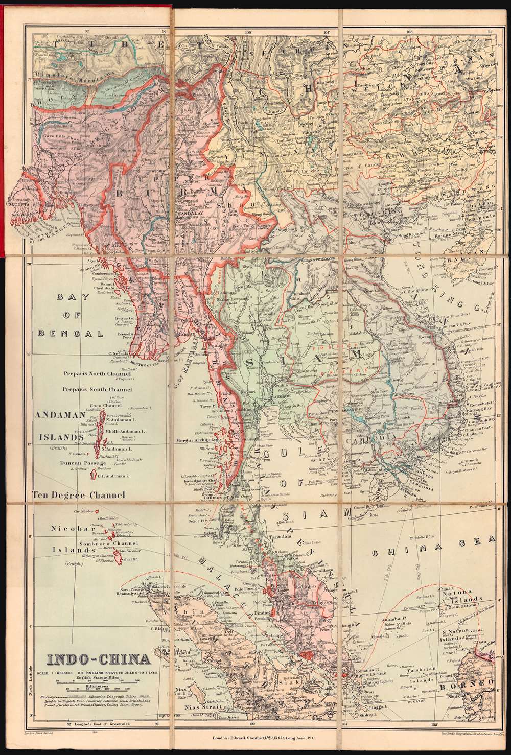
Indo-China.
sold
- Digital Map Information
- Suitable for large format printing
- Full resolution TIFF file
- ICC color profile embedded
- Delivered instantly via download link
A very attractive c. 1909 Stanford's Geographical Establishment folding map illustrating the colonial situation in Southeast Asia in the early 1900s. Centered on Bangkok, coverage extends from Tibet to Sumatra and Borneo, and from Calcutta to Hainan, embracing all of Siam (Thailand), Malaya, Burma, Laos, Cambodia, and Vietnam. (more details)
Real Estate in 1950s Fort Lauderdale.
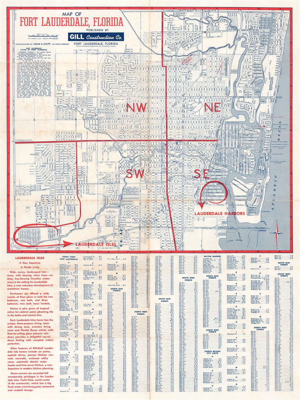
Map of Fort Lauderdale, Florida.
sold
This is a c. 1954 Theodore Politano city plan or map of Fort Lauderdale, Florida. Streets throughout the city are illustrated and labeled. Schools, parks, the city incinerator, City Hall, and the county courthouse are identified. The Lauderdale Drive-In Theatre is also labeled, as are the city ballpark and the city water department. As this map was created to promote Lauderdale Harbors and Lauderdale Isles, two housing developments under construction by the Gill Construction Company, both developments are circled in red and prominently labeled with red block letters. (more details)
City maps of Miami and Miami Beach.
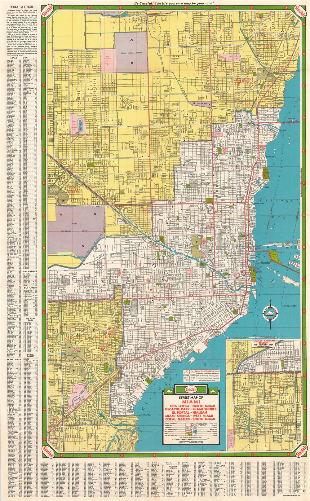
Sinclair Street Map of Miami - Opa Locka - North Miami - Biscayne Park - Miami Shores - El Portal - Hialeah - Miami Springs - West Miami - Coral Gables - South Miami.
sold
- Digital Map Information
- Suitable for large format printing
- Full resolution TIFF file
- ICC color profile embedded
- Delivered instantly via download link
This is a c. 1950 Rand McNally Sinclair Oil city plan or map of Miami, Florida. Printed on both sides of one sheet, the map on the verso depicts from Opa-Locka south to South Miami and from Miami Springs and Miami International Airport east to Biscayne Bay. Streets throughout are illustrated and labeled, with major thoroughfares shaded red. Churches, schools, parks, hospitals, airports, seaplane ports, and beacons are noted. A detailed street index surrounds the map on the left and bottom. An inset map of the Flagler-Tamiami Section occupies the map's lower right corner. Maps of Miami Beach and from Lake Worth to North Miami are printed on the e verso. The index is continued along the left side with indexes of buildings throughout the city, civic clubs, hospitals, parks and playgrounds, and colleges and universities, among others. Locations are numerically identified and could appear on any of the three maps printed on this sheet. (more details)
Missionary life just before the Boxer Rebellion.
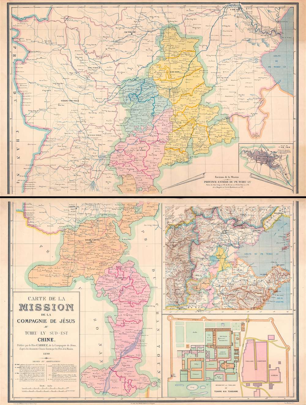
Carte de la Mission de la Compagnie de Jesus au Tcheu Ly Sud-Est Chine.
sold
- Digital Map Information
- Suitable for large format printing
- Full resolution TIFF file
- ICC color profile embedded
- Delivered instantly via download link
This is a rare 1890 Carrez map of western Shandong and southern Hebei, China, illustrating missionary activity in the region just a few years prior to the Boxer Rebellion (1899 - 1901). Coverage extends roughly from Tianjin (Tientsin), located in the upper right, south to roughly Zaozhuang. The map details the oddly shaped Apostolic Vicariate of Tché-Ly du Sud- East, occupying part of western Shandong and southern Hebei. The map is further subdivided into missionary districts, with coded icons representing the locations of churches and their status. In the lower right, there is a smaller map illustrating the general vicinity, and a large inset of the large fortified mission at Tchang Kia Tchouang (Chiang Kia-Chuang). (more details)
One of the First Maps of China engraved in England.
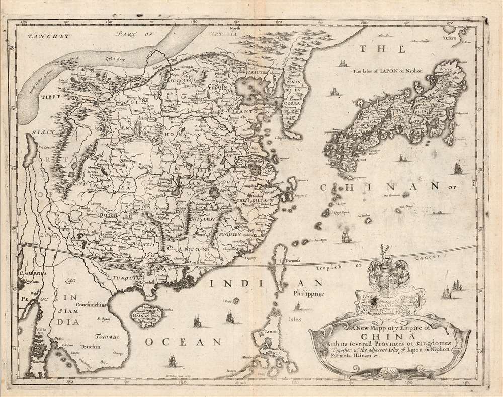
A New Mapp of y Empire of China With its severall Provinces or Kingdomes Together with the adjacent Isles of Japon or Niphon Formosa Hainan etc.
sold
- Digital Map Information
- Suitable for large format printing
- Full resolution TIFF file
- ICC color profile embedded
- Delivered instantly via download link
This is the scarce 1682 Richard Blome map of China, Korea, and Japan. This richly-detailed and surprisingly unique map was engraved in 1669 by the great Bohemian artist and etcher, Wenceslaus Hollar, who for most of his adult life practiced in his adopted England. Although most of the maps appearing in Blome's A Geographical Description of the Four Parts of the World were undisguised renditions of the work of the French geographer Nicolas Sanson, this map is derived from the work of Martino Martini, at least in part, via the atlas of China printed by Joan Blaeu in 1655.
Superficially, the map resembles the 1655 Blaeu Imperii Sinarum Nova Descriptio but this is no slavish copy. First, the area in focus differs: the western limits of this map extend perhaps five degrees less than the Blaeu, ending in the region of Pegu, where the Blaeu continues to Bengal; the southern limit of the Blome is five degrees north, whereas the Blaeu ends just beyond fifteen degrees. As a result, the Blome exchanges Blaeu's western expanses of blank desert for a more complete depiction of the Philippines, and a fuller treatment of the region of Southeast Asia (Siam / Thailand and Cochinchina / Vietnam). (more details)
Superficially, the map resembles the 1655 Blaeu Imperii Sinarum Nova Descriptio but this is no slavish copy. First, the area in focus differs: the western limits of this map extend perhaps five degrees less than the Blaeu, ending in the region of Pegu, where the Blaeu continues to Bengal; the southern limit of the Blome is five degrees north, whereas the Blaeu ends just beyond fifteen degrees. As a result, the Blome exchanges Blaeu's western expanses of blank desert for a more complete depiction of the Philippines, and a fuller treatment of the region of Southeast Asia (Siam / Thailand and Cochinchina / Vietnam). (more details)