
Map of the Upper West Side depicting a plan to extend an avenue.
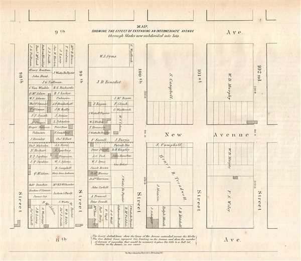
Map Showing the Effect of Extending an Intermediate Avenue through blocks now subdivided into lots.
sold
- Digital Map Information
- Suitable for large format printing
- File Size: 1.42 MB
- File Type: ZIP / TIFF
- ICC color profile embedded
- Delivered instantly via download link
This is an 1868 Major and Knapp map of the Upper West Side in New York City. The map depicts the Upper West Side between 8th and 9th Avenue and 98th Street and 102nd Street. By providing a visualization of a plan proposed by the Board of Commissioners of Central ... (more details)
States the history of the border between New York and Canada.

New York.
sold
- Digital Map Information
- Suitable for large format printing
- DPI: 300
- File Size: 13.62 MB
- File Type: ZIP / TIFF
- ICC color profile embedded
- Delivered instantly via download link
This is an 1825 Henry Shenk Tanner map of New York. The map depicts from Lake Erie and Lake Huron to Vermont and from Canada to Pennsylvania and New Jersey. The counties are differentiated by color, and Albany is labeled as the state capital. Each county seat is ... (more details)
Early U.S. Geological Survey and Charles Sargent arboreal map of the U.S. depicting hickory trees and the California Laurel.

Map Showing the Distribution of the Genera Carya and Umberllularia (The Hickories and California Laurel) in North America Exclusive of Mexico.
sold
- Digital Map Information
- Suitable for large format printing
- File Size: 13.64 MB
- File Type: ZIP / TIFF
- ICC color profile embedded
- Delivered instantly via download link
This is an 1884 Charles Sprague Sargent arboreal thematic map of North America. The map depicts the United States from Canada to Mexico and from the Pacific Ocean to the Atlantic Ocean. It was part of a portfolio entitled Sixteen Maps Accompanying Report on ... (more details)
Early U.S. Geological Survey and Charles Sargent arboreal map of North America depicting oak trees.
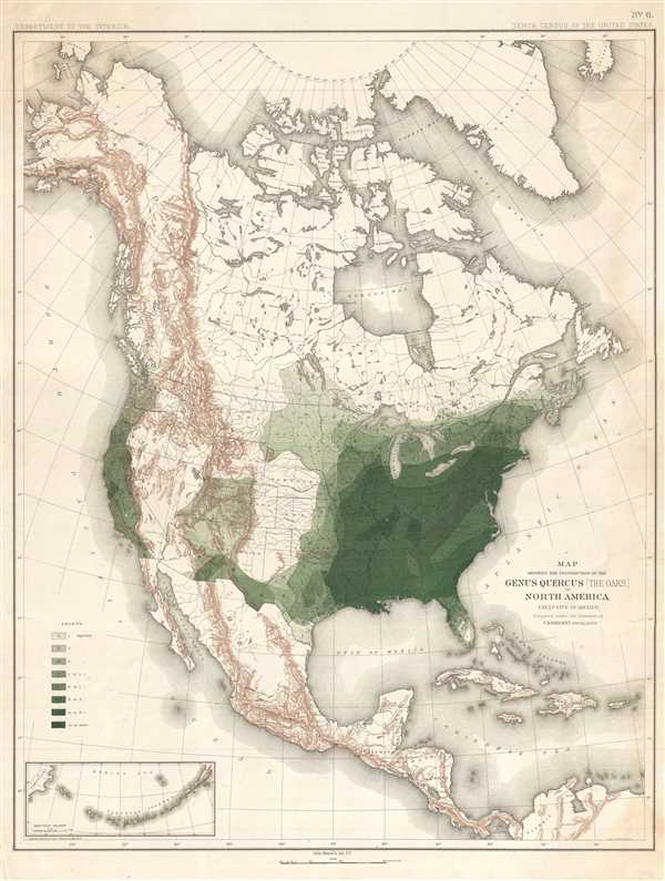
Map Showing the Distribution of the Genus Quercus (the Oaks) in North America Exclusive of Mexico.
sold
- Digital Map Information
- Suitable for large format printing
- File Size: 11.71 MB
- File Type: ZIP / TIFF
- ICC color profile embedded
- Delivered instantly via download link
This is an 1884 Charles Sprague Sargent arboreal thematic map of North America. The map depicts the continent of North America from the Arctic Ocean, Alaska, and Canada south to Mexico and Central America as well as the extreme northern reaches of South ... (more details)
Early U.S. Geological Survey and Charles Sargent arboreal map of the U.S. depicting beech trees.

Map Showing the Distribution of the Genera Castanea and Castanopsis (The Chestnuts and Chinquapins) in North America. Exclusive of Mexico.
sold
- Digital Map Information
- Suitable for large format printing
- File Size: 12.51 MB
- File Type: ZIP / TIFF
- ICC color profile embedded
- Delivered instantly via download link
This is an 1884 Charles Sprague Sargent arboreal thematic map of North America. The map depicts the United States from Canada to Mexico and from the Pacific Ocean to the Atlantic Ocean. It was part of a portfolio entitled Sixteen Maps Accompanying ... (more details)
Early U.S. Geological Survey and Charles Sargent arboreal map of North America depicting pine trees.
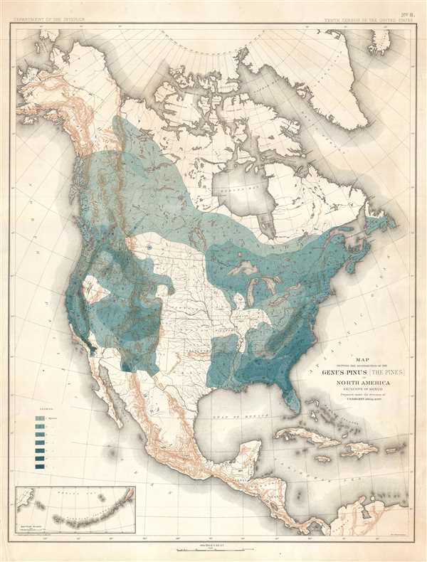
Map Showing the Distribution of the Genus Pinus (the Pines) in North America Exclusive of Mexico.
sold
- Digital Map Information
- Suitable for large format printing
- File Size: 11.66 MB
- File Type: ZIP / TIFF
- ICC color profile embedded
- Delivered instantly via download link
This is an 1884 Charles Sprague Sargent arboreal thematic map of North America. The map depicts the continent of North America from the Arctic Ocean, Alaska, and Canada south to Mexico and Central America as well as the extreme northern reaches of ... (more details)
Incredible hand colored map of Mexico depicting Cozumel Island.

Partie du Mexique ou de la Nouvelle Espagne où se trouve l'Audience de Mexique. Par le Sr. Robert de Vaugondy, Fils de Mr. Robert Géogr. ordin. du Roi.
sold
- Digital Map Information
- Suitable for large format printing
- DPI: 300
- File Size: 2.19 MB
- File Type: ZIP / TIFF
- ICC color profile embedded
- Delivered instantly via download link
This is a hand colored 1749 Didier Robert de Vaugondy map of Mexico. The map depicts Mexico from the Audience de Guadalaxara and Nouveau Leon , or approximately today's border between the United States and Mexico to the Yucatan Peninsula and ... (more details)
Beautiful map of the French Riviera and Provence - lavender!

Carte des Gouvernements de Dauphiné et de Provence avec le Comtat Venaissin et la Princte. D'Orange.
sold
- Digital Map Information
- Suitable for large format printing
- DPI: 300
- File Size: 6.93 MB
- File Type: ZIP / TIFF
- ICC color profile embedded
- Delivered instantly via download link
This is a 1771 Rigobert Bonne decorative map of the French regions of Provence and Dauphiné. The map depicts the regions in full from Savoy to the Mediterranean and from Languedoc to Nice. Nice, Cannes, St. Tropez, Toulon, and many other ... (more details)
Home to Fois Gras and Armagnac and the finest red wines!

Carte du Gouvernement de Guienne et Gascogne, avec celui de Bearn et Basse Navarre.
sold
- Digital Map Information
- Suitable for large format printing
- DPI: 300
- File Size: 6.37 MB
- File Type: ZIP / TIFF
- ICC color profile embedded
- Delivered instantly via download link
This is a 1771 Rigobert Bonne map of the French regions of Gironde and Gascony. The map depicts the regions from the Atlantic Ocean inland to the Garonne river and Cahors, France and from the Perigord to Spain. A highly detailed ... (more details)
Japanese anti-Soviet anti-Communist Propagana Pictorial!

最近の東 亞形勢圖解 / Illustrated Explanation of Recent East Asia Situations. / Saikin no Tōa keisei zukai.
sold
- Digital Map Information
- Suitable for large format printing
- File Size: 53.01 MB
- File Type: ZIP / TIFF
- ICC color profile embedded
- Delivered instantly via download link
A remarkable and rare 1937 large format Japanese anti-Soviet propaganda pictorial map of East Asia. Centered on China, this stunning map covers from Central Asia and India to Japan and from Siberia to Vietnam. The map employs ... (more details)
Very few printed pieces are of more importance in the history of Ohio than this survey of a part of the future state. – 'Fifty Ohio Rarities,' Clements Library.
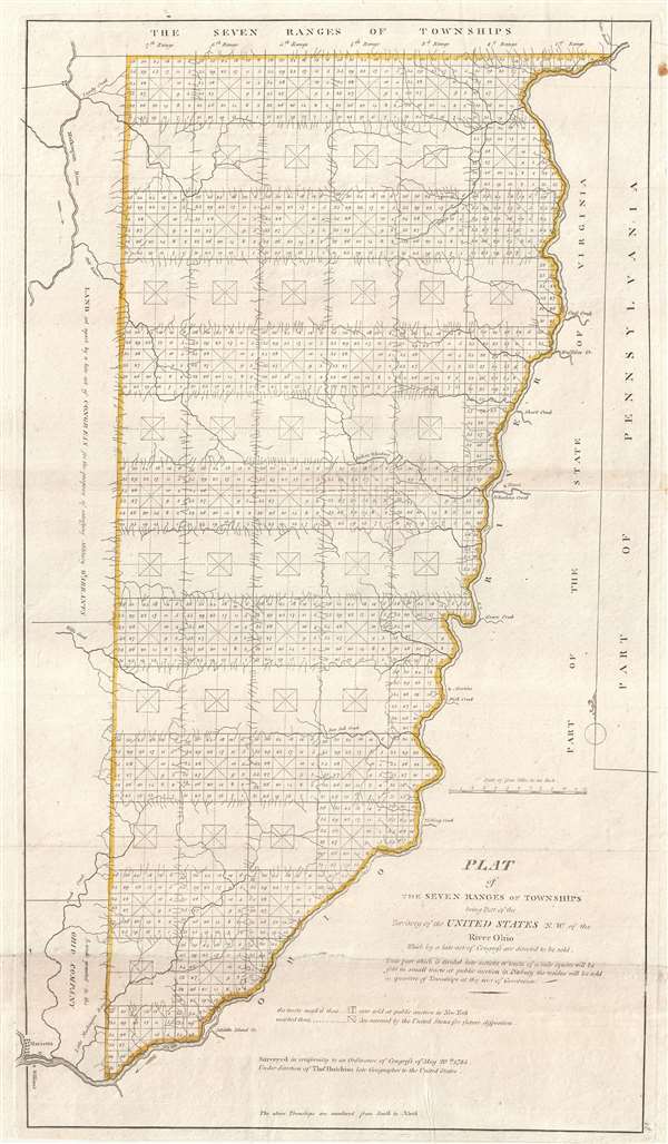
Plat of The Seven Ranges of Townships being Part of the Territory of the United States N.W. of the River Ohio Which by a late act of Congress are directed to be sold.
sold
- Digital Map Information
- Suitable for large format printing
- DPI: 300
- File Size: 6.19 MB
- File Type: ZIP / TIFF
- ICC color profile embedded
- Delivered instantly via download link
This is considered by some to be the map that began the opening of the American west and established the groundwork for the American westward expansion. It was initially published on September 30 of 1786 and is the first map ... (more details)
Stunning Art Deco Map of Paris in an early state.
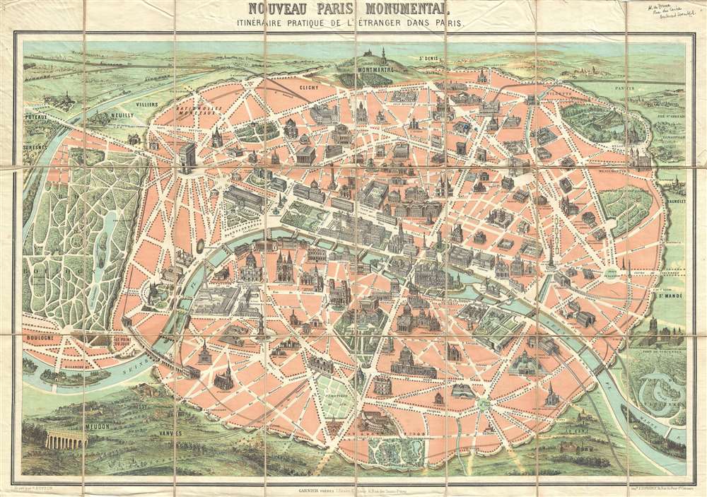
Nouveau Paris Monumental Inineraire Pratique de L'Étranger Dans Paris.
sold
- Digital Map Information
- Suitable for large format printing
- File Size: 17.41 MB
- File Type: ZIP / TIFF
- ICC color profile embedded
- Delivered instantly via download link
An iconic c. 1889 tourist pocket map of Paris, France. Presented as a same field birds-eye view, this map centers on the Seine River, and covers the embastilled heart of modern Paris. Issued as a tourist piece for the 1889 Exposition Universelle, which introduced the Eiffel Tower, buildings and monuments shown in profile, including the Eiffel Tower, the Arc de Triomphe, Sacre-Coeur, the Pantheon, etc. Paris itself is set as if in a verdant garden surrounded by the Bois de Boulogne, the Bois de Vincennes, and various suburban villages. In the north, under a blue sky, rolling hills stretch indefinitely into Normandy towards the English Channel. (more details)
Impressive large format nautical chart from the finest 17th century European nautical atlas.
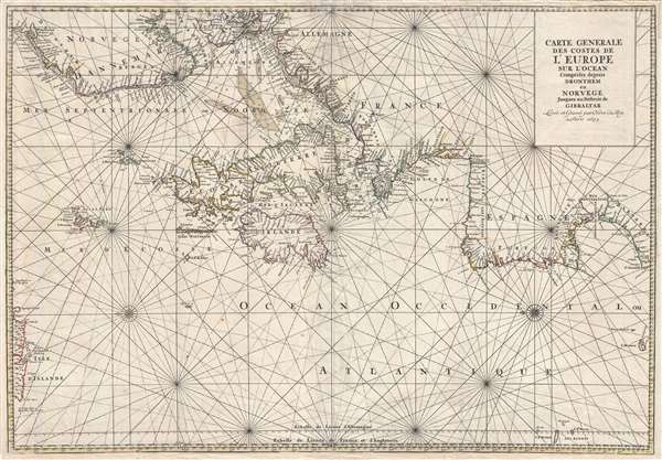
Carte Generale Des Costes De L'Europe Sur L'Ocean Comprises depuis Drontheim en Norvege Jusques au Detroit de Gibraltar. Levée et Gravée par Ordre du Roy à Paris 1693.
sold
- Digital Map Information
- Suitable for large format printing
- DPI: 300
- File Size: 23.32 MB
- File Type: ZIP / TIFF
- ICC color profile embedded
- Delivered instantly via download link
A stunning elephant folio nautical chart or maritime map of the western European coast issued in 1693 by Pierre Mortier and Alexis Hubert Jaillot. Oriented to the west and centered on the British Isles, the chart covers from ... (more details)
Spectualry image and map of the Lofoten Maelstrom or Moskenstraumen!

Voragine Di Moskestroom. / Onde Formate dalla Voragine di Moskestrom.
sold
- Digital Map Information
- Suitable for large format printing
- DPI: 300
- File Size: 6.15 MB
- File Type: ZIP / TIFF
- ICC color profile embedded
- Delivered instantly via download link
An uncommon page from Vincenzo Coronelli's Isolario dell' Atlante Veneto illustrating the remarkable phenomena of Norway's Lofoten Maelstrom or, the Moskenstraumen . By far the world's most famous whirlpool, the Lofoten ... (more details)
A highly uncommon Coprosperity Sphere map.

標準大東亞分圖 : ルソン島 / Standard Map of the Great East Asia: Luzon.
sold
- Digital Map Information
- Suitable for large format printing
- File Size: 13.22 MB
- File Type: ZIP / TIFF
- ICC color profile embedded
- Delivered instantly via download link
An important and rare World War II (WWII) 1943 Showa 18 Japanese Map of the Philippines. The map covers the northern Philippine Island of Luzon. Oceanic depths are illustrated with blue shading. Air and sea routes are ... (more details)
Comparative Arctic Exploration chart. The only known example of this edition!
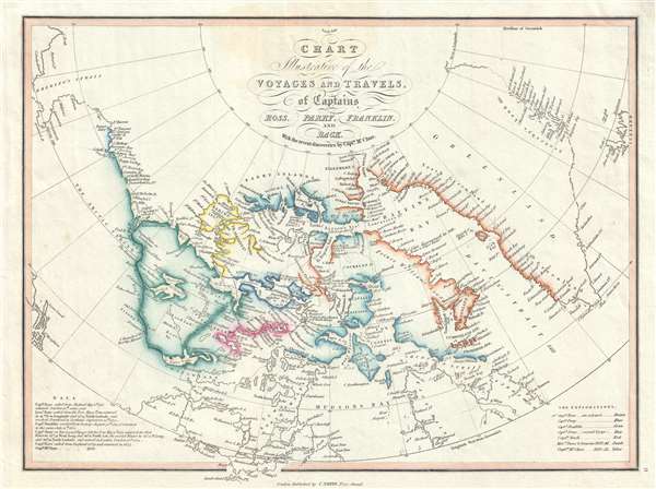
Chart Illustrative of the Voyages and Travels, of Captains Ross, Parry, Franklin, and Back With the recent discoveries by Captn. McClure.
sold
- Digital Map Information
- Suitable for large format printing
- DPI: 300
- File Size: 2.9 MB
- File Type: ZIP / TIFF
- ICC color profile embedded
- Delivered instantly via download link
A very attractive 1852 map of the North American Arctic by Charles Smith. This map was drawn to capitalize on an era obsessed with the wonders and dangers of Arctic exploration. Covering from Alaska to Iceland and ... (more details)
Masterfully engraved map of the Mongol homeland in Northeastern Asia.
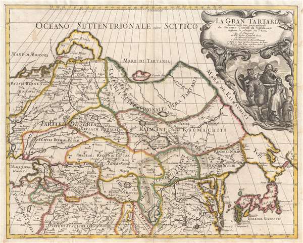
La Gran Tartaria.
sold
- Digital Map Information
- Suitable for large format printing
- DPI: 300
- File Size: 10.89 MB
- File Type: ZIP / TIFF
- ICC color profile embedded
- Delivered instantly via download link
A stunning 1693 map of northeast Asia, or as it was then known, Gran Tartaria by Giacomo Cantelli da Vignola. The map covers northeastern Asia from the Caspian Sea to the Japanese Kurile Islands, and from Nova ... (more details)
Includes an intriguing depiction of the Philippines with exaggerated mapping of the Cagayan River!
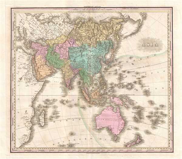
Asia.
$750.00
Acquire
- Digital Map Information
- Suitable for large format printing
- DPI: 300
- File Size: 11.18 MB
- File Type: ZIP / TIFF
- ICC color profile embedded
- Delivered instantly via download link
This is an 1825 Henry Shenk Tanner map of Asia. The map depicts from continental Europe and Africa (though both are uncolored) to Alaska and from the Arctic Ocean to Australia, South Africa, and the Southern ... (more details)
Brilliant 18th century navigational manuscript explaining the antipodes.

Definizioni Geografiche.
sold
- Digital Map Information
- Suitable for large format printing
- DPI: 300
- File Size: 9.16 MB
- File Type: ZIP / TIFF
- ICC color profile embedded
- Delivered instantly via download link
This is a page from a stunning 18th century manuscript treatise on navigation. The treatise, Introdusione alla sfera e alla Geografia Moderna , alas, is incomplete. Definitions of geographical terms critical ... (more details)
Incredible 18th century navigational manuscript defining different coastal formations.

Definizioni Geografiche.
sold
- Digital Map Information
- Suitable for large format printing
- DPI: 300
- File Size: 8.28 MB
- File Type: ZIP / TIFF
- ICC color profile embedded
- Delivered instantly via download link
This is a page from a stunning 18th century manuscript treatise on navigation. The teatise, Introdusione alla sfera e alla Geografia Moderna , alas, is incomplete. Definitions of geographical terms critical ... (more details)