

Plan of the Foeign Concessions. Tientsin. Drawn for Crow's 'Handbook for China.'
sold
- Digital Map Information
- Suitable for large format printing
- File Size: 1.87 MB
- File Type: ZIP / TIFF
- ICC color profile embedded
- Delivered instantly via download link
This is a 1921 Carl Crow city map or plan of the foreign concessions in Tianjin (Tientsin), China. The map, which is bisected by the Hai River, depicts the sector of the city in which the international concessions were located, from the Austria-Hungarian concession ... (more details)
Intriguing city map or plan of Victoria, Hong Kong, the de facto capital during the British colonial period.

Plan of Hong Kong. City of Victoria. Drawn for Crow's 'Handbook for China.'
sold
- Digital Map Information
- Suitable for large format printing
- File Size: 1.65 MB
- File Type: ZIP / TIFF
- ICC color profile embedded
- Delivered instantly via download link
This is a 1921 Carl Crow city map or plan of Victoria, Hong Kong. The map depicts Victoria from Kennedy Road, Bowen Road, and the Navy Yard to Hollywood Road and the Western Market and from the public gardens and Robinson Road to Connaught Road and the port. All ... (more details)
Attractive city map or plan of Suzhou (Soochow), China, 'The Venice of the Far East.'

Plan of Soochow. Drawn for Crow's 'Handbook for China.'
sold
- Digital Map Information
- Suitable for large format printing
- File Size: 2 MB
- File Type: ZIP / TIFF
- ICC color profile embedded
- Delivered instantly via download link
This is a 1921 Carl Crow city map or plan of Suzhou (Soochow), China. The map depicts the city and some of the surrounding area. Soochow, per Crow, lies '53 miles from Shanghai, on the Shanghai-Nanking Railway', which is depicted and labeled on the map. Due to ... (more details)
German map depicting the exploration of southwestern China including an inset city map of Lhasa.
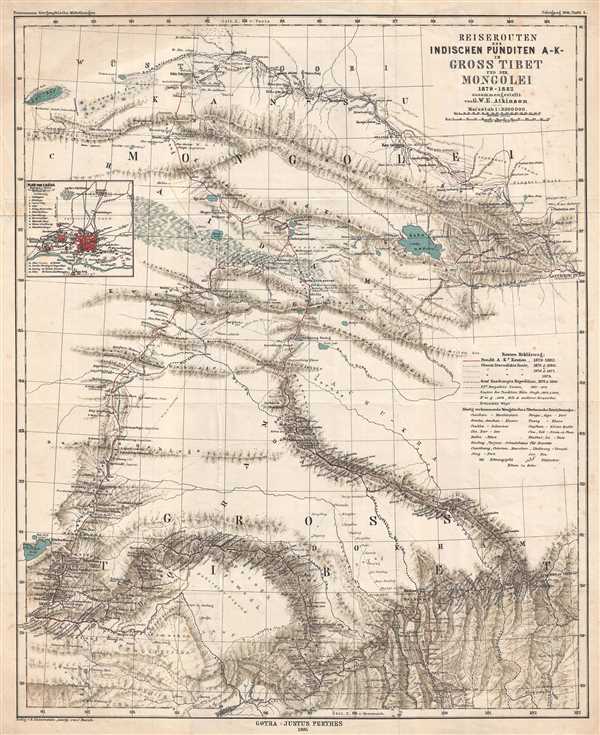
Reiserouten des Indischen Punditen A - K - in Gross Tibet und der Mongolei 1879-1882.
sold
- Digital Map Information
- Suitable for large format printing
- File Size: 9.1 MB
- File Type: ZIP / TIFF
- ICC color profile embedded
- Delivered instantly via download link
This is an 1885 map of expeditions in western China compiled by G.W.E. Atkinson. The map depicts from Mongolia through Qinghai Province to Tibet. The map illustrates several different routes takes by different explorers, including the route of three different ... (more details)
German map depicting the journeys of Nikolai Przewalski, and Qinghai Lake, the largest lake in China.
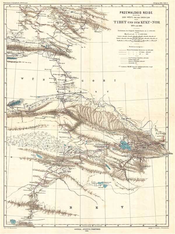
Przewalski's Reise durch die Gobi-Wüste und den Kwen-Lun nach Tibet und zum Kuku-Nor 1879 und 1880.
sold
- Digital Map Information
- Suitable for large format printing
- File Size: 5.28 MB
- File Type: ZIP / TIFF
- ICC color profile embedded
- Delivered instantly via download link
This is an 1883 German map which was published in Petermanns Geographische Mitteilungen . The map depicts the journeys of Russian explorer Nikolay Mikhaylovich Przhevalsky from Mongolia into northern Tibet and parts of western China. Three different routes ... (more details)
Rare first edition Burritt charts with individually colorized constellations.

Northern Circumpolar Map for each Month in the Year. Southern Circumpolar Map for each Month in the Year.
sold
- Digital Map Information
- Suitable for large format printing
- Full resolution TIFF file
- ICC color profile embedded
- Delivered instantly via download link
This is a beautiful hand colored set of the northern and southern circumpolar maps by Elijah Burritt. This pair of maps illustrates the night sky and constellations of both the northern hemisphere and southern hemisphere respectively. Constellations are ... (more details)
Beautifully colored set of four celestial maps showing the constellations throughout the year.

January February March. April May June. July August September. October November December.
sold
- Digital Map Information
- Suitable for large format printing
- Full resolution TIFF file
- ICC color profile embedded
- Delivered instantly via download link
This is a beautifully hand colored set of four maps depicting the night sky in the twelve months of the year, by Elijah Burritt. Each sheet features the stars and constellation in the night sky over a quarter. On each of the charts, the constellations ... (more details)
Elaborately decorated map of Africa, including views of Cairo, Alexandria, and Algiers.
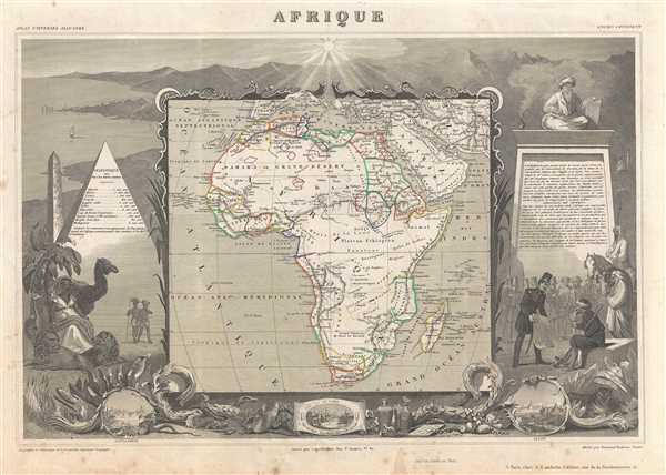
Afrique.
sold
- Digital Map Information
- Suitable for large format printing
- DPI: 300
- File Size: 10.01 MB
- File Type: ZIP / TIFF
- ICC color profile embedded
- Delivered instantly via download link
A fine example of Victor Levasseur's desirable decorative map of Africa, dated 1852. The map depicts the entire continent per perceptions of the time. Much of the interior is vague and unmapped, except for the northern Nile Valley, the French colonies ... (more details)
Decorative map of the South Pacific and Australia.
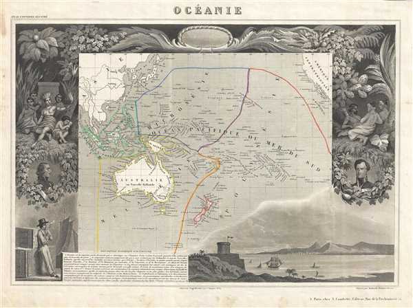
Oceanie.
sold
- Digital Map Information
- Suitable for large format printing
- DPI: 300
- File Size: 7.28 MB
- File Type: ZIP / TIFF
- ICC color profile embedded
- Delivered instantly via download link
A fine example of Victor Levasseur's desirable decorative map of Polynesia and Australia, dated 1852. The map depicts the Pacific from Sumatra to the California Coast, focusing on Australia, New Zealand, Indonesia, and the islands of Polynesia. The ... (more details)
Map of the Bordeaux wine region and the birthplace of Montesquieu.
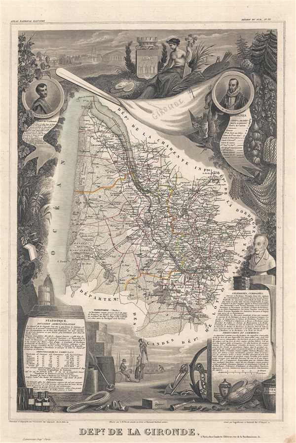
Dept. de la Gironde.
sold
- Digital Map Information
- Suitable for large format printing
- DPI: 300
- File Size: 7.62 MB
- File Type: ZIP / TIFF
- ICC color profile embedded
- Delivered instantly via download link
This is a fascinating 1852 map of the French department of Gironde. This coastal department is the seat of the Bordeaux wine region and produces many of the world's finest reds. The city of Bordeaux is located at center. The map depicts numerous ... (more details)
Pictorial Air India advertisement highlighting their international routes.
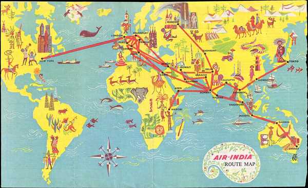
Air India Route Map.
sold
- Digital Map Information
- Suitable for large format printing
- File Size: 2.88 MB
- File Type: ZIP / TIFF
- ICC color profile embedded
- Delivered instantly via download link
This is a 1962 Air India route map of the world. The map depicts six of the seven continents, excluding Antarctica, in an almost cartoonish manner. Aiming to portray the various different locations where Air India flies, the map presents ... (more details)
Map of Turkey and the Middle East depicting Constantinople and Jerusalem.
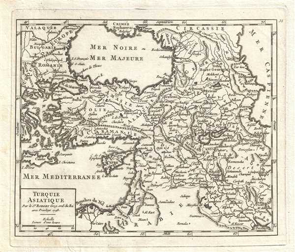
Turquie Asiatique. Par le Sr. Robert Geog. ord. du Roi
sold
- Digital Map Information
- Suitable for large format printing
- DPI: 300
- File Size: 1.71 MB
- File Type: ZIP / TIFF
- ICC color profile embedded
- Delivered instantly via download link
This is a 1749 Gilles Robert de Vaugondy map of Asia Minor (Turkey) and the Middle East. The map depicts from European Turkey (Bulgaria and Romania) to the Caspian Sea and Iran (Persia/Perse) and from Crimea (Crimée) and the Black Sea ... (more details)
Incredible hand colored map depicting the Republic of Venice at its height.
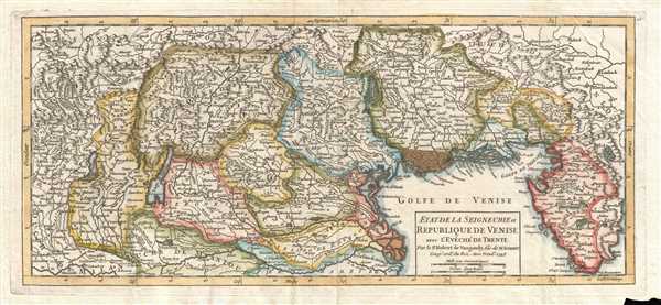
Etat de la Seigneurie et Republique de Venise avec l'Evêché de Trente. Par le Sr. Robert de Vaugondy, fils de M. Robert Geog. ord. du Roi.
sold
- Digital Map Information
- Suitable for large format printing
- DPI: 300
- File Size: 3.32 MB
- File Type: ZIP / TIFF
- ICC color profile embedded
- Delivered instantly via download link
This is a hand colored 1749 Didier Robert de Vaugondy map of the Republic of Venice in Italy. The map depicts the Republic of Venice following the War of Austrian Succession and stretches from the border with the Duchy of Milan to ... (more details)
Rare first edition of Lahontan's highly influential map of the supposedly apocryphal Riviere Longue (Missouri River?)
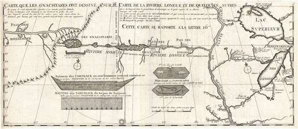
Carte que les Gnacsitares ont Dessine sur / Carte de la Riviere Longue et de quelques Autres qui se Dechargent dans le Grand Fleuve Missisipi.
sold
- Digital Map Information
- Suitable for large format printing
- DPI: 300
- File Size: 7.06 MB
- File Type: ZIP / TIFF
- ICC color profile embedded
- Delivered instantly via download link
A foundational map of extreme importance and influence, this is the rare 1703 first edition of Baron Louis-Armand de Lom d'Arce de Lahontan's, seminal map of the westernmost Great Lakes, the Mississippi River, and an enigmatic ... (more details)
Rare map of Malaysia with manuscript highlighting of the Eastern Tin Belt.
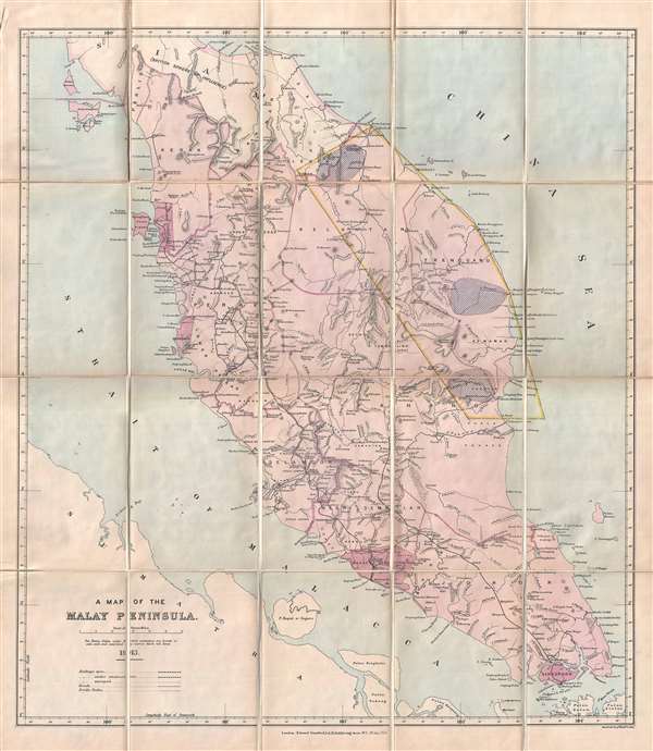
A Map of the Malay Peninsula.
sold
- Digital Map Information
- Suitable for large format printing
- File Size: 9.54 MB
- File Type: ZIP / TIFF
- ICC color profile embedded
- Delivered instantly via download link
A scarce 1913 map of the Malay Peninsula (Malaysia) by Edward Stanford with curious manuscript annotations associated with tin mining. The map covers from the Thai Border south to include Singapore, Georgetown (Pulau ... (more details)
Exceptional highly detailed French cart of the Malacca Strait and Singapore.
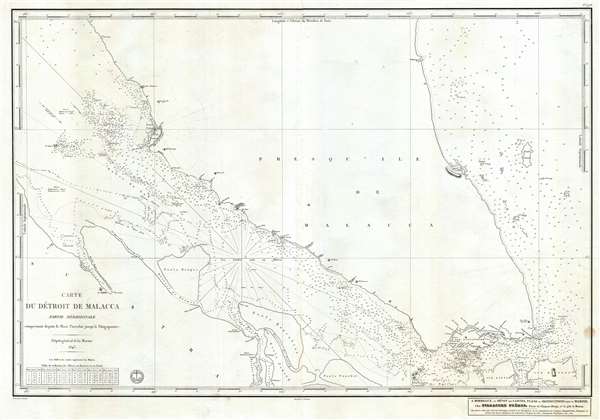
Carte du Détroit de Malacca Partie Méridionale comprenant depuis le Mont Parcelar jusqu'a Singapoure.
sold
- Digital Map Information
- Suitable for large format printing
- Full resolution TIFF file
- ICC color profile embedded
- Delivered instantly via download link
A rare French Dépôt Général de la Marine nautical chart or maritime map of Singapore and the southern part of the Strait of Malacca. The map covers from the Malay Peninsula roughly near Kuala Lumpur south to the ... (more details)
One of the two great Pre-WWII pictorial maps of Beijing.
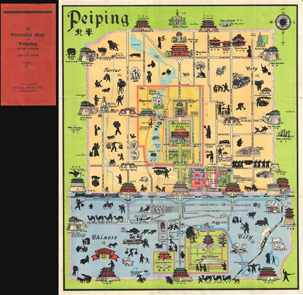
A Pictorial Map of Peiping in full colours.
sold
- Digital Map Information
- Suitable for large format printing
- Full resolution TIFF file
- ICC color profile embedded
- Delivered instantly via download link
This is John Kirk Sewall's rare c. 1928-1933 pictorial map of Beijing or Peking, China. This is one of two great pictorial maps of Beijing issued prior to World War II, the other being by Frank Dorn. The map uses ... (more details)
Exceptional large format Japanese map of the Philippines with detailed inset of Manila.

フィリピン詳密地圖 / Detailed Map of the Philippines. / Firipin shomitsu chizu.
sold
- Digital Map Information
- Suitable for large format printing
- File Size: 28.26 MB
- File Type: ZIP / TIFF
- ICC color profile embedded
- Delivered instantly via download link
A rare 1944 Showa 19 Japanese large format map of the Philippines issued just 5 days after the WWII Philippines Campaign (October 20, 1944 - September 2, 1945) began. The map is an expansion on a similar map issued for the 1942-3 'Greater East Asia Co-Prosperity Sphere' map series, which it stylistically resembles despite being 4x the size. There can be little down this map was issued to satisfied increased Japanese need for information and reconnaissance following General Douglas MacArthur's landing at Leyte. (more details)
The Sea of the West at its highest expression.
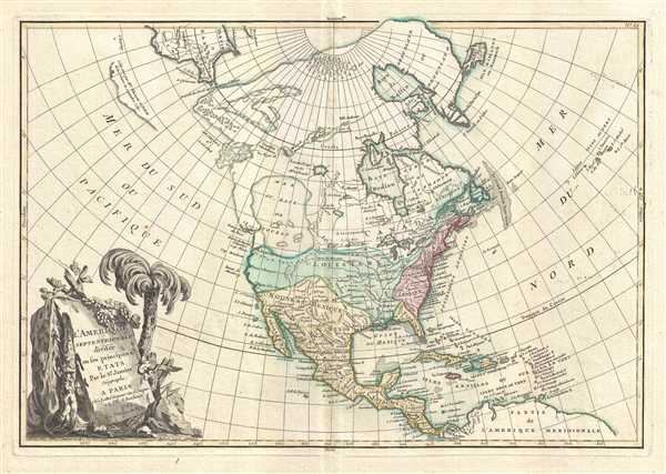
L'Amerique Septentrionale Divisee en ses Principaux Etats.
sold
- Digital Map Information
- Suitable for large format printing
- DPI: 300
- File Size: 6.25 MB
- File Type: ZIP / TIFF
- ICC color profile embedded
- Delivered instantly via download link
An altogether fascinating first edition example of Jean Janvier 1762 map of North America, including one of the most ambitions depictions of the Sea of the West in any map. The map covers the continent from Panama to the Arctic Circle, extends westward to include parts of Asia and eastward as far as Iceland. This map, which is heavily influenced by the theoretical mappings of Guillaume de l'Isle and Philippe Buache, went through several states of which this is the first and possibly the most interesting. Javier divides the continent according to the three colonial powers that controlled it, with England controlling the colonies along the east coast, France occupying Canada and Louisiana, and Spain dominating Mexico, Florida, Cuba and Central America. (more details)
The earliest obtainable map or plan of New Orleans, Louisiana.

Plan de la Nouvelle Orleans Dresse sur les Manuscrits du Depot des Cartes de la Marine.
sold
- Digital Map Information
- Suitable for large format printing
- Full resolution TIFF file
- ICC color profile embedded
- Delivered instantly via download link
This scarce 1744 map by J. N. Bellin is the earliest obtainable map of New Orleans, Louisiana. Oriented to the northwest, Bellin's map covers the original settlement of New Orleans along the Mississippi River and ... (more details)