
Whimsical map of Great Britain.
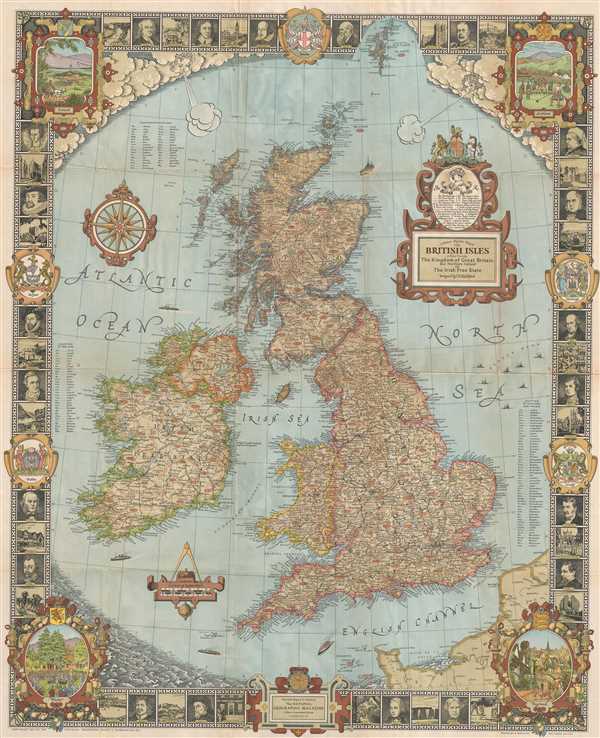
A Modern Pilgrim's Map of the British Isles, or more precisely the Kingdom of Great Britain and Northern Ireland, and the Irish Free State.
sold
- Digital Map Information
- Suitable for large format printing
- File Size: 42.73 MB
- File Type: ZIP / TIFF
- ICC color profile embedded
- Delivered instantly via download link
This is a whimsical 1937 map of the British Isles issued by the National Geographic Society. Covers England, Wales, Scotland and Ireland in incredible detail, noting cities, towns, roads, railways, districts, rives, lakes, and a host of other topographical features ... (more details)
Features a misshapen Florida.
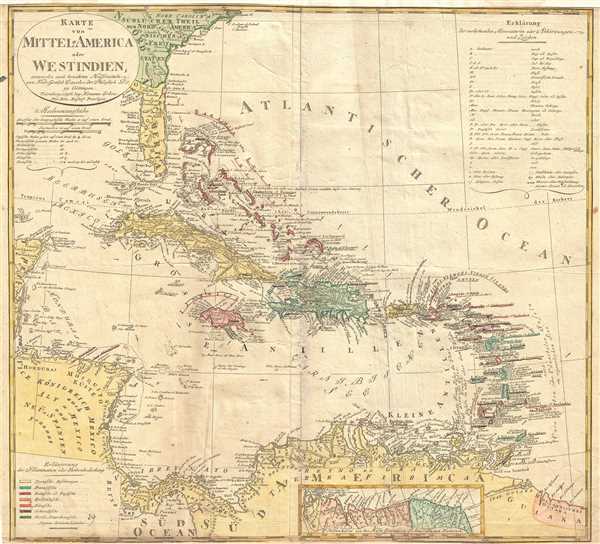
Karte von Mittel-America oder Westindien.
sold
- Digital Map Information
- Suitable for large format printing
- DPI: 300
- File Size: 14.39 MB
- File Type: ZIP / TIFF
- ICC color profile embedded
- Delivered instantly via download link
This is a beautiful 1796 map of the West Indies or Caribbean Islands by Homann Heirs. It covers the Caribbean from Florida south to Trinidad and Tobago. Includes Cuba, the Bahamas, Puerto Rico, Jamaica, Santo Domingo, and the Lesser Antilles. Based on the earlier ... (more details)
Rare large scale blueprint plan of Old Damascus. Unique!
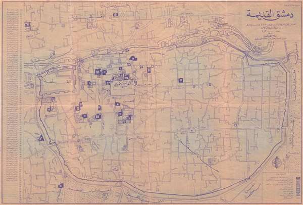
دمشق القديمةOld Damascus. /
sold
- Digital Map Information
- Suitable for large format printing
- File Size: 22.98 MB
- File Type: ZIP / TIFF
- ICC color profile embedded
- Delivered instantly via download link
An unusual c. 1920 blueprint plan or map of Old Damascus, Syria. The blueprint is centered on the Mausoleum of Saladin and the Al Azm Palace. It extends to include that areas confined to the old walled city center and the area just north of the Barada River as ... (more details)
Graphically stunning Dutch map of the Bible Lands.
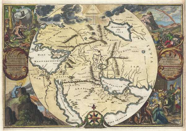
Orbis Per Creationem Institutus. / Orbis Per Diluvium De Stitutus. /Per Legem Constitutus. / Per Christum Restitutus.
sold
- Digital Map Information
- Suitable for large format printing
- DPI: 300
- File Size: 30.02 MB
- File Type: ZIP / TIFF
- ICC color profile embedded
- Delivered instantly via download link
A remarkable 1705 map of the Biblical lands by Romeyln de Hooghe. Centered on Babylon, then thought to be the center of creation, the map extends from the Bosporus to the Arabian Sea and from the Nile valley to the Caspian Sea. It names important Biblical ... (more details)
One of the best large format 18th century maps of Hawaii.
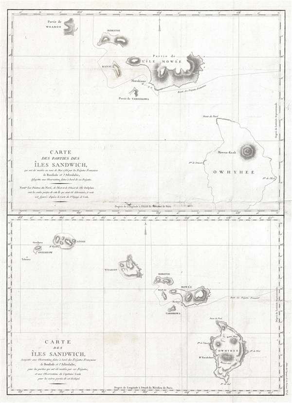
Carte des parties des Iles Sandwich, qui ont ete visitees aus mois de Mai 1786 par les Fregates Francaises la Boussole et l'Astrolabe / Carte des Iles Sandwich, assujettie aux observations faites a bord des Fregates Francaises la Boussole et l'Astrolabe.
sold
- Digital Map Information
- Suitable for large format printing
- DPI: 300
- File Size: 11.12 MB
- File Type: ZIP / TIFF
- ICC color profile embedded
- Delivered instantly via download link
A fine example of Jean François de Galaup, comte de La Pérouse and Gérard Sébastien Bernizet's map of Hawaii or the Sandwich Islands. Essentially two maps on a single sheet. The uppermost map details La Pérouse and Bernizet's shipboard surveys of ... (more details)
Anglophile edition of D'Anville's East Asia and Southeast Asia.
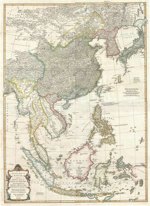
Second part of Asia, being China, part of India and Tartary: the islands of Sonda, Molucka, Philippin, Japan and c.
sold
- Digital Map Information
- Suitable for large format printing
- DPI: 300
- File Size: 31 MB
- File Type: ZIP / TIFF
- ICC color profile embedded
- Delivered instantly via download link
An exceptional 1755 map of East Asia by Malachy Postlethwayte and Solomon Bolton. Centered on the South China Sea, the map covers from Mongolia to java and from the Bay of Bengal to Hokkaido and new Guinea. It includes the countries of China, Japan, ... (more details)
The Paris of Victor Hugo and the June Rebellion.
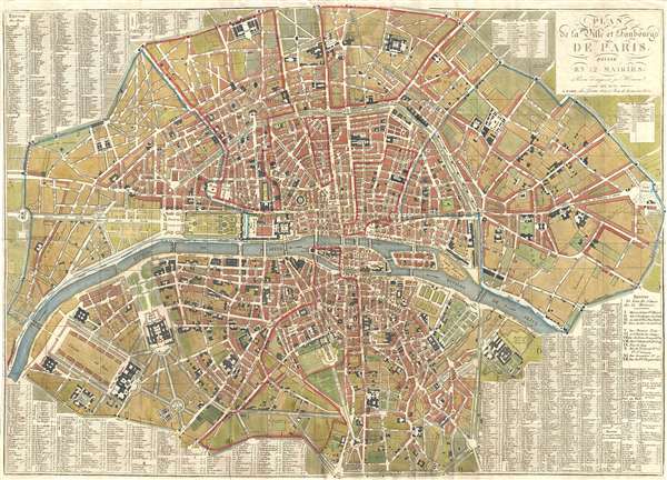
Plan de la Ville et Faubourgs de Paris, Divise en 12 Mairies.
sold
- Digital Map Information
- Suitable for large format printing
- DPI: 300
- File Size: 25.78 MB
- File Type: ZIP / TIFF
- ICC color profile embedded
- Delivered instantly via download link
A stunning large 1833 map of Paris, France, by Eustache Hérisson. Centered on the Ile de la Cité, this map covers central Paris from the Champ de Mars and the Arc de Triomphe to the Place du Trone (Place de la Nation), and from the Abattoir to the ... (more details)
A fine map illustrating British holdings in the West Indies.
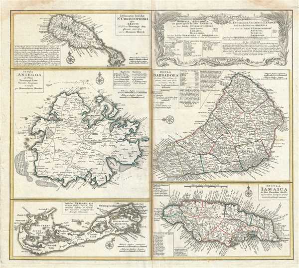
Dominia Anglorum in praecipuis Insulis Americae ut sunt Insula S. Christophori, Antegoa, Iamaica, Barbados nec non Insulae Bermudes vel Sommers dictae. Die Englische Colonie-Länder Auf den Insuln von America und zwar die Insuln S. Christophori, Antegoa, Iamaica, Barbados samt den Ins. Bermudes sonst Sommers genannt.
sold
- Digital Map Information
- Suitable for large format printing
- DPI: 300
- File Size: 17.25 MB
- File Type: ZIP / TIFF
- ICC color profile embedded
- Delivered instantly via download link
This is a beautiful c.1740 example of Homann Heirs’ beautiful map of the British possessions in the Caribbean. Essentially divided into five separate maps, this chart includes maps of the islands of Saint Christopher or Saint Kitts, Antigua, ... (more details)
Map of Martinique drawn to capitalize on general interest generated by the events of the Seven Years' War.
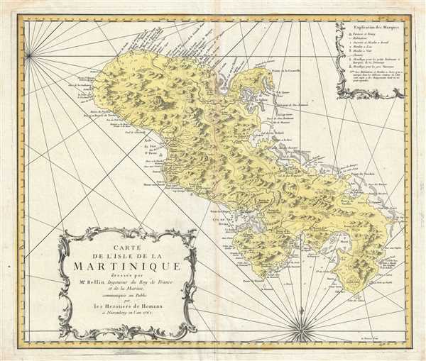
Carte de l'Isle de la Martinique.
sold
- Digital Map Information
- Suitable for large format printing
- DPI: 300
- File Size: 14.15 MB
- File Type: ZIP / TIFF
- ICC color profile embedded
- Delivered instantly via download link
This is a striking 1762 example of Homann Heirs’ beautiful map of the Island of Martinique in the Caribbean. Covers the entire island in exceptional detail with attention to the exceptionally varied topography. Based on the earlier work of ... (more details)
Issued on the eve of the French and Indian War or Seven Years' War.
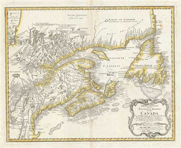
Partie Orientale de la Nouvelle France ou du Canada.
sold
- Digital Map Information
- Suitable for large format printing
- DPI: 300
- File Size: 16.4 MB
- File Type: ZIP / TIFF
- ICC color profile embedded
- Delivered instantly via download link
This is a beautiful 1755 map of eastern Canada and New England by Homann Heirs. Extends from Lake Ontario, St. Lawrence River and Cape Cod north to Newfoundland, Cap Rond and the Hudson Bay. The map renders the entire region in extraordinary ... (more details)
Based on the work of Delisle.
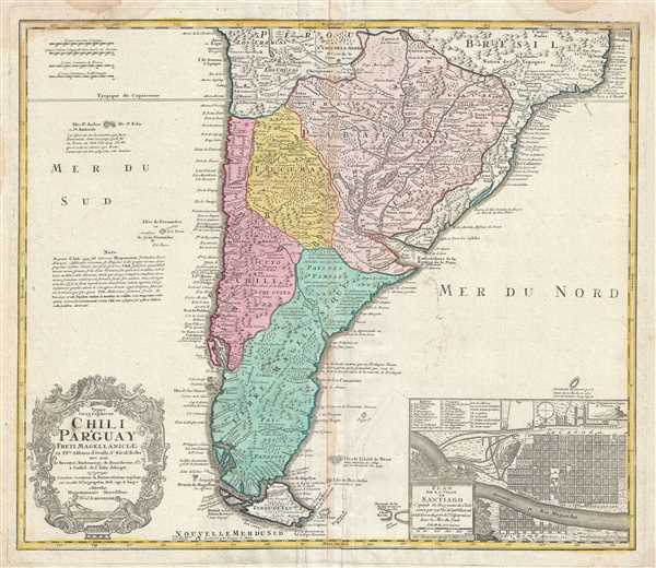
Typus Geographicus Chili Paraguay Freti Magellanicietc.
sold
- Digital Map Information
- Suitable for large format printing
- DPI: 300
- File Size: 17.27 MB
- File Type: ZIP / TIFF
- ICC color profile embedded
- Delivered instantly via download link
This is an extraordinary example of the Homann Heirs magnificent 1733 map of southern South America. It covers roughly from 18 degrees south latitude south to Tierra del Fuego, and includes the modern day nations of Paraguay, Chile, Uruguay ... (more details)
Topographical map of Michigan.
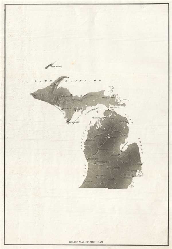
Relief Map of Michigan.
sold
- Digital Map Information
- Suitable for large format printing
- File Size: 5.03 MB
- File Type: ZIP / TIFF
- ICC color profile embedded
- Delivered instantly via download link
This is an appealing c.1890 map of Michigan. Covers the entire state. Presented in black and white, the map notes important towns and rivers. Issued primarily as a relief map, Lakes Michigan and Superior are labeled but boundaries are not ... (more details)
Beautifully rendered topography.
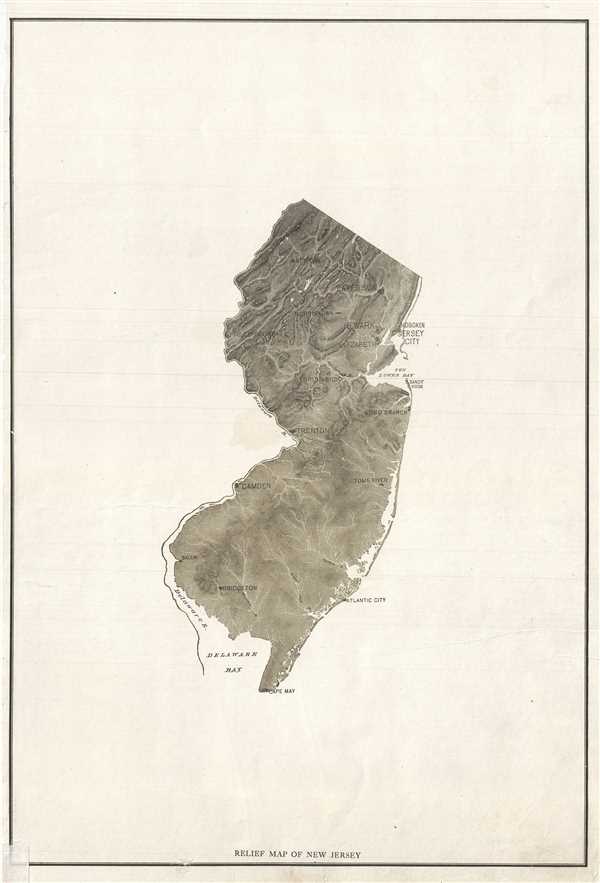
Relief Map of New Jersey.
sold
- Digital Map Information
- Suitable for large format printing
- File Size: 5.3 MB
- File Type: ZIP / TIFF
- ICC color profile embedded
- Delivered instantly via download link
This is an appealing c.1890 map of New Jersey. Covers the entire state. Presented in black and white, the map notes important towns and rivers. Issued primarily as a relief map, the Kittatinny Mountains and the Kittatinny Valley are ... (more details)
Graphically pleasing relief map.
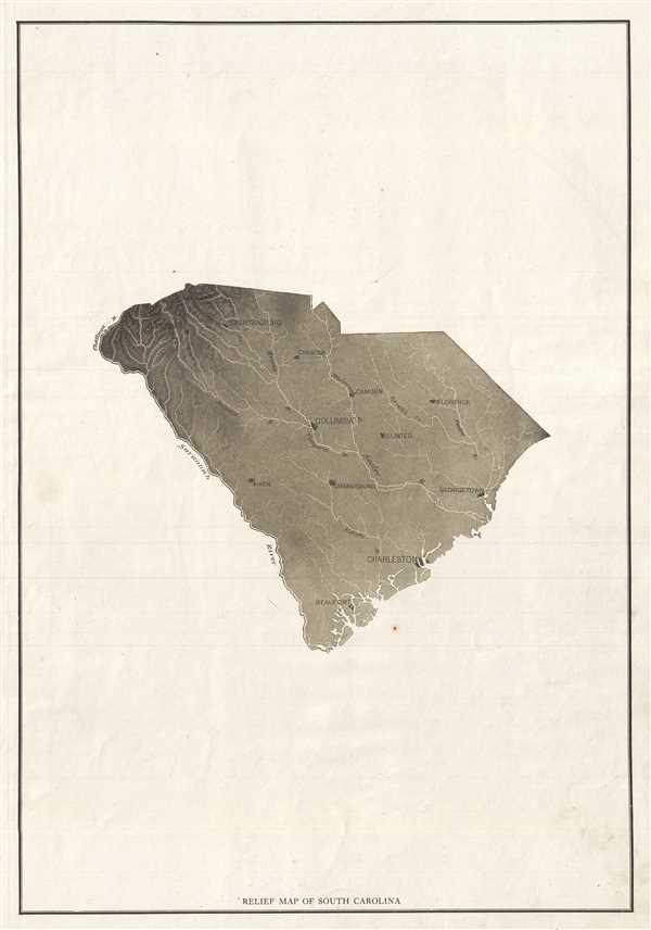
Relief Map of South Carolina.
sold
- Digital Map Information
- Suitable for large format printing
- File Size: 5.6 MB
- File Type: ZIP / TIFF
- ICC color profile embedded
- Delivered instantly via download link
This is an appealing c.1890 map of South Carolina. Covers the entire state. Presented in black and white, the map notes important towns and rivers. Issued primarily as a relief map, the Blue Ridge Mountains are clearly seen in the ... (more details)
One of the earliest obtainable separate issue maps of Duluth, Minnesota.

Map of Duluth St. Louis County Minnesota.
sold
- Digital Map Information
- Suitable for large format printing
- File Size: 24.4 MB
- File Type: ZIP / TIFF
- ICC color profile embedded
- Delivered instantly via download link
An exceptionally rare 1886 Map of Duluth, Minnesota by William Baird Paton and Charles H. Drew. This is one of the earliest obtainable separate issue maps of Duluth, Minnesota. The map covers roughly from Forest Hill Cemetery to ... (more details)
19th Century Japanese Map of Bangkok - very rare!

第四圖 / The Fourth Map.
sold
- Digital Map Information
- Suitable for large format printing
- File Size: 1.36 MB
- File Type: ZIP / TIFF
- ICC color profile embedded
- Delivered instantly via download link
A scarce Meiji 8, 1875 Japanese issue map of the Chao Phraya River from the Bay of Bangkok to the city of Bangkok. Bangkok is shows in the upper right with some detail, including the city's canal system. Some depths in the bay ... (more details)
Shows the extent of American Indian settlement in Mississippi before the Indian Removal Act.
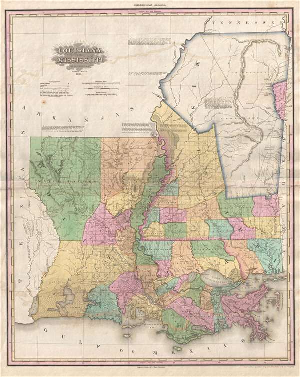
Louisiana and Mississippi by H. S. Tanner.
sold
- Digital Map Information
- Suitable for large format printing
- DPI: 300
- File Size: 15.43 MB
- File Type: ZIP / TIFF
- ICC color profile embedded
- Delivered instantly via download link
A rare and important map of Louisiana and Mississippi by H. S. Tanner. This elephant folio map covers all of Louisiana and Mississippi as well as, in less detail, adjacent parts of Texas, Arkansas, Tennessee and Alabama. The ... (more details)
Identifies oil deposits predating the Pennsylvania Oil Rush by more than 30 years.
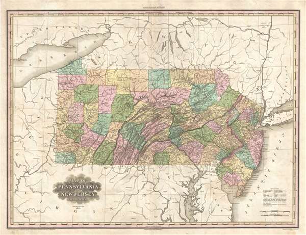
Map of Pennsylvania and New Jersey by H. S. Tanner.
sold
- Digital Map Information
- Suitable for large format printing
- DPI: 300
- File Size: 15.89 MB
- File Type: ZIP / TIFF
- ICC color profile embedded
- Delivered instantly via download link
A rare and important map of Pennsylvania and New Jersey by H. S. Tanner. This elephant folio map covers all of Pennsylvania and New Jersey as well as, in less detail, adjacent parts of New York, Ohio, Virginia, an Maryland. ... (more details)
Exceptional map of Boston on the cusp of its landfill transformation into a modern metropolis.
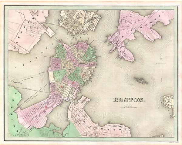
Boston.
sold
- Digital Map Information
- Suitable for large format printing
- DPI: 300
- File Size: 5.11 MB
- File Type: ZIP / TIFF
- ICC color profile embedded
- Delivered instantly via download link
This is an 1838 Thomas G. Bradford map of Boston on the cusp of its transformation, via landfills and railroads, from a colonial port to a major metropolitan center. The map centers on the Shawmut Peninsula or Boston ... (more details)
18th century plan of Ayutthaya, Thailand, considered at the time to be the largest city in the world.

Plan de la Ville de Siam Capitale du Royaume de ce nom Leve par un Ingenieur Francois en 1687.
sold
- Digital Map Information
- Suitable for large format printing
- DPI: 300
- File Size: 3.09 MB
- File Type: ZIP / TIFF
- ICC color profile embedded
- Delivered instantly via download link
A beautifully hand-colored, c. 1752 copper engraving of the former Thai royal capital Ayutthaya (known to Europeans as the 'Ville de Siam'). Cartographically the map is based upon French surveys completed by a ... (more details)