
Beautiful map of the Philippine Islands.

Mapa Orographico. Islas Filipinas Observatorio de Manila.
sold
- Digital Map Information
- Suitable for large format printing
- File Size: 3.3 MB
- File Type: ZIP / TIFF
- ICC color profile embedded
- Delivered instantly via download link
This is a nice 1903 map of the Philippines islands issued by the U.S. Geological Survey. The map covers the Philippines from the Batanes Archipelago south as far as Tawitawi. The map beautifully renders topography by hachure and notes important mountains along with ... (more details)
Interesting nautical chart of the major Red Sea port of Yanbu.

A View of the Town of Yambo on the Coast of Arabia, with the Soundings of the Harbour, lying in 24.10' North Lat.
sold
- Digital Map Information
- Suitable for large format printing
- DPI: 300
- File Size: 2.49 MB
- File Type: ZIP / TIFF
- ICC color profile embedded
- Delivered instantly via download link
This is an interesting example of the 1787 map depicting the city of Yambo or Yanbu’ al Bahr in Saudi Arabia issued by J. Dodsley. Yambo, located in the Al Madinah province of western Saudi Arabia is a major sea port on the coast of the Red Sea. Essentially a ... (more details)
Bus reference guide for London traveller during World War I.
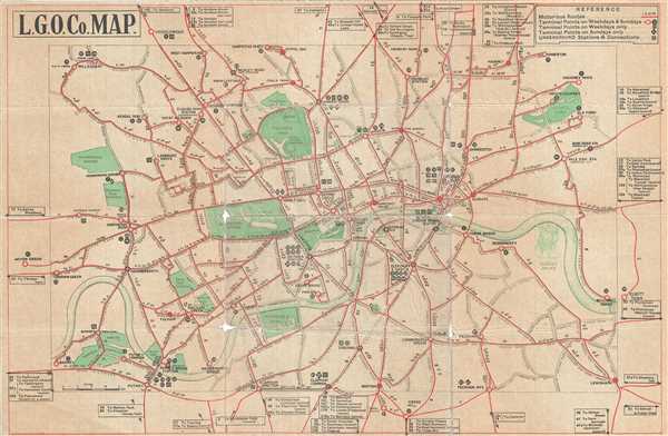
L. G. O. Co. Map.
sold
- Digital Map Information
- Suitable for large format printing
- File Size: 7.37 MB
- File Type: ZIP / TIFF
- ICC color profile embedded
- Delivered instantly via download link
This is a nice 1914 World War I era transportation map of London issued by the London General Omnibus Company. Covers the city of London in beautiful detail with red lines showing motor us routes. The map also notes terminal points for weekends and weekdays as ... (more details)
Speculative early map of Central Asia and Siberia.
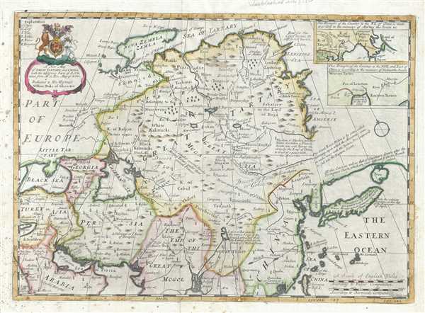
A new map of Great Tartary, and China : with the adjoyning Parts of Asia.
sold
- Digital Map Information
- Suitable for large format printing
- DPI: 300
- File Size: 10.57 MB
- File Type: ZIP / TIFF
- ICC color profile embedded
- Delivered instantly via download link
This is a decorative 1712 map of Tartary by Edward Wells of Oxford. It covers from the Black Sea and Turkey east as far as Japan. It extends north to Nova Zembla and south to the Ganges Delta. When Wells drew this map, this part of the world was relatively ... (more details)
A significant reimagining and re-engraving of Johnson's Comparative Mountains and Rivers Chart.

Johnson's Chart of Comparative Heights of Mountains, and Lengths of Rivers of Africa. Johnson's Chart of Comparative Heights of Mountains, and Lengths of Rivers of Asia. Johnson's Chart of Comparative Heights of Mountains, and Lengths of Rivers of Europe. Johnson's Chart of Comparative Heights of Mountains, and Lengths of Rivers of South America. Johnson's Chart of Comparative Heights of Mountains, and Lengths of Rivers of North America.
sold
- Digital Map Information
- Suitable for large format printing
- File Size: 18.47 MB
- File Type: ZIP / TIFF
- ICC color profile embedded
- Delivered instantly via download link
This is the 1864 edition of Johnson's Mountains and Rivers Chart. This chart, printed in 1864, represents a significant reimagining and re-engraving of Johnson's pre-1864 mountains and rivers charts. Johnson first introduced a mountains and rivers chart ... (more details)
Mid-18th century map of Hungary.

Royaume de Hongrie, Principaute de Transilvanie, Sclavonie, Croatie, et partie de la Principaute de Valaquie, de la Bosnie, de la Servie et de la Bulgarie.
sold
- Digital Map Information
- Suitable for large format printing
- DPI: 300
- File Size: 18.32 MB
- File Type: ZIP / TIFF
- ICC color profile embedded
- Delivered instantly via download link
This is a scarce 1751 map of southeastern Europe by Robert de Vaugondy. The map covers modern day Hungary and Slovakia along with parts of Transylvania (Romania), Croatia, Bosnia and Herzegovinia, Serbia, Austria, Czech Republic, Poland and the Ukraine. ... (more details)
Beautiful 18th century map of South America.
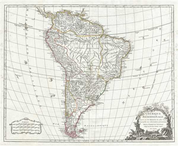
Amerique Meridionale, dressee, sur les Memoires les plus recents et assujetie aux observations astronomique.
sold
- Digital Map Information
- Suitable for large format printing
- DPI: 300
- File Size: 16.91 MB
- File Type: ZIP / TIFF
- ICC color profile embedded
- Delivered instantly via download link
This is a beautiful 1783 map of South America by Robert de Vaugondy. It covers the continent of South America from Panama to Tierra del Fuego and Cape Horn. It offers excellent detail throughout showing mountains, rivers, forests, swamps, cities and a ... (more details)
Decorative map of the Holland or The Netherlands.
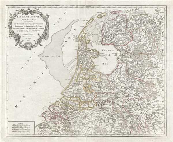
Les Provinces-Unies des Pays-Bas, que comprennent le Duche de Gueldre, les Comtes de Hollande, de Zelande, de Zutphen, les Seigneuries d'Utrecht, d'Ouest-Frise, d'Ower-Issel, et de Groningue.
sold
- Digital Map Information
- Suitable for large format printing
- DPI: 300
- File Size: 19.45 MB
- File Type: ZIP / TIFF
- ICC color profile embedded
- Delivered instantly via download link
This is a scarce 1753 map of the United Provinces of Netherlands by Robert de Vaugondy. It coves what is now northern Netherlands from Norden, Germany south to Middelburg and inland as far as Moers (Meurs), Germany. The entire region shows ... (more details)
World War II era map of India.

標準大東亞分圖 - インド / [India.]
sold
- Digital Map Information
- Suitable for large format printing
- File Size: 21.09 MB
- File Type: ZIP / TIFF
- ICC color profile embedded
- Delivered instantly via download link
This is a beautiful 1943 or Showa 18 large format map of India, issued by the Japanese during World War II. It covers all of India and Pakistan in great detail, and includes Sri Lanka. The map offers superb detail regarding topographic and political features and notes cities, roads, and trade routes on air, sea and land. Shading is used to display oceanic depths. Includes two insets in the lower quadrants. (more details)
Japanese World War II map of Java and Bali.
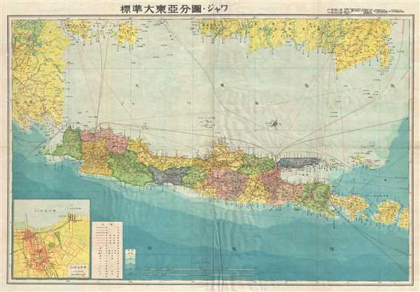
Java.
sold
- Digital Map Information
- Suitable for large format printing
- File Size: 16.61 MB
- File Type: ZIP / TIFF
- ICC color profile embedded
- Delivered instantly via download link
This is a scarce 1943 Japanese map of Java and surrounding islands, including Bali, Indonesia, issued during World War II. The southern part of Sumatra and Borneo is also included. The map offers superb detail regarding both topographical ... (more details)
Home of the Champagne wines.
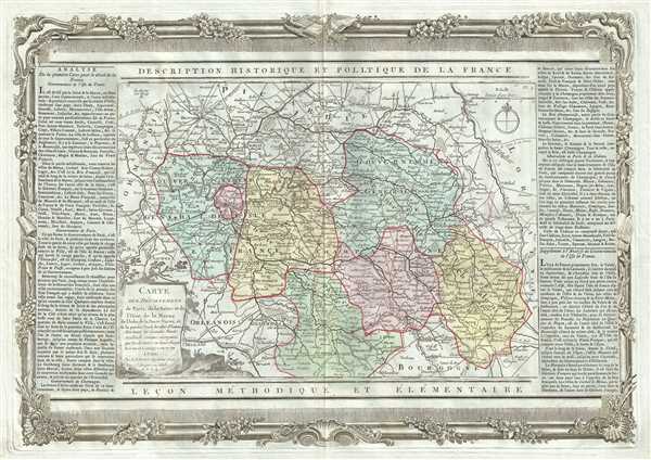
Carte des Departemens de Paris, de la Seine et de l'Oise de la Marne de l'Aube, de la Haute Marne, et de la partie Nord de celui d'Yonne.
sold
- Digital Map Information
- Suitable for large format printing
- DPI: 300
- File Size: 13.23 MB
- File Type: ZIP / TIFF
- ICC color profile embedded
- Delivered instantly via download link
This is a beautiful 1790 map featuring parts of the Ile-de-France, Champagne-Ardenne and Bourgogne regions of France, including Paris, by the French cartographer Louis Brion de la Tour. The map covers the departments of Yonne, Aube, ... (more details)
Map depicting the regions producing some of France's finest wines.
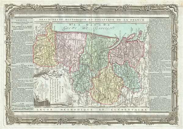
Carte des Departemens de la Charente Inferieure de la Charente, de la Gironde, de la Dordogne, des Landes, du Lot et Garonne et des Basses Pyrenees.
sold
- Digital Map Information
- Suitable for large format printing
- DPI: 300
- File Size: 12.58 MB
- File Type: ZIP / TIFF
- ICC color profile embedded
- Delivered instantly via download link
This is a beautiful 1790 map of the Aquitaine and part of the Poitou-Charentes regions of France by the French cartographer Louis Brion de la Tour. Oriented with north to the right, it covers the French departments of Charente, ... (more details)
Beautiful map of the French Riviera.

Provence, Divisee en Trois Departemens.
sold
- Digital Map Information
- Suitable for large format printing
- DPI: 300
- File Size: 13.71 MB
- File Type: ZIP / TIFF
- ICC color profile embedded
- Delivered instantly via download link
This is an attractive 1790 map depicting the southern coast or the Provence region of France by the French cartographer Louis Brion de la Tour. It covers Provence divided into the three departments of Var, Bouches du Rhone, and ... (more details)
18th century map showing the leading cheese producing regions of France.

Carte des Departemens du Puy de Dome, du Cantal, Du Rhone et Loire et de la Haute Loire.
sold
- Digital Map Information
- Suitable for large format printing
- DPI: 300
- File Size: 12.76 MB
- File Type: ZIP / TIFF
- ICC color profile embedded
- Delivered instantly via download link
This is a lovely 1790 map of the regions of Auvergne and Rhone-Alpes in France by the French cartographer Louis Brion de la Tour. It covers the French departments of Puy-de-Dome, Cantal, Haute Loire, Loire, and Rhone. Color ... (more details)
Map of France's Normandy region, famous for its ciders.
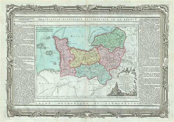
Carte des Departemens de la Manche, du Calvados, de l'Orne, de l'Eure et de la Seine Inferieure.
sold
- Digital Map Information
- Suitable for large format printing
- DPI: 300
- File Size: 13.32 MB
- File Type: ZIP / TIFF
- ICC color profile embedded
- Delivered instantly via download link
This is an attractive 1790 map of the Normandy region in northwest France by the French cartographer Louis Brion de la Tour. Covers the French departments of Calvados, Manche, Orne, Seine-Maritime, and Eure. Color coding ... (more details)
18th century map of the French wine and cheese producing region of Brittany.
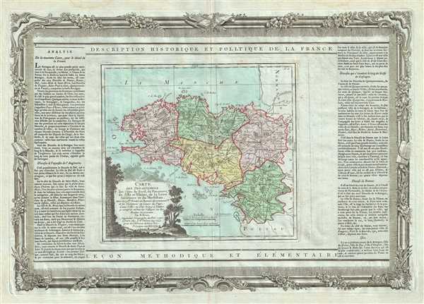
Carte des Departemens des Cotes du Nord, du Finisterre, de l'Ille et Vilaine, de la Loire inferieure et du Morbihan.
sold
- Digital Map Information
- Suitable for large format printing
- DPI: 300
- File Size: 13.08 MB
- File Type: ZIP / TIFF
- ICC color profile embedded
- Delivered instantly via download link
This is a lovely map of the Bretagne region in France by the French cartographer Louis Brion de la Tour. It map covers the French departments of Finistere, Cotes-d'Amor, Ille-et-Vilaine, Morbihan, and Loire-Atlantique ... (more details)
The Burgundy wine producing region of France.

Carte des Departemens de la Cote d'Or, de Saone et Loire, de la Haute Saone, du Doubs, du Jura, de l'Ain, et de la partie Sud de celui d'Yonne.
sold
- Digital Map Information
- Suitable for large format printing
- DPI: 300
- File Size: 11.49 MB
- File Type: ZIP / TIFF
- ICC color profile embedded
- Delivered instantly via download link
This is an attractive 1790 map of the Bourgogne and Franche-Comte regions by the French cartographer Louis Brion de la Tour. The map extends from Auxerre south to Lyon and east as far as Lac Leman (Lac de Geneve) and ... (more details)
Highway map of Yellowstone National Park and Vicinity
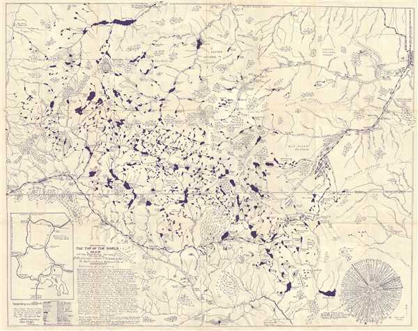
The Top of the World Map of the Beartooth Hi-way Route 212 Via Red Lodge - Cooke City - Silver Gate to Yellowstone National Park.
sold
- Digital Map Information
- Suitable for large format printing
- File Size: 18.7 MB
- File Type: ZIP / TIFF
- ICC color profile embedded
- Delivered instantly via download link
This is an attractive c.1949 Marino Map of the Yellowstone National Park and vicinity. It covers from Swamp Lake and Deep Lake in Northeast Wyoming north as far as Mystic Lake in Custer Gallatin National Forest in ... (more details)
Detailed map of Narragansett Bay.

Narragansett Bay and Vicinity.
sold
- Digital Map Information
- Suitable for large format printing
- File Size: 18.71 MB
- File Type: ZIP / TIFF
- ICC color profile embedded
- Delivered instantly via download link
This is an uncommon and attractive 1892 map of Narragansett Bay and vicinity, Rhode Island by the Boston map publisher George H. Walker. It covers the entirety of Narragansett Bay from Block Island to Providence ... (more details)
Beautifully detailed chart showing the triangulation of the coast of Georgia and South Carolina.

Sketch E Showing the Progress of the Survey in Section No. V from 1847 to 1861.
sold
- Digital Map Information
- Suitable for large format printing
- File Size: 16.44 MB
- File Type: ZIP / TIFF
- ICC color profile embedded
- Delivered instantly via download link
This is an appealing 1861 U.S. Coast Survey triangulation chart or map of the Georgia and South Carolina coastline from Cumberland Island to Bald Head Island in North Carolina. E essentially three maps on a ... (more details)