
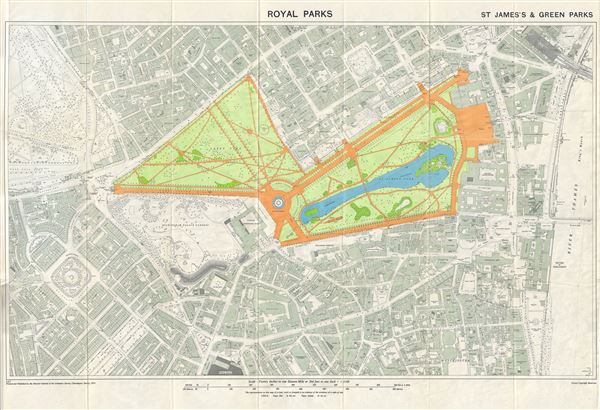
Royal Parks. St. James's & Green Parks.
sold
- Digital Map Information
- Suitable for large format printing
- File Size: 23.58 MB
- File Type: ZIP / TIFF
- ICC color profile embedded
- Delivered instantly via download link
This is a beautiful example of the 1953 Ordnance Survey map of St. James's Park and Green Park, two of the Royal Parks of London, England. It covers the vicinity of the two adjoining parks from Hyde Park to the River Thames, and south as far as Victoria Station. ... (more details)
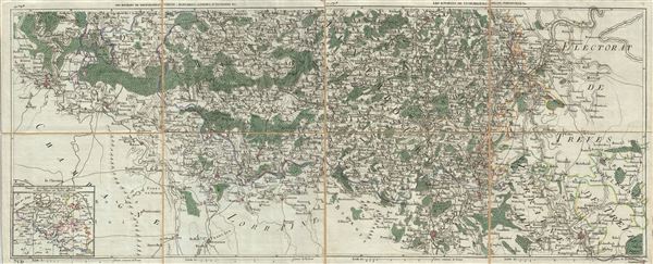
Les Environs de Neufchateau, Virton, Montmedy, Longwy, d'Anvillers &c. Les Environs de Luxembourg, Arlon, Thionville, &c.
sold
- Digital Map Information
- Suitable for large format printing
- DPI: 300
- File Size: 19.01 MB
- File Type: ZIP / TIFF
- ICC color profile embedded
- Delivered instantly via download link
This is a beautiful example of the 1786 Jean-Baptiste Map of France, Belgium, Luxembourg and Germany. It covers from Charleville-Mezieres, France to Saarbrucken, Germany, and includes parts of modern day France, Belgium, Luxembourg and Germany. Divided according ... (more details)
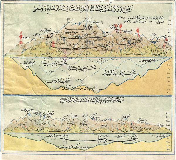
Comparative Map of World's Mountains.
sold
- Digital Map Information
- Suitable for large format printing
- DPI: 300
- File Size: 1.51 MB
- File Type: ZIP / TIFF
- ICC color profile embedded
- Delivered instantly via download link
This is an extremely uncommon example of a 19th century comparative map or chart of the world's mountains. Printed in Arabic, this chart notes the relative elevation of the important mountains of the World. The map is divided into two parts, each with heights ... (more details)

Map of Washington, Georgetown and Vicinity.
sold
- Digital Map Information
- Suitable for large format printing
- File Size: 9.87 MB
- File Type: ZIP / TIFF
- ICC color profile embedded
- Delivered instantly via download link
An interesting 1882 map of Washington D.C. issued by the W. H. Morrison. The map covers all of Washington D. C. as well as the surrounding region and was prepared for The Strangers Guide to Washington, Georgetown and Vicinity . This map was clearly reduced ... (more details)

Nouveau Paris Monumental Itieraire Pratique de l'Etranger dans Paris. Plan de Paris Divise en 20 Arrondissements.
sold
- Digital Map Information
- Suitable for large format printing
- File Size: 57.22 MB
- File Type: ZIP / TIFF
- ICC color profile embedded
- Delivered instantly via download link
This is an iconic 1946 tourist pocket map of Paris, France. Maps are printed on both sides of sheet. On recto, this map centers on the Seine River, and covers the embastilled heart of Paris. Designed with the tourist in mind, this map shows all major ... (more details)
A definitive map of the Pacific Northwest, considered by Wheat, 'really quite extraordinary.'

Map of the Oregon Territory by the U.S. Ex. Ex.
sold
- Digital Map Information
- Suitable for large format printing
- DPI: 300
- File Size: 29.57 MB
- File Type: ZIP / TIFF
- ICC color profile embedded
- Delivered instantly via download link
This important and extraordinary production is Commodore Wilkes' 1841 U.S. Exploring Expedition map of Oregon Territory. The map covers roughly from the 50th parallel to Mount Shasta, the upper Sacramento River, and Great Salt Lake (labeled Youta Lake) ... (more details)

Orographical Reduced Survey Map of the United States and Part of Canada.
sold
- Digital Map Information
- Suitable for large format printing
- File Size: 59.03 MB
- File Type: ZIP / TIFF
- ICC color profile embedded
- Delivered instantly via download link
This is an uncommon example of the 1915 pocket map of the United States and Part of Canada issued by J. G. Bartholomew. This topographical map covers all of the United States, along with parts of Canada and Mexico. The map is highly detailed and notes ... (more details)

Map of St. Louis and Suburbs.
sold
- Digital Map Information
- Suitable for large format printing
- File Size: 19.12 MB
- File Type: ZIP / TIFF
- ICC color profile embedded
- Delivered instantly via download link
This is an impressive 1941 pocket map of St. Louis, Missouri, by H. W. Gross. This map, part of the 'City Guide and Map of St. Louis' tourist guide book, is centered on Forest Park and covers all of central St. Louis from the Mississippi River to the ... (more details)
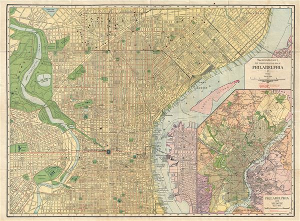
The Rand-McNally New Commercial Atlas Map of Philadelphia.
sold
- Digital Map Information
- Suitable for large format printing
- File Size: 21.36 MB
- File Type: ZIP / TIFF
- ICC color profile embedded
- Delivered instantly via download link
This is a fine example of the 1916 Rand McNally pocket map of Philadelphia, Pennsylvania. This city plan covers Philadelphia from the Queen Lake Reservoir to St. Mary's Cemetery and from the Pennsylvania hospital for the insane in west Philadelphia ... (more details)
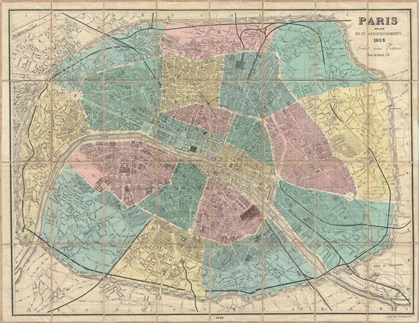
Paris Divise en 20 Arrondissements.
sold
- Digital Map Information
- Suitable for large format printing
- File Size: 34.66 MB
- File Type: ZIP / TIFF
- ICC color profile embedded
- Delivered instantly via download link
This is a fine example of the 1866 folding map of Paris, France by Ledot Freres. It covers the old walled city of Paris and its immediate vicinity. Drawn to illustrate Napoleon III and Georges-Eugène Haussmann's revolutionary modernization of ... (more details)

Flamm's New Index Map Baltimore.
sold
- Digital Map Information
- Suitable for large format printing
- File Size: 31.55 MB
- File Type: ZIP / TIFF
- ICC color profile embedded
- Delivered instantly via download link
This is a fine example of a 1913 map of Baltimore, Maryland by William A. Flamm. It covers from Montebello Park to Fort McHenry. The map is exceptionally detailed noting important buildings, streets, parks, lakes, cemeteries, railroads, and ... (more details)
An early pocket map of New York City.

Strangers Guide Through the City of New York, with the latest Improvements.
sold
- Digital Map Information
- Suitable for large format printing
- Full resolution TIFF file
- ICC color profile embedded
- Delivered instantly via download link
A scarce map of 1837 map New York City issued by Humphrey Phelps. This map details the southern part of Manhattan from the battery to 14th Street, though it technically extends, though with less detail, all the way to 41st street. Phelps ... (more details)

The Harbor of Wood's Hole Massachusetts.
sold
- Digital Map Information
- Suitable for large format printing
- File Size: 7.36 MB
- File Type: ZIP / TIFF
- ICC color profile embedded
- Delivered instantly via download link
A beautiful example of the 1857 U.S. Coast Survey nautical chart or maritime map of Woods Hole, Massachusetts. The map covers the southwestern tip of Barnstable County and parts of nearby Naushon Island. This chart offers exceptional ... (more details)
An exceptionally scarce variant of a cornerstone map of the American west and the finest of its era.
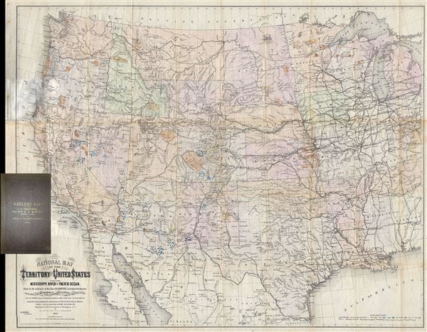
National Map of the Territory of the United States From The Mississippi River To The Pacific Ocean. Madeby the authority of the Hon. O. H. Browning Secretary of the Interior. In the Office of the Indian Bureau Chiefly For Government Purposes under the direction of the Hon. N.G. Taylor, Commisr. of Indian Affairsa and Hon. Chas E. Mix Chief Clerk of the Indian Bureau.
sold
- Digital Map Information
- Suitable for large format printing
- File Size: 46.46 MB
- File Type: ZIP / TIFF
- ICC color profile embedded
- Delivered instantly via download link
A map of the utmost importance and scarcity, this is William J. Keeler's 1868 pocket map of the American west, considered the 'the largest, finest and most detailed map of the West as it was then known.' The map covers from Detroit ... (more details)
One of only two known examples of the original membership certificate for the Merchants' Association of New York.

The Merchants' Association of New York.
sold
- Digital Map Information
- Suitable for large format printing
- File Size: 16.23 MB
- File Type: ZIP / TIFF
- ICC color profile embedded
- Delivered instantly via download link
An extraordinary unique find, this is an original 1897 membership certificate for the Merchants' Association of New York. The certificate was issued for one A. E. Sinauton (sp?), a class B non-resident member of the association, ... (more details)
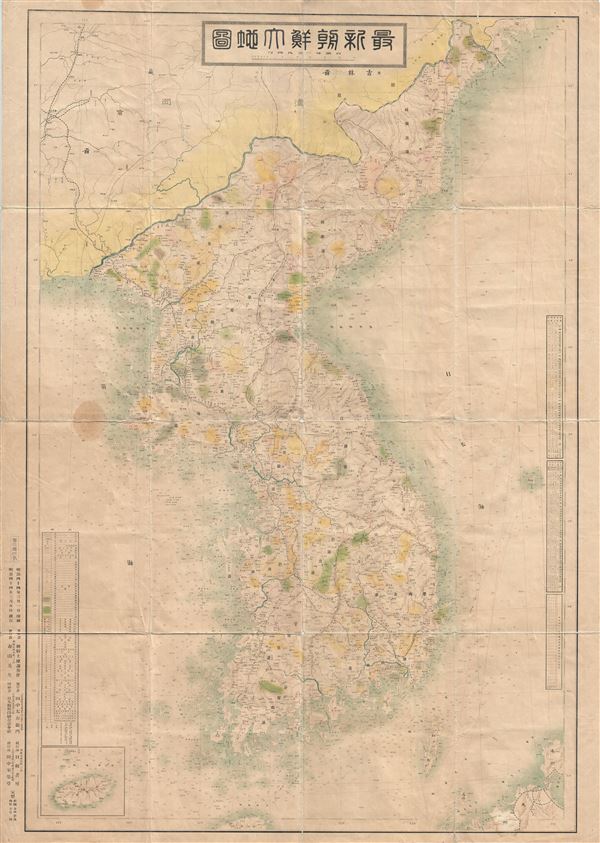
Korea.
sold
- Digital Map Information
- Suitable for large format printing
- Full resolution TIFF file
- ICC color profile embedded
- Delivered instantly via download link
This is a monumental and impressive 1911 or Meiji 44 Japanese map of Korea (Corea). One of the most impressive maps of Korea we have seen, this chart combines the virtues of the terrestrial map and a nautical chart. The map ... (more details)
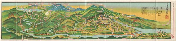
Nikko.
sold
- Digital Map Information
- Suitable for large format printing
- File Size: 6.98 MB
- File Type: ZIP / TIFF
- ICC color profile embedded
- Delivered instantly via download link
This is an extremely beautiful 1939 or Showa 14 Japanese view map of Nikko, Japan. It covers the mountainous capital city of the Tochigi Prefecture in extensive detail, featuring the Nikko railway line, cable car, lakes, ... (more details)
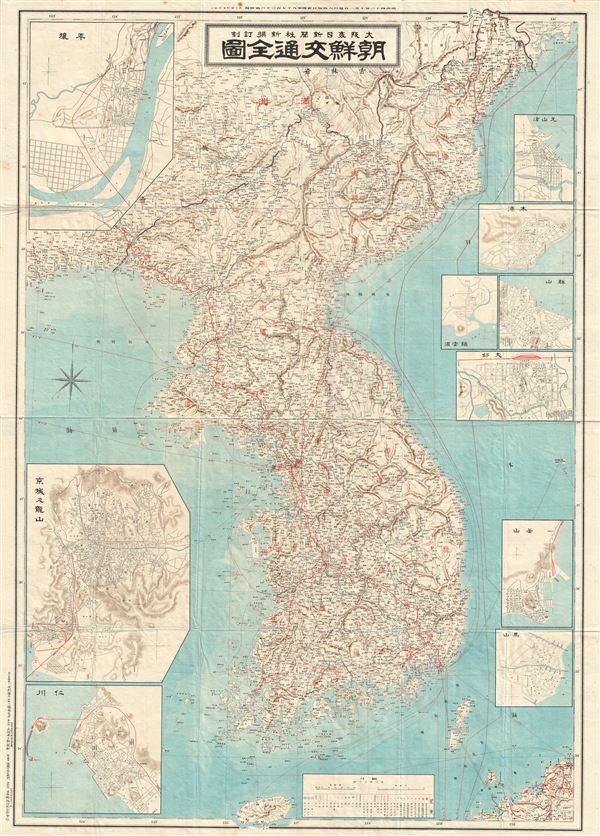
Korea.
sold
- Digital Map Information
- Suitable for large format printing
- File Size: 52.23 MB
- File Type: ZIP / TIFF
- ICC color profile embedded
- Delivered instantly via download link
This is an unusual and appealing large format map of Korea (Corea) dating to 1910 or Meiji 43. This map of Korea made in the 43rd year of the Emperor Meiji's reign, covers all of peninsular Korea (Corea) as well as parts ... (more details)

New Map of Kobe.
sold
- Digital Map Information
- Suitable for large format printing
- File Size: 26.57 MB
- File Type: ZIP / TIFF
- ICC color profile embedded
- Delivered instantly via download link
This is a scarce 1927 or Showa 2 map of Kobe City, Japan. It covers all of Kobe city, the fifth largest city in Japan and the capital of the Hyogo Prefecture. Founded in 1889, the city quickly became a prominent port ... (more details)

Kyoto.
sold
- Digital Map Information
- Suitable for large format printing
- File Size: 27.08 MB
- File Type: ZIP / TIFF
- ICC color profile embedded
- Delivered instantly via download link
This is a beautiful and scarce example of the 1911 or Meiji 44 map of Kyoto, Japan, published by the Japanese. It covers the former Imperial capital city of Kyoto as well as some of the surrounding hills in great ... (more details)