
Covers the Burgundy Wine Regions of Chablis, Cote de Nuits, Cote de Beaune, and Cote Chalonnaise.

Burgundiae Comitatus Recentiss Descriptio Dno Ferdinando Lannoyo auctore.
sold
- Digital Map Information
- Suitable for large format printing
- DPI: 300
- File Size: 15.58 MB
- File Type: ZIP / TIFF
- ICC color profile embedded
- Delivered instantly via download link
A stunning example of Abraham Ortelius' 1592 map of Burgundy, France. This map covers those areas which are today most commonly associated with the production of Burgundy Wine - arguably the finest French wine. The Burgundy wine regions included on this map ... (more details)
The first scientifically produced map of Puerto Rico.
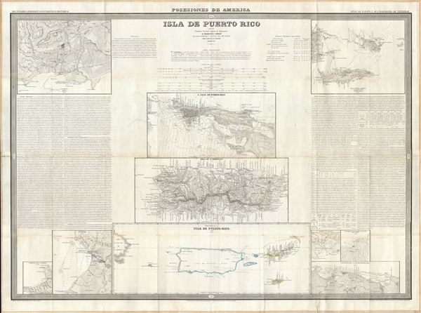
Isla de Puerto Rico por el Teniente Coronel Capitan de Ingenieros D. Francisco Coello, las notas estadisticas e historicas han sido escritas por D. Pascual Madoz. Madrid 1851.
sold
- Digital Map Information
- Suitable for large format printing
- Full resolution TIFF file
- ICC color profile embedded
- Delivered instantly via download link
A fine example of Francisco Coello de Portugal y Quesada's massive map of Puerto Rico. Coello's map is the first scientifically produced Spanish map of Puerto Rico. The map is essentially ten individual maps on a signal sheet with extensive historical and ... (more details)
Covers the Burgundy Wine Regions of Chablis, Cote de Nuits, Cote de Beaune, and Cote Chalonnaise.
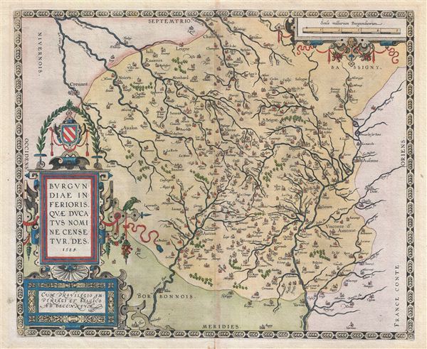
Burgundiae Inferioris Quae Ducatus Nomine Censetur, Des.
sold
- Digital Map Information
- Suitable for large format printing
- DPI: 300
- File Size: 14.15 MB
- File Type: ZIP / TIFF
- ICC color profile embedded
- Delivered instantly via download link
A stunning first edition first state example of the 1584 first edition of Ortelius' classic map of Burgundy, France. Although Ortelius references this region as 'Burgindiae Inferioris' or Lower Burgundy, it specifically covers those areas which are today ... (more details)
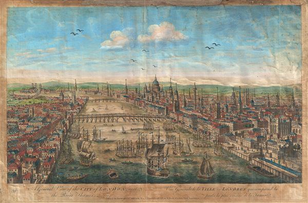
A General View of the City of London, next the River Thames. Vue Generale de la Ville de Londres qui comprend la partie la plus voisine de la Tamise.
sold
- Digital Map Information
- Suitable for large format printing
- DPI: 300
- File Size: 8.15 MB
- File Type: ZIP / TIFF
- ICC color profile embedded
- Delivered instantly via download link
An attractive 1753 view of London set midstream on the Thames, looking west. Set amidst busy river commerce, this view shows London Bridge (foreground), Blackfriars Bridge (middle ground) and, around the bend, Westminster Bridge and Abbey. St. Paul's ... (more details)

Regni Hungariae et regionum, quae ei quondam fuere unitae, ut Transilvaniae, Valachiae, Moldaviae, Serviae, Romaniae, Bulgariae, Bessarabiae, Croatiae, Bosniae, Dalmatiae, Sclavoniae, Morlachiae, Ragusanae Reipublicae, maximaeq[ue] partis Danubii Fluminis, novissima delineatio.
sold
- Digital Map Information
- Suitable for large format printing
- Full resolution TIFF file
- ICC color profile embedded
- Delivered instantly via download link
A sprawling 1688 decorative map of the Balkans by Fredrick de Wit. Covering from the Adriatic to the Black Sea and from Poland to Macedonia, this large map focuses on the multiethnic, multilingual, and multinational Hungarian Empire. It includes the ... (more details)

Sketch D Showing the progress of Section No. 4.
sold
- Digital Map Information
- Suitable for large format printing
- DPI: 300
- File Size: 1.69 MB
- File Type: ZIP / TIFF
- ICC color profile embedded
- Delivered instantly via download link
An uncommon 1849 U.S. Coast Survey triangulation chart of the Albemarle Sound, North Carolina. Centered on Albemarle Sound, this map covers from Chowan River near Edanton, North Carolina to the Atlantic Ocean. It details the progress of surveys ... (more details)
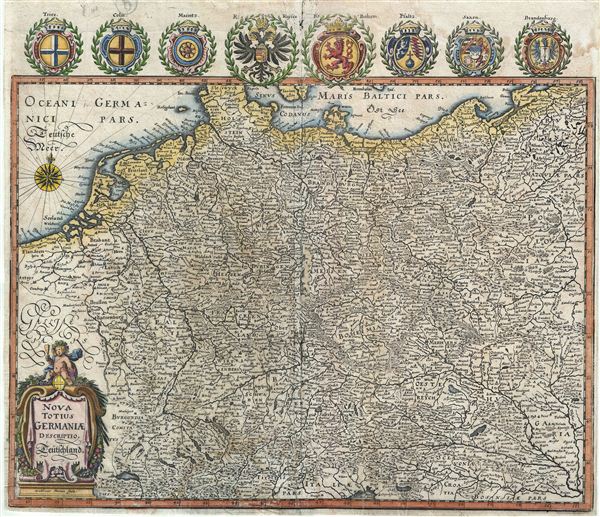
Nova Totius Germaniae.
sold
- Digital Map Information
- Suitable for large format printing
- DPI: 300
- File Size: 9.15 MB
- File Type: ZIP / TIFF
- ICC color profile embedded
- Delivered instantly via download link
This is a beautiful example of Matthuas Merian's c. 1649 decorative map of the Holy Roman Empire. It covers the include the modern day countries of Germany, Poland, Switzerland, Austria, Netherlands, Belgium, Czech Republic and parts of Poland ... (more details)
Shows the lost location of the Egyptian Labyrinth, said to be ancient Egypt's greatest wonder, as described by Strabo and Herodotus.
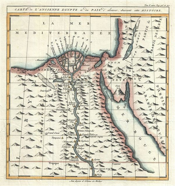
Carte de L'Ancienne Egypte et des Pais d'alentour, Suivant cette Histoire.
sold
- Digital Map Information
- Suitable for large format printing
- DPI: 300
- File Size: 4.67 MB
- File Type: ZIP / TIFF
- ICC color profile embedded
- Delivered instantly via download link
This is a fascinating and beautifully engraved example of Jacques Benigne Bossuet's c. 1750 map of ancient Egypt. Centered on the Nile River Delta, the map covers Egypt and part of Arabia and the Red Sea. Several ancient towns and oases along ... (more details)
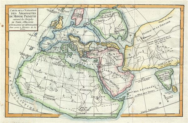
Carte de la Navigation des Argonautes du monde Primitif suivant les periples de Timee, d'Hecatee, d'Apollonius et d'Onomacrite Pour servir a l'Histoire de la Greece.
sold
- Digital Map Information
- Suitable for large format printing
- DPI: 300
- File Size: 4.32 MB
- File Type: ZIP / TIFF
- ICC color profile embedded
- Delivered instantly via download link
This is a fascinating example of Jean-Baptiste-Claude Delisle de Sales' map 1770 of the Ancient World. Is as much as it was understood by ancient Greek Geographicus, Delisle de Sales' map depicts the entire world and follows the journeys of ... (more details)
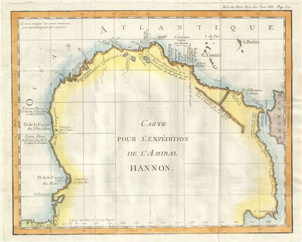
Carte pour l'Expedition de l'Amiral Hannon.
sold
- Digital Map Information
- Suitable for large format printing
- DPI: 300
- File Size: 2.25 MB
- File Type: ZIP / TIFF
- ICC color profile embedded
- Delivered instantly via download link
This is a fascinating example Jean-Baptiste-Claude Delisle de Sales' 1770 map of western Africa. Oriented to the west, this map covers northwest Africa from the coast of Benin to the Mediterranean Sea. This map depicts the journey of the ... (more details)

Carte de l'Inde Primitive.
sold
- Digital Map Information
- Suitable for large format printing
- DPI: 300
- File Size: 3.91 MB
- File Type: ZIP / TIFF
- ICC color profile embedded
- Delivered instantly via download link
This is a fascinating example of the 1770 Jean-Baptiste-Claude Delisle de Sales' map of India. It depicts India during ancient times, as described by the Greek explorer and ethnographer Megasthenes in his work Indica . The map covers ... (more details)

Carte de la Sicile, pour servir a l'Histoire de la Grece.
sold
- Digital Map Information
- Suitable for large format printing
- DPI: 300
- File Size: 4.25 MB
- File Type: ZIP / TIFF
- ICC color profile embedded
- Delivered instantly via download link
This is a beautiful example of the 1770 Jean-Baptiste-Claude Delisle de Sales' map of Sicily. It covers the Mediterranean Island in its entirety nearby Malta. Sicily became a Greek colony around 750 BC. Syracuse, identified in this ... (more details)

Carte de l'Assyrie Pour servir a l'Histoire des trois Monarchiea de Ninive, de Babylone et d'Ecbatane.
sold
- Digital Map Information
- Suitable for large format printing
- DPI: 300
- File Size: 4.09 MB
- File Type: ZIP / TIFF
- ICC color profile embedded
- Delivered instantly via download link
This is a beautiful example of the 1770 Jean-Baptiste-Claude Delisle de Sales' map of ancient Assyria. Essentially a map of the entire Middle East and Persia, this map covers from the Black Sea to the Gulf of Oman and from the ... (more details)
One of the most beautiful, important, and enduring maps of Manhattan ever published.
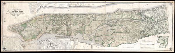
Topographical Atlas of the City of New York including the Annexed Territory, Showing original water courses and made land.
sold
- Digital Map Information
- Suitable for large format printing
- File Size: 9.68 MB
- File Type: ZIP / TIFF
- ICC color profile embedded
- Delivered instantly via download link
One of the scarcest, most important and most enduring maps of New York City ever published, this is the 1874 edition of Egbert L. Viele's topography and waterways map of Manhattan. Viele first issued this map in 1864. Nearly ... (more details)
One of the rarest and most desirable U.S. Coast Survey maps of the Chesapeake Bay.
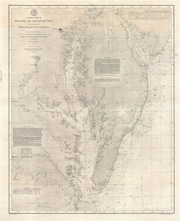
General Chart of Delaware and Chesapeake Bays and the Sea Coast from Cape May to Cape Henry.
sold
- Digital Map Information
- Suitable for large format printing
- File Size: 34.49 MB
- File Type: ZIP / TIFF
- ICC color profile embedded
- Delivered instantly via download link
An extraordinary 1882 U.S. Coast Survey nautical chart or maritime map of the Chesapeake Bay and Delaware Bay. This is one of the rarest and most desirable charts issued by the U.S. Coast Survey. Centered in the Chesapeake ... (more details)
Awe inspiring nautical chart of th north Pacific Ocean.
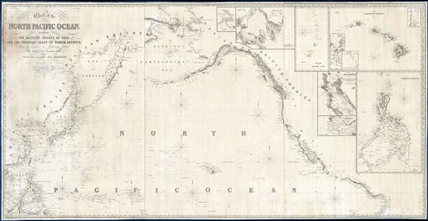
Chart of the North Pacific Ocean, Exhibiting the Eastern Shores of Asia and the Western Coast of North America from the Equator to Behring's Strait with plan, on an enlarge scale, of the Principal Island and Harbours.
sold
- Digital Map Information
- Suitable for large format printing
- DPI: 300
- File Size: 86.53 MB
- File Type: ZIP / TIFF
- ICC color profile embedded
- Delivered instantly via download link
A spectacular and massive 1849 James Imray nautical chart or maritime map of the northern Pacific. Roughly centered on Hawaii, this sprawling chart covers from Hainan and Borneo eastwards to Columbia and Panama, and from the Behring Strait to the Moluccas and the Galapagos Islands (the Equator). The chart is rendered on a Mercator Projection with latitude measured from Greenwich, England. Like most nautical charts, the cartographer offers very little inland detail, but a wealth of maritime data. This includes the identification of various ports and harbors, coastal topography, shoals and other undersea dangers, and countless depth soundings in fathoms. Additionally, the cartographer has noted aspects of various islands that may have been of importance to the mariner, for example Christmas Island has 'Plenty of Turtle, no fresh Water.'
This map is decorated with ten inset maps, from top center, Victoria Harbor (British Columbia), Awatska Bay on the east coast of Kamtschatka, the Mariana or Ladrones Islands (including Guam), the Hawaiian or Sandwich Islands (with four sub-insets: Waiakea or Byron Bay, Hanalei Bay (Kauai), Honolulu Harbor, and Kailua Bay), San Francisco Bay, the Mouth of the Columbia River (including the Fort Astoria settlement), and the Philippine Islands. (more details)
This map is decorated with ten inset maps, from top center, Victoria Harbor (British Columbia), Awatska Bay on the east coast of Kamtschatka, the Mariana or Ladrones Islands (including Guam), the Hawaiian or Sandwich Islands (with four sub-insets: Waiakea or Byron Bay, Hanalei Bay (Kauai), Honolulu Harbor, and Kailua Bay), San Francisco Bay, the Mouth of the Columbia River (including the Fort Astoria settlement), and the Philippine Islands. (more details)
One of the earliest and most important nautical charts showing Singapore Island.

The South Part of the Straits of Malacca inscribed to Captn. G. G. Richardson, by Captn. J. Lindsey.
sold
- Digital Map Information
- Suitable for large format printing
- DPI: 300
- File Size: 27.17 MB
- File Type: ZIP / TIFF
- ICC color profile embedded
- Delivered instantly via download link
An exceptionally scarce and important 1798 nautical map of the Malacca and Singapore Straits by the English maritime publishers Robert Laurie and James Whittle. This spectacular chart covers the southern tip of the Malay ... (more details)
The first edition of one of the best known maps of Victorian London.
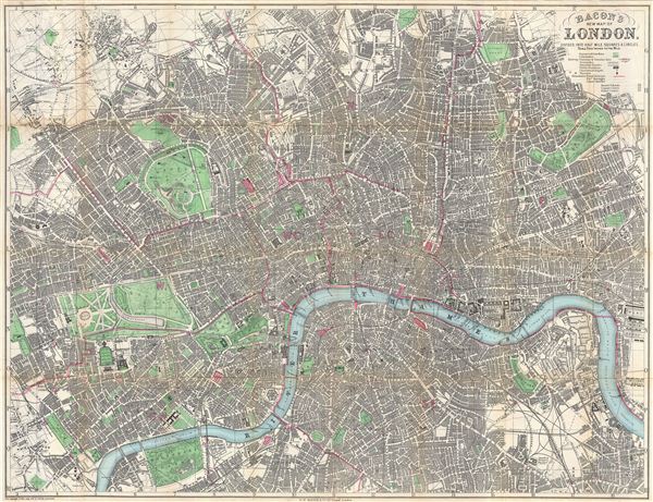
Bacon's New Map of London, Divided into Half Mile Squares & Circles.
sold
- Digital Map Information
- Suitable for large format printing
- File Size: 44.51 MB
- File Type: ZIP / TIFF
- ICC color profile embedded
- Delivered instantly via download link
A scarce 1876 first edition map of London by G. W. Bacon. Centered on the Thames River, the map covers from Hampstead to the West India Docks and from Camberwell to Notting Hill. It is divided into both a grid of 1/2 ... (more details)
One of the rarest and most desriable U.S. Coast Survey maps of the Chesapeake Bay.
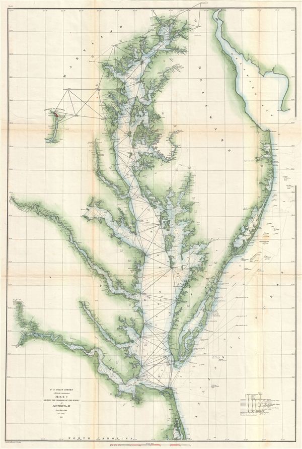
Sketch C Showing the Progress of the Survey in Section No. III From 1842 to 1860.
sold
- Digital Map Information
- Suitable for large format printing
- File Size: 21.71 MB
- File Type: ZIP / TIFF
- ICC color profile embedded
- Delivered instantly via download link
This is an exceptional example of the 1860 U.S. Coast Survey's progress chart of the Chesapeake Bay. The map covers from the mouth of the Susquehanna River southwards as far as Cape Henry and Norfolk. This chart ... (more details)
A classic view of Boston.

Bird's Eye View of Boston Harbor and South Shore to Provincetown Showing Steamboat Routes.
sold
- Digital Map Information
- Suitable for large format printing
- File Size: 8.41 MB
- File Type: ZIP / TIFF
- ICC color profile embedded
- Delivered instantly via download link
A remarkable chromolithograph map and view of Boston Harbor from Boston to Provincetown. The view includes all of Cape Cod Bay, Quincy Bay and Dorchester Bay with the communities of Boston, East Boston, South ... (more details)