
'Graveyard of the Atlantic'.
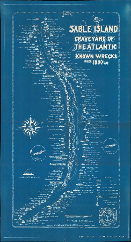
Sable Island Graveyard of the Atlantic Known Wrecks since 1800 A.D.
sold
- Digital Map Information
- Suitable for large format printing
- File Size: 94.79 MB
- File Type: ZIP / TIFF
- ICC color profile embedded
- Delivered instantly via download link
A striking 1948 cyanotype pictorial map of Sable Island, Nova Scotia, drawn by Donald S. Johnson. It highlights the very large number of shipwrecks that occurred around the island in the 19th and early 20th century, especially before the installation of lighthouses. (more details)
Spectacular first edition of an iconic Depression Era New York City view.
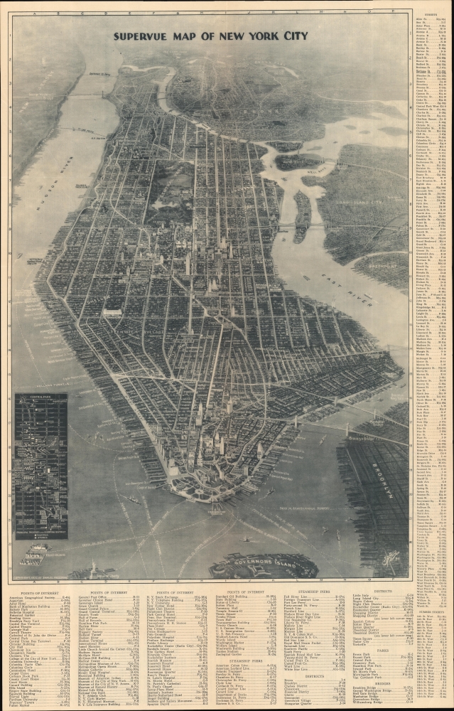
Supervue of New York.
sold
- Digital Map Information
- Suitable for large format printing
- Full resolution TIFF file
- ICC color profile embedded
- Delivered instantly via download link
This is a spectacular 1932 first edition Edward V. Spofford / Samuel Freedman bird's-eye 'Supervue' map of New York City. Despite being issued at the height of the Great Depression, this view highlights New York City's resilience, prosperity, and multicultural dynamism. (more details)
'Lafreri' map of Kefalonia
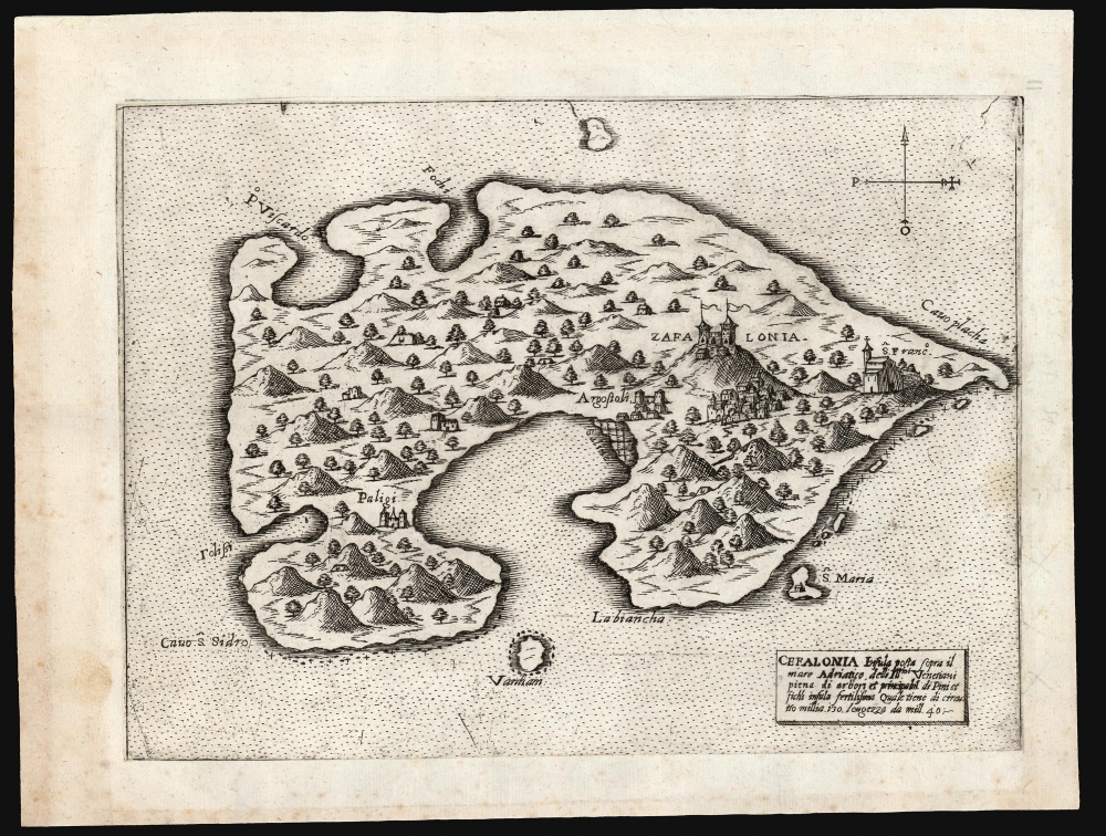
Cefalonia Insula posta sopra il mare Adriatico delli Ill.mi Venetiani piena di arbori et principalm.e di Pini et fichi insula fertilissima ...
sold
- Digital Map Information
- Suitable for large format printing
- DPI: 600
- File Size: 9.08 MB
- File Type: ZIP / TIFF
- ICC color profile embedded
- Delivered instantly via download link
This is a scarce, separately-issued Lafreri-type map of the Greek island of Kefalonia, produced in 1571 by the Venetian Giovanni Francesco Camocio. (more details)
Iconic pictorial map of the Hawaiian Islands by illustrator Joseph Feher.

The Dole Map of the Hawaiian Islands.
sold
- Digital Map Information
- Suitable for large format printing
- File Size: 134.28 MB
- File Type: ZIP / TIFF
- ICC color profile embedded
- Delivered instantly via download link
This is a 1950 Joseph Feher pictorial map of the Hawaiian Islands. The map depicts all eight of the major islands in the archipelago from Nihau and Kauai to Hawaii. Numerous illustrations populate the map evoking each island's unique qualities. Vignettes celebrating Hawaiian life, culture, and history are present, as are sailing ships from every era and even an airliner. Numerous tropical fish surround the archipelago, including a Humuhumunukunukuapuaa and a butterfly fish, along with an octopus and a moray eel. An index to the right details most of these illustrations. (more details)
Brilliant, data rich depiction of mid-century New York.

The City of New York.
sold
- Digital Map Information
- Suitable for large format printing
- File Size: 128.5 MB
- File Type: ZIP / TIFF
- ICC color profile embedded
- Delivered instantly via download link
This 1939 Richard Edes Harrison map of New York City - published in conjunction with the New York World’s Fair - represents a triumph of the visual display of quantitative information. Its aesthetic impact is all the more impressive in its clear expression of municipal and demographic data, making this a map of the people of New York City, as much as of the physical city itself. All five boroughs are represented in the primary map. On it, Harrison’s masterful use of vivid color to distinguish between residential, commercial, industrial, and federal use of land is clear yet supple, able to make distinction (for example) of low-income housing projects using the same palette. Parks and cemeteries both appear as green spaces, with white spots - evoking headstones - indicating the difference between the two. The two major airports (Floyd Bennett Field and North Beach Airport) are given their own color as well. The city’s industrial areas, shown in black, dominate the East River and Hudson coastlines, a reminder of the centrality of trade to the city’s development and history. (more details)
First Florida Land Boom.
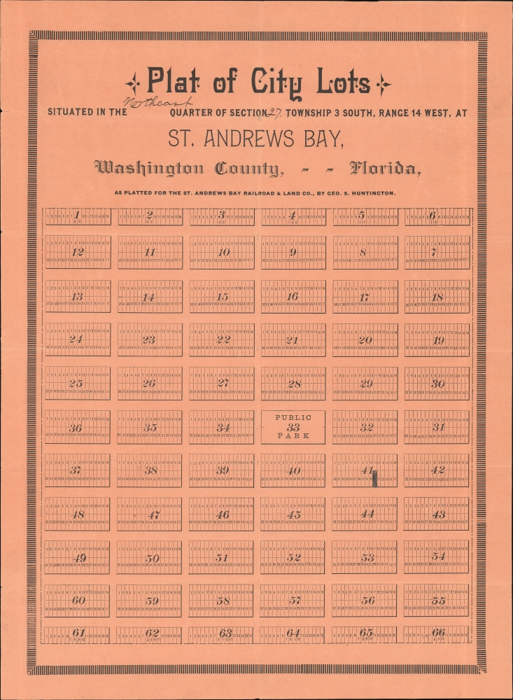
Plat of City Lots situated in the Northeast Quarter of Section 27, Township 3 South, Range 14 West, at St. Andrews Bay, Washington County, - - Florida.
sold
- Digital Map Information
- Suitable for large format printing
- File Size: 31.85 MB
- File Type: ZIP / TIFF
- ICC color profile embedded
- Delivered instantly via download link
An early c. 1886 George S. Huntington real estate plat of part of northeastern Panama City, Florida. The map was issued for the Cincinnati Ohio based Florida land speculation company, St. Andrew Bay Railroad and Land Company. (more details)
Land of Sunshine and Lunch

Welcome to Florida The Land of Sunshine.
sold
A decorative 1975 pictorial placemat map of Florida, designed and printed by Royal. (more details)
Printed in Montevideo while under siege!
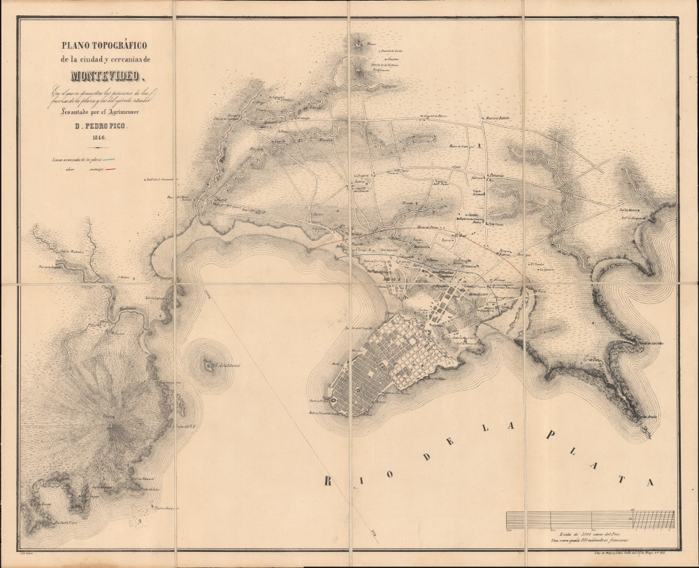
Plano Topográfico de la ciudad y cercanias de Montevideo.
sold
- Digital Map Information
- Suitable for large format printing
- DPI: 600
- File Size: 43.87 MB
- File Type: ZIP / TIFF
- ICC color profile embedded
- Delivered instantly via download link
This is an elegant and rare 1846 Pedro Pico map of Montevideo, Uruguay. It was published in Montevideo during the Great Siege of Montevideo during the Uruguayan Civil War (1839 - 1851). (more details)
Whimsical tribute to the oddities of New York.

Wonders of New York.
sold
- Digital Map Information
- Suitable for large format printing
- Full resolution TIFF file
- ICC color profile embedded
- Delivered instantly via download link
A production of the utmost weirdness, this is a fun-fact-filled 1953 pictorial map of New York City by the flamboyant Swedish-American artist Nils Birger Hansell. It is among the most interesting and desirable New York City pictorial maps. (more details)
American Whaling Capital.
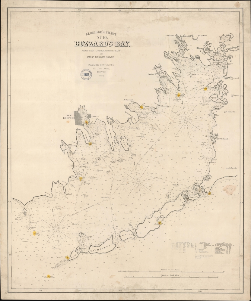
Eldridge's Chart No. 10. Buzzard's Bay, from the United States Coast and George Eldridge's Surveys.
sold
- Digital Map Information
- Suitable for large format printing
- File Size: 100.66 MB
- File Type: ZIP / TIFF
- ICC color profile embedded
- Delivered instantly via download link
This is a scarce, separately issued 1882 George Eldridge nautical map of Buzzard's Bay, Massachusetts. (more details)
Manuscript campaign map is more detailed than any known printed map of the Burma campaign.
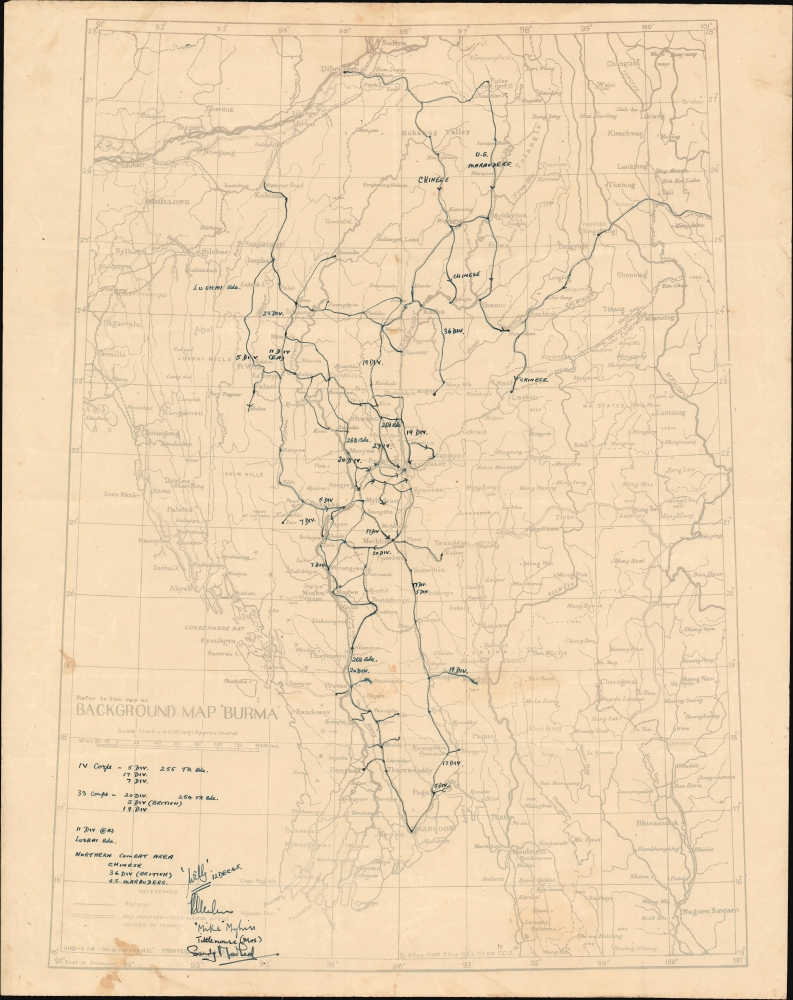
Background Map 'Burma'.
sold
- Digital Map Information
- Suitable for large format printing
- File Size: 14.51 MB
- File Type: ZIP / TIFF
- ICC color profile embedded
- Delivered instantly via download link
This is a 1943 Survey Department diazo / whiteprint map of Burma (Myanmar) during World War II featuring one-of-a-kind manuscript annotations. These annotations follow the advance of the 1944 – 1945 Allied campaign to recapture Burma from the Japanese and present a more detailed look at this scarcely remembered campaign than any contemporaneous printed map. (more details)
First Modern Atlas Map of the British Isles in its First State.
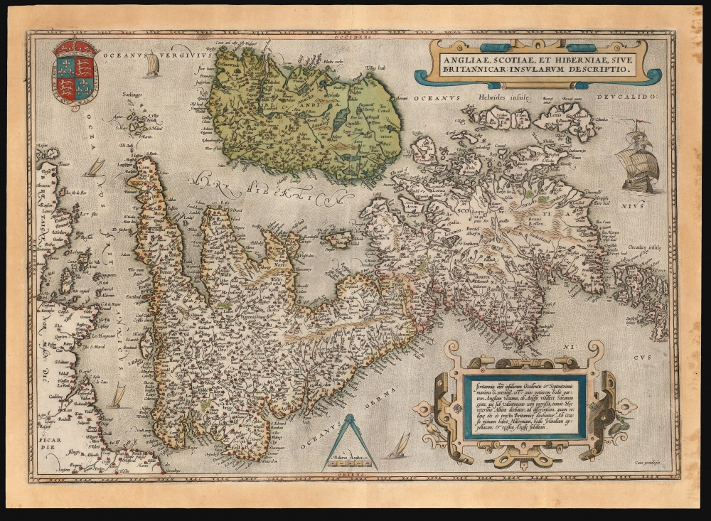
Angliae, Scotiae, et Hiberniae, Sive Britannicar: Insularum Descriptio.
sold
- Digital Map Information
- Suitable for large format printing
- Full resolution TIFF file
- ICC color profile embedded
- Delivered instantly via download link
This is Abraham Ortelius' 1570 map of the British Isles, the first atlas map of the British Isles, in a handsome example of the first state of the map, printed in 1571. (more details)
Last Days of the Silent Film Era in Hollywood.

Being A Map of Hollywood from the Best Surveys of the Time.
sold
A whimsical pictorial view of Hollywood at the end of the silent era by Harold Grieve, one of the great set designers of the era. Originally produced c. 1926, this example was issued c. 1970 and signed by Grieve in 1980. (more details)
Crescat scientia; vita excolatur.

University of Chicago.
sold
- Digital Map Information
- Suitable for large format printing
- File Size: 62.61 MB
- File Type: ZIP / TIFF
- ICC color profile embedded
- Delivered instantly via download link
This is a scarce 1906 Richard Rummell view of the University of Chicago, in a brilliant full-color example. (more details)
Essential Colorado map.
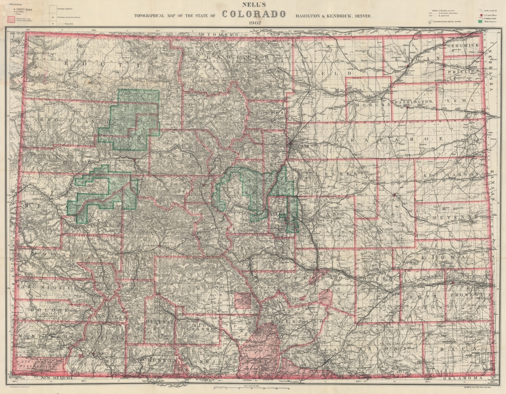
Nell's Topographical Map of the State of Colorado.
sold
- Digital Map Information
- Suitable for large format printing
- File Size: 203.08 MB
- File Type: ZIP / TIFF
- ICC color profile embedded
- Delivered instantly via download link
A beautiful example of the 1902 edition of Louis Nell's important topographical map of Colorado, considered the best commercial map of Colorado at the time of publication. (more details)
From farmland to professional suburb.
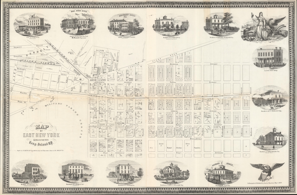
Map of East New York Kings County Long-Island NY.
sold
- Digital Map Information
- Suitable for large format printing
- File Size: 888.7 MB
- File Type: ZIP / TIFF
- ICC color profile embedded
- Delivered instantly via download link
This is the only known surviving example of an 1859 real-estate promotional map for East New York, Brooklyn, published by Charles W. Heitkamp. The map, printed and published by residents, captures the moment of East New York's transition from an agricultural community on the outskirts of Brooklyn to a German-American suburb well connected to major public transportation arteries. (more details)
World of the ThunderCats!

Third Earth.
sold
A scarce 6-part map of Third Earth, the refugee world setting of Marvel's ThunderCats. (more details)
'Tropical Florida's First Resort'.
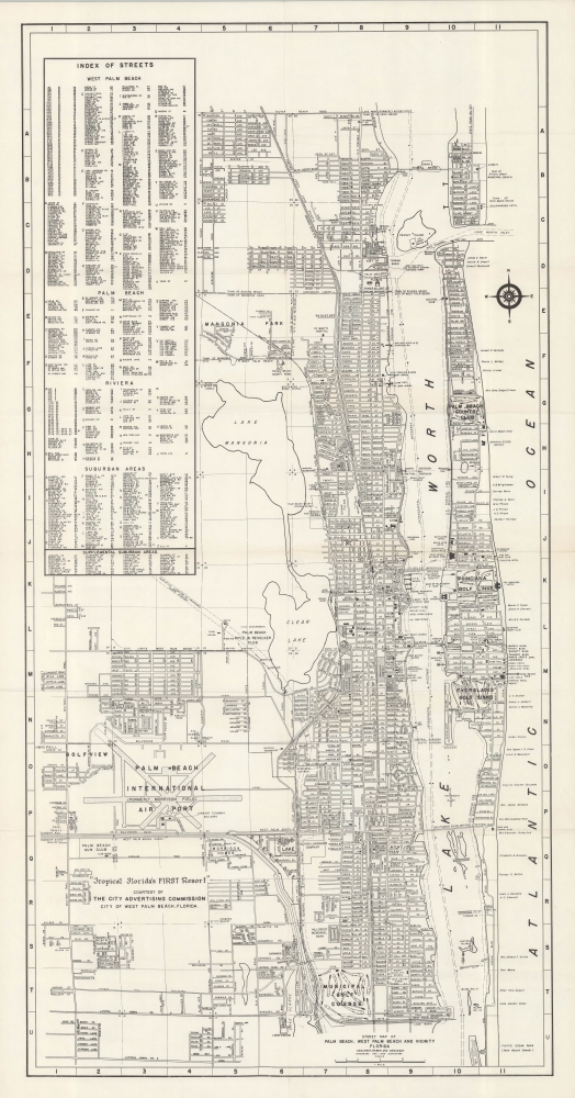
Street Map of Palm Beach, West Palm Beach an Vicinity Florida.
sold
This is a c. 1951 George Samuel Brockway map of Palm Beach and West Palm Beach, Florida. It was issued during the post-WWII heyday of Palm Beach's lavish opulence as a resort high society. (more details)
Stunning archipelago in Washington.

San Juan Islands, Washington.
sold
This is a 1981 Sharon Schumacher pictorial map of the San Juan Islands, Washington. The San Juan Islands are an enchanting archipelago of some 400 islands nestled between the mainland and Vancouver Island, British Columbia. (more details)
First edition of an iconic Vermont map.
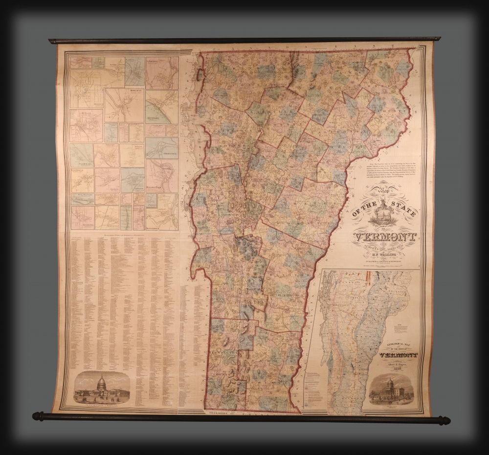
Map of the State of Vermont from Surveys Under the Direction of H. F. Walling.
sold
This is the extremely scarce 1859 first edition of H. F. Walling's spectacular wall map of Vermont, jointly published with 'Johnson and Browning'. It was the largest-scale and most accurate map of Vermont when it was issued, subsequently as the cartographic basis for two decades of Vermont maps. (more details)