

Asia.
sold
- Digital Map Information
- Suitable for large format printing
- DPI: 300
- File Size: 3.98 MB
- File Type: ZIP / TIFF
- ICC color profile embedded
- Delivered instantly via download link
A beautiful little production this is John Cary's 181 map of Asia. Centered on Tartary, Cary's map covers Asia from the Mediterranean Sea to Papua New Guinea. Includes the Peros Banhos Islands in the Indian Ocean. Identifies the Great Wall of China. 'Great ... (more details)
Identifies the Sea of Korea.

Siberia & Central Asia.
sold
- Digital Map Information
- Suitable for large format printing
- DPI: 300
- File Size: 4.48 MB
- File Type: ZIP / TIFF
- ICC color profile embedded
- Delivered instantly via download link
This is a fine example of the 1835 T. G. Bradford map of Siberia and Central Asia. Centered on the supposed site of the ancient Mongolian capital at Karakorum, this map extends from the Ural Mountains and the Caspian Sea eastward as far as Siberia, Kamchatka ... (more details)
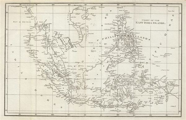
Chart of the East India Islands.
sold
- Digital Map Information
- Suitable for large format printing
- DPI: 300
- File Size: 6.77 MB
- File Type: ZIP / TIFF
- ICC color profile embedded
- Delivered instantly via download link
This is a fine example of the 1804 A. Arrowsmith map of the east Indies. Covers from the southern tip of Taiwan (Formosa) to the Indonesian island of Timor and from the Andaman and Nicobar Islands in the Indian Ocean as far east as Papua New Guinea. ... (more details)
Great Salt Lake identifed according to American Indian reports as 'Pearl Shell Lake'.
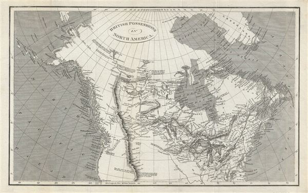
British Possessions in North America.
sold
- Digital Map Information
- Suitable for large format printing
- DPI: 300
- File Size: 9.16 MB
- File Type: ZIP / TIFF
- ICC color profile embedded
- Delivered instantly via download link
This is a fine example of the 1809 A. Arrowsmith map of the British possessions in North America, or Canada. Covers Canada, Alaska, and part of the United States from the Baffin Bay south as far as San Francisco - then an insignificant Spanish ... (more details)
Deatails Alabama shortly following the Trail of Tears and the Indian Removal Act.
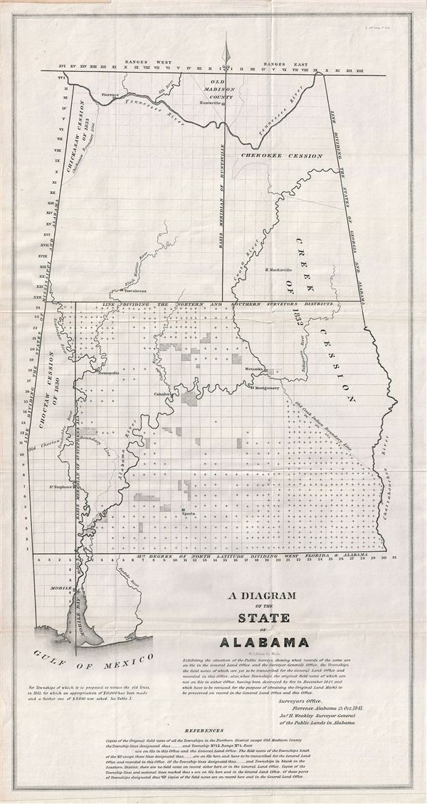
A Diagram of the State of Alabama.
sold
- Digital Map Information
- Suitable for large format printing
- DPI: 300
- File Size: 8.51 MB
- File Type: ZIP / TIFF
- ICC color profile embedded
- Delivered instantly via download link
This is a fine example of the 1841 public survey map of the Alabama, representing the work of the Alabama Land Survey as of October 1841. The map covers the entire state of Alabama from Old Madison County to the Gulf of Mexico and includes the ... (more details)
One of the largest and most impressive maps of England to appear in the 19th century.
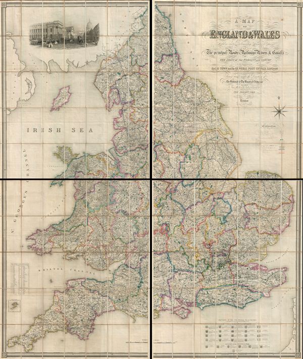
A Map of England and Wales, divided into counties, parliamentary divisions and dioceses : shewing the principal roads, railways, rivers and canals, and the seats of the nobility and gentry with the distance of each town from the General Post Office, London.
sold
- Digital Map Information
- Suitable for large format printing
- File Size: 26.5 MB
- File Type: ZIP / TIFF
- ICC color profile embedded
- Delivered instantly via download link
A striking and monumental 1846 map of England by Samuel Lewis. Lewis issued this map to accompany his Topographical Dictionary of England , first published in 1831. In four large sections, this map covers all of England as well as parts of ... (more details)
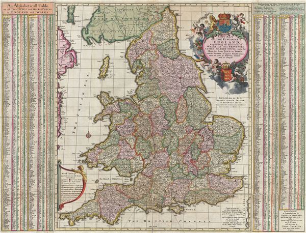
A New Mapp of the Kingdome of England, Representing the Princedome of Wales, and other Provinces, Cities, Market Towns, with the Roads from Town to Town.
sold
- Digital Map Information
- Suitable for large format printing
- DPI: 300
- File Size: 31.03 MB
- File Type: ZIP / TIFF
- ICC color profile embedded
- Delivered instantly via download link
A fine c. 1695 old color example of the deluxe John Overton edition of Visscher's stunning map of england and Wales. Constructed on the model established by the John Adams map of 1679, Anglia Totius Tabula , Visscher's map covers all of ... (more details)

Anglia, Scotia et Hibernia.
sold
- Digital Map Information
- Suitable for large format printing
- DPI: 300
- File Size: 13.14 MB
- File Type: ZIP / TIFF
- ICC color profile embedded
- Delivered instantly via download link
A beautiful old color example of the Mercator Hondius map of the British Isles. This map was first issued in 1595, one year after Mercator's death. Mercator's plates were acquired by Jodocus Hondius who, in 1606, issued the first ... (more details)
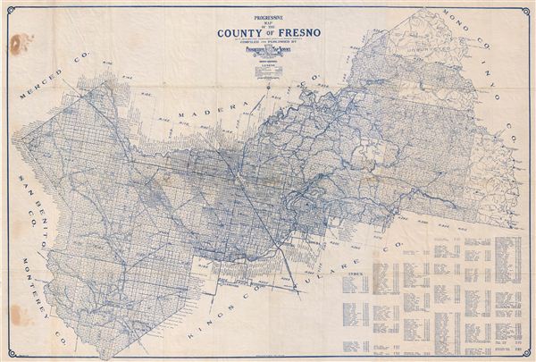
Progressive Map of the County of Fresno.
sold
- Digital Map Information
- Suitable for large format printing
- File Size: 30.62 MB
- File Type: ZIP / TIFF
- ICC color profile embedded
- Delivered instantly via download link
An appealing c. 1920 map of Fresno County, California by the Progressive Map Service. Printed in blue ink, this pocket map covers all of Fresno County broken up into land plats by the state survey. The city of Fresno is located at ... (more details)
Identifies competing sites for the 1893 Columbian Exposition or Chicago World's Fair.
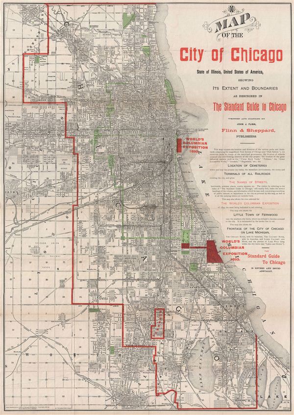
Map of the City of Chicago, State of Illinois, United States of America, showing Its Extent and Boundaries as Described in The Standard Guide to Chicago.
sold
- Digital Map Information
- Suitable for large format printing
- File Size: 20.72 MB
- File Type: ZIP / TIFF
- ICC color profile embedded
- Delivered instantly via download link
A fine decorative map of Chicago issued in 1890 for issue in various editions of the Standard Guide to Chicago . This excellent map covers Chicago from Church Road in the north to Wolf Lane in the south, and from the suburbs of ... (more details)

Carte Pittoresque Des Environs de Paris.
sold
- Digital Map Information
- Suitable for large format printing
- File Size: 33.83 MB
- File Type: ZIP / TIFF
- ICC color profile embedded
- Delivered instantly via download link
An appealing c. 1870 pictorial map of the environs of Paris by A. Vuillemin. Centered on the embastilled center of Paris, this map overs from St. Pierre in the northwest to Chartres in the southwest to Oulchy in the northeast ... (more details)
Massive blueblack Nautical Chart of the southeastern United States coastline.

[Chesapeake Bay to Cuba]
sold
- Digital Map Information
- Suitable for large format printing
- File Size: 80.38 MB
- File Type: ZIP / TIFF
- ICC color profile embedded
- Delivered instantly via download link
A massive four panel 1861 Edmund Blunt blueback nautical chart or maritime map covering the southeastern coast of the United States from the entrance to the Chesapeake Bay to Florida and Cuba, including Virginia, North Carolina, South Carolina, and Georgia coasts. This highly detailed chart is a fine example of Blunt's work offering limited inland detail but a wealth of nautical information including countless depth soundings, light houses, shore lines, river soundings, shipping lanes, and other practical information for the mariner. Although mostly focused on the southeastern United States, the leftmost map or southern sheet, extends to cover Cuba and offers an excellent inset of Havana. (more details)
The largest and most detailed map of New Jersey to appear in the 19th century - a seminal production.
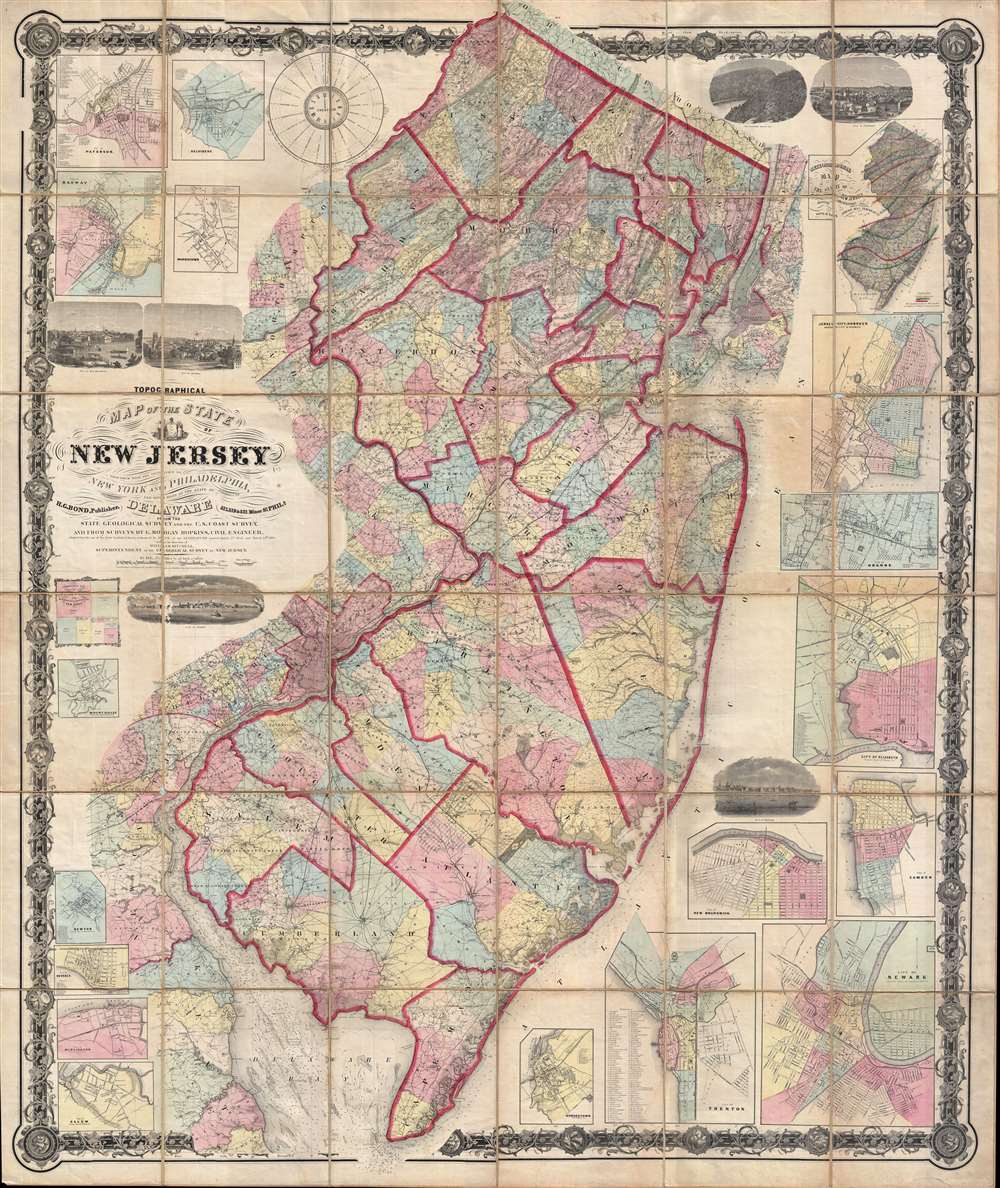
Topographical map of the State of New Jersey together with the vicinities of New York and Philadelphia, and with most of the state of Delaware from the State Geological Survey and the U.S. Coast Survey, and from surveys by G. Morgan Hopkins, civil engineer.
sold
- Digital Map Information
- Suitable for large format printing
- File Size: 166.59 MB
- File Type: ZIP / TIFF
- ICC color profile embedded
- Delivered instantly via download link
Magnificently detailed, visually stunning, and monumentally proportioned, this is William Kitchell's seminal 1860 case map of New Jersey. Dissected and mounted on thirty-six linen backed panels, this map covers the entire ... (more details)
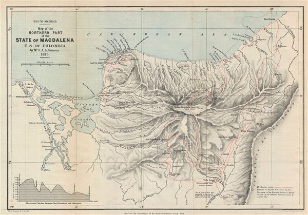
South America. Map of the Northern Part of the State of Magdalena U.S. of Colombia.
sold
- Digital Map Information
- Suitable for large format printing
- File Size: 4.8 MB
- File Type: ZIP / TIFF
- ICC color profile embedded
- Delivered instantly via download link
This is a fine example of the 1879 Stanford map of northern Magdalena, Colombia. The map covers the northern part of the State of Magdalena (now Department of Magdalena). A horizontal section between San Sebastian and ... (more details)
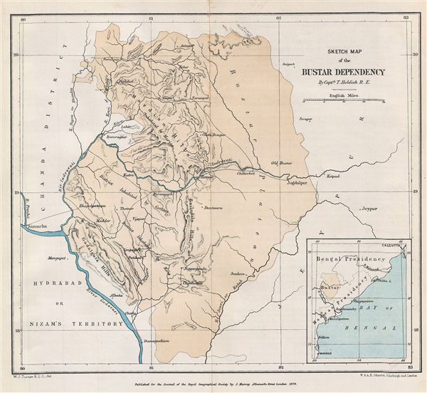
Sketch Map of the Bustar Dependency.
$150.00
Acquire
- Digital Map Information
- Suitable for large format printing
- File Size: 1.82 MB
- File Type: ZIP / TIFF
- ICC color profile embedded
- Delivered instantly via download link
This is a fine example of the 1879 Stanford Map of the Bustar Dependency (Bastar State) in central India. Centered on the Indravati River, the map covers from Chanda District in Hyderabad to the Jeypur estate (Jeypore) ... (more details)

Map of the Bamangwato Country to Illustrate Captn. Patterson's Paper.
sold
- Digital Map Information
- Suitable for large format printing
- File Size: 2.8 MB
- File Type: ZIP / TIFF
- ICC color profile embedded
- Delivered instantly via download link
This is a fascinating example of the 1879 Stanford Map of the territory of the Bamangwato (BamaNgwato) people of Botswana, Southern Africa. Centered on the Makarikari Salt Lake, this map covers from Lake Ngami to Fura ... (more details)
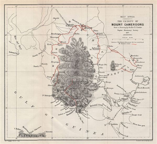
West Africa. The Vicinity of Mount Cameroons.
sold
- Digital Map Information
- Suitable for large format printing
- File Size: 2.65 MB
- File Type: ZIP / TIFF
- ICC color profile embedded
- Delivered instantly via download link
This is a fine example of the 1877 Stanford Map of Mount Cameroons and vicinity, West Africa. Centered over Mount Cameroon, the map covers from Rio del Rey to the Fernando Po (Bioko) Island. Based on the Drawing of ... (more details)

Physical Map of Madagascar.
sold
- Digital Map Information
- Suitable for large format printing
- File Size: 1.76 MB
- File Type: ZIP / TIFF
- ICC color profile embedded
- Delivered instantly via download link
This is a fine example of the 1879 Stanford physical map of Madagascar. Stanford's map covers the entire island country from Cape Amber to Cape St. Mary. It includes the Comoros Islands of Great Comoro (Grande ... (more details)

Hawaiian Islands Oahu to Niihau.
sold
- Digital Map Information
- Suitable for large format printing
- File Size: 36.08 MB
- File Type: ZIP / TIFF
- ICC color profile embedded
- Delivered instantly via download link
This is an uncommon 1948 nautical chart or maritime map of the Hawaiian Islands from Oahu to Niihau, including the islands of Niihau and Kauai, as well as part of Oahu. Offers some inland detail as well ... (more details)

Martha's Vineyard to Block Island Including Buzzards and Narragansett Bays.
sold
- Digital Map Information
- Suitable for large format printing
- File Size: 34.91 MB
- File Type: ZIP / TIFF
- ICC color profile embedded
- Delivered instantly via download link
This is an uncommon 1958 U. S. Coast and Geodetic Survey map or chart of Martha's Vineyard to Block Island. Covers from Buzzards Bay to Narragansett Bay. Offers some inland detail as well including ... (more details)