

Carte de L'Isle de Ceylan.
sold
- Digital Map Information
- Suitable for large format printing
- Full resolution TIFF file
- ICC color profile embedded
- Delivered instantly via download link
The Dezauche issue of Guillaume de L'Isle's fine map of Ceylon or Sri Lanka. A fine example of De L'Isle's work this map covers the entire island of Ceylon as well as the surrounding seas and parts of adjacent India. As this map was issued control of Ceylon and ... (more details)
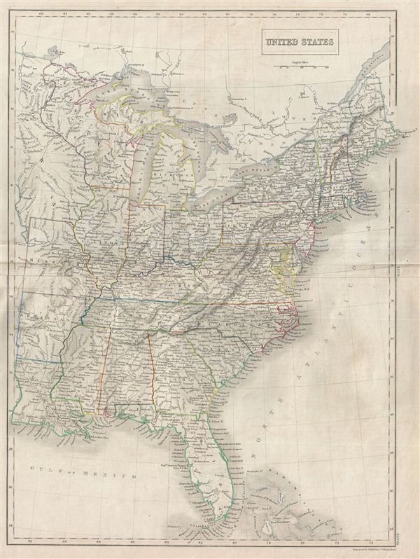
United States.
sold
- Digital Map Information
- Suitable for large format printing
- Full resolution TIFF file
- ICC color profile embedded
- Delivered instantly via download link
A fine example of Adam and Charles Black's 1840 map of the United States. Covers the populous eastern portions of the United States from Lake Superior in the north to the Bahamas in the south and from Missouri in the west to Maine in the east. The United States ... (more details)

Italy, South Part.
sold
- Digital Map Information
- Suitable for large format printing
- DPI: 300
- File Size: 6.17 MB
- File Type: ZIP / TIFF
- ICC color profile embedded
- Delivered instantly via download link
A fine example of Adam and Charles Black's 1840 map of southern Italy. The map covers the Kingdom of Naples of the Two Sicilies which extended from the Papal States south to include all of Sicily. It also shows the islands of Sardinia and part of the Island of ... (more details)
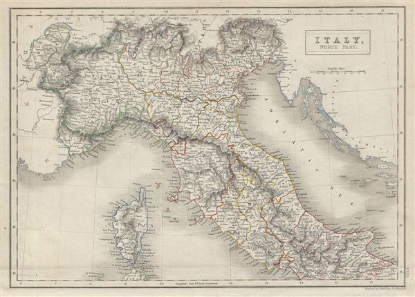
Italy, North Part.
sold
- Digital Map Information
- Suitable for large format printing
- DPI: 300
- File Size: 6.7 MB
- File Type: ZIP / TIFF
- ICC color profile embedded
- Delivered instantly via download link
A fine example of Adam and Charles Black's 1840 map of northern Italy. The map covers the island of Corsica and Northern Italy, depicting the regions of Tuscany, Modena, Parma, the Sardinian States, Venetian Lombardy, the States of the Church, and Corsica. It ... (more details)
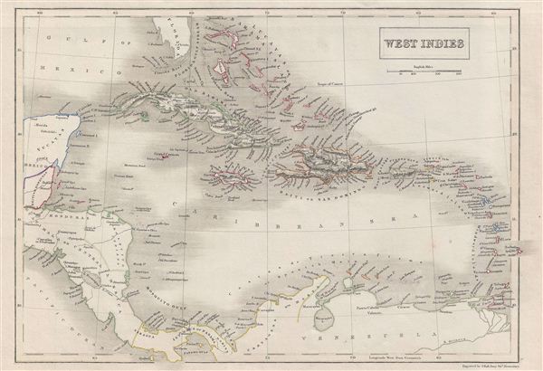
West Indies.
sold
- Digital Map Information
- Suitable for large format printing
- DPI: 300
- File Size: 6.21 MB
- File Type: ZIP / TIFF
- ICC color profile embedded
- Delivered instantly via download link
A fine example of Adam and Charles Black's 1840 map of West Indies. Centered on Hispaniola, the map covers the Caribbean from Florida to Venezuela and from Yucatan to the Lesser Antilles and Barbados. It includes the Bahamans, Cuba, Jamaica, Haiti and Santo ... (more details)

South America.
sold
- Digital Map Information
- Suitable for large format printing
- DPI: 300
- File Size: 6.75 MB
- File Type: ZIP / TIFF
- ICC color profile embedded
- Delivered instantly via download link
A fine example of Adam and Charles Black's 1840 map of South America. The map covers the entire continent from the Panama Canal to the Falkland and the South Georgia Islands. It includes Colombia, Guiana, Brazil, Peru, Bolivia, Paraguay, La Plata, Patagonia ... (more details)
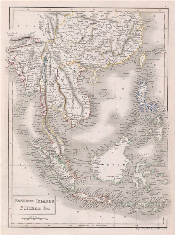
Eastern Islands Birmah & C.
sold
- Digital Map Information
- Suitable for large format printing
- DPI: 300
- File Size: 7.04 MB
- File Type: ZIP / TIFF
- ICC color profile embedded
- Delivered instantly via download link
A fine example of Adam and Charles Black's 1840 map of the east Indies, Southeast Asia, and the Philippines. Includes modern day nations of Myanmar (Burma), Laos, Vietnam, Cambodia, Thailand, Malaysia, Indonesia, the Philippines and parts of China. During ... (more details)
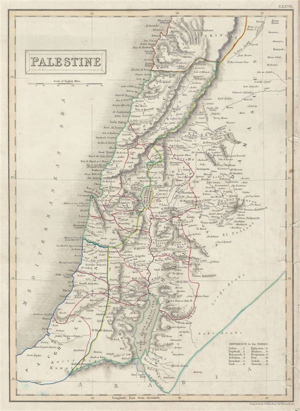
Palestine.
sold
- Digital Map Information
- Suitable for large format printing
- DPI: 300
- File Size: 5.68 MB
- File Type: ZIP / TIFF
- ICC color profile embedded
- Delivered instantly via download link
A fine example of Adam and Charles Black's 1840 map of Palestine or Israel or the Holy Land. The map shows the administrative divisions of the Ottoman empire which include the Pachalic of Gaza, Pachalic of Acre, Pachalic of Damascus and part of the ... (more details)
Drawn during the period of the Texas Rpublic
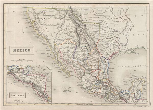
Mexico.
sold
- Digital Map Information
- Suitable for large format printing
- DPI: 300
- File Size: 6.22 MB
- File Type: ZIP / TIFF
- ICC color profile embedded
- Delivered instantly via download link
A fine example of Adam and Charles Black's 1840 map of Mexico and an Independent Texas. The map covers all of modern day Mexico as well as then pre-1846 Mexican territory in Upper California and a rebellious Texas. An inset map on the lower left ... (more details)

Canada, New Brunswick & C.
sold
- Digital Map Information
- Suitable for large format printing
- DPI: 300
- File Size: 6.58 MB
- File Type: ZIP / TIFF
- ICC color profile embedded
- Delivered instantly via download link
A fine example of Adam and Charles Black's 1840 map of Canada. The map covers from essex to Cape Breton Island in Nova Scotia (shown via inset at bottom center). It includes Upper (Ontario) and Lower (Quebec) Canada, New Brunswick, Nova Scotia ... (more details)
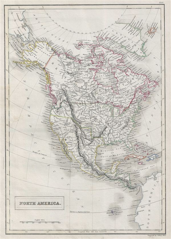
North America.
sold
- Digital Map Information
- Suitable for large format printing
- DPI: 300
- File Size: 7.16 MB
- File Type: ZIP / TIFF
- ICC color profile embedded
- Delivered instantly via download link
A fine example of Adam and Charles Black's 1840 map of North America. The map covers the continent from the North Georgian Islands in the Arctic Ocean to the Galapagos Islands in the North Pacific Ocean. Also covers Greenland and Iceland. ... (more details)
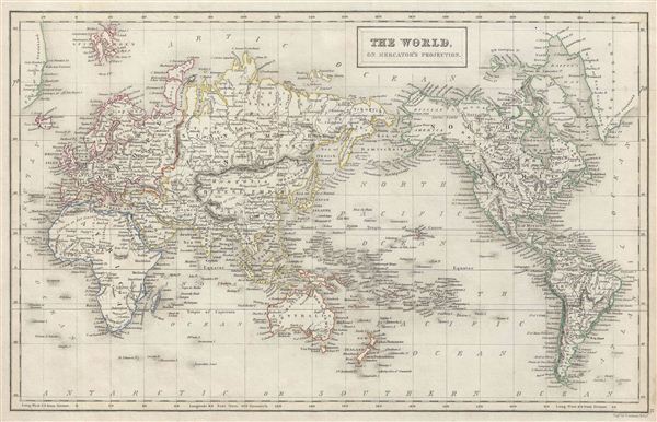
The World, on Mercator's Projection.
sold
- Digital Map Information
- Suitable for large format printing
- DPI: 300
- File Size: 6.73 MB
- File Type: ZIP / TIFF
- ICC color profile embedded
- Delivered instantly via download link
A fine example of Adam and Charles Black's 1840 map of the world on Mercator's Projection. An interesting map of the world issued just as most of the earth's non-polar shore has been explored. Gone are many of the errors of the previous ... (more details)
A monument to speculative cartography showing the Sea of the West and mythical discoveries of De Fonte.
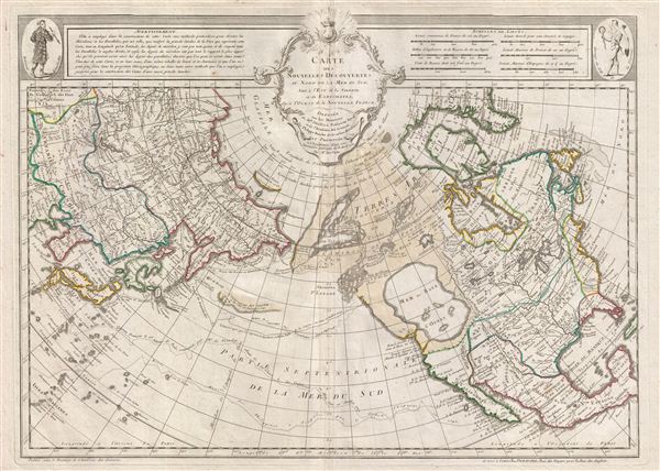
Carte Des Nouvelles Decouvertes au Nord de la Mer de Sud, tant a l'Est de la Syberie et du Kamtchatka, qu'a L'Ouest de la Nouvelle France.
sold
- Digital Map Information
- Suitable for large format printing
- DPI: 300
- File Size: 20.31 MB
- File Type: ZIP / TIFF
- ICC color profile embedded
- Delivered instantly via download link
The 1789 Dezauche edition of Joseph Nicolas De l'Isle's extraordinary 1752 map of North America, Siberia, the Arctic, and the North Pacific. J. N. De L'Isle and Buache drew this map to illustrate their speculations on the feasibly of a ... (more details)
Rare French map detailing the Golden Age of Caribbean Piracy.
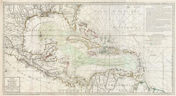
Carte du Golphe du Mexique et des isles Antilles.
sold
- Digital Map Information
- Suitable for large format printing
- DPI: 300
- File Size: 30.45 MB
- File Type: ZIP / TIFF
- ICC color profile embedded
- Delivered instantly via download link
A fine example of the 1780 Dezauche edition of Buache's important map of the West Indies. Centered on Cuba, this massive map covers Central America, the Gulf of Mexico, the West Indies, and the Caribbean from Mexico and Texas to the ... (more details)
Art deco style map of Paris, France.

sold
- Digital Map Information
- Suitable for large format printing
- File Size: 24.15 MB
- File Type: ZIP / TIFF
- ICC color profile embedded
- Delivered instantly via download link
This extremely appealing c. 1928 art deco style pocket map of Paris, France, combines the virtues of a map and a view. Covers the embastilled center of Paris and the immediate vicinity from Billancourt to Aubervilliers and from ... (more details)
Extremely scarce pocket map of the United States.
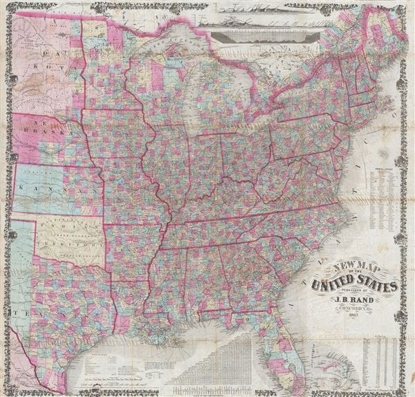
New Map of the United States.
sold
- Digital Map Information
- Suitable for large format printing
- File Size: 54.15 MB
- File Type: ZIP / TIFF
- ICC color profile embedded
- Delivered instantly via download link
An extremely 1867 rare pocket map of the United States issued in 1868 by J. B. Rand. Issued shortly following the close of the American Civil War, this large map covers the most inhabited parts of the United States from Texas, ... (more details)

Physical Geography.
sold
- Digital Map Information
- Suitable for large format printing
- DPI: 300
- File Size: 6.33 MB
- File Type: ZIP / TIFF
- ICC color profile embedded
- Delivered instantly via download link
A fine example of Adam and Charles Black's 1840 comparative mountains and rivers of the world chart. Charts of this time were first introduced in england around 1823 and became a common feature in atlases throughout the 19th ... (more details)

Philadelphia.
sold
- Digital Map Information
- Suitable for large format printing
- File Size: 10.7 MB
- File Type: ZIP / TIFF
- ICC color profile embedded
- Delivered instantly via download link
This is the uncommon 1857 issue of J. H. Colton's map or plan of Philadelphia. This scarce hand colored map is a lithographic plan covering the city of Philadelphia, divided into 24 districts or wards, between the western ... (more details)

Sweden and Norway.
sold
- Digital Map Information
- Suitable for large format printing
- File Size: 8.04 MB
- File Type: ZIP / TIFF
- ICC color profile embedded
- Delivered instantly via download link
This is the uncommon 1857 issue of J. H. ColtonÂ's map of Sweden and Norway. The map covers from the Arctic Ocean south to Denmark and east as far as the Gulf of Finland. It also includes the modern day nations of ... (more details)

Asia (physical).
sold
- Digital Map Information
- Suitable for large format printing
- File Size: 6.47 MB
- File Type: ZIP / TIFF
- ICC color profile embedded
- Delivered instantly via download link
A rare example of Colton's 1858 physical map of Asia. Centered over the Gobi Desert, the map depicts the physical geography of Asia from Arctic Ocean to the Indian Ocean and from europe and Africa to the Pacific ... (more details)