
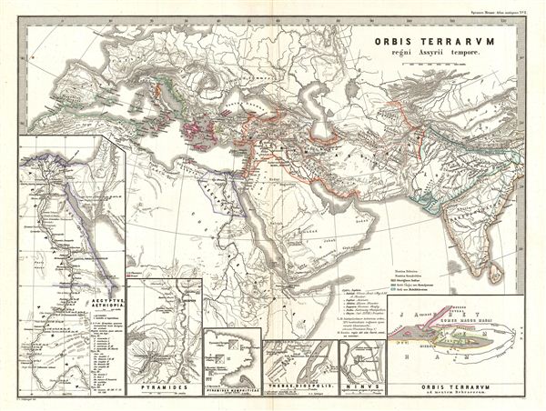
Orbis Terrarvm regni Assyrii tempore
sold
- Digital Map Information
- Suitable for large format printing
- File Size: 2.84 MB
- File Type: ZIP / TIFF
- ICC color profile embedded
- Delivered instantly via download link
This is Karl von Spruner's 1865 map, Orbis Terrarum Regni Assyrii Tempore, or, The World at the Time of the Assyrian Empire. The map features six inserts: (from left to right) Egypt and Ethiopia, the Pyramids, The Pyramids at Memphis (Gaza), Thebes, Nineveh, with ... (more details)
Significant pre-Cook first edition of Bellin's world map.
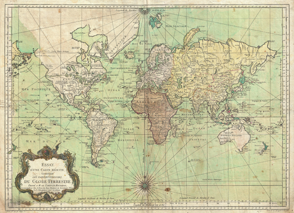
Essay d'une Carte Reduite, Contenant Les Parties Connuees du Globe Terrestre.
sold
- Digital Map Information
- Suitable for large format printing
- DPI: 300
- File Size: 76.97 MB
- File Type: ZIP / TIFF
- ICC color profile embedded
- Delivered instantly via download link
An attractive example of J. N. Bellin's 1778 nautical chart of the world. Presents the entire world on a Mercator Projection based on a Paris (L'Isle de Fer) meridian. While the map was initially composed and engraved in 1748, here it has been updated to ... (more details)
Highly unsual map of the world exhibiting speculative marine topography.
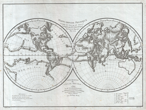
Mappe-Monde Physique d'Apres les Vues de Mr. Pallas Redigees par Mr. l'Abbe Mongez Journal de Physique, Mai, 1779.
sold
- Digital Map Information
- Suitable for large format printing
- Full resolution TIFF file
- ICC color profile embedded
- Delivered instantly via download link
This is a highly unusual 1779 map of the world exhibiting a very peculiar physical topography that reveals mountain ranges both on land and under the sea. The curious undersea mountain ranges displayed here was drawn by Abbe Mongez to illustrate the ... (more details)
Stunning pre Civil War map of South Carolina.
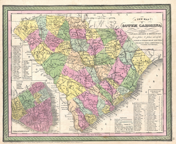
A New Map of South Carolina with its Canals, Roads & Distances from place to place along the stage & steam boat routes.
sold
- Digital Map Information
- Suitable for large format printing
- Full resolution TIFF file
- ICC color profile embedded
- Delivered instantly via download link
A fine example of Samuel Augustus MitchellÂ's important 1850 map of South Carolina. This map shows cities, topographical features, railways, ferries and roads with color coding at the county level. In addition to cartographic information this map ... (more details)
Reveals North Carolina's Gold Region.
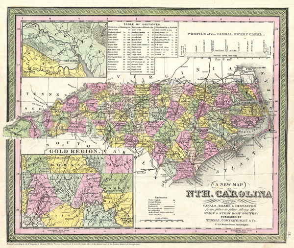
A New Map of Nth. Carolina with its Canals, Roads & Distances from place to place along the stage & steam boat routes.
sold
- Digital Map Information
- Suitable for large format printing
- DPI: 300
- File Size: 20.74 MB
- File Type: ZIP / TIFF
- ICC color profile embedded
- Delivered instantly via download link
A fine example of Samuel Augustus Mitchell's important 1850 map of North Carolina. This map shows cities, topographical features, railways, ferries and roads with color coding at the county level. In addition to cartographic information this map ... (more details)
Important 18th century map of the Ganges River, India, with Persian script.

Carte Generale du Cours du Gange et du Gagra, dressee sur les Cartes particulieres du P. Tiefentaller, J. Missionnaire Apostolique dans l'Inde.
sold
- Digital Map Information
- Suitable for large format printing
- Full resolution TIFF file
- ICC color profile embedded
- Delivered instantly via download link
A rare and remarkable discovery this is Joseph Tiefenthaler and Anquetil-Duperron's important 1784 map of the Ganges and Ghaghara (Karnali) river system. As a whole this map is a significant advancement over earlier mappings of this region as ... (more details)
Monumental 19th century wall map of Paris illustrating Haussmann’s “agrandissments”
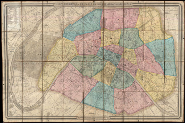
Plan Geometral de Paris et de Ses Agrandissements a l'Echelle d'un millimetre pour 10m. (1:10,000).
sold
- Digital Map Information
- Suitable for large format printing
- File Size: 85.25 MB
- File Type: ZIP / TIFF
- ICC color profile embedded
- Delivered instantly via download link
A stunning achievement, this 1860 map by Andriveau-Goujon is the largest folding map of Paris we have ever encountered. Measuring some 41 x 62 inches, this massive plan covers from Saint Cloud to Charenton, inclusive of the full curve of the ... (more details)
Dramatic large format map of the United States showing French and German colonies in Texas.
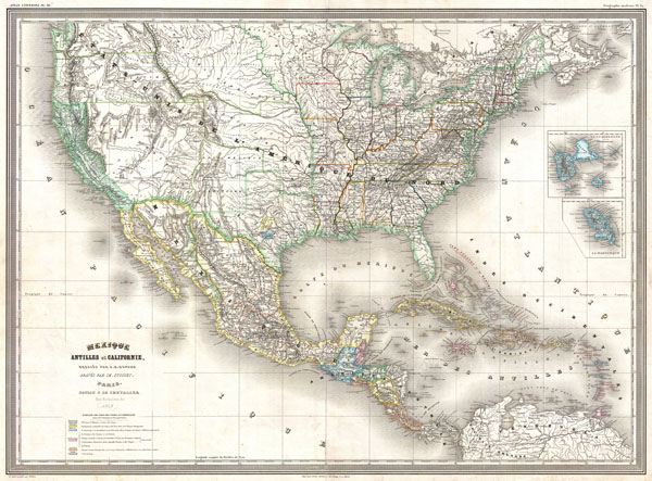
Mexique Antilles et Californie
sold
- Digital Map Information
- Suitable for large format printing
- File Size: 23.05 MB
- File Type: ZIP / TIFF
- ICC color profile embedded
- Delivered instantly via download link
A finely detailed large format 1858 map of the United States on Mercator's projection by the French cartographer A. H. Dufour. Convers the entirety of the United States during the brief period following the Gold Rush but before the outbreak ... (more details)
18th century French nautical chart of the Trincomalee, Ceylon or Sri Lanka.
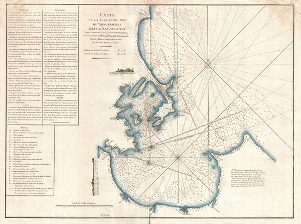
Carte de la Baye et du Port de Trinquemalay dans L'Isle de Ceylan.
$650.00
Acquire
- Digital Map Information
- Suitable for large format printing
- DPI: 300
- File Size: 14.24 MB
- File Type: ZIP / TIFF
- ICC color profile embedded
- Delivered instantly via download link
An extremely attractive large format 1775 maritime map or nautical chart of the port of Trincomalee, Ceylon (Sri Lanka) by Jean-Baptiste d'Après de Mannevillette. Trincomalee is natural deep water port on the east coast of Sri Lanka, about ... (more details)
18th century French nautical chart of the Ceylon or Sri Lanka.
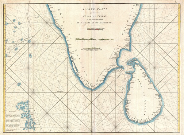
Carte Plate qui Comprend L'Isle de Ceylan, et une partie des Cotes de Malabar et de Cormandel.
sold
- Digital Map Information
- Suitable for large format printing
- DPI: 300
- File Size: 15.93 MB
- File Type: ZIP / TIFF
- ICC color profile embedded
- Delivered instantly via download link
An extremely attractive large format 1775 maritime map or nautical chart of southern India and Ceylon by Jean-Baptiste d'Après de Mannevillette. This chart covers the southern tip of India including the Malabar and Coromandel coasts as ... (more details)
18th century French nautical chart of the Cape of Good Hope.
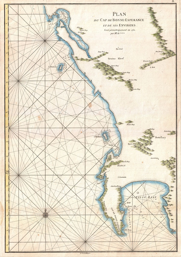
Plan du Cap de Bonne-Esperance et de ses Environs.
sold
- Digital Map Information
- Suitable for large format printing
- DPI: 300
- File Size: 6.85 MB
- File Type: ZIP / TIFF
- ICC color profile embedded
- Delivered instantly via download link
This is a very attractive 1752 nautical chart of the Cape of Good Hope and Cape Town region of South Africa. This maritime map covers from False Bay past the Cape of Good Hope northwards past Cape Town and Isle Robben as far as Saldanha ... (more details)
Important early 17th century map of the British Isles.
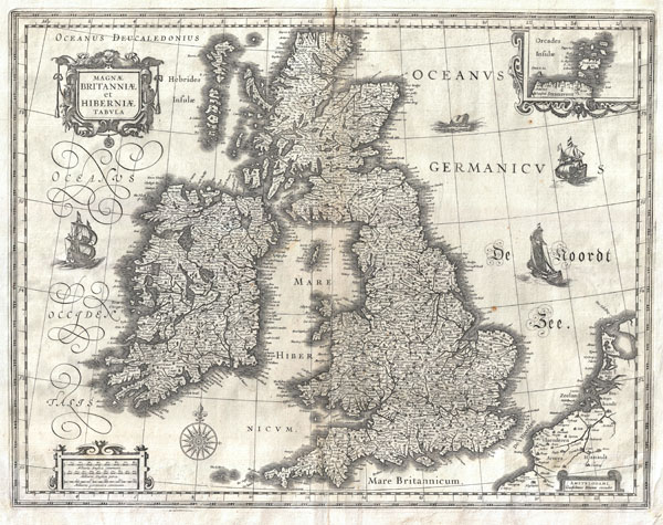
Magnae Britanniae et Hiberniae Tabula.
sold
- Digital Map Information
- Suitable for large format printing
- DPI: 300
- File Size: 12.42 MB
- File Type: ZIP / TIFF
- ICC color profile embedded
- Delivered instantly via download link
This is Guillaume Blaeu's 1631 map of the British Isles. Covers all of England, Scotland, Wales, and Ireland with adjacent parts of France and Holland and an inset of the Orkney Islands. Cartographically this map is based upon the ... (more details)
The most detailed map of Persia of its time.
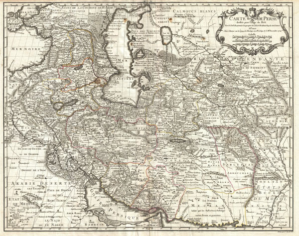
Carte de Perse, dressee pour l'usage du Roy. Par G. Delisle premier Geographe de S.M. de l'Academie Royale des Sciences.
sold
- Digital Map Information
- Suitable for large format printing
- DPI: 300
- File Size: 20.61 MB
- File Type: ZIP / TIFF
- ICC color profile embedded
- Delivered instantly via download link
A fine first edition example of Guillaume De L'Isle's important 1724 map of Persia. Covers from the Crimea and the Sea of Azov south to the Persian Gulf and the Straight of Ormuz and east as far as Kashmir (Cachmir) and Kabul ... (more details)
A highly influential early map of the Americas.
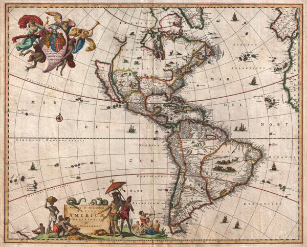
Novissima et Accuratissima Totius Americae Descriptio.
sold
- Digital Map Information
- Suitable for large format printing
- DPI: 300
- File Size: 12.66 MB
- File Type: ZIP / TIFF
- ICC color profile embedded
- Delivered instantly via download link
A striking first edition example of an extremely important and influential 1658 map of the Americas by Nicholas Janzoon Visscher. Covers all of the New World, the eastern extensions of Europe and Africa, and some Pacific ... (more details)
Possibly the most decorative atlas map of the world to appear in the 19th century.

Planisphere.
sold
- Digital Map Information
- Suitable for large format printing
- DPI: 300
- File Size: 31.83 MB
- File Type: ZIP / TIFF
- ICC color profile embedded
- Delivered instantly via download link
A visually stunning decorative map of the world dating to 1852, by French map publisher Victor Levasseur. Levasseur depicts the world on a Mercator Projection, showing the six known continents as well as traces of ... (more details)
The first large scale map of Devonshire or any other English county.
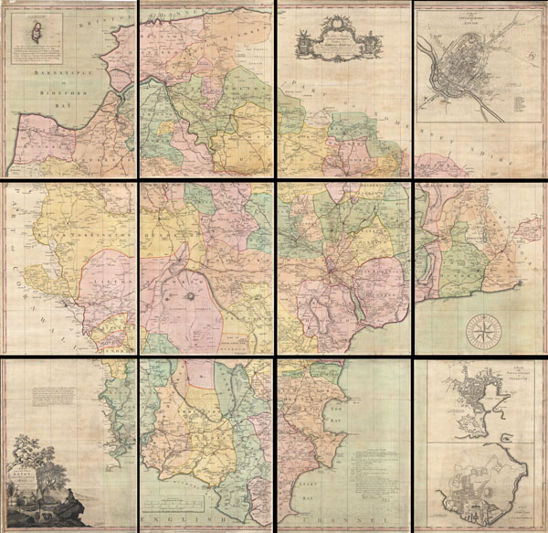
A Map of the County of Devon, with the City & County of Exeter.
sold
- Digital Map Information
- Suitable for large format printing
- DPI: 300
- File Size: 724.64 MB
- File Type: ZIP / TIFF
- ICC color profile embedded
- Delivered instantly via download link
This is a very rare and highly important 1765 wall map of Devonshire by Benjamin Donn. Drawn in twelve panels, this map covers the entirety of Devonshire or Devon from the English Channel to Barnstaple (Bideford) ... (more details)
Early Meiji map of Japan suggesting the beginnings of European influence on Japanese cartography.
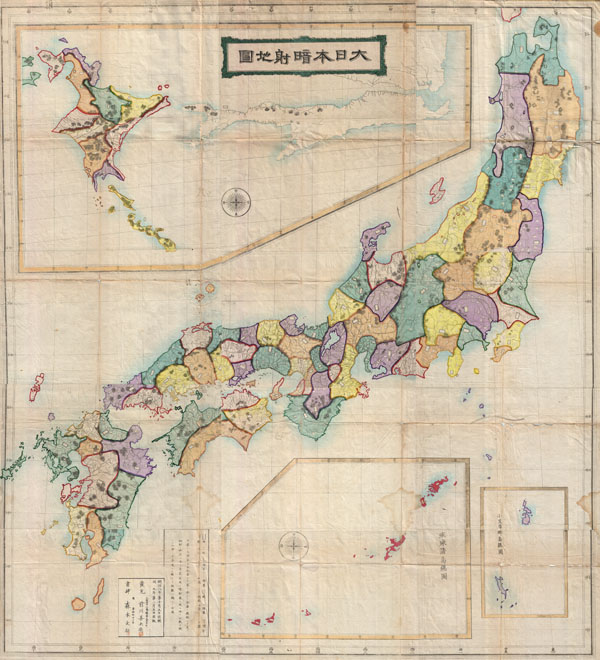
Dai Nihon Chiri Zenzu
sold
- Digital Map Information
- Suitable for large format printing
- File Size: 8.75 MB
- File Type: ZIP / TIFF
- ICC color profile embedded
- Delivered instantly via download link
This is a monumental Japanese map of Japan prepared in 1875 or Meiji 8. Covers the entirety of Japan inclusive of Hokkaido and the Ryukyu Islands. Cartographically this map, like most 18th century maps of ... (more details)
Shows Haussmann's modernization of Paris.
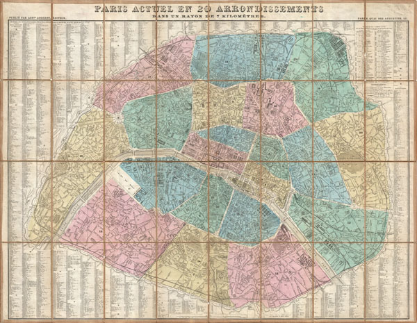
Paris Actuel en 20 Arrondissements dan un rayon de 7 kilometres.
sold
- Digital Map Information
- Suitable for large format printing
- File Size: 32.98 MB
- File Type: ZIP / TIFF
- ICC color profile embedded
- Delivered instantly via download link
A stunningly folding map of Paris, France, dating to 1867. Logerot drew this map to illustrate Napoleon III and Georges-Eugène Haussmann's revolutionary modernization of Paris. Shows the 1860 ... (more details)

sold
- Digital Map Information
- Suitable for large format printing
- Full resolution TIFF file
- ICC color profile embedded
- Delivered instantly via download link
Payment for Hua Yu Tu map. 1 of 3.
3 Payments of 5K each: Nov 1, 2019 / Feb 1, 2020 / May 1, 2020.
Delivery following final ... (more details)

The Constellations (July, August, September).
sold
- Digital Map Information
- Suitable for large format printing
- File Size: 8.77 MB
- File Type: ZIP / TIFF
- ICC color profile embedded
- Delivered instantly via download link
This rare hand colored map of the stars was engraved W. G. Evans of New York for Burritt's 1856 edition of the Atlas to Illustrate ... (more details)