

Johnson's Ohio.
sold
- Digital Map Information
- Suitable for large format printing
- File Size: 17.45 MB
- File Type: ZIP / TIFF
- ICC color profile embedded
- Delivered instantly via download link
This is A. J. Johnson's beautifully hand colored first edition 1864 map of Ohio. This map shows cities, topographical features, railways, ferries and roads with color coding at the county level. Johnson introduced this large folio map in the 1864 edition of his ... (more details)

Geometrical Projection of Two Thirds of the Sphere by Col. Sir H. James, R.E.F.R.S: M.R.I.A: & c.
sold
- Digital Map Information
- Suitable for large format printing
- File Size: 2.64 MB
- File Type: ZIP / TIFF
- ICC color profile embedded
- Delivered instantly via download link
This is a scarce and unusual hand colored map is an projection of to thirds of the earth centered on the pacific ocean and the polar Antarctic regions. Dates roughly to 1860. Antarctica itself is indication but not shown as it had yet to be fully defined as a ... (more details)

Johnson's Virginia Delaware and Maryland.
sold
- Digital Map Information
- Suitable for large format printing
- File Size: 20.23 MB
- File Type: ZIP / TIFF
- ICC color profile embedded
- Delivered instantly via download link
This is a beautifully hand colored 1864 lithograph map of the Virginia, Delaware, Maryland and West Virginia. Map shows cities, counties, topographical features, railways, ferries and roads with color coding at the county level. Due to the events of the ... (more details)

Calcutta.
sold
- Digital Map Information
- Suitable for large format printing
- Full resolution TIFF file
- ICC color profile embedded
- Delivered instantly via download link
This is a S.D.U.K. map or city plan of Calcutta, India. Calcutta was once the administrative capital of British India. The lower part of the map is decorated by several beautiful engraved illustrations of important Calcutta locations, including the ... (more details)
First Johnson's Africa to accurately map Lake Victoria and Mt. Kilimanjaro.

Johnson's Africa.
sold
- Digital Map Information
- Suitable for large format printing
- File Size: 15.53 MB
- File Type: ZIP / TIFF
- ICC color profile embedded
- Delivered instantly via download link
A beautiful first edition example of A. J. Johnson's highly decorative 1864 map of Africa. The map covers the entire African continent as well as adjacent parts of Arabia and the Mediterranean. Throughout, Johnson identifies various cities, towns, ... (more details)

West Indies. Guadaloupe. Antigua. MarieGalante & c.
sold
- Digital Map Information
- Suitable for large format printing
- DPI: 300
- File Size: 13.81 MB
- File Type: ZIP / TIFF
- ICC color profile embedded
- Delivered instantly via download link
A fine hand colored 1815 map of the West India islands of Antigua, Guadeloupe and Marie Galante. Depicts the islands in considerable detail with attention to rivers, topography, towns and villages, and major port cities. Issued as chart number 65 ... (more details)
Johnson's only flag chart to show the 'so called' Confederate States of America.

Johnson's New Chart of National Emblems.
sold
- Digital Map Information
- Suitable for large format printing
- File Size: 7.31 MB
- File Type: ZIP / TIFF
- ICC color profile embedded
- Delivered instantly via download link
A beautiful first edition example of A. J. Johnson's highly decorative 1864 chart of the world's flags and national emblems. Johnson first introduced this chart in 1863 edition of his atlas. Though common in European, particularly English atlases, ... (more details)

A New Map of Mexico, Central America, and the West Indies. / Map of the Island of Cuba. / Map of the Bermuda Islands.
sold
- Digital Map Information
- Suitable for large format printing
- File Size: 3.53 MB
- File Type: ZIP / TIFF
- ICC color profile embedded
- Delivered instantly via download link
A fine example of Mitchell's 1864 map of Mexico, Central America, and the West Indies. Depicts the region in considerable detail with notations regarding states, rail lines, shipping routes, and geographical features. Feature four inset maps. The ... (more details)
The first published representation of the pre-Columbian Aztec pilgrimage from Aztlan to Chapultepec.

The copy of a antient picture kept by D. Carlos Siguenza in which is drawn & describ'd the road the antient Mexicans travell'd when they came fromteh Mountains to inhabe the Lake, call'd at present of Mexico, with the Hieroglyphicks signifying the names of places & other things.
sold
- Digital Map Information
- Suitable for large format printing
- DPI: 300
- File Size: 8.24 MB
- File Type: ZIP / TIFF
- ICC color profile embedded
- Delivered instantly via download link
This unusual 1704 map, drawn by Giovanni Francesco Gemelli Careri, is the first published representation of the legendary Aztec migration from Aztlan, a mysterious paradise somewhere to the northwest of Mexico, to Chapultepec Hill, currently Mexico ... (more details)
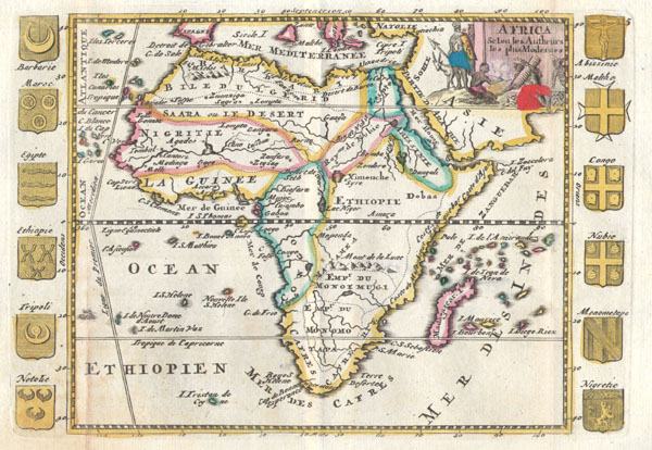
Africa Selon les Autheurs les plus Modernes.
sold
- Digital Map Information
- Suitable for large format printing
- Full resolution TIFF file
- ICC color profile embedded
- Delivered instantly via download link
A very scarce, c. 1710, map of Africa by Daniel de la Feuille. Depicts the continent of Africa form an early 18th century perspective. The Niger River is mapped with surprising accuracy, especially considering its highly inaccurate mappings nearly ... (more details)
First edition of Johnson's desirable West Indies Map.

Johnson's West Indies.
sold
- Digital Map Information
- Suitable for large format printing
- File Size: 12.3 MB
- File Type: ZIP / TIFF
- ICC color profile embedded
- Delivered instantly via download link
A beautiful first edition example of A. J. Johnson's highly decorative 1864 map of the West Indies. The map covers from Florida to Venezuela and from Honduras to Barbados. Includes the Bahamas, Cuba, Jamaica, Santo Domingo (Hispaniola), Porto ... (more details)
Extremely rare pocket map of New York's Central Park.

Map of the Central Park Showing the Progress of the Work up to January 1st, 1860.
sold
- Digital Map Information
- Suitable for large format printing
- File Size: 10.13 MB
- File Type: ZIP / TIFF
- ICC color profile embedded
- Delivered instantly via download link
A very attractive 1860 pocket map of New York City's Central Park. This is an extremely rare pocket map variant on the map of Central Park that later appeared in the 1860 Commissioner's Annual Report on the Progress of Central Park . This map ... (more details)
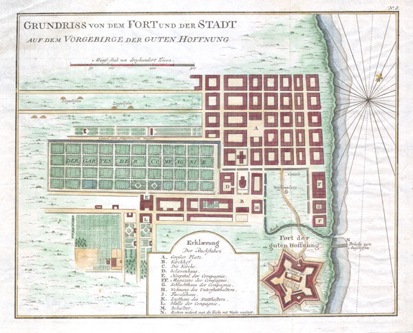
GRUNDRISS VON DEM FORT UND DER STADT AUF DEM VORGEBIRGE DER GUTEN HOFFNUNG.(Plan of the fort and the town on the promontory of Good Hope)
sold
- Digital Map Information
- Suitable for large format printing
- Full resolution TIFF file
- ICC color profile embedded
- Delivered instantly via download link
Featured here is a rare c. 1750 map of Cape Town, South Africa, by the French cartographer Jacques-Nicholas Bellin. Map depicts the city and for of Cape Town in considerable detail with particular emphasis on the identifications of individual ... (more details)
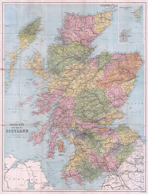
The Tourist's New Map of Scotland
sold
- Digital Map Information
- Suitable for large format printing
- File Size: 26.54 MB
- File Type: ZIP / TIFF
- ICC color profile embedded
- Delivered instantly via download link
This is a beautiful 1892 pocket map of Scotland by the famous cartographer John Bartholomew. Bartholomew established one of the most admired cartographic institutions in the world. His demand for the highest standards can be seen in this map ... (more details)

Asia.
sold
- Digital Map Information
- Suitable for large format printing
- Full resolution TIFF file
- ICC color profile embedded
- Delivered instantly via download link
A very scarce, c. 1706, map of Asia issued by Daniel de La Feuille. Extends from the Mediterranean to Alaska and as far south as Java. Depicts the Mogol Empire in India, the kingdoms of Siam and Chochine, China, Arabia and Tartary. In ... (more details)
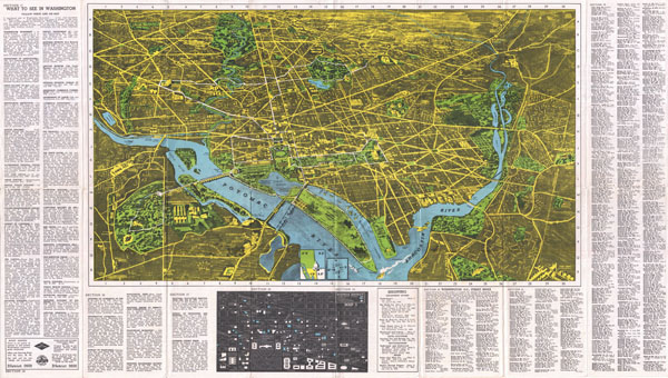
Washington In and Out Guide
sold
- Digital Map Information
- Suitable for large format printing
- File Size: 28.55 MB
- File Type: ZIP / TIFF
- ICC color profile embedded
- Delivered instantly via download link
This is a highly detailed and very interesting 1938 pictorial guide map to Washington D.C. The 'Washington D.C. In and Out' map features a birds-eye view of the city with streets, various monuments, parks, and neighborhoods labeled. ... (more details)

Reconnaissance of the Western Coast of the United States from Gray’s Harbor to the Entrance of Admiralty Inlet.
sold
- Digital Map Information
- Suitable for large format printing
- Full resolution TIFF file
- ICC color profile embedded
- Delivered instantly via download link
Offered is a U.S. Coast Survey map or chart of the northwest part of Washington State and indeed, the northwestern most point of the United States. Extends from Vancouver Island in the north, through the Straits of Juan de Fuca, ... (more details)
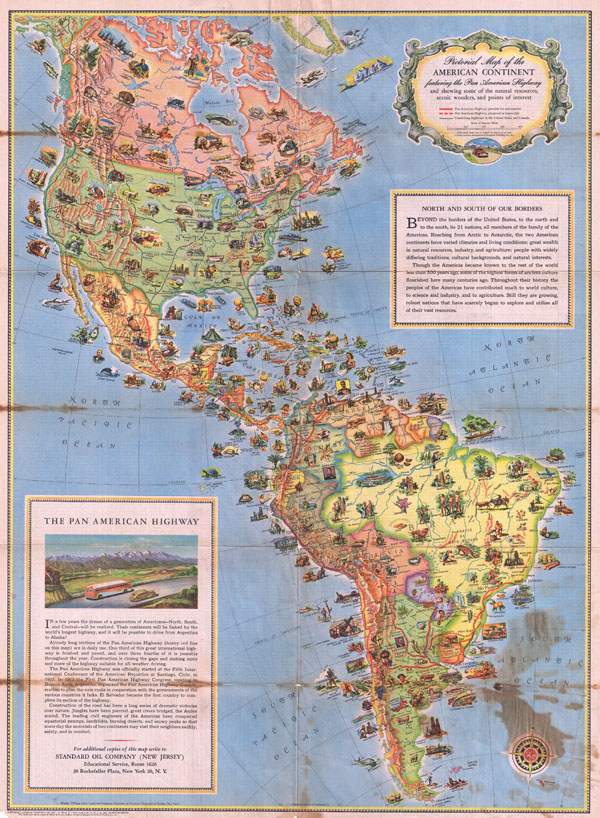
Pictorial Map of the American Continent Following the Pan American Highway
sold
- Digital Map Information
- Suitable for large format printing
- File Size: 19.18 MB
- File Type: ZIP / TIFF
- ICC color profile embedded
- Delivered instantly via download link
This is a very attractive and beautifully illustrated c. 1930 pictorial map of North America and South America drawn to illustrate the Pan-American Highway. The Pan-American Highway is a network of roads measuring about 29,800 ... (more details)
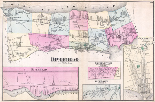
Riverhead Suffolk Co.
sold
- Digital Map Information
- Suitable for large format printing
- File Size: 5.61 MB
- File Type: ZIP / TIFF
- ICC color profile embedded
- Delivered instantly via download link
This scarce and large hand colored map depicts the town of Riverhead, Long Island, New York. Map depicts the populous cities and towns surrounding Riverhead, including Franklinville, Aquebogue, Jamesport, Wading River, Baiting ... (more details)

All About San Francisco
sold
- Digital Map Information
- Suitable for large format printing
- File Size: 21.76 MB
- File Type: ZIP / TIFF
- ICC color profile embedded
- Delivered instantly via download link
This pictorial map, 'All About San Francisco' is beautifully illustrated in the popular 1940's art-deco style. This black, white and red street map and birds-eye view of San Francisco also features a detailed map of the ... (more details)