

West Indies.
sold
- Digital Map Information
- Suitable for large format printing
- DPI: 300
- File Size: 5.42 MB
- File Type: ZIP / TIFF
- ICC color profile embedded
- Delivered instantly via download link
This scarce hand colored map is a lithographic engraving of the West Indies dating to 1850 by the legendary American Mapmaker S.A. Mitchell, the elder. Covers from Florida and the Bahamas south through the Caribbean nations of Cuba and Hispaniola (Haiti & the ... (more details)
Possibly the first published map of Prospect Park.

Design for Prospect Park as Proposed to be Laid Out for The City of Brooklyn.
sold
- Digital Map Information
- Suitable for large format printing
- File Size: 6.87 MB
- File Type: ZIP / TIFF
- ICC color profile embedded
- Delivered instantly via download link
A rare 1868 first edition of Vaux & Olmsted's map of Prospect Park, Brooklyn. Issued just months after its October 1867 completion, this is one of the first published maps to depict the design of Prospect Park. Depicts the park as a whole and includes ... (more details)
One of the most decorative maps of Brooklyn to appear in the 19th century.
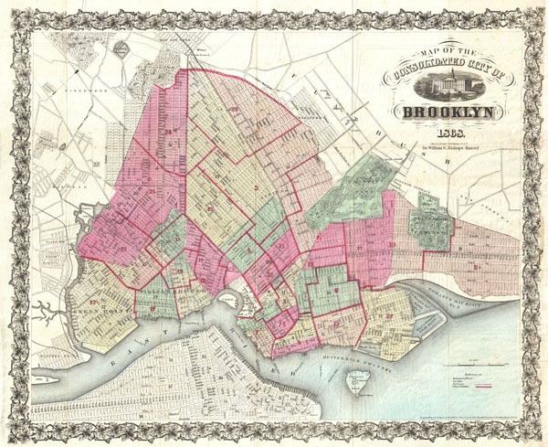
Map of the Consolidated City of Brooklyn.
sold
- Digital Map Information
- Suitable for large format printing
- File Size: 19.43 MB
- File Type: ZIP / TIFF
- ICC color profile embedded
- Delivered instantly via download link
An extremely rare first edition of William Bishop's 1868 pocket map of the city of Brooklyn, New York. In the mid-19th century, fueled by the advent of the steam ferry, which made crossing the East River practical, Kings County experienced an massive ... (more details)

Map of Hawaii.
sold
- Digital Map Information
- Suitable for large format printing
- File Size: 1.78 MB
- File Type: ZIP / TIFF
- ICC color profile embedded
- Delivered instantly via download link
This beautiful and fascinating map of the island of Hawaii, largest of the Hawaiian Island chain, was published for the 1883 Annual Report of the U. S. Geological Survey. Map offers detailed topographical and geological information in reference to ... (more details)
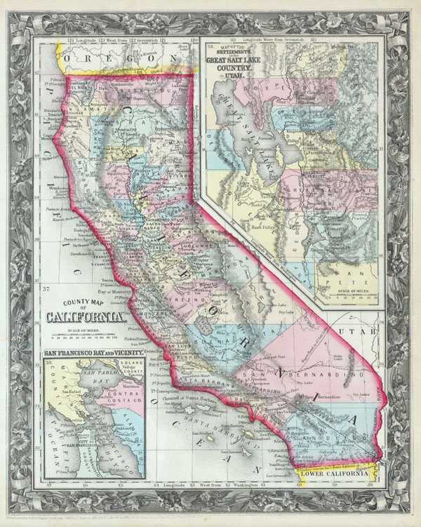
County Map of California.
sold
- Digital Map Information
- Suitable for large format printing
- File Size: 5.85 MB
- File Type: ZIP / TIFF
- ICC color profile embedded
- Delivered instantly via download link
This beautiful hand colored map is a lithographic engraving of the states of California and Utah dating to 1860. Map divides the state into counties with notations on both political and geographical features. An inset map entitled 'Map of the ... (more details)
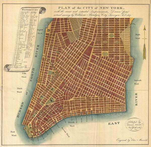
Plan of the City of New York, with the recent and intended Improvements, Drawn from actual survey by William Bridges City Surveyor; AD 1807.
sold
- Digital Map Information
- Suitable for large format printing
- File Size: 6.63 MB
- File Type: ZIP / TIFF
- ICC color profile embedded
- Delivered instantly via download link
An interesting and unusual map, this is William Bridges' 1807 revival or the failed 1801 Mangin-Goerck Plan. Those who know New York's shoreline will pause at the perfect blocks and ridged angles of this plan no more accurate today than it was ... (more details)

Colton’s United States showing the Military Stations, Forts & co.
sold
- Digital Map Information
- Suitable for large format printing
- File Size: 669.73 MB
- File Type: ZIP / TIFF
- ICC color profile embedded
- Delivered instantly via download link
A scarce and extremely attractive pocket map of the United States by J. H. Colton. This map was issued in 1862, in the midst of the Civil War, for inclusion in Victor's History of the Southern Rebellion . Depicts the United States as far ... (more details)
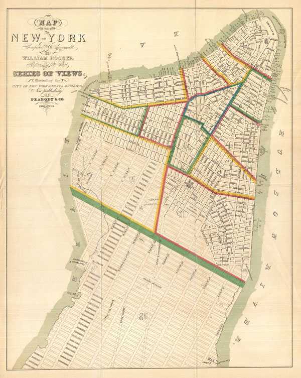
Map of the City of New-York Compiled & Surveyed by William Hooker.
sold
- Digital Map Information
- Suitable for large format printing
- File Size: 5.86 MB
- File Type: ZIP / TIFF
- ICC color profile embedded
- Delivered instantly via download link
This is an unusual map of New York City first issued in 1831 by William Hooker and Peabody. This example is a reissue, apparently from the same plate, dating to the Hardy edition of the Manual of the Corporation of New York , 1871. ... (more details)

Scandinavia.
sold
- Digital Map Information
- Suitable for large format printing
- Full resolution TIFF file
- ICC color profile embedded
- Delivered instantly via download link
This beautiful hand colored map of Scandinavia was produced by Daniel Lizars in 1840. Depicts the whole of Scandinavia including Norway, Sweden, Finland and Denmark. Inset of Iceland in the upper left corner. One of the finest ... (more details)
1871 Map of Manhattan Fire Departments.

Map of the Boundaries of the Fire Department of the City of New York Made under the direction of the Fire Comissioners.
sold
- Digital Map Information
- Suitable for large format printing
- File Size: 10.31 MB
- File Type: ZIP / TIFF
- ICC color profile embedded
- Delivered instantly via download link
This is large map 1871 map of New York City's fire departments. Covering all of Manhattan, this map defines which fire battalions and brigades are in charge of each area. When Hardy issued this map there were but nine fire ... (more details)

The Territories of Washington and Oregon.
sold
- Digital Map Information
- Suitable for large format printing
- DPI: 300
- File Size: 3.73 MB
- File Type: ZIP / TIFF
- ICC color profile embedded
- Delivered instantly via download link
An attractive 1853 Colton Map Washington and Oregon, inclusive of the modern day states of Idaho, Montana & Wyoming. Colton maps of this region exhibit dramatic changes from year to year, indicating actual changes in the ... (more details)
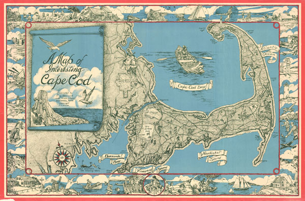
A Map of Interesting Cape Cod.
sold
- Digital Map Information
- Suitable for large format printing
- File Size: 27.6 MB
- File Type: ZIP / TIFF
- ICC color profile embedded
- Delivered instantly via download link
This unusual map of Cape Cod was drawn in 1945 by F. J. Miller. Covers all of Cape Cod as well as parts of the adjacent South Shore including New Bedford, Fairhaven, Plymouth, Buzzard Bay, and Duxbury. Names important ... (more details)

Tartary.
sold
- Digital Map Information
- Suitable for large format printing
- Full resolution TIFF file
- ICC color profile embedded
- Delivered instantly via download link
This fascinating hand colored 1815 map by Edinburgh cartographer John Thomson depicts southern Tartary, Tibet (Thibet), Mongolia, and generally the whole of Central Asia. Area covered extends from the Caspian Sea to ... (more details)

Map of Ipswich.
sold
- Digital Map Information
- Suitable for large format printing
- File Size: 12.68 MB
- File Type: ZIP / TIFF
- ICC color profile embedded
- Delivered instantly via download link
This unusual map of Ipswich was drawn in 1930 by Mark Hayes to celebrate the Ipswich Tercentennial. Covers Ipswich from Plum Island to Hamilton and Wenham Lake. Includes profiles of historic buildings including the ... (more details)

Philadelphia.
sold
- Digital Map Information
- Suitable for large format printing
- Full resolution TIFF file
- ICC color profile embedded
- Delivered instantly via download link
This scarce hand colored map is a lithographic plan or map of Philadelphia dating to 1846 by the legendary American Mapmaker S.A. Mitchell, the elder. Depicts the entire city in stupendous detail with even important ... (more details)
Features an unusual and ephemeral mapping of Australia.
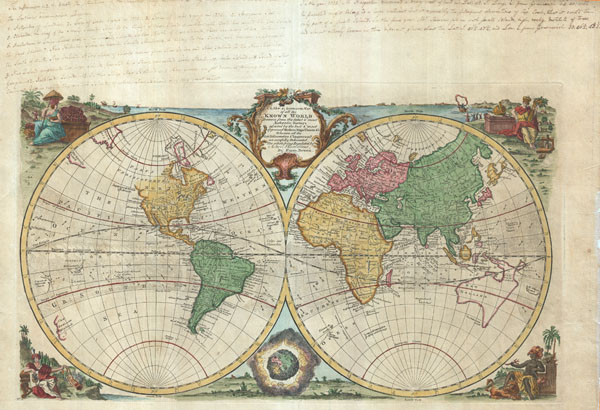
A new & accurate map of all the known World drawn from the latest & most authentic surveys assisted by the best & most approved modern maps charts & c.
sold
- Digital Map Information
- Suitable for large format printing
- DPI: 300
- File Size: 13.59 MB
- File Type: ZIP / TIFF
- ICC color profile embedded
- Delivered instantly via download link
An extremely attractive 1744 decorative double hemisphere world map by the English cartographer Emmanuel Bowen. This beautiful map covers the entire world as it was understood in the middle part of the 18th century, ... (more details)
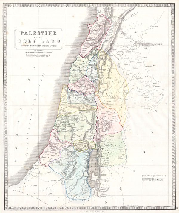
Palestine or the Holy Land According to its Ancient Divisions & Tribes.
sold
- Digital Map Information
- Suitable for large format printing
- Full resolution TIFF file
- ICC color profile embedded
- Delivered instantly via download link
This beautiful hand colored map is a steel plate engraving of Israel / Palestine or the Holy Land. Depicts the region as it would have been during the period of the Twelve Tribes of Israel. There are numerous ... (more details)
Unusual political map of Victorian New York.

Map of the City of New York, Showing its Political Divisions and Subdivisions November 1870.
sold
- Digital Map Information
- Suitable for large format printing
- File Size: 20.1 MB
- File Type: ZIP / TIFF
- ICC color profile embedded
- Delivered instantly via download link
This large map 1870 map of New York City is actually five maps in one. Each map is drawn to illustrate one aspects of the political terrain of New York City in 1870. The primary map, which stretches through ... (more details)
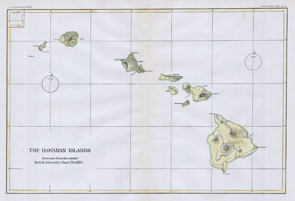
The Hawaiian Islands.
sold
- Digital Map Information
- Suitable for large format printing
- File Size: 1.29 MB
- File Type: ZIP / TIFF
- ICC color profile embedded
- Delivered instantly via download link
This beautiful and fascinating map of the Hawaiian Islands (Sandwich Island Group), was published for the 1883 Annual Report of the U. S. Geological Survey. Map offers topographical and nautical information. ... (more details)
The first comparative chart of the Moon.
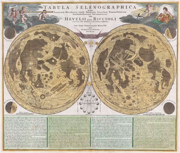
Tabula Selenographica in qua Lunarium Macularum exacta Descriptio secundum Nomenclaturam Praestantissimorum Astronomorum tam Hevelii quam Riccioli Curiosis Rei Sidereae Cultoribus exhibetur Joh. Babr. Doppelmajero Math. P.P. upera Joh. Baptistae Homanni Norinbergae.
sold
- Digital Map Information
- Suitable for large format printing
- DPI: 300
- File Size: 20.87 MB
- File Type: ZIP / TIFF
- ICC color profile embedded
- Delivered instantly via download link
A stunning full color example of J. B. Homann and Johann Gabriel Doppelmayr's important c. 1742 map of the Moon. Essentially a comparative chart, Doppelmayer constructed this map to illustrate the lunar ... (more details)