
Cruttwell, Clement (sold)

Clement Cruttwell (1743 - August 5, 1808) was an English book and map publisher active in Bath and London in the late 18th and early 19th century. Cruttwell was born the son of William Cruttwell, a gentleman of Wokingham, Berkshire, England. As a young man Cruttwell was educated to be an Anglican Reverend and consequently maintained a lifelong interest in religious matters. Throughout his life, he published a number of religious works and geographical gazetteers including several focused on the British Isles and one dedicated to France. Though little is known of Cruttwell today, he was highly regarded in his own time. In his obituary, a period publication, The Universal Magazine of Knowledge and Pleasure describes Cruttwell as
a gentleman whose various literary performances, for labour, extent, and utility, have rarely been equaled, and, when regarded as the productions of an unassisted valetudinarian, have perhaps never been surpassed.Cruttwell was also a known correspondent of George Washington to whom he sent his own translation of the Holy Bible, which Washington kept in his personal library until his death.
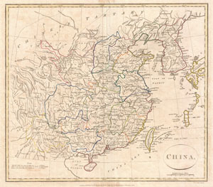
China.
sold
- Digital Map Information
- Suitable for large format printing
- DPI: 300
- File Size: 8.38 MB
- File Type: ZIP / TIFF
- ICC color profile embedded
- Delivered instantly via download link
A fine 1799 map of China by the English mapmaker Clement Cruttwell. Includes the modern day provinces of Sichuan (Setchuen), Yunnan, Fujian (Fokien), Zchejiang (Tche Kiang), Honan (Henan), Shandong (Chan Tong), and Shanxi (Shansi). Also shows abolished provinces, ... (more details)
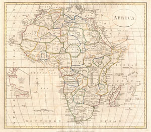
Africa.
sold
- Digital Map Information
- Suitable for large format printing
- DPI: 300
- File Size: 6.94 MB
- File Type: ZIP / TIFF
- ICC color profile embedded
- Delivered instantly via download link
A fine 1799 map of Africa by the English map publisher Clement Cruttwell. Covers the entire region, including a detailed inset of the rivers of Sierra Leone and Sherbro (labeled 'A correct chart of the Rivers Sierra Leone and Sherbro.') Of note is the way ... (more details)
Identifies the Sea of Korea.
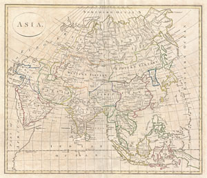
Asia
sold
- Digital Map Information
- Suitable for large format printing
- DPI: 300
- File Size: 9.52 MB
- File Type: ZIP / TIFF
- ICC color profile embedded
- Delivered instantly via download link
A fine 1799 map of Asia by the English map publisher Clement Cruttwell. Cruttwell's map covers the entire continent from Turkey to Japan and from the Arctic to the East Indies. Our survey of this remarkable continental map begins in the northern regions, ... (more details)
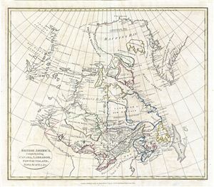
British America, Comprehending Canada, Labrador, New-Foundland, Nova Scotia &c.
sold
- Digital Map Information
- Suitable for large format printing
- DPI: 300
- File Size: 10.71 MB
- File Type: ZIP / TIFF
- ICC color profile embedded
- Delivered instantly via download link
An unusual and appealing 1799 map of Canada by the english map publisher and religious scholar Clement Cruttwell. Centered on the Hudson Bay, Cruttwell's map embraces the territory from the Arctic Ocean and the Baffin Bay southwards to the Great Lakes and ... (more details)
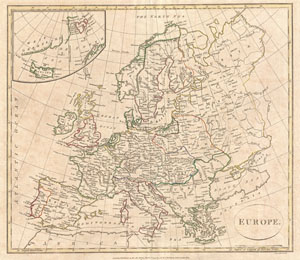
Europe.
sold
- Digital Map Information
- Suitable for large format printing
- DPI: 300
- File Size: 7.8 MB
- File Type: ZIP / TIFF
- ICC color profile embedded
- Delivered instantly via download link
A fine 1799 map of Europe by the English map publisher Clement Cruttwell. Covers the entire European continent, including an very confusing inset of Greenland, Spitsbergen, and Iceland. Also includes western Russia (Muscovy) and the Black Sea. Poland is ... (more details)
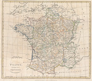
France, Divided into Provinces.
sold
- Digital Map Information
- Suitable for large format printing
- DPI: 300
- File Size: 8.02 MB
- File Type: ZIP / TIFF
- ICC color profile embedded
- Delivered instantly via download link
A fine 1799 map of France Divided into Provinces by the English map publisher Clement Cruttwell. France was organized into provinces until March 4, 1790, when the establishment of the department system superseded provinces. The change was an attempt ... (more details)
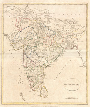
Hindoostan.
sold
- Digital Map Information
- Suitable for large format printing
- DPI: 300
- File Size: 6.45 MB
- File Type: ZIP / TIFF
- ICC color profile embedded
- Delivered instantly via download link
A fine 1799 map India, here labeled Hindoostan, by the English map publisher Clement Cruttwell. Covers the entire subcontinent and is divided into the various princely states. Though there is no specific reference to British dominance in the region, ... (more details)
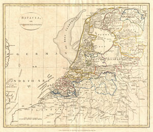
Batavia or United Dutch States.
sold
- Digital Map Information
- Suitable for large format printing
- DPI: 300
- File Size: 7.37 MB
- File Type: ZIP / TIFF
- ICC color profile embedded
- Delivered instantly via download link
A fine 1799 map of Batavia or the United Dutch States (the Netherlands) by the English map publisher Clement Cruttwell. Map is highly detailed, with counties and municipalities outlined. Of note on this particular map are the canals and dikes ... (more details)
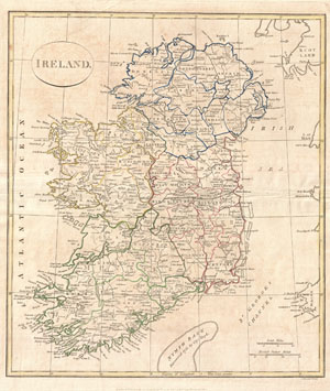
Ireland.
sold
- Digital Map Information
- Suitable for large format printing
- Full resolution TIFF file
- ICC color profile embedded
- Delivered instantly via download link
A fine 1799 map of Ireland by the English map publisher Clement Cruttwell. Map shows Ireland's four provinces, which remain the same to this day. In the north is Ulster, Connaught in the west, Leinster in the east, and Munster in the south. ... (more details)
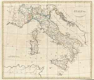
Italy & c:
sold
- Digital Map Information
- Suitable for large format printing
- DPI: 300
- File Size: 7.63 MB
- File Type: ZIP / TIFF
- ICC color profile embedded
- Delivered instantly via download link
A fine 1799 map of Italy by the English map publisher Clement Cruttwell. Shows the entire country including the islands of Sicily, Sardinia, and Corsica, and Malta. Includes the regions Piedmont, Savoy, Allesandrine, Parma, Venice, Genoa, ... (more details)
Ephemeral map showing an incomplete understanding of the American Arctic.
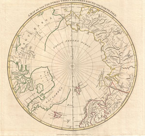
A Map of the Countries Thirty Degress Round the North Pole.
sold
- Digital Map Information
- Suitable for large format printing
- DPI: 300
- File Size: 6.29 MB
- File Type: ZIP / TIFF
- ICC color profile embedded
- Delivered instantly via download link
A fine 1799 map of the northern polar regions by the English map publisher Clement Cruttwell. Covers the polar regions from roughly 60 degrees north latitude to the North Pole. Reveals a primitive yet ephemeral understanding of Arctic ... (more details)
Shows the partitioning of Poland.
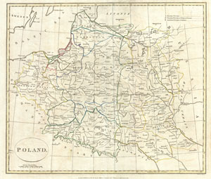
Poland.
sold
- Digital Map Information
- Suitable for large format printing
- DPI: 300
- File Size: 6.98 MB
- File Type: ZIP / TIFF
- ICC color profile embedded
- Delivered instantly via download link
A fine 1799 map of Poland by the English mapmaker Clement Cruttwell. Shows the partitioning of the Polish-Lithuanian Commonwealth in 1765-1795 between Prussia, Austria, and Russia. The map covers the area from Poznan in the west to ... (more details)
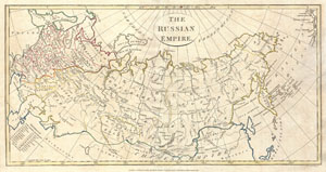
Russian Empire.
sold
- Digital Map Information
- Suitable for large format printing
- DPI: 300
- File Size: 6.37 MB
- File Type: ZIP / TIFF
- ICC color profile embedded
- Delivered instantly via download link
A fine 1799 map of the Russian Empire by the English mapmaker Clement Cruttwell. Covers the entire region and makes note of the many regional governments, or oblasts, as they were then known. These include the governments of ... (more details)
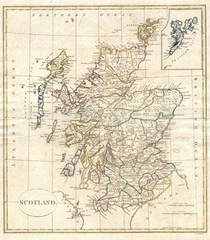
Scotland.
sold
- Digital Map Information
- Suitable for large format printing
- Full resolution TIFF file
- ICC color profile embedded
- Delivered instantly via download link
A fine 1799 map of Scotland by the English map publisher Clement Cruttwell. Covers the entire region in great detail, including a detailed inset of the Shetland Isles. Here all the counties are labeled as Shires, as the word ... (more details)
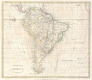
South America.
sold
- Digital Map Information
- Suitable for large format printing
- DPI: 300
- File Size: 7.3 MB
- File Type: ZIP / TIFF
- ICC color profile embedded
- Delivered instantly via download link
A fine 1799 map of South America by the English mapmaker Clement Cruttwell. Covers all of South America as well as parts of Central America as far north as Honduras. Crutwell identifies a number of indigenous peoples ... (more details)
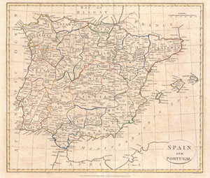
Spain and Portugal.
sold
- Digital Map Information
- Suitable for large format printing
- DPI: 300
- File Size: 7.54 MB
- File Type: ZIP / TIFF
- ICC color profile embedded
- Delivered instantly via download link
A fine 1799 map of Spain and Portugal by the English map publisher Clement Cruttwell. Map shows the provinces as they appeared at this time, including the islands of Majorca, Minorca, and Ibiza (Yvica). The most ... (more details)
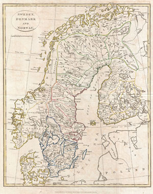
Sweden, Denmark and Norway.
sold
- Digital Map Information
- Suitable for large format printing
- DPI: 300
- File Size: 8.76 MB
- File Type: ZIP / TIFF
- ICC color profile embedded
- Delivered instantly via download link
A fine 1799 map of Sweden, Denmark and Norway by the English map publisher Clement Cruttwell. Map includes the Kingdom of Norway, Denmark, Sweden, and Finland. Includes the 25 provinces of Sweden, which have no ... (more details)
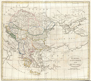
Turkey in Europe, and Hungary.
sold
- Digital Map Information
- Suitable for large format printing
- DPI: 300
- File Size: 7.16 MB
- File Type: ZIP / TIFF
- ICC color profile embedded
- Delivered instantly via download link
A fine 1799 map of Greece, the Balkans, and Turkey in Europe by the English map publisher Clement Cruttwell. Covers from Hungary and Moldavia in the north, down to Crete (Candia) in the south; and from Croatia ... (more details)
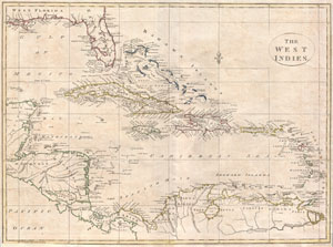
The West Indies.
sold
- Digital Map Information
- Suitable for large format printing
- Full resolution TIFF file
- ICC color profile embedded
- Delivered instantly via download link
A fine 1799 map of the West Indies by the English mapmaker Clement Cruttwell. Shows what was then known as West and East Florida, along with the Bahamas Islands, Cuba, Jamaica, Domingo, and Puerto Rico (Porto ... (more details)
Scarce map of the post-Revolutionary United States with the 14th colony of Sagahaddok.
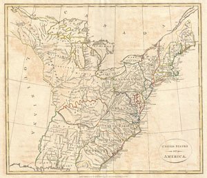
United States of America.
sold
- Digital Map Information
- Suitable for large format printing
- DPI: 300
- File Size: 7.39 MB
- File Type: ZIP / TIFF
- ICC color profile embedded
- Delivered instantly via download link
This is a highly unusual and extremely scarce 1799 map of the United States by the English map publisher Clement Cruttwell. Depicts a post-colonial pre-Louisiana United States extending from the Mississippi ... (more details)
Attractive double hemisphere map showing the routes of the great explorers.
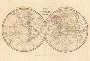
The World. Western Hemisphere. Eastern Hemisphere.
sold
- Digital Map Information
- Suitable for large format printing
- DPI: 300
- File Size: 8.46 MB
- File Type: ZIP / TIFF
- ICC color profile embedded
- Delivered instantly via download link
A fine example of Clement Cruttwell's 1799 map of the world in two hemispheres. This is an elegant world map designed to illustrate the activities of important explorers of the 17th and18th centuries. The ... (more details)
Attractive world map showing the routes of the great explorers.
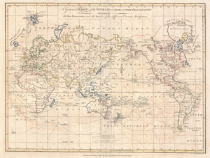
A General Chart of the World on Mercators Projection exhibiting all the New Discoveries and the Tracks of the Different Circum Navigators.
sold
- Digital Map Information
- Suitable for large format printing
- DPI: 300
- File Size: 8.86 MB
- File Type: ZIP / TIFF
- ICC color profile embedded
- Delivered instantly via download link
A fine example of Clement Cruttwell's 1799 map of the world on Mercator's Projection. This is an elegant world map designed to illustrate the activities of important explorers of the 17th and18th ... (more details)